Two
AMERICAN INDIANS,
EXPLORERS, AND
MOUNTAIN PASSES
Three mountain passes cross the Sangre de Cristos leading westward to the Great Sand Dunes. The elevation decreases from north to south, from Music Pass, to Medano Pass, to Mosca Pass. So it was natural that the two southern passes (Medano and Mosca) were most used by American Indians, explorers, and settlers. Just south of Great Sand Dunes, archeological excavations have revealed that prehistoric hunter-gatherers occupied the area between about 11,000 and 10,000 years ago. Their projectile points (Clovis points and Folsom points) indicate their skill in carving stone points to hunt mammoth and bison. The historic Ute tribe used horses captured from the Spanish conquistadors to become the dominant tribe in the area, crossing the mountain passes for trade and hunting.
Lt. Zebulon Pike of the US Army was the first recorded American explorer to cross the Sangre de Cristos to the Great Sand Dunes. Pike and his men were exploring the Louisiana Purchase territory under orders from Pres. Thomas Jefferson. In January 1807, they crossed either Medano or Mosca Pass (they did not know where they were and left no accurate description of the pass), and Pike recorded seeing the dunes in his journal. Later, explorers John Charles Fremont (in 1848) and Capt. John Gunnison (in 1853) crossed the passes searching for a suitable rail route for the transcontinental railroad. Neither Medano nor Mosca Pass was suitable for a railroad, but Mosca Pass became an important wagon road to the San Luis Valley in the 1870s.
In 1871, Frank Hastings received a charter from the Colorado Territorial Legislature to build and maintain a toll road over Mosca Pass. The community of Montville was established at the location of Hastings’s general store and toll gate at the west end of the Mosca Pass Road. This location can be viewed in Great Sand Dunes National Park today on the trail leading from the Montville parking lot to Mosca Pass. Traffic was heavy over Mosca Pass with as many as 40 wagons crossing in a day. Montville boomed with a total of about 20 houses and a post office located in the general store.
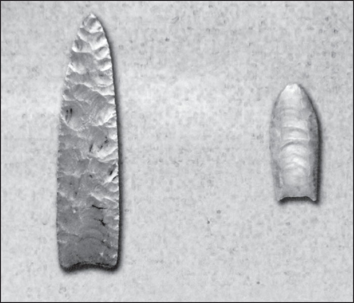
CLOVIS AND FOLSOM PROJECTILE POINTS. Clovis points (left) were found just south of the Great Sand Dunes in 1979, along with mammoth bone and ivory. The Clovis culture has been dated to 11,000 years ago. Folsom points (right), along with the remains of 35 bison, were found from between 1981 and 1983 at an excavation on the Zapata Ranch south of the dunes and were dated to about 10,000 years ago. (GRSA.)
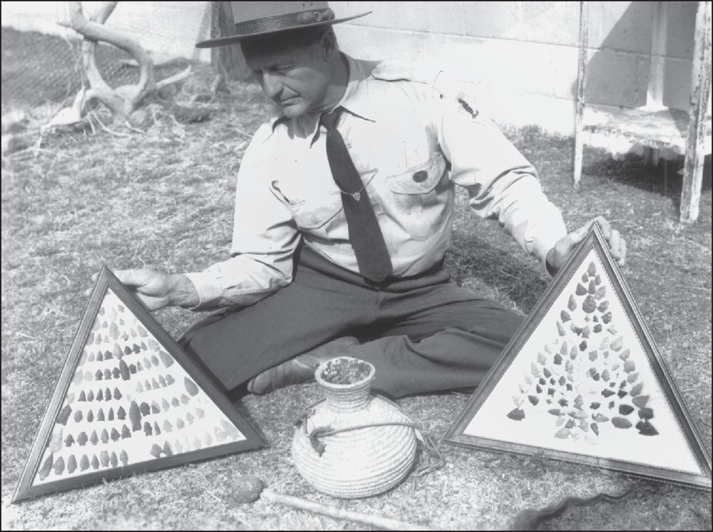
GREAT SAND DUNES ARROWHEADS. In 1958, park superintendent Harold Schaafsma displayed these arrowheads donated by area ranchers. Mostly from the Ute tribe, the arrowheads were found by the hundreds on ranches surrounding the dunes. Many were found at Indian Spring, in what is now the southwest portion of the park. Today, removal of arrowheads and artifacts from national parks is prohibited. (GRSA-2157.)
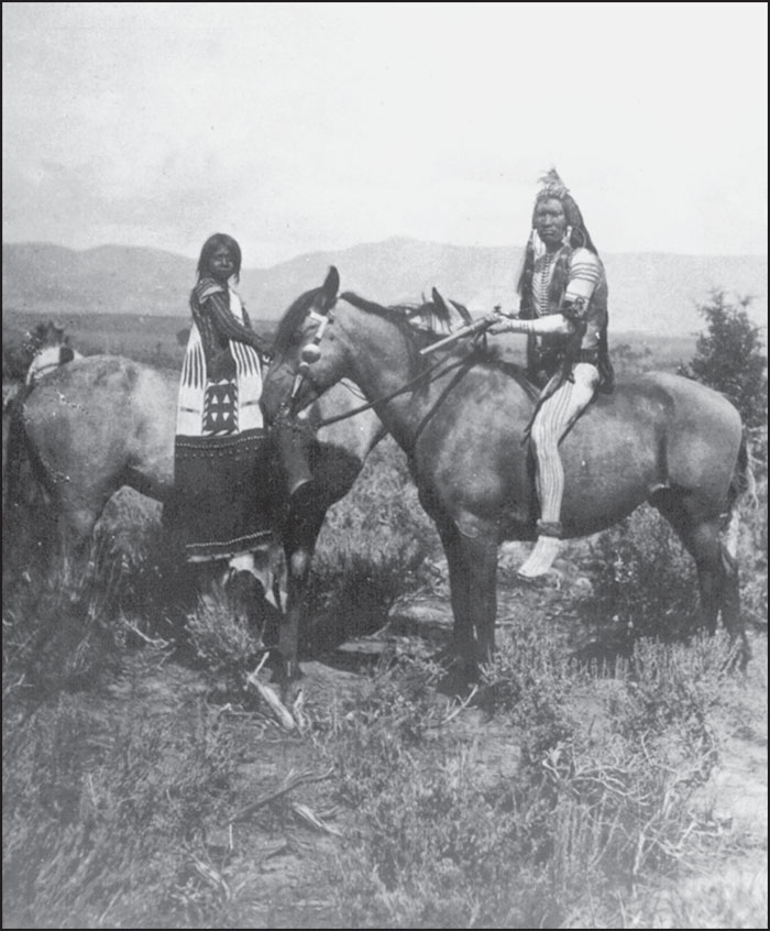
UTES ON HORSEBACK. After securing horses from Spanish explorers and conquistadors during the 1600s, the Utes became very adept in using horses for hunting and fighting. By the 1800s, they were the dominant American Indian tribe from the San Luis Valley east to the Spanish Peaks. (GRSA.)
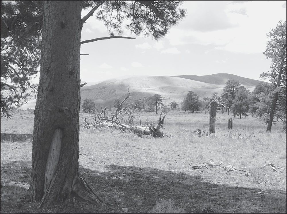
CULTURALLY PEELED PINE TREES. Over 100 scarred ponderosa pine trees have been found in Great Sand Dunes. Tree ring dating has revealed that the lower bark of these trees was peeled off between 1815 and 1846, when the Ute tribe dominated the area. The interior bark layer was eaten, suggesting the scarcity of buffalo and other big game by this time period. The bark was also used for medicinal purposes. (GRSA.)

PORTRAIT OF LT. ZEBULON MONTGOMERY PIKE. After crossing Medano (or perhaps Mosca) Pass in January 1807, Pike came upon the Great Sand Dunes and, according to his journal, “ascended one of the highest hills of sand and with [his] glass could discover a large river flowing nearly north by west and south by east through the plain.” Pike was looking at the Rio Grande River. (Independence National Historic Site.)
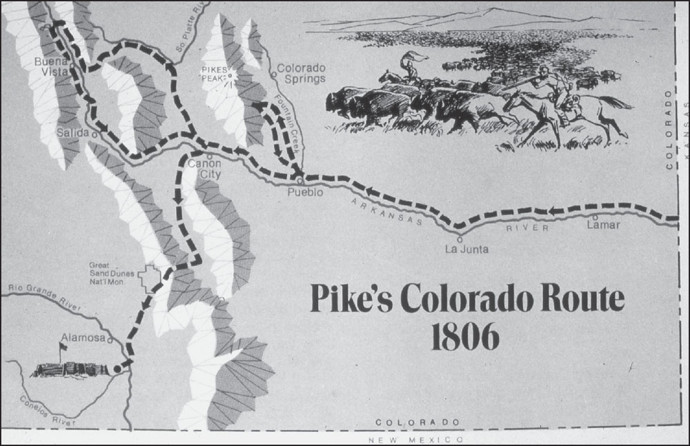
PIKE’S JOURNEY, 1806–1807. Zebulon Pike explored the area north of Pueblo in 1806, reaching the base (but not the summit) of Pikes Peak. He then made a loop northwest from the Canon City area before heading southwest over the Sangre de Cristo Mountains to the Great Sand Dunes. He built a rough defensive stockade near the confluence of the Rio Grande and Conejos Rivers. (GRSA.)

PIKE’S STOCKADE, 1977. In 1952, the Colorado Historical Society reconstructed Pike’s stockade near its original location at the confluence of the Rio Grande and Conejos Rivers. Here, in February 1807, Pike and his men were captured by Spanish soldiers and sent as prisoners to Mexico. They were later released on US soil, and Pike was killed in 1813 while fighting against the British in the continuing War of 1812. (GRSA.)
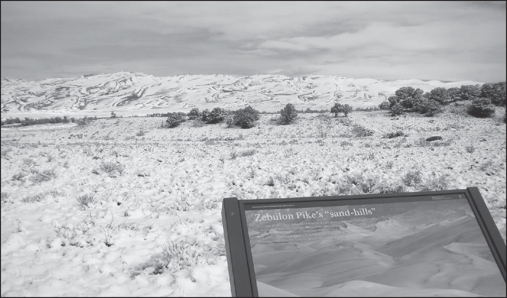
PIKE’S “SAND HILLS.” In his journal, Pike noted that “the sand hills extended up and down at the foot of the White Mountains (Sangre de Cristos) and appeared to be about five miles in width.” The “sand hills” were covered in a couple of inches of snow in this scene from the Visitor Center, May 10, 2012.

MARKER AT MONTVILLE ON MOSCA PASS TRAIL. Frank Hastings constructed his toll road over Mosca Pass in 1871, and a small settlement grew up at its western terminus at the base of the Great Sand Dunes. Known variously as “Mosco,” “Monteville,” and, finally, “Montville,” the settlement included 20 homes and Hastings’s general store/toll cabin.
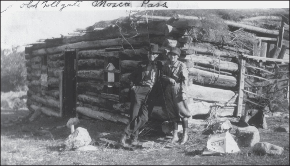
OLD TOLLGATE CABIN AT WESTERN FOOT OF MOSCA PASS. This 1927 photograph shows Walter and Ada (Wellington) Holeman posing in front of the ruins of the Mosca Pass tollgate cabin at Montville. Ada was the daughter of William Wellington, a pioneer settler at Uracca. She was also the sister of Frank Wellington, who built the Wellington cabin, which still stands in Great Sand Dunes National Park. (GRSA-731.)
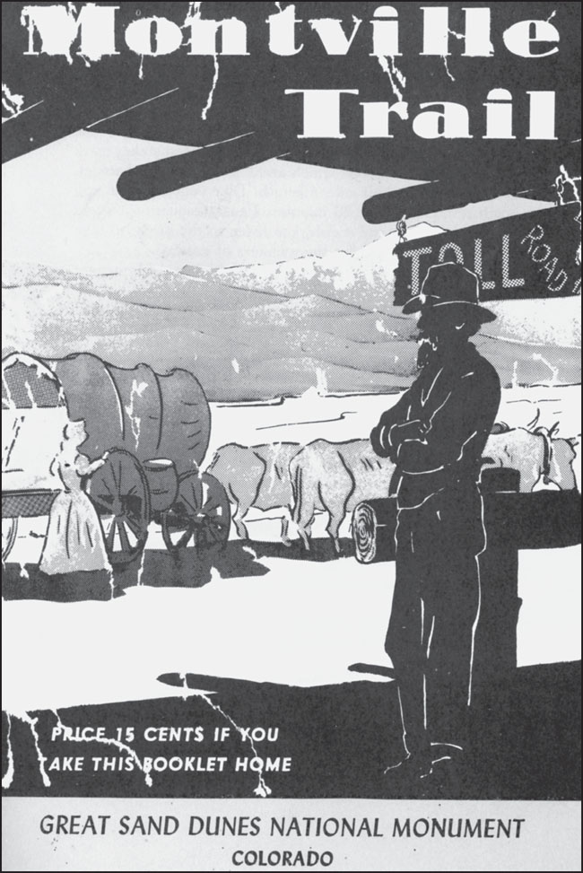
MOSCA PASS TOLL ROAD. This 1968 booklet cover illustrates the toll cabin at Montville with a team of oxen pulling a covered wagon up the road. In the background, the Great Sand Dunes can be seen with Mount Herard rising above them. Tolls were 50¢ per head of livestock, $1 for a horse and rider, and $2 for a team and wagon.
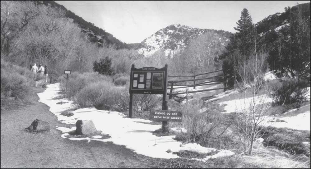
MONTVILLE AREA, MOSCA PASS TRAIL, 1989. This view east at Montville illustrates how the toll area operated with a fence across Mosca Creek, forcing wagons and riders to stay on the road and pay at the toll cabin, which was on the left. The Mosca Pass road was obliterated by a flood in 1911 and never reopened. (GRSA-2183.)
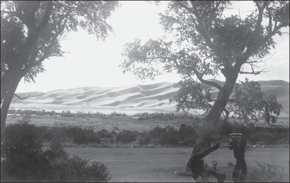
SAND DUNES RISE ABOVE MONTVILLE PARKING LOT, 1958. The Montville Post Office operated in the general store building from February 28, 1887, until January 31, 1900. Montville was abandoned not long after the road over Mosca Pass was closed in 1911. This parking lot was built by the National Park Service for hikers on the Mosca Pass Trail. Paved in 1964, it still serves today. (GRSA-2160.)
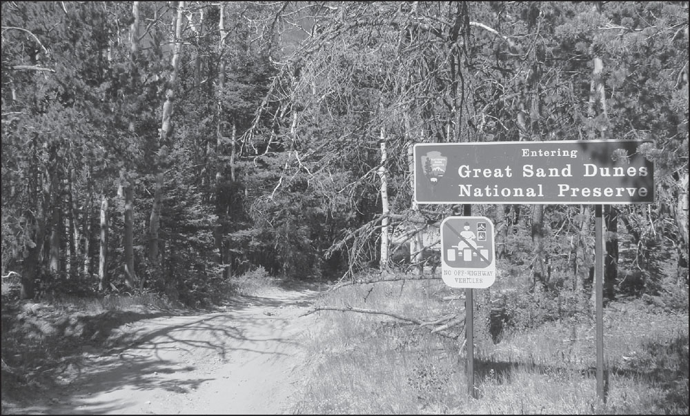
MEDANO PASS ENTRANCE TO GREAT SAND DUNES. The Medano Pass Road, north of Mosca Pass, is still open to four-wheel drive vehicles. Steeper and higher in elevation, it crosses more treacherous sand areas than the Mosca Pass Trail. Wagon drivers preferred Mosca Pass, while individual riders could bypass tolls by using Medano Pass.


