Three
SETTLERS AND RANCHERS
AROUND THE DUNES
The Homestead Act, passed by Congress in 1862, opened the American West to settlers, particularly after the Civil War ended in 1865. A settler could obtain 160 acres of federal land by filing a claim, living on and improving the land for five years, and then filing for a deed on the property. In the area around the Great Sand Dunes, settlement was a mixture of Hispanic and Anglo (including Mormon) homesteaders, plus leftover owners from Mexican land grants, and large ranches financed by easterners that sometimes bought out the homesteaders or took over their land by force.
Hispanic settler Teofilo Trujillo claimed land southwest of Indian Spring in 1865 and started a cattle and sheep ranch. His son Pedro also claimed land nearby in 1879 and built a ranch house by 1885. Pedro’s log home has been restored and was added to the National Register of Historic Places in 2004. Unfortunately, his father Teofilo’s ranch house was burned down in 1902 by local cattle operators, and both Trujillo families sold their land and moved out of the area.
Mexican land grants in the area were declared invalid by Colorado’s surveyor general in 1874, and Hispanic settlers on the grants sold their land to large ranches such as the nearby Zapata Ranch, just south of the Great Sand Dunes, and the Medano Ranch, just west of the dunes. However, the Baca Grant of 100,000 acres north of the Great Sand Dunes was validated for the Baca family in 1864 by the surveyor general of the Colorado Territory. The Bacas immediately deeded the grant to their lawyer, and the ranch went through a series of many owners over the years. When it was finally purchased by the Nature Conservancy in 2004, part of it was included in Great Sand Dunes National Park, about one third went to the US Forest Service, and the remainder formed the newly created Baca National Wildlife Refuge. Also, not to be forgotten are the Mormon homesteaders who settled on Uracca Creek, just south of the dunes, many of whose descendants still live in the San Luis Valley.
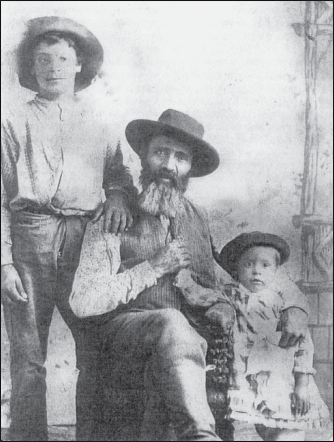
TEOFILO TRUJILLO AND HIS GRANDCHILDREN, 1901. Teofilo and his wife, Andrellita, homesteaded southwest of Indian Spring in 1865. His son Pedro and daughter-in-law Sofia homesteaded nearby in 1879. In this image, two of Pedro’s children, Frederico (left) and Maria Elena (right) pose with Teofilo. Frederico was born in 1889, and Maria in 1897. (Maria Lujan Causby.)
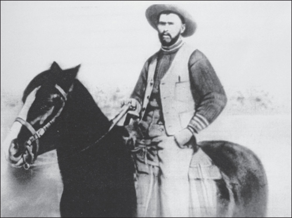
PEDRO TRUJILLO, C. 1890. Pedro homesteaded near his father, Teofilo, but unlike his father, he raised only cattle, not sheep. Since sheep deprive cattle of grass to graze on, Teofilo’s sheep ranching raised the ire of local cattle ranchers, and they were suspected of burning down his ranch house in 1902. Teofilo and Pedro both subsequently sold their ranches to the Medano Ranch and moved farther away in the San Luis Valley. (Maria Lujan Causby.)
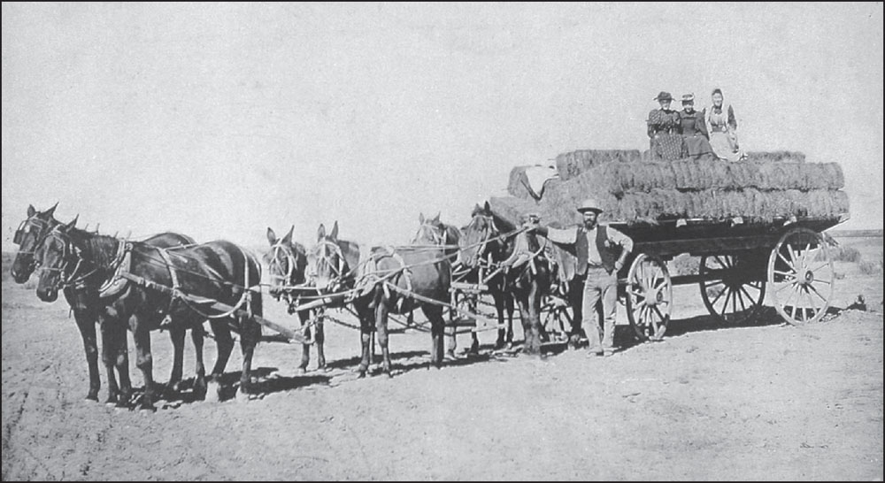
PEDRO TRUJILLO AND HAY WAGON, C. 1890. Over time, Pedro added more land to his homestead, eventually amassing over 500 acres. Pedro grew hay on the ranch to feed his cattle. It was a fairly successful operation, and Pedro and his wife, Sofia, had 16 children (nine boys and seven girls). (Maria Lujan Causby.)
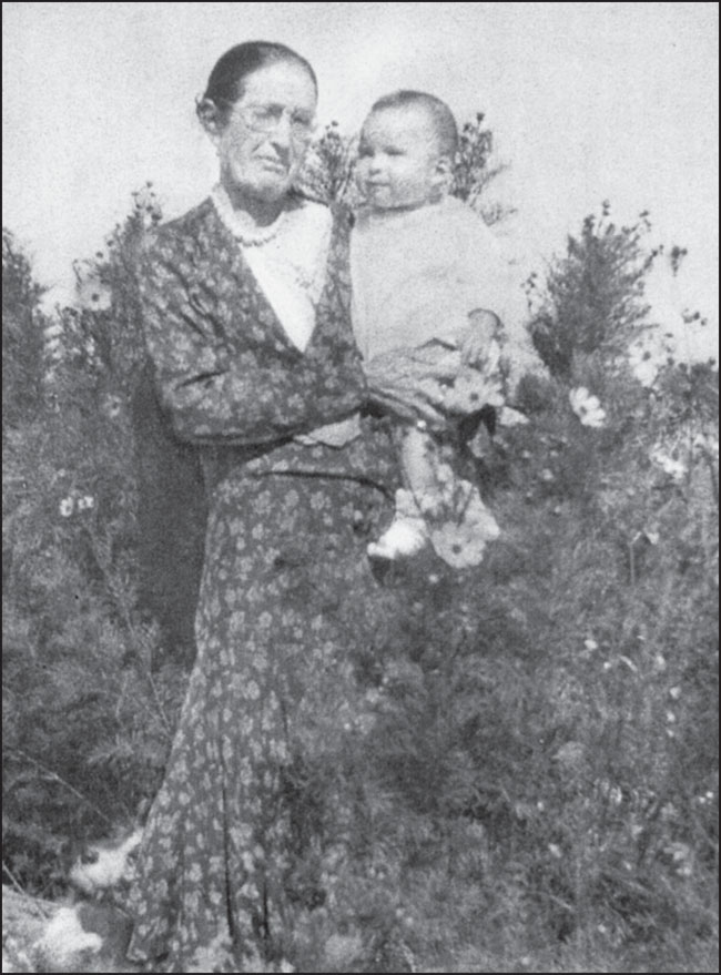
SOFIA TRUJILLO AND GRANDSON BENITO MARTINEZ, 1936. Pedro Trujillo was married to Sofia Maria Martinez in 1885. They had nine children on their Medano homestead, and then seven more after they sold the homestead in 1902 and moved northwest of Monte Vista. Benito was the son of their daughter Epiphania and Frederico Martinez. Epiphania (Fanny) was a cook at the Zapata Ranch for the Linger family, and Frederico (Fred) was a foreman at the Zapata Ranch. (Maria Lujan Causby.)

RESTORED PEDRO TRUJILLO HOME, 2012. Pedro Trujillo built a log home on his ranch in 1885, one of the few Hispanic settlers to use log construction instead of adobe. In 2012, Pedro’s granddaughter Maria Lujan Causby (center) visited the home with her grandson Jerry Paul Causby Jr. (left) and her brother Armenio Lujan (right). Maria and Armenio are the children of Andrea Trujillo Lujan, one of Pedro and Sofia’s seven daughters. (GRSA.)
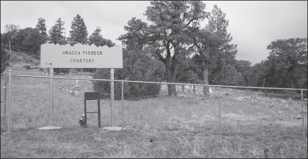
URACCA CEMETERY, 2012. Mormon families settled in the Uracca valley in the foothills of the Sangre de Cristo Mountains, overlooking the Great Sand Dunes and San Luis Valley. Several graves of the pioneering Wellington family are located here. William Wellington built a sawmill on Zapata Creek, two miles north of this location, and his son Charles operated a sawmill on Sawmill Creek, just east of Great Sand Dunes.
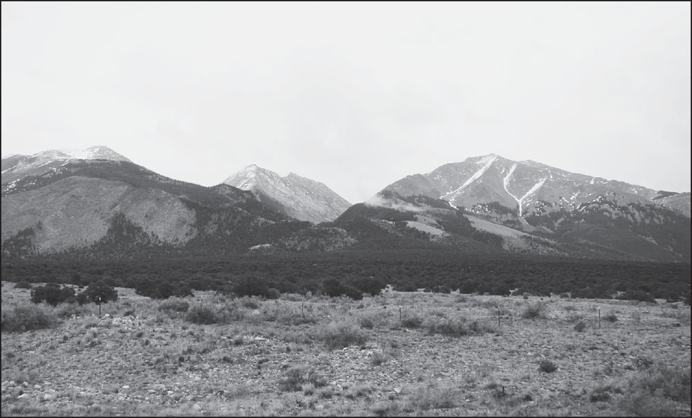
URACCA VALLEY, 2012. The Uracca (sometimes spelled Urraca or Euracca) valley was homesteaded by Mormon settlers in the 1870s and 1880s. Today, at Milepost 9 on Highway 150, just south of the Great Sand Dunes, the Uracca Road heads east into the mountains to the cemetery. Uracca Creek flows west out of the valley, seen in the center of the photograph with the Twin Peaks on the right.
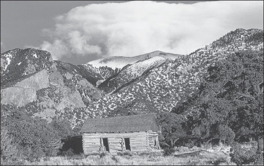
REMAINS OF URACCA SCHOOLHOUSE, C. 1960s. The Uracca School District was formed in 1888 with Nellie Calkins as the teacher. Among the first settlers in Uracca in 1871 were the following families: Leggit, Ranson, King, Land, Denton, Bailey, Orton, Calkins, Chadwell, Rumsey and Sealy. Wiley King was the presiding elder of the local Mormon church. (GRSA.)

ZAPATA FALLS, FEBRUARY 5, 1908. Two miles north of Uracca Creek, Zapata Creek becomes a frozen waterfall as it cascades down the canyon in winter. William Wellington’s sawmill processed timber harvested along Zapata Creek. The wood was then used for railroad ties, bridge timbers, and homes in the San Luis Valley. (MVHS.)
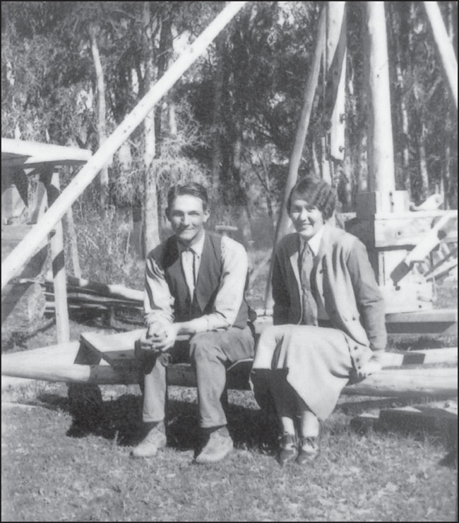
ZAPATA RANCH HOUSE CONSTRUCTION. A couple of miles northwest of Zapata Falls, the Dickey brothers brought in cattle herds from Texas, establishing the Zapata Ranch in 1876. They purchased the land from Hispanic settlers whose Mexican land grant claims were denied in 1874. In this photograph, Albert and Genevieve Linger oversee construction of a new Zapata ranch house in 1928. (GRSA.)
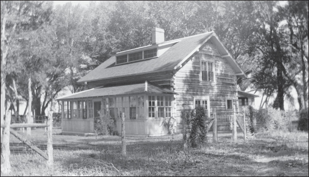
FINISHED ZAPATA RANCH HOUSE, C. 1928. The early Zapata Ranch was a stage stop and a post office with the post office operating from 1879 to 1900. The Dickey brothers sold the ranch in 1882 to New York investors Adee and Durkee. Eventually, the combined Medano-Zapata Ranch was purchased by George W. Linger in 1912, and his family operated it until 1947. (GRSA.)

ZAPATA RANCH HOUSE, 2012. The original structure, with three dormer windows on the roof, can be seen in the center of the photograph. The later additions included lodging and a dining room. The Nature Conservancy bought the combined Medano-Zapata Ranch (over 100,000 acres) in 1999 for $6.5 million, and the Medano Ranch portion is now part of Great Sand Dunes National Park.

MEDANO RANCH AND GREAT SAND DUNES. Directly west of the Great Sand Dunes, brothers Valentine and William Dickey established the Medano Ranch in the early 1870s, prior to their purchase of the Zapata Ranch in 1876. The brothers sold their beef at the Dickey Meat Market, operated by William in the mining town of Leadville, to the north. Valentine, meanwhile, operated the ranch. (GRSA.)

MEDANO RANCH HEADQUARTERS. In April 1877, Valentine Dickey constructed a one-room log house, which became the headquarters of the Medano Ranch. A post office called Medano Springs was opened there in June 1877 with William Dickey as postmaster. This later photograph shows the considerable expansion of the ranch buildings by the Linger family. (GRSA.)

MEDANO RANCH WAGONS AND WATCHTOWER. In the 1870s and 1880s, raids by Ute Indians upon San Luis Valley ranches were rare but still a potential threat. The Medano Ranch operators constructed a tall watchtower (to the left in the photograph) to keep an eye out for roaming bands of Ute raiders. (GRSA.)

MEDANO RANCH WATCHTOWER. Ranch hands stop for a drink of cool water from an irrigation pipe below the Indian watchtower. When George W. Linger purchased the Medano-Zapata Ranch in 1912 for $200,000, he obtained 12,948 deeded acres, 52,500 acres of leased state land, and water rights in 10 irrigation ditches. (GRSA.)
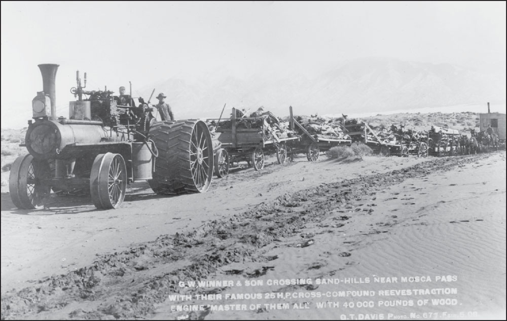
FORTY THOUSAND POUNDS OF WOOD CROSS SAN LUIS VALLEY, 1908. In this O.T. Davis photograph, G.W. Winner and his son haul six wagonloads of wood behind their powerful steam tractor, heading west toward the town of Mosca. The Great Sand Dunes and Sangre de Cristo Mountains can be seen faintly in the background. Also note the horse-drawn chuck wagon at the rear. (MVHS.)
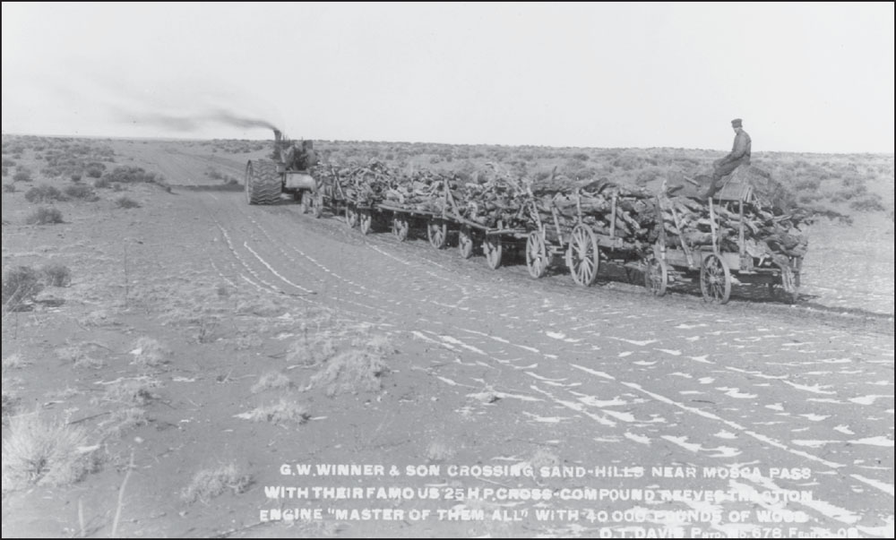
TWENTY-FIVE HORSEPOWER CROSS-COMPOUND REEVES TRACTION EWNGINE, 1908. Wood was a precious commodity in the largely treeless San Luis Valley. Settlers needed wood for fence posts, homes, and fuel, so cut timber was hauled west from the Sangre de Cristo Mountains across the sandy plains. This location is actually about 20 miles west of Mosca Pass, near the town of Mosca. (MVHS.)
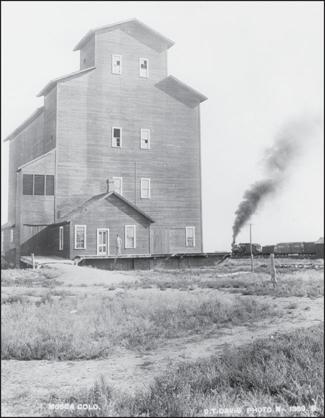
MOSCA FARMERS’ ELEVATOR COMPANY, 1912. The Denver & Rio Grande (D&RG) Railroad opened a narrow-gauge rail line from Villa Grove at the north end of the San Luis Valley to Alamosa in November 1890. Small towns immediately sprang up along the line, including Mosca, Hooper, and Moffat. The railroad encouraged these settlements in order to build up freight revenue along the line. (MVHS.)
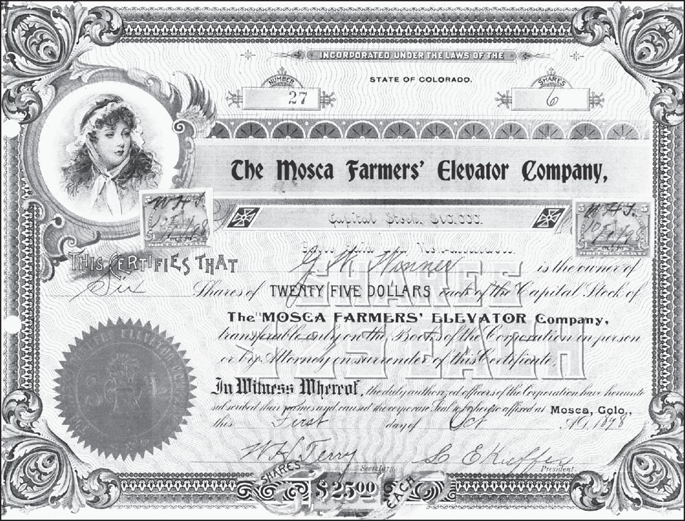
MOSCA FARMERS’ ELEVATOR COMPANY STOCK CERTIFICATE, OCTOBER 1, 1898. Wood hauler G.W. Winner owned six shares in the Mosca Farmers’ Elevator Company. The tall elevator building stored wheat, which was milled into flour and then shipped out on the D&RG Railroad. The railroad also encouraged San Luis Valley farmers to grow potatoes, onions, carrots, and sugar beets. (MVHS.)
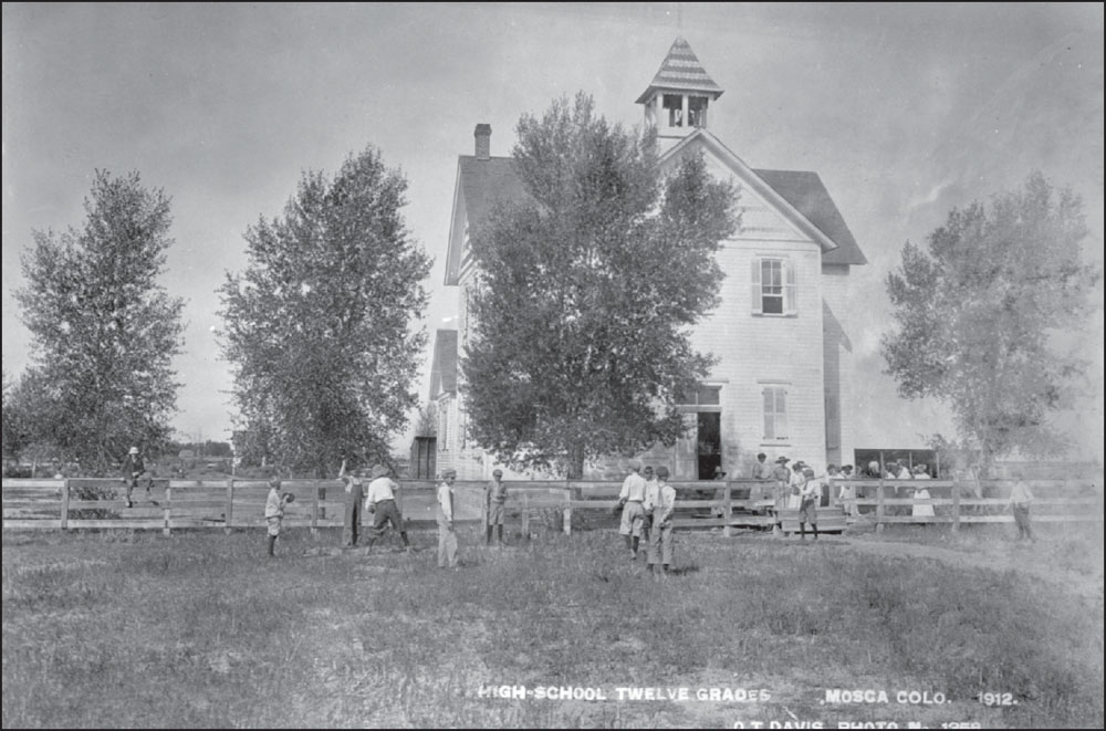
MOSCA SCHOOL, 1912. This O.T. Davis photograph captures children playing at recess at the Mosca School, which had 12 grades. The town of Mosca and Mosca Pass (located about 20 miles to the east) may have been named after mosca, the Spanish word for “fly,” the predominant irritating insect in the Great Sand Dunes area. (MVHS.)
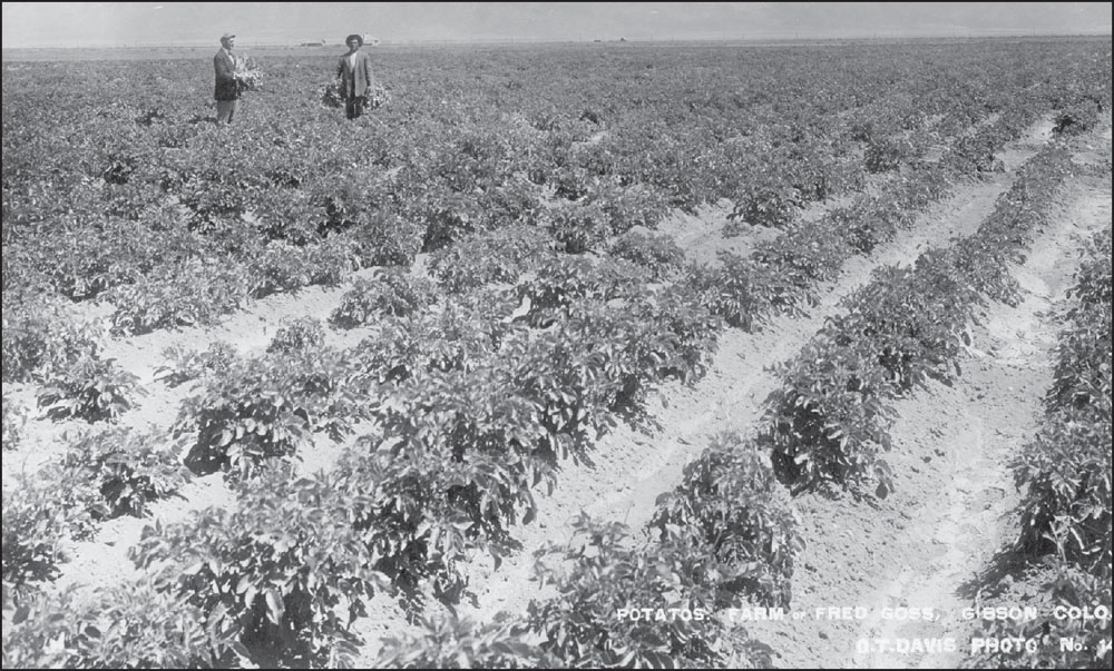
FRED GOSS POTATO FARM NEAR HOOPER, 1911. Potatoes were, and still are, the major crop of the San Luis Valley. This O.T. Davis photograph looks east toward the Great Sand Dunes (the white line at base of Sangre de Cristo Mountains). Hooper was named for Maj. Shadrach K. Hooper, the general passenger and ticket agent for the D&RG Railroad. (MVHS.)

HOOPER HOT SPRINGS POOL, C. 1940. In Sand Stories, Emmett Calkins, a Zapata ranch hand, says of the pool in the 1920s, “Them farmers just went in there with teams and horses and dug out a big pit there, and that water come out of there—it was hot! Boy, I mean it could cook you when it come out of the ground.” (MVHS.)
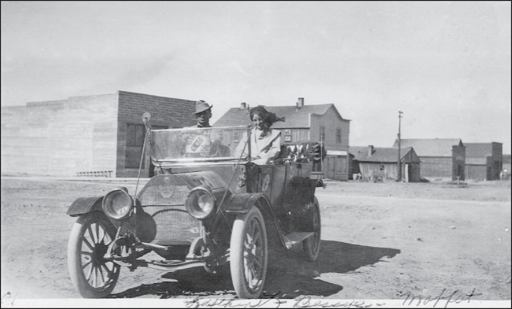
MOFFAT MAIN STREET, 1913. Luther and Bessye Gross are pictured showing off their new car on an otherwise deserted Main Street in Moffat. Moffat was named for David H. Moffat, president of the D&RG Railroad when the line was built through the area in 1890. (MVHS.)
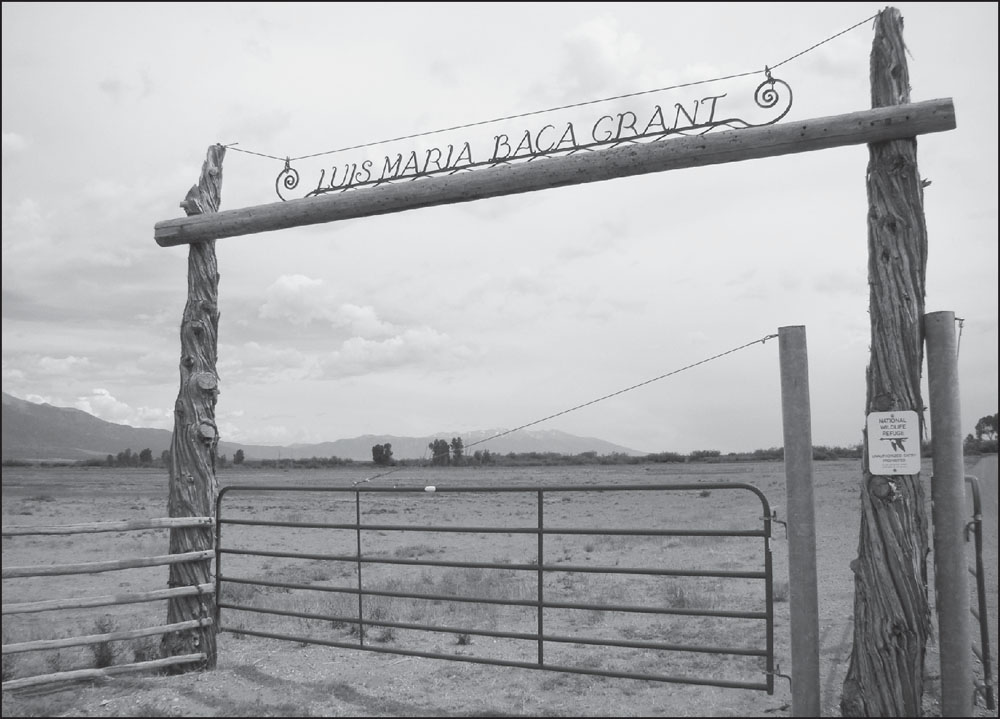
ENTRANCE GATE, BACA NATIONAL WILDLIFE REFUGE, 2012. When the Nature Conservancy purchased and transferred the Baca Ranch to the federal government in 2004, it marked the end of a long line of owners that began with the Luis Maria Baca family in 1864. The eastern section of the ranch became part of Great Sand Dunes National Park & Preserve, while the western section became the wildlife refuge.
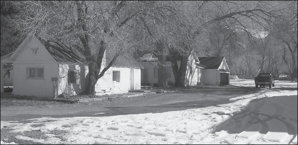
BACA RANCH HEADQUARTERS, FEBRUARY 2005. With over 100,000 acres, the Baca Ranch was one of the largest cattle ranches in the San Luis Valley. In the summer, the large ranches often drove their cattle to the railhead in Hooper, where cattle were loaded onto cattle cars and shipped to northern New Mexico. There, they were unloaded and allowed to graze and fatten on the lush mountain meadows near Cumbres Pass. (GRSA.)


