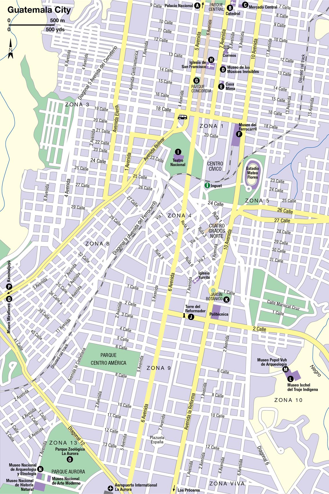
Guatemala City presents security concerns for travelers, and you should always take basic precautions to minimize the risk of being robbed: keep your valuables (including smart phones) out of sight. Though Zona 1 looks run down, it is considered safe to explore during daylight hours and in the early evening. The Zona Viva (in Zona 10) is a lively upmarket area, and the sheer number of cafes and restaurants here make it fine to explore on foot, except perhaps very late at night. The Transmetro bus network is a safe, fast way to get around the city, but after 8pm or so stick to taxis – Amarillo (tel: 2470 1515) is a reliable company with metered cabs.
Guatemala City
Guatemala’s capital has an undeniable energy, some good museums, and quirky attractions, even if it is not the most graceful city.
Main Attractions
It is the political and administrative hub of the country, yet sights are quite slim on the ground, and many travelers make Antigua their base.
An urban vortex of humanity and traffic, Guatemala City, colloquially known as “Guate,” is in most respects everything that the rest of the country is not. Plagued by pollution, many of the crumbling streets of the central zone are run down, but steadily parts of the historic centre are being revitalized by pedestrianization, renovation, and improved transportation links. In the richer suburbs in the south of the city, the atmosphere is very different, but even here the bougainvillea flowers draped over middle-class homes are intertwined with razor wire, put up to deter intruders.
Nevertheless, if you want to get a real flavor of the complexities (and inequalities) of the country, then a day or two in “Guate” is essential. Stroll pretty La Sexta avenue in the historic centre and take a coffee, and mingle with the Guatemalan elite in the Zona Viva. There are three excellent museums and a cosmopolitan plethora of restaurants, bars, and clubs. The climate – as the city is at 1,500 meters (4,900ft) – is also benign, and never gets oppressively hot.
TIP
Origins and development
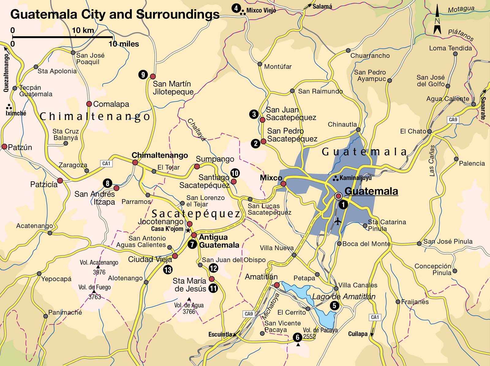
Guatemala City 1 [map] is actually the country’s fourth capital city, only established after a series of catastrophic earthquakes and mudslides all but destroyed nearby Antigua in 1773. Yet the new capital was built close to the ruins of Kaminaljuyú, which 2,000 years ago was the most important highland Maya city.
Today, the plazas and temples of Kaminaljuyú have been all but swallowed by Guatemala City’s suburbs, and the architectural remains in Zona 7, 3km (2 miles) from the center of town, give no impression of the Maya city’s size (around 50,000 inhabitants) and its position as a pivotal trade center for the transportation of obsidian and quetzal feathers.
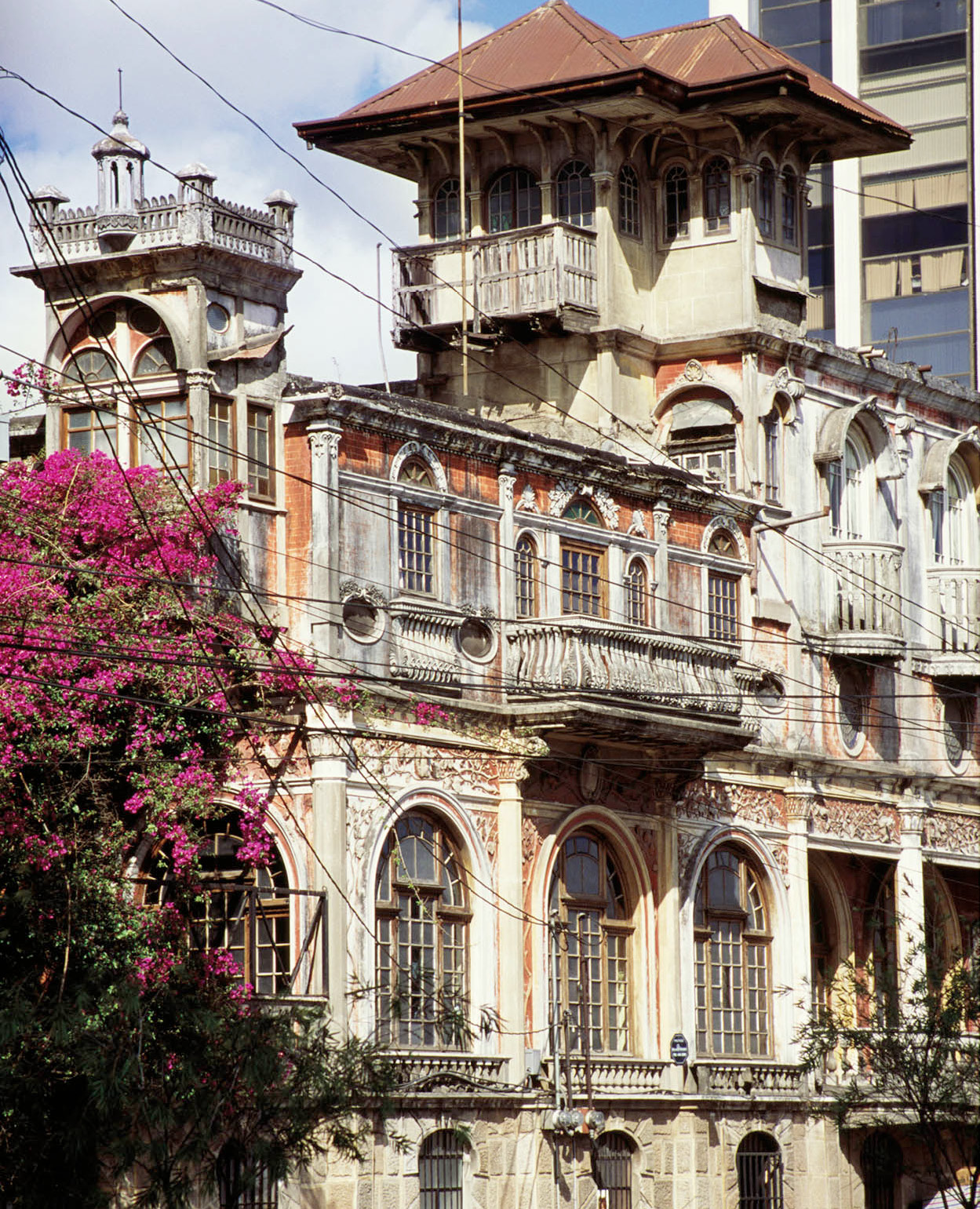
Guatemala City.
Getty Images
The new capital did not develop quickly at first, but following the 1902 earthquake that decimated the rival city of Quezaltenango, Guatemala City grew rapidly and uncontrollably as waves of migrants arrived in the capital. Many were landless campesinos (land workers), who were forced to settle in totally inappropriate barrio shantytowns, situated tight against railroad tracks and highways and on the fringes of the ravines that surround the north of the city.
Guatemala City, in common with most capitals in the developing world, faces many problems, yet in recent years there have been sure signs of regeneration. The city now boasts a modern bus transportation system, the Transmetro, which is efficient, secure, and the fastest way to get around. New life has been breathed into the heart of the city, Zona 1, as restaurants and bohemian bars have opened in colonial buildings. That said, crime, pollution, and urban decay remain pressing issues, and much work needs to be done before Guate becomes a really rewarding place to visit.
Getting your bearings
Fortunately, almost everything of interest is in five zones: Zona 1 in the north of the city, Zona 4 in the center, and Zonas 9, 10, and 13 in the south. In common with most Latin American capitals, Guatemala City is organized according to the Spanish grid system: all calles run east to west and all avenidas north to south. The Parque Central in the heart of Zona 1 is the most important landmark. Other landmarks include the Centro Cívico bureaucratic buildings and the Torre del Reformador, a Guatemalan copy of the Eiffel Tower, in Zona 9.
To find an address, first find the zona, followed by the street, and then the number. If you are given the address “10 C, 12–15, Zona 9”, first look for Zona 9, then the street (10 Calle), then the number (12–15); 12 means the street is between 12 and 13 avenidas, and 15 is the number of the house.
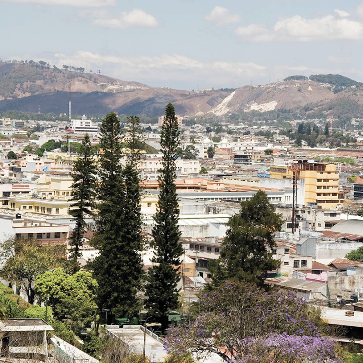
The Centro Cívico.
Corrie Wingate
Zona 1
The Parque Central is considered both the heart of the city and the nation; indeed, all distances are measured from here. It is surrounded by some of the most historic and prestigious edifices in the country. On Sundays, when it is occupied by a huge indigenous textiles market, this plaza really comes to life.
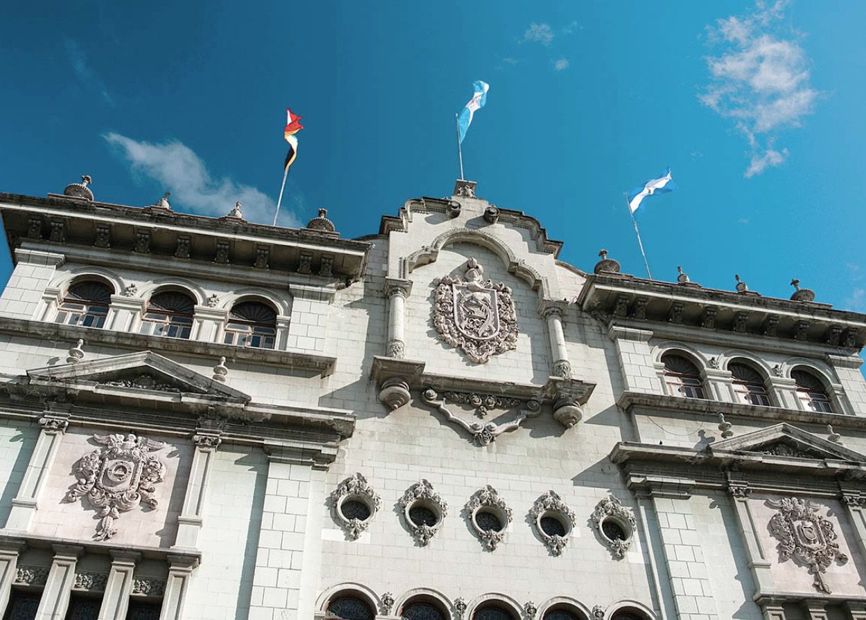
Palacio Nacional.
iStockphoto
Presiding over the Parque, on the northern side, is the monumental bulk of the Palacio Nacional A [map] (daily 10am–4pm; charge), built by the architect Rafael Pérez de León during the Ubico dictatorship between 1939 and 1943. The Palacio contained the presidential offices until 1998; if you visit you can take a guided tour (in English and Spanish). The sober grey-green stone exterior belies an eclectically decorative interior of Moorish and neoclassical influences. Giant stairwell murals by Alfredo Gálvez Suárez depict an idealized history of Guatemala, and in the reception hall on the first floor a massive chandelier groans under the weight of crystal and four bronze quetzals. In the banqueting hall are stained-glass windows by Julio Urruela Vásquez and Roberto González Goyri. Don’t miss the two attractive Mudéjar (Moorish) inner courtyards planted with palm trees on the ground floor.
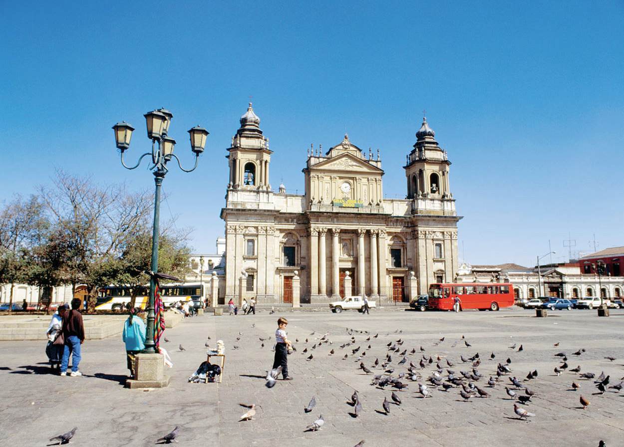
The Catedral on Parque Central.
Getty Images
Dominating the east side of the Parque Central is the city Catedral B [map] (daily 7am–noon, 3–7pm; free), constructed in a mixture of Baroque and neoclassical styles between 1782 and 1809, though its blue-tiled dome and towers were added later, in 1868. It does not rank amongst Guatemala’s most impressive churches, but its sturdy construction has at least survived two earthquakes. The somewhat austere interior contains three naves and 16 altars, some painted in gold leaf.
Around the corner from the Catedral on 8 Calle is the Mercado Central C [map], in an inauspicious triple-deck sunken concrete block. Though it does not look especially inviting, this is quite a good place to shop for textiles, leather goods, basketry, and other handicrafts. If you are feeling adventurous, there’s a huge number of foodstalls on the middle floor serving up a range of caldos (stews) and snacks.
Heading south from the Mercado, the Correos (post office), on 12 Calle and 7 Avenida, is the next place of interest. Its great arch spans 12 Calle and the whole building is painted salmon pink. Continuing south along 7 Avenida you soon reach Museo de los Músicos Invisibles D [map] (Mon–Sat 8am–6pm; charge), a quirky museum devoted to the “invisible musician” which has an incredible collection of automated antique musical instruments – including organs, jukeboxes, and Art Deco radios – all in working order, and demonstrated as part of the tour. A block south of here on 8 Avenida is Casa Mima E [map] (Mon–Sat 10am–5pm; charge), a fine 19th-century town house that has been beautifully restored and contains some fine period furniture and furnishings. Six blocks from here, at 18 Calle and 9 Avenida, Guatemala City’s former train station has been converted into the excellent Museo del Ferrocarril F [map] (Tue–Fri 9am–4pm, Sat–Sun 10am–4pm; charge), devoted to the history of Guatemalan railroads. There are several superb old steam engines, plus a small collection of classic cars and train paraphernalia.
If you head west of here you can return to the Parque Central via pedestrianized Sexta Avenida (6 Av), a delight to stroll as it takes you past fine 19th-century and Art Nouveau buildings and cafes. You will pass the Parque Concordia G [map], a small green oasis with a good percentage of Zona 1’s very few trees. This little city park is popular with preachers, limpiabotas (shoeshine boys), street performers, quack medicine sellers, and amateur philosophers.
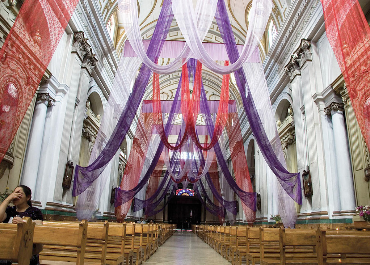
Iglesia de San Francisco.
Corrie Wingate
Next up, close to the castle-like Police Headquarters, is the Iglesia de San Francisco H [map]. The church was built in 1780 in an Italianate neoclassical style, and the mortar used to construct it consisted of milk, cane syrup, and egg white. There is a terrific collection of paintings of martyrs, and the relics include the sacred heart of Trujillo. A small but worthwhile museum inside the church houses the belongings of Fray Francisco Vásquez, a Franciscan friar (daily 9am–noon, 3–6pm). From here the Parque Central is just a five-minute walk away, to the north.
The Centro Cívico – Zona 4
Bridging the divide between the old quarter of Zona 1 and the richer, leafy environs of Zonas 9 and 10 is the cluster of concrete buildings known as the Centro Cívico. Here you will find Inguat, the tourist board HQ, housed in a large block on 7 Avenida, near the railroad tracks.
The Teatro Nacional I [map], part of the Centro Cultural Miguel Ángel Asturias, is also in this zone, set superbly above the traffic on the remains of the old Spanish fortress of San José – the ancient ramparts are still evident. The views over the city and of the surrounding mountains, including Volcán de Pacaya, are excellent. The Teatro Nacional was completed in 1978 to a radical design that has a distinctly nautical flavor, painted blue and white, with porthole windows, reminiscent of an ocean liner. A Greek-style outdoor theater, a small chamber-music auditorium, and a small armament museum complete the complex (Mon–Fri 9am–4.30pm and for performances).
In the south of Zona 4, the neo-Gothic Iglesia Yurrita on Ruta 6 is a startling sight (note the leaning spire, damaged in the 1976 earthquake).
Zonas 9 and 10
These two wealthy zonas are bisected by Avenida la Reforma, an attractive tree-lined boulevard. Zona 9, to the west, is the less exclusive of the two, with a mixed combination of businesses, mid-range restaurants, and hotels. The one landmark in this part of the city is the Torre del Reformador J [map], a small-scale imitation of the Eiffel Tower in Paris, erected in honor of Guatemala’s liberal reformer, President Rufino Barrios (1873–85). At the southern end of the boulevard is the Parque El Obelisco, named after the huge obelisk commemorating Guatemalan independence.
On the opposite side of Avenida la Reforma, in Zona 10, there is much more of interest. This is the natural abode of Guatemala’s wealthy elite, with a good proportion of all the city’s luxurious hotels, restaurants, and nightlife. At the Jardín Botánico K [map] (Botanical Garden), just off the Avenida la Reforma on Calle Mariscal Cruz, there’s a diverse range of nearly 1,000 species of Guatemalan plant life, and a small museum with some stuffed birds, including a quetzal (Mon–Fri 8am–3.30pm, Sat 8am–noon; charge).
TIP
The Museo Ixchel has a superb collection of huipiles complete with explanations about the weaving process and the importance of Maya symbolism in the colorful patterns and designs.
Top museums
Perhaps the two biggest attractions in the city are the twin museums inside the verdant grounds of the Universidad Francisco Marroquín, down 6 Calle Final in the valley of the Río Negro. Museo Ixchel del Traje Indígena L [map], superbly set in a dramatic Maya-esque structure, is dedicated to Maya culture, especially textiles. All the exhibits are clearly presented and explained in English as well as Spanish; it also has a good gift shop selling some unusual textiles (Mon–Fri 9am–5pm, Sat 9am–1pm; charge).
The Museo Popol Vuh de Arqueología M [map], adjacent to the Ixchel, is another private museum with a small range of top-quality archeological artifacts arranged into pre-Classic, Maya Classic, post-Classic and Colonial rooms. Highlights include a replica of the Dresden Codex and some stunning funerary urns (Mon–Fri 9am–5pm, Sat 9am–1pm; charge).
There are also a couple of museums worth a visit in Zona 13, just to the south (all Tue–Fri 9am–4pm, Sat–Sun 9am–noon, 1.30–4pm). By far the most impressive is the Museo Nacional de Arqueología y Etnología N [map] (charge), in the Parque Aurora, which has some spectacular Maya art, costumes, masks, and jade artifacts. Spend an hour or two at the Parque Zoológico La Aurora O [map] close by, where there is plenty of endemic wildlife, and even elephants, tigers, leopards, and lions, all looking quite healthy (Tue–Sun 9am–5pm; charge).
Around Guatemala City
Heading northwest of the capital, along Calle de San Juan Sacatepéquez, you pass close to the ruins of Kaminaljuyú P [map], once one of the most important cities of the Maya world, and believed to be one of the very first centers where writing developed. It is now reduced to an inauspicious collection of grassy mounds, but you can get an idea of its former splendor in the nearby Museo Miraflores Q [map] on Calzada Roosevelt (Tue–Sun 9am–7pm, charge), a 10-minute walk south of the ruins. This modern museum has exhibits such as stone sculptures and ceramics, jade jewelry, and also a permanent exhibition of Guatemalan textiles.
Continuing farther out of the city, you pass through the Maya villages of San Pedro Sacatepéquez 2 [map] and San Juan Sacatepéquez 3 [map], both sharing a prestigious weaving tradition and the same market day – Friday – when they come alive, particularly the larger San Juan, where the women wear striking huipiles. Some 28km (17.5 miles) from San Juan Sacatepéquez are the ruins of Mixco Viejo 4 [map], the former capital of the Pokoman Maya. The site, comprising nine temples and two ball courts, has been well restored, forming a dramatic setting on flat-topped ridges surrounded by steep ravines (daily 8am–5pm; charge).
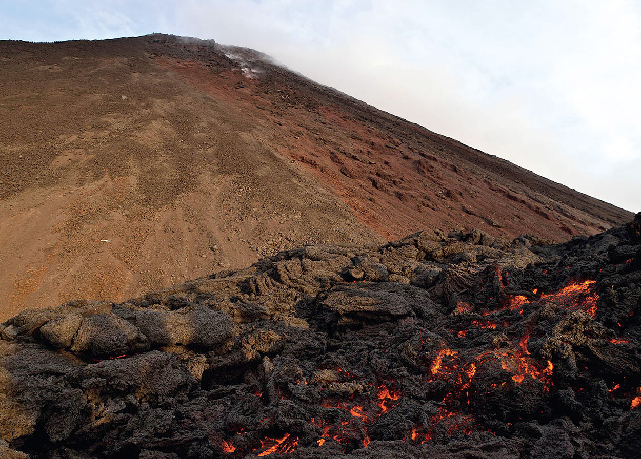
The active Volcán de Pacaya.
iStockphoto
About 30km (18.5 miles) to the south of Guatemala City, following the Carretera del Pacífico, is one of the most beautiful lakes in Guatemala, Lago de Amatitlán 5 [map]. Unfortunately, its waters have been polluted for years and are not safe for swimming.
High above the lake is Volcán de Pacaya 6 [map] one of the most active volcanoes in Central America, which has been in a state of almost constant eruption since 1965. Pacaya is an astonishing sight, especially at night when the finest sound and light show in Guatemala can paint the sky orange with great plumes of lava and gas.
Tour agencies in Antigua or Guatemala City can arrange transportation and a guide for the volcano hike, which is about a one-hour climb.
