Northern Districts
Wide open spaces – vast forests, wetlands, fields of sugar cane – and the magical mix of environmental and archeological treasures make northern Belize a rewarding destination.
Main Attractions
The north of Belize is the most agriculturally developed region of the country but also the least appealing for visitors. Probably the main reason the people here have been slow to promote the attractions of their part of the country is because they are too busy growing sugar cane, Belize’s main crop. Beyond sugar, though, there’s plenty to see and do, and the north is home to the country’s most successful, privately run conservation projects.
North of Belize City, the Northern Highway winds between the Belize River and the deep blue sea to Ladyville, a village dominated by the International Airport, and Price Barracks, home of the Belize Defence Force, and the remaining British army presence in Belize (they still run jungle training courses here).
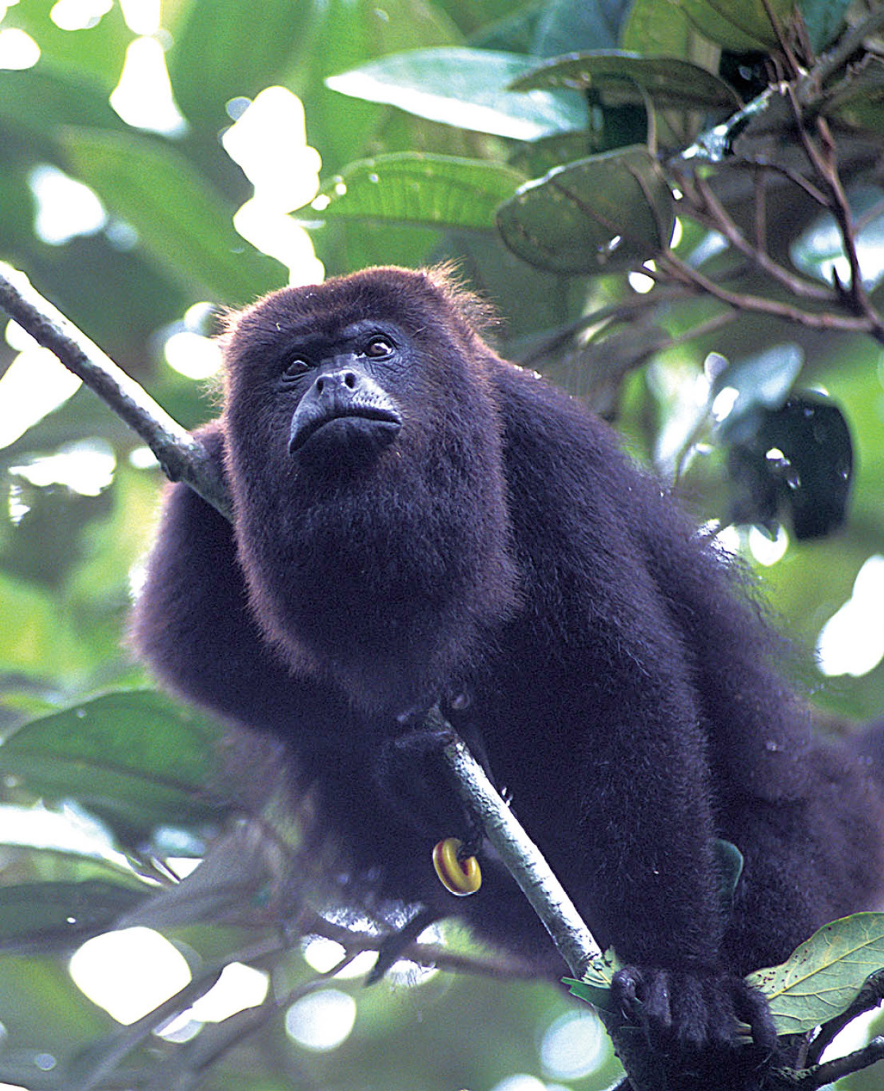
A black howler monkey.
Fotoseeker
Community Baboon Sanctuary
Five miles (8km) past Ladyville, a left turn signposted to Burrell Boom and Bermudian Landing is the start of a paved road which winds west through quiet Creole villages created and then abandoned by the logging industry.
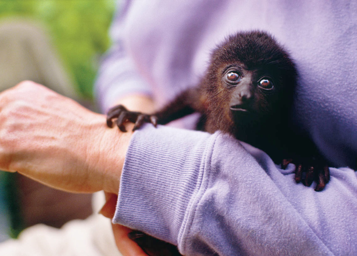
A three-month-old black howler monkey at the Community Baboon Sanctuary.
© George H.H. Huey / Alamy
Bermudian Landing hosts the Community Baboon Sanctuary 2 [map], a conservation project established in 1985 by an American zoologist backed by the Worldwide Fund for Nature. Persuading local farmers to sign to a plan protecting the broadleaf forest habitat of local black howler monkeys (known in Belize as “baboons”), the project has spread to eight neighboring riverside villages and reversed an alarming fall in monkey numbers.
Tours of the sanctuary can be arranged from the visitors’ center (www.howlermonkey.org; daily 8am–5pm; charge for entry and tour). Led by local guides, the tours explore the forest, with the highlight being the chance to hear a howler’s howl, a frighteningly loud noise which sounds more like what you might expect a jaguar’s roar to be.
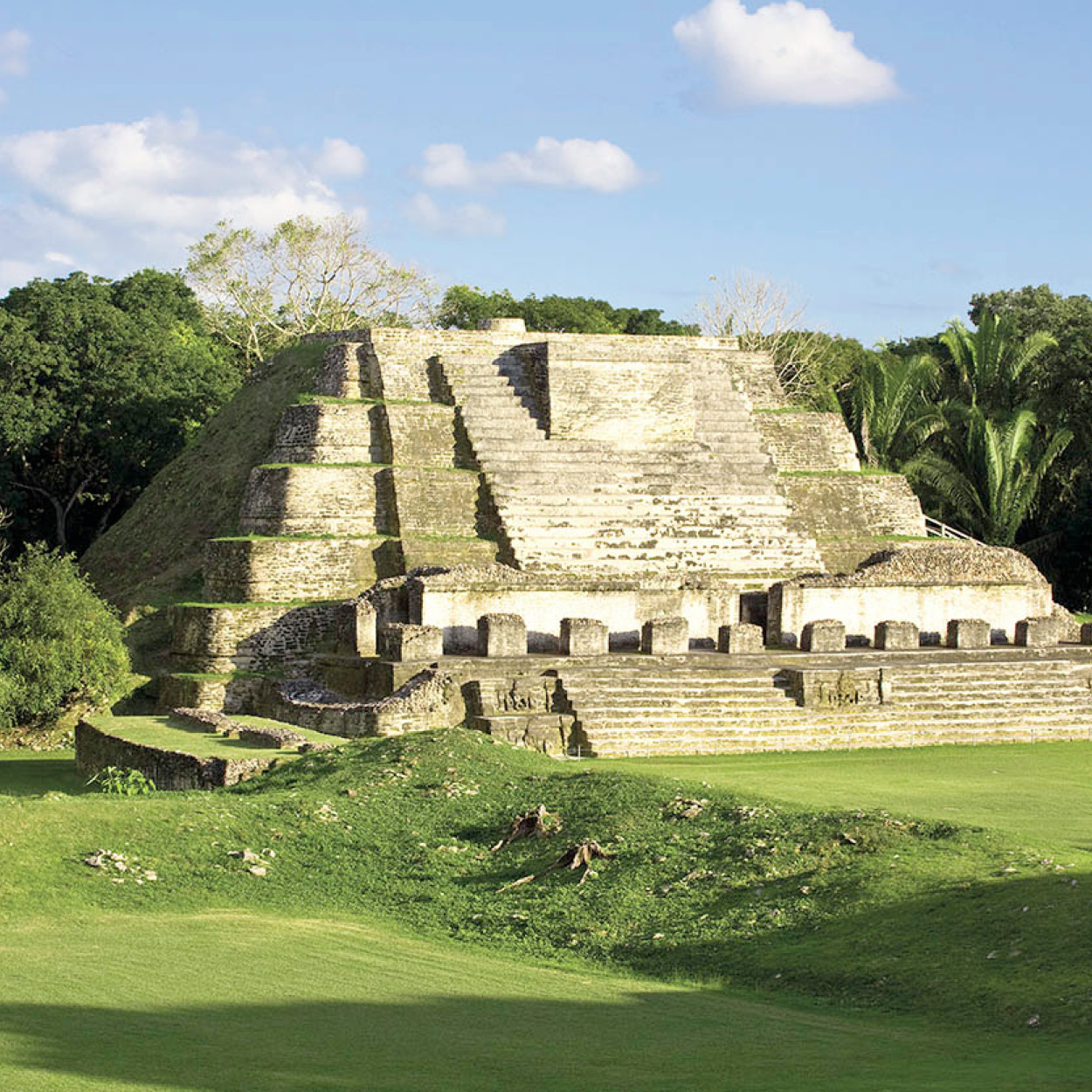
Temple of the Masonry Altars at Altun Há.
© Jane Sweeney / AWL Images Ltd
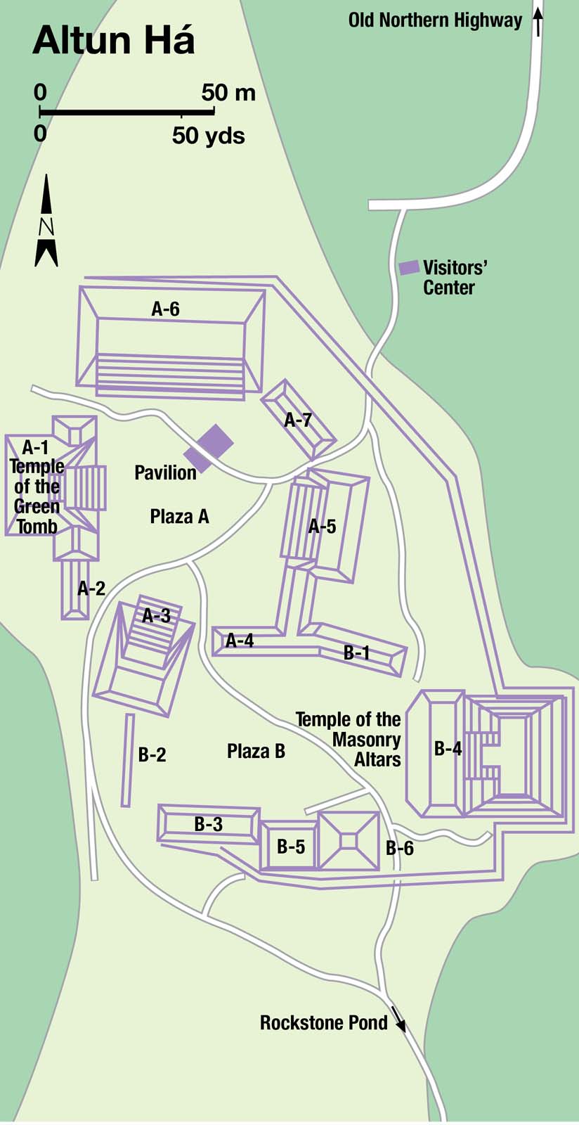
Altun Há
Back on the Northern Highway, past the village of Sand Hill, a turning on the right is signposted to Maskall and Orange Walk. This is the Old Northern Highway, and 12 miles (19km) along this one-track, pot-holed lane is a turn-off that leads to the impressively restored Maya ruins of Altun Há 3 [map] (daily 8am–5pm; charge).
Altun Há, Mayan for “stone water,” was first excavated in 1957, but extensive work did not start until the discovery of a jade pendant in 1963, which excited a great deal more interest. Archeological excavations unearthed a jade replica of the head of the Maya sun god Kinich Ahau, found in the Temple of the Masonry Altars (also known as Temple of the Sun God). At 6in (15cm) high and weighing 9.75lbs (4.4kg), it is the largest carved jade object ever found in the Maya world.
Altun Há is made up of two plazas surrounded by temples. Plaza A is the first you come to, and beneath Temple A-1 is a magnificent temple, the Temple of the Green Tomb. More than 300 pieces were unearthed here, including jade, jewelry, flints, and jaguar skins.
Plaza B has the site’s largest temple, B-4, the Temple of the Masonry Altars (which is depicted on the Belikin beer label). A single stairway leads to an altar at the top. The discoveries at Altun Há have pointed to its importance as a coastal trading base and ceremonial center, though the final fate of the settlement, which was suddenly and mysteriously abandoned, has never been discovered.
Crooked Tree Wildlife Sanctuary
At Mile 33 (Km 52) on the Northern Highway is a left turn signposted to the village of Crooked Tree and the Crooked Tree Wildlife Sanctuary 4 [map] (Mon–Sat 8am–4.30pm; charge). Crooked Tree, built on a freshwater island, is the largest of Belize’s Creole villages and the oldest inland community. The growing popularity of its developing Wildlife Sanctuary has given it a new lease of life. However, since most of the 900 people who live here rely on either their feet or their horse to get around, it is in no danger of getting busy.
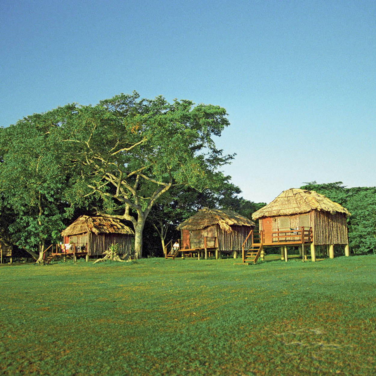
Guest accommodation at the Crooked Tree Wildlife Sanctuary.
© Ange / Alamy
The 36,480-acre (14,760-hectare) sanctuary opened in late 1984 and is run by local volunteers with support from the Belize Audubon Society. The sanctuary’s lagoons, rivers, and wetlands provide perfect habitats for more than 300 species of birds and waterfowl, including ospreys, snail kites, and kingfishers, as well as other wildlife, including crocodiles and turtles. The rarest of all is the jabirú stork, a tall, prehistoric-looking monster of a bird, which makes an unnerving rattle with its long beak if it becomes agitated.
TIP
The one-hour boat trip to Lamanai is worth making even without the lure of the Maya ruins. Plants, birds, and the occasional crocodile give the expert tour guides plenty to talk about, as the boat slowly drifts through the Mennonite colony at Shipyard, past old deserted logging camps, before opening out onto the New River Lagoon.
To help you get the most from the sanctuary there is a visitors’ center at the end of the 3-mile (5km) causeway linking the Northern Highway to Crooked Tree village, which has displays and maps, and can advise on lodgings and tours.
Crooked Tree also hosts the annual Crooked Tree Cashew Festival. Held in May, this has grown into one of the area’s biggest annual events, showcasing Belize’s culture, products, and above all the ability of locals to have a good time. Ostensibly to celebrate the cashew harvest, the festival is really just a good opportunity to eat, drink, and make merry on home-made Creole food and wine.
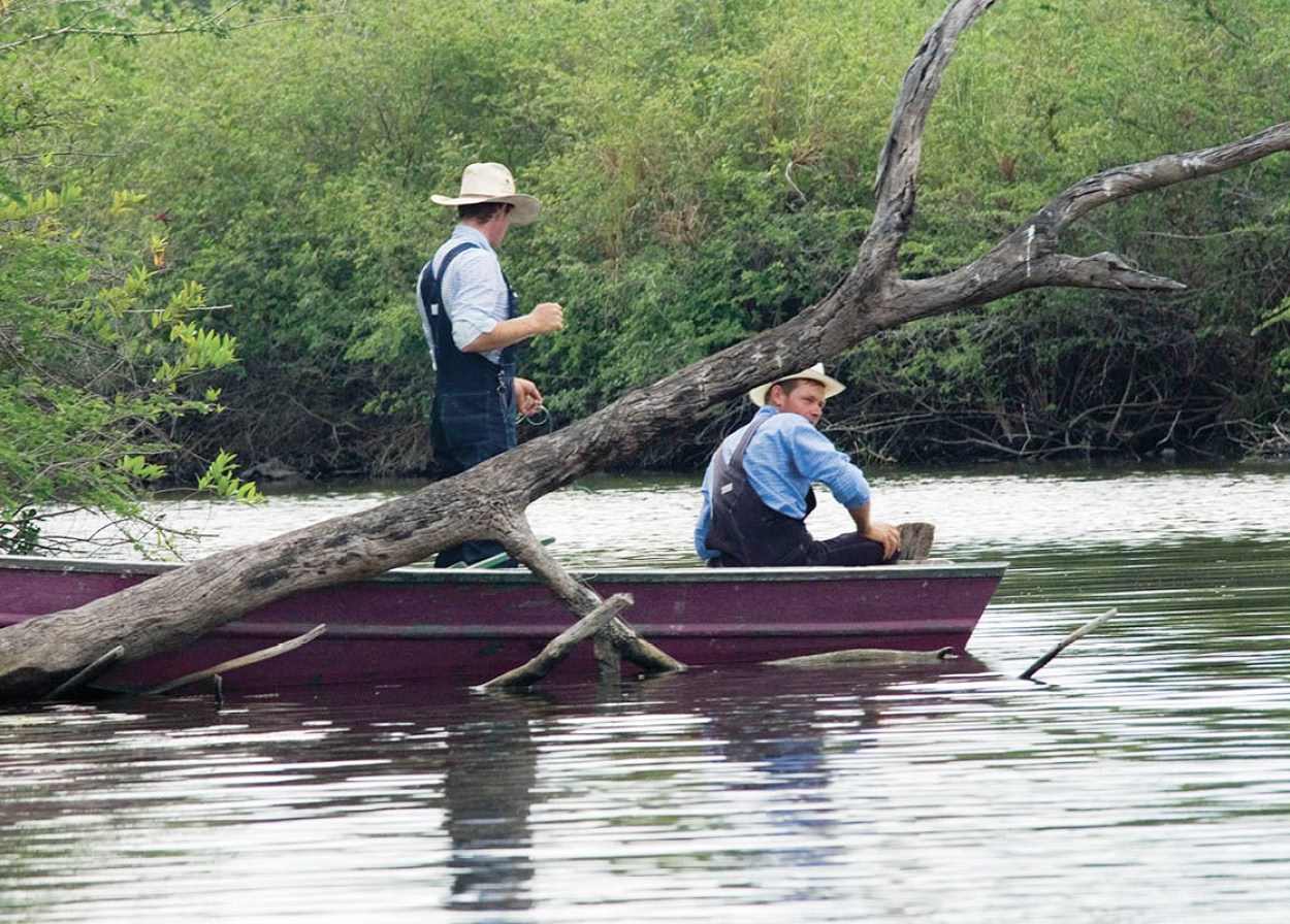
Mennonites from Shipyard, Orange Walk district.
Corrie Wingate
Lamanai
Approaching Orange Walk on the Northern Highway, some 22 miles (35km) from Crooked Tree is the Tower Hill Toll Bridge. On the New River, by the bridge, boats wait to take you along the scenic river journey to Lamanai.
On the west shore of the New River Lagoon, Lamanai 5 [map] (daily 8am–5pm; charge), which translates as “submerged crocodile” (though “place of the mosquito swarm” would be an equally appropriate name), was one of the longest continually inhabited settlements anywhere in the Maya world, dating back to at least 1500 BC. As well as the Maya ruins, excavations have uncovered the remains of two 16th-century Spanish missions destroyed by the Maya, who apparently rejected this attempt to convert them to Christianity.
Most of the stelae, relating the lives of the city’s Maya rulers, were found scattered, burned, and broken amongst the ruins. One of the most elaborate, Stela 9 (showing Lord Smoking Shell), was discovered intact, however, and is now on display under a thatched canopy, near the site’s main temple. An impressive visitors’ center and museum contains pottery and other artifacts dug from the site, as well as details of plant and animal life around Lamanai, which doubles as a wildlife and botanical reserve with rare untouched tracts of jungle and savanna.
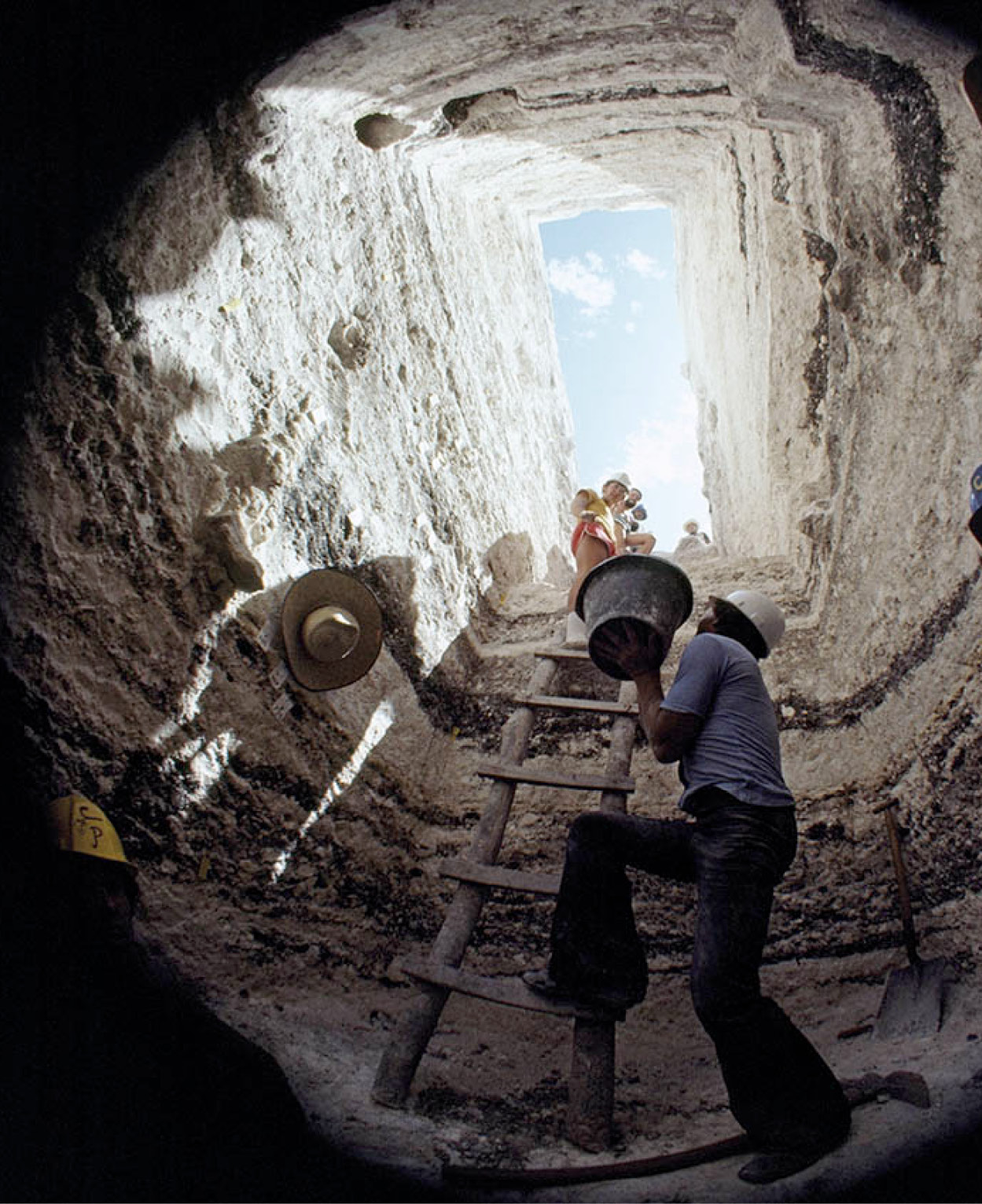
Excavating Maya artifacts from within a pyramid.
(Photo by Lowell Georgia/National Geographic/Getty Images)
Cuello Maya Ruin
The route west of Orange Walk passes by the small Cuello Maya ruin, which is on land owned by the Cuello brothers’ distillery, whose permission is needed to visit the site (ask to speak to Oswaldo or Hilberto, or tel: 322 2141). While there is not much for the casual observer to see (excavations are filled in after research has been completed), the site has become of pivotal importance in understanding the history of the Maya.
Cuello has been systematically explored and researched from 1973 to the present day, led by Norman Hammond of Cambridge University, who found the site had been continuously occupied from at least 1000 BC until AD 1500. The findings were startling for historians, because the earliest known Maya civilization before then had only dated from 600 BC. Compounding this discovery, previously unknown trade artifacts (probably obtained in exchange for local bird feathers and animal skins) found at Cuello have led Hammond to suggest the Maya may have had other unknown influences independent of the Olmec peoples from whose culture the Maya way of life is usually believed to descend.
There is no visitors’ center, nor any other source of information at the site, but background information can be obtained from Banquitas House of Culture in Orange Walk and the Institute of Archeology in Belmopan. The site is open every day except Sunday.
Orange Walk
Back on the Northern Highway, Orange Walk 6 [map], 57 miles (92km) north of Belize City, is Belize’s second commercial center, and the working-class heart of the sugar industry. Nearby is the Tower Hill Sugar Refinery, which handles all Belize’s sugar cane, and at harvest time the rumble of trucks can be heard from dawn to dusk, pulling the precious cane to the factory.
From Orange Walk and beyond the culture perceptibly changes from Creole to Hispanic – this part of the country was settled by mestizos fleeing the Yucatán Caste Wars in the 1860s, and for a long time, until the Northern Highways were built, the people here had closer ties with Mexico than with the rest of Belize.
Río Bravo Conservation Area
Farther southwest is the Mennonite settlement at Blue Creek, famed for having built its own hydroelectric plant out of parts salvaged from an airplane wreck. South of Blue Creek is one of Belize’s most successful environmental conservation projects. The Program for Belize was launched in 1988 by the Massachusetts Audubon Society and has established the 260,000-acre (105,000-hectare) Río Bravo Conservation Area 7 [map]. The lands were acquired through donations inspired by its distinctive “sponsor an acre of rainforest” fund-raising appeal.
With more than 240 species of trees, 390 species of birds, and over 70 known species of mammal, Río Bravo represents one of Belize’s highest concentrations of biodiversity. To generate further income, the program has entered the eco-tourism industry and offers on-site accommodations and meals at two field stations: La Milpa and Hill Bank, located at opposite ends of the reserve.
TIP
To find out more about the Shipstern Nature Reserve before visiting, check the comprehensive website (www.shipstern.org). There is plenty of information on the plants and animals you can see here, and details of the ongoing conservation efforts and research program.
Corozal
Some 90 miles (145km) north of Belize City, Corozal is a seaside town (no beach) with a quiet and welcoming character. The name derives from the Spanish for the cohune palm tree, a Maya symbol of fertility, and reflects Corozal’s fertile soils and benign climate. On a wall inside the Corozal Town Hall, the town’s history is told through the colorful mural by Manuel Villamor Reyes, which traces events from the original settlement in 1849 by refugees fleeing a massacre in the town of Bacalar in Mexico’s Yucatán Peninsula.
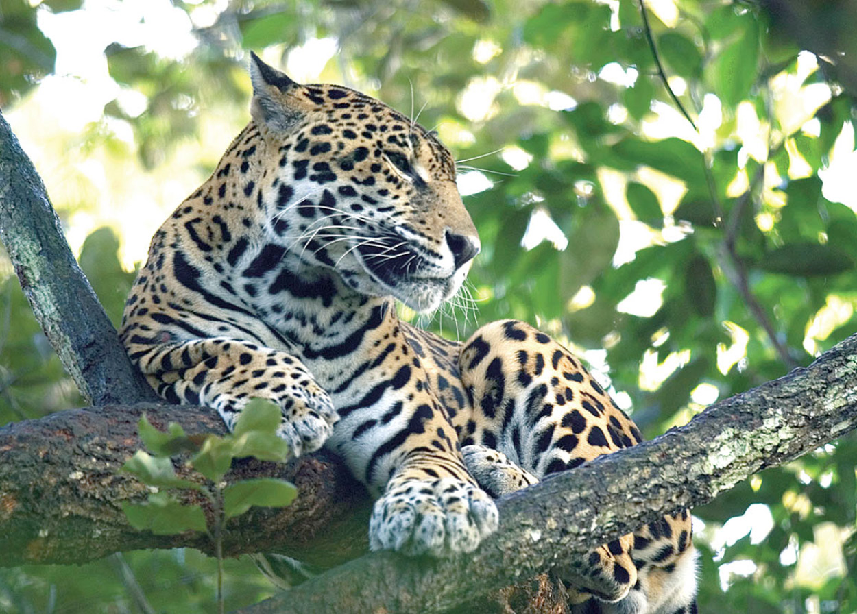
A rare sighting of a jaguar.
Fotoseeker
Shipstern Nature Reserve
About 15 miles (24km) southeast from Corozal is the 27,000-acre (11,000-hectare) Shipstern Nature Reserve 8 [map] (daily 8am–4pm). The trees on the Shipstern Peninsula were flattened by Hurricane Janet in 1955 but, thanks to the assistance of the International Tropical Conservation Foundation, the nature reserve and forest here have made a remarkable recovery.
This is one of the most remote and untouched areas in Belize and native mammals found here include tapirs, peccaries, coatimundi, wild cats, and birdlife including egrets, teals, keel-billed toucans, and collared aracari. The camouflaged treehouses and new 65ft (20-meter) observation tower enable you to observe wildlife without disturbing the animals, but you will need to be accompanied by a guide.
The reserve can be reached by boat or plane from San Pedro, Ambergris Caye, or Corozal (via the village of Sarteneja). Alternatively, there is a rough road from Orange Walk, via Little Belize and then on to Chunox and Sarteneja. The reserve headquarters are 3 miles (5km) before Sarteneja, and tours can be arranged from here.