West Sumatra’s terrain, with its fertile valleys, lush rainforests and majestic peaks, offers some of the most memorable landscapes in all of Indonesia. Bukit Barisan Selatan National Park, home of the few remaining two-horned Sumatran rhinoceros, the country’s largest national park, Kerinci Seblat, and Bukit Tigapuluh National Park are all here. The region is also graced with two large crater lakes, the larger and more stunning of which is Maninjau just west of Bukittinggi, with smaller Singkarak to its southeast.
The highest peak in West Sumatra is Gunung Kerinci in the rugged, little-visited Kerinci Seblat National Park. Indonesia’s second-highest volcano, it attracts climbers who like a challenge. Conservation groups there have trained local guides to take the adventurous on treks through the forest and climbing.
Just off the west coast lies a string of islands that lure visitors of entirely different sorts. The spectacular breaks at Nias have beckoned surfers for the last decade or two, some of whom have become volunteers in health care, community empowerment and disaster relief through SurfAid International, which has weathered the many upheavals of nature over recent years. The other islands, the Mentawais, draw extreme trekkers who relish visiting the friendly Siberut people, who live in the forests and happily tell the stories that their tattoos represent.
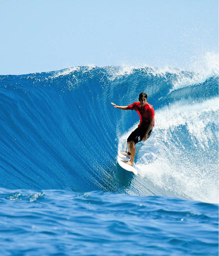
Surfing off the coast of Nias.
iStock
While the attractions in this region are limitless, the number one destination remains the Minang highlands, home to the Minangkabau people who, despite their staunch Islamic devotion, make up the largest matrilineal society on Earth (for more information, click here). Property and wealth are inherited through the female line, and both men and women trace their lineage through their mothers and retain loyalty to the clan houses of their grandmothers. Their distinctive traditional rumah gadang (clan houses) dot the countryside of the highlands, with elaborately carved exteriors and upturned rooflines that resemble the horns of a water buffalo.
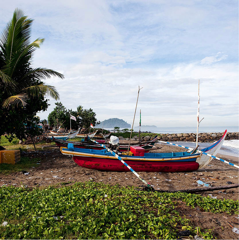
Fishing boats at Padang.
Corrie Wingate/Apa Publications
Padang
The capital of and gateway to West Sumatra is Padang 5 [map], a thriving commercial centre. It is the island’s third-largest city, and 90 percent of its population are ethnic Minangkabau. Home to the largest seaport on the western coast, Teluk Bayur is 6km (4 miles) south of the city centre. The harbour came into existence in the 18th century after the discovery of gold in the highlands and to accommodate the lucrative pepper trade. At one time, Sumatra supplied over half of the world’s pepper needs. Today, the busy seaport loads ships with cargoes of coffee, tea, cinnamon, coal and wood.
Shop
West Sumatra is a good place to buy exquisite songket cloth – gold and silver brocade on silk or cotton. You will see many Minangkabau women dressed in traditional outfits made from songket.
Most travellers regard Padang as a stopover to the Minang Highlands or west coast islands. But the city does have some semblance of old-world charm, in the Dutch-built colonial homes and the shophouses lining the wide avenues in the area around Kampung Cina (Chinatown) and the Pasar Raya (Central Market) area. Best explored by walking or by horse-drawn cart, the route starts at Jalan Hiligoo and continues south along Jalan Pondak and onto Jalan Niaga to the old colonial waterfront. Here, both banks of the Sungai Muara are filled with hand-painted fishing boats and ferries. Cross over for a view of the Chinese cemetery before proceeding 4km (2.5 miles) south to Air Manis fishing village.
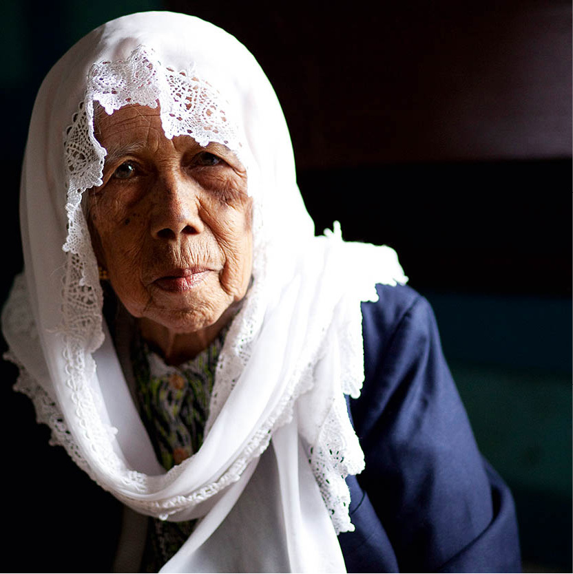
A Minangkabau matriarch.
Corrie Wingate/Apa Publications
Padang offers few sights other than the Museum Adityawarman (daily) which houses Minangkabau artefacts in a traditional rumah gadang (clan house). Regularly scheduled cultural dance performances take place nearby. (Check the programme with the tourist office or museum.) In the evening, head to the waterfront for a spicy Padang meal, cool ocean breezes and a view of the sunset over the Indian Ocean.
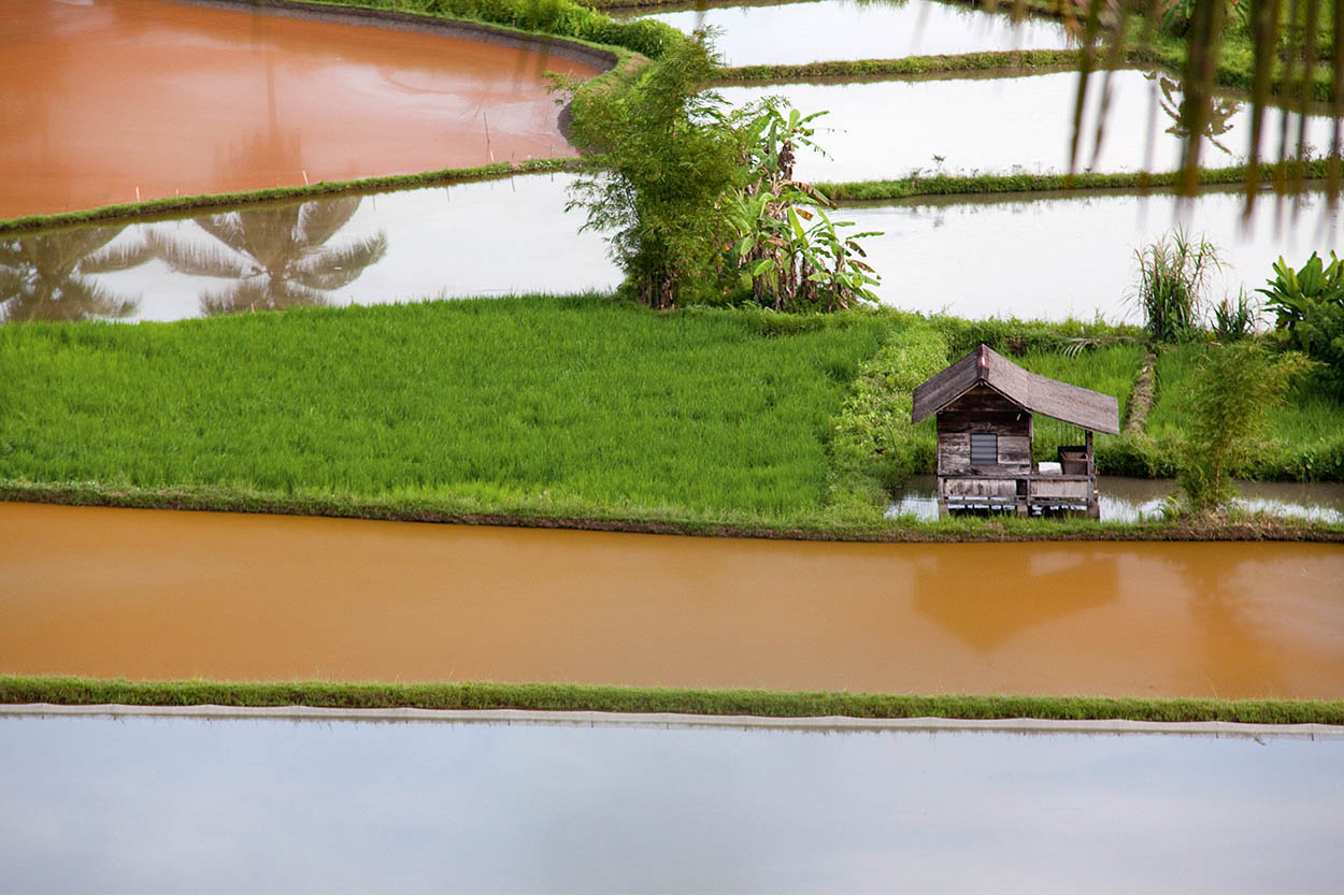
Rice paddies.
Corrie Wingate/Apa Publications
Batang Gadis
Lacking sufficient infrastructure to attract more than a few intrepid trekkers, the entry point to obscure Batang Gadis National Park is Panyabungan village, north of Padang. In addition to protecting strange and wonderful creatures such as Malayan tapirs and porcupines, Sumatran serows, tigers and elephants, and many varieties of rare cats, the park has 242 bird species and the huge, smelly Rafflesia flower. Also within park boundaries are natural and Japanese caves and Sorik Marapi volcano.
When Batang Gadis was established in 2004 it was unique in that it was Indonesia’s first national park to be founded based on the requests of the local people, who were concerned about the illegal logging that was destroying their forests.
Bukittinggi
A 3-hour drive from Padang north through the lush tropical Anai Valley delivers you to picturesque hilltop Bukittinggi 6 [map], the heart of Minangkabau culture. Blessed with friendly people, a relaxed atmosphere and cool mountain air, Bukittinggi is the best base for visiting the surrounding Minang Highlands.
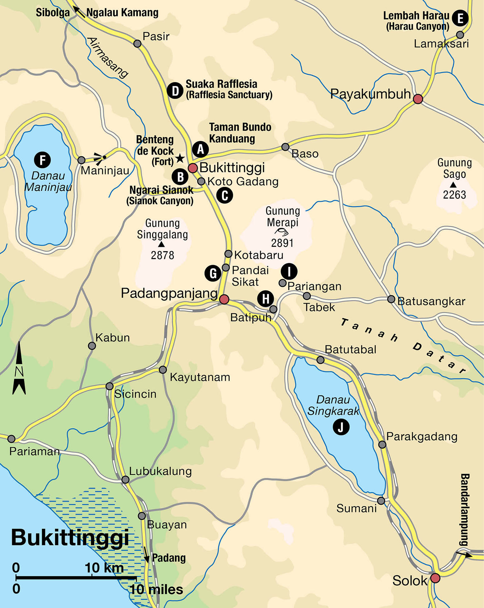
Bukittinggi, which means ‘Tall Hill’, stands at 930 metres (3,050ft) and is surrounded by the Gunung Agam, Gunung Singgalang and Gunung Merapi volcanic peaks. It is a pleasant town to stroll through. The well-educated townsfolk, who have the highest literacy rate in the nation, are friendly and eager to practise their English. The cool mountain air also enhances touring on foot. In the centre of town, a clock tower with a stylised roof stands as the city’s landmark; nearby is the busy Pasar Raya (Central Market).
Taman Bundo Kanduang A [map] (Rumah Adat Baandjuang Museum; daily 7.30am–5pm), a 140-year-old rumah gadang, marks the city’s highest point. Exhibits include wedding and dance costumes, musical instruments, weaponry and other cultural artefacts.
Crossing a footbridge takes you to the remains of Benteng de Kock, built by the Dutch in 1825. The fortress itself does not hold much interest, but it provides a good vantage point to view farmland and the smouldering Gunung Merapi (2,891 metres/9,484ft) and Ngarai Sianok Canyon B [map].
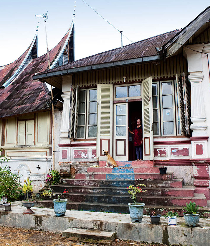
A Dutch colonial dwelling in the countryside outside Bukittinggi.
Corrie Wingate/Apa Publications
Better views of the spectacular canyon, sometimes referred to as the Grand Canyon of Indonesia, can be had at the lookout point in Panorama Park, a favourite leisure spot for locals. A pleasant hike through the 4km (2.5 mile) canyon is possible along a footpath that starts in rice fields. At the halfway point is a bridge; head up a flight of steps (slippery in the rainy season) to the silversmith village Koto Gadang C [map]. Here, delicate silver filigree jewellery and hand-embroidered shawls (based on Flemish laces) are made. From here, you can take public transport back to Bukittinggi.
North of Bukittinggi
An easy 12km (7.5 mile) drive north of Bukittinggi is the 3,100-hectare (750-acre) Rimba Panti Nature Reserve, which contains the Rafflesia Sanctuary D [map], named after the world’s largest flower, which can grow up to a metre (3ft) in diameter. The foul-smelling Rafflesia arnoldii only blooms between August and September. It may be necessary to hike over muddy paths in search of the bloom.
Continuing north another 15km (9 miles) is Ngalau Kamang, a limestone cave with stalactites and stalagmites. It also houses a small lake. Payakumbuh, 40km (25 miles) east, is the gateway to the cliffs and waterfalls at Harau Canyon E [map], a lush reserve surrounded by 100-metre (330ft) high granite walls and home to various species of monkey and deer, as well as sun bears, leopards and even a few tigers. To get there from the main highway, head north past Payakumbuh for 10km (6 miles) to Lamaksari village. Turn left and proceed for another 3km (2 miles). Permits are sold at the entrance.
West and south of Bukittinggi
Heading west from Bukittinggi is the deep crater lake Danau Maninjau F [map], renowned for its serenity and beauty. There is a wide range of accommodation and eateries there, along with canoes and motorboats for hire. For a day trip, the lake can be reached within 2 hours by bus from Bukittinggi. Even better, spend a few days relaxing and swimming in the cool, clear water. From the Embun Pagi lookout point, the road winds and zigzags an amazing 44 turns before arriving at the lake.
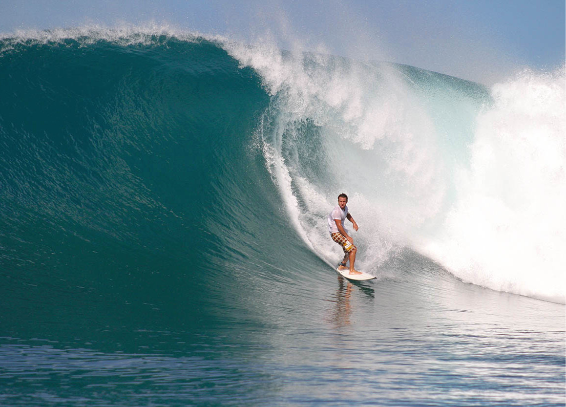
Surfing off Nias island is top-class.
Mentawil surf camp
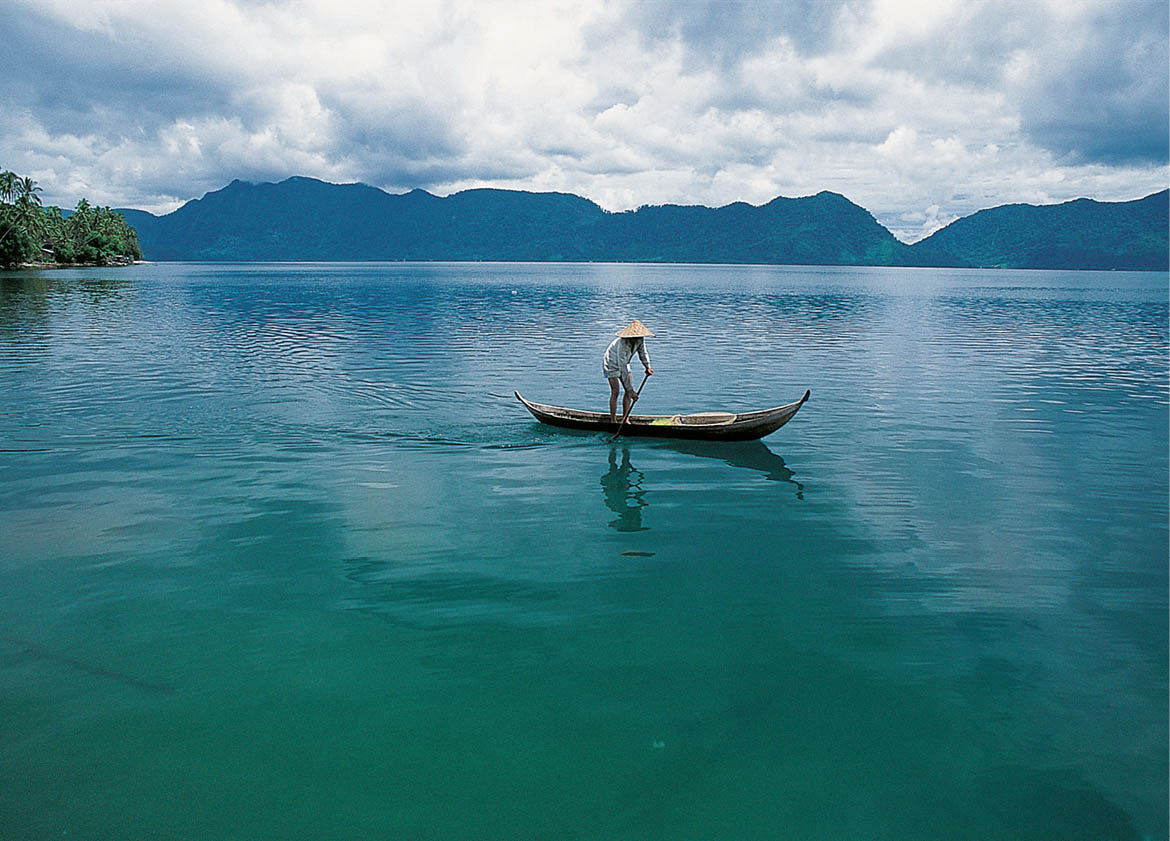
A fisherman on Danau Maninjau.
Martin Westlake/Apa Publications
Just 12km (7.5 miles) south of Bukittinggi is the weavers’ village Pandai Sikat G [map]. Weaving has been a major business since the late 18th century, and women and girls here create by hand kain songket (cotton or silk base worked through with heavy gold or silver threads), which are popular with Jakarta women for formal events. Excellent-quality sarongs can be expensive and are sometimes just rented for the evening.
Continue southeast to the plains at Tanah Datar, where the ancient Minangkabau kingdom existed for half a millennium before succumbing in the Paderi wars of the early 1800s. The area has the finest examples of traditional Minangkabau architecture: rumah gadang with roofs turned up to resemble the horns of a water buffalo. The first stop in Batipuh H [map] village is the traditional surau, or men’s house, built entirely of wood in the Koto Piliang style.
A side road from here, heading east for 5km (3 miles) and skirting Gunung Merapi, goes to Pariangan I [map], believed to be the original Minangkabau village. Set in a beautiful valley, steps lead to the traditional clan houses and a royal tomb. Take a leisurely stroll here and see one of the last surau of its kind still in use. Back on the main road, Tabek village has fine examples of traditional clan houses and the oldest building in West Sumatra.
Continuing east, the area between Bukittinggi and Batusangkar is arguably among the most scenic. Fertile lands grow many varieties of fruits and vegetables, as well as irrigated highland rice. Some 20km (12 miles) east of Padangpanjang, Batusangkar was once a residence of the Minangkabau kings. The main attraction, the royal palace Istana Pagaruyung, was destroyed by fire in 2007, and a new palace has been built.
South from Batipuh is the lovely Danau Singkarak J [map], larger than Danau Maninjau and easily accessible by rail or road, though not as developed. Beyond the lake is Solok, a mountain town known for its picturesque high-roofed houses and woodcarvings.
West coast islands
Running parallel to Sumatra’s west coast, about 100km (60 miles) offshore, is a string of ancient islands – peaks of an undersea non-volcanic ridge separated from mainland Sumatra by a deep trench. Simeulue, Nias, the Mentawai group and Enggano were first ‘discovered’ in the 17th century by the Dutch. In the 19th century, missionaries arrived, and today 80 percent of the islanders are Christians, but they still retain strong animistic beliefs. The most visited island, Nias, is known for its stone-jumping rituals. Travelling overland from Medan or Padang will require an overnight stay in Sibolga. From here take a ferry to Gunung Sitoli on Nias, or go by one of the daily flights from Medan.
Nias island
The main points of interest on Nias 7 [map] – the traditional villages and surfing beaches – are located in the south, a 4–7-hour journey on decent roads thanks to tsunami aid programmes.
Fact
SurfAid International was established in 2000 by a doctor-surfer concerned by what he considered to be a lack of health care on Nias and Mentawai while on a surfing charter to the islands. When the December 2004 Indian Ocean tsunami hit, SurfAid was the first on the scene, and when Nias was devastated by an 8.7-magnitude earthquake, SurfAid was there. Then a 7.9-magnitude ’quake rocked nearby Padang in 2009. Their office was spared, and today SurfAid is an important part of local health centres, community empowerment and emergency preparedness. See www.surfaidinternational.org for further details.
Nias warrior in ceremonial garb.
Martin Westlake/Apa Publications
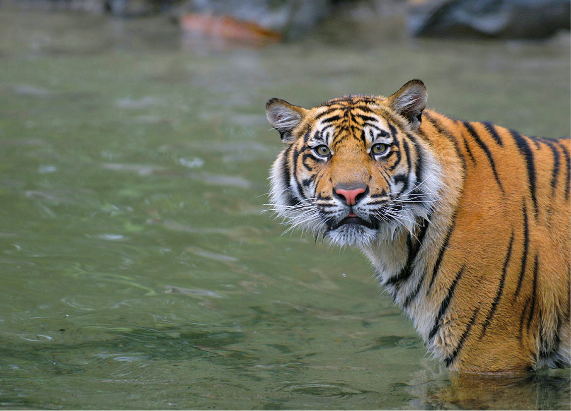
Sumatran tiger.
iStock
The largest of the west coast islands, Nias is 100km (60 miles) long by 50km (30 miles) wide, and is home to one of Southeast Asia’s most unusual ancient cultures, which revolves around stone: in architectural style, sculptures and rituals. In its most memorable traditional dance, Fahombo, Niasan tribesmen leap feet first over stone columns several metres high. Tutotolo is a warrior dance performed by young men leaping in combat.
Niasan villages are veritable fortresses, with great stone-paved central ‘runways’. Stilt houses stand in parallel rows on hillsides, shielded by a thorny bamboo barricade from foreign attack. Northern Nias, raided by Acehnese slave traders for centuries, has few cultural remnants, although the capital, Gunung Sitoli, is found here. The remote centre of the island holds cultural interest, however. Amid jungle are the ruins of abandoned villages with huge menhirs, single standing stones.
Southern villages of Nias
All of the major tourist attractions are located in southern Nias. Telukdalam is the largest city and offers simple losmen. Most visitors head for the beautiful white-sand beaches and aquamarine waves at Lagundri, proclaimed to be one of the best surf spots in the world. Simple losmen or stilted beach huts and a resort offering bungalow accommodation are available here.
Bawömataluwo, 15km (9 miles) from Telukdalam, is a village turned touristy because of its easy accessibility. Built more than 100 years ago on a summit for protection from Dutch attacks, it is reachable by a wide stone staircase of 480 steps along an alley between two rows of houses. The central ‘square’ is the venue for stone-jumping performances and nearby is the ornate chief’s house. There are stone statues and around 300 megaliths.
Hillisimaetano is a quiet village built in the past 70 years, where raising chickens and pigs – the main livelihood – goes on at a traditional pace. All 140 houses in the village face the chief’s house located in the centre. Gomo Lahusa, 40km (24 miles) northeast of Telukdalam, and Gomo are both worth a visit to see fine old menhir stones.
Siberut island
South of Nias, Siberut 8 [map] is the largest and most visited of the Mentawai archipelago and is covered in dense tropical rainforest with isolated farming settlements. The indigenous inhabitants are forest people, living in close harmony with nature.
Shop
In remote inland villages on Siberut island, the preferred ‘currency’ is barter, particularly food and tobacco.
Siberut island measures about 110km by 50km (70 miles by 30 miles), and the port of entry is in the south at Muara Siberut, reached by ferry from Padang. There are no hotels or losmen, and travellers have to rely on the generosity of locals. The main attraction is the trek inland to visit remote villages where people live in traditional longhouses. Rodok, a 4–5-hour boat ride away, is a government village, and another 2 hours’ journey leads to Madobat. Both are ideal locations from which to begin a trek inland.
The people of the interior live in small villages or in uma (longhouses). They are well known for the tattoos they incise over large sections of their bodies, and for their puliajiat rituals: these go on for several weeks to purify houses, in order to ensure harmony and reunite the souls of individuals with their bodies.
A Unesco Biosphere Reserve, Siberut National Park is home to a unique collection of flora and fauna due to its separation from any other landmass for over 500,000 years. Most notable are its endemic monkeys: primitive black gibbons (Hylobates klossii), Mentawai macaques, and two langurs, Presbytis potenziani and pig-tailed.
National parks
Back on the mainland, east of Padang the Bukit Tigapuluh National Park is under tremendous threat from logging and palm-oil plantations, with two-thirds of the park already logged. With the park housing at least 10 critically endangered species, these operations have drawn the attention of wildlife conservation organisations worldwide. On the upside, orang-utan reintroduction has worked well here, and the World Wildlife Fund caught several rare Sumatran tigers on film using camera traps in mid-2011, intensifying the campaigns of several groups against further logging.
Along Sumatra’s entire west coast, stretching from the northern to the southern tips, is the Barisan mountain range, and Bukit Barisan Selatan National Park encompasses 3,568 sq km (1,378 sq miles) of these heavily forested hills. This park joins Gunung Leuser and Kerinci Sebalat National Parks as a single Unesco World Heritage Site, and is home to three important Sumatran species – elephant, rhino and tiger – and has the only population of Sumatran striped rabbit ever recorded. The threat to this conservation area is not logging, but encroaching coffee plantations.
Two hours south of Padang is the northern border of Indonesia’s largest reserve, Kerinci Seblat National Park, which covers an amazing 14,000-sq km (5,400-sq mile) stretch of jungle and mountains. Most visitors begin their explorations in the Kerinci district dominated by the active volcano Gunung Kerinci, which rises 3,800 metres (12,480ft), making it Indonesia’s second-highest peak after Gunung Puncak Jaya in Papua.
Tip
Before planning to climb Gunung Kerinci – or any Indonesian volcano – it is best to find out if it is active or not. The Indonesian Department of Volcanology website (www.vsi.esdm.go.id) lists the status volcanoes that show activity. A blinking amber light means ‘danger’; a blinking red light means ‘stay away’.
Rare wildlife in this Unesco World Heritage Site park includes Sumatran tigers and elephants, clouded leopards, Malayan sun bears and tapirs, over 375 species of birds, and the world’s largest and tallest flowers. There are no orang-utans, but occasionally sightings have been reported of the mysterious orang pendek, a bipedal ape similar to an orang-utan, and the mythical cigau, half-lion and half-tiger.
The national park office in Sungaipenuh (Mon–Fri) has a good visitor centre and some English-speaking staff. There are a number of simple hotels and a colourful market there. Homestays and trekking operators are available in Kersik Tuo, a tea plantation village at the foot of Gunung Kerinci, where treks start. From the south of Kerinci, trek on forest paths (2 days) to Renah Kenumu, a traditional village with many megaliths, hot springs and good wildlife-spotting.
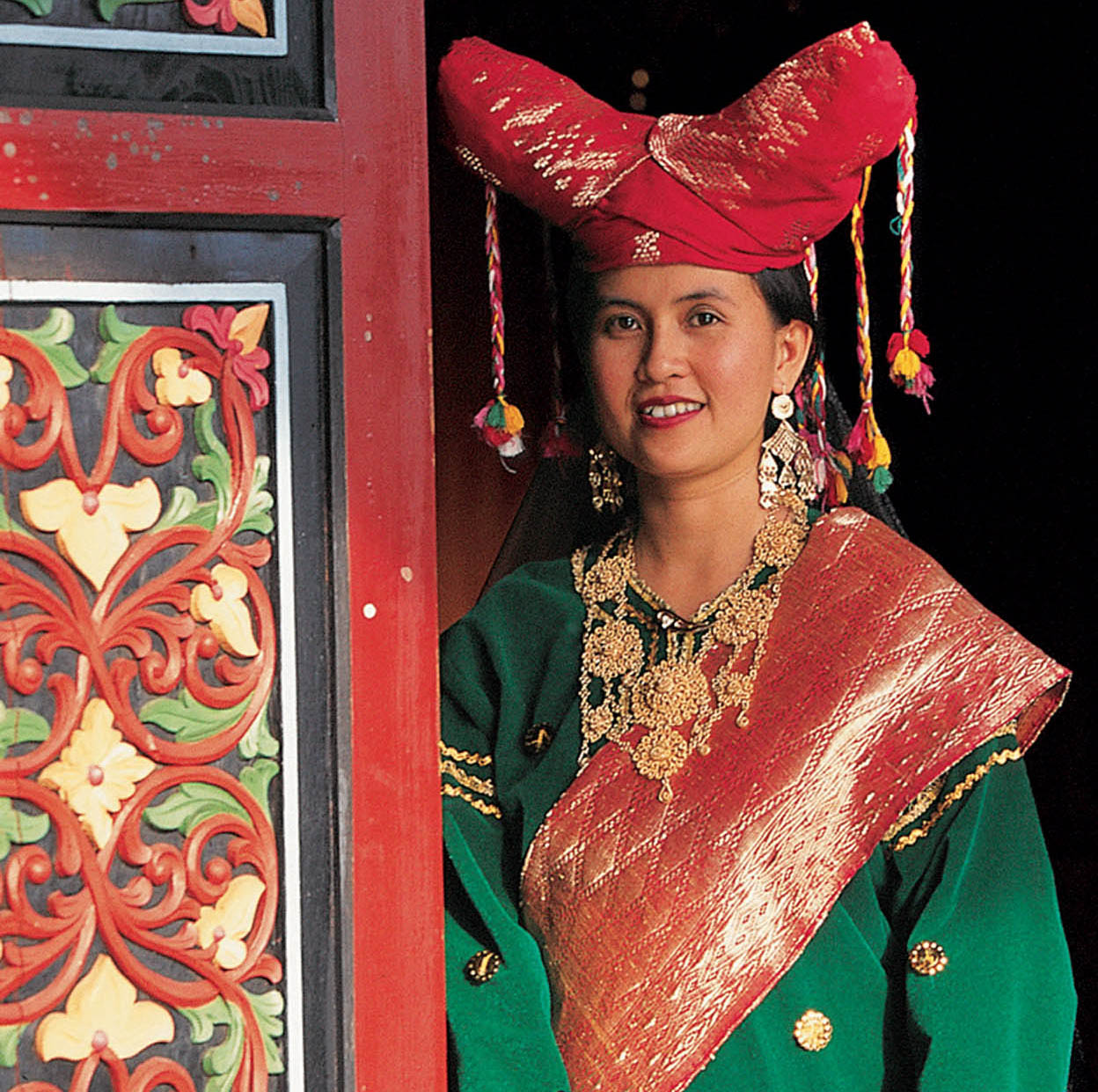
A Minangkabau woman in distinctive costume.
Martin Westlake/Apa Publications
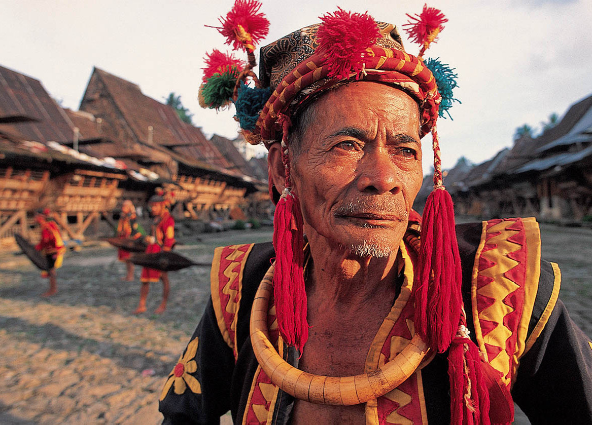
The matrilineal Minangkabau
They may be Muslims, but intriguingly in Minangkabau culture it is the women who hold the key to social rights, identity and inheritance.
The fertile highlands of West Sumatra are home to one of Indonesia’s most interesting ethnic groups, the Minangkabau. With a reputation for being intellectuals, Minangkabau men feature prominently in the national government and are known for their keen business sense. Throughout Indonesia there are restaurants run by Minangkabau men who serve up spicy Padang food.
What makes the Minangkabau so interesting is that while they are devout Muslims, they also belong to a matrilineal society, tracing social identity and inheritance through the female line. In fact, the Minangkabau are one of the few remaining matrilineal societies that still exist in the modern world.
Minangkabau can trace their descent to a rumah gadang (clan house), to which they pledge allegiance and maintain a social obligation throughout their lives. Each rumah gadang has descendants who can be traced back to a single grandmother.
All valuable property, land and house are owned in common by the clan, led by the grandmother and including all her female heirs and her eldest brother, and cannot be sold without group consent. The men are involved in the management of the communal property, but it is the women who maintain the rights of use, including landownership. Minangkabau women thus have a high economic status in society.
Roles for Minangkabau men
Men spend most of their time in the fields, and at night young boys go to the surau, the Islamic study hall. Young men are encouraged to travel in what is known as merantau (‘to know about being without’), to seek their fortunes and experience the world, When the seasoned wayfarer returns home with his wealth, he is deemed ready for marriage.
When a woman marries, she pays a groom price to her husband’s female family members. After the wedding, the man goes to ‘visit’ his wife in her home, but in the morning, he returns to his mother’s house to work the crops and to raise his sisters’ children. His nieces and nephews are his responsibility; his own children are in turn raised by his wife’s brothers.
Households are the domain of the women, who are actively involved in daily affairs, while husbands and brothers live elsewhere. The men travel, but their hearts are always with the village, sending money home for ceremonies, the building of mosques and for the maintenance of the family’s rumah gadang, a source of cultural pride.
The rumah gadang has a roof that resembles buffalo horns, and elaborately carved exterior panels are the pride of local woodcarvers. Other examples of the tribe’s excellent craftsmanship are beautiful hand-woven kain songket textiles, fine silver filigree jewellery, lively music and a silat dance combining martial arts movements with dance.
Tradition has it that the Minangkabau derived their name – minang (victory) and kabau (buffalo) – from an ancient battle. In an effort to avoid bloodshed they proposed a contest between two water buffaloes. The Javanese brought to the arena a strong buffalo bull, while the Sumatrans entered a nursing calf that had been starved for days and had spikes affixed to its horns. The small calf quickly went in search of milk only to impale the underside of the bull, killing it. The Javanese returned home and left the Minangkabau in peace.