An increasing number of visitors are escaping the congestion of South Bali and Ubud in favour of other areas of the island that are ideal for quieter getaways with fewer crowds. In the west the landscape is much drier, and off the coastal highway that leads from Pura Tanah Lot to Gilimanuk, the beaches are experiencing development that promises to continue for several years. Once only remote surfing areas, their newly built resorts and villas are good bases for taking in the refreshing sea air and for scenic mountain drives to the north. Menjangan island in West Bali National Park is Bali’s premier dive destination, with the north coast’s Pemuteran a close second.
The north coast highway grips the shore, passing through Lovina, an excellent starting point for exploring the scenic Bedugal highlands to the south. Also along this road are even more developments: villas and resorts catering to wellbeing, yoga, meditation and healing that continue east of bustling Singaraja.
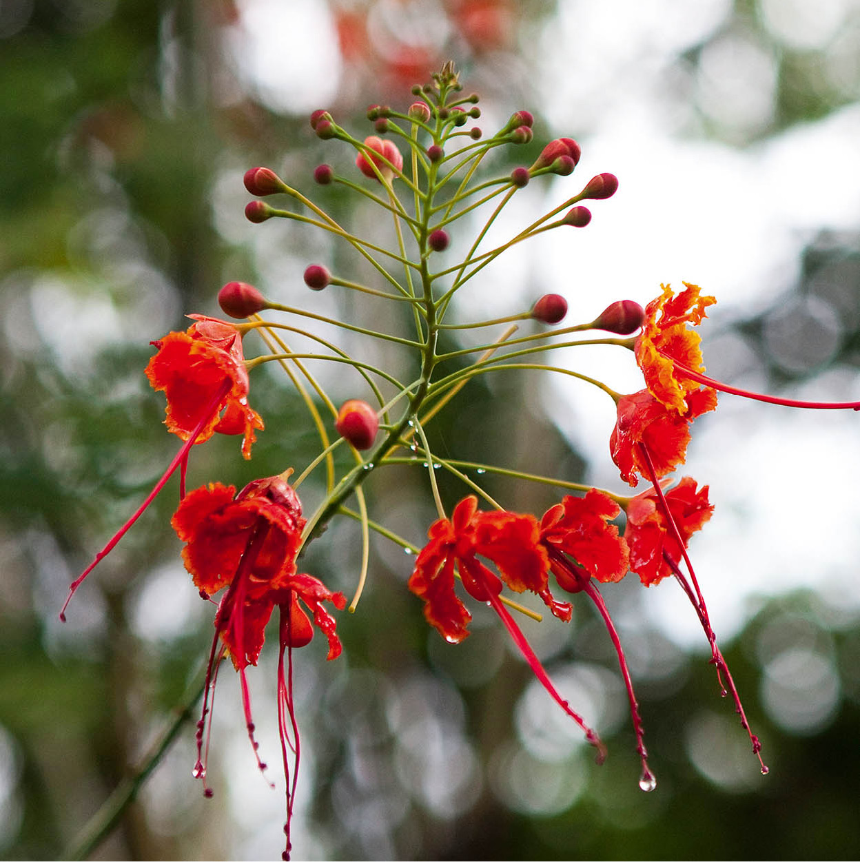
Flowers at Tabanan.
Corrie Wingate/Apa Publications
West Bali
North of Pura Tanah Lot, Tabanan regency is one of Bali’s most prolific rice-growing areas. It has also long been home to some of the island’s most admired gamelan orchestras and dancers. New tourist resorts are springing up throughout the region, particularly on the coast, which is popular with surfers. At the end of every side road from the main highway leading to the shore are long, often black-sand beaches with surf that sometimes breaks over 3 metres (10ft) high. Be aware that the undertow and currents are treacherous.
Mengwi and Tabanan
Northwest of Denpasar, at the start of the highway that goes on to hug the southern coastline, Kapal ( [map] shelters the most important temple in the area, Pura Sada (daily during daylight hours; donation), an ancestral sanctuary honouring the deified spirit of Ratu Sakti Jayaningrat, whose identity remains uncertain. The temple’s original foundations may be as old as the 12th century, but the temple itself was rebuilt during the 17th century. The oldest of the Mengwi state shrines, Pura Sada was destroyed in the great earthquake of 1917 and restored in 1949.
Mengwi , [map] principality, 6km (4 miles) north of Kapal, was, until 1891, the centre of a powerful kingdom dating from the Gelgel dynasty. Pura Taman Ayun (daily during daylight hours), built in the 18th century, has a surrounding moat, giving the impression of a garden sanctuary, explaining the name taman, or garden. The temple is a penyawangan, or a place to worship the gods of other sacred sites. The shrines here are a place to worship Bali’s holy mountain peaks Agung, Batukau and Batur, as well as the gods of other sacred sites, for example Pura Sada.
Subak
Unesco awarded the ‘Cultural Landscape of Bali’ the status of World Heritage Site in 2012. With its origins in the Tri Hita Karana philosophy that developed on Bali with influence from India more than 2,000 years ago, subak is Bali’s traditional system of irrigation, and has shaped the island’s landscape to how it looks today. Working in harmony between man, nature and God, subak was first introduced in the 9th century. There are five areas on Bali with rice terraces and water temples that have made use of the water available in an efficient, sustainable and harmonious way, as well as producing very productive paddy fields that supply rice for the relatively high density of people on Bali.
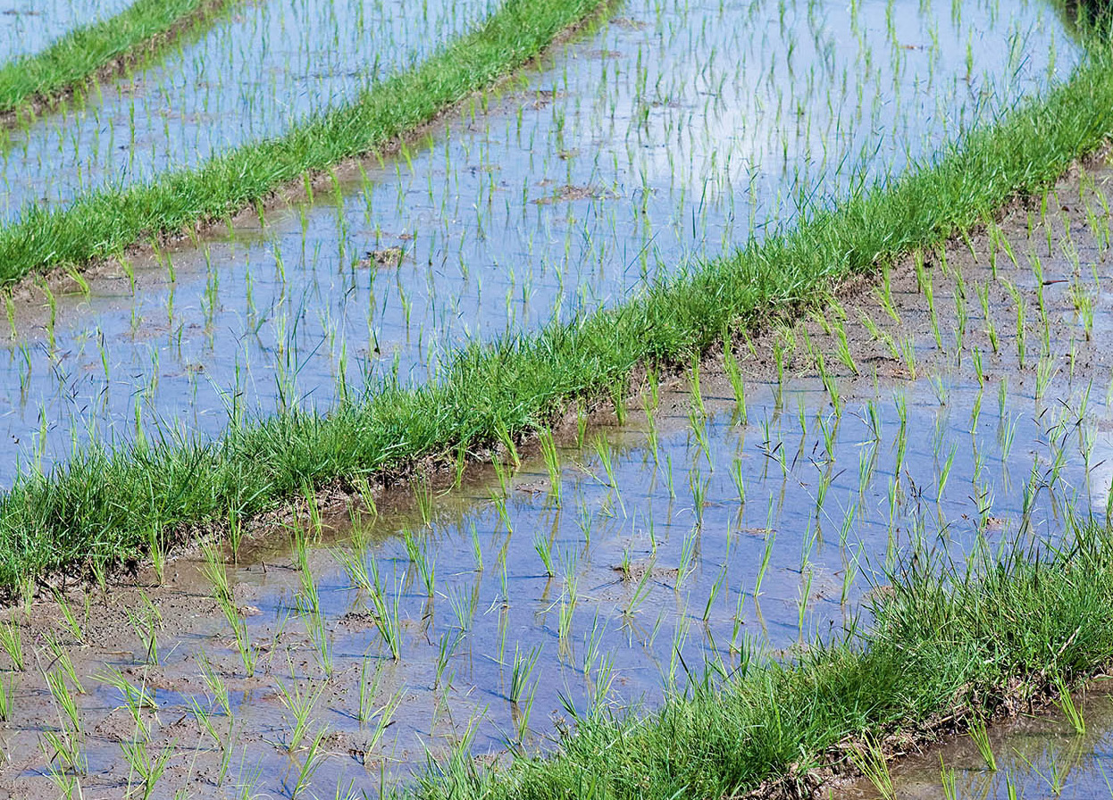
Belimbing rice terraces, Tabanan.
Corrie Wingate/Apa Publications
Dipping down off the main road to a southern bypass, in Kerambitan ⁄[map] the Tabanan royal family has two palaces – Puri Anyar and Puri Agung – where they showcase their tektekan gamelan ensemble of bamboo drums and wooden cow bells. For a fee, anyone can book a ‘royal’ evening, including either a joget (flirtation dance accompanied by a bamboo gamelan) or a Calonarang (trance performance), complete with a dinner. If it is just the surroundings you are interested in, there is a guesthouse in Puri Anyar.
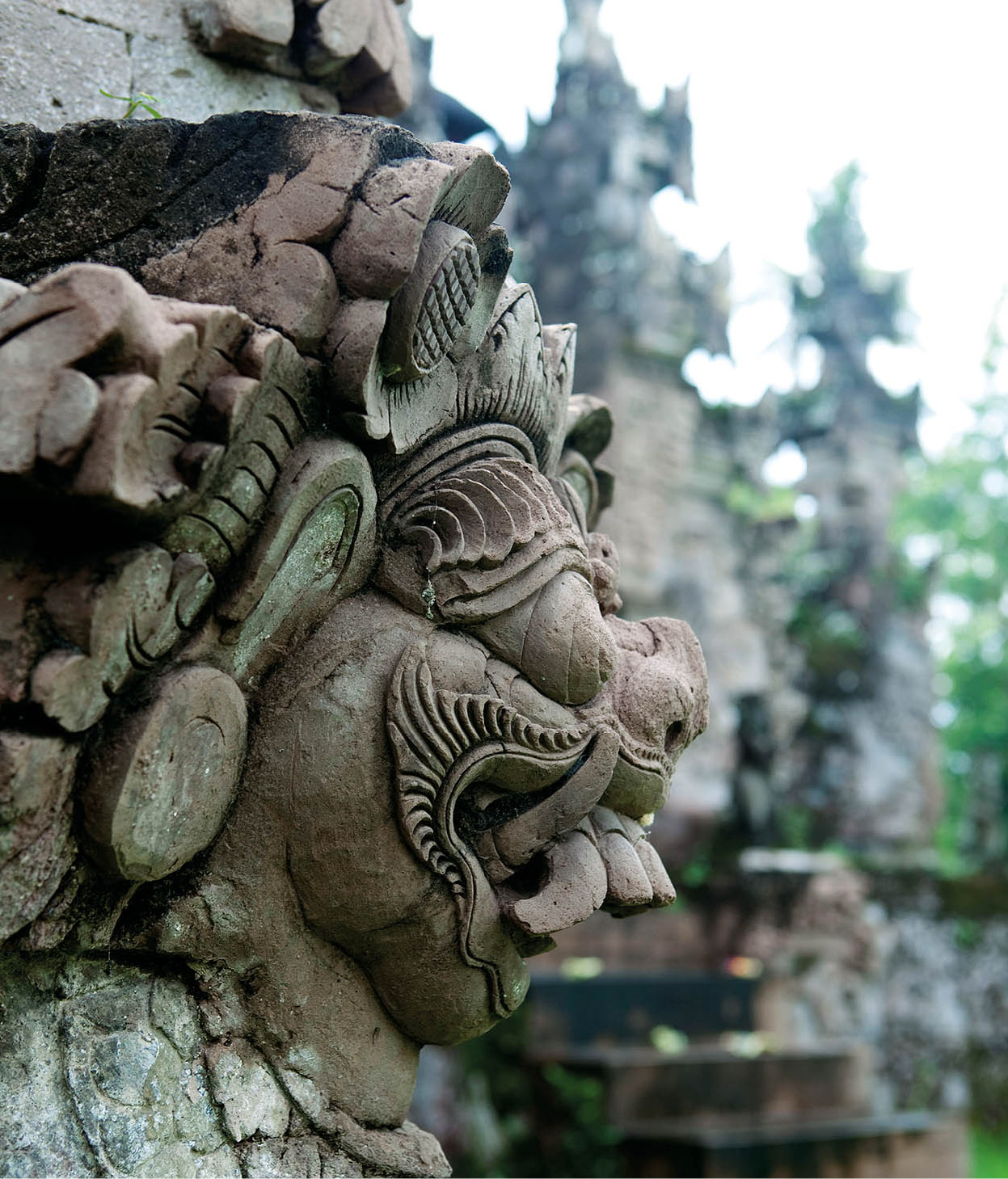
Pura Beji detail.
Corrie Wingate/Apa Publications
Continuing west along the southern Trans-Bali highway, the environment begins to change and the landscape becomes increasingly dry. About 10km (6 miles) west of Antosari, a side road through Lalang Linggha village leads to the crashing surf at Balian beach ¤ [map]. With the exception of a couple of locally owned losmen catering to budget travellers, all the other lodgings and villas are new, and most of them are owned by foreigners. There is a homestay here serving very tasty Western food and a medium-sized, rather upmarket resort catering to surfers right on the beach that makes a wonderful stopover for a bite to eat while taking in the enormity of the sea.
Scenic drives
For spectacular scenery, take the winding road from Antosari, west of Balian beach, north to Belimbing and Sanda, where rice terraces are carved from hillsides on either side of the road as far as the eye can see. Continuing north in the direction of Pujungan, a track on the right leads to a scenic waterfall. From this point onwards, clove and coffee plantations are interspersed with rice fields until the road reaches Pupuan.
From Pupuan, there are two options: head north across the hills for 12km (7.5 miles) to Mayong and on to the coast at Seririt, or continue south, descending by twisting road via Tista, Manggissari and Asahduren villages to Pekutatan in West Bali, from where you can rejoin the main highway to Gilimanuk.
Medewi to Gilimanuk
At Pekutatan ‹ [map], a side road heads north over the mountain and descends to the northern coast at Pengastulan. This narrow, paved road is among Bali’s most beautiful routes, its 10km (6 miles) passing through exquisite rainforest and coffee, cocoa and clove plantations. The destination is a giant old bunut tree that is so large that its aerial roots descend on both sides of the road, which passes through the tree. A holy site for Balinese-Hindus, there is a shrine on one side of the tree, and many motorists stop there to ask the spirits for permission to continue their journeys by making a small offering.
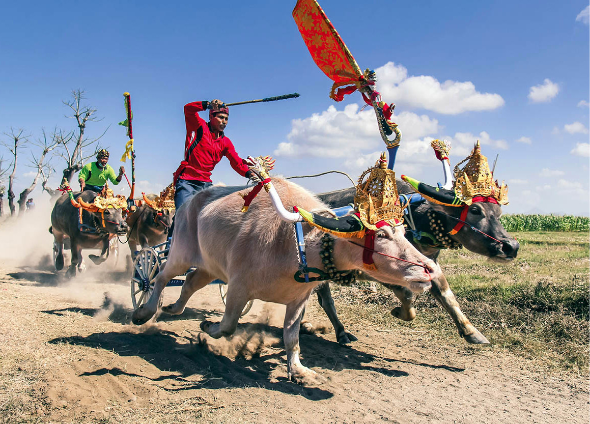
Negara bull races.
iStock
Fisherman at Labuhan Lalang.
Corrie Wingate/Apa Publications
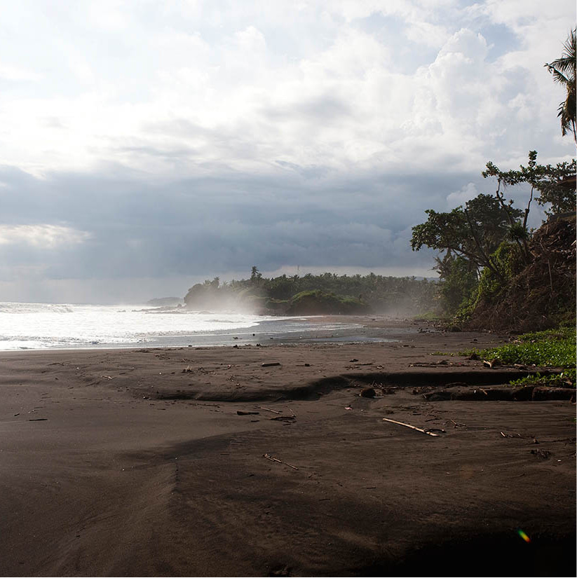
For several decades, extreme surfers have kept the eastern reaches of Medewi beach › [map] to themselves, staying in basic lodgings and picking their way across the rocky shore to reach the good waves, carefully avoiding the dangerous undertow. Now, upmarket resorts are going up and others are being renovated along this stretch of coast, where black-sand beaches far removed from their crowded counterparts in South Bali are luring an increasing number of travellers. Almost all the resorts still cater mainly to surfers, but instead of the nomadic hard-core dudes who dominated Medewi in the past, there is a new generation of novices who are eager to learn the sport in safer environments and with the benefit of babysitting services, spas, restaurants and cultural tours for those times when the sun gets too hot.
Near Medewi stands the tranquil Pura Rambut Siwi fi [map] (Lock of Hair Temple; daily during daylight hours; donation), founded by High Priest Danghyang Nirartha in the 16th century. Perched on a cliff overlooking the sea, the pavilions west of the temple offer panoramic views over rice fields and the ocean. It is said that Nirartha’s stopover here relieved the village of a devastating epidemic, and before moving on, he presented the people with a lock of his hair, explaining the temple’s name. His hair and some of his personal belongings are enshrined in the inner courtyard of the main temple.
West of Pura Rambut Siwi is Negara, the provincial capital. There is little to see here, except that every year between July and October the town’s prized buffalo take part in annual racing competitions, which are fun to watch. Wearing colourful banners, their horns decorated and with wooden bells tied around their necks, they race along the 4km (2½-mile) track at speeds of up to 50kph (30mph). The daredevil charioteers twist the bulls’ tails to give them extra motivation. Rehearsals are held every second Sunday and the competitions are staged in August, around Independence Day, and in October.
One kilometre (0.6 mile) south of Negara is Loloan Timur fl [map]. Its residents are Muslim Buginese who originated from Sulawesi, and they continue to build their homes in the Buginese style on stilts. The bamboo musical instruments they play, gamelan jegog, which accompany traditional dances, sound like thunder. Today there are nearly 50 ensembles, mostly located in the Sangkar Agung area.
Further south, along the coastline near Perancak, villages run a sea turtle conservation programme. Small donations to tour the area and an adopt-a-nest scheme help to fund the hatchery. While in Perancak, look for the fishing boats painted in bright colours that line the shore.
The north and southwest coast roads meet at Cekik, where a short spur road continues a few kilometres north to Gilimanuk, the access point for a 30-minute ferry journey (but much longer wait), operating 24 hours a day across the Bali–Java Strait. Accommodation in Gilimanuk is limited to homestays. The Bali–Java Strait is just 3km (2 miles) wide, but its waters are treacherous.
In order to visit West Bali National Park ‡ [map](Taman Nasional Bali Barat; park headquarters Mon–Thu 8am–3.30pm, Fri 8am–1pm), first obtain a hiking permit and ticket from the visitor centre in Labuhan Lalang ° [map] (daily 8am–4pm; tel: 0361-61060) on Teluk Terima (Reception Bay). You can also book tours and treks at the centre.
Tip
The endangered Bali starling is rarely spotted in the wild at West Bali National Park, as their numbers are so few. See them instead on Nusa Penida, off the southeast coast, where a breeding-and-release programme has proved overwhelmingly successful.
Official guides, who usually speak English, are a requirement for trekking within the park, and are part of a community empowerment programme. The 760-sq km (300-sq mile) conservation area, much of which is off-limits, is home to deer, civets, monkeys, rare wild Javan buffalo and the nearly extinct Bali starling or Rothschild’s mynah (Leucopsar rothschildi), a small white-crested bird with brilliant blue streaks around its eyes and black-tipped wings. Many wild birds live on the gentle slopes of Gunung Prapat Agung, which anchors Bali’s western tip. There are several trails from which to choose, designed to suit different interests and capabilities. Short and medium treks (1–3 hours) focus on mangrove and mountain forests and savannahs for birdwatchers. Longer treks (6–7 hours) can be customised. All guided tours must be booked in advance.
The park is known for its spectacular diving and snorkelling off Pulau Menjangan · [map] (Deer Island), about 10km (6 miles) offshore. Now considered Bali’s best dive site, it is surrounded by deep waters, coral reefs, sandy slopes and walls housing a wide variety of large and small marine life. There are eight dive sites, and at Pos 2 a shallow reef attracts snorkellers. Walking around the perimeter of the uninhabited island takes about 45 minutes, and there are some stunning panoramic views of volcanoes and mountains on Java from here.
Boats to the island can be hired at Labuan Lalang and at a second pier at Banyumandi, near Mimpi resort. On Menjangan there is an ancient temple, Puri Gili, and Balinese-Hindus often depart from Banyumandi to make offerings here. There is a modest canteen, and showers and changing rooms are available for a small charge. Wait until other divers appear and share the cost of the boat. Overnighting on the island is forbidden.
There are four upmarket resorts in the area; for cheaper accommodation most people stay at nearby Pemuteran, where transport to and from Menjangan can be arranged.
Near Labuan Lalang and still within the park is Makam Jayaprana, a local hero’s tomb and temple, which is worth the hike for the view.
Medewi beach.
Corrie Wingate/Apa Publications
Belimbingsari and Palasari
From Cekik on the far western coast, travel 15km (9 miles) south to Melaya and turn inland to Belimbingsari village. Home to Bali’s largest Protestant community, its impressive church has distinctly Balinese design elements and a kulkul (warning drum) instead of a bell to signal the start of Sunday services, which begin at 9am.
A short drive to the south is the 1,500-strong Catholic community in Palasari. Like Belimbingsari, the early converts settled in remote West Bali by choice after being shunned by the Hindu Balinese. The cathedral, built in 1958, is adorned with Balinese touches, and is a stunning piece of architecture in the middle of nowhere. Friday mass at 5.30pm and Sunday mass at 6.30am are good times to visit.
North Bali
A rather sleepy fishing village, Pemuteran º [map] is the nearest place to the West Bali National Park and has a wide range of low- to medium-priced bungalows and hotels, and some exquisite luxury villas, all catering to divers, snorkellers and nature-lovers. For many years, Pemuteran was only a place to sleep and eat, but it has earned a good reputation for diving and snorkelling in its own right thanks to the Reef Seen Aquatics Dive Center and Taman Sari Bali Resort, which pioneered reef restoration here over a decade ago. Now joined by other dive shops and local businesses, an effort that began simply has blossomed considerably.
A community project called Reef Gardeners teaches local people the importance of environmentally sound fishing practices and that keeping the reefs healthy is an economic plus. Village divers who have been trained by the co-op patrol reefs regularly looking for signs of lawbreakers and plagues that may devastate the corals. They also operate a sea turtle egg rescue centre, hatchery and release programme, Proyek Penyu, which can be visited. Donations for tours are welcome and keep the programme running.
Using local divers and products, the project has also created an astonishing submarine wonderland by sinking several traditional boats, some at great depths and one only 5 metres (16ft) from the surface at low tide. The main attraction is the Taman Pura (Temple Garden), a re-creation of a Balinese Hindu temple complex under the sea comprising 25 carved sandstone statues.
Inland detour
A road leads south at Pengastulan-Seririt ¡ [map], climbing over the mountains and through rice fields and clove plantations before eventually descending to the coast in South Bali. Several scenic routes are possible, among which is a beautiful but meandering drive that goes through Ringdikit and Rangdu villages. Just south of Rangdu, a turn eastwards at Mayong continues to Lakes Tamblingan and Buyun, nestled in hillside coffee plantations, and Bratan in the Bedugul highlands.
Bedugul ™ [map], 1,300 metres (4,300ft) above sea level, is a mountain-lake resort area favoured by Indonesians for weekend retreats. In the not-so-distant past, tourists limited their visit there to a day trip from Ubud or Lovina to see Danau Bratan, a lake filling the long-extinct, often mist-veiled Gunung Catur crater, and its temple, Pura Ulun Danu Bratan (daily during daylight hours), sitting on a small promontory and arguably the most photographed site on the island. The lake is an essential water source for surrounding farmlands, and Bedugul people honour Dewi Danu, the lake goddess, here. Nowadays, improved accommodation and an increasing choice of activities are luring travellers to stay longer and soak up the clean, cool climate. The spectacular Bali Handara Kosaido Country Club golf course is here.

Puru Ulun Danu, Bratan.
Corrie Wingate/Apa Publications
North of Bedugul proper is Bukit Munggu market, popularly called Candi Kuning, where wild orchids and colourful flowers are sold alongside vegetables. Nearby is Kebun Raya Eka Karya Bali (Bali Botanical Gardens; daily 8am–6pm). This refreshing 1.5-sq km (370-acre) park is sliced by hiking trails through towering forests, and the sprawling grounds are home to more than 2,000 plant species, focusing on orchids, medicinal and ceremonial plants, roses and cacti. There is a library and café, and guides are available for a nominal additional cost.
Southwest of the Bedugal highlands, along the winding artery skirting the mountains, is one of Bali’s most venerated temples, Pura Luhur Batukau # [map] (daily during daylight hours), situated near Batukau on the slopes of Gunung Batukau (2,276 metres/7,467ft high). The western Batukau highlands are famed for magnificent landscapes, and the view from Jatiluwih village takes in the whole landscape of southern Bali. Nearby, Yeh Panas surges hot water from the riverbank, graced by a small temple for prayers and offerings. The springs are part of a modest resort and are open to visitors for a fee.
Tip
Dolphin-watching, a popular activity in Lovina, is increasingly controversial. Convoys of early-morning boats carrying dolphin-seeking tourists go on a chase, which very likely disturbs the dolphins’ morning reveries.
Pengastulan-Seririt to Singajara
Back to the north coast highway, from Pengastulan-Seririt heading east there are pockets of resorts away from the main highway on the north shore dedicated to healing, meditation and yoga. Set almost alongside these is an astonishing number of private villas, many of them for rent. The road is lined with vineyards that feed Bali’s blossoming wine industry.
Further east is a 12km (7.5-mile) long stretch of black-sand beach encompassing Pemaron, Tukad Mungga, Anturan, Kalibukbuk, Kalisasem and Temukus villages, collectively called Lovina ¢ [map]. In the 1970s and 1980s, Lovina was the escape of choice for crowd-weary former Kuta enthusiasts, but as development continued it was transformed from quiet fishing village to a Kuta clone, minus the bars. After a slump, when it became threadbare and musty, it has taken on new life; modern resorts and renovations abound, but it is no longer the quiet haven it once was. The diving has never been spectacular here – the biggest attraction is early-morning dolphin-watching boat trips – and today’s travellers use it primarily as a base for exploring North Bali and the highlands with sand and surf on the side rather than the other way around.
Tip
West of Lovina, turn left at Dencarik and continue for about 3km (2 miles) to Brahma Arama Vihara (daily 8am–6pm) in Banjar. The striking Thai-style Theravada Buddhist temple, with its bright orange roof and colourful statues of Buddha and other figures, was founded in 1958 by a Balinese monk and rebuilt in this location in 1971. The views down the coast are stunning, and visitors are welcome as long as they dress modestly, lower their voices and walk quietly barefooted.
The next stop is Singaraja, formerly Bali’s capital city. In contrast to the south, citrus fruit orchards, tomatoes, vanilla, coffee, cacao, grapes and cloves replace the familiar rice paddies. About 10km (6 miles) south of Singaraja, the Air Terjun Gitgit (daily during daylight hours) waterfalls flow vigorously during the rainy season. The soft pink sandstone that gives North Bali’s temples their distinctive character was quarried near here.
Singaraja ∞ [map] has a cosmopolitan flavour, derived from centuries as an important trading port until 1953 when shipping was moved to the more convenient Benoa Harbour in the south. Bali’s second-largest city after Denpasar, its population comprises Buddhists, Javanese, Arabs and Chinese. The Gedong Kirtya historical library (Mon–Thu 7.30am–3.30pm, Fri 7am-12.30pm) on Jalan Veteran is a repository of old books and Balinese manuscripts established by the Dutch in 1928. It has a fine collection of lontar manuscripts – books inscribed on palm-leaf strips and preserved between two pieces of wood or bamboo. The ancient volumes cover subjects such as literature, mythology, history and religion.

Singajara.
Corrie Wingate/Apa Publications
There are some Dutch-era buildings hidden behind clutter on Jalan Ahmad Yani, and across a small bridge, a gift from the queen of Holland, is the old harbour. Just over the bridge is Ling Gwan Kion Chinese temple, an interesting structure dating back to 1873, with beautifully manicured gardens. Someone will be happy to show you around and tell you about the historic accoutrements that remain here. Some of the old waterfront buildings are being restored and the restaurants on stilts make an excellent lunch stop, serving grilled fish amid cool ocean breezes. From Singaraja, a major north–south highway goes to Denpasar.
Air Panas Banjar.
Corrie Wingate/Apa Publications
Singaraja to Air Sanih
East from Singaraja, the land becomes increasingly dry as the road winds around the east coast, eventually passing an area devastated by the 1963 Gunung Agung eruption north of Tulamben. Deep, black gashes in the earth caused by lava flows replace all forms of agricultural life here.
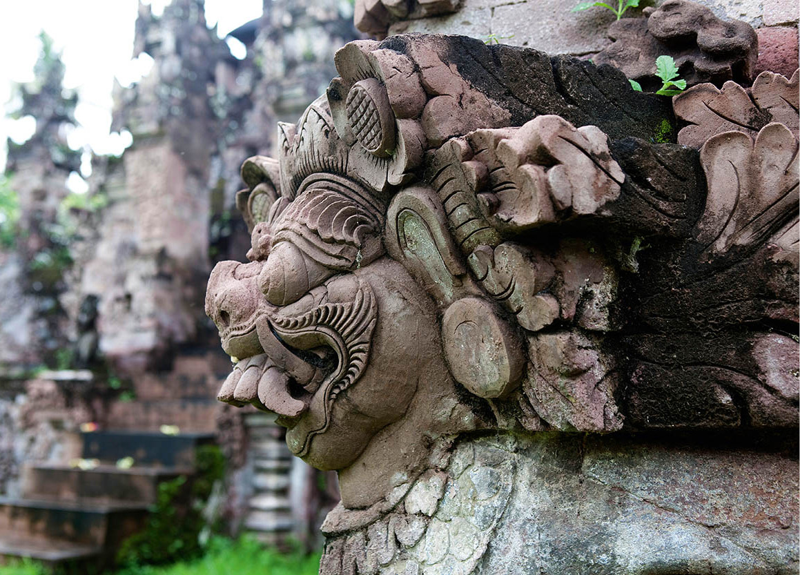
Pura Beji features numerous naga serpent sculptures.
Corrie Wingate/Apa Publications
In Sangsit § [map] an unusual 15th-century subak (irrigation cooperative) temple, Pura Beji (daily during daylight hours; donation), dedicated to rice goddess Dewi Sri, is garnished with many naga – serpents that symbolise water and fertility. The road from nearby Kubutambahan going south leads to Danau Batur and Kintamani.
About 15km (10 miles) southeast of Singaraja at Jagaraga is Pura Dalem ¶ [map] (Temple of the Dead; daily during daylight hours; donation). Interesting reliefs portray life before and after the arrival of the Dutch, including scenes such as two Europeans in a Model T Ford attacked by armed bandits and a Dutch steamer under siege by a sea monster. Southwards is Sawan, a village with gamelan makers and a talented gamelan angklung orchestra.
Further east on the coast road, Pura Meduwe Karang • [map] (daily during daylight hours; donation), is a dry-land agriculture temple. Just as subak temples ensure irrigated crop harvests, this 1890 temple gives ‘blessings’ for plants grown on non-irrigated land. It has many fertility themes, including numerous portrayals of erotic acts. Carvings in this ‘Temple of the Landowner’ show ghouls, domestics, lovers, noblemen and even a bicycle-riding Westerner, believed to be Dutchman W.O.J. Nieuwenkamp, who travelled all over Bali by bicycle at the beginning of the 20th century.
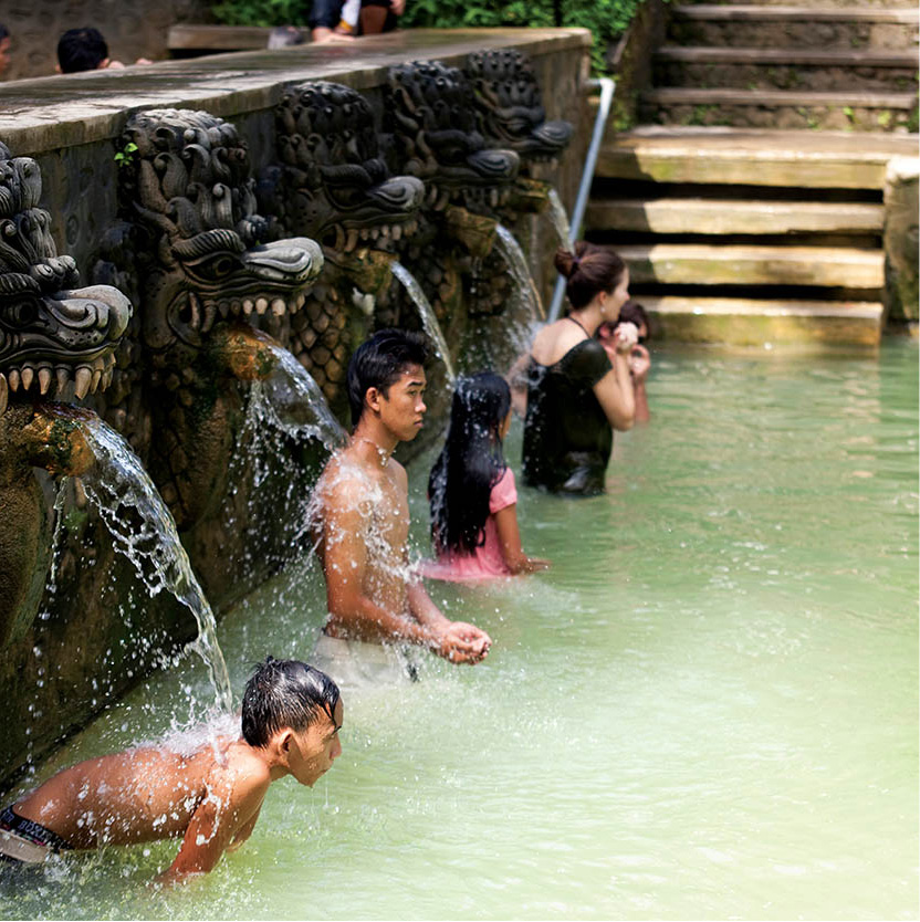
Further east, 17km (11 miles) from Singaraja, at Air Sanih ª [map] (Yeh Sanih; daily during daylight hours; donation) travellers, for a small fee, can dip in a cool, spring-fed swimming pool. Facilities include luxury villas and spas as well as budget lodgings and restaurants. Continuing east, the road and villages become simpler, the land grows more arid and the number of tourists dwindles.