26
Barrow Deep
And in the great silence the deep, faint booming of the big guns being tested at Shoeburyness hangs about the Nore – a historical spot in the keeping of one of England’s appointed guardians.
– The Mirror of the Sea, Joseph Conrad, 1906
The plan was to travel south-east, following the natural channels between the sandbanks from Harwich to the Gunfleet, then south-west into East Swin and Barrow Deep, before traversing over the sandbar into the Knock John and Knob channels, then on to Shivering and Red Sands and, finally, into the River Swale, where we would moor for the night. The passage of approximately forty nautical miles would take us into the heart of the Outer Estuary, through the seascape we had wanted to explore over four years before on Ideaal.
Blinding white light reflected off the water in the harbour as we sailed out of Harwich in the early morning. The sky above was a clear, bright blue. In front of us, the Harwich–Hook of Holland ferry cut a swathe through the sea as it headed out of the deep-water channel towards Rotterdam. My maternal grandmother, Molly, worked on these ships in the early 1970s, collecting data for a small government department called the Office of Information. She would ask the passengers a series of questions about where they were from and how long they were staying in the country. She loved the work, meeting all these new people, and she was never seasick, even when the crossings were rough. My mother said it was considered to be quite a glamorous occupation at the time. She would stay overnight in a hotel in Holland and bring back exotic treats such as chocolate liqueurs, which were hard to come by in England at that time. She worked before this in Tilbury, at the cruise terminal, conducting these surveys as passengers disembarked on to the large wooden pontoon there. At the time of our sailing trip on Jacomina, I was involved in curating a multidisciplinary festival of the Thames Estuary for arts organization Metal, which would take place at the cruise terminal in Tilbury the following year. I had invited John Eacott to perform Floodtide there, and he had chosen the pontoon where my grandmother would have stood all those years ago as the location for his performance.
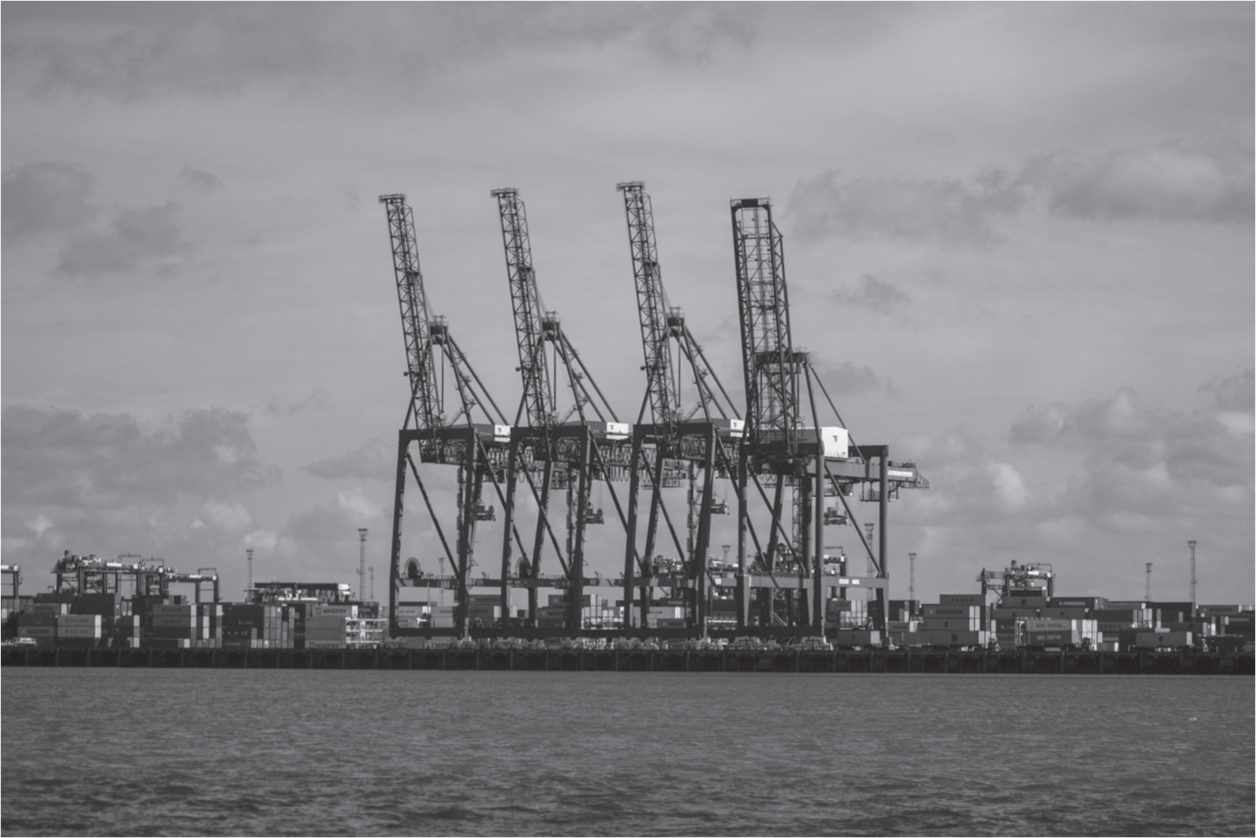
As we sailed past the busy industrial port again, I saw the huge container ship from the night before, now fully loaded and about to depart. On the opposite side of the harbour stood the old town of Harwich, the most northern coastal place in Essex, with its distinctive church spire and Regency-style houses along the shoreline.
As we left the noise and chaos of the harbour behind, there was a great bang as the boom flipped over port side. We were sailing goose-winged on a dead run with the wind right behind us and a high risk of an accidental gybe. We altered course, James winched in the main sheet and the boat began to heel more dramatically. In the narrow channel out, there were many big ships and lots of activity, and then we entered the silent Estuary.
Sealand slowly came into focus on the horizon out towards the North Sea. From that distance, the shape of the distant fort looked much like the Hebrew letter chai (which means ‘life’), standing alone on the edge of the sea. We passed Armada buoy and the water changed colour to a rich pea-green mixed with streaks of orange. Dark shadows flitted across the surface of the sea as wispy high-altitude clouds passed quickly overhead. The deep water of the shipping channel further north was a dark aquamarine.
Even though we were on a rising tide, from the moment we entered Estuary waters, there was a constant risk of touching the bottom with the deep keel of the yacht. Standing at the helm, I looked for signs of breaking water – indicators of sandbanks. John instructed me to check the depth reading constantly. As we tacked towards North Cardinal, the echo sounder in front of me showed the distance between the boat and the seabed had gone down to thirteen feet. I saw waves breaking on a sandbank on our starboard side and realized we might run aground.
Before buoyage, the Estuary would have been a deadly place to navigate through because of these submerged sandbanks. They are particular to estuaries and deltas, where wind and tide, exacerbated by shallow water, creates huge sandbars which can eventually become land. This is seen in exaggerated ways in delta landscapes like the Mississippi and the Nile, but also in the Thames Estuary (which is sometimes referred to as the Thames Delta) in places such as Canvey Island, which were created by tidal deposits of silt and sand over time.
We soon reached Gunfleet wind farm. Apart from a fishing boat moving along the edge of a row of turbines, there were no other visible vessels. We gybed, turning ninety degrees bearing south-west, leaving Gunfleet to our port side and sailing leisurely on a broad reach. The Essex shoreline soon faded into the distance until only the tips of the quay cranes of the port could be seen, rising up above the horizon behind the curvature of the Earth.
The wind dropped. We put the engine on for a while and motored along East Swin, which is a well-used shipping channel flanked by sandbanks. Looking at the chart, I noticed we were sailing over a disused explosives dumping ground. As we reached Barrow number three deep anchorage, Jaywick and Clacton became visible in the distance and the chimney on Sheppey also came into view. From that point onwards, we never lost sight of land again.
By the early afternoon, we had reached the deep-water channel of Barrow Deep, which runs parallel to Black Deep. The two age-old shipping lanes are separated by the Middle Sunk Sandbank. Deep-draught vessels and bulk carriers use these channels to enter or exit the Medway and the Estuary. In the sixteenth century, Richard III was believed to have disposed of the murdered bodies of Edward V and the Duke of York in the Black Deep, ‘whereby they should never rise up, or be any more seen’, but these places have also been used as dumping grounds for thousands of tons of untreated raw sewage that would arrive daily on the ‘gravy boats’. William Sangster, a Methodist preacher of the early twentieth century, described the process with surprising poetry: ‘When the vessel reaches the Black Deep, the valves are opened and the complete cargo runs out in about twenty minutes. Down it goes, down into the salt aseptic sea. A dark stain spreads over the wake of the ship.’
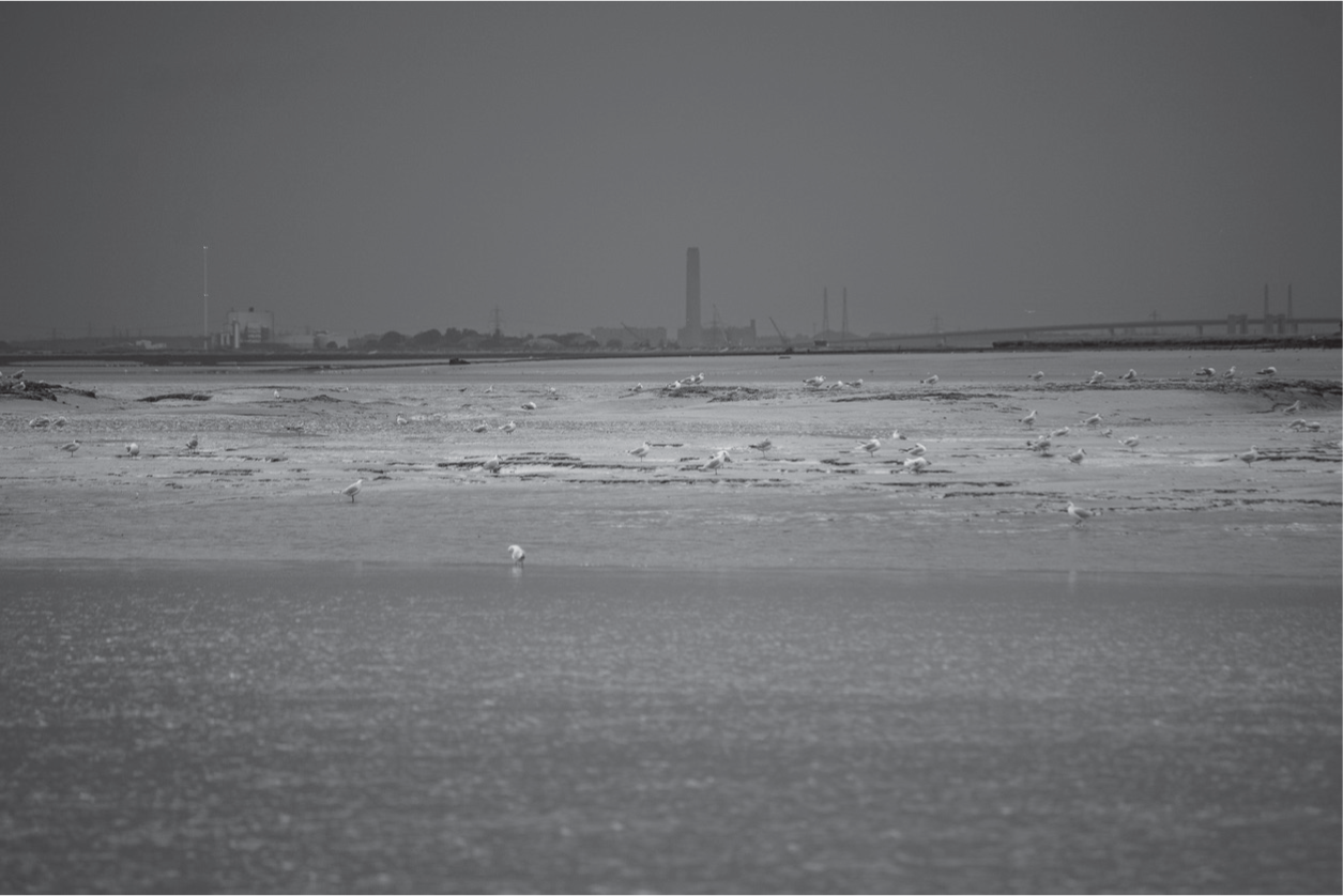
As we motored along Barrow Deep, flotsam drifted past – mainly seaweed, but the occasional piece of wood. Flags denoting lobster pots bobbed up and down all around, attached to plastic cartons or small buoys. The only rubbish I saw in the sea during our entire trip was a still-inflated pink helium balloon.
The Knock John Fort soon came into view: identical in size and shape to Sealand, it is the first place that Roy Bates set up his pirate radio station. On the horizon, we could see the Shivering Sands Sea Forts, alien structures rising out of the water on stilts. I thought instantly of H. G. Wells’s description of the Martians in The War of the Worlds: ‘so far out to sea that their tripod supports were almost entirely submerged’. The Essex coast and the Estuary feature in the novel as Wells describes the stampede of millions of people trying to escape the Martian invasion, which ‘spread itself slowly through the home counties … and along the roads eastward to Southend and Shoeburyness’. Thousands arrived in Essex to try to escape by boat. As the crowds waited on the shoreline, a Martian appeared, ‘advancing along the muddy coast from the direction of Foulness’, then another and another, ‘all stalking seaward, as if to intercept the escape of the multitudinous vessels that were crowded between Foulness and the Naze’.
The dark shape of the former naval fort, with its gun batteries still in place, looked forbidding as we approached. Knock John Tower sits on a sandbank of the same name. The water depth dropped progressively as we drew nearer. John chose the deepest route by looking thoroughly at the state of the water. He could see where the sandbanks were situated because the water was flat and calm over them, as they take the energy out of the waves and slow the current down. As we got closer, we saw the distinctive fin of a dolphin rise and fall beside the fort. A number of fishermen and sailors I had spoken to had mentioned seeing various new species in the Estuary in the last decade, including octopi, turtles, thresher sharks, dolphins and anchovies.
Knock John is a rusty, riveted, offshore defence platform standing on top of two circular concrete legs. On top of the gun platform is a small upper deck with a radar platform above it. The armaments had long since been removed. The entrances into the tower were welded shut and the place looked completely abandoned. The words ‘Radio Essex 222’ are still scratched into one side of the structure.
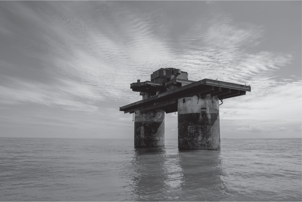
We turned the engine off for a while and circled the fort in silence, listening to the gentle sound of the boat cutting through the water, the creaking of the shrouds, the ensign flapping at the stern, the rattle of the boom and the occasional lonely call of a seagull, and then, in the distance, the great boom of guns being tested on Foulness Island. Mist engulfed the marshy shore, adding to the eeriness of the scene. Time slipped: naval personnel hunkered down on the roof, manning great guns, checking the skies for German aircraft. Now, fish jumped around in the dark shadows beneath the tower. Terns dived in and out of the water around the tower’s concrete legs, which contain rooms where over a hundred men would have slept during the war.
We moved reluctantly away, heading straight for Shivering Sands. We had just enough rise of tide to cover the Knock John sandbank. Once we were safely in the channel, the Estuary waters were green and clear; the sky was purple-grey. A coastguard border-control ship came towards us, moving quickly through the water. Seawater splashed up over the bow; the wash made us lurch violently from side to side. There was another big explosion over at Foulness: a great cloud of black smoke rose over the Essex coastline. We were quiet up on deck, feeling a mixture of excited expectation at seeing the forts up close for the first time and a little anxiety about the ever-present possibility of running aground.
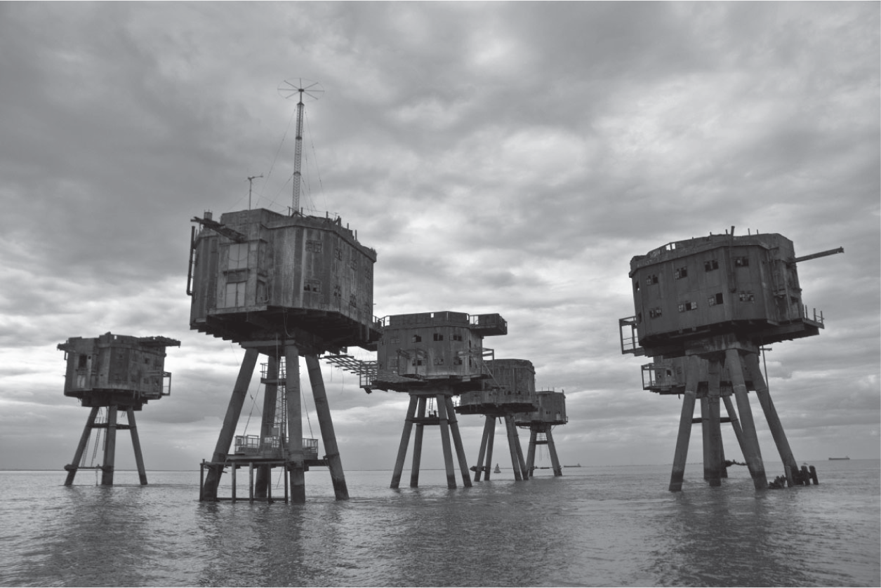
The sky and the sea resembled molten lead as we approached the sea forts in the late afternoon. I could see the tip of the collapsed fort at Shivering Sands poking out of the water as we got nearer; it had been knocked into the sea by a passing ship many years before. The remaining six forts, covered in rust, standing on their tripod legs, looked dark, menacing, precarious and strangely beautiful. The thought of staying out there alone for six weeks, as Stephen Turner had, was unimaginable. Then I thought about all those young men trapped out there for over a month at a time during the war, with little to do but wait and listen for the sound of enemy aircraft, and how terrifying it must have been, with such a real threat of being killed by bombs or aircraft fire at any point.
We circled the forts in complete silence, as before; the sound of a nearby bell on a buoy rang out as it rocked in the sea. We caught glimpses of stairwells through open doorways; broken windows, rusting rooftops covered in plants. The words ‘Radio City’ had been painted on the side of one of the structures. The searchlight tower in which Stephen had stayed stood alone from the rest.
I remembered John Cotgrove’s tales of visiting the Shivering Sands Sea Forts in September 1946 as a young teenager after taking a sailing trip from Thorpe Bay with some friends on their EODs. The forts were still occupied by the army then and had gangways, anti-aircraft guns and searchlights. ‘As we approached, we saw some pongoes hanging out of a window, they were keen for us to visit, anything to alleviate the boredom. So we climbed up some rickety ladders on to one of the forts. It was horrible inside, very spartan. They were having a party for one of the soldiers’ nineteenth birthday. The army cook made a wretched cake, which looked as though it was covered in ball bearings. We had a sing-song, ate the cake, drank some tea, then the wind got up so we stayed the night in the soldiers’ quarters on pipe-cots, which were like shelves with mattresses on – they were pretty rudimentary. We had no way of contacting our parents. My father went out on the mud in the middle of the night, looking for the body of his son. We got hell off our parents when we got home the next day.’
As we sailed away from Shivering Sands towards Red Sands, a distance of just four nautical miles, a container ship passed by, closely followed by a ro-ro cargo vessel. These two sets of army forts had been specifically placed to protect the main shipping channels into London by attacking any German mine-laying ships that tried to enter into these passageways, as well as any Nazi aircraft and doodlebugs. The army and naval forts were just part of the defences employed in the Estuary during the war: an anti-submarine boom was laid off Canvey Island; controlled mines were placed in the channel and four torpedoes fixed at Shell Haven. The old Dutch wall of Canvey Island was fringed with barbed wire, and forts, batteries and a fleet of minesweepers dotted the length of the Thames from Kew to the Nore.
We passed the yellow Princes Inner buoy, which marks the site of a wreck, as we entered the most treacherous area of the Estuary: the Nore – a great swathe of sandbanks which stretch out from the Kent coast right up to the main shipping channels. This is the area where so many vessels, including the Montgomery, have met their fate over the years.
There was a foul tide against us when we reached Red Sands. A strong current swirled around the legs of the forts; our skipper looked worried and told us we would not linger there unduly but we were all transfixed by the sight of them. Five intact turrets circle a central command at Red Sands. KEEP OFF! is painted in giant white letters on the side of one of the structures. One of the forts has been partly refurbished by Project Redsand, a group of committed enthusiasts who have been actively involved in conserving these forts for decades, and has new windows, a good access ladder, a landing gantry and a large aerial on the roof. The group now plans to work with business partners to convert the decaying forts into a futuristic-looking luxury hotel complex, with penthouse and executive apartments, a spa and over four hundred rooms. Guests would fly in by helicopter or arrive by hovercraft from Whitstable or Harwich. But, for now, the Red Sands and Shivering Sands Sea Forts stand abandoned in the Estuary, havens for wildlife and poignant reminders of the efforts by the British military to protect London during the Second World War.
Artist Chloe Dewe Mathews recently gained access to these forts, going out there with volunteers from Project Redsand. On her first trip, the fog was so thick they could not see the structures at all until the boat was bang up against them. She started filming from the restored tower, recording details of the atmospheric forts in the sea and the odd sailing or container ship passing by in the white mist. She plans to mix this eerie footage with crackly archive sound recordings she found online – 1960s broadcasts from Radio 390, one of many offshore pirate radio stations that once operated from the sea forts. The station was originally named Radio Eve: it was conceived as an easy-listening station aimed at housewives: ‘the women’s magazine of the air’.
We headed towards the mouth of the Swale, past Middle Sand to port. The sea was calm and glassy, a deep metal grey. The still water became a mirror, reflecting the sky above; we were immersed in a seascape of quicksilver. Dead ahead we passed the remote hamlet of Shell Ness, a small, sparsely populated coastal town on the most easterly tip of Sheppey. Some of the houses were boarded up. There were a few ramshackle wooden huts on the shore, and nobody on the nudist beach on the foreshore.
With a knot of tide pushing against the boat, we struggled to get into the mouth of the river. The water was falling fast; it was a race against time to reach our mooring. To starboard, the beach turned quickly into marsh, intersected by muddy creeks teeming with birdlife. Black-headed gulls and avocets waded along the water’s edge. Terns flew low over the mudflats and the landscape was filled with the sound of birdsong. We narrowly avoided a spit of sand as the water beneath us shallowed rapidly. We reached Sand End intact and watched a single balloonist flying high over the Kent hills.
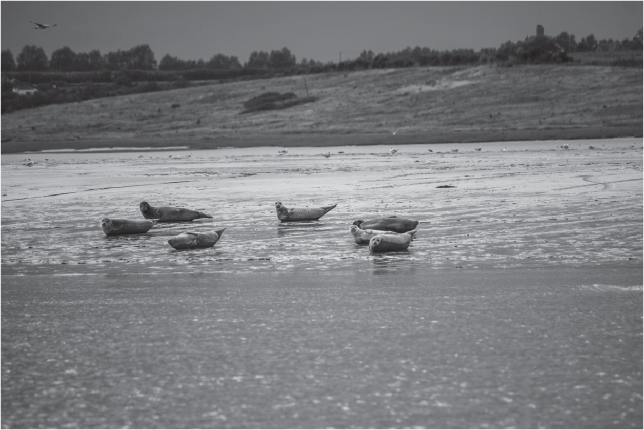
Basking in the early-evening sun on the Horse Sands lay an entire colony of common and grey seals. As we passed by, they lifted up their tails and turned their heads towards us. One of the younger-looking seals, the colour of rust, slipped into the river and swam towards us for a while before disappearing back under the surface of the water.
Horse Sands had been a popular place for gun-punting – shooting wildfowl from a boat. This is something else John Cotgrove remembered from his youth: hunting in a handmade, single-handed, plywood gunning punt in the 1940s, towing the punt over from Leigh to the Swale and lying down to sneak along the edge of the creeks in the shallow water. The punts were roughly twenty feet long, shaped like a canoe, with a large, old-fashioned hammer gun mounted on the front; they acted like a mobile bird hide, letting hunters get right up to the birds. John told me a story about his friend David Wallace, who was gun-punting at the Horse sandbank one day: ‘He shot some ducks and rode up to the mudbank to collect them, but he didn’t anchor his boat. Before he knew it, the punt was away. There he was in February, on a mudbank, in the middle of the river, with the tide coming in. Luckily, a fishing boat came by and picked him up.’ A small group of dedicated Kent wildfowlers continue this practice today in the Swale, the only legal place in the Estuary to gun-punt. Most gave up the sport decades ago, due to the danger involved and the protection of wild birds in conservation zones.
We moored Jacomina up to a buoy in the middle of the river at Harty Ferry, a remote spot opposite a small island. We contemplated taking the inflatable dinghy out to the pub on the island, but there was a high chance of getting stuck on the sandbank on the way back, so we sat up on deck instead, drank schnapps and sang some songs whilst listening to the cries of curlews and oystercatchers as the sun went down.
