During the Late Stone Age, about 27,000 years ago, a group of hunter-gatherers in the Pavlov Hills, in what is now the Czech Republic, looked around the landscape in which they lived and realised that if they had some means by which they could easily find their favourite hunting grounds and the best places in which to camp, then they would have a better chance to survive. Word of mouth from one generation to the next would have been one way to stoke tribal knowledge, but these people had a new and more permanent solution: they scratched marks onto a mammoth tusk, and this would provide them with a visual representation of where they had been, where they were now, and where they could go … in other words, they had created a map.
Those early cartographers were limited in their outlook. They had to make their observations from the tops of hills or, like later civilisations, from the masts of ships, but that did not stop them from considering the bigger picture. There was always a desire to view ourselves as the gods might see us, and in the sixth century BCE, the Babylonians had a go at depicting the entire Earth in space with their Map of the World. It is a clay tablet, in size about 12 by 8 centimetres, that shows our planet as a flat disc surrounded by the sea, and, according to the British Museum where the artefact is kept, it is thought to be copied from an earlier depiction made sometime after the ninth century BCE.
Archaeological finds like these show how, since the mists of time, people have had an abiding curiosity about what the world looks like when seen from above. But it was not until Greek philosophers and mathematicians came along that we realised the Earth was not a flat disc, but a sphere. It was the perfect shape the gods would have preferred.
By the 13th century CE, ancient mariners had drawn up navigational charts, like the portolan charts, which guided ships across the world in pursuit of silk, spices, opium, political influence and the conquest of new lands. They were so valuable that the charts were often closely guarded state secrets, and the outlines of the known continents were remarkably accurate considering the highest a ship’s navigator could climb to view the sea and shore was to the crow’s nest, about 30 metres above the deck.
Then, during the 18th century, there was a quantum leap in the way the Earth could be observed: the invention of the balloon. In November 1783, the Montgolfier brothers flew a manned balloon in France, but it was not until 75 years later that balloons were used to take photographs of the Earth below.

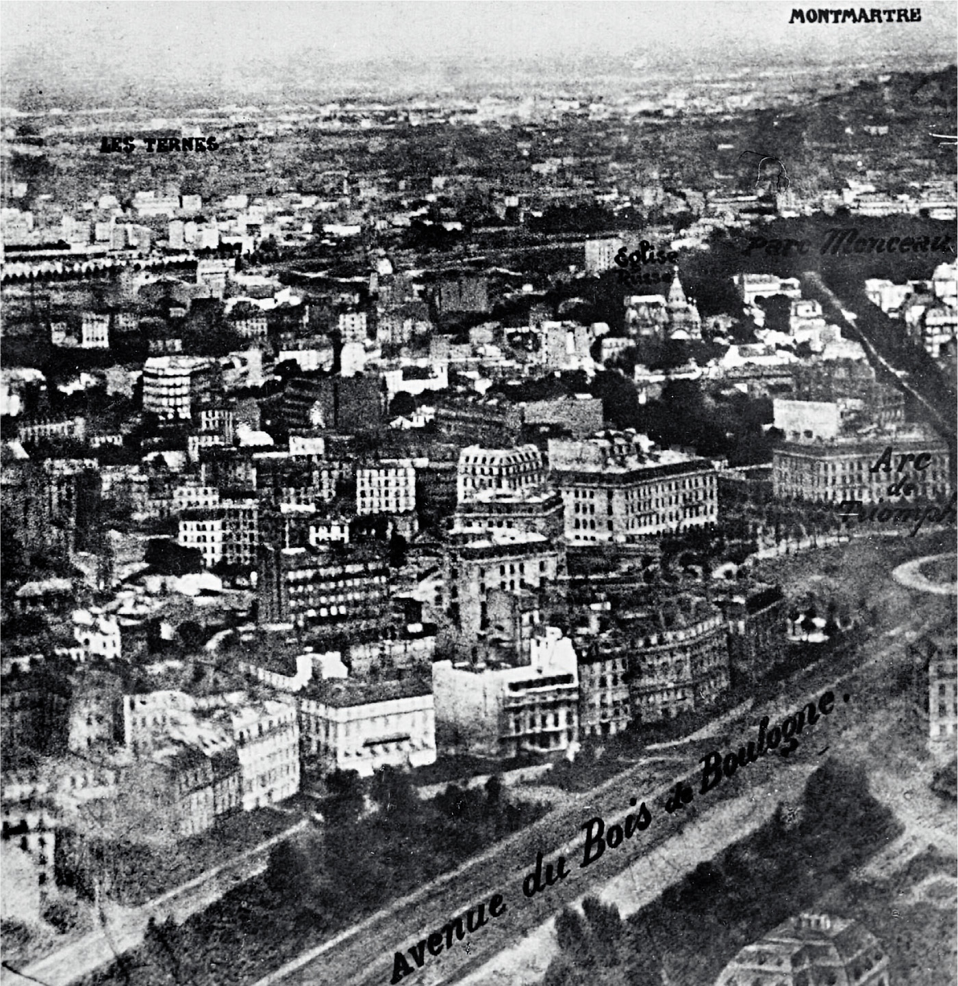
The pioneer was French photographer Gaspard-Félix Tournachon, known professionally as ‘Nadar’. In 1858, he took the first known aerial photograph from a tethered balloon about 80 metres above the valley of the Bièvre. It was not easy. The wet colloidal photographic process in those days involved him taking not only a bulky camera and tripod, but also an entire darkroom in the balloon’s basket. These early balloonists took enormous risks and very often put their lives in danger.
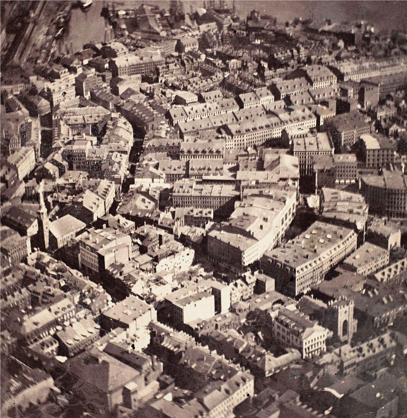
In the USA in 1860, American photographer James Wallace Black and his fellow balloonist Samuel Archer King tried to photograph the countryside around Boston, but their balloon broke free and they were dumped unceremoniously but safely in high bushes about 50 kilometres from their starting point. Two years later, British scientist James Glaisher and balloonist Henry Tracey Coxwell attempted to go considerably higher in order to photograph above the clouds. They reached an altitude of about 10,900 metres, but Glaisher passed out due to a lack of oxygen. Coxwell lost all sensation in his hands, but could pull the relevant valve cord with his teeth, and they returned gently to the ground but failed to photograph anything at all. And, in the early 1900s, George R. Lawrence was photographing from a cage strung beneath a balloon above Chicago when the cage detached itself and both Lawrence and camera fell towards the ground, only to be caught by telephone wires. Miraculously, he walked away unharmed.
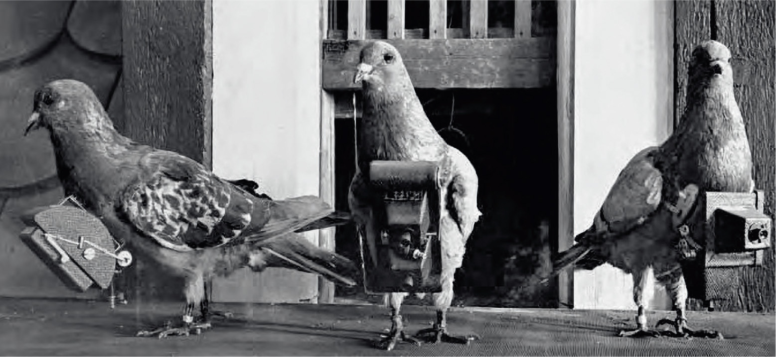
During the years that followed, the desire to photograph the Earth from above gave rise to techniques that became increasingly bizarre. In 1903, German apothecary Julius Neubronner designed and patented a small camera mounted on the breast of a pigeon. The pigeon did not always fly the intended track, but creating a camera this small was an achievement nonetheless. The pigeons were probably less impressed, flying as they did with a wooden box attached to their breast. It was a wonder that they were able to take off at all, let alone fly!
The next major innovation was humankind’s copy of the bird – the airplane, and taking pictures from an aircraft had immediate appeal for the military. During World War I, aerial photographs replaced hand-drawn sketch maps in pinpointing enemy positions, establishing troop movements and mapping battlefields, and, in World War II, aerial photography developed to such an extent that General Werner von Fritsch, chief of the German General Staff, remarked that, ‘the nation with the best photoreconnaissance will win the war’. Aerial reconnaissance became vital in the planning stages of almost every military operation, and one of the most critical ops for the Allies was the destruction of V-1 and V-2 rocket sites.
Towards the end of World War II, Adolf Hitler saw rockets as a way to win, and he had the scientists and engineers to make it happen. It was at Peenemünde in Nazi Germany that Wernher von Braun and his colleagues developed the V-2 rocket, the world’s first guided ballistic missile. It was designed to flatten London, but on 20th June 1944, test rocket MW 18014 went straight up into the stratosphere and beyond, reaching an altitude of 176 kilometres to become the first manmade object to cross the Kármán Line, the notional 100-kilometre boundary between the Earth’s atmosphere and outer space. It was the first ‘space rocket’, and, by association, von Braun became the ‘father of space exploration’.
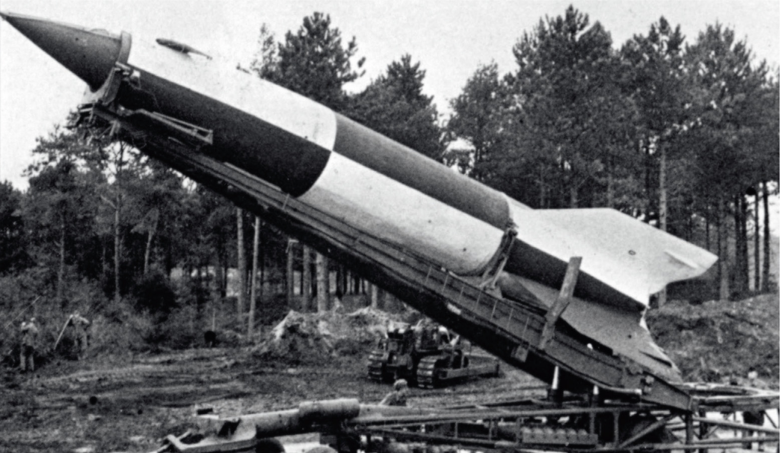
At the end of the war, Operation Paperclip spirited von Braun and 1,600 other German scientists and engineers out of Europe, and they were secretly moved to the USA, along with 300 goods wagons filled with V-2 rocket parts. There, the assembled team began new experiments with V-2s. American-born NASA pioneer John T. Mengel, for example, replaced V-2 warheads with cameras. It enabled scientists to look at our planet in a very different way.
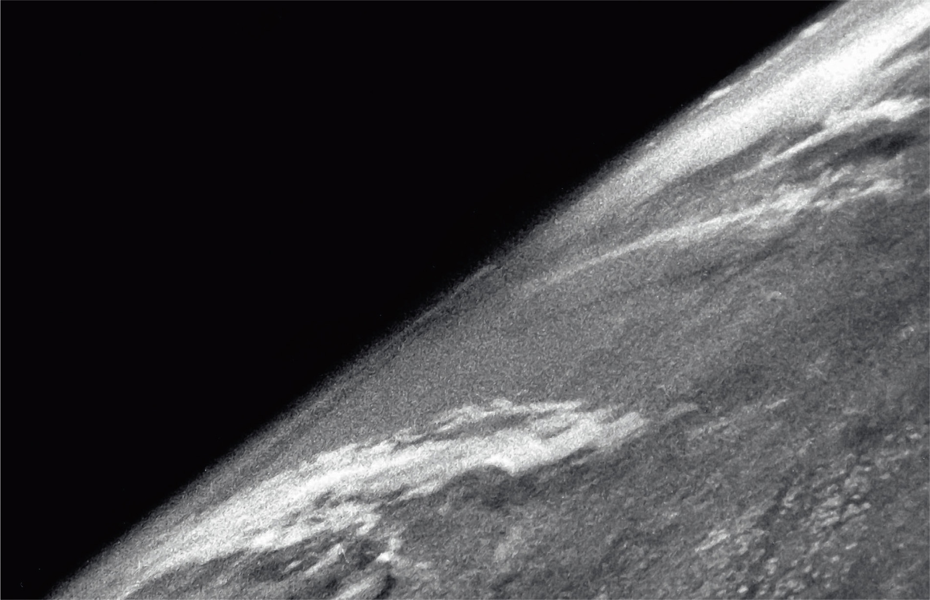
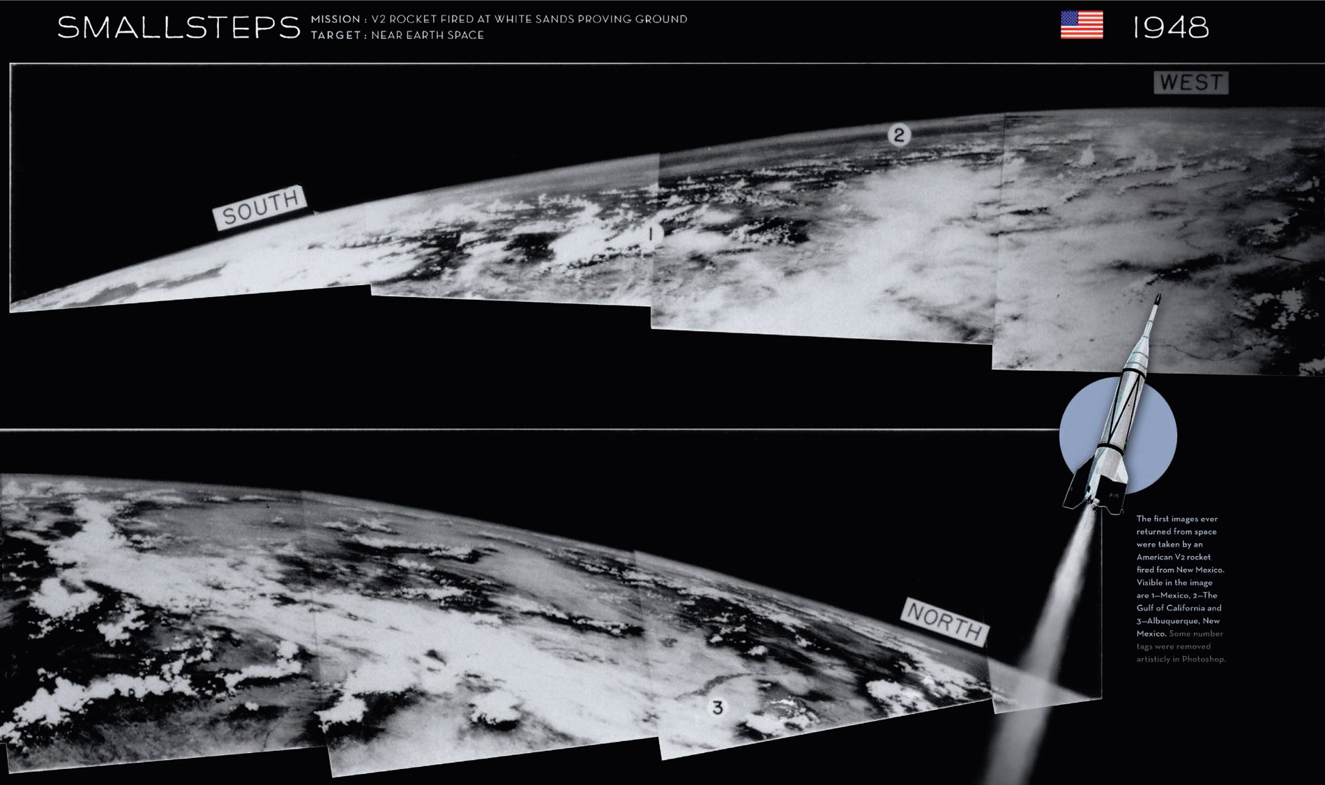
On 24th October 1946, sub-orbital V-2 rocket number 13 took off from White Sands Missile Range in New Mexico and rose to an altitude of 105 kilometres to obtain the first photographs of the Earth from space. The rocket fell back to Earth and ploughed into the ground, smashing the camera, but the film was safe inside its steel cassette. When the footage was processed, it led the camera’s designer, Clyde Holliday of John Hopkins University Applied Physics Laboratory, to remark in a 1950s edition of National Geographic magazine that the photo showed for the first time ‘how our Earth would look to visitors from another planet.’
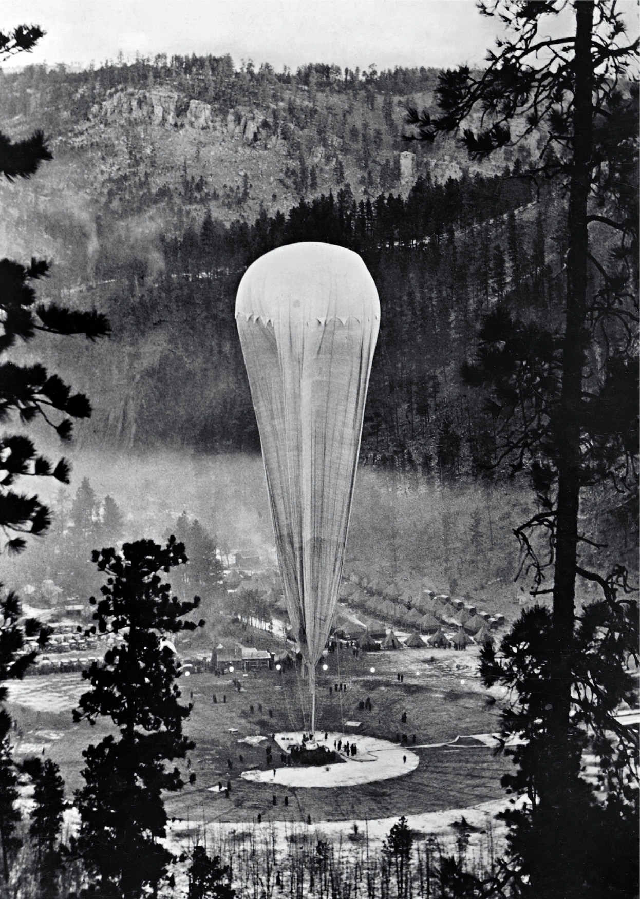
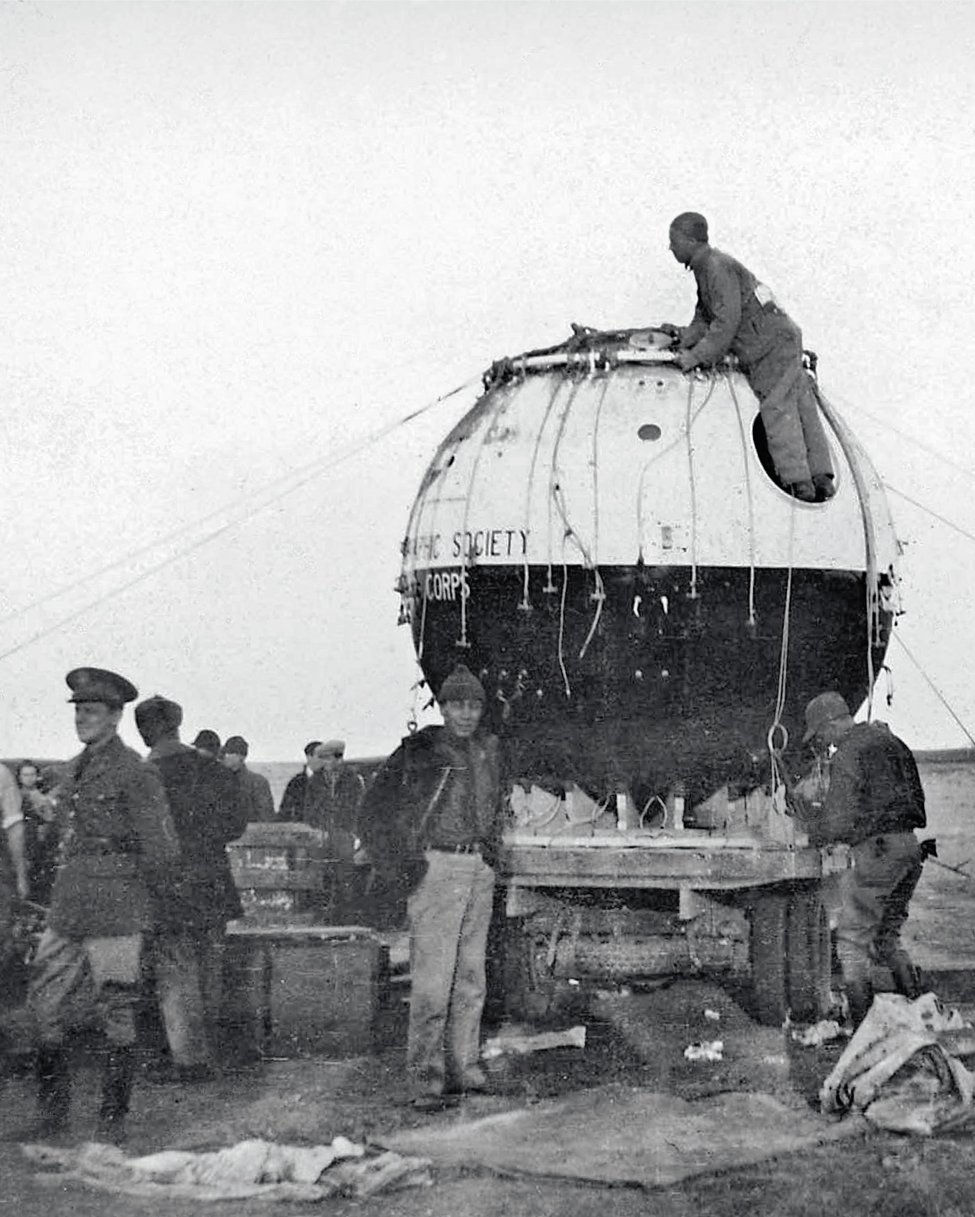
Until then, the only pictures taken of our planet from the edge of space were from Explorer II, a manned, helium-filled, high-altitude balloon that reached a record 22 kilometres above the Earth’s surface. It took off from South Dakota on 11th November 1935, with the crew – Captain Albert W. Stevens and Captain Orvil A. Anderson of the US Army Air Corps – ensconced inside its spherical, 2.8-metre-diameter cabin. Until then, the programme had been fraught with difficulties, and, like their 19th-century forebears, the two balloonists found themselves in mortal danger. The previous attempt – the hydrogen-filled Explorer I (not to be confused with the USA’s first satellite Explorer 1) – suffered a rip in the fabric of the balloon and its hydrogen canisters exploded. As the cabin plummeted towards the Earth, the crew had just enough time to bale out and drift down the last 150 metres to the ground on parachutes, their cabin having been totally destroyed on impact with the ground. When they returned to Earth on the Explorer II mission, and touched down softly and safely, the two captains were hailed as national heroes, but far more exciting was a very significant scientific accomplishment: they took the first picture showing the curvature of the Earth. They had seen that the Earth was not flat.
The V-2 rockets went five times higher than those balloons, and, on 7th March 1947, a rocket obtained the first pictures above an altitude of 160 kilometres. They were black and white and grainy, but they showed the Earth with patches of white cloud against the blackness of space, and, when the mosaic of pictures was stitched together, each panorama covered thousands of square kilometres of the Earth’s surface. The USA, however, did not have space to itself.
In 1957, the USSR’s Sputnik, the world’s first satellite, ushered in the ‘space age’ and accelerated the ‘space race’. The first satellite photographs followed a couple of years later. On 14th August 1959, America’s Explorer 6 satellite was at a distance of 27,000 kilometres when it beamed back the first pictures of the Earth from a satellite in orbit. The pictures were not too good. Landscapes and seascapes were virtually unrecognisable, a far cry from the images we see today.
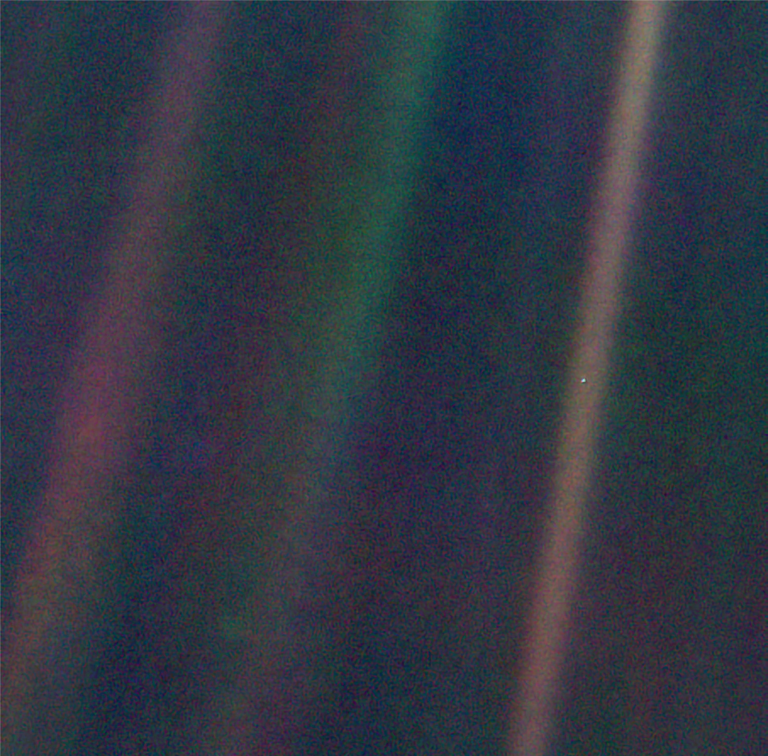
One of the game-changers was ATS-3, a small, tin-can-shaped NASA weather and communications satellite. On board was a camera designed by Finnish-American Verner Suomi, the ‘father of satellite meteorology’. On 10th November 1967, at a distance of 35,800 kilometres from the Earth’s surface, it captured an image of the whole planet. It was grainier than the famous Blue Marble picture of the Earth taken in 1972 by the Apollo 17 astronauts, but it showed the whole of our small and fragile planet set in the darkness of space for the very first time. Since then, many other satellites have presented us with whole Earth images, but the most poignant, perhaps, was the Earth as a very tiny pale blue dot, when photographed on St Valentine’s Day 1990 by Voyager 1. The spacecraft was beyond the orbit of Neptune, close to the edge of the Solar System, a distance of about 6 billion kilometres from home, and, as Voyager scientist and astronomer Carl Sagan pointed out, it showed just how small our planet is and how insignificant we are in the Universe.

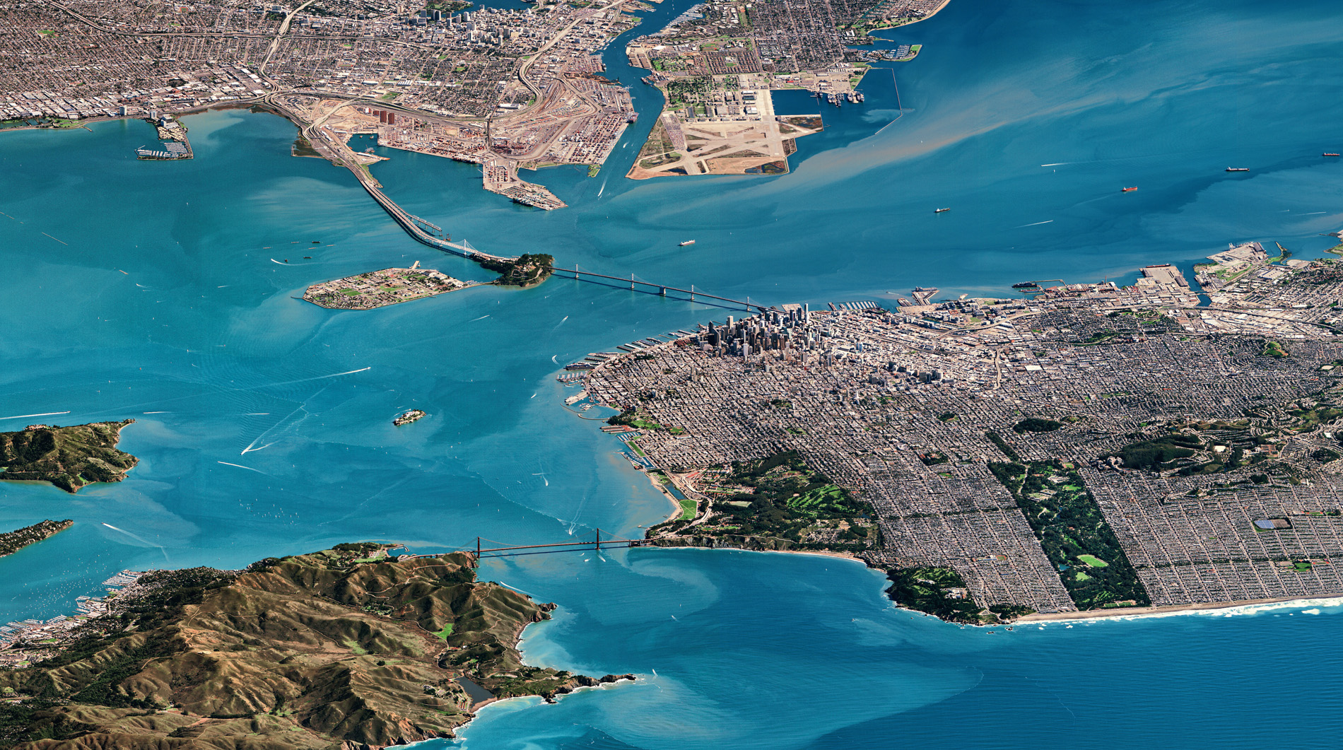
Today, satellites closer to home are doing quite the opposite. They show just how significant people are in looking after that pale blue dot. Satellite imagery is now so refined that changes in the fabric of our planet can be seen with unbelievable clarity, and that’s from hundreds of kilometres above the Earth’s surface – the equivalent of a person standing in London and seeing a football in Amsterdam. This powerful tool is part of an ongoing revolution in space technology that has not only enabled us to look at our world in a new way, but has also changed our lives in many different ways.
In this book, we dip a toe in the water of satellite imagery, and explore the movements, colours, patterns and changes we can see when we look down at the Earth from space. From dust clouds crossing the Atlantic to bring nutrients from the Sahara to the Amazon rainforest, to melting ice creating vivid turquoise lakes in Greenland, we reveal our planet as you’ve never seen it before.
