The Eastern Seaboard is Thailand’s most commercially and industrially developed shore, with the length from Bangkok to Rayong featuring numerous factories and oil refineries. Thankfully, the development has done little to deter tourism, and with miles of sandy beaches and dozens of islands lying just offshore, plus relatively calm seas all year round, it’s easy to find your own secluded oasis.
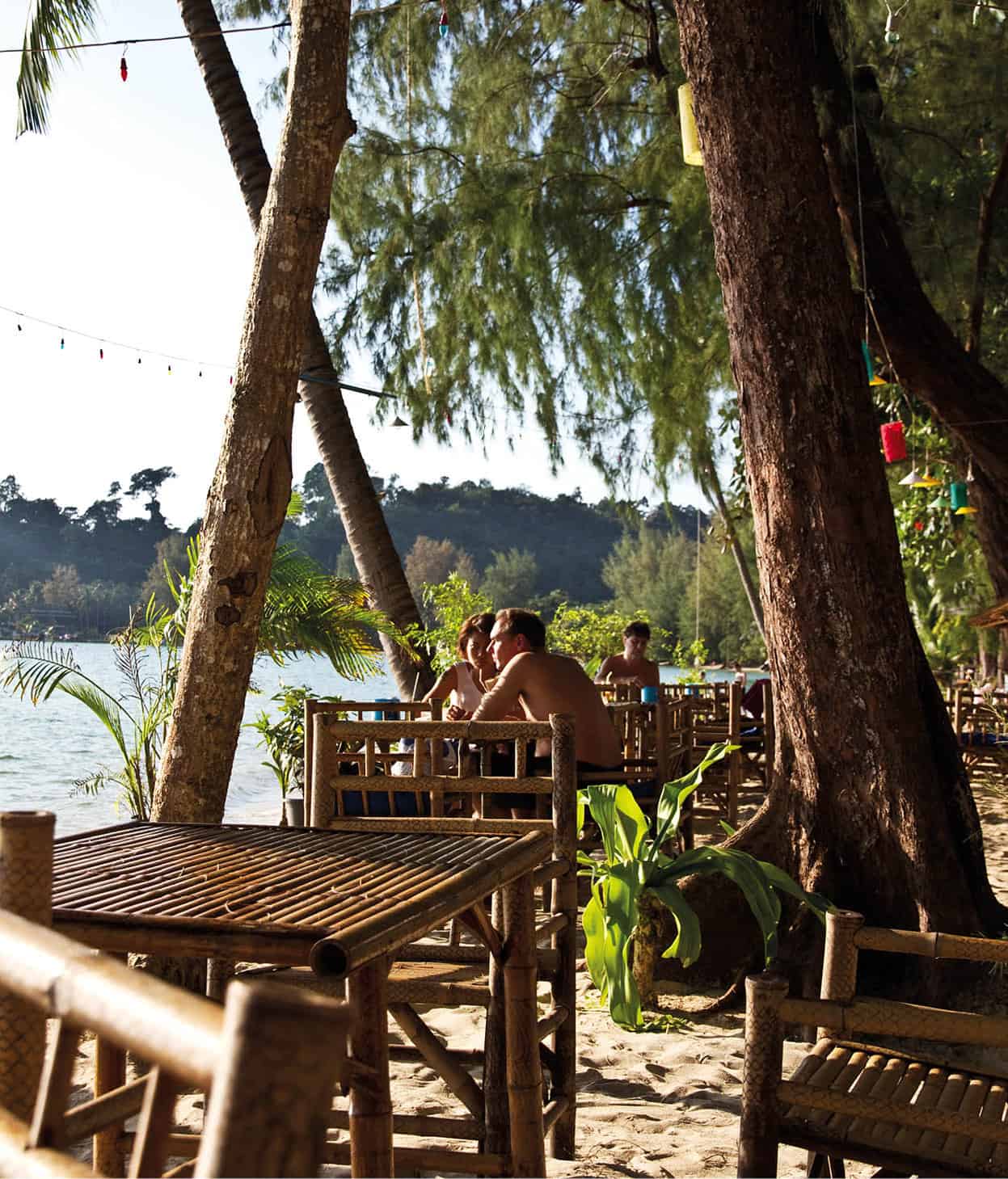
Relaxing at Ko Chang National Marine Park.
Getty Images
This section of the Thai coast has just about something for everyone; the beaches around Pattaya and Rayong, along with the islands of Ko Samet and Ko Chang, abound with activities. Speckled with orchards and national parks, the region is also a golfer’s paradise, with more than 25 international-standard fairways in close proximity to Pattaya.
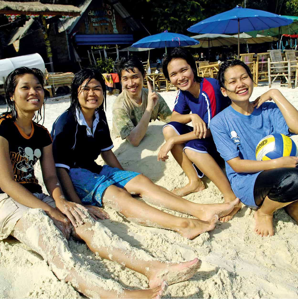
Young Thais in Ko Samet.
John W. Ishii/Apa Publications
Highway 3 is the principal road that trails through the provinces of Chonburi, Rayong, Chantaburi and Trat, all the way to Cambodia. There is a rail line as far as Pattaya, but services are limited and slow. Two small airports serve the vicinity, the closest being U-Tapao Airport near Pattaya. Further down the coast is Trat Airport, which cuts down on travel times from Bangkok for travellers wishing to reach Ko Chang.
The easterly location of Bangkok’s Suvarnabhumi International Airport significantly reduces travel times to destinations such as Pattaya, and many visitors are now opting to head straight to the coast, rather than spend a night in Bangkok. International hotel brands and luxury property companies are developing the area and it is likely that the region will see yet further growth in the coming years.
Bang Saen
The elevated highway that leads out of Bangkok runs past Chonburi, which is considered the gateway to the Eastern Seaboard. Just south of Chonburi municipality, the 2km (1-mile)-long beach at Bang Saen 1 [map] springs to life each weekend as hordes of middle-class Bangkokians arrive in cars and buses. The nearest stretch of beach from the capital, you will find it covered with a profusion of beach umbrellas and inflatable inner-tubes, the surf filled with bobbing bodies fully dressed to avoid a tan (many Thais associate tanned skin with working folk who toil in the sun).
Si Racha
The run-of-the-mill coastal town of Si Racha 2 [map], about 100km (62 miles) from Bangkok, nestles between two hill ranges, with a busy harbour extending beyond its piers. Visitors and locals alike enjoy the waterfront restaurants here, dipping fresh shrimp and crab into nam prik si racha, a spicy, thick red sauce that is famous throughout the land. Offshore, connected by a bridge, is the islet of Ko Loi, where the tree-shrouded Wat Ko Loi fuses Thai and Chinese elements on top of a rocky outcrop.
The Sriracha Tiger Zoo (daily 8am–6pm; tel: 0-3829 6556/8; www.tigerzoo.com; charge) claims to be the largest tiger zoo in the world, with around 400 Bengal tigers. The tigers star in the daily circus shows, which also feature crocodiles. There is also an elephant show, a crocodile show, pig racing, and plenty of other entertaining animals and birds.
Ko Si Chang
A 45-minute boat ride from Si Racha is the island of Ko Si Chang 3 [map], known primarily as the coastal retreat of King Chulalongkorn (Rama V). The king built his summer palace here in the 1890s, only to abandon it after the French briefly occupied the island a few years later. Once a customs point for cargo ships unloading on to smaller vessels to sail up the Chao Phraya River, the sea is always crowded with large freighters and rows of flat barges waiting to be supplied. Busy at weekends with Thai day-trippers, the island has a few passable beaches, though certainly not Thailand’s best or cleanest.
Tip
The best months of the year along the Eastern Seaboard are from Nov to Feb. Expect scorching temperatures from Mar to May, and rain from June to Oct. But even then, the wet season is not as intense as the Andaman coast, making for relatively calm seas even during the rainy months.
Ko Si Chang provides an interesting slice of island living without the typical tourist presence. It can be visited as a day or overnight trip from the capital or as a stop-off en route east to Pattaya and beyond. Day-trippers are approached as soon as they step off the ferry by drivers of motorcycle trishaws, who offer 3–4-hour-long tours around the island for THB250.
Sights and activities
Once off the pier, and after exploring Tha Bon, the island’s main fishing town, most visitors head straight for the grounds of Judhadhut Palace (daily 8am–6pm; free). Recently restored, the grounds double up as an ocean-front public park, with a small pebbly beach beside the rebuilt Atsadang Bridge. Once a colonnaded wooden pier used as Chulalongkorn’s landing stage, this is now a popular spot for kids to leap from and swim around moored fishing boats.
While the main teak palace itself was dismantled and rebuilt in Bangkok as the Vimanmek Mansion (for more information, click here), several of the palace’s other structures have been remodelled, including the green wooden house Ruen Mai Rim Talay, which was used as a convalescent home for infirm Western visitors. The pretty gardens that extend up the hill are worth exploring; at the top is the white spire of Wat Atsadang Nimit. As with palace buildings of the day, the temple’s design was a fusion of Thai and European architecture, with the circular chedi featuring unique stained-glass panels.
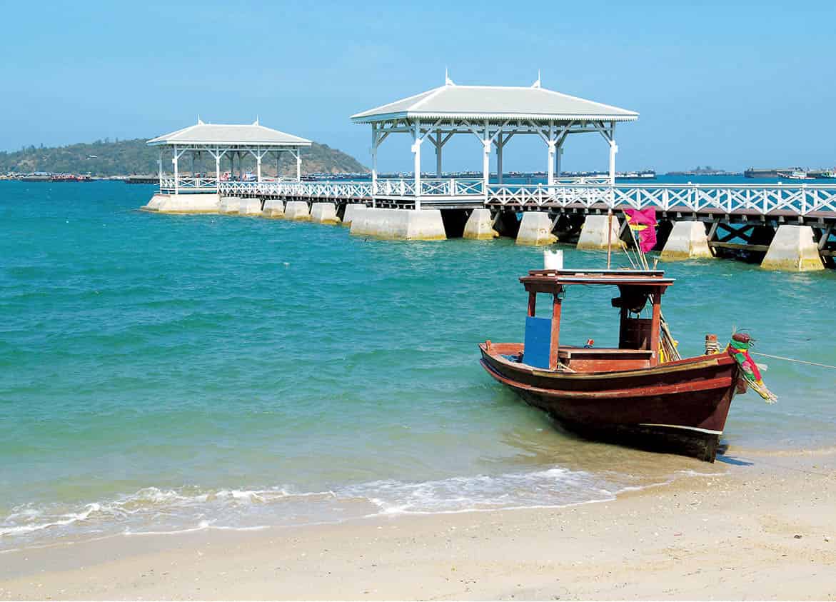
Atsadang Bridge.
John W. Ishii/Apa Publications
Strange as it may sound, ask any trishaw driver to take you to Dracula’s Castle and they will pull up in the middle of nowhere beside a bizarre-looking house that towers eerily above the tree-line. The abode is a labour of love for a professor of architecture and isn’t open to the public, but it provides a creepy photo opportunity before continuing on to the island’s principal beach of Hat Tham Pang (Fallen Cave), on the west coast. Depending on the tide, the 1km (0.5-mile)-long beach can shrink in size, and is usually crowded with lines of beach umbrellas and food shacks located behind.
Religious retreats on the island include the meditation centre at Wat Tham Yai Prik (daily 8am–6pm; free), where monks and nuns meditate in caves that reach deep into the rocky hill that the temple rests against. Foreigners often come to stay here to find their spiritual ‘centre’. There is no charge to stay at the temple, but donations are welcomed.
On steep Kayasira hill is Sanjao Pho Khao Yai (daily 8am–6pm; free), the Shrine of the Father Spirit of the Great Hill. This gaudy Chinese temple perched high on the rock has great views overlooking the town and port below. Said to date back to China’s Ming Dynasty, the colourful temple is a popular stop for Chinese visitors, who pay homage at the damp cave shrines before hiking up further to a sala containing the Buddha’s footprint.
There aren’t many restaurants of note, but Pan & David, a simple streetside eatery, is recommended. Run by an American and his Thai wife, the restaurant is a good source of tourist tips. The couple can also help arrange fishing, scuba diving and boat trips to nearby islands such as Ko Khang Khao, which has the nicest beach in the area.
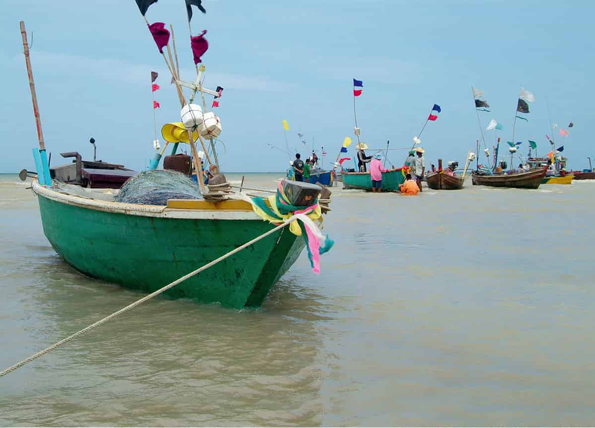
Fishing boats off Jomtien beach.
Bigstock
Pattaya
Good and bad, the reputation of Pattaya 4 [map] precedes it, with most people having formed their own opinion of this resort area even before they set foot here. This notoriety dates back to the Vietnam War, when boatloads of American GIs flocked to the then quiet beaches and bars for R&R. With the Thai Navy operating from the nearby port at Satthahip, battalions of visiting US marines still occasionally descend on Pattaya – much to the delight of the resort’s entertainment spots.
Located 147km (91 miles) from Bangkok, or just under two hours by road, the seaside town has long been popular with Thai youth and families. In recent years, Europeans have been outnumbered by visitors from Asia and the Middle East, along with significant numbers from Russia.
The once-polluted beaches have been cleaned up, but they are nowhere near as pristine as those of the southern islands. However, whatever Pattaya lacks, it more than compensates for in other areas. There is a plethora of good-value accommodation and restaurants, a wide range of outdoor and indoor activities, as well as several cultural attractions. Beyond that, Pattaya’s buzzing, if salacious, nightlife scene is something to be experienced, or avoided, depending on your sensibility.
Although Pattaya tries hard to create the ambience of a cosmopolitan playground, with glitzy malls and hotels, a pedestrianised shopping street and tree-lined paths, it still retains a provincial character.
Pattaya is also a popular spot for foreigners owning beach condos and houses, used as weekend getaways for Bangkok expats and as winter homes for retirees from Europe. Property is being built at an astonishing rate. There are some swanky residences on the market, and improvements to infrastructure, especially international schools, are drawing in more respectable residents. But its seedy reputation also attracts a strong criminal element. Thankfully, the underworld is rarely visible to the average tourist and Pattaya feels as safe as anywhere else in Thailand.
Pattaya’s beaches
On the beach front is the 3km (2-mile)-long crescent-shaped Hat Pattaya A [map], the least attractive of the three beaches, with only a narrow and umbrella-crammed wisp of yellow sand. It is backed by a palm-lined promenade that has unfortunately become a pitching point for ‘working girls’. The Phra Tamnak hill area separates the main resort splay from a huddle of mid- and high-end hotels (such as the Sheraton and Royal Cliff) that front several small but pleasant beaches.
Just a short ride south is the 6km (4-mile)-long Hat Jomtien B [map], with a stretch of beach that is only marginally cleaner and better than Hat Pattaya. The nicest-looking (with fewer umbrellas) and least-populated bays are found in north Pattaya, rounding the Hat Naklua C [map] headland towards the fishing village. Accessed from Naklua Soi 16 is Hat Wongamart, a pleasant stretch of sand backed by several condo towers and small hotels.
Beach activities
Pattaya and Jomtien are good locations for water sports, with windsurfing and sailing equipment available for rent, along with jet-skis, waterscooters and waterskiing equipment. Beware the scams associated with hiring these craft (for more information, click here). The brave can try parasailing, strapped into a parachute and towed aloft by a speedboat.
Ko Larn – identified in brochures as Coral Island but whose name actually translates as Bald Island – is one of Pattaya’s most popular day-trip locations. Its once-pristine coral reefs have been destroyed by fishermen using dynamite to stun fish. Yet glass-bottomed boats still ferry visitors around its waters, the passengers peering in vain at the dead grey coral. However, Ko Larn has the wide, soft-sand beaches that Pattaya lacks and is a great place to spend a leisurely day. The shore is lined with seafood restaurants, and there are water-sports facilities for those who manage to get off their beach chairs.
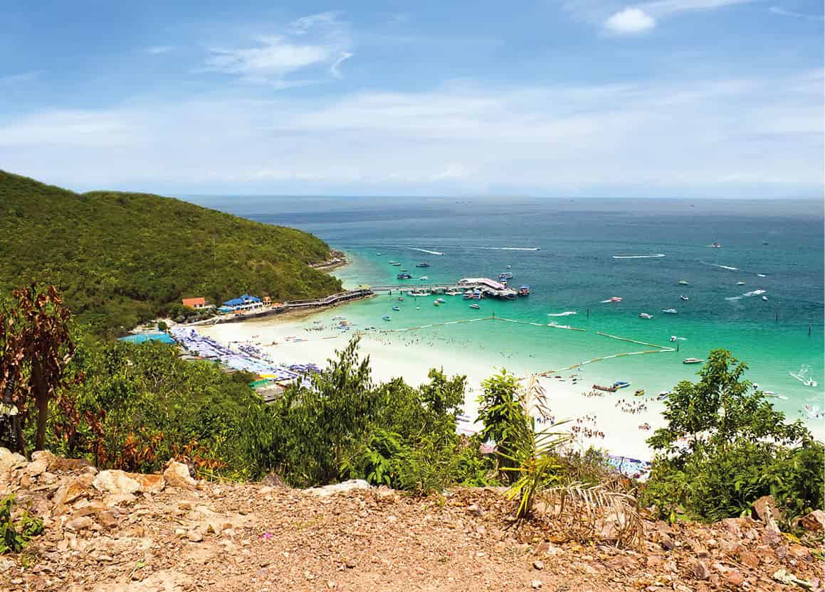
Ko Larn, also known as Coral Island.
iStock
Several scuba schools run dive trips to Pattaya’s outlying islands; the surrounding waters harbour one of Thailand’s best wreck dive sites, with no less than four sunken vessels scattered between Pattaya and Satthahip port. Ko Larn and the surrounding islands, such as Ko Sak and Ko Krok, see more tourist activity – visibility isn’t crystal-clear but the waters are fairly protected from currents, which make them suitable for diving beginners. The further islands of Ko Rin and Ko Man Wichai present better dive spots, with clearer visibility and an abundant range of marine life, and the opportunity to spot sharks and turtles. The Hardeep Wreck, Bremen Wreck, and the recently scuttled HMS Kram Wreck are frequently explored by more experienced divers.
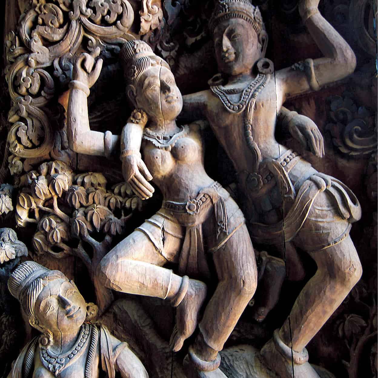
Detail of the Sanctuary of Truth in Pattaya.
John W. Ishii/Apa Publications
Land attractions
On land, a must-see is the intricate wood-carved Sanctuary of Truth D [map], in Naklua Soi 12 (daily 8am–6pm; tel: 0-3836 7229; www.sanctuaryoftruth.com; charge). This awe-inspiring structure made of teak is intended to revive traditional artisan techniques as well as act as a spiritual beacon. Dramatically perched on the seafront, the fantastical tower blends ancient religious iconography from Thailand and Southeast Asia. Work began in 1981 and is expected to be complete in 2050. Aside from the cathedral-like structure filled with chiselled figures, there are regular dolphin shows and Thai cultural shows, plus horse and elephant riding.
Rather more kitsch is the branch of Ripley’s Believe It or Not E [map] (daily 11am–11pm; tel: 0-3871 0294; www.ripleysthailand.com; charge) at the Royal Garden Plaza. Its collection of oddities from around the world may appeal to some.
While many of Pattaya’s visitors prefer to quaff bottles of cold beer, others can opt to view a unique collection of delicate miniatures displayed inside some 300 bottles at the Bottle Art Museum F [map] on Thanon Sukhumvit (daily 8.30am–5.30pm; tel: 0-3842 2957; charge). All the items have been patiently assembled over a period of 15 years by a Dutchman, Pieter Bij De Leij and a Thai woman, Prapaisi Thaipanich.
Another of Pattaya’s tourist stops is the Million Years Stone Park & Crocodile Farm G [map] (daily 8am–6.30pm; tel: 0-3824 9347; www.thaistonepark.org; charge). This is a collection of weirdly shaped boulders set among a landscape of rare and exotic flora. Situated off Thanon Chaiyaphruek, there are also beasts aplenty at the park, such as crocodiles, bears, tigers, camels and even giant freshwater catfish.
Tip
Pattaya has a bad reputation for con artists – collecting donations for spurious causes, selling precious stones at ‘bargain’ prices, or offering ‘free’ trips to tourist sights, so keep your wits about you.
Feel like a giant at Mini Siam H [map] as you step around tiny scale models of many of the world’s architectural landmarks (daily 7am–10pm; tel: 0-3872 7333; www.minisiam.com; charge). This Lilliputian world is on Thanon Sukhumvit in North Pattaya.
Families with young children will enjoy Pattaya Elephant Village I [map] on Thanon Sukhumvit (daily 8.30am–5.30pm; tel: 0-3824 9818; www.elephant-village-pattaya.com; charge). It offers a daily elephant show as well as fun rides into the surrounding countryside.
If you want to keep your feet dry, a land-based view of marine wonders can be had at Underwater World J [map] (daily 9am–6pm; tel: 0-3875 6879; www.underwaterworldpattaya.com; charge), just after the Thanon Thep Prasit junction with Thanon Sukhumvit. The large aquarium has a 100-metre (328ft)-long fibreglass viewing tunnel, along with a ‘touch pool’ for hands-on interaction with smaller marine animals, and a shark and ray tank. For an extra fee, you can scuba dive among the sharks.
South of Pattaya, 163km (101 miles) along Thanon Sukhumvit is Nong Nooch Garden & Resort K [map], a 243-hectare (600-acre) landscaped parkland enclosing two manmade lakes (daily 8am–6pm; tel: 0-3870 9361; www.nongnoochtropicalgarden.com; charge). Apart from one of the biggest collections of orchids and palms in the world, the park features a butterfly garden, mini-zoo and a daily cultural show with traditional dancing, boxing and an elephant circus.
Opposite Nong Nooch on Thanon Sukhumvit, Cartoon Network Amazone (daily 10am–7pm; tel. 0-3300 4999; www.cartoonnetworkamazone.com; charge) is a themed waterpark and has a beach and 150 features based on characters such as Ben 10, with a wave pool, an ‘adventure river’ and a speed slide falling from a six-storey tower.
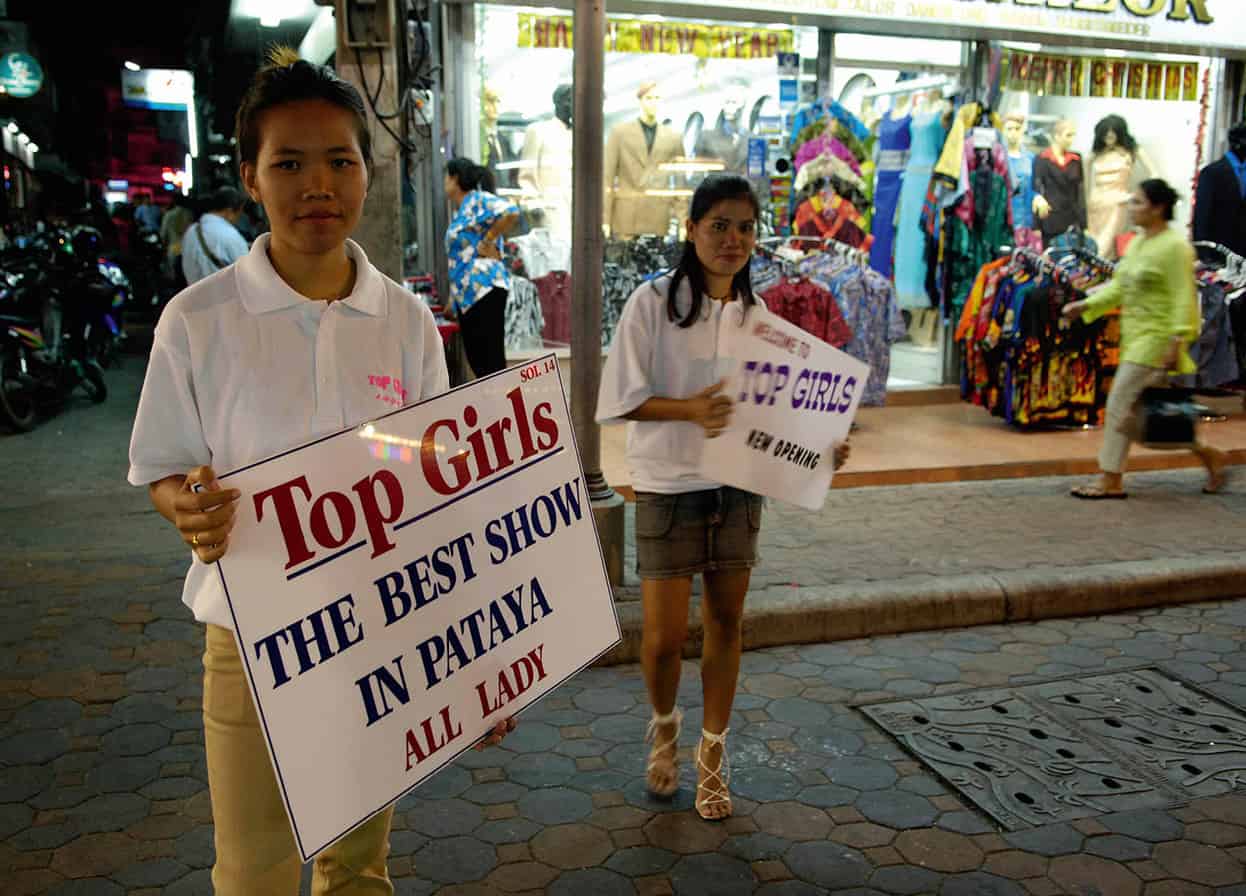
Bold signs beside the road make it clear what Pattaya’s main entertainment is.
John W. Ishii/Apa Publications
Pattaya’s nightlife
Pattaya’s main nightlife zones cluster around Beach Road and Walking Street in South Pattaya. There’s a staggering range of bars, Irish pubs, German brew houses, live-music venues, nightclubs, plus many go-go bars, open-air ‘beer bars’ and massage parlours. The strip called Boyz Town (Pattayaland Soi 3) follows the same theme for gay men. Of the lip-synching Vegas-style cabarets featuring kathoey or ‘lady-boys’ (transsexuals), the best is Tiffany’s, on Pattaya 2 Road (daily shows at 6pm, 7.30pm and 9pm; www.tiffany-show.co.th; charge). More family-oriented, Alangkarn Theatre (Thu–Tue shows at 6pm; www.alangkarnthailand.com; charge) at Km 155 along Thanon Sukhumvit combines traditional dance and theatre in a spectacle of historic Thailand, complete with elephant battles, lasers and pyrotechnics. Pattaya has its own mini Chatuchak at Thepprasit Market (Fri–Sun 5pm–11pm), close to the junction of Thepprasit and Sukhumvit roads, selling the usual knock-off watches, bags, T-shirts and interior decor.
Tip
While the regular fishing boat ferries are much cheaper, taking a speedboat across to Ko Samet (around THB800) from the mainland port is much faster, drops you on the bay of your choice, and usually means you escape the national park entry fee of THB200 per foreign person, which is pretty steep compared with the THB20 that Thais are charged.
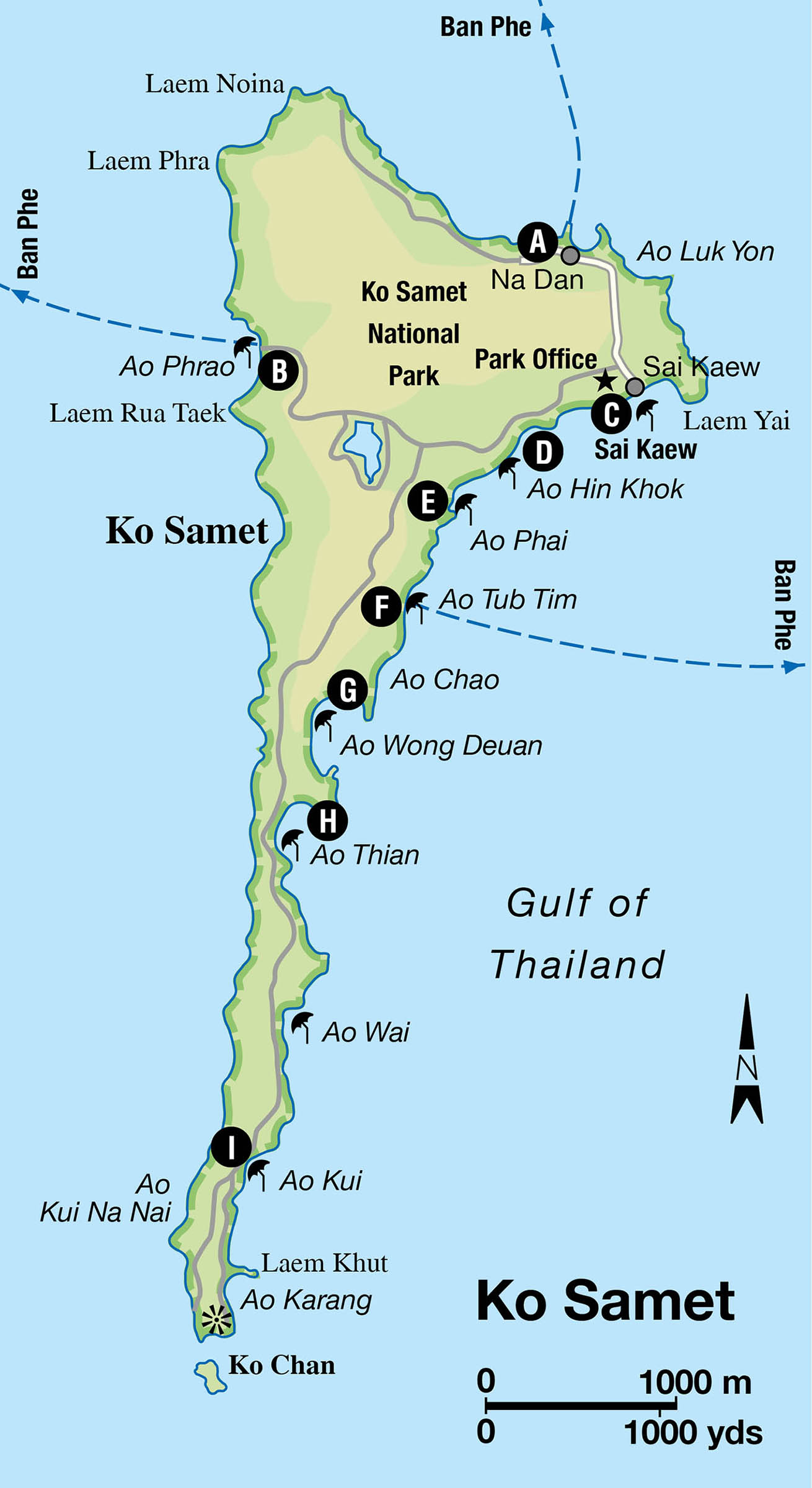
Located 200km (124 miles), or three hours by road, from Bangkok and a short boat trip across from the fishing harbour of Ban Phe, the postcard-perfect island of Ko Samet 5 [map] is a popular weekend getaway for Bangkokians. The island is well known among Thais as the place where Sunthorn Phu (1786–1855), a flamboyantly romantic court poet, retired to compose some of his works. Born in nearby Klaeng on the mainland, Sunthorn called the island Ko Kaew Phisadan, or ‘island with sand like crushed crystal’, and it was here that his best-known poem, Phra Aphaimani, a tale about a prince and a mermaid, was set.
From a quiet poetic retreat, the island has gained popularity as a laid-back resort, helped by the fine, white sand beaches and clear turquoise waters. The island was declared part of a national marine park in 1981 (entry fee on arrival), so technically, most of the resort and bungalow operations are illegal. Ko Samet is very popular with Thai students and young professionals, making it extremely busy on public holidays, when room rates can increase by more than 50 percent. Its popularity has also led to the construction of new and upscale resorts on the island. Note: the island has a reputation for dengue fever, so take all of the necessary precautions.
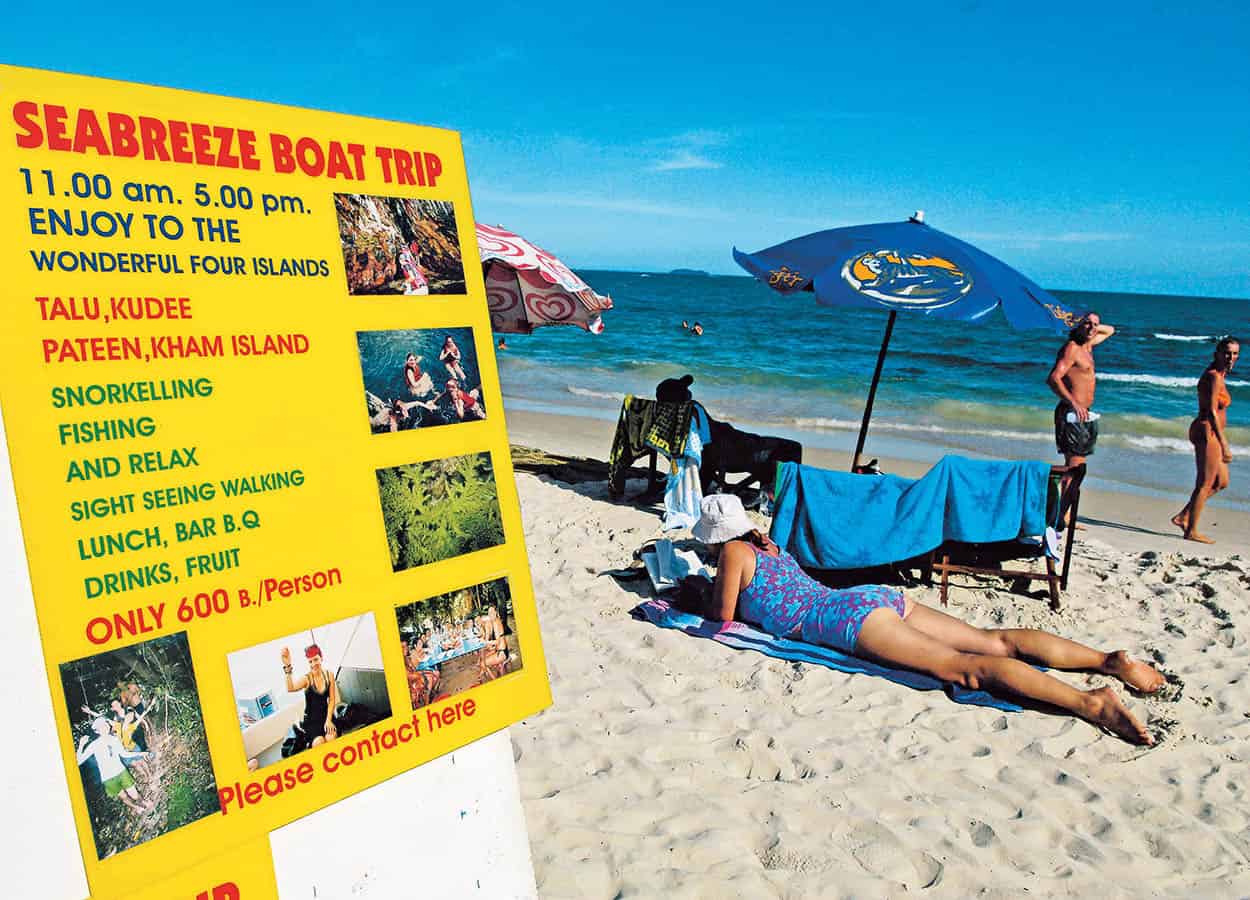
Hat Sai Kaew on Ko Samet.
John W. Ishii/Apa Publications
Ko Samet’s beaches
Almost all of the island’s sandy beaches run down the east coast, starting near the larger northern tip with Hat Sai Kaew, and gradually getting more isolated as the island narrows to the southern bay of Ao Karang. Most of the island’s infrastructure – school, clinic, temple, market and a few shops – is located near Na Dan A [map] pier and along the paved road to Hat Sai Kaew.
The island is relatively small, at only 6km (4 miles) long and 3km (2 miles) wide, and a hike from top to bottom, passing by all the east-coast-beaches, can be done in a few hours, though the coastal track cuts across several rocky headlands. There is a single road running down the centre of the island, which turns to bumpy dirt track at its outer reaches.
The west coast’s only beach, but the island’s most exclusive, Ao Phrao B [map], has just a few upmarket hotels nestled into its small scenic bay. On the east, Hat Sai Kaew C [map] (Diamond Sand), a short walk from Na Dan pier, is the most developed beach, with a larger selection of air-conditioned hotels, bars and seafood restaurants, plus luxuriant powdery white sands. Consequently, it is also one of the most congested.
Further down the coast is the bay of Ao Hin Khok D [map], separated from Hat Sai Kaew by a rocky promontory, marked by a weathered mermaid statue inspired by Sunthorn Phu’s famous poem. Here, and at the next bay – Ao Phai E [map], which has an equally nice white sandy beach – is where foreigners tend to nest. Hotels such as Naga Bungalows (Ao Hin Khok) and Silver Sand (Ao Phai) frequently host late-night parties.
The next white-sand bay is small and intimate Ao Tub Tim F [map]. There are only two places to stay here but the noisier attractions of Ao Phai are only a short walk away. There are two more quiet bays, Ao Nuan and Ao Chao, until you hit the picturesque, crescent-shaped Ao Wong Deuan G [map], which is becoming increasingly spoilt by boats, noisy jet-skis and the cram of bars and resorts (mostly middle- to upper-end price range). The facilities are good, with minimarts, motorcycle rental and internet cafés, but the scene is more akin to Pattaya, with older Western men being pampered by their hired female ‘guides’.
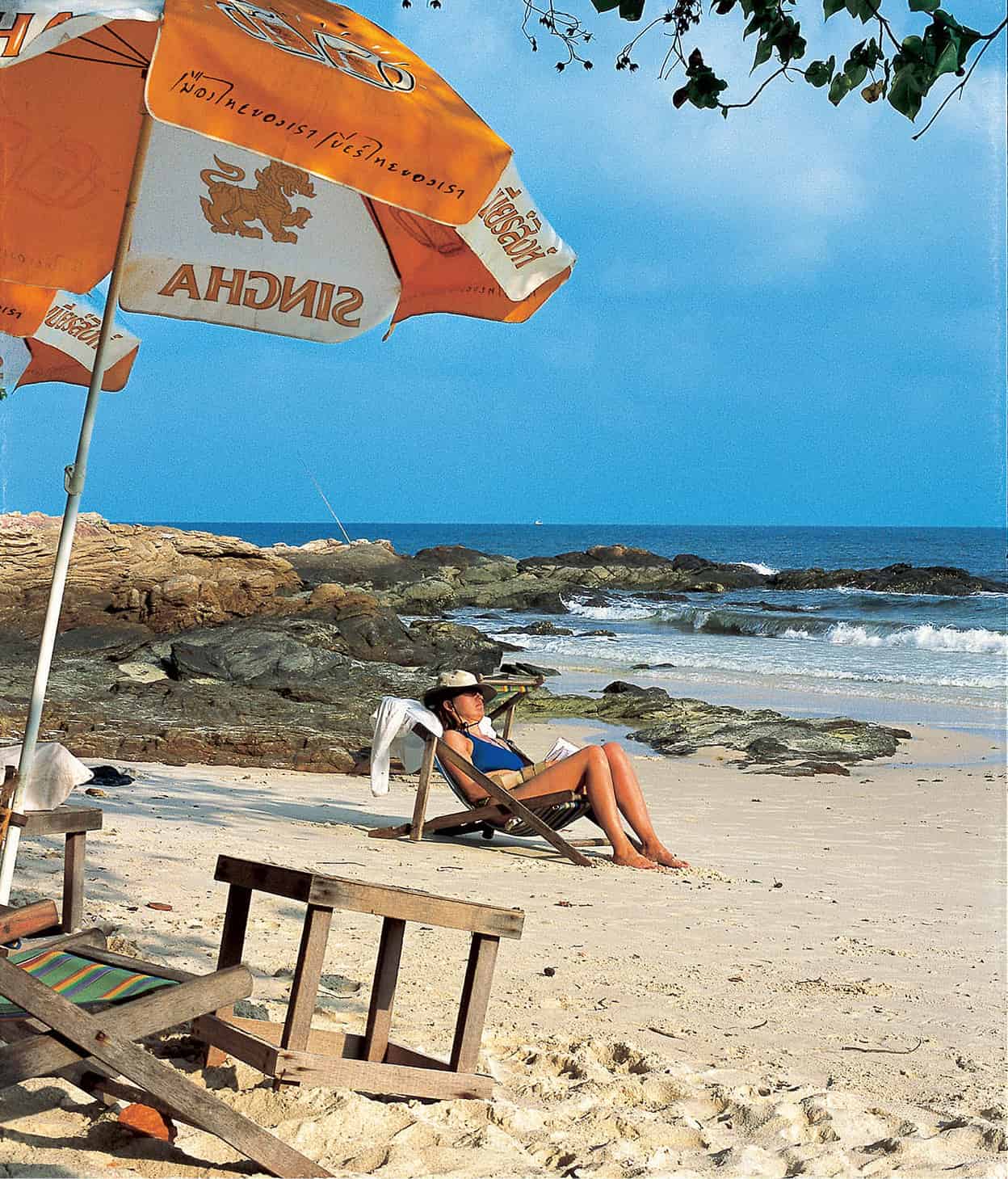
Lounging at Ao Thian, Ko Samet.
Jason Lang/Apa Publications
After Ao Wong Deuan, the bays become very peaceful, such as scenic Ao Thian H [map] (Candlelight Beach), which is actually a series of small beaches separated by rocky outcrops, and the southern Ao Kiu I [map], which has the island’s most exclusive accommodation, the Paradee Resort.
Sights and activities
Most activity at Ko Samet is relaxed and beach-bound – sunbathing, beach strolls, swimming and snorkelling are all options – though jet-skis and inflatable banana boats do occasionally interrupt the peace. Vendors hawk fruit, beer, ice cream, snacks and sarongs, and there’s an army of women offering massage and hair-braiding on the busier beaches. There isn’t much in the way of reef around the shoreline, and what few spots there are have been badly damaged, but you will still encounter colourful varieties of tropical fish. Several resorts offer snorkelling trips by speedboat around Ko Samet and to nearby islets.
A few places offer scuba diving off the beach at Ao Phrao, while boat trips head out to nearby islands such as Ko Talu, where visibility is clearer but abandoned commercial fishing debris is an eyesore. Further east is Hin Ploeng, and off the island’s southern tip is Shark Point, which can have strong currents and is best suited to experienced divers.
Ko Samet is to be avoided on public holidays, when visitors outnumber beds, and tents are pitched on any spare patch of land to be found. Evenings are relatively low-key; restaurants set up fresh-seafood beach barbecues, while some eateries entertain the purse-tight backpacker crowd with the latest pirated Hollywood movies. With local tourists making up the bulk of arrivals, Samet’s service staff can be rather curt to foreign visitors and their needs.
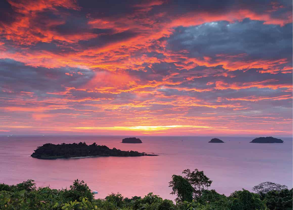
Sunset viewed from Ko Chang.
iStock
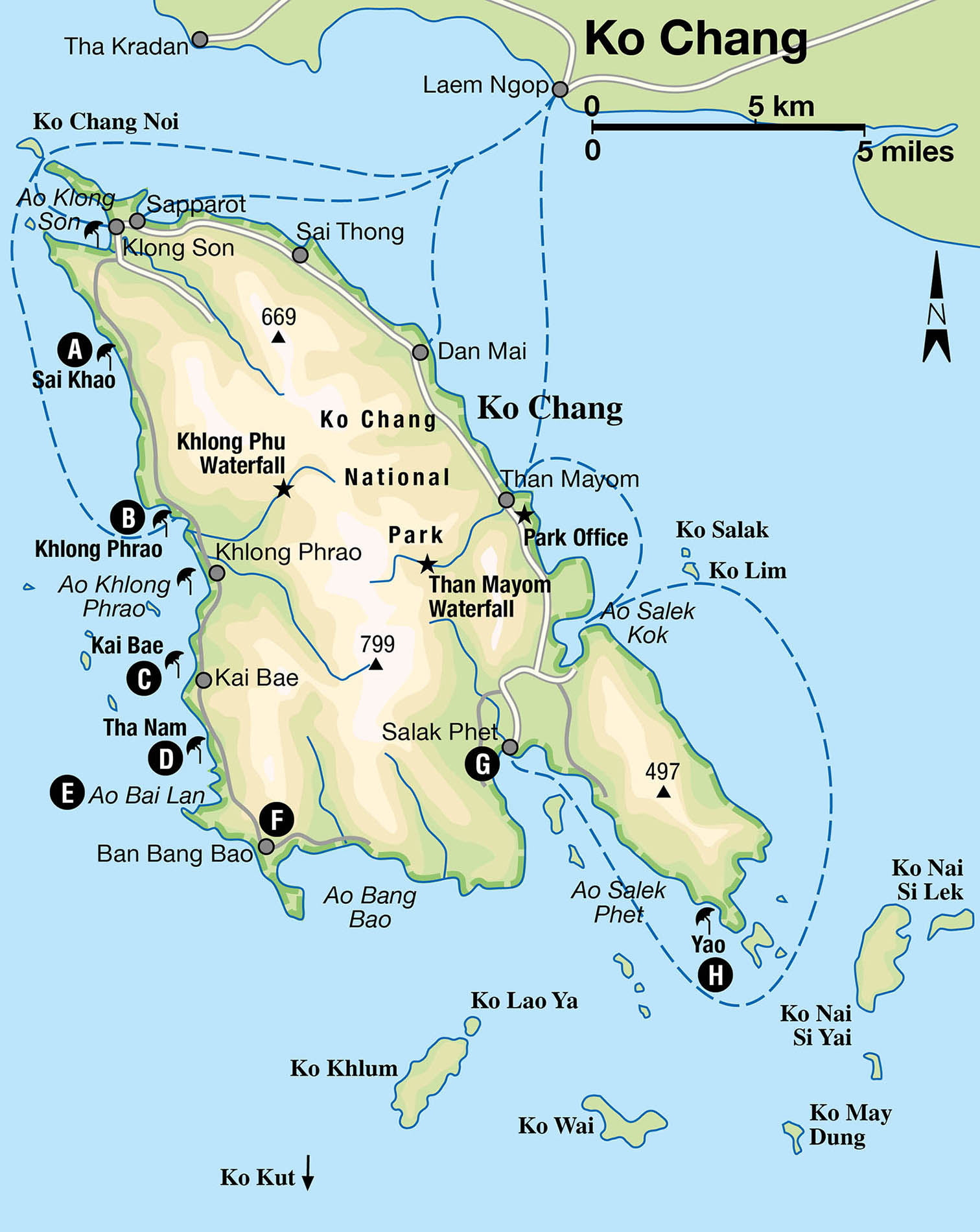
Thailand’s second-largest island, at 492 sq km (190 sq miles), after Phuket, Ko Chang 6 [map] (Elephant Island) is part of a national marine park that includes some 52 islands. It has a rich ecology, with more than 60 species of tropical bird. Around a five-hour drive from Bangkok (or 45 minutes by plane to Trat on the mainland, then transfer by boat), the verdant island is part of Trat province, close to the Cambodian border. Located 20km (12 miles) southwest of Trat town, the mainland pier of Laem Ngop is the main setting-off point to the island.
For years, Koh Chang managed, to escape the rapid development of islands such as Phuket and Ko Samui, and remained a firm favourite almost exclusively with backpackers and low-budget travellers. However, building began in earnest after former Prime Minister Thaksin Shinawatra actively promoted Ko Chang as a playground for the rich in 2003. The official plan has since been abandoned, but the legacy is a boom in construction that now lines a large part of the single road that runs around (and will eventually loop) the island.
While the upsurge may detract from the island’s untouched appeal, it does mean that there is a wider range of accommodation, including stylish hotels with spas. There is a corresponding increase in foreign tourists and wealthier Thai vacationers, although, despite the lack of the old rock-bottom prices, several beaches do still attract the budget crowd. Car ferries from the mainland are also more numerous, and the loop road is now fairly busy in high season. This, and several hazardous hill passes with sharp bends, means more care needs to be taken if exploring the area on a rented motorcycle.
Ko Chang’s beaches
Still, don’t be put off by the changes taking place; the island still has a relatively untouched hilly interior, a mangrove forest and some lovely beaches. The main beaches line up along the west coast, with Hat Sai Khao A [map] (White Sand Beach) the most developed (and longest) stretch, with its swathe of powdery sands framed by a backdrop of casuarina trees.
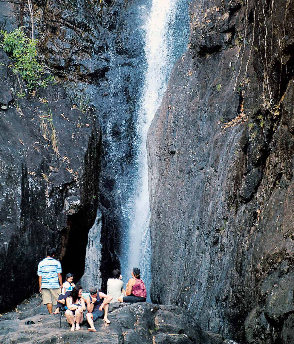
Than Mayom Waterfall, Ko Chang.
John W. Ishii/Apa Publications
South is Hat Khlong Phrao B [map], one of the nicest yet quietest beaches on the island. It is effectively divided into the northern, central and southern sections by canals. Beyond that lies Hat Kai Bae C [map], which has seen much recent development. Unfortunately, parts of its beach disappear when the tide is high. Next up is the last vestige of Ko Chang’s hippie traveller scene, the lovely stretch of Hat Tha Nam D [map], or Lonely Beach; it’s no longer such a haven of solitude, with plush resorts starting to edge in. Just over 1km (0.5-mile)-long, this fine-sand beach gets a little coarser towards the south. It’s the island’s best beach for swimming, although there is a steep shelf at the northern tip. Next is Ao Bai Lan E [map], a bay with rocks and reef but no beach.
At the bottom of the west coast is the stilted fishing village of Ban Bang Bao F [map], which has become little more than a narrow concrete pier devoted to tourism, with seafood restaurants, dive shops, souvenir shops and a guesthouse. This is also the departure point for dive and snorkel trips to surrounding islands.
The coastal road continues east but eventually arrives at a gate that claims private access to Ko Chang Grand Lagoona resort. Until the island loop is completed, this is where the journey ends.
Tip
Hat Tha Nam (also known as Lonely Beach) is one of Ko Chang’s nicest beaches but beware of the strong undertow and currents at its northern end. A good number of drownings have occurred in these treacherous waters.
Accessed from the east coast, in the next bay along the south coast nestles Salak Phet G [map] fishing village, which has a more authentic and less developed feel than Ban Bang Bao.
Compared with the west coast, the eastern shoreline has little in the way of beaches and is largely ignored by most visitors. This makes a leisurely drive along the plantation- and hill-backed road a real pleasure, with few vehicles and the reward of a seafood lunch at Salak Phet. An alternative route runs along the east of Salak Phet where a newly built winding road continues all the way to Hat Yao H [map], or Long Beach, on the southern tip.
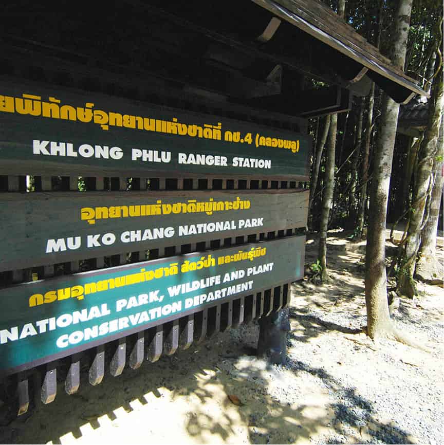
A sign for the waterfall at Khlong Phlu.
John W. Ishii/Apa Publications
Sights and activities
Most island-hoppers understandably confine themselves to the west-coast beaches, but just as appealing is the lush verdant mountainous backbone. The island’s ecosystem features many avian species (including hornbills), macaques, pythons and cobras, monitor lizards, deer and boar, as well as striking wild flora. Day-long as well as overnight treks are conducted by the reputable Trekkers of Ko Chang (tel: 0-3952 5029), and many hotels organise trips with Mr Anong (mobile tel: 08-6152 5271).
With the island named after the noble pachyderm, it is no surprise that there are at least three elephant camps conducting treks into the interior. The best one, located deep in the forest, is the elephant camp of Ban Kwan Chang (daily 8am—5pm; tel: 08-9247 3161), which conducts well-organised half-day treks and feeding sessions.
Other popular activities include kayaking and treks to the island’s numerous waterfalls. The two most well-trodden are Khlong Phlu Waterfall and Than Mayom Waterfall, both of which have park offices that charge foreigners an inflated THB200 for each fall, while Thais pay THB20.
Snorkelling and scuba-diving trips usually head to the smaller outlying islands (for more information, click here) off the southern end of Ko Chang, going as far as Ko Kut, the second-largest island in the archipelago. There is fine diving at reasonably shallow depths, which is best done from November to March when the sea is calmer and visibility clearer.
Some of the best dive and snorkel sites include the pinnacles off Ko Rang, the reefs around Ko Wai, where sharks frequently hover, shallow dives off Ko Khlum and Hin Luk Bat, a rock pinnacle 30 minutes south by boat from Ban Bang Bao, and the Thonburi Wreck off Ko Chang’s southeastern tip, where the warship Thonburi was sunk by French troops on 17 January 1941.
Nightlife
Ko Chang’s nightlife is subdued compared to Ko Samui or Phuket, with each beach having its own preferred watering holes. Hat Sai Khao is where the main energy is, where the large Sabay Bar sees the most action. Lying on cushioned beach mats is the typical set-up, and live music is a feature at many of the bars. As a sign of things to come, there is a block of raucous ‘beer bars’ (nicknamed Mini Pattaya by residents) on the road at the southern end of Hat Sai Khao, with scantily clad bar girls to lure in customers.
Further down the west coast, Hat Kai Bae has a burgeoning nightlife scene, with a growing number of bars, restaurants and resorts. Hat Tha Nam has its own pocket of entertainment, with the Treehouse being its most popular hangout.
Ko Chang Archipelago
If Ko Chang feels a little too well-trodden, an alternative course of action is to head for the string of isolated islands off the southern tip. Many of Ko Chang’s best snorkel and dive sites are found in the waters surrounding these islands. Around 10km (6 miles) off Ko Chang, the tiny island of Ko Wai has limited and basic accommodation, but the vibe here is very relaxed, the views of surrounding islands are spectacular, and there’s a lovely coral reef just a short swim from the main beach.
An hour by speedboat from the mainland pier of Laem Ngop, the flat island of Ko Mak is dense with coconut trees and has two lovely beaches with few tourists but, unfortunately, plenty of sand flies; be sure to bring insect repellent. While the beaches are relatively unspoilt, the lack of development means that stretches of sand on Ao Kao, on Ko Mak’s southwest coast, are littered with unsightly flotsam from fishing craft – a possible danger to barefooted walkers. Ao Suan Yai, on the opposite side of Ko Mak, is the island’s prettiest bay. Both places have some basic accommodation and restaurants.
The southernmost island in the archipelago, and the closest to Cambodia, is Ko Kut 7 [map], Thailand’s fourth-largest island and 2.5 hours away by speedboat. Some 25km (16-miles) long and 12km (7-miles) wide, some of the island’s populace is of Khmer origin, with most inhabitants earning a living from fishing or agriculture. Aside from several beaches and clear seas, attractions include Khlong Chao Waterfall and the fishing village at Ao Sa Lad. Due to its remote location, the island’s development has been fairly low-key, attracting mainly organised tour groups.
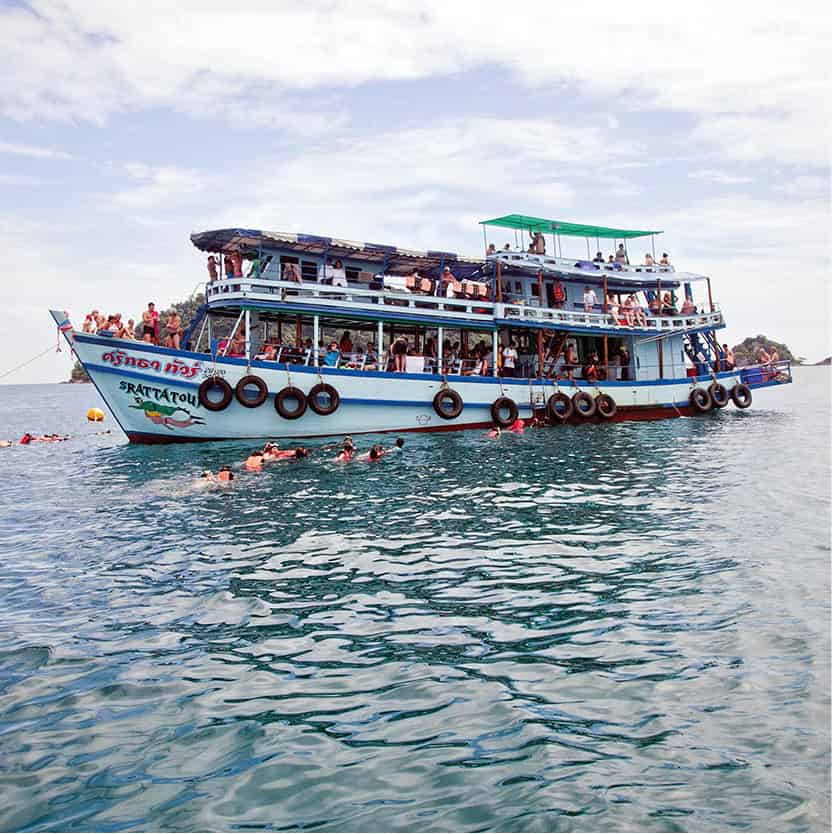
Excursion boat in front of Ko Wai island.
Alamy
Seasonal boats to Ko Wai, Ko Mak and Ko Kut leave from Laem Ngop pier on mainland Trat. From Ko Chang’s Bang Bao pier, there are boats that organise tours to the more popular islands; resorts can also arrange for you to hitch a ride on a sightseeing tour boat. Speedboats can be arranged, but are expensive so are best hired for a group.
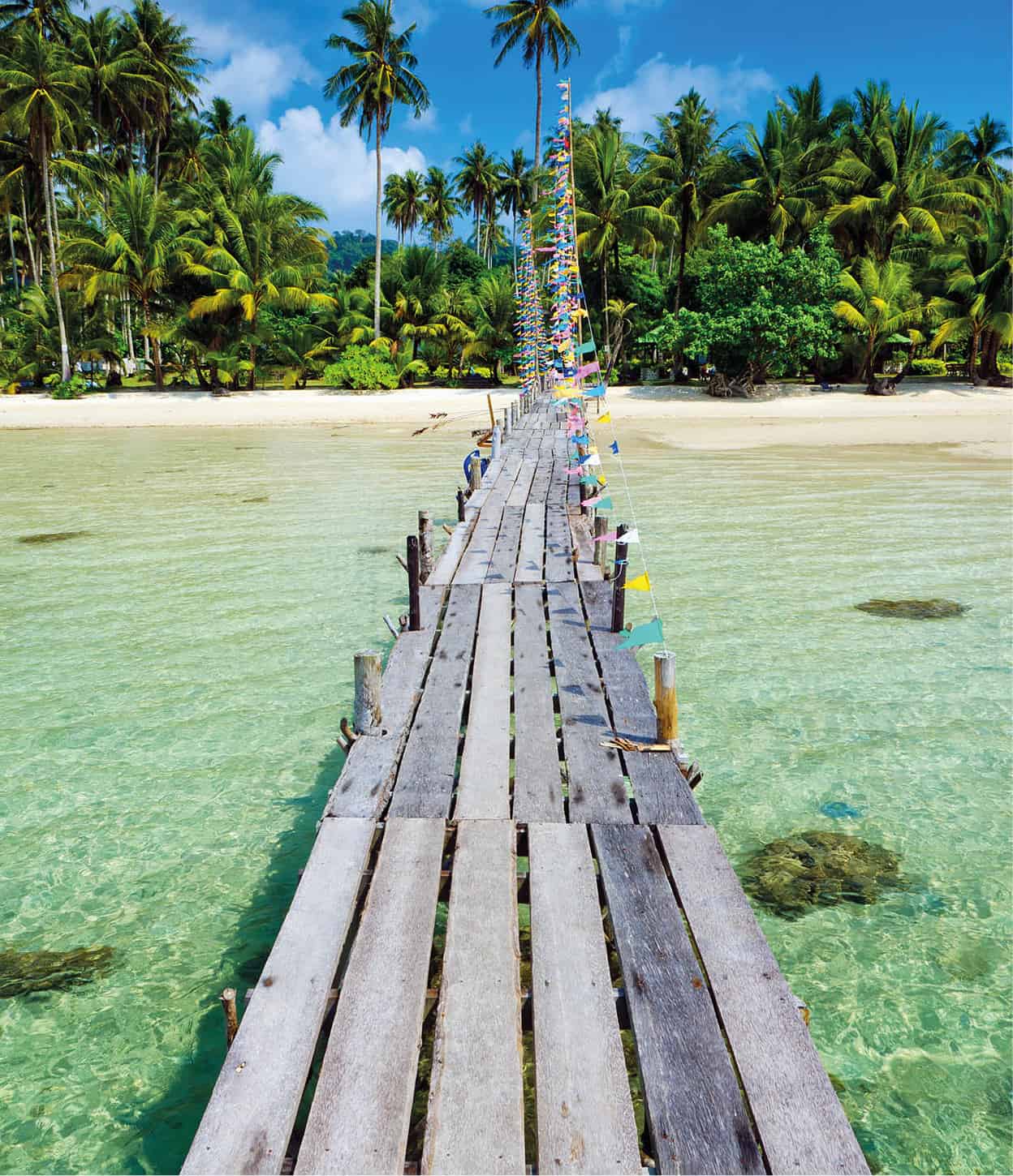
Rustic wooden pier off Koh Kut Island.
Shutterstock


