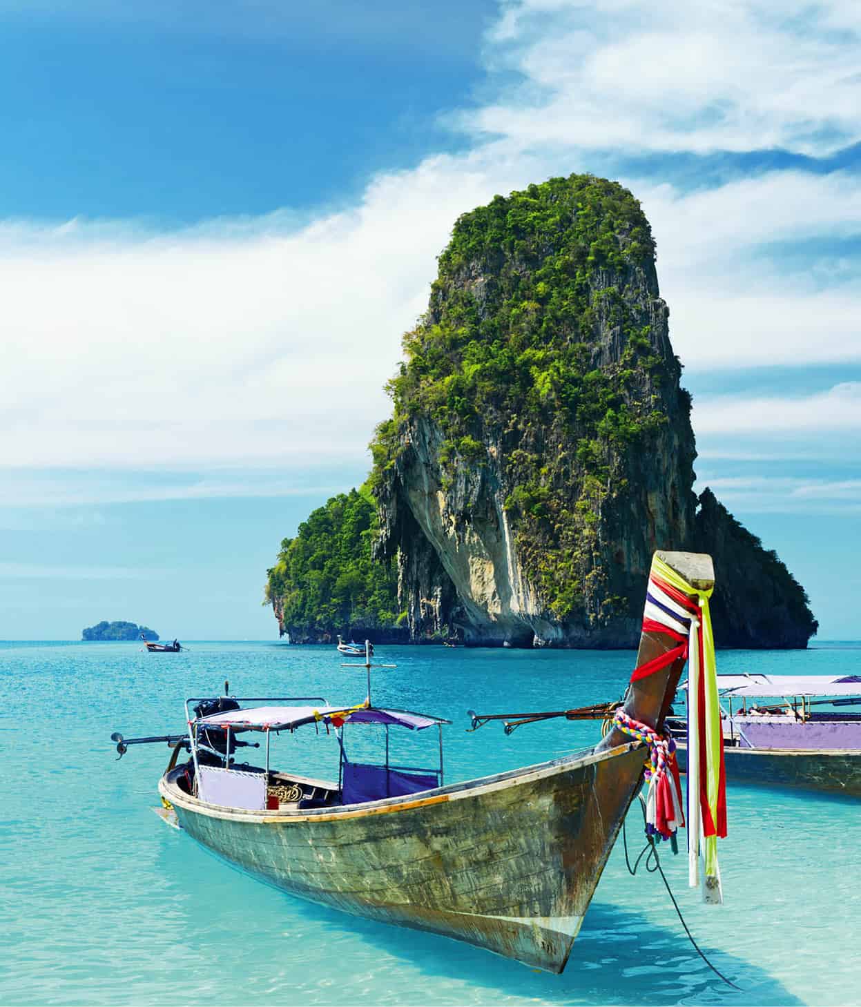
The lush and sprawling 4,708-sq-km (1,818-sq-mile) Krabi Province, just east of Phuket, is famous for sheer-sided limestone outcrops known as karsts. Their formation began millions of years ago as a result of limestone created by seashell deposits when parts of mainland Krabi were submerged with water. Subsequent continental shifts bulldozed the limestone into the towering peaks that are now scattered in the waters of the Andaman Sea, including at Ao Phang Nga (for more information, click here). Krabi is a popular destination with climbers, who come to scale these challenging rock faces.
Sea canoeing along the Krabi coast.
Dreamstime
Many of the islands around Krabi Province are tiny or uninhabited, although the best known, Ko Phi Phi and Ko Lanta, are both inhabited and extremely attractive to tourists for their legendary beaches.
The Krabi mainland is also blessed with a string of white-sand beaches that attract thousands during the dry season from November to April (for more information, click here). Inland on Krabi are lush rainforests that harbour rare species of bird and wildlife. Camera crews often travel miles to take advantage of Krabi and the idyllic surroundings for commercials, television shows and even movies, including the blockbusters The Beach, Around the World in 80 Days and Star Wars III.

Krabi Town children.
John W. Ishii/Apa Publications
Krabi Province
Krabi Town
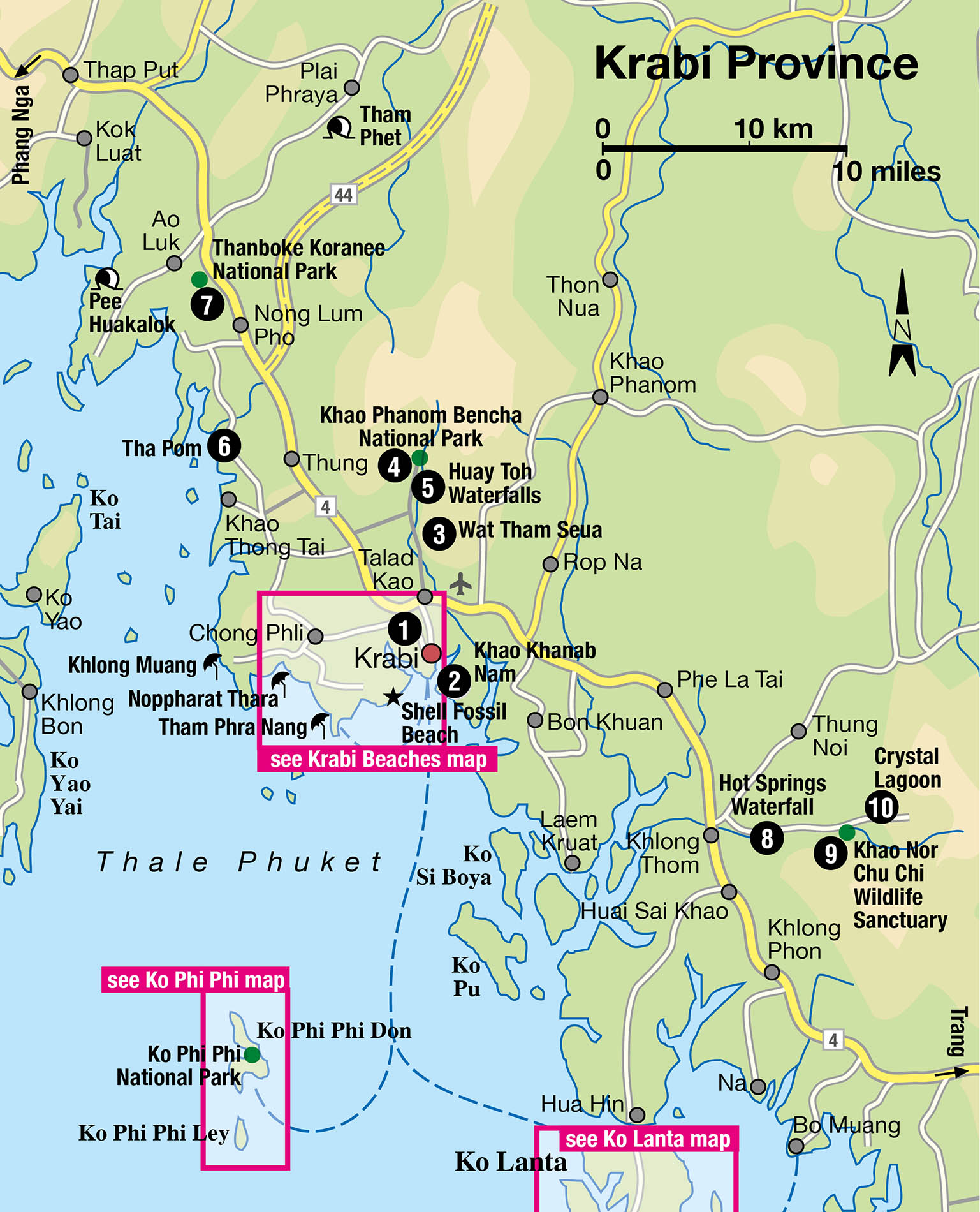
Located some 180km (112 miles) from Phuket, Krabi Town 1 [map] is the main jump-off point for travellers en route to the beaches and islands of Krabi Province. Thanon Maharat, which is the central point in the busy and compact town, is where the main market and most of the restaurants and shops are found. A concentration of guesthouses and hotels is located on Thanon Chao Fa, a few minutes from Chao Fa Pier. The pavements around Chao Fa Pier become a hub of bustling activity in the evenings when grills are fired up and saucepans and woks clatter in unison to whip up a feast of freshly caught grilled seafood and various stir-fries.
At the bottom of Krabi Town is Thara Park, an attractively landscaped and shaded spot overlooking Krabi River. On the river’s opposite bank are dense mangroves and a small but thriving fishing community living in wooden huts raised on stilts. Longtail boats can be hired at Chao Fa pier to explore these mangrove forests, which shelter many types of fish, crab, shrimp and shellfish, and are important nesting grounds for hundreds of bird species.
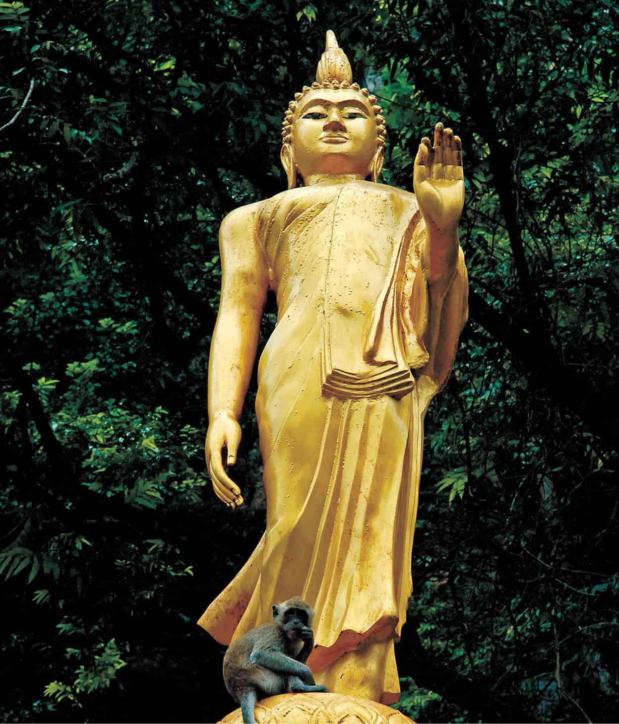
Buddha statue at Wat Tham Seua.
John W. Ishii/Apa Publications
Most tours of the mangroves will include a stop at the limestone pinnacles of Khao Khanab Nam 2 [map]. The two 100-metre (328ft) pinnacles that rise dramatically from the side of Krabi River have come to represent the town. Legend has it that two ceremonial krabi (swords) were discovered here in ancient times. Inside one of the peaks is a series of caves with impressive formations of stalactites and stalagmites. In one of the caves, skeletons have been found, thought to belong to people who took refuge here before being cut off and trapped by a massive flood.
Krabi’s Interior
Wat Tham Seua
More commonly referred to as ‘Tiger Cave Temple’, Wat Tham Seua 3 [map] (daily 8am–4.30pm; charge) was founded by Jamnien Silasettho, a monk and teacher of meditation. The temple is set amid forests and cliffs 9km (6 miles) from Krabi Town and is easily reached by car or motorbike. At the rear of the temple is a concrete staircase; clambering up the 1,272 steps to the 600-metre (1,970ft) peak brings you to a small shrine and a footprint of the Buddha in a flat rock. The hour-long ascent is exhausting, but the fantastic view of the surrounding area from the top makes up for it. A second staircase, next to a large statue of Kwan Im, the Chinese Goddess of Mercy, takes you on a different route up 1,237 steps.
Scattered around this forest are towering limestone rock faces and a large cave with a Buddha image. Flanking the sides of the statue are a human skeleton encased in glass and several ticking clocks, intended to serve as poignant reminders of the fragility of time and life.
Tip
The southwest monsoon brings heavy rain from May to Oct to the Andaman Coast, including Krabi, Ko Phi Phi and Ko Lanta islands. Room rates can drop as much as half during the wet months, so some people take advantage of this and hope for the best. There can be intermittent days of sunshine in between rainy spells.
Khao Phanom Bencha N P
Khao Phanom Bencha National Park 4 [map] (daily 8am–6pm; charge), about 20km (12 miles) to the north of Krabi Town, is the site of a dramatic 1,397-metre (4,583ft) karst called Khao Phanon Bencha, or ‘Five-Point Prostration Mountain’. Other attractions include leopards and Asiatic black bears among the reserve’s official list of 32 species of mammals and 218 of birds. Even tigers have been spotted, although sightings of these are extremely rare. The cascading waterfalls flowing down the mountain slopes are other features in the 50 sq km (19 sq miles) park, but are best seen in or just after the rainy season when the waters are full. The main waterfall, the 11-tiered Huay Toh Falls 5 [map], is a 350 metre (1,150ft) walk from the park headquarters, and the tiers are at varying heights of up to 80 metres (262ft).
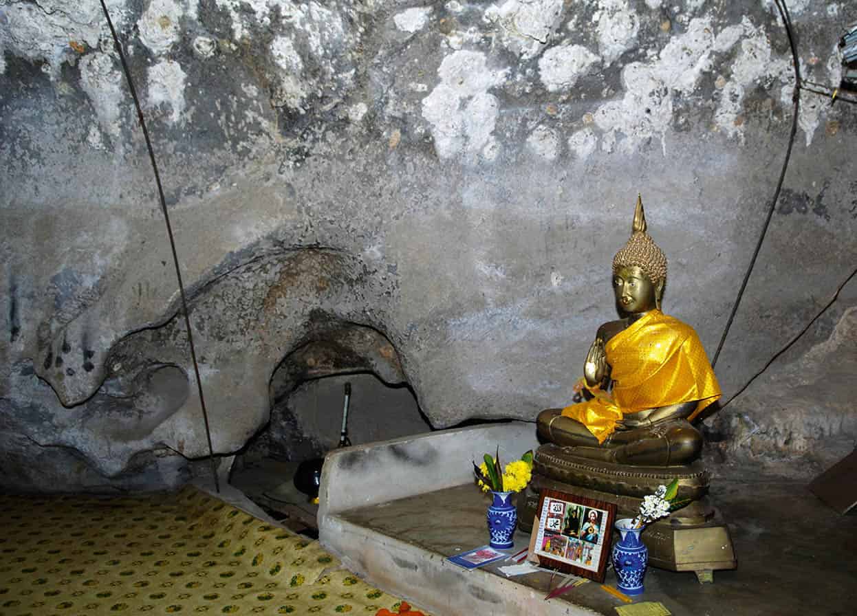
Wat Tham Seua, Krabi.
John W. Ishii/Apa Publications
Tha Pom
There is an unusual canal some 34km (21 miles) north of Krabi Town that most locals refer to as Tha Pom 6 [map] (daily 8.30am–4.30pm; charge), although on signs leading to it the name appears as Tha Pom Khlong Song Nam, which translates as ‘Canal of Two Waters’. A 700-metre (2,300ft) boardwalk takes you on a trail past mangrove and forest, eventually leading to the main attraction, a stream of clear water with two distinct colours. The water will appear colourless in poor weather, but on a good day, when the sun’s rays penetrate the water, turquoise-blue and emerald-green layers appear. This phenomenon apparently happens during high tide when tidal seawater meets fresh spring water running off the mountainside.
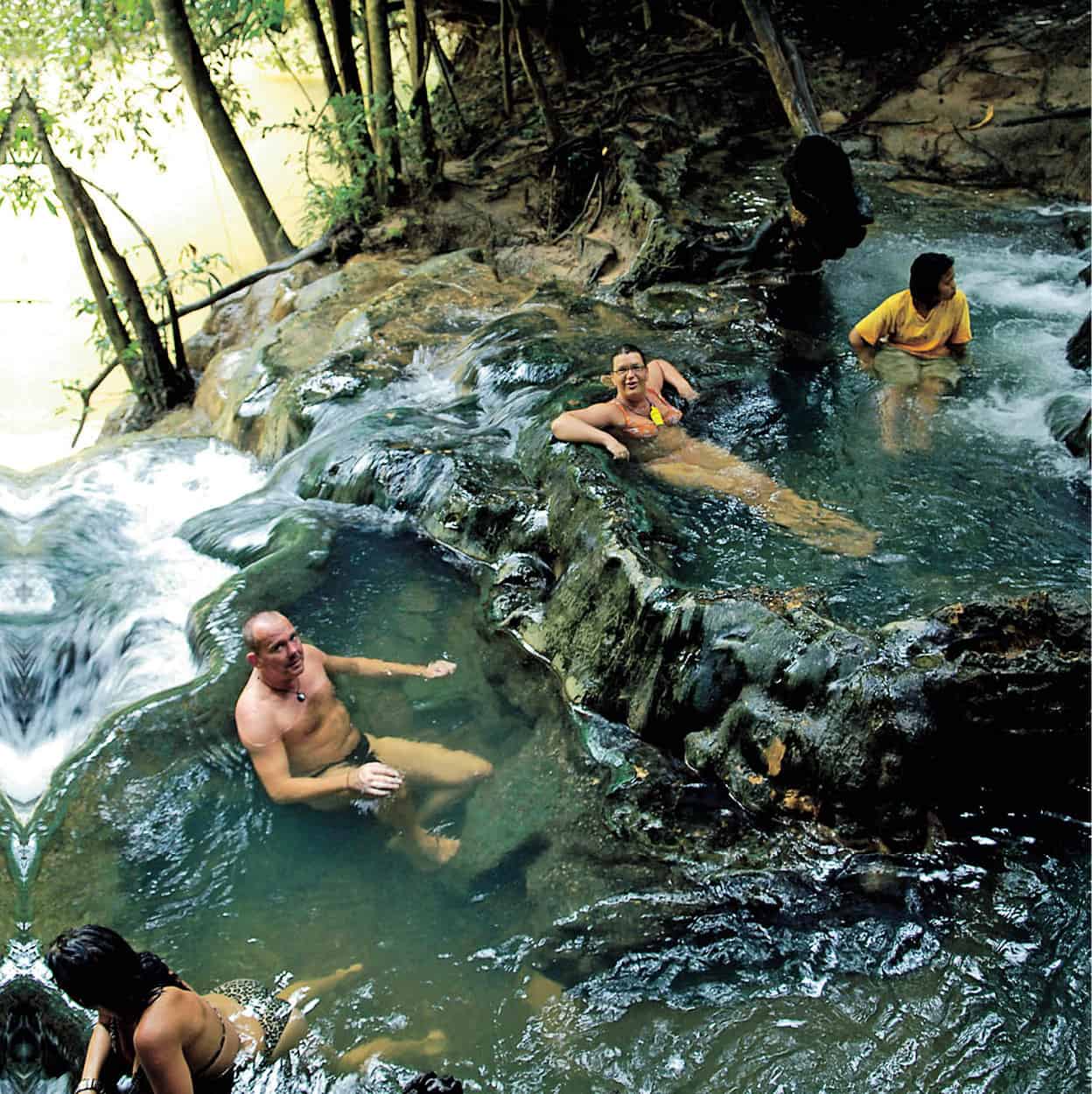
Hot Springs Waterfall at Thanboke Koranee National Park.
John W. Ishii/Apa Publications
Thanboke Koranee N P
Numerous caves and waterfalls are among the charms of Thanboke Koranee National Park 7 [map] (daily 6am–6pm; charge), located about 45km (28 miles) northwest of Krabi Town. One of the highlights is Pee Huakalok, a cave where an oversized human skull was found over half a century ago. Superstitious locals believe that the ghost of this head dwells within the cave and they have immortalised their fear with its name: pee is Thai for ghost, hua means head and kalok is skull. The walls of the cave are embellished with hundreds of colourful cave paintings and prehistoric drawings, estimated by archaeologists to be between 2,000 and 3,000 years old. The cave burrows deep into a hill surrounded by water and mangroves, but is accessible by boat from Bor Tor Pier, 7km (4 miles) south of Ao Luk.
Hot Springs Waterfall
Beyond the town of Khlong Thom, around 55km (34 miles) southeast of Krabi Town on Highway 4, there is an unusual phenomenon at the Hot Springs Waterfall 8 [map] (daily 8.30am–6pm; charge). An underground hot spring here leaks water through the earth’s surface and cascades down smooth boulders. It is quite an experience to let the soothing warm water wash over you before you take a dip in the cool waters of the stream, a sort of natural hydrotherapy in the middle of the jungle. This picturesque waterfall is a popular place to relax in but is relatively small and can get crowded around lunchtime when large tour groups arrive. If travelling on your own, early morning is the best time to get here.
Khao Nor Chu Chi Wildlife Sanctuary
A 10-minute drive east of the Hot Springs Waterfall is the Khao Nor Chu Chi Wildlife Sanctuary 9 [map] (daily 8.30am–5pm; charge), also known as Khao Pra Bang Khram Wildlife Sanctuary. This is said to be the last patch of lowland rainforest in Thailand and one of the few locations in the world where the endangered bird species known as Gurney’s Pitta can be found.
A 3km (2-mile) trail from the park leads through a shaded path to the Crystal Lagoon ) [map]. Bacteria and algae living in this emerald-coloured pond cause a variation of colours ranging from pale green where the temperature is cooler to a greenish blue where the temperature peaks at around 50°C (122°F). It’s safe to swim in but the calcium carbonates in the water make it unsuitable for drinking, and a sign at the entrance asks you to refrain from using shampoo or soap. Be cautious of slippery moss at the water’s edge – the best way in is to sit first and slowly inch your way into the pond to avoid a painful and ungraceful splash.
Krabi’s Beaches
Hat Khlong Muang and Hat Noppharat Thara
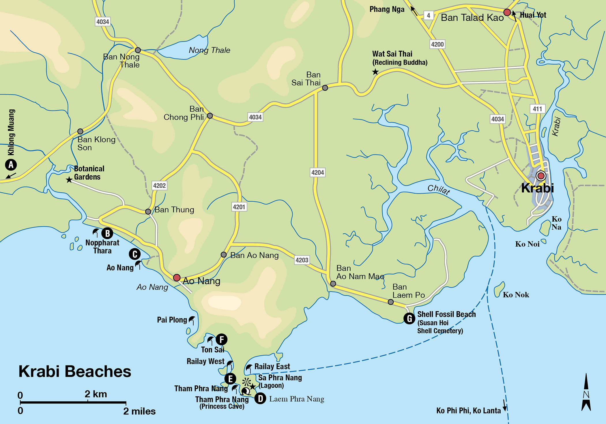
Several hotels are fortunate enough to share the secluded white sands at Hat Khlong Muang A [map]. Backed by lush vegetation, this lovely beach is extremely quiet and has a nice ambience. Set away from Krabi Town (but only a 30-minute drive away), it has clean waters that are pleasant to swim in year-round. The accommodation at Hat Khlong Muang is now going more upmarket, joining the long standing 5-star Dusit Thani Krabi Beach Resort and the stylish Nakamanda resort.
An extended finger of land called Hang Nak Cape separates Khlong Muang from the next beach, Hat Noppharat Thara B [map], which has beautiful, uninterrupted views out towards a cluster of limestone islands. Shady casuarinas back this 2km (1-mile)-long beach and seafood vendors congregate around the car park. The western end of the beach is quiet and because it is separated by a canal, can only be accessed by longtail boat. The middle section is similarly quiet, with a visitors centre and the park headquarters, while the eastern section is the busiest.
Ao Nang
A few minutes’ drive from Hat Noppharat Thara, and sharing the same view of the limestone cliffs in the distance, albeit obstructed by a line of longtail boats, is Ao Nang C [map], the most commercial and developed beach on mainland Krabi.
Located 22km (14 miles) east of Krabi Town, Ao Nang gets somewhat crowded in the high season but is not yet so built up as to be completely ruined, and the development at least means that facilities such as bars and restaurants will be provided for those who prefer a little action.
Ao Nang beach would be nicer were it not for the longtail boats congesting its shore; at high tide there is very little space to relax. The quiet is also shattered by the loud and piercing drone from the engines of these longtail boats. The splendid backdrop of the limestone cliff-studded Andaman Sea, however, makes up for it. At the north of the beach is a cluster of open-air seafood restaurants, usually owned by the small hotels behind them. With displays of snapper, barracuda and shellfish, these restaurants fill up rapidly in the evenings. Other restaurants serving mostly Thai and Italian food are found along the main beach road.
Laem Phra Nang (Railay Bay)
Surrounded by sheer limestone cliffs on three sides and only accessible by boat, the peninsula of Laem Phra Nang D [map], better known as Railay Bay, feels more like an island paradise than the mainland beach that it actually is. This stunning peninsula has four beaches, each with crystal-clear turquoise waters, powdery white sands and the aforementioned limestone cliffs that seemingly melt into the waters below, making it one of the world’s leading rock-climbing destinations.
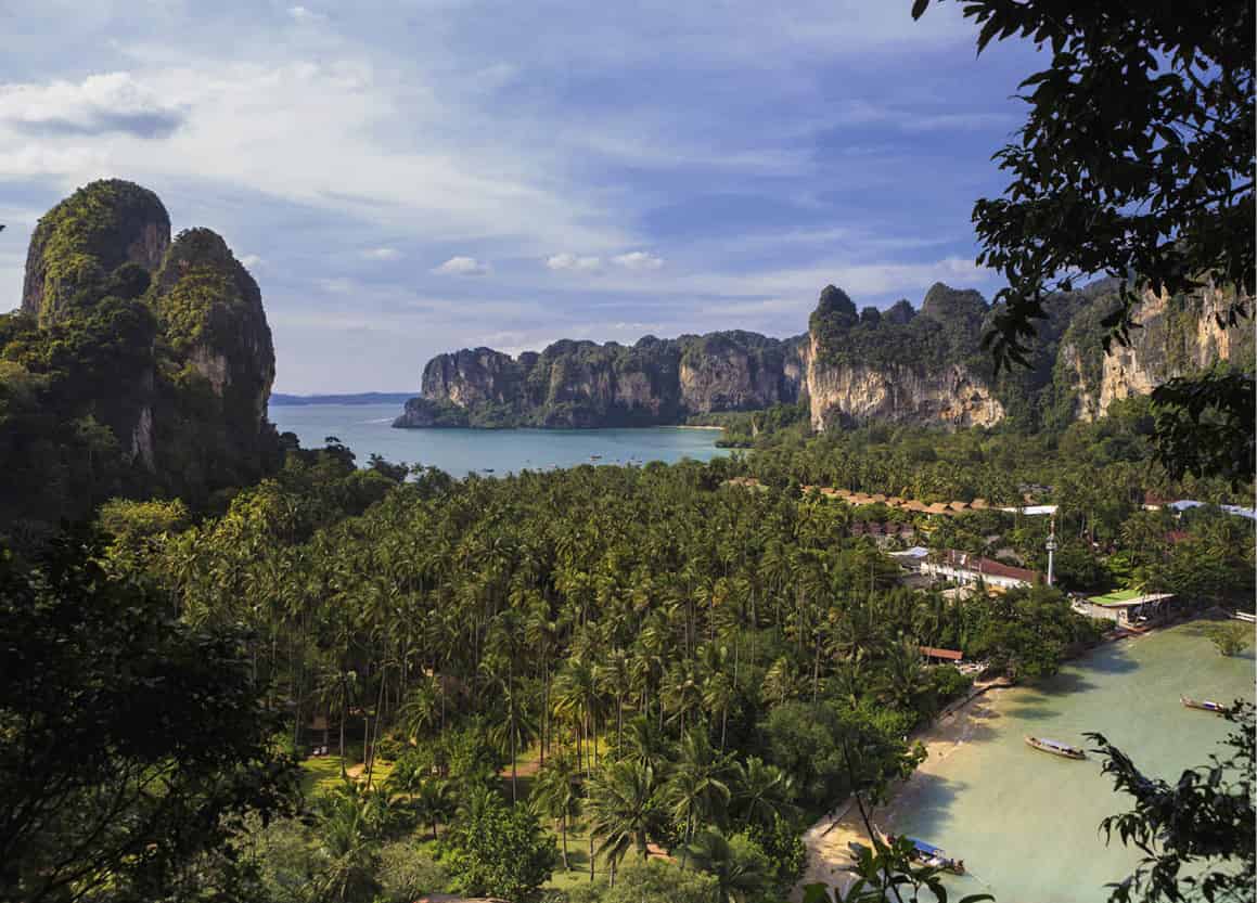
View of Hat Railay East and Hat Railay West beaches.
iStock
Hat Railay West and Hat Railay East
Most arriving boats head straight to the western side of the peninsula, to Hat Railay West. The absence of a pier demands a short wade to the shore, but this has fortunately also prevented ferry-loads of day-trippers landing on its pristine white sands. Although developing, Railay West is a world away from nearby Ao Nang. Its tastefully designed resorts (no ramshackle guesthouses here) along with nice landscaping has prevented it from turning into a busy backpacker haunt. Accommodation is more expensive than on the other Krabi beaches, but that is the premium to be paid for direct access to such a lovely beach.
On the opposite side of the peninsula is Hat Railay East. Backed by dense mangroves, this is a less scenic beach and is unsuitable for swimming due to the incredibly low tides and the jagged rocks along the foreshore. Still, the lower-priced bungalows here get their fair share of trade. Access between the two Railay beaches is easy – a 5-minute walk along a flat, paved pathway takes you from one beach to the other. The same people appreciating the mango-streaked sunsets on Railay West are often seen a few hours later enjoying fire shows and all-night parties at Railay East.
Tip
Check the tide before scaling the cliff towards the viewpoint high above Hat Tham Phra Nang. When the tide is at Hat Railay East, it makes for much more stunning views from the top.
Hat Tham Phra Nang
Undeniably, the prettiest beach in Railay Bay, if not the whole of Thailand, is Hat Tham Phra Nang E [map], where the extravagant and ultra-expensive Rayavadee Resort occupies prime position (there is no other accommodation here). Set amid 11 hectares (26 acres) of coconut groves and surrounded by limestone cliffs, Tham Phra Nang is endowed with the softest of white sands, limpid turquoise-blue waters and beautiful coral reefs offshore. Although staying at the Rayavadee gives you the most direct access to this beach, many daytrippers from Railay West and Railay East flock to Tham Phra Nang to sunbathe, swim and snorkel.
Hat Tham Phra Nang is named after a princess (phra nang) whom locals believe resides in the area. Near the Rayavadee Resort, at the beach’s eastern end, is Tham Phra Nang (Princess Cave), where a collection of wooden phallic objects sit as an offering to her, the supplicants hoping that she will bestow the surrounding mountains and sea with fertility. The cave is not as spectacular as it’s made out to be and is little more than a series of small overhangs, but a map at its base highlights the way towards a viewpoint and Sa Phra Nang (Princess Lagoon), which are both far more impressive.
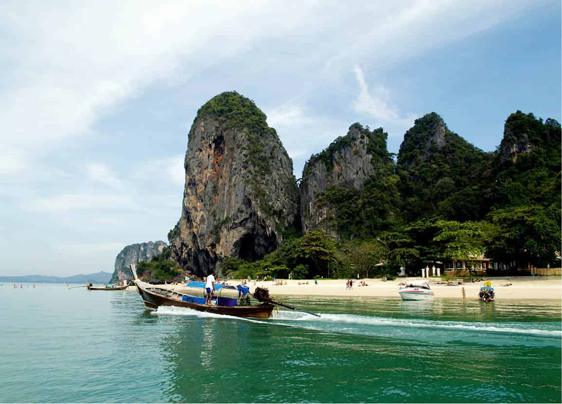
A longtail boat in Railay.
John W. Ishii/Apa Publications
The route to both sights is straightforward but neither is suitable for the very young, elderly or unfit, and good shoes are a must. The most challenging part of the walk is at the beginning, which involves clinging to ropes to clamber up a fairly steep incline; after this, the pathway becomes easier to follow. Veering to the left as the pathway splits leads to a viewpoint with spectacular vistas of the east and west bays of Railay. Continuing straight leads to a sharp rock face with yet more ropes, this time used to almost abseil down into the Princess Lagoon. The lagoon is suitable for swimming, but is not crystal-clear and does have some rocks.
Hat Ton Sai
From Hat Railay West, it is possible at low tide to walk to the nearby Hat Ton Sai F [map]. Longtail boats can also be hired to make the 5-minute journey, or if feeling energetic, you may simply swim to the beach. Budget travellers are attracted to Ton Sai by its cheaper accommodation and more convivial atmosphere. Of all the beaches on the Laem Phra Nang headland, Ton Sai has the most vibrant nightlife, with beach bars open until the early hours and hosting monthly full-moon parties. The view out to sea is as beautiful as that of Railay’s, with limestone monoliths in the foreground and to the sides, but the sand is not as white, and at low tide the beach becomes muddy which makes swimming difficult.
Rock climbing
Sheer limestone cliffs facing mile upon mile of tranquil sea make Railay Bay a favoured spot for rock climbers. Most of the roughly 650 routes that have developed since Krabi’s cliffs were first scaled in the late 1980s are located in this peninsula. Among the most popular climbs is the challenging yet phenomenal Thaiwand Wall on the southern end. There are a range of other climbs suited to beginners right through to professionals, involving limestone crags, steep pocketed walls, overhangs and stalactites. Any of the climbing operations around Railay will advise on the best climbs, some of which are accessed by a combination of boat and a hike through the jungle.
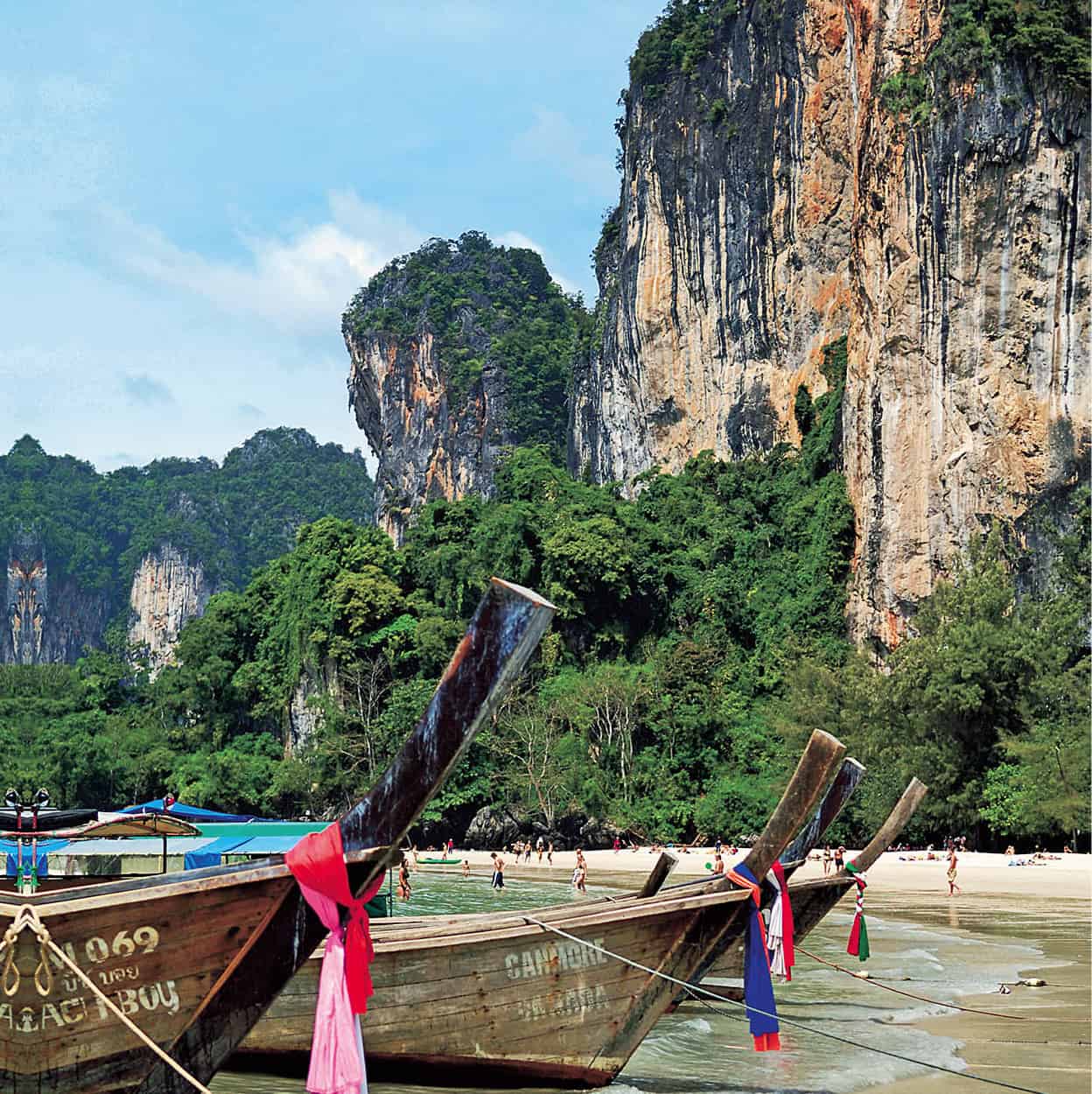
Longtail boats moored at Hat Ton Sai.
John W. Ishii/Apa Publications
Shell Fossil Beach
Some 17km (11 miles) from Krabi Town, with its entrance marked by a small Chinese temple, is the Shell Fossil Beach G [map] (also known as Susan Hoi Shell Cemetery). Extending right to the edge of the sea are the remnants of a 75-million-year accumulation of shell deposits – which look like large concrete slabs from afar. This phenomenon can only be seen at two other locations worldwide, one in Japan and the other in the US – the one in Krabi is the only coastal site. Visitors either love or hate this sight but some people appreciate the enormity of witnessing evidence of life that existed millions of years before humans.
Lying in the Andaman Sea between Phuket and Krabi (about two hours by boat from either location) are the twin islands that together make up Ko Phi Phi – the larger Ko Phi Phi Don and the smaller Ko Phi Phi Ley. The islands are part of the protected Mu Ko Phi Phi National Park, but somehow, development, especially on Ko Phi Phi Don, seems to have escalated over the years, ruining its natural beauty. From afar, though, they are still stunning with their mountains and lovely arcs of soft white sand washed by crystal-clear waters. Ko Phi Phi Don is where all the accommodation and facilities are while Ko Phi Phi Ley is uninhabited and mainly visited on day trips.
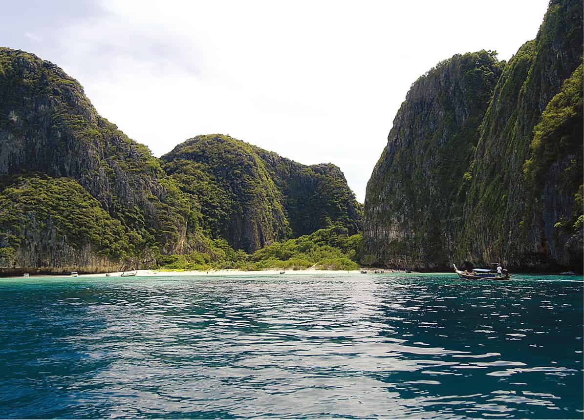
Maya Bay on Phi Phi Lei.
John W. Ishii/Apa Publications
The islands’ rise to fame is characterised by both fortune and tragedy. Until 1999, Ko Phi Phi was still considered a quiet, idyllic retreat. Turquoise waters bordering limestone cliffs and palm tree-filled interiors made it a postcard-perfect location, and visitors would leave feeling that they had seen a truly idyllic tropical island. Then came the hit film The Beach, which was shot mainly at Ao Maya (Maya Bay) in 1998 on Ko Phi Phi Ley. Within one year, thousands were flocking to Ao Maya in the hope of seeing this utopian image of the perfect unspoilt beach up close. While Ko Phi Phi Ley was spared development, it suffered from overcrowding and this took its toll on the ecology. The larger Ko Phi Phi Don also saw a rash of construction – resorts, restaurants and bars built quickly to cater for the relentless onslaught of tourists.
The December 2004 tsunami hit Ko Phi Phi at its busiest time. Its popularity coupled with the peak tourist season meant that hotels on Ko Phi Phi Don were fully booked and every tourist facility was at its maximum capacity. When the tsunami waves hit the narrow centre of Ko Phi Phi Don, the damage that they caused was immense; numerous shops, restaurants and hotels were reduced to rubble and thousands of lives were lost. The most evident damage was opposite the main Ton Sai village at Ao Lo Dalam, where entire resorts were washed away. Given the scale of the disaster, Ko Phi Phi’s recovery was a lot swifter than predicted – although some lament the government’s failure to assign national-park status to the area in the aftermath of the catastrophe.
There are no roads on the island, so walking from one place to another is generally the only way to get around. Most dive sites around Ko Phi Phi were unaffected by the tsunami, and it remains one of Thailand’s most popular diving locations.
Tip
Several companies operate regular ferry services to Ko Phi Phi Don from Phuket and Krabi. The more expensive ones justify their higher prices with indoor air-conditioned areas. However, if the seas are rough, it’s better to be on deck with the bracing salty air blowing against you.
Ko Phi Phi Don
Ko Phi Phi Don is made up of two elongated islands joined together by an isthmus to create what looks like, from the air, a giant high-backed chair. Most development is concentrated on the bays found on either side of the isthmus – Ao Ton Sai and Ao Lo Dalam.
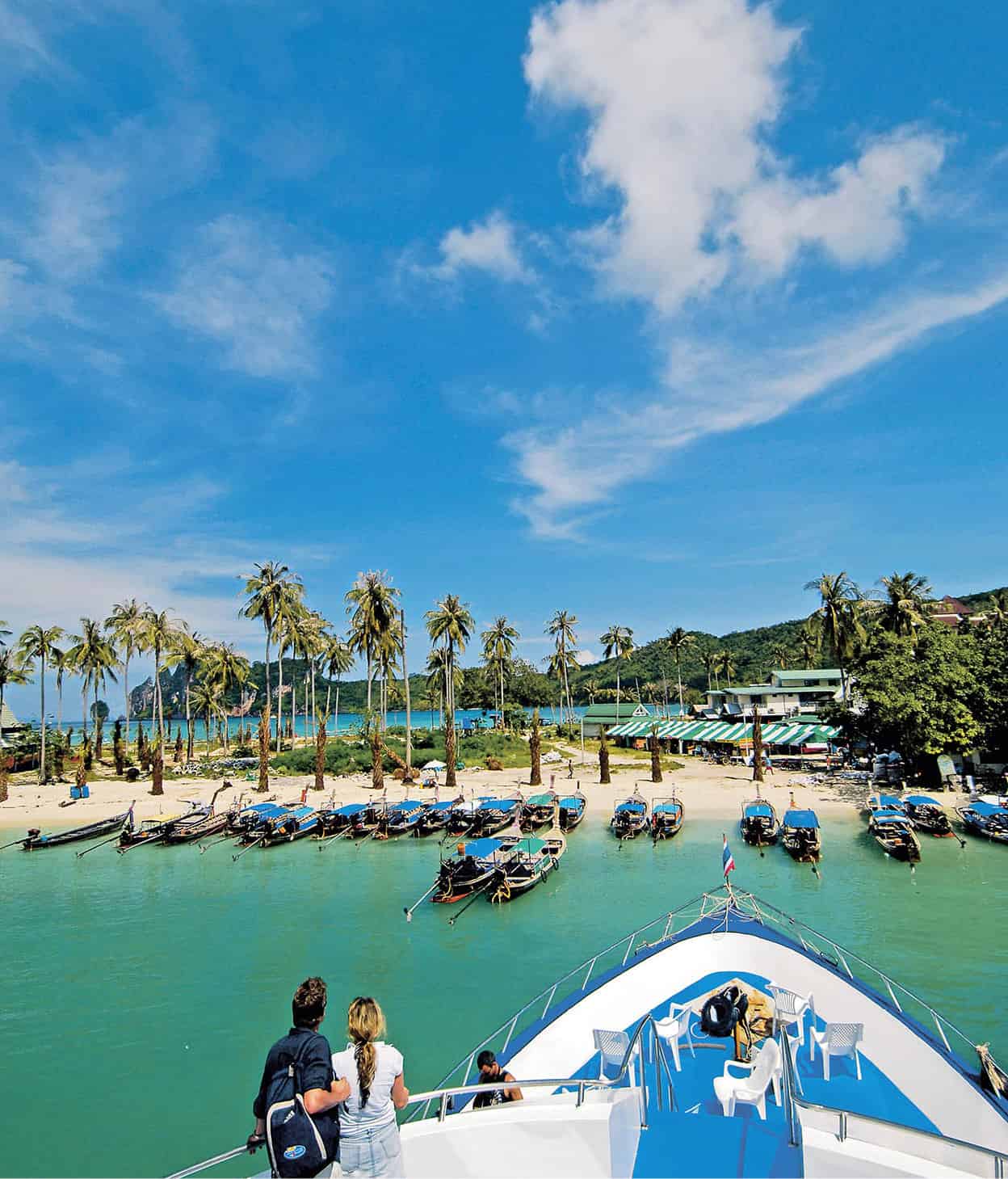
Approaching the pier at Ko Phi Phi Don.
John W. Ishii/Apa Publications
Boats to the island dock at the main pier at Ao Ton Sai 1 [map], a bay that would be far prettier were it not for the ferries and longtail boats lining it from one end to the other. An entrance fee of THB20 to stay on the island is payable on disembarking. There are a few information booths at the end of the pier, beyond which is Ton Sai village, a compact area of restaurants, bars, dive shops, internet cafés and stalls selling everything from sarongs and beaded jewellery to sandwiches and banana pancakes.
Opposite Ao Ton Sai, and only a few minutes’ walk away, is Ao Lo Dalam 2 [map], a quieter and prettier bay with a lovely curve of white sand skimming clear blue waters. What makes it even nicer is that post-tsunami reconstruction along this beach was slower and thus less ramshackle than Ao Ton Sai.
Much of the island’s accommodation is today located on Hat Hin Khom 3 [map], at the western end of Ao Ton Sai, and on Hat Yao 4 [map] (Long Beach) at the southwestern tip of the island. Access to Hat Yao is either by longtail boat (10 minutes) from Ton Sai or a 40-minute walk. Prices are typically higher than elsewhere in Thailand and although rooms are generally of above-average standard, the elevated prices do not usually reflect the actual quality.
The best snorkelling and the most exclusive resorts are found to the north of the island on Hat Laem Thong 5 [map], where the majority of visitors are either honeymooners or those seeking a more isolated beach. There is a morning ferry between here and Ton Sai, otherwise all transport is by hired longtail boat. Hat Laem Thong is also the home of a small community of chao lay, or ‘sea gypsies’. These folk mainly make their living by fishing or ferrying tourists around the islands.
South of Hat Laem Thong, along the same northeastern coastline, is Ao Lo Bakao 6 [map], which has mainly upmarket accommodation on its quiet beach. Both Hat Laem Thong and Ao Lo Bakao were spared the worst of the huge waves of the tsunami as they are located on the east side of the island.
Inland attractions are limited but many people take the 30-minute hike over to the viewpoint located high on a bluff at the southern end of Ao Lo Dalam. To get there, follow the path eastwards towards Hat Hin Khom and turn left when it forks inland. Understandably, the scenic point is at its busiest around sunrise and sunset; from here the vista of the twin bays of Ao Ton Sai and Ao Lo Dalam, separated by a thin band of land with the mountain behind, is breathtaking.
Ko Phi Phi Ley
The uninhabited Ko Phi Phi Ley is a mere speck at 6.5 sq km (2.5 sq miles). It lies about 4km (2 miles) south of Ko Phi Phi Don. Formed entirely from limestone, the island is surrounded by steep karsts rising out of the sea that circle it almost completely. Of the picturesque bays around the island, the most visited are Ao Pileh to the east and the aforementioned Ao Maya 7 [map] on the west coast. Ao Maya would be a more beautiful spot were it not for the daytrippers who descend here in droves and frequently leave their litter behind.
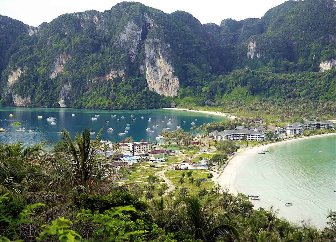
From the viewpoint on Ko Phi Phi Don.
John W. Ishii/Apa Publications
Also at Ko Phi Phi Ley is the Viking Cave 8 [map], at the northeastern end of the island. Inscribed on the cave walls are coloured chalk drawings of various boats, believed to have been sketched hundreds of years ago by pirates who used the cave as a shelter. Today, the pirates have been replaced by hundreds of swifts that build their nests in crevices high up in the steep cave walls. These nests are collected by local villagers who climb the tall rickety ladders, risking life and limb, to collect the birds’ nests so highly prized by Chinese gourmets for their claimed health-giving properties. Swarms of swifts descend on the caves of Ko Phi Phi Ley every year between January and April and build nests using their saliva as a bonding material.
Diving and snorkelling
Many of the dive sites around Ko Phi Phi can also be accessed from Phuket, Krabi and Ko Lanta. Around Ko Phi Phi itself, the best diving and snorkelling sites are Hin Bida (Phi Phi Shark Point), Ko Pai (Bamboo Island), Ko Yung (Mosquito Island) and Ao Maya, on the western side of Ko Phi Phi Ley. The King Cruiser wreck between the waters of Phuket and Ko Phi Phi is another favourite dive site.
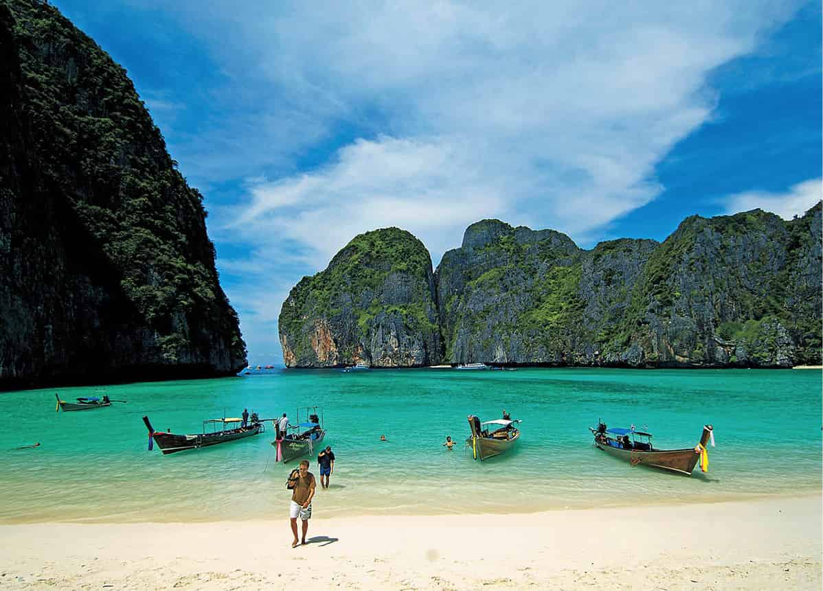
Magnificent Maya Bay.
John W. Ishii/Apa Publications
The term Ko Lanta is generally used to refer to Ko Lanta Yai, the largest of only three inhabited islands in an archipelago of over 50. Originally named Pulao Satak, meaning ‘Island with Long Beaches’, by the chao lay (sea gypsies) who first settled on the island, Ko Lanta Yai stretches 27km (17 miles) in length and 12km (7 miles) in width.
Most visitors to Ko Lanta travel direct from Krabi, from which ferries set off twice daily on a journey that takes about 2 hours and terminates at Ban Sala Dan village on Ko Lanta’s northernmost tip. Due to strong winds and rough seas, boats do not operate between May and October. The island’s one main road loops around the island, while a few smaller roads lead inland towards the southeastern coast, where there are small settlements of sea gypsies. Development has been mainly confined to the west coast, where spectacular sunsets viewed from along a number of striking white-sand beaches are a near-daily certainty. The east coast is fringed by long stretches of mangroves and swimming is not possible. Ko Lanta has developed rapidly over the past few years, although much of the island still shuts down during the quiet low season. Most of the new hotel developments have been of the upscale variety, but Ko Lanta still manages to maintain its sleepy island feel, with beach bungalows out-numbering high-rise hotel developments.
The development also means there is now a greater range of accommodation available, as well as an increase in activities. Many resorts have in-house spa treatments to offer, some have Thai cooking lessons, and there are some with on-site dive operations.
Tip
If you plan to rent a jeep or a motorbike and explore Ko Lanta yourself, be sure to fill up with enough petrol before leaving the main village of Ban Sala Dan. The few petrol stations on Ko Lanta are expensive, difficult to find and shut early.
Ban Sala Dan
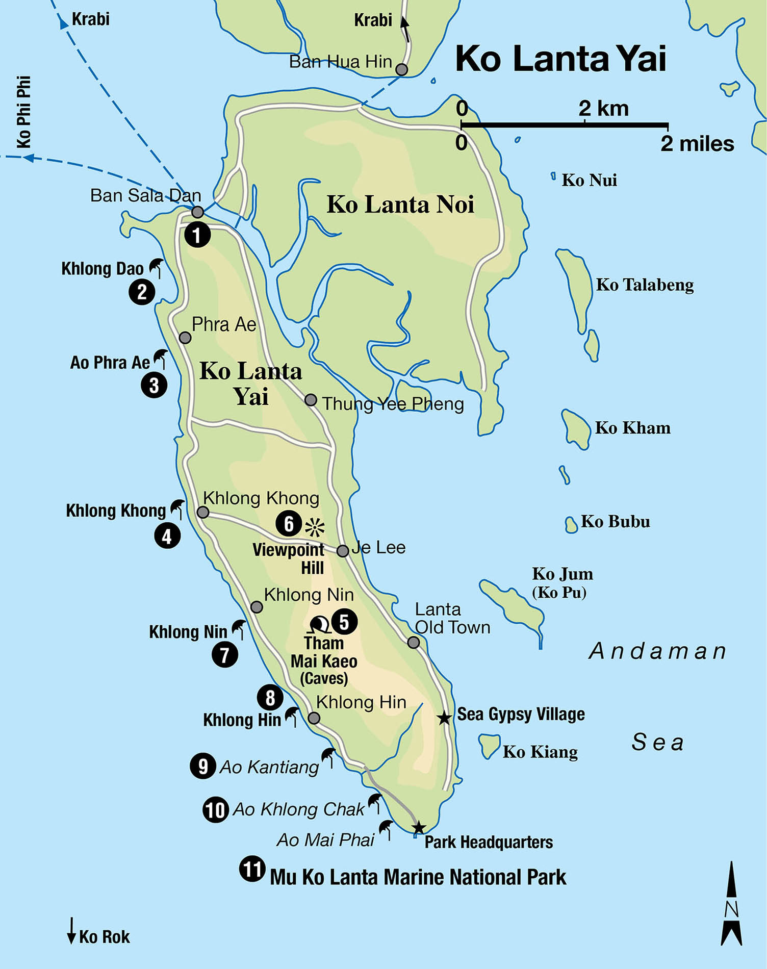
Whether arriving by passenger or car ferry, the first stop for most visitors is the compact main village of Ban Sala Dan 1 [map]. Guests at the more exclusive resorts on Ko Lanta have the luxury of being delivered right to the doorstep, or rather shorestep, of their hotel by private boat transfers.
Concrete posts and overhead hanging cables make Ban Sala Dan village a rather unsightly place, but for a relatively small island it is well equipped with a police post, clinic, tour agents and internet facilities. There are also a few small but well-stocked local convenience stores. Along the pier are a number of seafood restaurants where fresh daily catches are displayed on beds of ice.
Hat Khlong Dao
A few kilometres south of Ban Sala Dan is the first of the island’s westerly beaches, Hat Khlong Dao 2 [map]. Shallow waters and safe swimming conditions make this 3km (2-mile) stretch of beach a popular choice with families. Its close proximity to the pier at Ban Sala Dan also appeals to scuba divers seeking easy access to the nearby dive sites. Despite its attractions – white sand, picturesque hilly backdrop and some of the most dramatic sunsets along the western coast – Khlong Dao rarely seems crowded. The beach is wide enough that, even in the peak season, it’s often possible to find a relatively secluded spot.
Ao Phra Ae
Almost, if not equally, as popular as Khlong Dao is the neighbouring Ao Phra Ae 3 [map] (Long Beach), which is slightly longer at 4km (3 miles) and shaded by vast stretches of coconut and pine trees. Phra Ae is good for swimmers and sunbathers, although parts of the seabed are steep and the water not as calm, so families with small children should consider alternative options. There are lots of accommodation choices and an ample variety of restaurants.
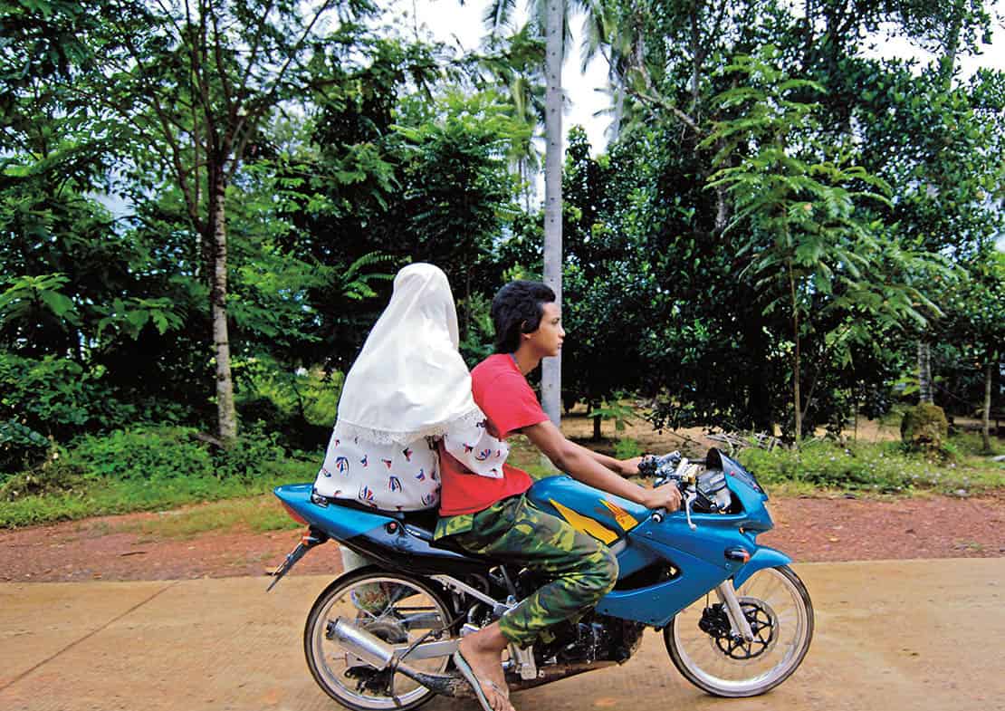
Muslim islanders on Ko Lanta.
John W. Ishii/Apa Publications
Hat Khlong Khong
Just south of Ao Phra Ae is laid-back Hat Khlong Khong 4 [map], which, although not great for swimming, is one of the island’s best beaches for snorkelling; at low tide the rocky underlay reveals an assortment of fish and other marine life. Accommodation is generally cheaper than on the more northerly beaches, with an emphasis on clean but basic beach-front bungalows. Most have attached restaurants and beach bars that spring to life in the evenings, enticing customers with tables on the sand and colourful performances by fire-eaters.
Inland diversions
There are limited attractions on Ko Lanta, apart from its stunning beaches. Some 4km (2.5miles) south of Hat Khlong Khong, the road splits into two. The left fork leads all the way to the east coast of the island, where few tourists venture. A turn-off at the 3km (2-miles) mark to the right leads to the Tham Mai Kaeo 5 [map] caves. It is best to get your hotel to organise this trip as finding the caves on your own is a bit of a challenge – you need to clamber up a steep hill, often with the help of tree branches. The combination of slippery paths, rickety bamboo ladders and confined spaces make this an inadvisable activity for the less physically fit. The expedition leads through a labyrinth of winding tunnels and caverns, past dramatic rock formations. At the end, after negotiating a steep slope with the aid of a rope, is a deep pool, where you can cool off.
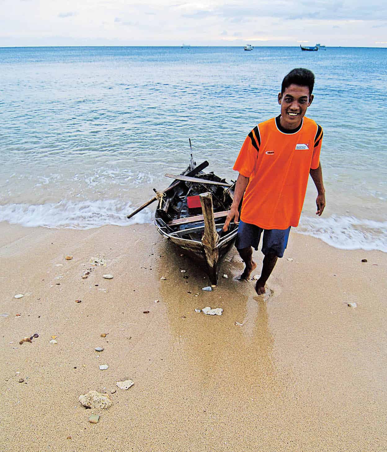
Ko Lanta fisherman.
John W. Ishii/Apa Publications
A sunrise trip to the central peak referred to simply as Viewpoint Hill 6 [map] is worth the effort. To get there, continue on the road that heads east (signs along the way will guide you towards this attraction).
As the early-morning sky changes from pitch-black to soft blue, the haunting, gravestone-like profiles of limestone cliffs will appear almost magically, one by one, until the sea seems filled with them. The near 360-degree panoramic vista in the crisp morning air is truly breathtaking. The experience can be enjoyed over a sunrise breakfast at the café on the hill. If the thought of rising before dawn fills you with dread, you can go at sunset and have cocktails at the romantic Noon Restaurant, which has good Thai food and a few Western dishes.
Hat Khlong Nin and Hat Khlong Hin
Turning right about 4km (2 miles) from Hat Khlong Khong leads past a few convenience stores and wooden restaurants before emerging at Hat Khlong Nin 7 [map]. This lovely beach has a relaxed feel and is imbued with the atmosphere of a small, intimate village. The powdery white sands of Hat Khlong Nin stretch about 2km (1 mile), and calm waters outside of the monsoon season make it excellent for swimming. Accommodation consists primarily of stylish resorts such as SriLanta and the Rawi Warin, most with in-house restaurants and beach bars. At the start of Hat Khlong Nin is the popular reggae-style Rasta Baby Bar. A stroll along the beach front reveals more of the same; at night-time, the next bamboo beach bar is never more than a short walk away.
At its southern end, Hat Khlong Nin merges with the similar-sounding but much smaller and secluded Hat Khlong Hin 8 [map]. Separated from the former by a cluster of trees, the waves here are rough during the monsoon season. It is quite empty at the moment and awaits further development.
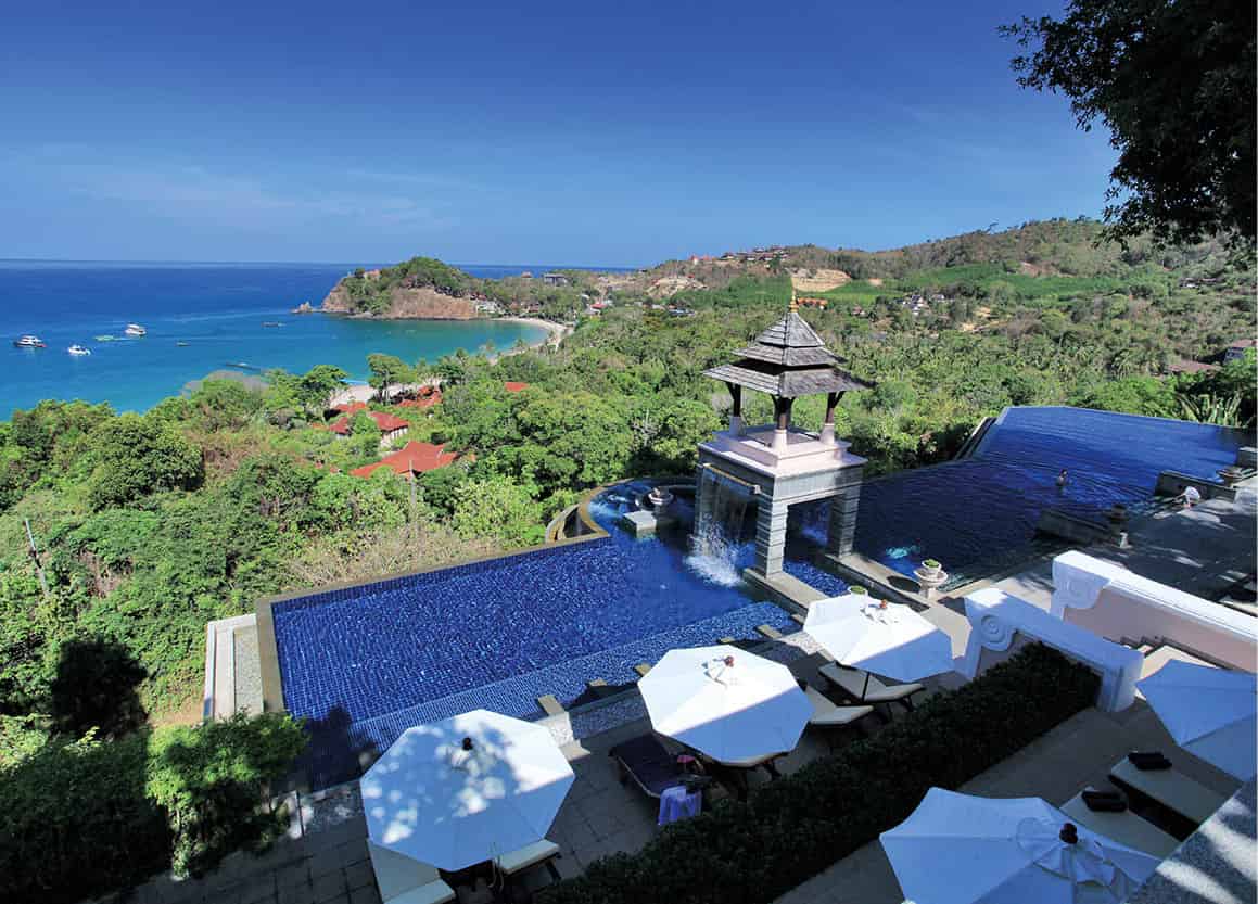
Picturesque Ao Kantiang is anchored by Pimalai Resort and Spa at one end.
Leonardo
Ao Kantiang
About 6km (4 miles) from Hat Khlong Hin is the lovely and picturesque bay of Ao Kantiang 9 [map]. This bay has a secluded and private feel to it as it’s framed on both sides and to the back by jungle-covered hills. To the north and high up on the hill are a handful of small resorts; there are lovely views from the top but it also means climbing up a considerable number of steps to reach it. The southern end of this bay is anchored by the luxury Pimalai Resort and Spa. This five-star resort is set in 40 hectares (100 acres) of natural tropical surroundings and has direct access to the 1km (0.5-mile)-long stretch of pure white-sand beach.
Ao Khlong Chak and Ao Mai Phai
Beyond Ao Kantiang, the further south one ventures, the more remote and isolated the beaches become. But persevere and you will be rewarded with a cluster of the most scenic and sparsely developed beaches on the entire island, including Ao Khlong Chak ) [map], one of the smallest, at just 400 metres (1,310ft) long. Only a handful of resorts are found here. Ao Khlong Chak is most famous for its impressive waterfall, found 1.5km (1 mile) inland, that flows throughout the year.
Beyond this is a short but steep drive through the jungle leading to the lovely cove of Ao Mai Phai (Bamboo Bay). This is the last and southernmost beach before reaching the headquarters of the Mu Ko Lanta Marine National Park on the southern tip. Ao Mai Phai is backed by mountains on three sides, and the relative difficulty of access and geography give this bay a real sense of remoteness and tranquillity. It’s a quiet haven with little development. The beach is only 500 metres (1,640ft) in length, but is ideal for swimming; a shallow boulder-strewn stretch at the northern edge is more suited to snorkelling. As you head south from here, look out for monkeys foraging in the area (but be careful not to approach them, even if they appear tame).
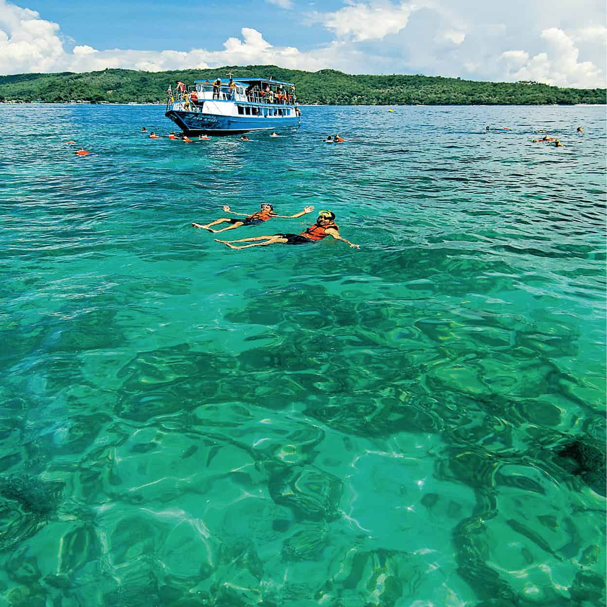
Snorkelling near Ko Rok.
John W. Ishii/Apa Publications
Declared Thailand’s 62nd official National Park in 1990, Mu Ko Lanta Marine National Park ! [map] comprises the southern tip of Ko Lanta Yai and 15 small surrounding islands. The southernmost tip of Ko Lanta comprises two beaches: Laem Tanode and the rocky Hat Hin Ngam; the latter is where the park headquarters is situated. A 2.5km (1.5-mile) hiking trail leading along a cliff begins here and offers the chance of spotting a range of fauna such as fruit bats, deer, wild pigs and reptiles, including monitor lizards, cobras and green snakes. Also here is a small white lighthouse, from which there are scenic views out to the sea and mountains.
Snorkelling and diving
Some of Thailand’s finest spots for snorkelling and scuba diving are found in the waters off Ko Lanta. The most visited site for snorkelling, and considered by many to be one of Thailand’s best for such activity, is Ko Rok, about 47km (29 miles) south of Ko Lanta. There are actually two islands here, Ko Rok Nai and Ko Rok Nok, both graced with powdery white-sand beaches with an extensive patch of brightly coloured coral in between. Visibility is very good, and many interesting types of reef fish can be found in these waters.
Approximately 20km (12 miles) from Ko Rok are the twin peaks of Hin Daeng and Hin Muang, frequently rated as one of the world’s top-10 dive sites. An incredible variety of marine life thrives around this site. As the only outcrops in this area of deep, open sea, they also attract many pelagics, as well as large tuna and barracuda. Schools of grey reef sharks often approach divers and the area has one of the highest incidences of whale-shark sightings in the world.
Other islands
Ko Bubu
Those seeking an even quieter retreat than Ko Lanta may wish to visit the smaller and more peaceful islands nearby. At 7km (4 miles) off the east coast of Ko Lanta, the tiny island of Ko Bubu takes just 30 minutes to circumnavigate by foot. This uninhabited island only has a basic restaurant and a few simple bungalows on the western coast, where the small but stunning gently-sloping beach is fringed by turquoise waters ideal for swimming. Boat transfers can be arranged for guests of Bubu Island Resort (tel: 0-7561 8066), the only resort on the island; there is no other regular service. Longtail boats at Krabi and Ko Lanta can, however, be chartered for the journey.
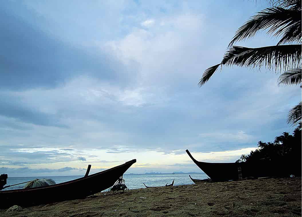
Ko Bubu at dusk.
John W. Ishii/Apa Publications
Ko Jum (Ko Pu)
Larger than Ko Bubu is Ko Jum (Ko Pu), to the northwest of Ko Lanta. While facilities are steadily increasing here, it has yet to sustain much impact from tourism and is still pleasantly underdeveloped. The flat southern part is covered in palms and casuarinas, and the mountainous northern tip reaches a height of 395 metres (1,296ft). The island is gifted with powdery white-sand beaches and clear waters with plenty of healthy and colourful coral reefs. Some 3,000 permanent islanders reside on Ko Jum, earning a living mainly from fishing and the rubber plantations that are found here. Accommodation now runs from budget to expensive at resorts such as the stylish Koh Jum Beach Villas (tel: 08-6184 0505; www.kohjumbeachvillas.com).
