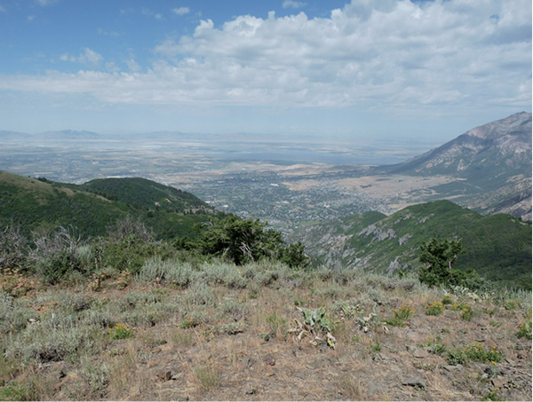
View over North Ogden
WEBER COUNTY
2
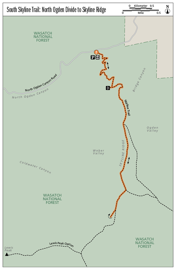
South Skyline Trail: North Ogden Divide to Skyline Ridge
South Skyline Trail to the ridge is about the view, but it also boasts a climb amidst maples, subalpine and white fir, Gambel oak, and seasonal wildflowers. From North Ogden Divide the trail switchbacks to the top ridge of the mountain. Where vegetation falls away, the ridge view opens up down both sides of the mountain range: Weber Valley to the west, Ogden Valley and Pineview Reservoir to the east, and the towering view of Ben Lomond Peak to the north. As you hit the ridge the trail eases into an easy ridgeline, the Skyline that connects North Ogden Divide to Ogden Canyon in the south. This may be one of the best trails for enjoying fall’s color display.
Start: North Ogden Divide trailhead
Distance: 5.4 miles out and back
Hiking time: About 2.5 hours
Difficulty: Moderate
Elevation gain: 1,870 feet
Trail surface: Dirt and rock path
Best season: Summer and fall
Other trail users: Mountain bikers, horses, off-road vehicles
Canine compatibility: Dogs permitted
Nearest town: Pleasant View
Fees and permits: No fees or permits required
Maps: USGS Huntsville (UT)
Trail contacts: Weber Pathways, PO Box 972, Ogden 84402; (801) 393-2304; www.weberpathways.org Ogden Ranger District, 2501 Wall Ave., Ogden 84401; (801) 625-5306
Special considerations: The mountain wildflowers usually hit their peak from the last week in July to approximately the second week in August. If winter and spring have been wet, be prepared for more ticks, mosquitoes, and deerflies. Snakes and birds will be more prolific as well.
Finding the trailhead: Heading north on I-15, take the 2700 N/Farr West exit. Head east along 2700 N to Washington Boulevard. Turn left onto Washington Boulevard and go to 3100 N. Turn right at the light and follow this road for 4 miles to the North Ogden Divide pass. The trailhead sits right at the pass with plenty of parking, a restroom, and trailhead markers. GPS: N41 19.211' / W111 53.953'
The Hike
In 1852 when the area was first settled, three boys made the first recorded ascent to the peak. Sixty years later the peak was named Lewis Peak in the youngest boy’s honor. Today the route to Lewis Peak and the Skyline Ridge it sits on involves a set of switchbacks that climb up the North Ogden Divide. At the ridge of the mountain crest, the lush alpine environment falls away to grasses, dirt, and long, clear views.
This trail is called the Skyline Trail because it literally walks the line between sky and mountain. The view along the ridge is a destination in itself. Additional trail options include following the Skyline Ridge all the way to Lewis Peak or continuing south along the ridge into Ogden Canyon, but South Skyline Ridge provides a spectacular full-bodied view, often from one vantage point, down the range and across the communities on both sides.
View over North Ogden
From the North Ogden Divide trailhead, the first section of the trail is socked in with Gambel oak, maples, fir, and plenty of undergrowth. Your first viewpoint occurs at 0.7 mile, where the trail allows a peek into Weber Valley, North Ogden, Pleasant View, and other communities to the west. At 1.2 miles, while you are still switchbacking up the mountain, the trail forks. The right fork is a small jaunt of 100 feet to a lookout point. The left fork continues up the trail.
The trail winds to the east side of the mountain, and at 1.3 miles the east side view opens down the other side of the mountain into Ogden Valley. To the north you can see the Wellsville Mountains; to the southeast is Pineview Reservoir. The trail curves around the mountain and back to the west, where it hits the skyline and the views open up. At 1.6 miles you can stand on the Skyline Ridge and look both east and west down the Wasatch Range.
Continue down the ridge for another mile, enjoying the views of the communities, Willard Bay to the west, and Pineview Reservoir to the east. Head for Overlook Knob 1 at 8,115 feet in elevation (GPS: N41 17.748' / W111 53.560'). This is a nice area to stop for lunch, take photos, and enjoy the view before your return. Return the way you came, or continue on to Lewis Peak or Pineview Reservoir. By all means, bring your camera.
Miles and Directions
0.0Start at the North Ogden Divide trailhead.
0.7The first views along the trail open up.
1.2Come to a fork; go right for a quick overlook down into Weber Canyon. Return to the main trail and continue to the left.
1.3First views to the east and into Ogden Valley open up.
1.6Come to the Skyline Ridge.
2.7Reach Overlook Knob 1, your turnaround point.
5.4Arrive back at the trailhead.
Options
Lewis Peak Trail: Continue south from Overlook Knob 1 to the Lewis Peak Trail. The signed trail is 5.5 miles long, climbing 1,847 feet in elevation as it climbs up and down along the ridge and then heads west out to the peak.
Skyline Trail to Pineview Reservoir: This route runs 9.5 miles to join North Ogden Canyon with Ogden Canyon. Defined trailheads sit at both ends. Trail users are the same as for the featured hike. During summer get an early start—the trail’s southern exposure and minimal leaf cover make for a warm hike once you reach the ridge and head down toward Pineview Reservoir.
Hike Information
Local events and attractions: iRock at the Solomon Center, 2261 Kiesel Ave., Ogden 84401; (801) 399 4653; Ogden’s newest indoor rock climbing and bouldering facility
Organizations: Weber Pathways, PO Box 972, Ogden 84402; (801) 393-2304; www.weberpathways.org; e-mail: wp@weberpathways.org
Camping: Anderson Cove Campground, located on the south shore of Pineview Reservoir in Ogden Canyon (about 8 miles east of Ogden on UT 39). Open May 1 through September 20; gate locked the rest of the year. Campground is patrolled nightly by a Weber County sheriff’s deputy or forest service law enforcement. For reservations call (877) 444-NRRS (6777).
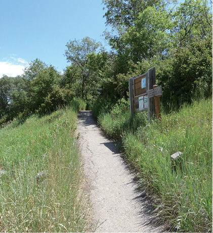
Skyline trailhead