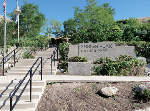
Ensign Peak Plaza trailhead
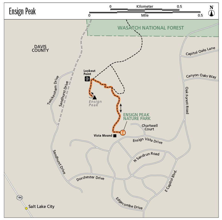
14
Ensign Peak
The historic Ensign Peak Trail climbs to an overlook used by Brigham Young and other Latter Day Saint church leaders upon settling the valley. The viewpoint from the historical obelisk atop the peak provides a view of the Salt Lake Valley as it sits cradled between the Wasatch Mountains on the east and the Oquirrh Range on the west. This short hike up a barren, grass-lined trail takes you to the point where you can view it all—both mountain ranges, the valley between, the Great Salt Lake, the heart of downtown Salt Lake City, and everything in between. This hike is all about the view and the history.
Start: Ensign Peak Nature Park
Distance: 1.0 mile out and back
Hiking time: About 30 minutes
Difficulty: Moderate due to steepness of trail
Elevation gain: 398 feet
Trail surface: Dirt path with a paved section
Best season: Year-round
Other trail users: None
Canine compatibility: Leashed dogs permitted
Land status: Salt Lake city park, managed by the city and the Ensign Peak Foundation
Nearest town: Salt Lake City
Fees and permits: No fees or permits required
Schedule: Open daily sunrise to sunset
Maps: USGS Salt Lake City North; Ensign Downs Park
Trail contacts: Salt Lake City Parks and Public Lands; (801) 972-7800
Special considerations: Stay on the designated trail to protect the native grasses and flowers.
Other: No water or restrooms are available at the trailhead. Carry out your own trash. No campfires or camping permitted.
Finding the trailhead: From the State Capitol building in Salt Lake City, take East Capitol Boulevard (UT 150 East) north for 0.6 mile to Edgecombe Drive (UT 800 North). Turn left onto Edgecombe Drive, which becomes Ensign Vista Drive, and continue for 0.4 mile to the Ensign Peak Nature Park trailhead and entry plaza on the left. GPS: N40 47.518' / W111 53.291'
The Hike
On July 26, 1847, two days after Mormon prophet Brigham Young declared Salt Lake Valley the place where his followers were to set up their new community, he and a party of prominent church leaders climbed this hill as a vantage point to survey the valley and decide how they would lay out their future city. It was suggested that this peak was a fitting place to set up an ensign, and it was named Ensign Peak. On July 26, 1934, an obelisk was erected atop the peak. Today the hike to overlook the entire valley is defined by a dirt path lined with information markers describing the history, geology, flora, and fauna of the area.
As you head up the trail you immediately come to the Vista Mound offshoot trail to your left. This side trail is a nice lookout point from which you can see the Oquirrh Mountains to the west; Kennecott Copper Mine to the southwest; and downtown Salt Lake City, the Capitol Building, Temple Square, the University of Utah, and the Wasatch Mountains to the east.
The trail is lined with grasses, thistle, Gambel oak, but no shade. The well-marked trail provides places to sit if you tire on the steady climb to the top.
Ensign Peak Plaza trailhead
At 0.4 mile, as you round the corner on the north side of the trail, you can look down on the industrial area at the northern point of the mountain moving into Davis County. You can also see the Great Salt Lake, Antelope Island, and the north corner of the Oquirrh Mountains. The view from the top overlooks the entire Salt Lake Valley. The obelisk holds a historic plaque, and railings line the walking deck.
On July 26, 1996, President of the Church of Jesus Christ of Latter Day Saints, Gordon B. Hinckley dedicated Ensign Peak Nature Park, which included Ensign Peak and an additional 66 acres surrounding it. President Hinckley dedicated it that it may “be a place of pondering, a place of remembrance, a place of thoughtful gratitude, and a place of purposeful resolution.” The effort was headed by the Ensign Peak Foundation, later known as the Mormon Historic Sites Foundation, which worked closely with the Salt Lake City Corporation. The Church of Jesus Christ of Latter-day Saints also constructed a memorial garden near the base of the peak that tells of its significance and the early pioneers who built up Salt Lake Valley.
After enjoying the vast vista, return to the trailhead the same way you came up.
The Great Salt Lake is 80 miles long and 30 miles wide, with an average depth of 13 feet. The shoreline changes dramatically with any change in depth.
Miles and Directions
0.0Start at the trailhead in Ensign Peak Nature Park.
9 feetCome to the Vista Mound side trail to the left. Visit the overlook and then turn left onto the main trail.
0.4Reach the overlook with a westerly view to the Great Salt Lake and north to the industrial area below.
0.5Arrive at Ensign Peak summit. Return the way you came.
1.0Arrive back at the trailhead.
Hike Information
Local Sightseeing: Salt Lake City Convention and Visitors Bureau; www.visitsaltlake.com; for guided city and historic tours. Temple Square also has free tours for the public.