MILL CREEK CANYON
18
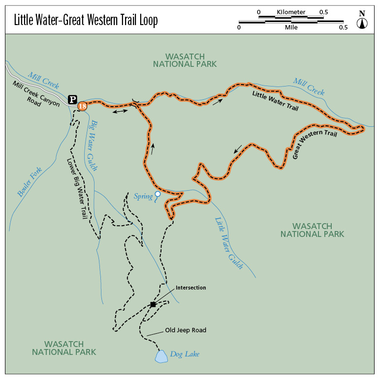
Little Water–Great Western Trail Loop
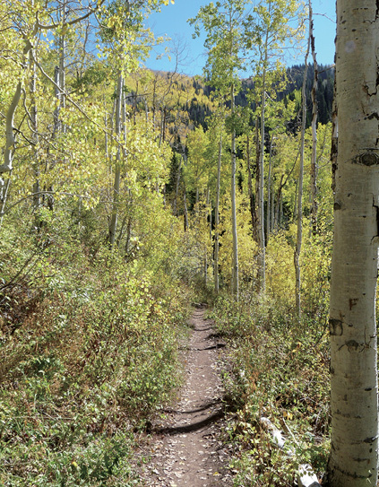
The Little Water trailhead is less well known and sits quietly on the northeast side of the Upper Big Water parking area and trailhead. This well-defined, packed trail twists beneath tall aspen and evergreens, often traveling next to Mill Creek, and explores the east end of Mill Creek Canyon. At the eastern terminus the trail intersects a section of the Great Western Trail and then eventually loops back to the Little Water Trail. The golden aspen, tall evergreens, and lush vegetation make tackling this trail pleasant and cool in summer and colorful in the fall.
Start: Little Water trailhead, northeast side of Upper Big Water trailhead parking area
Distance: 4.1-mile lollipop
Hiking time: About 1.5 hours
Difficulty: Easy
Elevation gain: 850 feet
Trail surface: Dirt path and bridges
Best season: Summer through winter
Other trail users: Bikers allowed on even-numbered days
Canine compatibility: Dogs permitted. Must be leashed on even-numbered days; may be off-leash on odd-numbered days but must be in sight of handler. Dogs must be leashed at all times in campgrounds, on roadways, and at trailheads. Be sure to clean up after your dog.
Land status: Uinta-Wasatch-Cache National Forest
Nearest town: Salt Lake City
Fees and permits: Fee to enter Mill Creek Canyon. The fee station is located at the bottom of the canyon; payment is requested upon exit.
Maps: USGS Mount Aire
Trail contacts: Salt Lake County Park Operations; (801) 483-5473 Public Lands Information Center, Recreational Equipment Inc., 3285 East 3200 South, Salt Lake City 84109; (801) 466-6411; www.publiclands.org Salt Lake Ranger District, 6944 South 3000 East, Salt Lake City 84121; (801) 236-3400
Finding the trailhead: Mill Creek Canyon sits on the far east side of 3800 South in Salt Lake City. Follow 3800 South, which leads directly into Mill Creek Canyon. Upper Big Water trailhead is at the top of Mill Creek Canyon where the road dead-ends at the parking area. The Little Water Trail leaves from the northeast corner of the parking lot. GPS: N40 41.070' / W111 38.800'
The Hike
The Little Water Trail begins as a doubletrack forested trail that heads east, deeper into Mill Creek Canyon. A Little Water Trail sign marks the trailhead. The trail immediately dives into aspen and evergreens—a lush and pleasant alpine environment. Within only 300 feet the trail forks. Continue straight up the right fork. At 0.25 mile you hit the first critical intersection after crossing a bridge. The more used trail curves to the right and continues toward Dog Lake. The trail marker is a wooden arrow that points you in this direction. Do not follow the arrow; instead take the left fork and continue straight ahead.
The beautiful, shaded forest trail follows Mill Creek along its south shore on a packed-dirt singletrack. At just under 1.0 mile the trail appears to climb up the mountain to your right. Instead cross the stream here and follow the trail on the north side of Mill Creek. As the trail continues up the canyon, the incline increases, as do the size of the rocks and boulders in the trail. Keep climbing up to the intersection with the Great Western Trail. This easy-to-find junction is marked with wooden trail markers. Head right, down the trail.
The Great Western Trail is a unique corridor in the western United States comprising braided and paralleling trails that traverse 4,455 miles through Arizona, Utah, Idaho, Wyoming, and Montana. The trail cuts through desert and canyon landscapes, plateaus, woodlands, dense forests, and alpine meadows while linking eighteen national forests and tribal, state, and Bureau of Land Management (BLM) administered lands. The Great Western Trail intersects many popular Utah trails, including this loop.
This section of the Great Western Trail cuts through thick aspen groves and crosses another bridge before coming to a major four-way intersection where the Great Western Trail continues forward, Dog Lake Trail heads straight up the mountain, and Little Water Trail turns down the mountain for a 1.0-mile descent back to the trailhead. Along the descent the trail hooks back into the original trail to complete the loop and then crosses back over the bridge and heads west back to the trailhead.
The most serious contributor to heat-related illness is dehydration. Bring plenty to drink, and sip even when you don’t feel thirsty. Drink early, during your hike, and after you’ve stopped for the day. You won’t “feel” thirsty until your body is already 2 to 5 percent dehydrated; your thirst will disappear when only two-thirds of the fluid deficit has been replaced
Miles and Directions
0.0Start at the Little Water trailhead.
300 feetCome to a fork in the trail; continue straight.
0.25Cross a bridge to an intersection; continue straight past the arrow sign that points right.
0.9The trail forks. Cross the stream to the left and follow the trail on the north side of Mill Creek.
1.0The trail incline increases.
1.6The trail joins the Great Western Trail.
3.2Reach a major four-way trail intersection; head right (north) down the mountain.
3.9The trail hooks back into the original trail and completes the loop. Cross the bridge and head left (west) back to the trailhead.
4.1Arrive back at the trailhead.
Hike Information
Local events and attractions: Mill Creek Canyon is dotted with picnic sites, all accessible from the main road up the canyon. Picnic sites include Church Fork, Box Elder, Terraces, Maple Grove, White Bridge, Maple Cove, Evergreen, Fir Crest, and Clover Springs.
Camping: Overnight camping is not available in Mill Creek Canyon. For more detailed information go to www.parks.slco.org/Mill CreekCanyon/index.html. For reservations at campgrounds in other areas, contact Salt Lake City Parks and Recreation at (801) 483-5473.
Little Water Trail