
Kondalilla Falls, Kondalilla National Park
PARK INFORMATION
NPRSR 13 7468
SIZE
1591 ha
VISITOR INFORMATION
Montville (07) 5478 5544 | Maleny Hinterland (07) 5499 9788 | www.sunshinecoastvisit.com.au
LOCATION AND ACCESS
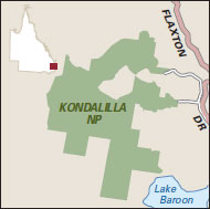
131 km north of Brisbane via Bruce Hwy, Glass House Mountains Rd, Landsborough–Maleny Rd and Maleny–Montville Rd
CAMPING
No camping

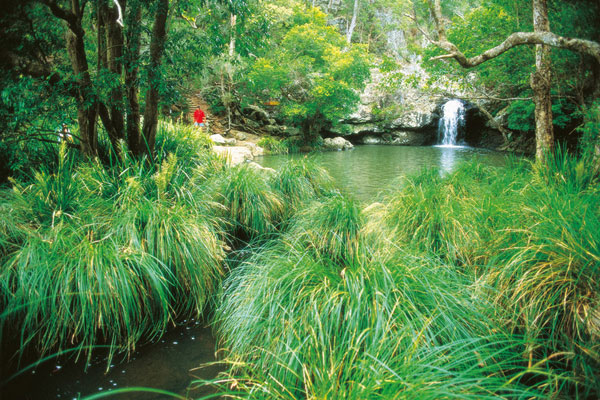
Kondalilla, an Aboriginal word meaning 'rushing waters', is an apt name for this national park in the Sunshine Coast hinterland, which boasts the spectacular 90-metre Kondalilla Falls that tumbles down into a rainforest valley in the Blackall Range during the wet season. In the valley there are dense stands of piccabeen palms, pink ash and bunya pines – the bunya nuts were the focus of celebratory feasts for the traditional owners of the area, the Gubbi Gubbi people. Tall open eucalypt forest, interspersed with patches of rainforest, grows above the falls. On the western escarpment are casuarinas with an understorey of grasstrees. From the 1880s to the early 1900s, the forest around Kondalilla was heavily logged for red cedar, blackbutt and tallowwood. Now a protected area, Kondalilla supports some 107 species of birds, and a number of rare animals and vulnerable plants, including the pouched frog, and the bopple nut with its brilliant red fruit containing a large edible nut.
There are two walking trails: Picnic Creek circuit (1.7 km return, 45 minutes–1 hour, easy), leading to a lookout over the valley, and Kondalilla Falls circuit (4.7 km return, 2–3 hours, medium difficulty), which winds its way down through the rainforest to the base of the waterfall and involves climbing over 100 steps to return. Montville, Flaxton and Mapleton are charming towns renowned for their art, craft and antique galleries, teashops and restaurants, so visitors to the area will find plenty to do.