09 PALOS/SAG VALLEY FOREST PRESERVE: Cap Sauers And Swallow Cliff Loop
KEY AT-A-GLANCE INFORMATION
LENGTH: 3.8 miles
CONFIGURATION: Loop
DIFFICULTY: Easy to moderate
SCENERY: Bluffs, rolling hills, streams, marshes, savannas, woods, deep ravines, and a toboggan run
EXPOSURE: Shady with some exposed stretches
SURFACE: Crushed-limestone-and-dirt path
HIKING TIME: 2–3 hours
DRIVING DISTANCE: 25 miles from Millennium Park, downtown Chicago
ACCESS: 6:30 a.m.–sunset
WHEELCHAIR ACCESS: No
FACILITIES: Water, restrooms, and picnic tables at the Teasons Woods picnic area
MAPS: Check out the Cook County Forest Preserve trail map online at fpdcc.com/downloads/sv_trailmap.pdf; USGS topo Sag Bridge, IL
SPECIAL COMMENTS: Pets must be leashed. If hiking with children, be careful crossing 104th Avenue.
GPS TRAILHEAD COORDINATES
Latitude 427247
Longitude 4614853
Directions
Take I-55 south until reaching Exit 274. Follow IL 83 (Kingery Highway) south. At 4 miles, continue to follow IL 83 as it turns left and becomes 111th Street. After 3 more miles, turn right on 104th Avenue and park in the lot for Teasons Woods immediately on the left.

IN BRIEF
As part of the larger Palos/Sag Valley Preserves, Cap Sauers Holdings and Swallow Cliff offer great hiking close to Chicago. The terrain is varied and sometimes dramatic, with bluffs and ravines, pristine oak savannas, and scenic stream crossings.
DESCRIPTION
In a county of more than 5 million people, the wild and isolated ambience of Cap Sauers Holdings seems like an impossibility. Named after the first superintendent of the Cook County Forest Preserve District, Cap Sauers is the largest roadless tract in the county and the largest nature preserve in Illinois. One striking part of this hike features an 80- to 100-foot-high bluff known as Swallow Cliff, formed by torrents of meltwater as the most recent glacier retreated about 12,000 years ago. As the last glacier shrank, Lake Michigan swelled. The growing lake eventually released some of its meltwater by carving a couple of channels in the Palos area. One of these outlets sculpted the bluffs and the basin of the nearby Des Plaines River, and the other created Swallow Cliff and the Calumet Sag Channel, which flows just a quarter mile north of the cliff.
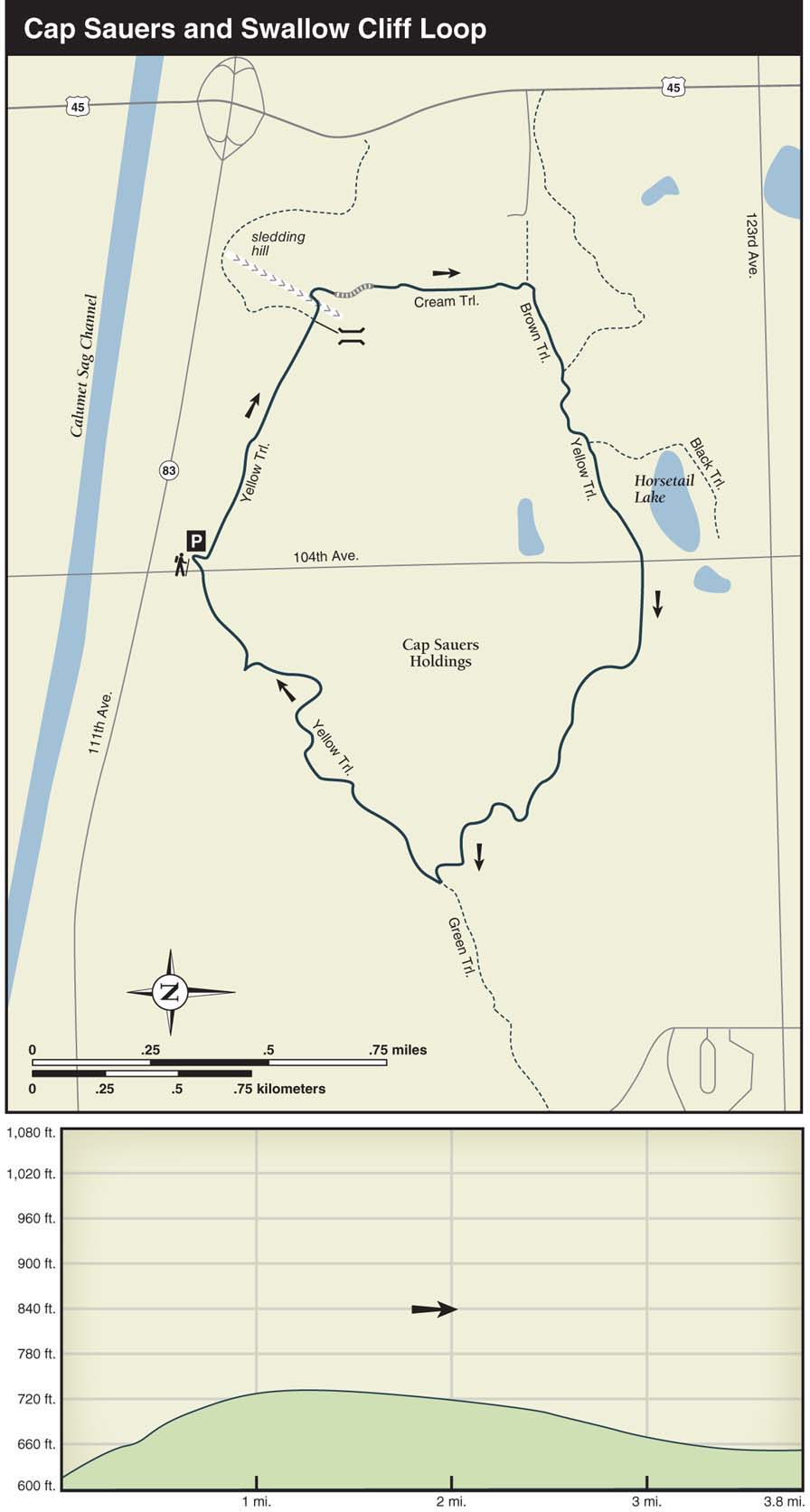
Swallow Cliff rises up immediately south of the Teasons Woods parking lot where the hike starts. Hop on the Yellow Trail, which runs along the back side of the parking area. Heading east—away from 104th Avenue—on the crushed-limestone trail at the base of Swallow Cliff, hikers will see trails going up the slope on the right. Those in the mood for exploring can find dramatic ravines and bluffs within this several-mile network of unmarked trails. Be warned, though, some sections are not quite so beautiful. Despite the signs banning bicycles on these trails, damage from off-road biking is clearly a problem. Because this cluster of trails can be confusing, bring a map and compass or carry a GPS unit.
While hiking along the base of Swallow Cliff, look for the points where steep ravines intersect the bluff. At 0.6 mile, cross a small bridge and follow the first marked trail on the right after the bridge. From the trail, head over to the lengthy stone staircase to the right. At the top of the stairs, continue ahead on the Cream Trail. After passing a marsh on the left at 0.8 mile, turn right on the Brown Trail when coming to a T intersection. As the terrain flattens, an attractive oak canopy develops overhead. At 1.2 miles into the hike, keep right on the Yellow Trail. A short distance ahead, keep straight as the Black Trail merges from the left. After the junction with the Black Trail, Horsetail Lake will be visible through the trees on the left.
On summer weekends, the first half of this hike from Swallow Cliff south to Horsetail Lake is active with runners, equestrians, bikers, hikers, and people using the lengthy stone staircase for an outdoor workout. If solitude is what you’re after, visit this section during off-peak hours. Within the 1,520 acres of Cap Sauers, however, solitude is usually in abundant supply.
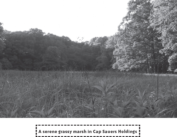
Crossing 104th Avenue into Cap Sauers Holdings on the Yellow Trail, the terrain is flat and shrubby, offering little evidence of the farming that once took place in this section of the preserve. You'll remain on the Yellow Trail for the remainder of the hike. At 2 miles into the hike, the trail drops down alongside a marsh and then continues through stunning oak savannas, sometimes thick with deadfall. At 2.7 miles, when you arrive at the junction with the Green Trail, keep right on the Yellow Trail. Turn right and you will hike through a semi-open area, over a shallow stream, and alongside a few ravines. While hiking this section of trail, keep an eye out for animal trails that cross the Yellow Trail. Look for mud near these trails to determine what creatures recently passed by. Coyotes, rabbits, and raccoons are common in Cap Sauers, as are deer; in fact, at dusk deer become nearly as common as squirrels in a city park. As traffic noise from 104th Avenue comes within earshot, the trail loses elevation and winds through wild rose bushes before reaching a grove of stately walnut and oak trees. At 104th Avenue, the Teasons Woods parking lot where you began is straight ahead.
If you’re in the mood for extending the hike a couple of miles and you’re interested in seeing one of the best examples of an esker in Illinois, take a left on the Green Trail at the last T junction. After hiking 0.4 mile beyond the junction, take the first side trail on the right indicated with a marker. This is the trail leading to the esker (it is a narrow trail and not color coded). Right away, the esker trail passes over a hilltop and then through a labyrinth of dense shrubs. Turn right at a trail intersection at the edge of a savanna. Shortly after passing through a small muddy ravine and alongside a marsh on the left, the trail starts to snake along the top of what is known as Visitation Esker. Sloping down 40 to 50 feet on each side of the trail, the esker looks like a perfectly shaped winding mound. Indeed, some geologists maintain that this landform—created by a subglacial stream—is one of the most well-defined examples of an esker in the state. On the sides of the esker, look for the occasional remnants of controlled burnings: charred stumps and blackened tree trunks lying on the ground. These burnings clear out the invasive plant species and the understory, and, in turn, allow for open vistas of the rolling terrain sprinkled with oaks.

Nearly 1 mile into the esker path, the esker disappears and the trail intersects with another trail at the top of a bluff. This is your turnaround. Now retrace your steps back to the Green Trail and then return to the Yellow Trail, which you’ll follow back to the Teasons Woods parking area.