41 ROUND POND HIKE
KEY AT-A-GLANCE INFORMATION
LENGTH: 2.33 miles
CONFIGURATION: Loop
DIFFICULTY: Easy
SCENERY: Oak and pine forest, 3 ponds, and a cranberry bog
EXPOSURE: Mostly shaded
TRAFFIC: Moderate
TRAIL SURFACE: Packed earth and some sandy areas
HIKING TIME: 1–1.5 hours
SEASON: Year-round sunrise–sunset
ACCESS: Free
MAPS: Available at Duxbury town hall (878 Tremont Street; follow Mayflower Street east to its end and turn left onto Tremont; town hall is ahead on the left). Hiking trails leading to Round Pond and North Hill Marsh are accessible immediately behind the town hall.
FACILITIES: None
SPECIAL COMMENTS: This hike is easily extended into longer hikes by linking to trails in Duxbury Town Forest and North Hill Marsh, or by using it to access Bay Circuit Trail, which leads south approximately 2 miles to Bay Farm on the edge of Duxbury’s Kingston Bay.
WHEELCHAIR TRAVERSABLE: No
DRIVING DISTANCE FROM BOSTON COMMON: 34 miles
Round Pond Hike
UTM Zone (WGS84) 19T
Easting: 358195
Northing: 4655153
Latitude: N 42° 02' 08"
Longitude: W 70° 42' 47"
Directions
From Boston take I-93, merge onto MA 3 south. Take Exit 10 off MA 3 south and bear right. Follow MA 3A to the Duxbury Fire Station. Turn left onto Mayflower Street. Parking for Round Pond is about 1 mile past the Duxbury transfer station, on the left.


IN BRIEF
Setting out from a pond that once supplied ice to local kitchens, this loop takes you through a landscape of cranberry bogs, kettle ponds, and peaceful woodland.
DESCRIPTION
In 1627, itching for elbowroom after seven years of living within shouting distance of their fellow Mayflower-borne New Englanders, the Pilgrims of Plymouth Plantation spread north and south along the coast as soon as their London-based financial backers would let them. One to make the leap was Captain Myles Standish, their fearless man in arms, who was granted land situated on a cove called “The Nook” overlooking the mother plantation, which lay just a tack or two to the south.
It took some time—at first the land was used only for crops during the growing season—but inevitably the green pastures to the north lured families away from Plymouth for good. After successfully petitioning Plymouth officials for permission to build their own church, the ruddy captain, William Brewster, John Alden, and others officially founded their new village, which Standish named Duxbury after his family’s estate in Chorley, Lancashire, England.
Over the course of King Philip’s War (1675–76) Duxbury was spared attack by Wampanoag warriors wielding tomahawks and torches, perhaps because the natives saw that attacking the settlement would jeopardize their chances of achieving their highest goal—the annihilation of Plymouth. In any case, Duxbury avoided conflict for well over a century.
Up until the American War for Independence, Duxbury’s citizens lived quiet, productive lives as subsistence farmers, but the consequences of the country’s victory over England brought rapid change. Most significant was that, following the Treaty of Paris, America secured fishing rights on the Grand Banks, which, located south of Newfoundland, was well within the reach of the enterprising citizens of New England’s coastal villages.
Quick to rise to the occasion several of Duxbury’s wealthy families set about building large fishing schooners. Before long, Ezra Weston, who launched his career in 1764 by turning out modest vessels, was operating a merchant fleet so profitable it earned him the nickname “King Caesar.” Weston’s son, Ezra II, who inherited his father’s drive and sobriquet, ultimately owned both the largest fleet in America and the largest ship. Given the truly American name Hope, the vessel weighed 880 tons and had masts so tall they dwarfed those of sister ships and reached closer to heaven than Duxbury’s church steeples.
Through the first half of the 19th century the world-renowned Weston industries employed all but the entire population of Duxbury, if not in its shipyards, sail lofts, or schooner crews, then in mills and forges, on farms, and most important of all, in lumbering operations. The hulls and masts for more than 643 ships were built of wood cut from Duxbury’s old-growth forests.
Starting the hike from the parking area on Mayflower Street, set out on the Yellow Trail heading west through sparse woods of white pine and red oak. At about 0.2 miles, the trail converges with Bay Circuit Trail and bends south, passing a shade east of Round Pond.
Ahead, where Bay Circuit Trail diverts west, continue on the Yellow Trail to reach a T-intersection, where the Old Meetinghouse Road runs east and west. Incorporated into a recreational trail system in the 1890s, this road dates back to Duxbury’s early days, when settlers would use it to travel from the outskirts of the village to the central meetinghouse for regular religious, government, and social gatherings. Located beside the Old Burial Ground, the meetinghouse is a 2-mile walk from this spot.
Bear left to briefly follow this route worn by the footsteps of the Pilgrims, then bear right at the next intersection to resume hiking south on the Red Trail. Dipping in elevation, the trail passes over increasingly sandy terrain. Chickadees, tufted titmice, the occasional flock of cedar waxwings, and other forest birds flit and sing among the pines and understory of low bush and dry-land blueberries, ferns, teaberry, and lady’s slippers.
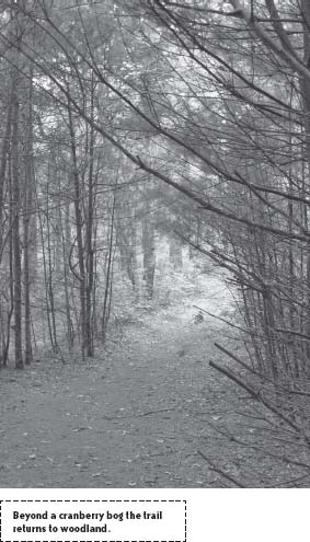
Opening to a pronounced dune after winding westward, the trail swings south again to pass a trail to the right. Continue to the next junction, then bear left, leaving the Red Trail for a narrower path sloping eastward into wetland, where species including red maple, aspen, black cherry, alder, sagebush, summersweet, highbush blueberry, sweet pepperbush, and native azaleas grow in humus-rich soil. At the bottom of the hill, the trail spills out to one of Duxbury’s many cultivated cranberry bogs.
Although called ibimi by the Pequot people, folklore has it that the Pilgrims saw in the cranberry’s small pink blossoms the head and bill of a sandhill crane and hence renamed the native fruit “crane berry.” However it is just as likely that they recognized ibimi for kraanbere, a native of Holland, the country where for eleven years the Pilgrims had lived in exile before sailing to America.
Partial to the unique and highly acidic conditions found in glacier-formed peat bogs, cranberries were harvested exclusively from the wild until 1816. It was in that year that a Revolutionary War veteran named Captain Henry Hall, of Cape Cod, observed that both the plant’s vigor and the quality of its fruit improved when sand is added to the peat. After some experimentation, Hall perfected his cultivation techniques, a new industry was born when others quickly followed his lead.
Skirting the cranberry bog, the trail traces woods to reach a drive running parallel to Island Creek Pond. Bear right passing a pump house, and at the southern end of the bog loop, head west to hike along a causeway that divides the bog in two.
Arriving at a crossroads where Bay Circuit Trail swings in from the north and drops south, take up this epic trail and continue west into woods. In short time, Bay Circuit Trail winds north and, after a stretch through sometimes wet lowland, gains elevation on nearing the southeast shore of Pine Lake.
Together with the cranberry bogs lying farther north and Round Pond ahead to the east, Pine Lake attracts a full spectrum of wildlife. In the early morning and evening hours, raccoons and opossums descend from trees and upland haunts to forage at the waterside. Deer and foxes dash in and out like apparitions, and overhead, when the wind obliges and the light is right, osprey course in to swipe at schooling fish.

Follow the trail as it hugs the bank of Round Pond, pauses at a lookout, then arches northeast. Where it meets the Yellow Trail, bear right and backtrack to the parking lot.
NEARBY ATTRACTIONS
The town’s beauty is reason enough to prolong your visit, but if you enjoy history two of Duxbury’s historic homes provide a ready excuse to do some sightseeing. Visit Alden House Museum Historic Site (105 Alden Street, just off MA 3A). Built in 1653 on property deeded to the Alden family in the 1620s, this remarkable house has never been owned by any other family. Unlike other historic houses, Alden House has never been updated. Admission is $5 for adults 18 and over and $4 for children 3 to 17. There is a $1 discount for AAA members. The museum is open to the public between mid-May and Columbus Day, Monday through Saturday noon to 4 p.m.; the last tour begins at 3:30 p.m. Off-season hours generally are 10 a.m. to 1 p.m., but it’s best to call ahead to be sure; phone (781) 934-9092.
King Caesar House (20 King Caesar Road, Duxbury) is a second historic house worth visiting. It’s open July through August, Wednesday through Sunday from 1 to 4 p.m., and in September, Saturday and Sunday 1 to 4 p.m. From Mayflower Street, drive southeast to Lincoln Street. At the rotary, take the first exit onto MA 14. MA 14 becomes St. George Street. After 1 mile, turn left onto Washington Street, which becomes Powder Point Avenue. Turn right to King Caesar Road.