42 SLOCUM’S RIVER HIKE
KEY AT-A-GLANCE INFORMATION
LENGTH: 3.87 miles
CONFIGURATION: Loop
DIFFICULTY: Easy
SCENERY: The magnificent Slocum’s River, woods, wetlands, a nursery, and agricultural fields
EXPOSURE: Mostly shaded
TRAFFIC: Light
TRAIL SURFACE: Grass, packed earth with some muddy areas, and a stream or two to ford
HIKING TIME: 2 hours
SEASON: Year-round sunrise–sunset
ACCESS: Free (donation appreciated)
MAPS: Online at www.thetrustees.org/properties; maps also available on location while supplies last.
FACILITIES: None
SPECIAL COMMENTS: Dogs are welcome but must be leashed. Water-resistant boots—or better yet all-weather sandals—are recommended when the weather is warm and wet. In summer it might be a good idea to forgo the Dartmoor Wildlife Management half of the hike unless you have a high tolerance for mosquitoes, gnats, and deer flies.
WHEELCHAIR TRAVERSABLE: No
DISTANCE FROM BOSTON COMMON: 58 miles
Slocum’s River Hike
UTM Zone (WGS84) 19T
Easting: 332439
Northing: 4601988
Latitude: N 41° 33' 07"
Longitude: W 71° 00' 33"
Directions
From Boston take I-93/US 1 south 12.5 miles. At Exit 4 merge left onto MA 24 south toward Brockton. Exit onto MA 140 south, turn right onto MA 6 west. At the fourth set of traffic lights, turn left onto Old Westport Road and follow it 0.4 miles. Bear left onto Chase Road and follow it 3.6 miles to the end. Take a right onto Russells Mills Road and follow it 1 mile through historic Russells Mills Village. Continue straight onto Horseneck Road and follow it 1.4 miles to the entrance; there is parking for about 10 cars on the left.


IN BRIEF
There is no place in Massachusetts, or even the whole country, more beautiful than this reservation set on a hillside overlooking the splendidly picturesque Slocum’s River. Following easements through privately owned farmland, this hike explores a quintessentially New England landscape that is as lovely now as it was centuries ago.
DESCRIPTION
Whether the river was named for Anthony Slocum in the 17th century or his descendant Joshua Slocum in the 19th century depends on whom you ask—regardless, each man is worthy of the honor.
Like the Pilgrims of Plymouth, Anthony Slocum came to America seeking opportunity and religious freedom, but by 1637, the year he arrived, the Pilgrims had secured a firm toehold and Slocum quickly found that when it came to tolerance, the Puritans were remarkably like the Church of England. All were free to embrace Puritan beliefs, and all who tipped the apple cart were free to be gone. And so the Pilgrim of Taunton indulged Slocum his freedom until he joined the Society of Friends (later known as the Quakers) at which time they promptly expelled him from the settlement. Thus, in 1664, forced to find another home, Slocum went south to the coast and settled among fellow Quakers on land they purchased from Myles Standish, William Bradford, and other Plymouth officials. That same year, Metacomet—also known as King Philip, son of Wampanoag sachem Massasoit—fixed the bounds of the township and authorized the charter.

Another Slocum, also a Quaker, was forced to give up America altogether for having refused to participate in the War for Independence. Deemed a Loyalist for his pacifist ways, and therefore no longer welcome in the land of the free, he sailed for Canada in 1780 leaving America for good. Two hundred thirty-four years later, an intrepid descendent of this naturalized Canadian, Joshua Slocum, sailed into the harbor at Newport, Rhode Island, and in so doing became the first man to complete a solo circumnavigation of the globe.
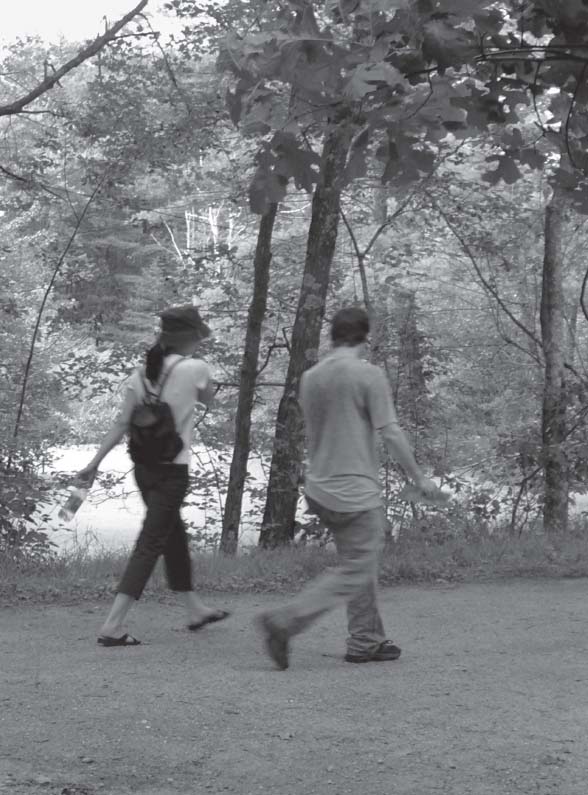
The hike begins at the far end of the parking lot beside a kiosk erected by the Trustees of Reservations. As soon as you are able to free your eyes from the arresting view across fields to the river, set out along the easement that runs east between a formidable stone wall and a field planted with young fruit trees.
Where the fields and stone wall leave off, a trustees sign marks the true boundary of the reserve. Enter woods here and continue east following the trail as it leads slightly to the right then downhill beside another stone wall partially concealed by bittersweet vines and other species exuberant enough to be dismissed as weeds.
Step through first one gap in the stone wall, then another, bearing left to hike to the river over upland grown in with hearty oaks, hickories, and vigorous young sassafras. As the trail descends closer to sea level, the view clears and the south-flowing waters of Slocum’s River seize center stage.
Responding to the irresistible pull of this waterway, the trail winds free of the woods and opens to a field stretched flat beside salt marsh buffered by a thin screen of trees. To get a good look at the river, follow one of the several unofficial paths that cut through to the windswept marsh—stepping carefully to avoid poison ivy.
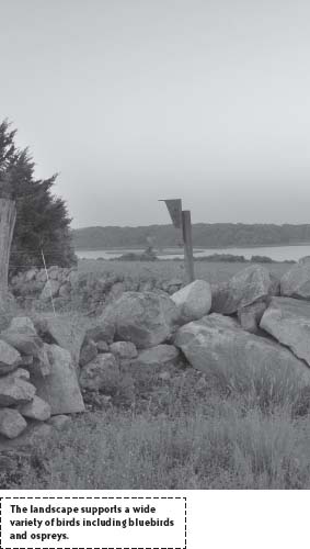
When ready, trace the field’s periphery counterclockwise to its southwest corner where the trail diverts back into woods. Take it slow to allow a chance sighting of a dazzling bluebird or oriole, acrobatic flycatcher, or wild turkey hen with hatchlings. For a good long look, take a seat on the granite bench placed among daisies and Indian paintbrush at the center of the field.
From the field hike west bearing right at a junction to continue north through woods. On emerging on the edge of privately owned farmland, bear right where the trail makes a T and follow the wide grassy avenue spotted with wild strawberries past a small meadow ensconced in trees to a trustees’ sign pointing left to Dartmoor Farm. Turn here and track the reservation’s northern boundary via a mowed path that leads back to Horseneck Road.
To continue the hike, navigate the iron gate on Dartmoor Farm’s drive and travel north along the west side of Horseneck Road following a mowed path running between an electric fence and a wooded buffer on the farm’s northern boundary. There are few trail markers; however, birdhouses with hay spilling from their circular openings line the way, and pastel-colored beehives stationed on the route indicate the easement’s halfway point.
Beyond a large barn set back behind Dartmoor Farm’s many rows of ornamental trees and shrubs, the trail darts north leaving solid footing for the forested wetland of the Dartmoor Farm Wildlife Management Area. Here the trail threads through tree cover staying close to the wire fence laced around a shaded grove of baby rhododendrons and azaleas. After a run to the south the trail reaches the end of the nursery and splits to the right as it nears a maintenance yard.
Now free of fencing the trail cuts a northwest course through a landscape looking something like a Rousseau painting—at least in warm months when layer on layer of green limits visibility to what is close at hand.
Covering relatively level ground the trail continues on a northwest run to eventually meet a stone wall built along a property line, whereupon it begins a gentle arc southward. Embossed with moss and fringed with ferns, the trail flirts with obscurity now and again as it disappears beneath puddles and streams. Stay the course by hiking straight on whenever faintly etched paths divert left or (most often) right.
At 0.86 miles from Horseneck Road, the trail intersects with a broad cart road running west to east. Shake off the mud and bear left onto this dry, even plane and enjoy easy walking through woods of oak and pine for the next 0.3 miles, passing an abandoned camper on the right a few hundred yards along.
Reaching a junction where the trail splits off to a clearing on the right, continue straight once again on a narrow footpath. For the next short stretch staying on track is a bit of a challenge due to fallen trees and the previous meanderings of other hikers, therefore proceed with care. Fortunately, just as the trail becomes impossibly vague, a gap in a stone wall confirms the path’s direction. Once through this passage, keep the stone wall to the left and continue hiking east.
Winding onward, the trail travels through another section of stone wall and momentarily aims north passing a tremendous knotted holly tree on its left just before it reaches a cellar hole containing great flanks of granite. Hike along the right-hand edge of the cellar hole and continue a hundred or so yards to find another trail dead ahead marked with red discs.
Bear right to hike southeast on this new trail through older woods of maple and holly. Stone walls shadow to the left and right indicating pasture laboriously cleared centuries ago now once more glutted with trees.
Bending directly east, the trail loses breadth as it slopes back to wetland. Then as shadbush, blueberries, and sweet pepperbush crowd in, the trail steers straight on to startling brightness, for beyond a stream bridged by slabs of stone, it emerges to an enormous commercial hay field. Hike to the right and trace the farmland’s border around this field, then head east along a mowed strip outside an electric fence to return to Horseneck Road.
Watch for traffic, then cross to a burly stone wall framing pasture. Continuing from a sign demarking another easement, hike east along a field of grazing angus to arrive at a point where four walls meet. Standing here on a hill that rises above Slocum’s River like an enormous cresting wave, you can see for miles. If you are like Slocum or the many who have built replicas of Slocum’s oyster sloop, Spray, you will feel a tug as you look downriver toward the sea. If you are an earth-bound sort, you might instead shiver, look at your watch and think about dinner.
Joshua Slocum ran away to sea as a boy of 14, then jumped from ship to ship for 58 years before finally hauling his sea chest to dry land at Martha’s Vineyard—a piece of turf as like a ship as land can be. Even then, he dry-docked at his island home only through the summer months. Come autumn, when others hunkered down for winter, Slocum shuttered his house and sailed for the tropics.
To continue the hike, heed the left-pointing arrow of the trustees’ sign posted beside the stone wall and cross the top of a field planted with alfalfa interspersed with oats (or another crop in rotation). Ahead, where the trail splits, bear right to hike downhill. This path leads directly to a canoe landing on the riverbank; follow the trail to its end or bear left at the fork midway.
From the left turn the trail undulates upward through a grassy meadow dotted with wildflowers to arrive at a stone seat set back from a grassy lookout. Stop to revel in the beauty, the warm sun, and misty sea air, then head north to the next fork in the path. At this junction, lengthen the hike slightly by dipping to the right. A moment later the path arrives at a stone monument dedicated to Dr. Milton A. Traverse who donated funds to maintain the reservation. Veer off to the right again to cross a meadow gone feral and right once more before swinging left to meet the path that leads to the parking lot.
NEARBY ATTRACTIONS
Two beautiful and distinctly different places are worth visiting while in the area; the 600-acre Horseneck Beach State Reservation (follow Horseneck Road south until you see a sign for the beach) and the historic village and harbor of Padanaram in South Dartmouth. For an overnight stay, consider the Paquachuck Inn located at 2056 Main Road, Westport Point (phone [508] 636-4398), just 5 minutes from Horseneck Beach. Wine lovers may also want to plan a visit to the Westport Rivers Winery, also down the road from the beach at 417 Hixbridge Road, Westport (phone [800] 993-9695).