
The Piedmont Battlegrounds Tour, Part 3
Fort Mill, York, Clover, Kings Mountain
Total mileage: approximately 84 miles.
THIS TOUR MAKES ITS WAY through an area in north-central South Carolina that was the scene of heavy fighting during the last several years of the Revolution. It was on a bloody battleground here that the tide of the war shifted in favor of the American colonies.
The tour begins at the intersection of S.C. 72 and U.S. 21 in Rock Hill. Proceed 4.9 miles north on U.S. 21 to S.C. 161 (Ebenezer Road), turn left, and drive to Ebenezer Presbyterian Church. Organized before 1785, this is said to be the oldest church in Rock Hill. Located in a forest behind the church is an immense stone bearing a moccasin print. Local tradition holds that it was put there by an Indian maiden who became enraged after her parents refused to give her permission to marry a white settler during colonial days.
Return to U.S. 21, turn left, and proceed 1 mile northeast to the bridge over the Catawba River. A nearby state historical marker notes that Nation Ford was located 2 miles downstream on the river. Since before recorded history, when the Catawba Indians used the ford, it has played a significant role in shaping military and economic events in the area. Colonial traders from Virginia used Nation Ford in the late seventeenth century. In July 1780, Thomas Sumter camped there with an army of five hundred partisans.
Continue for 0.4 mile to where U.S. 21 Business separates from U.S. 21 Bypass. Follow U.S. 21 Business for 1.8 miles to Main Street in Fort Mill. Turn right on Main, proceed one block to Tom Hall Street, turn right, and drive one block to Unity Street. Turn left and go eight blocks to Summersby Street.
Located at the junction is Old Unity Cemetery. Surrounding the eighteenth century graveyard is the original rock wall. Buried here are some of the earliest settlers of the Fort Mill area, including at least seven Revolutionary War soldiers. A bronze D.A.R. marker near the iron gate pays homage to the Patriots.
Fort Mill was so named because it was built by the colonial government of North Carolina to protect the women and children of the Catawba Indians while their men were away fighting the Cherokees at Webb’s Mill on Steele Creek.
Retrace your route to U.S. 21 Business. Drive south on U.S. 21 Business to Brickyard Road (S.R. 46-379), turn left, and proceed two hundred yards to the site of the home of Thomas Spratt, located on the eastern side of the road.
Spratt erected a log cabin here at an unknown date in the eighteenth century on Catawba land at the invitation of his Indian friends. Two hundred yards west of his home was the site of the fort built by North Carolina to protect the local Indians.
Lord Cornwallis’s army camped here in the first week of October 1780 on its retreat from Charlotte to Winnsboro. Recent rains had raised the water level at nearby Nation Ford, and the Redcoats were forced to wait until the flood receded. During Cornwallis’s stay here, Patriot forces harassed his flanks.
Return to U.S. 21 Business, turn right, and proceed 4.3 miles north to U.S. 21 Bypass. Go south on U.S. 21 Bypass for 7.4 miles to S.C. 161, turn right, and drive west for 8.1 miles to S.C. 274. Turn right and go 3.6 miles north to S.R. 46-1081. On the right side of the road here stands a small monument for Hill’s Ironworks.
Ironmaster William Hill and his partner, Isaac Hayne, developed a prosperous ironworks on the banks of nearby Allison Creek at the close of the colonial period. Hill produced high-quality farm implements and tools for the local settlers. When war clouds gathered, he directed his business toward the production of cannon and cannonballs for the American cause.
Incensed by Hill’s ardent support of the Patriots, Captain Christian Huck attacked and burned the factory in June 1780.
Proceed another 0.4 mile on S.C. 274 to the state historical marker honoring William Hill and his ironworks. Hill’s life will be detailed at a subsequent stop on this tour.
Continue north on S.C. 274 for 1.2 miles to the unpaved S.R. 46-1613. Turn left and drive 1.5 miles west to Nanny’s Mountain, a peak that measures 2 miles in diameter and five hundred feet in height. It was here that William Hill mined the iron used at his factory to craft military wares used by Patriots in the war.
Continue 0.2 mile to S.C. 49, turn left, and drive 1.5 miles south to the D.A.R. marker at the site of the home of Colonel Samuel Watson (1731-1810).
An early supporter of the cause of the colonies, Watson served in the Provincial Congress in 1776. Thereafter, he devoted his attention to military matters by serving as an officer of the South Carolina militia.
Colonel Watson’s home was of strategic importance during the war because of its proximity to Hill’s Ironworks. At the very time General Huck and his raiders were forming to attack the factory on Allison Creek, a force of Patriots gathered at Watson’s residence here. In an attempt to repel the Loyalists, the Patriots placed several small cannon on a hill north of the creek. Despite their efforts, Huck’s men succeeded in destroying the works. In addition, they burned Hill’s home and the adjacent outbuildings.
Turn around and drive north on S.C. 49 for 3.4 miles to the junction with S.C. 45 and S.R. 46-1099. Turn right on S.R. 46-1099 and go east for 1.9 miles to where the road ends at Lake Wylie. Located nearby in Revolutionary War times was Bigger’s Ferry. Sumter’s troops fought a minor skirmish here against Lord Rawdon’s command in 1780. On December 22 of that year, General Daniel Morgan crossed here with a force of six hundred men.
Retrace your route to S.C. 274. Turn right and proceed 2.1 miles north to the junction with S.C. 49/S.C. 274/S.C. 557. Turn right on S.C. 49 and drive 2.9 miles to the Buster Boyd Bridge over the Catawba River. The home of Colonel Thomas Neal stood on the northern side of the highway approximately a hundred yards from the bridge.
A staunch Patriot, Colonel Neal was active in the campaign against the Indians after he completed service in the Provincial Congress of 1776. He was killed in action in 1779. His son, Colonel Andrew Neal, followed in his father’s footsteps as a Patriot. Andrew was killed while participating in Sumter’s attack at Rocky Mount on August 1, 1780. The Neal family’s tragedy further intensified when Thomas Neal’s wife, Jean, was scalped and murdered by marauding Indians at a later date.
Return to the junction with S.C. 557. Proceed west on S.C. 557 for 2 miles to S.R. 46-152, turn left, and go south for 1.3 miles to the junction with a dirt road on the left. In this general vicinity stood New Acquisition School. Andrew Jackson attended school here before taking up arms against the British.
Return to S.C. 557, turn left, and drive west for 2.1 miles to S.R. 46-1582. On the southern side of the highway is Bethel Presbyterian Church. Organized in 1764, this is the oldest church in York County. The existing frame building, designed in the style of a colonial meeting house, was constructed in 1873 and is the fourth sanctuary at the site.
Many Revolutionary War soldiers are buried in the expansive church cemetery. Of special interest is the grave of William Hill (1741-1816). Not only did Hill serve the American cause by providing iron products from his factory, but he also fought in a number of battles. He found personal revenge at the Battle of Williamson’s Plantation on July 12, 1780. There, he took an active role in the Loyalist defeat that cost Captain Huck his life.

Hill was subsequently wounded in the Battle of Hanging Rock on August 6, 1780. However, his recovery was rapid; he participated in the pivotal Patriot victory on October 7 at Kings Mountain.
Following the war, Hall rebuilt his ironworks. In time, his property grew to include two furnaces, four gristmills, and two sawmills on a fifteen-thousand-acre tract. More than eighty laborers were employed in the enterprise. Much of the city of York is located on land formerly owned by the Hill family.

Drive west on S.C. 557 for 2.5 miles to S.C. 55, turn right, and go 2.1 miles to Clover. Continue west on S.C. 55 for 3.6 miles to the junction with a dirt road on the left. The Henry Houser House was located nearby during the Revolutionary War.
On the eve of the Battle of Kings Mountain, Patriots assembled here to mold bullets. The log cabin threatened to become uncomfortably crowded when two messengers dispatched by Patrick Ferguson with information for Cornwallis in Charlotte arrived. The master of the house pretended to hide the couriers from the Patriot soldiers. But on the next day, he hanged them. Their graves are located three hundred yards from the house site.
Continue west on S.C. 55 for 2.2 miles to S.C. 161, turn right, and proceed 0.2 mile to Bethany Associate Reformed Presbyterian Church.
Organized in the eighteenth century, the church is housed in a brick structure with an arcaded entrance and a belfry with a battlemented parapet. One of its earliest ministers was John Miller, to whom the following prayer of battle is ascribed:
Good Lord, Our God that art in Heaven, we have great reason to thank Thee for the many battles we have won. There is the great and glorious battle of Kings Mountain, where we kilt the great General Ferguson and took his whole army; and the great battle at Ramsour’s and Williamson’s; and the ever memorable and glorious battle of the Cowpens, where we made the proud General Tarleton run down the road healter-skelter [sic], and Good Lord, if ye had not suffered the cruel Tories to burn Hill’s ironworks, we would not have asked any more favors at Thy hands. Amen.
Buried in the adjoining church cemetery are a number of Revolutionary War soldiers, including some who were killed at Kings Mountain. The oldest grave here is said to be that of an Indian warrior.
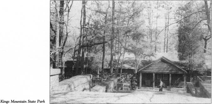
Continue north on S.C. 161 for 3 miles to S.R. 46-705, turn left, and proceed 0.8 mile to Kings Mountain State Park. Located adjacent to the site of the pivotal battle, the park features a “Living History Farm”—a recreation (with original buildings) of a frontier homestead similar to the ones in the Carolina back country during the Revolutionary War.
Continue on S.R. 46-705/S.C. 216 to enter Kings Mountain National Military Park. Admission to the park is free. Special events related to the Revolutionary War and the battle fought here are offered throughout the year. Each year on the anniversary of the battle, a group of reenactors arrives at the park after following the route and the itinerary of the Overmountain Men.
Proceed 1.5 miles to the entrance to the visitor center; en route, you will notice several markers related to the titanic struggle that took place here on October 7, 1780.
Turn left into the parking area and walk to the center, a spacious, modern building of wood and stone. Inside, visitors are treated to an excellent audiovisual orientation program and numerous exhibits related to the battle.
In the aftermath of his overwhelming victory at Camden on August 16, 1780, Cornwallis began to formulate plans for an invasion of North Carolina, the one state that stood in the path of his total conquest of the South. To pave the way for the invasion, he dispatched a trusted lieutenant, Major Patrick Ferguson, to the Upcountry of northwestern South Carolina and the Piedmont of North Carolina. There, the thirty-six-year-old career officer from Scotland was to punish insurgents, recruit Loyalist soldiers to assist in the invasion, and protect the left flank of the British army as it poured into North Carolina.
Ferguson was fearful of the frontier Patriots of the North Carolina mountains and Piedmont, with whom he had skirmished throughout the summer in the South Carolina Upcountry. He grew even more concerned in late September 1780 at his encampment at Gilbert Town when he learned that the Overmountain Men had mustered across the mountains in what is now Tennessee. In a vain attempt to dissuade the frontiersmen from doing battle with him again, Ferguson sent a courier with a threat to the “backwater men,” as he called them, saying that if they did not cease their opposition, he would march over the mountains, hang their leaders, and lay their country waste.
On the other side of the mountains, the fiercely independent frontiersmen of Scots-Irish descent did not wait for Ferguson to make good on this threat. Instead, they came after him, pouring over the mountains to join ranks with Patriots from the foothills of the Carolinas and Virginia.
When they reached Gilbert Town in early October, the frontiersmen, attired in hunting shirts and leggings, were disappointed to learn that their prey had fled. Undaunted, they continued their movement south.
At Cowpens on Friday, October 6, the Patriots received intelligence that Ferguson and his 1,100-man army were in the vicinity of Kings Mountain, 30 miles distant. There was no time to lose. A mounted force of 910 soldiers—approximately half the American army—galloped off in pursuit of Ferguson at nine o’clock that evening. The remainder of the attack force would follow on foot during the dark, rainy night. According to Colonel Isaac Shelby, “It was determined … to pursue him [Ferguson] with as many of our troops as could be well armed and well mounted, leaving the work horses and footmen to follow as fast as they could.”
Throughout the miserable night, the men rode and walked in a torrential downpour. When fatigue and exposure threatened both soldiers and horses, Colonels William Campbell, John Sevier, and Benjamin Cleveland conferred with Shelby about the need for rest. Voicing grim determination, Shelby proclaimed, “I will not stop until night if I follow Ferguson into Cornwallis’s lines.” His fellow commanders gave no argument, and the tedious march continued.
Patrick Ferguson had positioned his army on a promontory near where the visitor center stands today. That rocky, forested spur of the Blue Ridge featured a six-hundred-yard-long plateau that rose sixty feet above the surrounding plains and afforded what Ferguson believed to be a defensible position while he waited for both reinforcements and the enemy.
On October 5, in a communiqué dispatched to Cornwallis, who was then in Charlotte, Ferguson made a desperate plea for assistance: “Three or four hundred good soldiers, part dragoons, would finish the business. Something must be done soon. This is their last push in this quarter and they are extremely desolate and [c]owed.” Despite being anxious to receive additional manpower, the veteran officer exuded confidence: “I … have taken a post where I do not think I can be forced by a stronger enemy than that against us.”
Tradition has it that prior to the battle, Ferguson remarked that God Almighty could not drive him from his position here.
By early afternoon on Saturday, October 7, Campbell, Shelby, Sevier, Cleveland, and their soldiers were poised to prove him wrong. Once they were within a mile of the enemy position, the Patriots tied their horses and proceeded to encircle the mountain. So quiet was their approach in the rainy mist and so ineffective was Fergusons intelligence that the Americans were within 0.25 mile of the enemy encampment before the first skirmishers opened fire.
The gray skies suddenly gave way to bright sunshine in midafternoon—perhaps a sign that the fortunes of the American war effort were about to turn. It was three o’clock when the four columns of Patriots encountered the first fire from Ferguson’s besieged soldiers. The ensuing battle lasted exactly one hour. When it was over, the frontiersmen had achieved one of the most important victories of the Revolutionary War. Patrick Ferguson was dead. His Loyalist army suffered staggering casualties: 157 killed, 164 wounded, and 698 captured. On the other hand, the Patriots lost but 38 killed and 64 wounded.
To see the very landscape where the high drama of the battle was played out, leave the visitor center and follow the nearby 1.5-mile battleground trail. The paved walkway follows a circular route along the serene, forested mountain slopes and onto the plateau of Ferguson’s encampment before ending back at the visitor center. Numerous monuments, markers, and signs interpret the events that transpired along the route.
The first significant marker on the trail is the D.A.R. monument on a hillside on the left where Major William Chronicle fell. It was Chronicle and his friend Captain John Mattocks who provided invaluable intelligence about the geography of the battleground. As luck would have it, the two men had maintained a deer-hunting camp the previous autumn at the very site of Ferguson’s encampment.
Major Chronicle, in the absence of his immediate commander, Colonel William Graham, assumed command of the South Fork Boys just before the battle. Near the current tour stop, the young major from Lincoln County, North Carolina, sword in hand, spurred his horse up the steep slope near the site of his former camp. There, he spotted the swarming enemy. To his dismounted soldiers, who had put bullets in their mouths for quick loading, he turned and exclaimed, “Face to the hill! Come on, my boys, never let it be said a Fork boy run!”
No sooner had Chronicle uttered the command than a Loyalist bullet pierced his heart and toppled him from his saddle. Yet his shouting men rushed onward. Well-directed fire from the ridge took a deadly toll on the local soldiers, who were anxious to defend their homesteads. Captain Mattocks, Lieutenant William Rabb, and Lieutenant John Boyd were mortally wounded soon after Chronicle fell.
Return to the trail. On the right, you will notice a marker at the common grave of Chronicle, Mattocks, Rabb, and Boyd.
Continue on the trail. Along the way, you can observe the treacherous terrain the frontiersmen faced as they stormed up the mountain. As it turned out, the densely wooded slopes worked to the advantage of the attackers. Ferguson’s sharpshooters, firing down the mountain, often aimed too high. Moreover, they were forced to shoot at targets who fought from behind trees. As one of the victorious Patriots reported, “[I] took right up the side of the mountain and fought from tree to tree … to the summit.”
Continue to the Hoover Monument, located approximately 0.4 mile from the Chronicle marker. A short side trail on the right leads to the monument, which was erected to commemorate President Herbert Hoover’s visit to the Kings Mountain battleground on October 7, 1930, during the sesquicentennial commemoration of the Patriot victory. At this site, the president delivered a twenty-two-minute address to an audience of seventy-five thousand—a crowd of enormous size, considering the isolated location and the scarcity of motor vehicles at the time.
Resume the trail as it turns south and begins a steady climb. Less than 0.2 mile from the Hoover Monument stands the Centennial Monument near the crest of the hill. Inscribed on the tall granite memorial are the names of the Patriots killed in the battle.
Soon after the last shots were fired on that Saturday afternoon, darkness enveloped the landscape. The victorious frontiersmen, exhausted from their all-night march and the battle, had to camp on the ground with the dead and wounded. Wounded soldiers, suffering from loss of blood, screamed out in agony, “Water! Water!” Propped against trees and boulders where they fell, men from both armies expired during the night.

Sunday dawned with a bright sun that cast its rays through the orange, yellow, and red leaves of the dense hardwoods and on to a forest floor littered with dead bodies. One eyewitness described what he saw that day: “The scene became distressing. The wives and children of the poor Tories came in great numbers. Their husbands, fathers, and brothers lay dead in heaps. … We proceeded to bury the dead, but it was badly done. They were thrown into convenient piles and covered with old logs, the bark of old trees, and rocks, yet not so as to secure them from becoming a prey to the beasts of the forests, or the vultures of the air. And the wolves became so plenty, that it was dangerous for anyone to be out at night.”
Near the Centennial Monument, the landscape offers a spectacular view of the surrounding countryside. This was the vantage point that emboldened Patrick Ferguson to make his fateful boast.
Proceed east on the trail along the plateau to the United States Monument, the most impressive in the park. Plaques on the base of the towering obelisk bear the names of Americans involved in the battle.
Among the prominent officers listed on the monument are Colonels William Campbell and Isaac Shelby. From the southwestern and northwestern sides of the mountain, these two gallant commanders led their soldiers up the slopes in the face of heavy fire.
When the battle hung in the balance, Shelby shouted these famous words of encouragement to his charges: “Now, boys, quickly reload your rifles and let’s advance upon them and give them another hell of fire. … Shoot like hell and fight like demons!”
Colonel Campbell, sensing that triumph was at hand, charged ahead of his Virginians and exclaimed, “Boys, remember your liberty! Come on! Come on, my brave fellows; another gun—another gun will do it! Damn them, we must have them out of this!”
From the gallantry of Campbell, Shelby, and all the Indian fighters who had left their frontier homes and families undefended to do battle with Ferguson came the decisive victory at Kings Mountain.
The United States Monument proclaims that the battle here was the turning point of the Revolution. Thomas Jefferson, the author of the Declaration of Independence and the third president of the republic born of the war, eloquently described the importance of the events at Kings Mountain: “It was the joyful annunciation of that turn of the tide of success which terminated the Revolutionary War with the seal of our independence.” Sir Henry Clinton, the longest-serving British commander in chief during the war, termed the battle “a fatal catastrophe.”
Indeed, when news of the devastating setback reached Charlotte, Cornwallis promptly called off his invasion of North Carolina and scampered back to South Carolina, where he lingered for three months while Nathanael Greene reorganized the American forces in the South.
Just east of the United States Monument is a monument at the site where Major Patrick Ferguson fell. For the time being, turn to the left and walk down the stone steps to the marker at the site where Lieutenant Colonel Frederick Hambright was wounded in the dramatic charge of the South Fork Boys.
When Major Chronicle and his fellow officers fell, Captain Joseph Dickson ordered their surviving comrades to charge. The local soldiers scrambled up the mountain, only to face a bayonet charge by the enemy. Momentarily, the Patriots fell back to reload. Then they charged again, this time led by Lieutenant Colonel Hambright on horseback. Hambright proved an attractive target for Loyalist marksmen. A bullet plowed deep into his thigh, causing blood to pour down his leg, but he remained in the saddle and continued to fight until victory was certain.
Return to the stone marker at the spot where Ferguson was fatally wounded. Until he was brought down, the fearless officer (who, ironically, was the only British soldier on the field) displayed the kind of gallantry that had earned him a sterling reputation on countless battlefields during the war. Even as the Patriots began to close in on his position here on the plateau, Ferguson, attired in a checkered vest, rode among his troops and blew his silver whistle to urge them to continue the fight.
As soon as his junior officers realized the futility of continuing, they pleaded with Ferguson to surrender rather than having his men annihilated like “ducks in a coop.” Their commander was unyielding. Replying that he would not submit “to such a damned banditti,” Ferguson galloped forward with sword in hand in a last desperate charge. As he slashed his way through the oncoming Patriots, his sword broke. Still, he rode on into danger until he encountered the waiting rifles of John Sevier’s men. Numerous shots rang out. Six or eight struck their target. One pierced Ferguson’s head.
The Loyalist commander tilted over, his body riddled by bullets. Both of his arms were broken. When he fell from his mount, one of his feet remained caught in the stirrup. Four of his soldiers stopped his fleeing animal, laid their commander on a blanket, and bore him out of harm’s way.
From the Ferguson marker, the trail turns sharply to the south. At the bottom of the hill, you will notice a large monument and a cairn on the left at the grave site of Patrick Ferguson. It was to this spot that the dying officer was carried. He was propped up with rocks and blankets. Men from both armies happened by to catch a glimpse of the famed officer.
The son of a Scottish judge and the nephew of a major general in the British army, Ferguson (1744–80) aspired to a military career at an early age. By the time he arrived in New York in 1777, he was a veteran soldier who had seen action in Europe and the West Indies. He had achieved his greatest fame in 1776 with his invention of a breechloading rifle. It was said that the weapon could be fired six times a minute by a marksman lying on his back in a drizzling rain.

Intelligent and imaginative, Ferguson was judged the best marksman in the entire British army. While serving in the North in the early stages of the war, he was within voice range of—and had within the sight of his deadly rifle—an unidentified American officer. Ferguson refused to squeeze the trigger because he deemed the officer “an unoffending individual who was acquitting himself very cooly [sic] of his duty.” That American officer turned out to be none other than General George Washington.
Tradition maintains that Ferguson had two female companions with him at Kings Mountain. One of them, Virginia Sal, was killed early in the battle, and her body was laid to rest beside her slain lover. Her red hair is said to have made her a target for American riflemen. Virginia Paul, the other camp follower, survived. Her coolness during the battle impressed her captors, including Colonel William Campbell, who told his victorious soldiers, “She is only a woman, our mothers were women. We must let her go.”
From Ferguson’s grave site, the trail winds approximately 0.2 mile to the visitor center.
Return to your vehicle. Turn left out of the parking lot and drive south for 0.8 mile to the D.A.R. marker on the left side of the highway. This stone monument notes that the Battle of Kings Mountain was fought in York County on South Carolina soil. Without question, the battleground is now just south of the border with North Carolina. However, when the battle was fought, the site may well have been in North Carolina. Popular tradition has it that the engineers subsequently assigned to survey the state line detected the aroma of “mountain dew” in the area and strayed from their course to reach the distillery. It was thus that the battleground was assigned to South Carolina.
Regardless, it was a joint effort by the two states that made the national military park a reality. In 1926, Congressman A. L. Bulwinkle of North Carolina and Congressman W. E. Stevenson of South Carolina introduced the legislation that led to the establishment of a national park at the battleground.
The D.A.R. marker stands near the southern boundary of the park.
Turn around near the marker and proceed north for 1.7 miles to the park’s administration office; you will need to obtain permission here to visit the Henry Howser House, a prominent early-nineteenth-century landmark acquired by the National Park Service in the 1930s.
To reach the house, proceed north from the administration office for 1.1 miles to S.R. 11-86 (Rock House Road), turn left, and drive 0.9 mile to a fire lane on the left. Park nearby and walk 0.3 mile down the lane to the magnificent rock house constructed in 1803 by Henry Howser.
A Revolutionary War soldier who fought in the North, Howser settled near Kings Mountain after the war. Here, he became a friend and neighbor of Lieutenant Colonel Frederick Hambright. Howser, a talented stone mason, constructed his two-story rock masterpiece with the assistance of his wife, Jane, and their slaves. After years of neglect, the structure was carefully restored by the National Park Service in 1977. Today, it stands in an excellent state of preservation surrounded by a grassy lawn and the forests of the national park.
Retrace your route on the fire lane. The grave of Henry Howser is located in an ancient family cemetery in the woods on the left about midway down the lane.
Return to your vehicle and continue on Rock House Road to S.C. 216. At the junction, look directly across S.C. 216 to an unimproved lane on the eastern side of the highway. The home where Lieutenant Colonel Frederick Hambright lived at the time of his death stood approximately a hundred yards down the lane. That house burned in 1926.
Before Hambright built the house, he lived in a cabin in the forest to the east of the homesite. Traces of the cabin foundation are still visible on the forest floor.
Following the battle here, Hambright purchased significant acreage in the area. In his later years, the former militia officer could proudly proclaim that he owned the very peak where he had fought to turn the tide of the fight for independence.
Turn left on S.C. 216 and drive 1.5 miles to the junction with U.S. 29. Turn right and go 4.9 miles north on U.S. 29/N.C. 216 to U.S. 74 Business (King Street) in the city of Kings Mountain, North Carolina, where you’ll notice a state historical marker for the battle. Turn left on U.S. 74 Business, follow it west for 1.6 miles to Afton Drive, turn left, and go 0.1 mile to a driveway on the left. Park nearby and walk up the driveway approximately three hundred feet to the Goforth family cemetery.
Buried in this small, unattended graveyard is Preston Goforth (1739–80), one of four Rutherford County brothers killed in the Battle of Kings Mountain. His grave tells one of the many stories of fratricide written during the war. Preston was alone among the Goforth brothers in fighting for the victorious army at Kings Mountain. When he and one of his siblings encountered each other in the heat of battle, they promptly fired their weapons. According to Colonel Shelby, “Two brothers, expert riflemen, were seen to present at each other, to fire and fall at the same instant.” Both of them died.
Retrace your route to U.S. 29/N.C. 216, turn right, and drive 1.5 miles to S.R. 2278 (Elm Street) in the town of Grover, North Carolina. Turn left and go 0.7 mile to Shiloh AME Zion Church, where you’ll see a short, unnamed, unimproved road on the right almost opposite the church. Follow this treacherous, deeply rutted road to its terminus if you wish to visit the old cemetery of Shiloh Presbyterian Church. Buried in a well-marked grave in the forested, unkept graveyard is Lieutenant Colonel Frederick Hambright, one of the least-known Patriot heroes at Kings Mountain.
A native of Germany, Hambright (1727–1817) settled in North Carolina near the mouth of the South Fork of the Catawba River around 1760. An Indian fighter in colonial times, he was an early advocate of American independence.
In 1777, he was appointed lieutenant colonel of the militia, a position he held for the duration of the war. When his immediate commander, Colonel William Graham, prepared to start for home just before the Battle of Kings Mountain (for reasons covered later in this tour), fifty-three-year-old Hambright relinquished his right to command the South Fork Boys to Major William Chronicle, a much younger soldier.
When Major Chronicle fell mortally wounded while leading the soldiers up the steep northeastern side of Kings Mountain, Hambright assumed command of the brave band, which included his eldest son, John Harden Hambright.
While Lieutenant Colonel Hambright was in the thick of the fight, a rifle ball smashed into his leg and passed through it. Blood overflowed his boot, but Hambright refused the urgent pleas of his men to care for his wound. Instead, he exclaimed, “Huzza, my brave boys, fight on a few minutes more and the battle will be won!” Despite intense pain, Hambright continued fighting until victory was achieved.
He never fully recovered from the effects of the gunshot and walked with a limp for the rest of his life.
Retrace your route to the junction of S.R. 2278 and U.S. 29 in Grover. Turn left and drive 0.2 mile to N.C. 226. Located along the railroad tracks near the junction are two South Carolina historical markers commemorating the sites of important British movements during the campaign in the Carolinas.
One of the markers notes the site of the encampment of Patrick Ferguson and his army of Loyalists on October 4 and 5, 1780, just before their fateful showdown with the frontier Patriots at Kings Mountain.
The other stands at the place where Cornwallis and his army entered North Carolina on their second invasion, which began during the third week of January 1781. It was here that Cornwallis began the chase of Nathanael Greene and Daniel Morgan that led the British army halfway across the state, then into Virginia, then back into North Carolina over the next two months. Despite the costly setback that Banastre Tarleton suffered at nearby Cowpens, Cornwallis exuded confidence while encamped at the current tour stop. Reinforced by 1,530 soldiers, including the crack command of General Charles O’Hara, the British commander wrote his superior, Sir Henry Clinton, “Be assured, that nothing but the most absolute necessity shall induce me to give up the important object of the Winter’s Campaign.”
Turn right on N.C. 226 and go 2.7 miles to the site of Graham’s Fort, located across the line in North Carolina. The fort stood on a knoll on the right side of the road northeast of the state historical marker near Buffalo Creek. It was located on the site now occupied by a late-eighteenth-century house that has since been incorporated into another home.
Colonel William Graham, a man experienced in building forts for the protection of settlers along the frontier of western North and South Carolina, lived in a large weatherboarded log cabin on the banks of Buffalo Creek. During the Revolutionary War, the structure became known as Graham’s Fort.
Graham was an outspoken advocate of American independence. As a delegate to the Fifth Provincial Congress, he took part in the deliberations that produced North Carolina’s first state constitution. As a militia officer, he fought courageously in both Carolinas, participating in the important victories over Loyalists at Moores Creek and Ramsour’s Mill. Thus, as summer gave way to fall in 1780, Graham was a most wanted man by local Tories.
A band of Tory marauders came calling at Graham’s Fort in September 1780. Congregated inside the fort were many people, most of whom were young, old, or otherwise unable to take up arms against the twenty-three soldiers in the Tory band. Colonel Graham had only David Dickey and nineteen-year-old William Twitty to help him defend the place.
When the Tories sought to enter the cabin, Graham adamantly refused to let them. Then they opened fire. After each volley came a loud cry in demand for capitulation: “Damn you, won’t you surrender now?” Graham was unyielding. The attack continued without much effect.
Finally, one of the more brazen Tories, John Burke, decided to take matters into his own hands. He left the ranks and raced up to the cabin, where he aimed his musket through a cracks at young William Twitty. Just as he was about to squeeze the trigger, Twitty’s seventeen-year-old sister, Susan, pulled him to safety. Burke’s musket ball missed its target and penetrated the opposite wall of the cabin.
Peering outside, Susan observed that Burke was on his knees reloading. She cried out, “Brother William, now’s your chance—shoot the rascal!” In an instant, the young Patriot marksman sent a ball that crashed into Burke’s head. Almost as soon as the Tory fell, Susan unbolted the door, ran out into the open amid a hail of gunfire, and grabbed Burke’s gun and ammunition. Stunned by her bravery, the Tories momentarily held their fire. But as she headed back toward the door, the Tory guns blazed again.
Once she was safely inside, Susan put the captured weapon to use by taking shots at the Tories. At length, the standoff ended when the attackers left after suffering four casualties.
Graham feared another attack, so he sent his pregnant wife and the others at the fort to a safer location. Soon thereafter, his fears were realized when Tories plundered Graham’s Fort while it was undefended.
Less than a month later, Graham was with his command, the South Fork Boys, at the base of Kings Mountain before the great battle there. Suddenly, a courier brought news that his wife was in a “precarious condition” some 16 miles away and needed him at once.
Torn between his military duty and his family responsibilities, Graham chose the latter and requested a leave of absence from Colonel William Campbell. Reluctant to grant the request, Campbell asked the advice of Major William Chronicle, one of Graham’s subordinates: “Ought Colonel Graham to have leave of absence?” Chronicle, who would soon die leading Graham’s men, responded, “I think so, Colonel. As it is a woman affair, let him go.”
Although there is some dispute as to what happened next, most accounts suggest that just as Graham began to make his way home, he heard the firing that announced the opening of the battle. Although separated from his command, he could not resist the fight. He returned to the scene, arriving in time to take part in the final charge up the mountain that ended the battle. With the Patriot victory ensured, Graham rode away on his black charger waving his sword. He made his way to his wife’s side, where, just hours later, she gave birth to his only child, Sarah.
After the war, he returned to the site of Graham’s Fort, where he built the late-eighteenth-century house that still stands. Susan Twitty returned to her home in Rutherford County, North Carolina, where she married John Miller, a Revolutionary War soldier. Years later, after each of their spouses had died, William Graham and Susan Twitty married.
Graham and his first wife are buried in marked graves in an isolated family cemetery several miles from the current tour stop.
The tour ends here, at the site of one of the most dramatic (if unheralded) stories of the Revolution in the western Carolinas.