
ATLANTIC SEABOARD – GREEN POINT

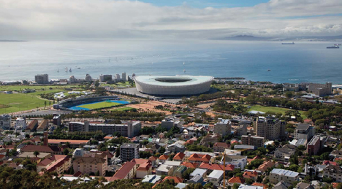
In the eighteenth century, Green Point Common was known as ‘De Waterplaats’ and stretched from Three Anchor Bay to Cape Town. The extent of the Common has been much reduced over the years as parts have been taken over for various purposes. In 1860 Fort Wynyard was built on the site of an old Dutch East India Company battery. Somerset Hospital, the first teaching hospital in South Africa, was opened in 1864.
The first horse race at the Cape was held on Green Point Common in 1797, and the Common continued to be used as a racecourse until 1890. Some of the earliest cricket and rugby matches were played here, and sports fields are still a feature of the Common today. A golf course was laid out, and the Green Point track catered for cycling and track sports.
During the Second Anglo-Boer War (1899–1902), the Common was turned into an army camp, with orderly rows of huts and tents to accommodate some of the tens of thousands of troops who poured into the country. A prisoner-of-war camp was also situated here, from which about 26 000 Boer prisoners were shipped to camps in distant St Helena, Bermuda, Ceylon and India.
The Common is now dominated by the oval Cape Town Stadium, which was constructed at a cost of R4.4 billion for the 2010 FIFA World Cup™. Construction began in March 2007, and was completed within 33 months. The 64 000-seat stadium (the capacity was reduced to 55 000 after the World Cup) replaced the old 18 000-seat Green Point Stadium, which was used mainly for soccer matches and music concerts. The building of the stadium was accompanied by a general revamp of the Common, including construction of the multipurpose Green Point Urban Park.
Cape Town Stadium is operated by the City of Cape Town, and the venue caters for soccer matches (both club-level and international), concerts and other major events. There are also training and conference facilities available.
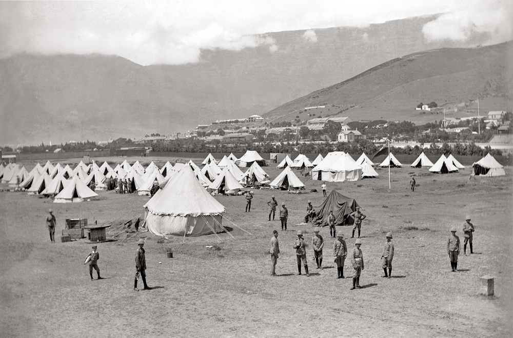
British troops encamped on Green Point Common during the Second Anglo-Boer War (1899–1902).
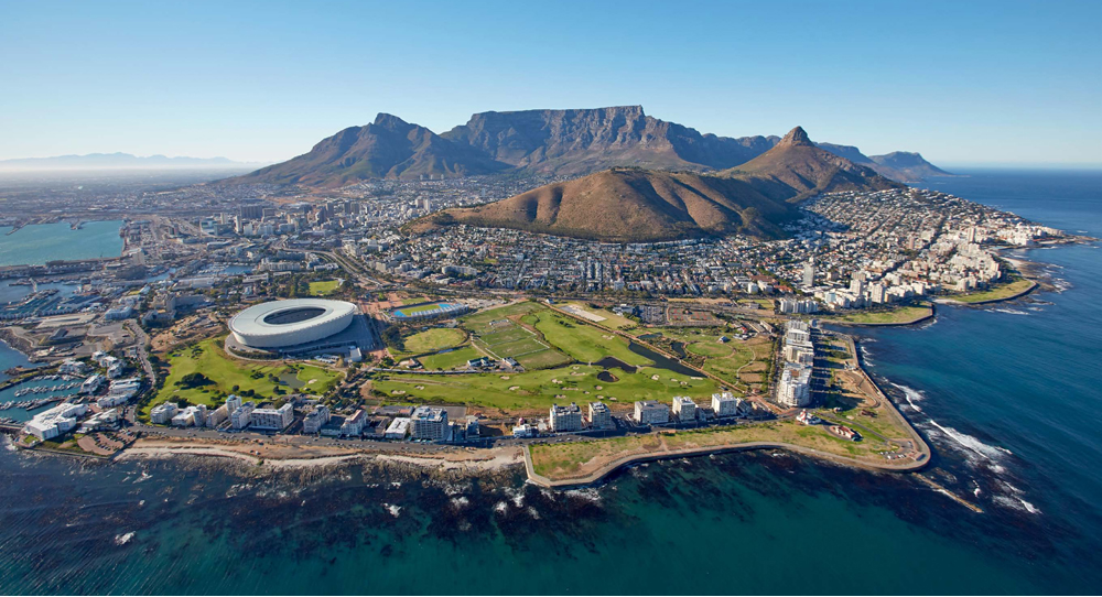
A panoramic view takes in the sweep of Cape Town’s Atlantic seaboard, from the V&A Waterfront at left, past Cape Town Stadium, Green Point, Mouille Point and round to Sea Point and Bantry Bay at far right. Above the city rises the bulk of Signal Hill and Lion’s Head, with the Table Mountain massif in the background.
ATLANTIC SEABOARD – MOUILLE POINT
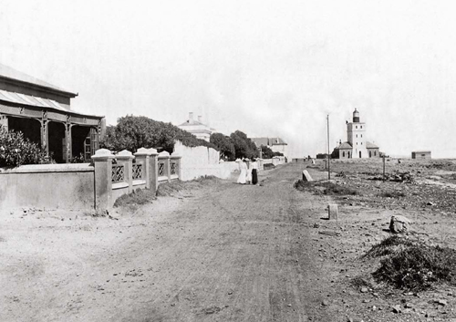
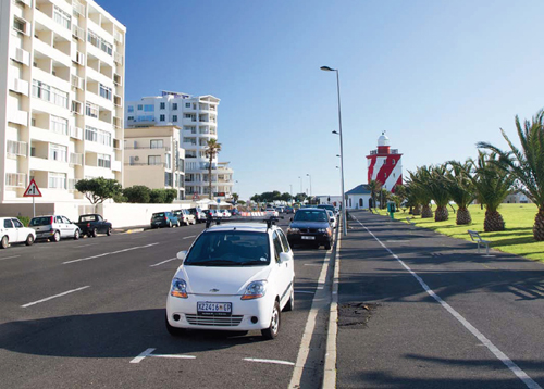
The lighthouse on Beach Road, Mouille Point, is commonly known as the Mouille Point lighthouse but is in fact the Green Point lighthouse, completed in 1824. Its popular name derives from a structure built near Granger Bay and later demolished. Green Point is the oldest lighthouse still in operation in South Africa, and is a well-known local landmark.
A government notice was published on 9 April 1824 stating that ‘the Light House, erected on the projecting Point of Land between the Great Mouillêe, or Moulin Battery, and Three Anchor Bay, under the Lion’s Rump, at the entrance of Table Bay, being now completed, the Lighting thereof will commence on Monday, the 12th instant’.
The name Mouille Point comes from the Dutch word moilje (‘breakwater’), and refers to the unsuccessful attempts, begun in 1743, to construct a mole to protect ships anchored in Table Bay. Later, in 1781, when France and Holland were at war with Britain, French troops stationed at the battery next to the abandoned mole referred to the Mouille Battery, and it is this version of the name which has survived.
In common with the rest of the Atlantic seaboard of Cape Town, the dusty, unsurfaced road and unpretentious houses have given way to a tarred road flanked by high-rise apartment buildings. The nearby seafront promenade is a popular spot for walkers, runners and dog-walkers.
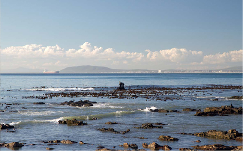
ON MONDAY 11 SEPTEMBER 1899, THE THERMOPYLAE, a steamship of the Aberdeen White Star Company under the command of Captain Philip, approached Cape Town. It was a misty night with a fine drizzle. As well as 52 passengers and a crew of 84 men, the ship carried 20 boxes of specie (valued at £100 000) and two valuable racehorses. One of these was the property of Mrs De Barthe (better known as Lillie Langtry, a celebrated actress and at one time the mistress of the future King Edward VII).
Captain Philip was misled by the mist into believing that he was further from the shore than he was. Too late he recognised the danger, and the ship struck the Mouille Point reef.
All the passengers and crew were safely landed, but the horses were left in their horse-boxes forward of the bridge. By the early hours of Tuesday morning a heavy sea was running, with waves breaking over the ship. Fortunately, the horses were eventually brought safely to land. The valuable cargo of specie was also saved.
A board of enquiry found that the loss of the ship was due to the captain’s error of judgement, and his master’s certificate was suspended for six months.
Although the photograph above shows the area where the Thermopylae ran aground, the wreckage visible in the picture is in all probability the rusted boiler machinery belonging to the RMS Athens, a steam-driven mailship of 739 tons, which was driven ashore much earlier, in fact – during the Great Gale of 17 May 1865.
ATLANTIC SEABOARD – THREE ANCHOR BAY
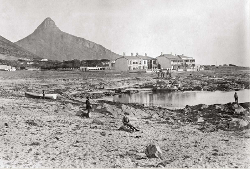
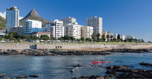
The name Three Anchor Bay was first recorded in 1661 and is supposed to refer to a defensive chain, held in place by three anchors, across the entrance to the small anchorage.
In the nineteenth century, a number of people applied to the colonial government for permission to establish business ventures at Three Anchor Bay. In 1807 Cornelis Moll wished to establish a lime-burning business ‘in the vicinity of the sea strand betwixt the so called Three Ancres Bay and the Society’s House at the westward of the Lion’s Rump’.
A year later Jan Tenius asked for a grant of three acres of ground ‘between Cape Town and the Society House … in the proximity of the Moulie and the usually so called Drie Anker’ in order to establish a vegetable garden. Neither of these gentlemen obtained the permission he sought.
In 1813 Messrs Melville and De Necker were ‘desirous of adventuring on the Establishment of a Fishery for the Catching and Curing (by salting and drying in the Sun) of Cray-fish’, which they intended to sell to Mauritius and Réunion as well as to sailors from the East. Unfortunately there is no record of whether the application was successful.
The Cape of Good Hope Almanac of 1881 lists nine private residents in Three Anchor Bay, all of them businessmen working in Cape Town, as well as a boarding house run by a Mrs De Jongh. The scene is quite different today.
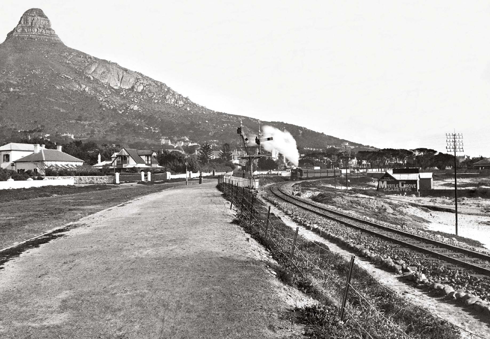
In 1889 Sea Point began to develop as a residential suburb of Cape Town. The privately owned railway between Cape Town and Sea Point was taken over by the Cape Government Railways in 1905, but could not compete with the service offered by the Electric Tramway Company. Although this was the first line in South Africa to be electrified, the fact that it was uneconomic led to the closure of the line in 1929.
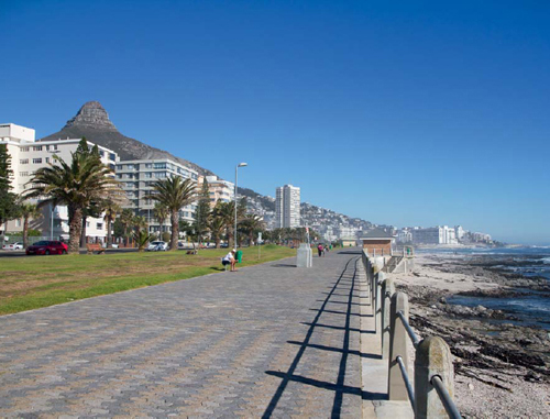
The tranquil life of Sea Point in the early 1900s has changed considerably. Blocks of flats line the beachfront, and the area is one of the most densely populated in the Peninsula.
The Sea Point promenade, a paved walkway that hugs the sea front for six kilometres, follows part of the former railway permanent way. Popular with walkers and runners, the promenade offers excellent sea views and often captivating sunsets.
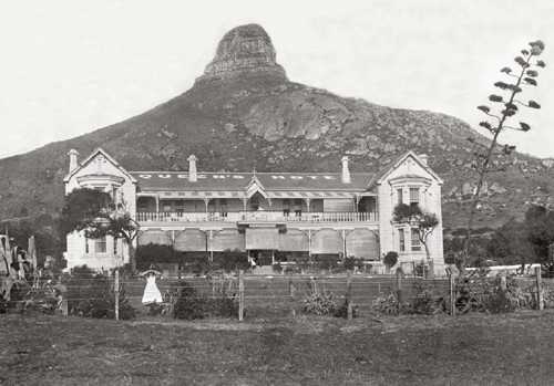
The Queen’s Hotel, a popular base for seaside holidays, stood near the shore at Saunders Rocks. The first building on this site dated from 1767 and was a recreation centre known as the Societeits Huis (‘Society House’). By 1800 it was a private home. In 1835, under the ownership of Mr Justice William Menzies, it was considerably enlarged and became known as Sea Point House.
Sea Point House first became a hotel in 1876. Initially known as the Sea Point Hotel, it was later renamed the Wenthworth Hotel. In 1887 the old structure was demolished, and an elegant building erected in its place. This was named the Queen’s Hotel in honour of Queen Victoria’s Golden Jubilee.
The hotel was built (1882–1889) by Thomas James Ingleby, who started up as a builder on his own account in 1851. He was responsible for a number of buildings in Cape Town, including the new post office building (1874) and the Standard Bank building in Adderley Street (1882).
An advertisement for the hotel in 1909 stated that it had ‘a large private garden, electric light and all modern improvements’. Cape Town was only a 15-minute journey away by railway or electric tram.
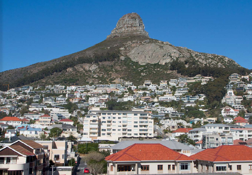
In the early 1900s, Sea Point was a place of gracious and elegant residences. Just over a century later, the suburb is heavily built up and has expanded up the mountainside.
ATLANTIC SEABOARD – BANTRY BAY
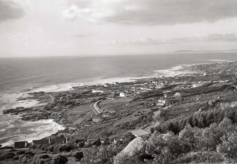
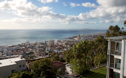
Bantry Bay was originally known as Botany Bay. A botanical garden was established here in the early 1800s by Dr Friedrich Ludwig Liesching (later the first president of the South African Medical Society), mainly for growing medicinal herbs. The garden was abandoned after a few years, but the name Botany Bay remained in use until the land was purchased by a Mr O’Callaghan. He renamed it Bantry Bay after the well-known inlet on the southwestern coast of Ireland.
This was one of the most attractive and unspoilt areas of the Cape Peninsula. After the First World War, a number of British families settled at the Cape, one of whom was Captain LG Fenner. He bought a tract of land at Bantry Bay and built a block of flats, which he named Bantry Court Flats. (The concept of living in a flat was relatively unknown in the Peninsula at the time.)
This was the first step in the development of Bantry Bay, and by the 1950s almost all the slopes overlooking the bay had been built over, and its charm had been lost. Today the coast is lined with apartment blocks, and there is virtually no access to the shore.
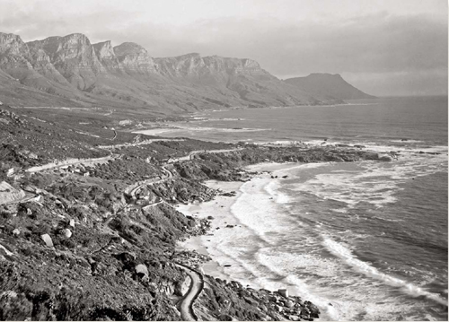
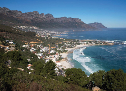
Clifton, with the tramway route visible above the coast road, was originally known as Schoenmakersgat (‘cobbler’s hole’ in Dutch), supposedly because a shoemaker lived in one of the caves in that area. The first official reference to the name was in 1802, when the Acting Governor of the Cape directed that ‘a small piece of Ground facing the sea under the Lion’s Head called Schoenmakers Gat’ be registered in the name of a Major McNab, who was to pay an annual rent of 24 rix-dollars.
The property was sold to Henry Hewitt, a merchant, circa 1829, and the house that stood here was renamed Kloof Cottage. Eventually it became a hotel. In the early 1890s a Mrs Bess Clifton was manager of the hotel, and it is likely that this is the origin of the later name Clifton-on-Sea.
Today Clifton is one of the most exclusive addresses in Cape Town, and properties change hands for many millions of rands.
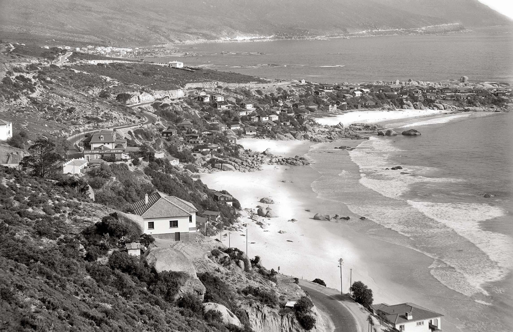
There are four beaches at Clifton, separated by falls of large granite boulders. The granite sand is dazzlingly white. These beaches are one of the few areas that are sheltered from the southeasterly wind, and this has added to their popularity. In this photograph, the Clifton-on-Sea Hotel is clearly visible on the coast road, above the rocky shore.
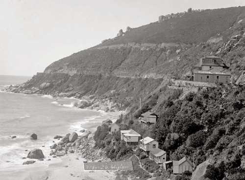
The Clifton-on-Sea Hotel is described by the Cape Town Guide of 1900 as ‘charmingly situated’ and ‘far from the noise, dust and wind of the city’. In 1905 Clifton was described in the Handbook of Cape Town and Suburbs as ‘a small group of houses just above the road, with cultivated grounds extending down the hillside towards the Clifton-on-Sea hotel – a solitary landmark on the Victoria Road’.
By 1913, Clifton was a popular camping spot, and in his book Our Beautiful Peninsula Herbert Tucker vividly describes the scene: ‘The quaint many-coloured wigwams of quite a considerable community of campers’ were clustered on the ‘steep and broken shoreward slopes’ of Clifton Bay. The camp sites were leased to summer residents, and later the lessees built bungalows on the sites, although they were not allowed to live there permanently, being required to vacate their properties in the winter. This restriction was only lifted in 1929.
In 1950 the Guide to South and Eastern Africa described Clifton-on-Sea as ‘a pretty resort’ with good rock fishing, although it warned that ‘bathing [was] dangerous, except in certain localities’.
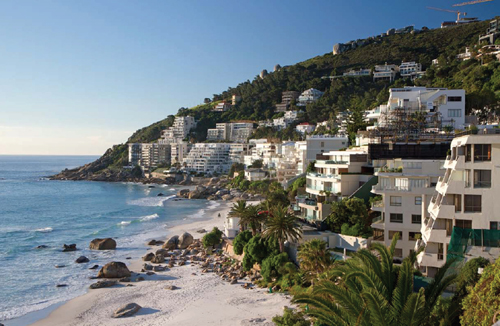
Nowadays the slopes above and below Victoria Road are crowded with ultra-luxurious homes and apartment complexes – a far cry from the modest wooden bungalows of the early twentieth century.
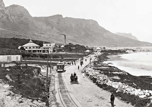
This view of Camps Bay, with the Rotunda visible on the left, shows one of the trams that ran between Cape Town and Camps Bay. The first electric trams ran in 1896. Five years later, on 9 May 1901, the line between Cape Town and Camps Bay (via Sea Point) was opened, and this initiated the transformation of Camps Bay into a popular holiday resort. The single-decker tramcars were painted in an elegant cream and chocolate livery.
In 1902, a further section of tramway was built from the terminus at Camps Bay, over Kloof Nek, to Cape Town. The 19-kilometre trip ‘around the mountain’ became a popular excursion. Travelling time along this route was an hour and a quarter, and cost one shilling and nine pence.
A guide to Cape Town published in 1904 described the tram ride from Cape Town to Camps Bay as ‘without doubt the most beautiful in the world, affording one vast panorama of matchless beauty’.
The Rotunda was built in 1904, and was the brainchild of James Riddell Farquhar, whose aim was to promote Camps Bay as a holiday resort. All kinds of events took place here, including concerts, dances, silent film shows and boxing matches.
A new section was added to the Rotunda in the 1950s. Subsequently, when new owners decided to demolish the building and put up a seven-storey block of flats, a storm of protest by Camps Bay residents led to the Rotunda being declared a heritage site.

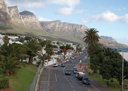
This photograph shows the tram route from Kloof Nek to Camps Bay, below the rocky buttresses of the Twelve Apostles. It was only in the 1930s that this route became a public road. It is now known as Camps Bay Drive. Near the shore is the chimney of the tramway power station and depot, with the Rotunda clearly visible nearby.
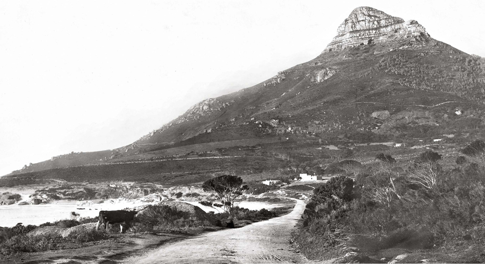
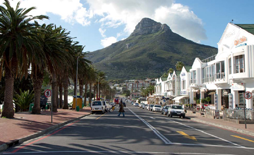
With its serried ranks of palm trees and upmarket shops and restaurants, Victoria Road is virtually unrecognisable from the days when cattle ambled beside the quiet coastal road.
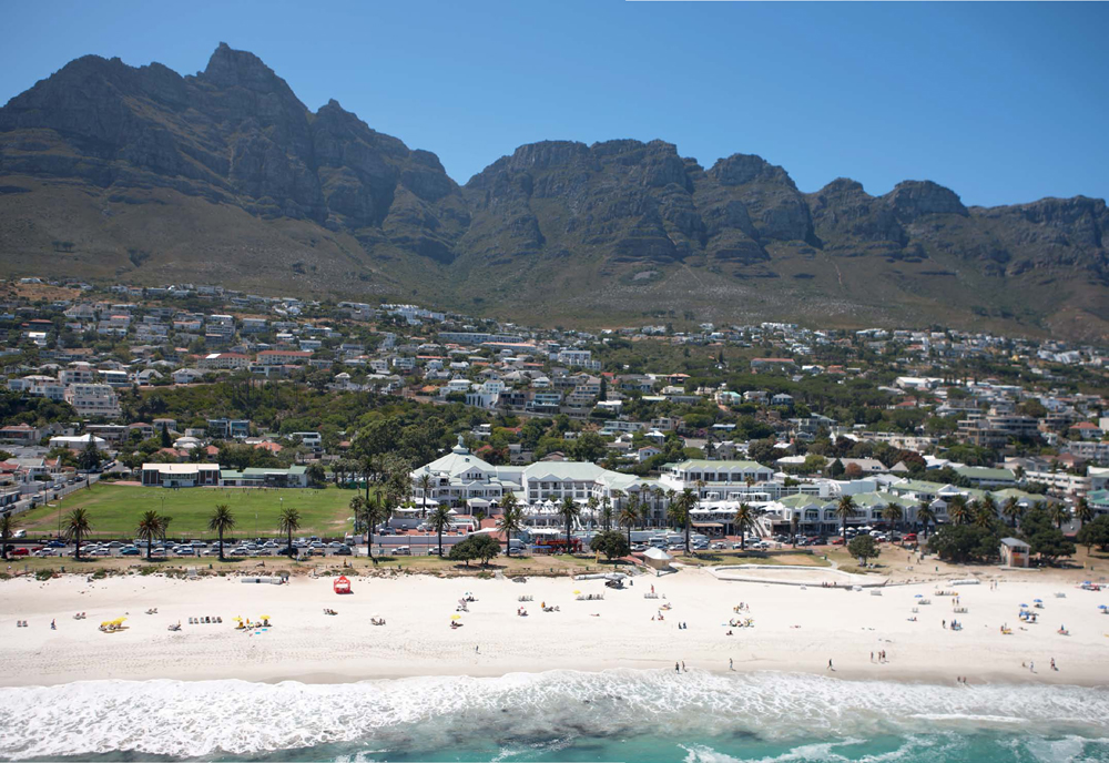
Camps Bay’s wide sandy beach makes it one of Cape Town’s most popular seaside escapes, while the tiny village of yesteryear has mushroomed into a major city suburb. The Rotunda, visible in the foreground, is now part of a luxury hotel complex and is a sought-after venue for functions such as conferences and weddings.
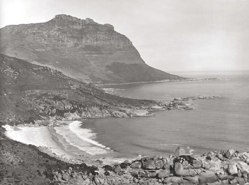
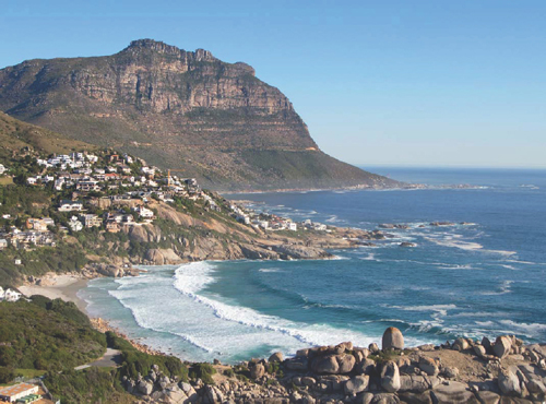
This view of Llandudno, circa 1893, was taken from Victoria Road. Llandudno is situated in a valley facing the Atlantic Ocean, with Twelve Apostles on one side and the Karbonkelberg (‘Carbuncle Mountain’) on the other. For centuries this area, known as Kleinkommetjie Bay, was inhabited by the Khoisan. A track, along which the Khoisan drove the cattle they bartered to the Dutch, ran from this wilderness to the settlement that became Cape Town. It was only in the 1880s that a proper road was built, when Thomas Bain constructed a coastal road between Camps Bay and Hout Bay. The road, opened shortly before Queen Victoria’s Golden Jubilee in 1887, was named in her honour.
In 1903 the area was declared a township. A Mrs Wege, who had recently made a trip to Britain, noticed that Kleinkommetjie Bay looked remarkably similar to the bay at Llandudno, a popular seaside resort in Wales. So it came about that the nascent village was named Llandudno.
The first house was built in 1905, but by 1930 there were still only two permanent residents. People came to Llandudno at weekends, many of them camping in the caves among the boulders in the small cove adjacent to the attractive white beach. Slowly the township grew, with houses being built right up to Victoria Road, but the area has remained unspoilt to this day.