The nine islands of the Azores floating in the Atlantic Ocean are gratifyingly rich in romantic history, cryptic legend and stunning natural beauty. You cannot ignore their volcanic origins – deep craters or calderas are their most outstanding feature. But greenery and trim, patchwork fields impose order and a surprising gentleness. With their tall cliffs and farm-quilted countryside, their tiny homesteads sprinkling the lush landscape, the islands are a magical presence in a volatile ocean.
To Portuguese explorers, who first mapped them in the 15th century, the Azores (Açores in Portuguese) became vital stepping stones in an expanding empire. Christopher Columbus, returning from his momentous 1492 voyage to the New World, took on water at the eastern island of Santa Maria. For centuries the Azores have offered a safe haven and restful stopover for other mariners.
This remote island group has an extra dimension if you share the view that the 650km (400-mile) -long archipelago’s two tiny, westernmost islands, Flores and Corvo, more than a third of the way across the Atlantic, mark the true outermost limit of Europe. The Azores’ capital, Ponta Delgada, is on São Miguel, the largest island in the group. The islands are meteorologically important to weather forecasters – an Azores High (high-pressure area) extending to the east means fine weather for western Europe.
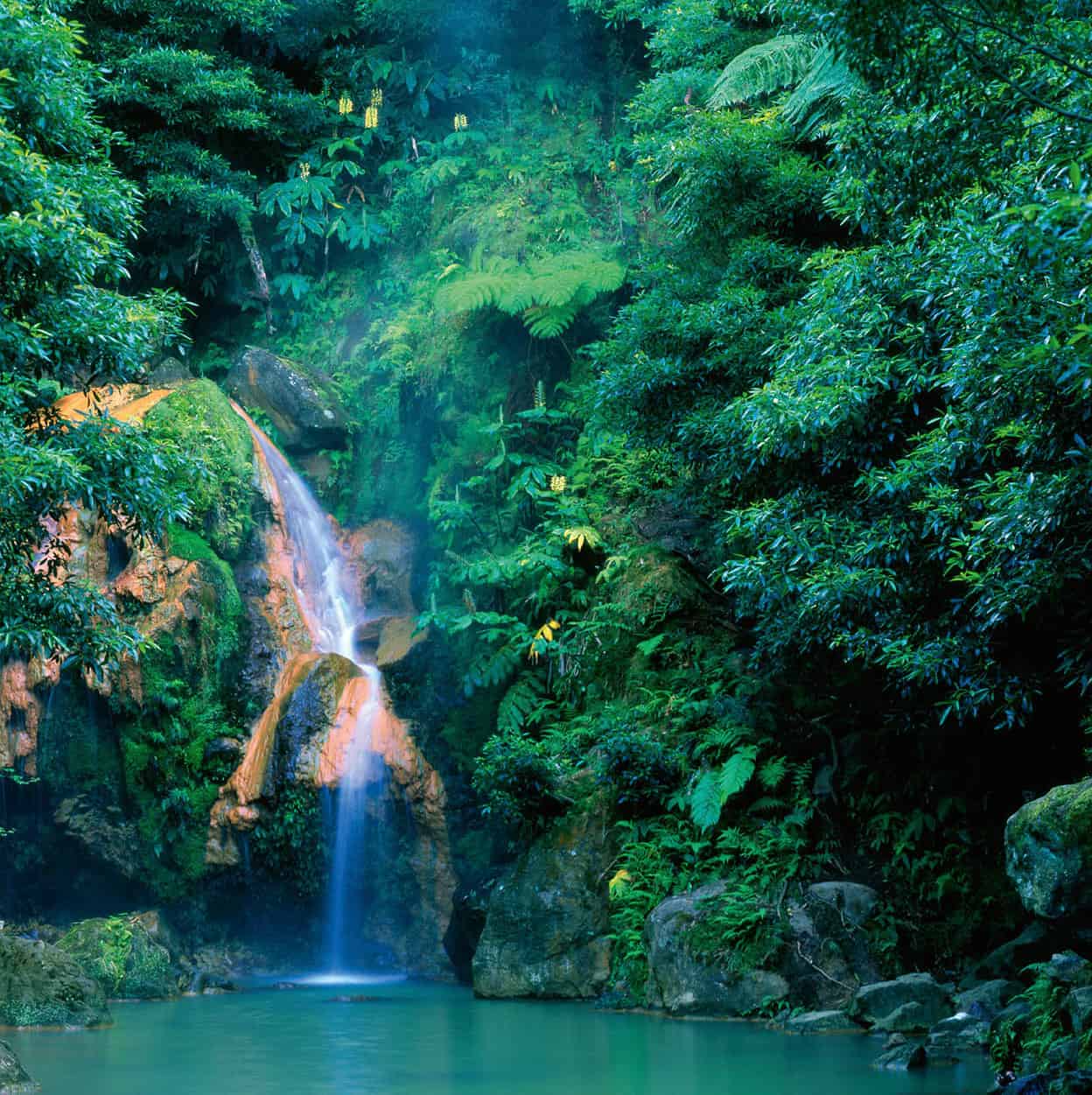
Hot ferrous waterfall in São Miguel.
iStock
Origins
The name Açores was bestowed on the archipelago by Gonçalo Velho Cabral who, with Diogo de Silves, landed at Santa Maria in 1427. These daring seafarers mistook the many buzzards there for hawks, which are called açores in Portuguese. But from myth, fable and fanciful charts, another legend persists. Here, some believe, is the lost Atlantis, from Plato’s account of a sunken empire lying beyond the Pillars of Hercules. Yet chroniclers wrote that all the islands were uninhabited when the Portuguese arrived.
In 1439, settlement officially began on the seven then-known islands (Flores and Corvo were not discovered until 1452), through the efforts of Prince Henry the Navigator. His colonisation policy was so zealous that he offered land to Flemish farmers (the connection was through his sister, Isabel, who was married to the Duke of Burgundy, ruler of Flanders). Prince Henry not only foresaw the role of the islands in his larger purpose of African discovery but, in his businesslike way, realised they could be productive and profitable, and organised the planting of wheat and sugar cane.
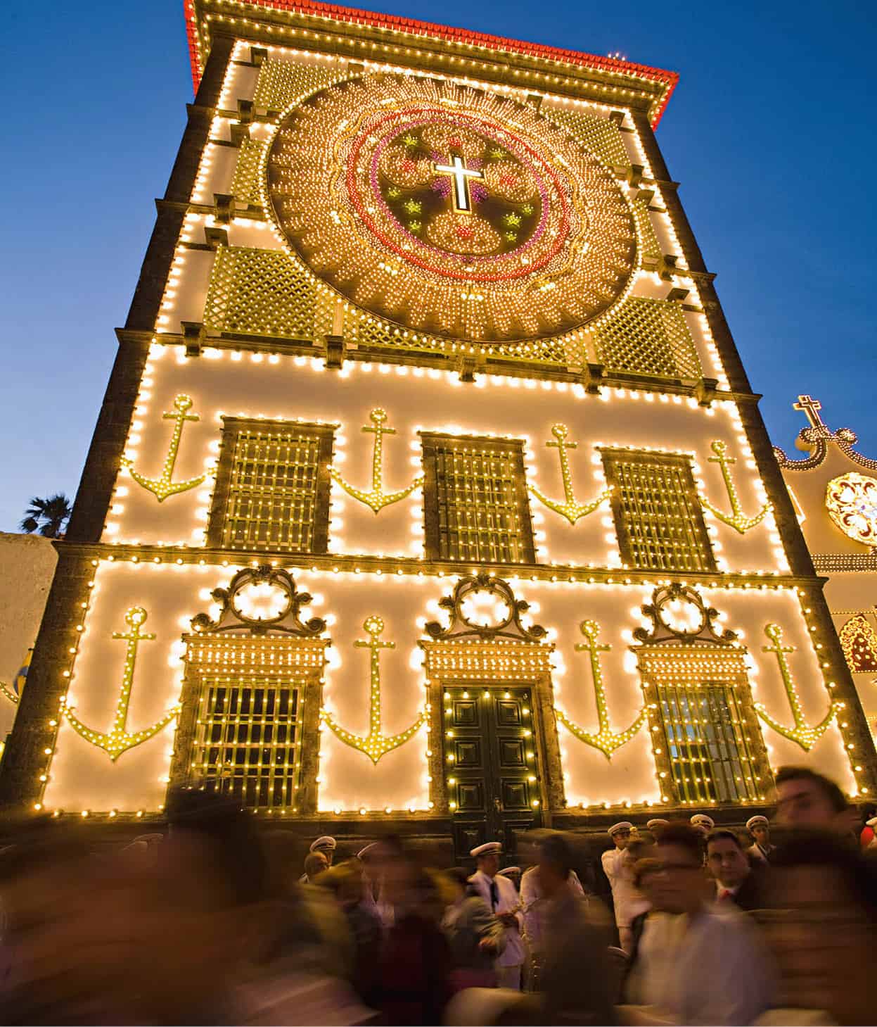
Holy pilgrimage at Convento de Nossa Senhora da Esperanza.
Corbis
Throughout Portuguese history, the islanders have held themselves apart from Lisbon, and have often chosen an opposing path. During the 19th-century War of the Two Brothers – the Miguelist Wars between two sons of King João VI – islanders supported the liberal Dom Pedro IV against his absolutist brother, Dom Miguel, who had the support of most of Portugal.
Hardy islanders today still live by farming and fishing. There’s a significant dairy industry. You will see cows milked on steep hillsides, their milk occasionally still carried in churns by farmers on horseback. But there are more cerebral pursuits, too, and from the Azores have emerged many of the finest poets, novelists and philosophers in Portuguese culture. One of several daily newspapers, O Açoriano is the third oldest in Europe. The islands’ identity was established long ago; autonomous government came in 1976, two years after the coup that toppled Salazar’s dictatorship (for more information, click here).
Island attractions
The Azores are gradually attracting more tourists, but still remain off the radar. Great for walking holidays, they are full of pleasant surprises, and invite the visitor to explore. In other words, a dream world for anyone seeking unspoilt nature, tranquillity and the chance to “get back to basics”. What they are not, though, are bland resorts for sophisticates or sun worshippers. There are relatively few sandy beaches, and these are mostly volcanic black. The weather is mild (the winter averages 14°C/57°F, summer 23°C/74°F) but except for June to September, it is often wet and windy.
Island pleasures are unpretentious and relaxed. You will discover awe-inspiring scenery of stunning beauty, luxurious vegetation with exotic plants (50 of 850 species are endemic), enchanting lakes amid extinct craters, tranquil hill country with rolling fields and lush meadows, magnificent coasts lined by picturesque villages and historical towns, and spectacular hydrangea hedges crisscrossing the landscape. There is also much to see in the daily working life, which still has a rather traditional aspect. Entertainment is generally limited to discos and bars. Custom and religion are served by frequent festas, and the striking Baroque churches carved from basalt.
Espírito Santo cult
On the island of Terceira, gaudy chapels (impérios) reflect the islanders’ ardour for the Espírito Santo cult, which originated in medieval Germany and was promulgated in Portugal through the teachings of the 17th-century Jesuit priest, António Vieira, and brought to the Azores by early Portuguese settlers. On Whit Sunday, the day of the Holy Spirit, there are processions in towns and villages throughout the island, and many villages have regular Sunday celebrations. A child is usually crowned as an ‘emperor’, and bears a sceptre, overseeing the ensuing festivities. Local people believe that worship of the Holy Spirit – whose insignia, a crown, sceptre and a white dove, are kept in the impérios – will protect their communities from volcanic eruptions, earthquakes, and damage from storms.
You can see the relics of a long tradition of whaling, and will encounter the sons and grandsons of whaling men – and, in summer, numerous emigrant families on annual trips home. The Azores are worth a visit even if you only have time to see São Miguel. The Government Tourist Office (Turismo) is very friendly and helpful, and the Portuguese Tourist Board will provide plenty of information (for more information, click here).
The islands are ideal for walking. The more ambitious can climb Pico (Peak) on Pico island: at over 2,300 metres (7,550ft), this is Portugal’s highest mountain, but there are numerous less demanding hikes. Additionally, an expanding number of sports facilities range from deep-sea fishing, whale-watching and diving to golf and tennis.
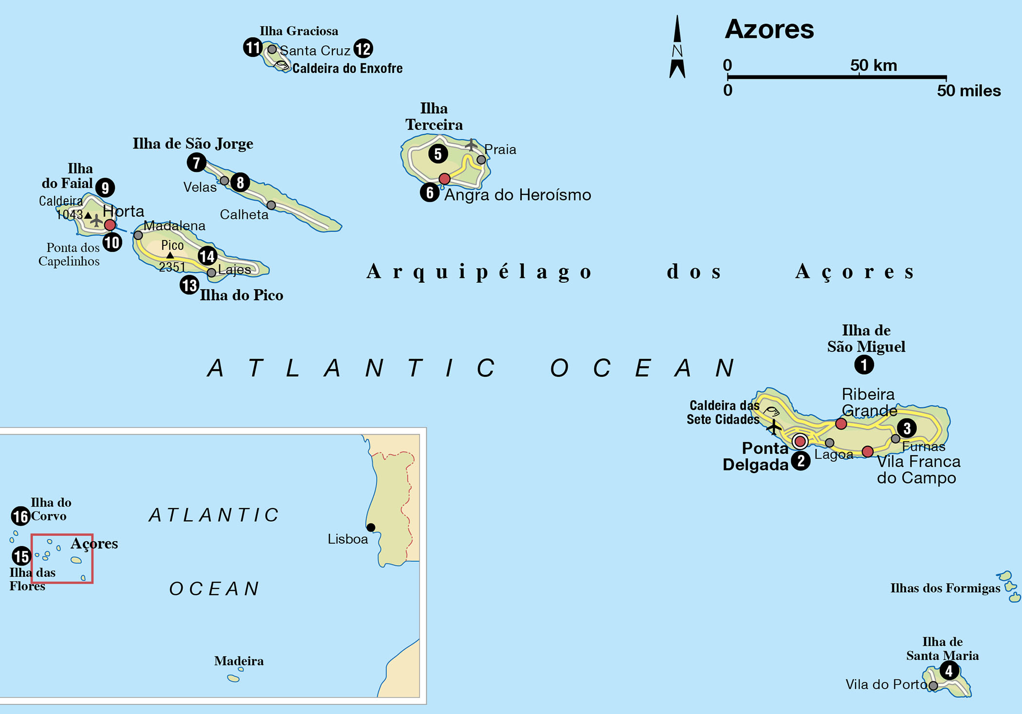
The islands divide naturally into three groups: São Miguel and Santa Maria in the east; Terceira, São Jorge, Graciosa, Faial and Pico in the centre; and Flores and Corvo to the west.
Tip
The main tourist office in the Azores is on Avenida Infante Dom Henrique, in Ponta Delgada, São Miguel island, tel: 296 288 082; www.visitazores.com.
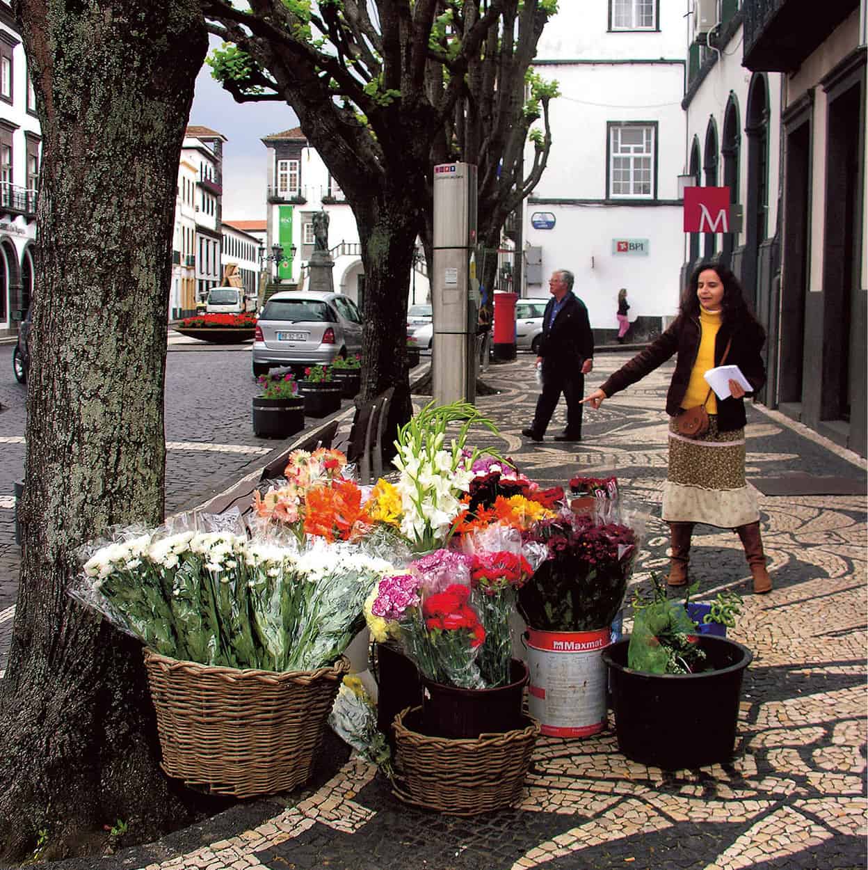
A flower vendor in Ponta Delgada.
Pictures Colour Library
São Miguel
São Miguel 1 [map] is perhaps the most varied of the islands. It is also the largest, measuring 65km by 16km (40 miles by 10 miles), and the most populated, with nearly half the archipelago’s population of 246,000.
On the south coast, the capital of Ponta Delgada 2 [map] sprawls behind the waterfront – the Avenida Infante Dom Henrique – with its arcades and 18th-century city gates. The town is dramatically set off against numerous small volcanic cones rising on the distant hills. City sights include several fine Baroque churches, among them the 16th-century parish church, Igreja Matriz de São Sebastião. Also of architectural interest are the Palácio da Conceição, which houses the government; and the curious Baroque Casa de Carlos Bicudo with its mermaid facade.
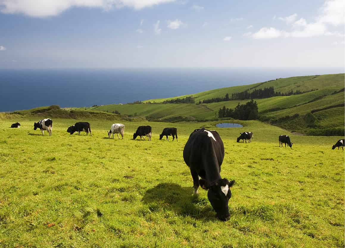
Milk cows grazing on a pasture overlooking the Atlantic.
Corbis
For a view that overlooks the city, head for the Reduto da Mãe de Deus, where in 1944 an ill-informed anti-aircraft battery shot at an aircraft carrying General Eisenhower on his way home. There’s a good museum, the Museu Carlos Machado (museucarlosmachado.azores.gov.pt; Tue–Sun 10am–6pm), in the 16th-century Convento de Santo André (there are two other branches in the Church of the Jesuite College and the Santa Bárbara Centre on Rua Dr. Carlos Machado), with exhibits on the island’s natural history and ethnography, as well as folk art, paintings and sculpture.
In the west of the island are the enchanting twin lakes within the Caldeira das Sete Cidades (Cauldron of the Seven Cities). This is best viewed from Vista do Rei (The King’s View), but you will be able to spot only one sleepy village in the crater. In sunlight, one lake is blue, the other green – stemming, legend has it, from the tears of a princess forced to part from her shepherd lover. A half-day circuit of the island might lead past pineapple plantations (visitors welcome) just north of the capital, on to Sete Cidades and the promontory of Ponta dos Mosteiros, eastwards to Capelas and its tobacco fields, and finally to the historical town of Ribeira Grande. Further east are the Caldeiras da Ribeira Grande, a small spa in picturesque surroundings, and the tea plantations of Gorreana (http://gorreana.pt; open to the public daily 9am–8pm).
Eastwards from Ponta Delgada, past sandy beaches, are the potteries of Lagoa and the diving centre at Caloura, and, beyond, the attractive town of Vila Franca do Campo with three ornate Baroque churches. The municipal museum (Tue–Fri 9am–12.30pm and 2–5.30pm, Sat–Sun 2–5pm) has a good collection of musical instruments and pottery. Above Vila Franca, the pilgrimage chapel of Senhora da Paz affords a splendid view over the south coast. Just offshore, accessible from the pretty harbour, is the tiny crater island of Ilheu, with a natural seawater swimming pool.
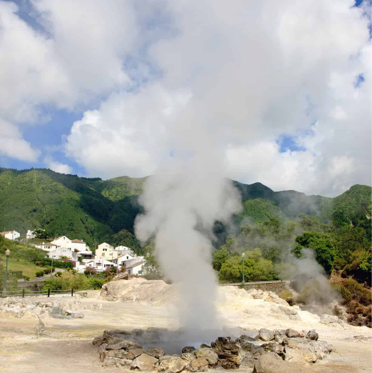
Hot springs, or furnas, on San Miguel.
iStock
Northeast and inland, past the crater lake of Lagoa das Furnas, is the village of Furnas 3 [map], with hot springs and boiling mud cauldrons that give off the rich stink of sulphur. But here, too, is the famous Terra Nostra botanical park with more than 2,000 different trees, a volcanically heated lake you can swim in, and a pleasant hotel and restaurant, the Terra Nostra Garden Hotel. The dish of the house is cozido à Furnas – meats and vegetables steamed in underground ovens. For a picnic, you can boil your own eggs in the hot springs beside the crater lake.
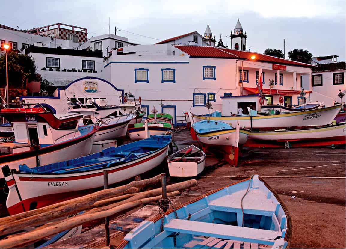
The harbour at Terceira island.
SuperStock
Santa Maria and Terceira
The island of Santa Maria 4 [map], only 17km by 9km (10 miles by 5 miles), has peaceful fields and red-roofed whitewashed houses in a southern Portuguese style (initially settlers came from Algarve and Alentejo). Today there are some 5,552 inhabitants. Apart from the underlying volcanic massif, there is also sedimentary rock, and the beaches therefore are a shining gold, in bright contrast to the more usual volcanic black. Santa Maria is the driest, sunniest island, often called the “Algarve of the Azores”. Just north of the airport in Anjos is the reconstructed church, where Christopher Columbus once knelt in prayer. The main town is Vila do Porto. The nearby Dalberto Pombo Environmental Interpretation Centre (tel: 296 206 790) displays several collections on the island’s natural heritage.
In the central group, Terceira 5 [map] (29km by 17km/18 miles by 10 miles) derives its name from the fact that it was the third island in the archipelago to be discovered. All the settlements on Terceira stretch along the coastline, while the unpopulated interior of the island – a wild and rugged landscape partly covered with native brushwood of tree heather, juniper and mosses – is often enveloped in clouds.
Terceira is distinguished by its capital, Angra do Heroísmo 6 [map], which is, deservedly, on Unesco’s World Heritage list – it is undoubtedly the most beautiful town in the archipelago. Once the capital of the Azores, it was granted its heroic title by Queen Maria II, the daughter of Dom Pedro IV, whose regency the island stoutly supported. Severely damaged by an earthquake in 1980, Angra has largely recovered. Its cathedral (constructed between 1570 and 1612 and considered the largest temple of the archipelago), plus several churches, castles and palaces, are of considerable interest. The municipal museum, Museu de Angra de Heroísmo (Ladeira de São Francisco; tel: 295 240 800; Tue–Sun 10am–5pm), is a good place to learn more about the island’s history. A circuit of the island encompasses stunning views of green patchwork fields subdivided by stone walls. Terceira’s most boisterous festas are around 24 June, the day of São João (St John the Baptist), and include touradas à corda, the running of rope-restrained bulls.
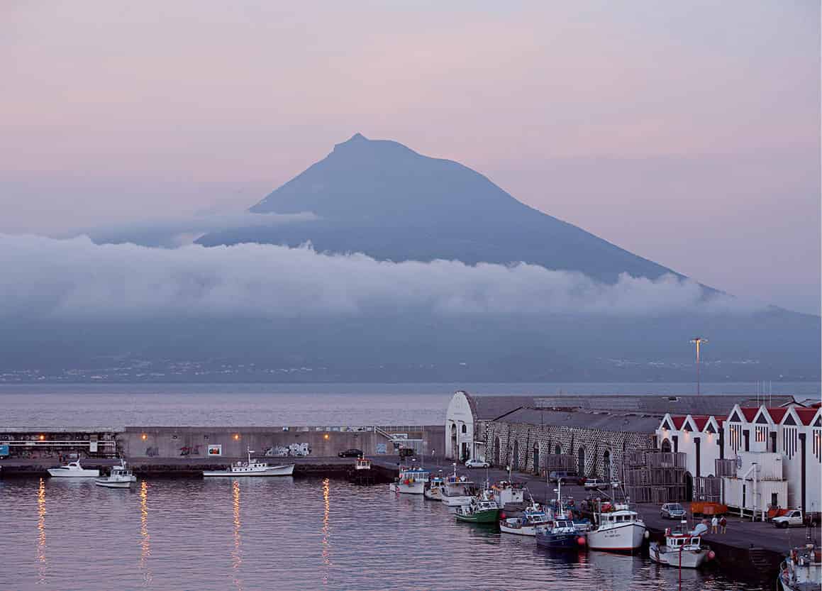
View of Horta harbour with Pico Mountain at dusk.
Corbis
From São Jorge to Corvo
Beautiful São Jorge 7 [map], 56km (35 miles) long by only 8km (5 miles) wide, rises abruptly from the sea and culminates in a mountain ridge that is often shrouded in mist. Besides its glorious natural setting, São Jorge affords magnificent views of all the central islands. Almost all the villages are set on small coastal plains (fajãs) at the foot of tall cliffs; some hamlets can only be reached via narrow footpaths. This island is another excellent choice for walkers. The Fajã da Caldeira de Santo Cristo natural reserve is also a surfer’s Mecca and the only place in the Azores where clams grow. Velas 8 [map], with stunning views across to Pico, is the main town and a good base to explore the island and to buy the excellent local cheese. Among its main attractions are several churches, an 18th-century Baroque town hall, natural pools and the Museum of Sacred Art (tel: 295 412 214).
Faial 9 [map] rises almost symmetrically on all sides to the central Caldeira, an eerie crater with a depth of some 300 metres (1,000ft). Faial’s epithet, “Blue Island”, was inspired by its hydrangea hedgerows running like blue ribbons over the countryside in June and July – a stunning sight for people used to seeing these bushes only in neat parks and gardens.
The lively capital of Horta ) [map] is extremely pleasant, with some interesting museums and churches. Its harbour is a port of call for transatlantic sailors, with each crew commemorating their journey by painting a picture on the mole (breakwater). It is said that this ritual secures divine protection for the rest of the journey. The famous Peter Café Sport (www.petercafesport.com) is a well-known meeting spot for sailors, seamen and even spies, which has been in business since 1918. Ponta dos Capelinhos is a dramatic contrast to the lively town and flowery countryside: here, in 1957–8, an undersea volcanic eruption rumbled and grumbled and left a legacy of vast, grim dunes of dark cinder. The Porto Pim Whale Factory Museum (Fábrica da Baleia) provides an interesting insight into what used to be one of the island’s main industries.
Graciosa ! [map] is as gracious as its name suggests, with soft sloping hills and peaceful villages scattered over the island. Yet it also has a volcanic heritage: in Caldeira do Enxofre you may descend 182 stone steps to a huge cavern (furna) with a sulphurous subterranean lake. In the small, tidy capital of Santa Cruz @ [map] it becomes obvious why Graciosa was known as the “White Island”: all its houses are traditionally whitewashed. Graciosa is home to the archipelago’s smallest seabird – the endemic Monteiro’s storm petrel which nests on the islets off the coast.
The towering peak which gives the island its name is the main reason to visit Ilha do Pico £ [map], but a look round the island reveals fertile countryside in the east and bizarre rocky regions (called mistérios) in the west, which have been flooded by lava comparatively recently. In the sheltered enclosures between dry-stone walls, grapes are grown to produce the local wines.
In Lajes $ [map], a small whaling museum, the Museu dos Baleeiros (Tue–Fri 9.15am–12.30pm, 2–5.30pm, Sat–Sun 2–5.30pm) recalls the all-too-recent past, when men went out hunting the giant creatures: Herman Melville’s Moby Dick is set in these waters. Rising to over 2,350 metres (7,700ft), majestic Pico is the highest mountain not only in the Azores but in the whole of Portugal. To climb the main peak (this is best done in summer), you will need proper gear and a reliable route-finder.
Ilha das Flores % [map] (17km by 12km/10 miles by 7 miles) does not abound in flowers, as its name suggests. But it is the most humid island of the Azores, its wet climate accounting for the lush evergreen vegetation. Flores offers some wild landscapes that are quite different from those of the other islands: basalt predominates, in the form of high-lying, boggy plateaux where waterfalls plummet down over steep rock faces. In the capital, Santa Cruz, there is the charming ethnographic Museu das Flores (Mon–Fri 9am–12.30pm and 2–5.30pm), in a converted convent, with displays about life on the island and interesting, quirky artefacts.
From Flores, a boat runs daily, weather permitting, to Ilha do Corvo ^ [map] (corvo means crow in Portuguese), which measures only 6km by 3km (4 miles by 2 miles). It is the smallest and quietest island in the archipelago, with the 430 inhabitants all living in Vila Nova, which is the only village. Corvo’s prime sight is a tranquil lake embedded in an isolated crater, whose swampy islets reputedly resemble a map of the Azores. The voracious birds after which the island was named can still be seen around the shores.
Where
Between April and October, daily whale-watching trips are organised (see www.visitazores.com for details) by Espaço Talassa in Lajes, on Ilha do Pico (tel: 292 672 010; www.espacotalassa.com). Trips last around three hours and are preceded by a multimedia presentation (on dry land) all about the creatures you are hoping to see.