Two
VISION,
GROUND BREAKING,
WATER INFRASTRUCTURE
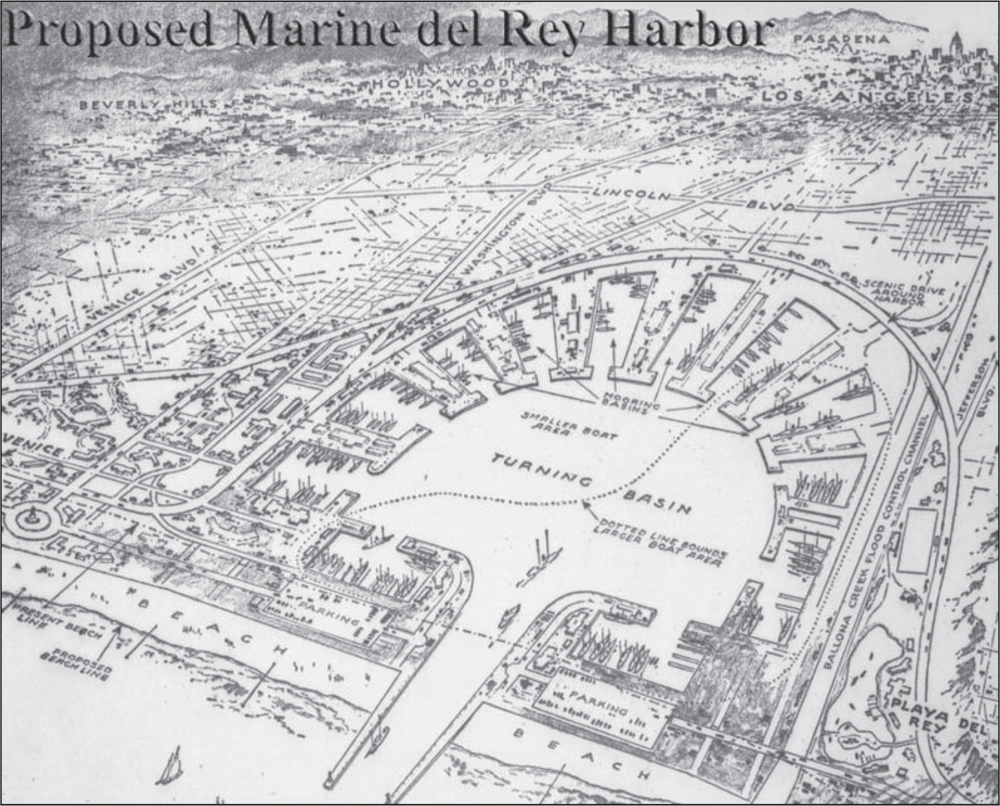
Los Angeles County engineers drew up several footprints of the marina, to be built just north of Ballona Creek. The original “Playa del Rey Harbor” map dated 1947 shows a circular design, with basins and docks arrayed around the perimeter and dirt disposal for mole development. The US Army Corps of Engineers 1955–1956 revised plan for Marina del Rey Harbor considered prevailing winds and angled the entrance channel to keep heavy seas from reaching moorings. (Courtesy of Tom McMahon.)
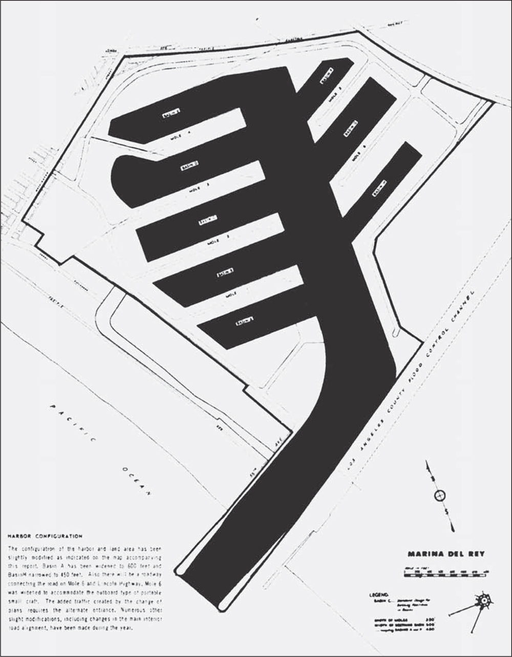
This image, taken from a map bidder’s package, includes the following caption: “The configuration of the harbor and land area has been slightly modified. Basin A has been widened to 600 feet and Basin H narrowed to 450 feet. Also there will be a roadway connecting the road on Mole 6 and Lincoln Highway. Mole 6 was widened to accommodate the outboard type of portable small craft. The added traffic created by the change of plans requires the alternate entrance.” (Courtesy of US Army Corps of Engineers.)
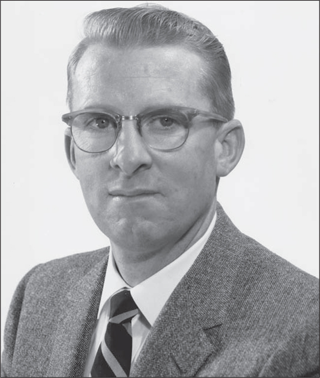
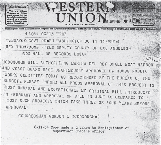
On January 21, 1954, the chief administrative officer of the County of Los Angeles, Arthur J. Will (pictured), and field deputy Rex Thomson wrote a five-page letter to Congressman Gordon McDonough, requesting federal help to eliminate a blighted area and build a small-craft harbor. A Western Union telegram (below) was received by Thomson five months later and taken to Burton W. Chace. A second, later telegram confirmed approval of the Marina Del Rey Project by the House of Representatives on July 16, 1954. (Both, courtesy of LACDBH, 1954.)
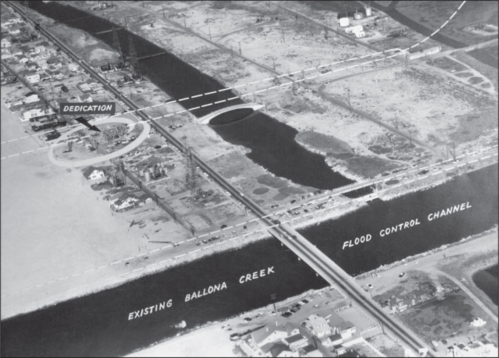
The circle at left, at the beach, indicates the group of dignitaries participating in the long-awaited ground breaking for the marina. The dotted white lines show the location of the entrance channel. The mammoth job of dredging the basins and reinforcing the bulkheads and seawalls has begun! (Courtesy of LACFD.)
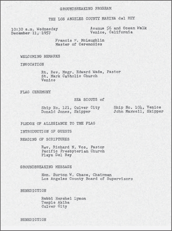
The dedication took place on December 11, 1957, at Avenue 56 and Ocean Front Walk in Venice, California. Francis McLaughlin was master of ceremonies; Sea Scouts presented colors and the pledge of allegiance; Hon. Burton W. Chace gave the ground-breaking message in the presence of several religious leaders. Connolly-Pacific Company of Long Beach began construction. (Courtesy of LACDBH.)
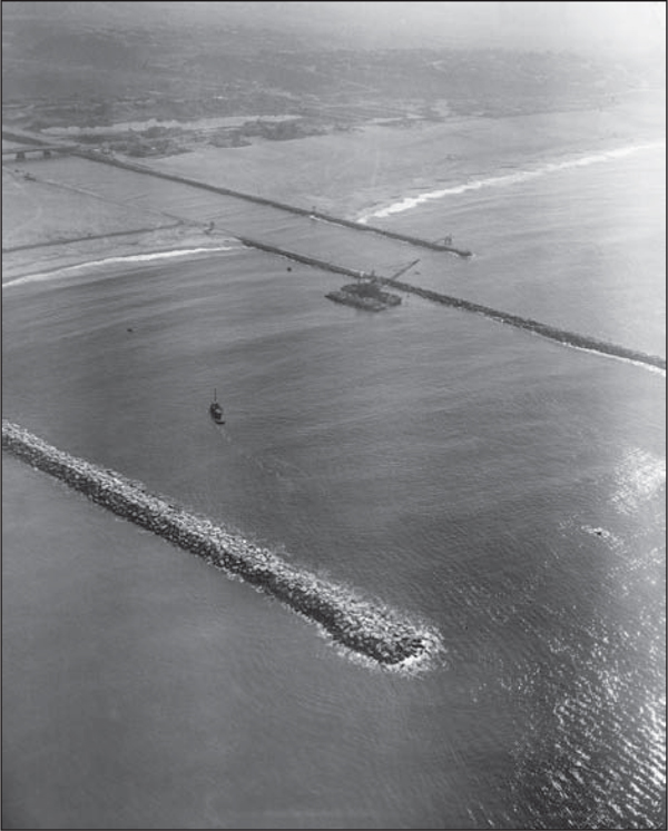
Marina del Rey’s north and south jetties were built with rocks carried by barges from a Catalina Island quarry, 26 miles away. The barge and crane are visible in the center of this 1958 photograph. The jetties lined the entrance channel into the Pacific Ocean prior to the dredging. The south jetty was an extension of the Ballona Creek exit into the ocean. (Courtesy of LACFD.)
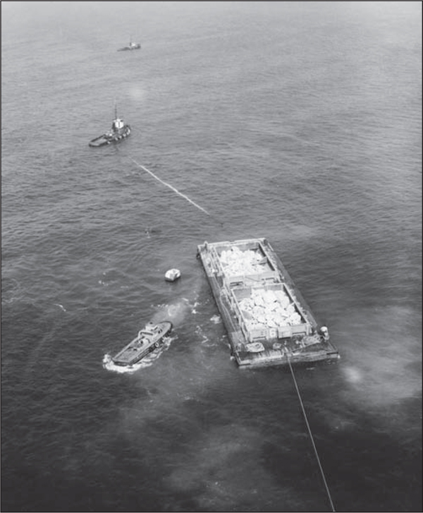
The US Army Corps of Engineers oversaw construction of the north and south jetty walls, containing the main channel. Large barges filled with boulders were towed from Catalina Island. Tugboats in the convoy ensured that the barges made the journey without incident. The giant crane stacked the rocks so as to reduce wave action for boats entering the harbor. This photograph was taken in 1958. (Courtesy of LACFD.)
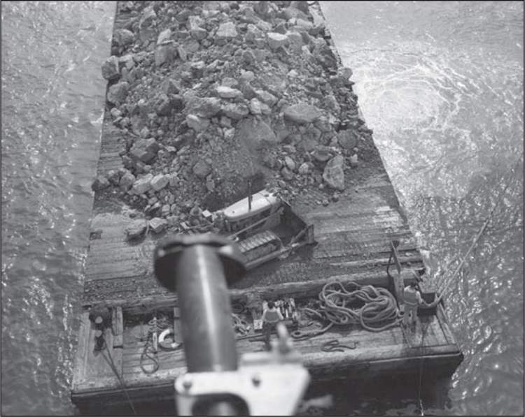
The volume of rocks and the size of the barge are evident, compared to the bulldozer traveling on the barge and the almost invisible persons handling the towlines. A portion of the dredge hose is seen in this 1958 photograph. (Courtesy of LACFD.)
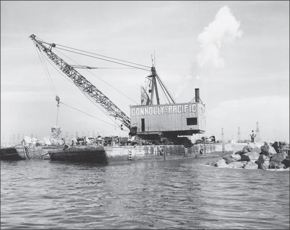
A large crane hoists rocks off the barges as it builds the north jetty and extends the south jetty. Known for quality construction of docks and wharves, Connolly-Pacific Company of Long Beach, California, was awarded the contract for the Marina del Rey water infrastructure. This photograph is dated October 16, 1958. (Courtesy of LACFD.)
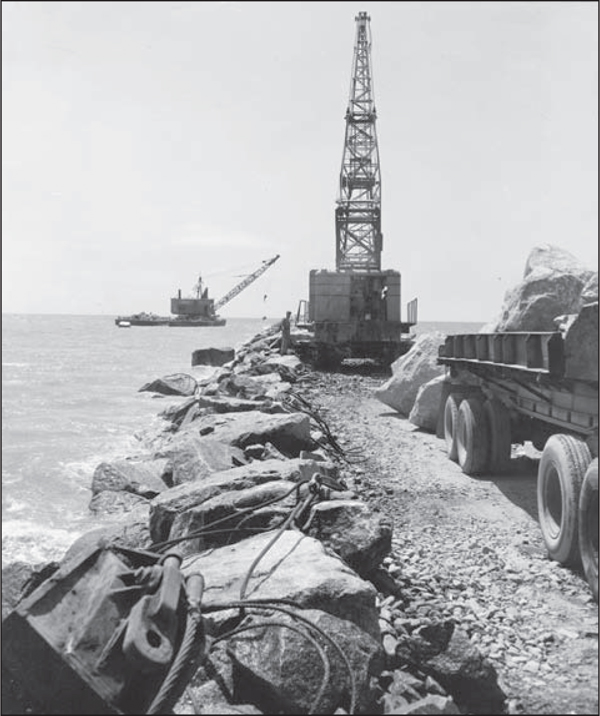
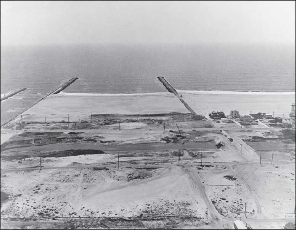
In the photograph to the right, another huge crane on the north jetty lifts rocks into place, completing construction prior to the actual start of dredging the sand and ocean bottom between the jetties. In the photograph below, a dirt berm and dam are being constructed between Ballona Creek and the north jetty to continue traffic between Venice and Playa del Rey while the entrance channel and main channels are being built. The Pacific Ocean is contained to the beach line while the entrance channel, east of the berm (center foreground), is dredged. Pre-dredge seawall construction is evident in the right half of the photograph, taken in 1958. (Both, courtesy of LACFD.)
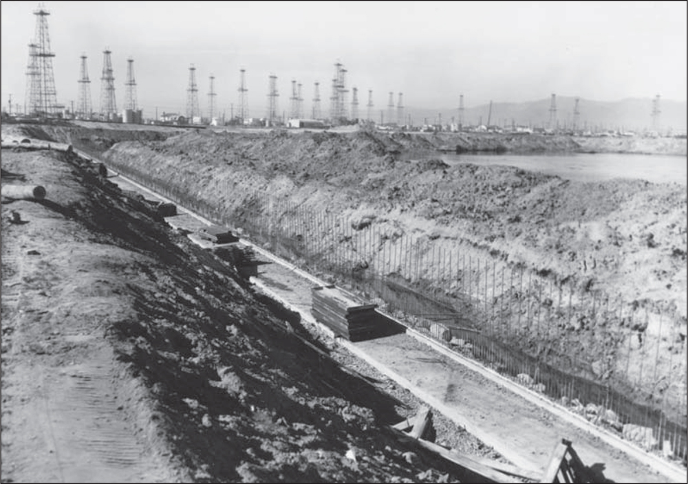
Trenches are being dug for anchors of reinforced concrete seawalls and dams to prepare for gradual excavation of the enclosed basins. In this 1959 photograph, mounds of earth are heaped to one side. Oil derricks are visible in the background. Most of them are no longer producing wells, and they will be removed as dredging and seawall construction progresses. (Courtesy of LACFD.)
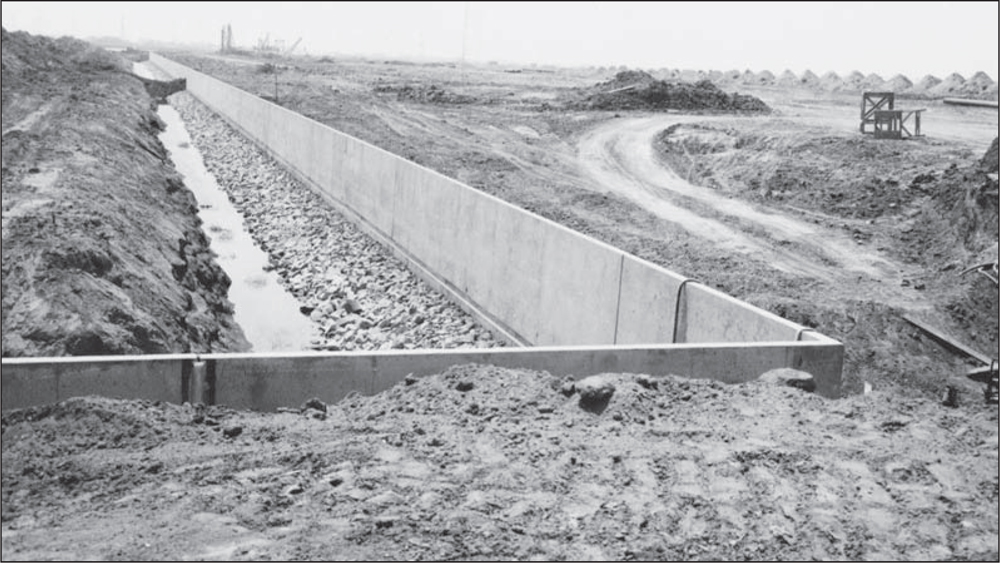
Seen here in 1960, the concrete reinforced bulkhead is complete in this section. The dirt materials are ready to be dredged. The natural sea level of the seeping water table is evident. Rock riprap has been poured at the base of the bulkhead to strengthen and mitigate wave action against the seawall. (Courtesy of LACFD.)
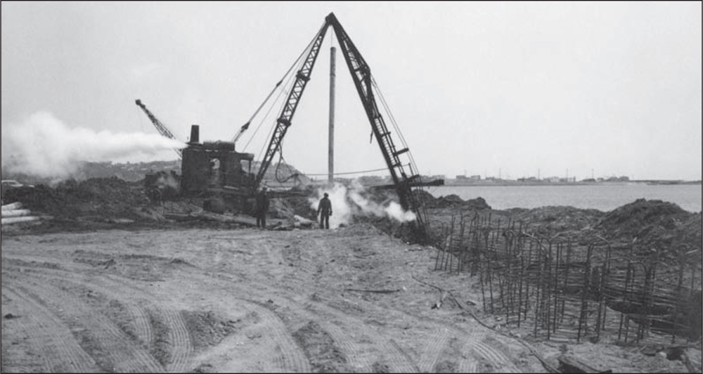
As the trenching for the seawalls continues, the pile driver sinks 30-foot piles to reinforce the bulkheads at each basin. There were 7,500 piles driven on the basin perimeters. The main channel waterway has been partially dredged in this 1960 view looking south toward the Playa del Rey bluffs. (Courtesy of LACFD.)
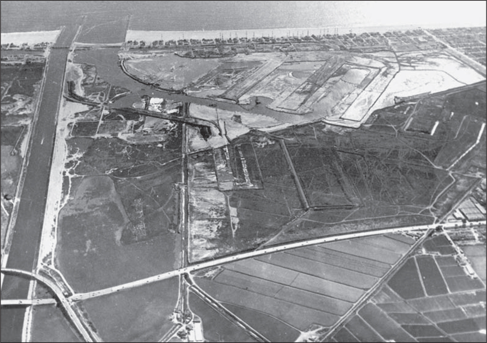
The Ballona Creek channel is at the left in this 1960 photograph. The main channel is at the top left, with ocean water on both sides of the Pacific Avenue berm. Dredging of the inner entrance, main channel, and side basins has now begun. The faint white lines in the center of the photograph are footprints of the concrete seawalls being built to the configuration of the harbor. (Courtesy of LACFD.)
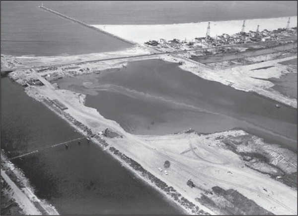
A few oil wells are still standing on Pacific Avenue in 1960. The roadway is connecting to the Ballona Creek Bridge, and more of the entrance channel has been dredged. Dirt roadways are intertwined throughout, as mud and sediment continue to be relocated. It is estimated that the volume of dirt relocated in the building of the marina would fill over eight Los Angeles Coliseums. (Courtesy of LACFD.)
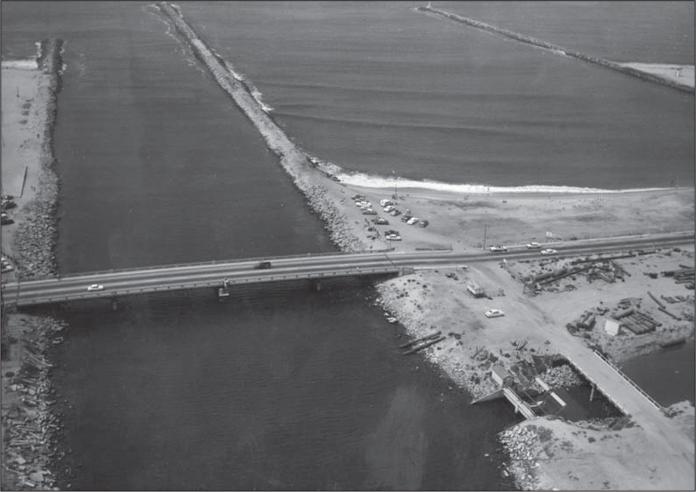
As seen in this 1960 photograph, the entrance channel is clearly dredged between the north and south jetties. Pacific Avenue is still connected by roadway over the berm and onto the bridge over Ballona Creek going south (left) into Playa del Rey. The Grand Canal of the former Venice canal system is being fitted with sluice gates (lower right corner) to allow tidal action to flow into the canals still extant in the city of Venice. Sluice gates allow ocean water to enter the dredged entrance channel. (Courtesy of LACFD.)
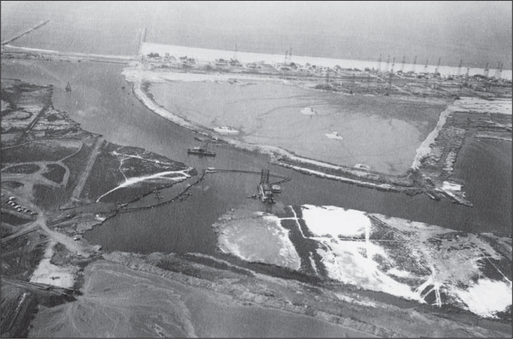
In this view of the area being dredged, the dredger pumps out sediment from the entrance channel. Basin A (center right) has been partially dredged in this September 1960 aerial photograph. The earth-water slurry is being discharged through the hoses to specific areas, which will become earthen moles, filled and modified for land development with utilities, sewers, and roads. Marina del Rey harbor is becoming a reality. (Courtesy of LACFD.)
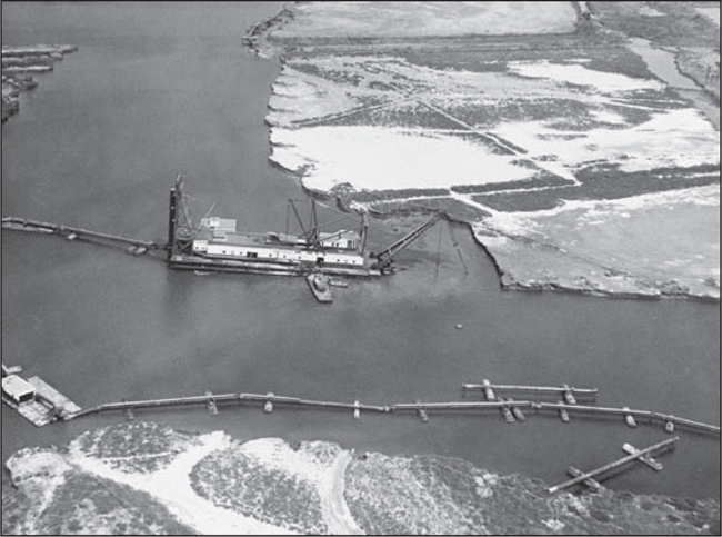
This 1960 photograph offers a view of the “suction dredge.” This device pumps its mixture of mud and water through movable pipes, which then deposit the slurry into shoreside pools, where the earth settles to the bottom and the water is drained off the top. This process removes the earth from the channels contained by earlier seawall construction. The deposits build up land for mole development. (Courtesy of LACFD.)
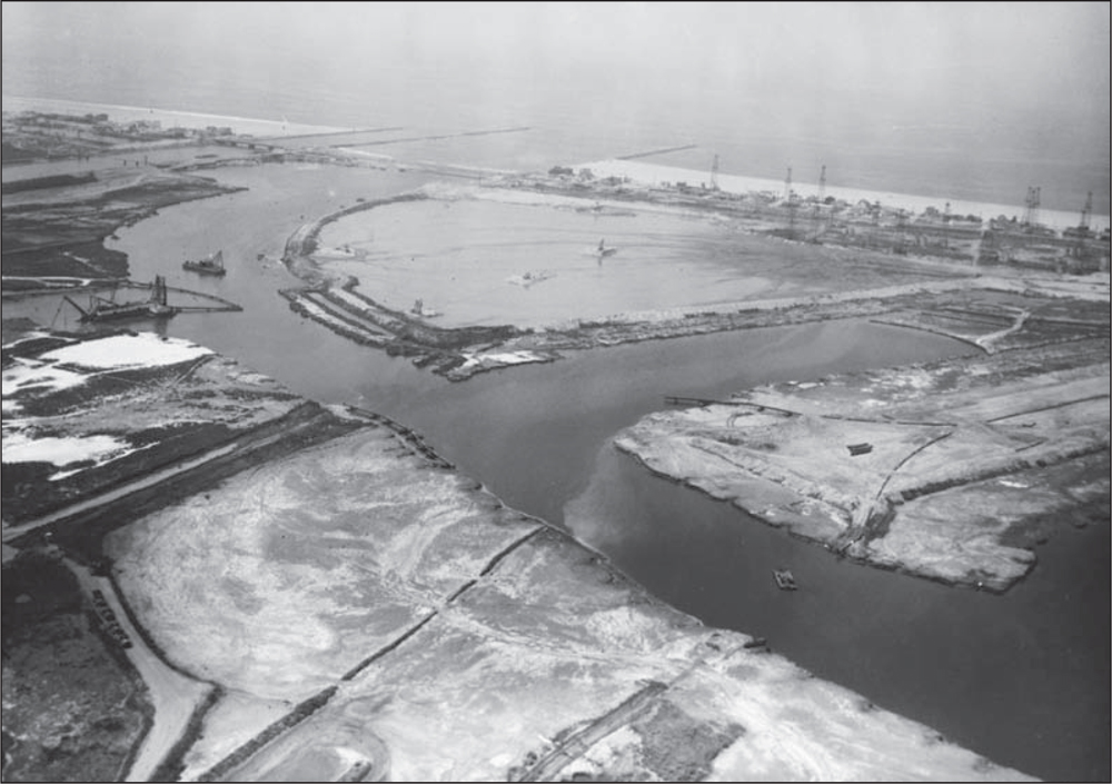
The view in this 1960 photograph faces west to the Pacific Ocean. The dredging process has progressed up Basin A. The future fuel dock is at the corner site of the upper landmass (center). A few oil wells remain on the peninsula. (Courtesy of LACFD.)
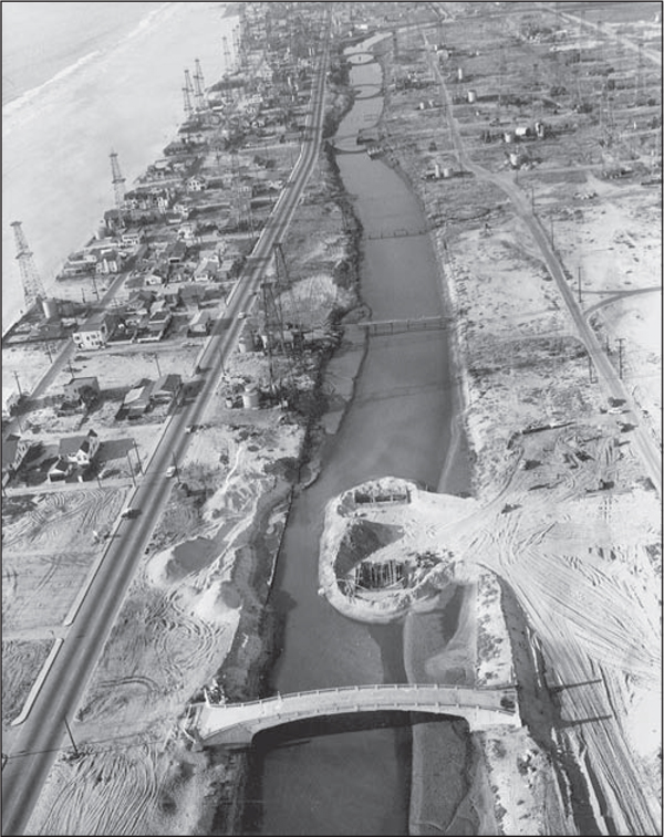
In order to maintain adequate tidal action and ocean flow into the Grand Canal, which will now open to the ocean through the harbor entrance channel instead of via Ballona Creek, two oil wells were removed and capped. In this 1959 photograph, the two coffer dams (circle area) are adjacent to the Lighthouse Bridge (center bottom) connecting the peninsula with the marina development. (Courtesy of LACFD.)
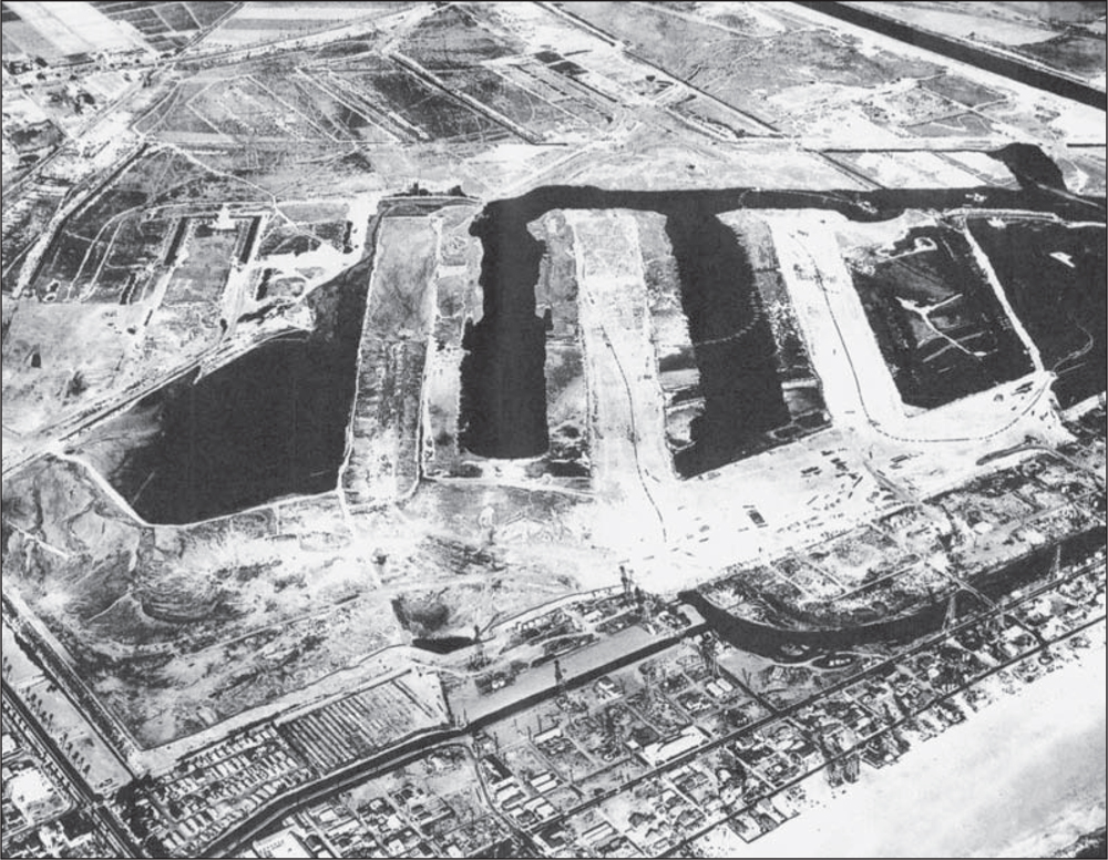
Shown here being dredged around 1960 are, from left to right, Basins D, C, B, and A. Basin D has much the same shape as Mud Lake in the 1940s and 1950s. That area will become Marina Beach, nicknamed “Mother’s Beach.” More sand will be brought in to create a family-oriented protected beach and small-boat sailing area. A very faint outline of the concrete seawall perimeter around the basins toward the top of the photograph indicates the planned footprint of Marina del Rey, still to be dredged. (Courtesy of LACFD.)
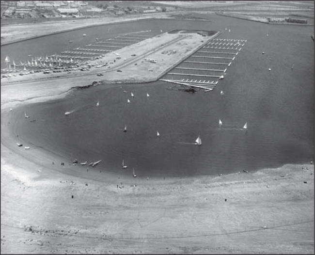
Mother’s Beach was created with additional sand. Sailboats are visible on the water in this 1962 photograph. The mole between Basins D and E has a roadway, Palawan Way, and boat docks under construction. The docks at far left have boats berthed in Basin E. (Courtesy of LACFD.)

This 1961 aerial photograph shows the dredged main channel, running from the Pacific Avenue berm (lower right) to the north head wall boundary of the marina (left of center). Basins E and F have visible perimeter outlines made by earlier construction of the seawalls, where dredging will take place. The photograph shows that the marina has eliminated much of the marshlands to the north (left) of Ballona Creek, which runs from lower right to middle top of picture. Wetlands remain on the south side (right). The city side of the marina has yet to be dredged. The Westside area of Los Angeles is beginning to fill with residential and commercial properties. The connecting roadway from Pacific Avenue over the entrance channel via the bridge over Ballona Creek is evident. (Courtesy of LACFD.)
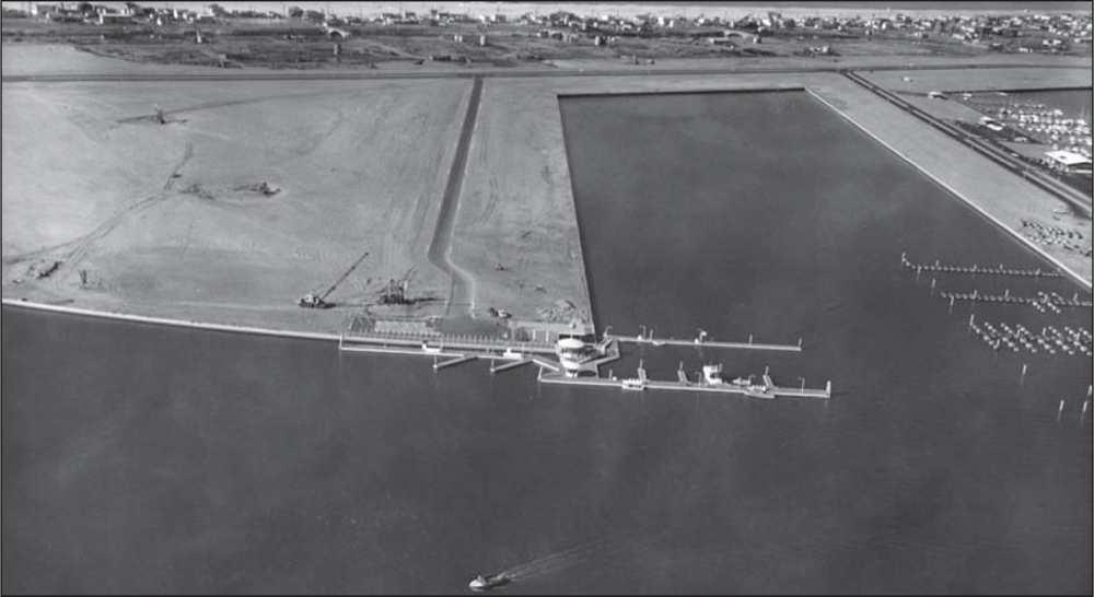
The Union Oil fuel dock, built on the corner of A Basin and the main channel “turning basin,” could accommodate 24 vessels at one time. It claimed to be the world’s largest pleasure-craft fuel dock. Bora Bora Way (paved road left of center) connects to Via Marina Way at the top of the frame. Some original oil derrick structures are visible in the background. This photograph was taken in 1962. (Courtesy of LACFD.)
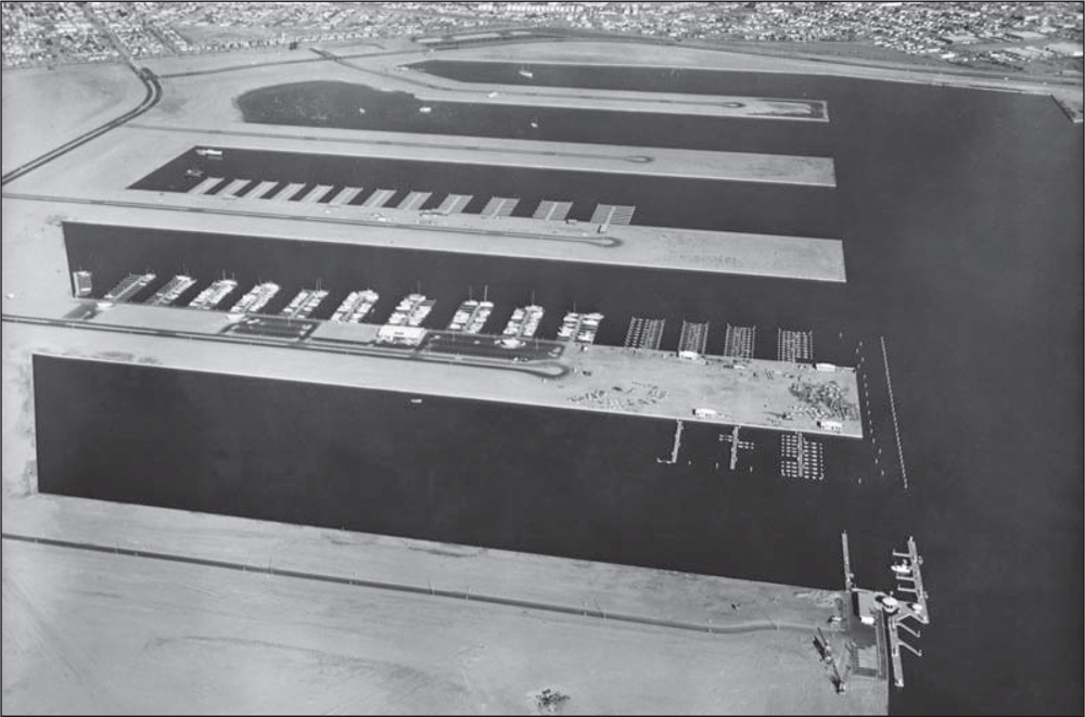
In this view looking north in 1962, five basins are complete. They are, from front to back, Basins A–E. Basin B shows “fingers” extending from the north side. This is the first marina opened, Westside Marina, in September 1962. In Basin C, the fingers of Villa del Mar Marina are being established. Via Marina roadway (upper left) is angling into Admiralty Way (top). (Courtesy of LACFD.)
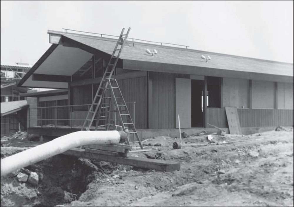
The first structures built in 1962 in Marina del Rey included the Los Angeles County (LAC) Administration Center for the director of Marina del Rey, his staff, and their planners. The Harbormaster’s Office opened in May 1962, with docks for patrol boats. The US Coast Guard station shown here was under construction at the same time as the Harbor Patrol station. (Courtesy of LACDBH.)
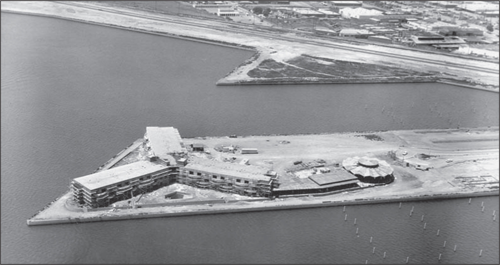
The Sheraton hotel opened in August 1962. It suffered financial shortfalls in the early years, coincident with the storm surge problems, and then declared bankruptcy. The hotel leasehold was purchased, and the establishment was renamed Marina del Rey Hotel in the late 1960s. (Courtesy of LACDBH.)
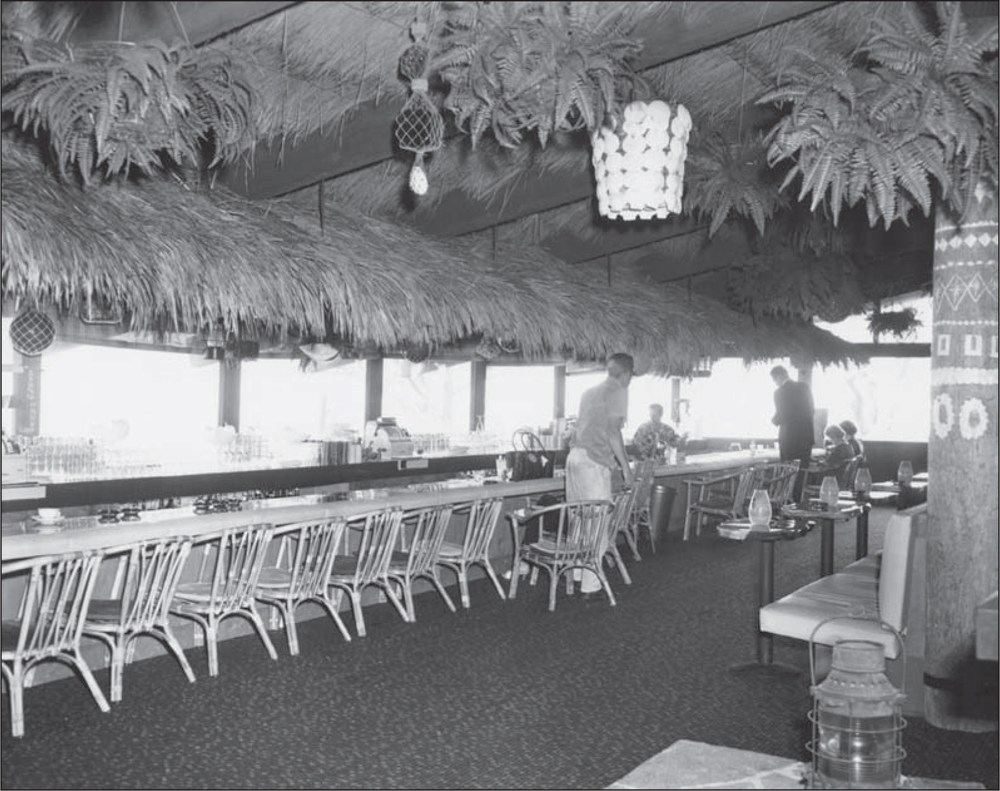
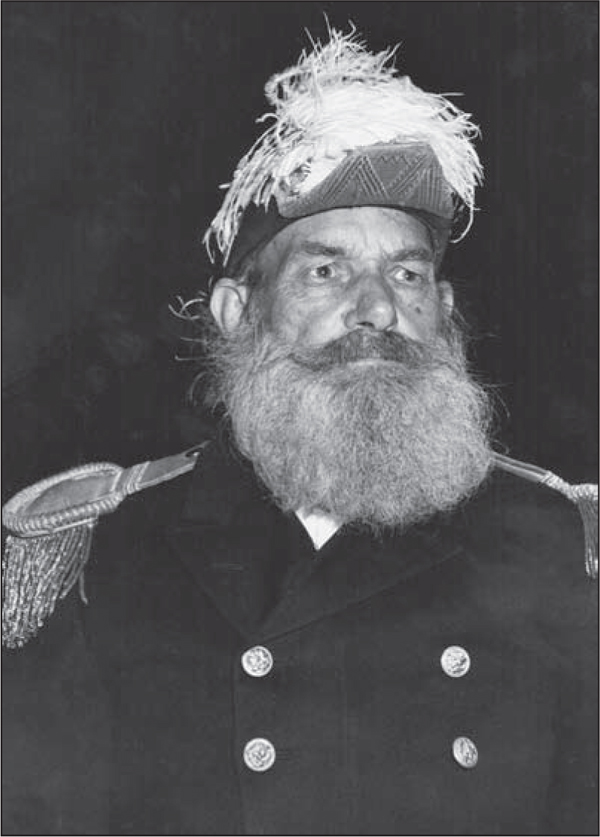
Pieces of Eight restaurant (above) was built next to the Harbor Department on Fiji Way. The streets in Marina del Rey are named for tropical Pacific Ocean islands. The restaurant’s tropical decor, food, and exotic drinks were unique to the area at the time, making Pieces of Eight very popular. In the early 1960s, Capt. Long John Silver (right), dressed in pirate’s costume and peg leg, stood on Lincoln Boulevard by the unimproved roadway leading to the restaurant, beckoning diners to the water’s edge of the newly opened marina. He was a public-relations boom, as motorists were captivated and drawn to visit the new marina. (Both, courtesy of LACDBH.)
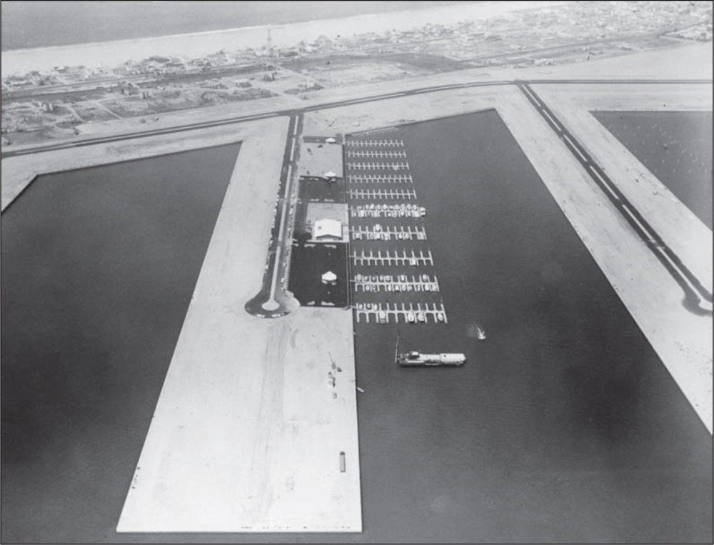
The water infrastructure was completed in 1962. The dredging operation left the marina in December 1962. Recreational sailboats and powerboats moved into the new Westside Marina, Parcel 36, in August. Boat owners from other Southern California marinas brought their craft to the new marina, happy to be closer to home. Among the new tenants was Commodore William DeGroot, who was also a commissioner for California Boating and Waterways. (Courtesy of LACDBH.)
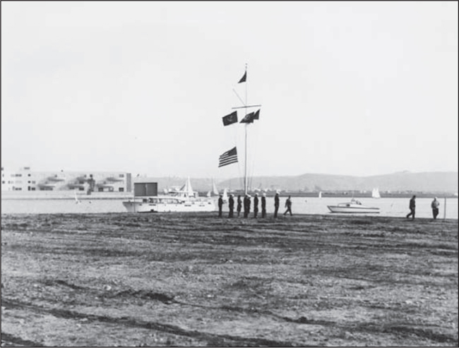
As most boat owners were optimistic about a wonderful water experience, the Del Rey Yacht Club looked to the future by building its own clubhouse on an ideal leasehold, pictured here in a 1962 dedication. The Del Rey Yacht Club signed its lease with Los Angeles County on March 27, 1962. However, the clubhouse was not completed until 1965. (Courtesy of LACDBH.)


