Four
LAND DEVELOPMENT,
FISHERMAN’S VILLAGE,
PUBLIC SERVICES
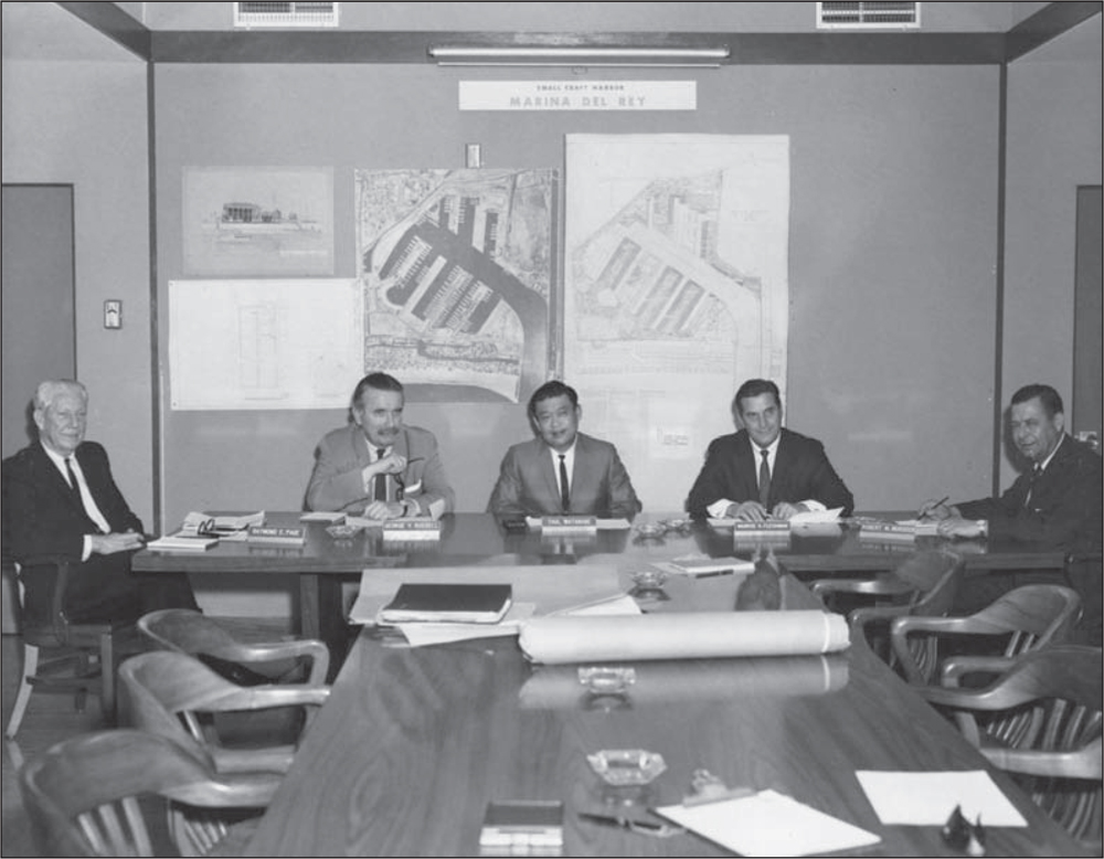
Marina del Rey development was controlled by the Design Control Board, whose members were appointed by each supervisorial district. The members in 1962 are, from left to right, Raymond E. Page, George V. Russell, Taul Watanabe, Maurice Fleishman, and Robert M. Murdock. Every project’s architectural designs, signage, parking, and extra components were subject to review and approval. When passed, the project was also reviewed by county staff. Final approval was given by the county’s board of supervisors. (Courtesy of LACDBH.)

Charley Brown’s Steakhouse lost no time in applying for the leasehold at the “head of the marina.” Its site, on Admiralty Way, had a north-south view of the marina and no anchorage slips. Located close to the site of the former Mud Lake, the restaurant, seen here in 1965, became an immediate favorite of sailors and diners. Its current name is Tony P’s Bar & Grill, a popular dining spot. (Courtesy of LACFD.)

Sailing scenes, such as the one shown in this 1966 photograph of a Snipe sailboat and a Lido sailboat, were typical of the view from Charley Brown’s restaurant. Boat slips were ultimately added for the adjacent Station 110 Fire Station. The California Yacht Club has several fingers of slips in front of the current Tony P’s Bar & Grill. (Courtesy of LACFD.)
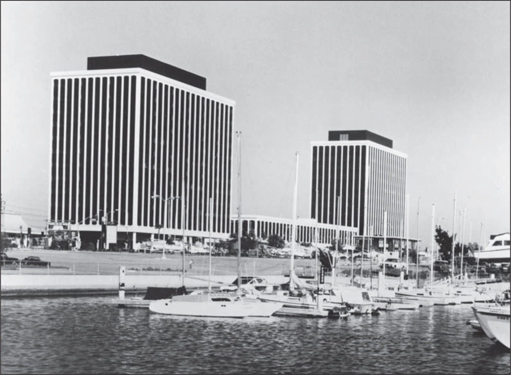
The TriZec Towers, built by a Canadian development company, were originally named Marina Airport Plaza. However, the name was often confused with other “airport” buildings that were actually closer to Los Angeles International Airport (LAX). North and South Admiralty Towers did not prove to be a popular name, either. The TriZec Towers are occupied by doctors, lawyers, a bank, the University of Southern California Sea Grant, and other professional tenants. (Courtesy of LACFD.)

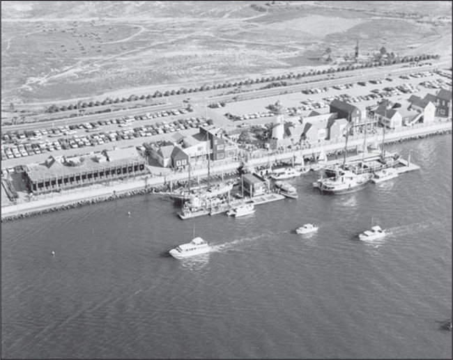
A harbor cruise loads at the concrete dock in the Fisherman’s Village area in 1966. Little Toot, a tugboat, was the perfect vessel to cruise the basins at about five knots. Passengers could view the various structures being built and just enjoy the fresh air and water experience. (Courtesy of LACDBH.)
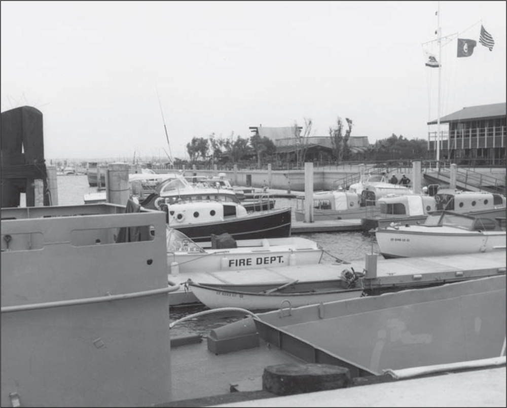
In the early days of the marina, one fireboat existed. It could be run by an engineer, captain, and fireman. While docks and facilities were being built, the Harbor Patrol, with two boats, shared the docks with the fireboat and the lifeboats that were used by the Coast Guard. This photograph was taken in 1962. (Courtesy of LACDBH.)
Flags fly on the yardarm in front of the Harbor Administration Center building, indicating that the facility has been commissioned. Pieces of Eight restaurant can be seen in the background of this 1963 photograph. The lifeboats used by the US Coast Guard were finally supplemented with the addition of the 82-foot cutter, which was readied for blue-water rescue. (Courtesy of LACDBH.)
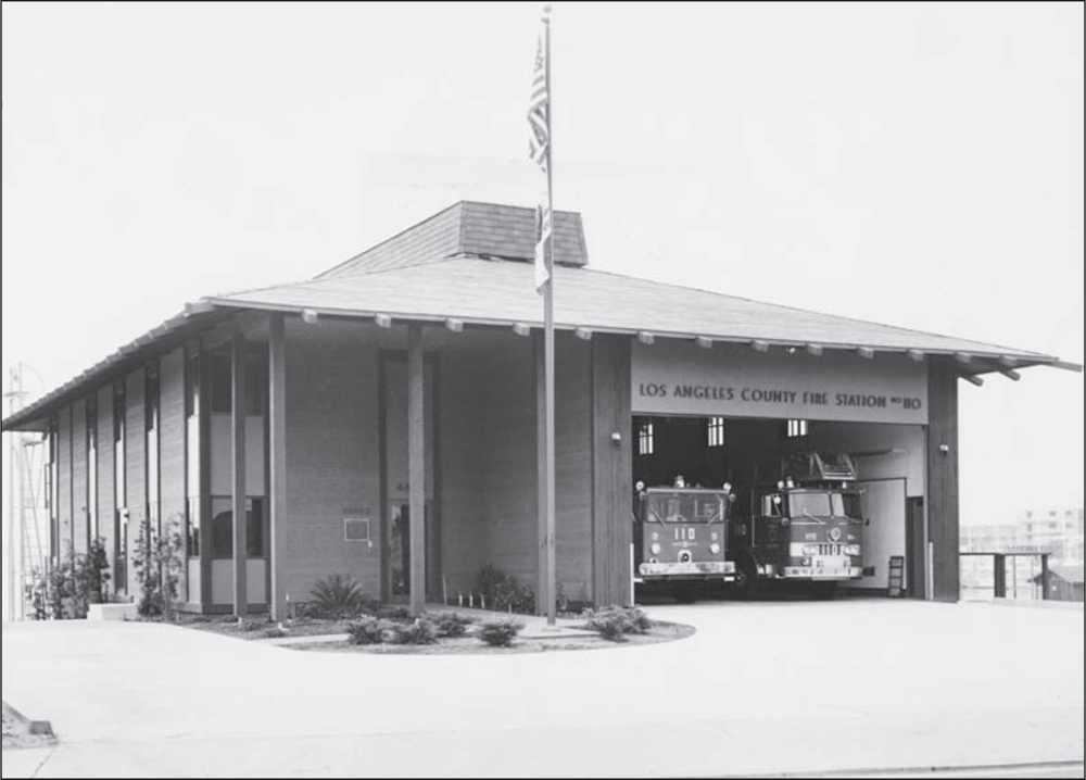
The original firehouse was in a trailer on the dirt bank of Admiralty Way. The new building (shown above) houses two fire trucks, including a hook and ladder truck and a paramedic full-response system. The more modern fireboat (below) can be seen at the fire station’s own docks (left of center). Fire Station 110 Marina del Rey is situated at the head of the main channel, reducing the time it takes first responders to get to either side of the marina. The department also responds to apartment emergencies. (Both, courtesy of LACFD.)


At the dedication of the new fire station, in November 1965, Aubrey Austin Jr. (far left) poses with three unidentified firemen assigned to the new station. Standing second from right is Capt. Mickey Foster, a legendary early firefighter in Los Angeles, then in Marina del Rey. At the far right is Arthur Will, director of the marina. (Courtesy of LACFD.)
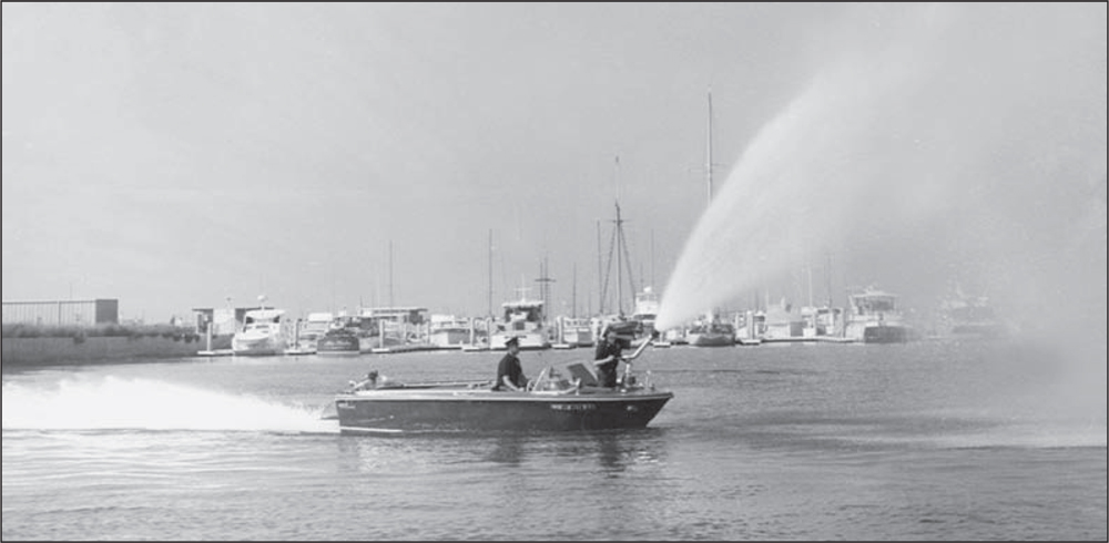
The new jet-powered fireboat demonstrates its powerful water spray in November 1965. The configuration of the boat’s keel was intended to reduce wake when under way at more than five knots. Excessive wake can cause damage to docks and boats in slips. (Courtesy of LACFD.)
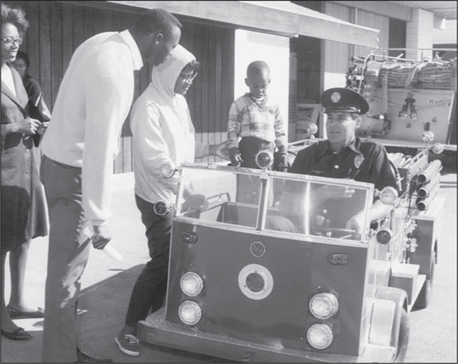
A 1965 open house at the new Marina del Rey fire station was an opportunity for the public to tour a fire station on the waterfront. This miniature fire truck demonstrates the new features on the real vehicles. (Courtesy of LACFD.)

The rigid hose units on the side of the truck were used to increase the pressure of the water from the hydrants to the truck. The units could then pump the water on land to apartment fires or help squelch fire on a boat if the boat was towed to a vacant seawall near a hydrant. Marina del Rey was well prepared for such emergencies. This photograph was taken in 1970. (Courtesy of LACFD.)

The Harbor Patrol boat was christened in traditional fashion by launching it with a bottle of champagne. Among those shown here are four unidentified harbor commissioners. The Harbor Patrol was composed of uniformed peace officers, who had limited law-enforcement authorization while on duty. Off duty, they were civilians. Most of the officers had been in the US Navy, and they brought boat-handling knowledge to the patrol. Leo Porter was the first Marina del Rey harbormaster. In April 1984, the Harbor Patrol was merged into the sheriff’s department, making Marina del Rey a substation of the Lennox Division, Los Angeles County Sheriff’s Department under Capt. Rob Lyons. Lt. Tom Sherrill was the harbormaster from 1984 to 1985. Sgt. Gary Thornton, a member of the original Harbor Patrol, served under four captains as harbormaster until he retired in 2005. In 1979, harbor patrolman Harold Edgington, one of the original peace officers, was killed by a deranged man near Panay Way. The 16-year officer was remembered by the community with the naming of Edgington Park, located at the corner of Via Marina and Admiralty Way. (Courtesy of LACDBH.)

Deauville Apartments, Parcel 12, are shown under construction at the end of Marquesas Way in 1965. Boat slips at Villa del Mar Anchorage Basin C, on the mountain side of the mole, appear to be filled with vessels, as are the slips on the Basin B side at Neptune Marina. The anchorage portion of Deauville has no pilings or docks at the time of this photograph, but it will eventually have them. (Courtesy of LACFD.)

Boat slips are empty at this apartment development on Tahiti Way, Marina Point Harbor, on Basin A. The undeveloped area to the right is the site of the future Tahiti Marina Apartments. The docks at this facility were completed in 1964 after the sheet-pile baffles were installed in the main channel to protect against storm surge. Tahiti Yacht Landing was the original marina name. This photograph was taken in 1965. (Courtesy of LACFD.)

In 1965, Congressman James Roosevelt (center) joins King Neptune and Miss Neptune Marina in a ground-breaking ceremony for the Neptune Townhouses and Marina. The two unidentified men on the right are part of the development corporation. Roosevelt was an important force in obtaining funding for marina projects. (Courtesy of LACFD.)

The Neptune Townhouses, seen here in 1965, were highly sought after in the early years. The after-work “swinging singles” crowd filled the waterfront restaurant, Donkins, later named Clems. The restaurant’s guest dock for boats was constantly filled. The marina slips were the home to Wind ‘N’ Sea Sailing Club, a low-cost membership club that shared a variety of boats. Malcolm Steinlauf was the founder and commodore. (Courtesy of LACFD.)

The public launch ramp, seen here in 1966, is accessible from either Mindanao Way or Fiji Way. The facility had three areas of wooden ramps off concrete and asphalt parking lots. It is a very popular site for activity, especially in the summer months. Fishermen take off shortly after dawn and return early in the afternoon. (Courtesy of LACDBH.)
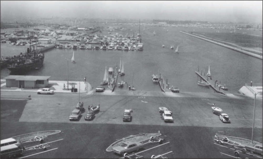
The launch ramp, seen here in 1966, opens onto a large basin area, which is called Dock 52. At the public parking area, large commercial fishing boats or cruise-charter boats can arrange to pick up groups for fishing expeditions, whale watching, or harbor cruises. The county operates the launch ramp facility and parking area, but charter operations are conducted by licensed private commercial vessels. (Courtesy of LACDBH.)

Cyrano’s restaurant was built in 1967 by proprietor John Oldrate, a well-known Sunset Boulevard restaurateur. Celebrities enjoyed his cuisine and the elegant ambience of waterside dining. The restaurant’s large guest boat dock appealed to dining boaters. As the clientele changed to younger crowds, the leasehold was transferred to new owners. The site was renamed Moose McGillycuddy’s and then Waikiki Willie’s. The facility, seen here in 1967, has since reverted to the county. (Courtesy of LACFD.)

Cyrano’s was often the site of Marina Chamber of Commerce social mixers. Seen here in 1967, the restaurant’s host, John Oldrate (third from left), is in conversation with Rudy Abeyta (second from right), owner of the Cleaning Baron, and Jim Coughlin, executive director of the Marina Chamber of Commerce. The two women are unidentified. (Courtesy of LACDBH.)

The Warehouse restaurant was built by Burt Hixson, an award-winning cameraman turned restaurateur. Designed in a tropical theme, the restaurant’s “tin roof” and setting among palm trees, bamboo clusters, and weathered wharf posts were his signature. The posts were trucked in from San Pedro, along with old whiskey kegs, nautical rigging, nets, and hawser ropes. Hixson’s photographs lined the walls. Exotic drinks, food, and a waterfront view made it an instant favorite. The Warehouse is seen here in 1969. (Courtesy of LACFD.)
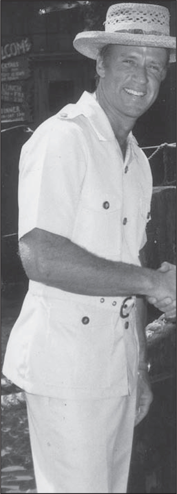
Burt Hixson’s straw hat and safari attire were his trademark. His early efforts to promote the new marina and its restaurant destinations through the Marina Chamber of Commerce and the Restaurant Association assisted in the economic success of Marina del Rey’s early restaurants. (Courtesy of MDRHS.)

In 1969, service was easy and quick to Catalina Island, “26 miles across the sea” by seaplane. Catalina Seaplanes (1966–1972) operated a five-passenger “Grumman Goose,” shown here taking off in the main channel past a moored fleet of Victory sailboats. The boats were available for rent at Rent-A-Sail at Fisherman’s Village. (Courtesy of LACFD.)
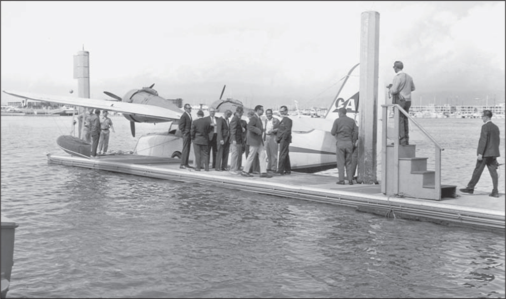
Boarding the airplane to Catalina Island usually took place at the fuel dock, as seen here in 1970. The flight took 20 to 30 minutes, depending on the area visitors were headed for. Boaters had to be sure to anchor away from the seaplane landing area at Catalina. Many new boaters did not know the landing area’s location at Two Harbors Isthmus, which called for very hurried cries of “Move your boat now!” (Courtesy of LACFD.)

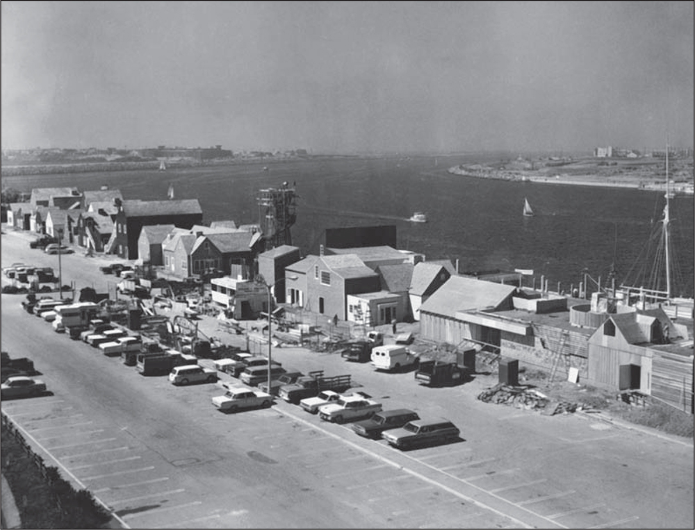
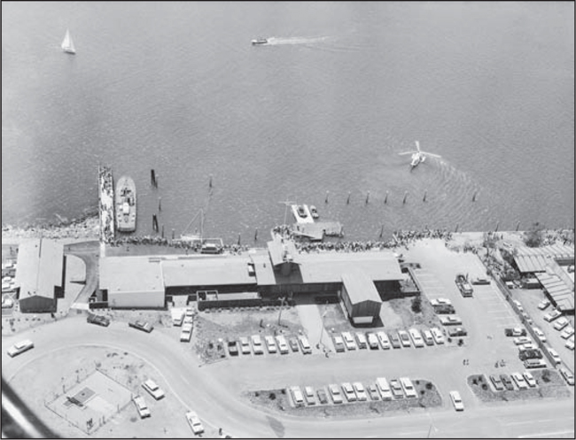
Development on Basin H, the commercial area for boat repair, is under way in the foreground of this c. 1969 photograph. The baffles are gone, and the breakwater can be seen faintly in the upper area of the photograph. The white, rectangular building with floating dock at the corner point of Basin H and the main channel is the new Loyola Marymount University boathouse, which houses rowing shells. The college rowing teams practice on the water at five o’clock in the morning. Fisherman’s Village is being built along the waterway at center. Its lighthouse, under construction close to the docks, will become an iconic structure at Marina del Rey. At upper left, the white-roofed building between Villa Venetia Apartments and the south jetty is the present-day UCLA Marina Aquatic Center. This center and its launch ramp is the site of sailing classes, scheduled every day, including weekends. The undeveloped property across the main channel will become Mariners Village townhouses and apartments. The Union Oil fuel docks extend into Basin A from Bora Bora Way. (Courtesy of LACFD.)
Developed by Bryant L. Morris and Stan Berman, Fisherman’s Village nears completion in late 1969. Artist Raymond E. Wallace created renderings evoking a New England seaside, Cape Cod–style village. Architect Norv Pieper drew construction plans based on Wallace’s drawings, and Sheldon Pollock Co. built the center. (Courtesy of LACDBH.)

Visitors to Fisherman’s Village, seen here in 1973, could park at the Dock 52 lot on Fiji Way, take a free tram to the center, enjoy shopping, dining, boating, or fishing, and return to their vehicles via the tram. The arcade was a popular place. Fishing aboard the Betty O, Captain Frenchy’s trawler, provided many happy hours at sea for fishermen and fisherwomen. (Courtesy of LACDBH.)
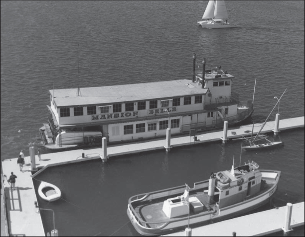
The Mansion Belle, a Mississippi River–style paddle-wheel boat, was a tourist’s delight as it made its way around the calm waters of the harbor and the main channel within Marina del Rey’s outer breakwater. A Malibu outrigger sailboat is at the dock, a catamaran is in the main channel, and the tour tugboat Little Toot is docked in the foreground of this 1970 photograph. (Courtesy of LACFD.)

One of several harbor cruises departs from Fisherman’s Village in 1970. Cruises operated as often as every 35 minutes on weekends. Scenic rides were a very popular activity for visitors, resulting in a waiting line for tickets. Each boat had a public-address system, allowing the captain to point out the sights, including celebrities’ boats. (Courtesy of LACFD.)
The southwest-facing view in this aerial photograph shows Fisherman’s Village in 1973. Developers Morris and Berman owned and operated the center for three years, then sold it for $2 million to Real Property Management in August 1972. At the time of sale, the center was fully leased, with 38 specialty shops, three restaurants, and extensive boating and fishing activities. (Courtesy of LACDBH.)

Newly opened in 1969, Fisherman’s Village offered a beauty salon, a wig shop, art galleries, and an array of clothing, gift, and craft retailers. Original restaurant tenants were El Torito, the Fish Market, Port D’Italy, Orange Julius, Hot Dog on a Stick, and Captain Saul’s. (Courtesy of LACDBH.)

Had the outer stairwell been wide enough to pass construction code, the 60-foot-tall structure at Fisherman’s Village might not have resembled the lighthouse familiar to all today. Instead, the stairwell’s width remained narrow, public access was off-limits for decades, and the structure’s iconic New England lighthouse image was preserved. (Courtesy of LACFD.)

The open-air, colorful tram, seen here in 1970, ran continuously during the weekends. It was just one part of the experience of visiting Fisherman’s Village. Visitors could take a harbor tour, go to the arcade, or have a hot dog and just wander about the pebbled waterfront walkway, watching the boats. (Courtesy of LACFD.)
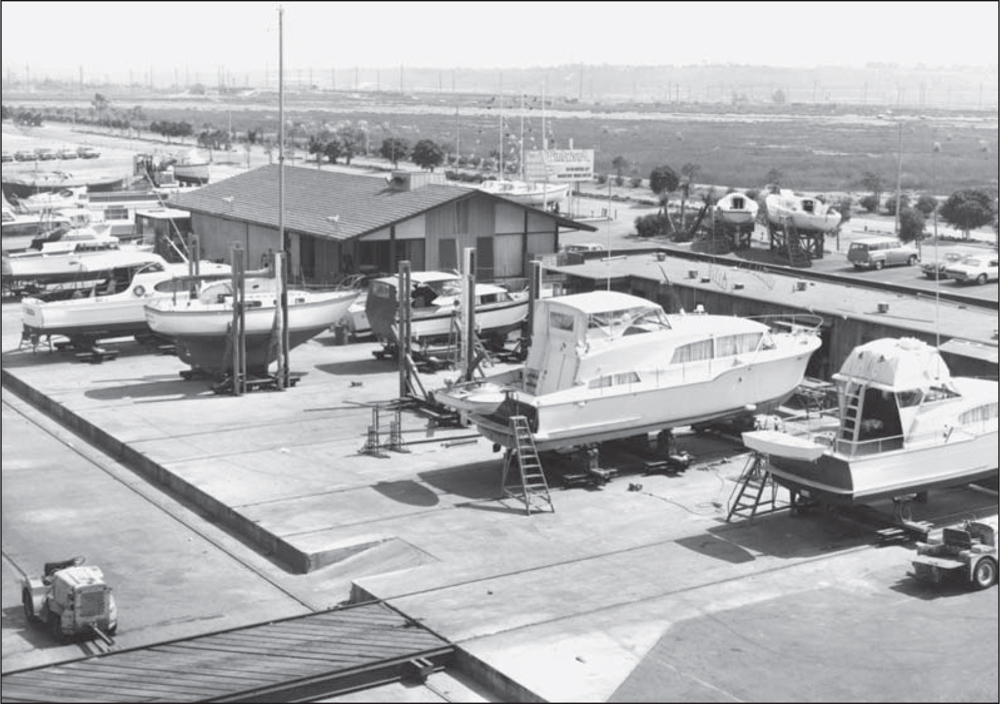
The first boat repair yard was Windward Yacht Repair, seen here in 1969. Situated on Fiji Way by Basin H, it eventually had a 100-ton travel lift operation. It was operated by Jacob Wood, who owned a series of racing yachts, each named Sorcery. The first boats brought in for repair were lifted by crane and set on dollies, then on blocks in the area where they would be worked on. (Courtesy of LACFD.)

The second repair yard was the Chris-Craft Boat Repair yard, operated by George Agajanian. Seen here in 1969, the yard catered to smaller boats and used a crane for lifting craft out of the water onto dollies. The county required this boatyard to establish a do-it-yourself facility after boat owners in the 1970s demanded a facility where they could work on their own craft. (Courtesy of LACFD.)

The first bank building, Civic National Bank, was designed by Guy A. Bartoli for leaseholder Lloyd W. Taber. The bank, seen here in 1970, was on Admiralty Way, next to the Warehouse restaurant. Bartoli designed a large percentage of the single-family homes on the marina peninsula following the stabilization of the real estate market with the success of the breakwater as a storm surge deterrent. (Courtesy of LACFD.)

The first medical building was erected on the land strip between Lincoln Boulevard, Bali Way, and Admiralty Way, just north of the TriZec Towers. Before this property was developed, it was the site of fairs and amusement-park events. The University of California, Los Angeles (UCLA) has medical outpatient offices and a clinic here. In addition, a pharmacy serves the community. This photograph was taken in the 1970s. (Courtesy of LACFD.)

Marina del Rey’s shopping center, seen here in 1968, featured a Boys Market, a laundry with washing machines, a hair salon, a few specialty and clothing stores, a movie theater, a drugstore, and Security Pacific National Bank. There was always sufficient parking. Mr. D’s restaurant was a popular and reasonably priced diner. Boys Market prepared gourmet baskets for boat owners headed out for a day on the water. (Courtesy of LACFD.)
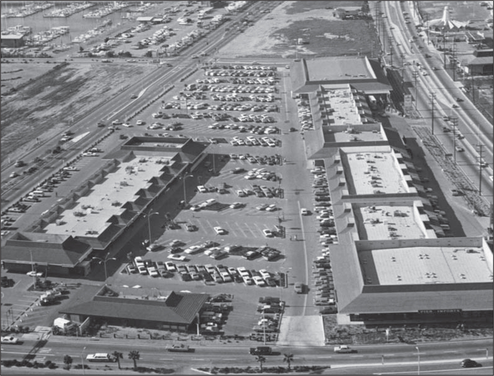
The north-facing view in this aerial photograph shows the Marina del Rey Shopping Center in 1968. The main channel is beyond the photograph, to the left. The center, now called Waterside at Marina del Rey, has been upgraded and refurbished by successful developer Rick Caruso. Mr. D’s is now California Pizza Kitchen, Boys Market is now Ralphs Market, and Bank of America has acquired Security Pacific. Upscale fast-food cafés and clothing boutiques now abound. (Courtesy of LACFD.)
The footprint of the huge complex named Marina City Club is evident in this 1970 photograph. There will be three residential towers, each 16 stories high, equipped with a fitness center, tennis club, bar/restaurant, spa, on-site beauty services, store, and more. There will be 600 residential units, condominiums, apartments, and boat slips. (Courtesy of Greg Wenger Photography.)

The Marina City Club West Tower rises beyond the Red Onion nightclub in 1971. The Lobster House restaurant is in the left foreground. The three-tower project will take six years to complete and will be Marina del Rey’s only high-rise at water’s edge until the Ritz-Carlton hotel is built years later. The promenade apartments are at center right, appearing as small white squares. (Courtesy of Greg Wenger Photography.)

An unidentified sheriff’s department officer (far left) is being recognized at a Marina del Rey ceremony. Shown with him are, from left to right, Jerry Epstein, developer, in 1965, of Del Rey Shores; Leo Porter, harbormaster of Marina del Rey; Robert Leslie, executive director of the Marina del Rey Lessees’ Association; Sheriff Peter Pitchess of the Los Angeles County Sheriff’s Department; Victor Adorian, director of Marina del Rey; an unidentified sheriff’s department officer (partially obscured); Leo Bialis, harbor lease and finance administrator; and Jim Quinn, of harbor development and operations. The happy occasion is reflected in the participants’ smiling faces. The Marina del Rey Lessees’ Association was composed of parcel leaseholders who invested money in their respective developments. The sheriff’s helicopter dates this photograph to the 1960s or 1970s. (Courtesy of LACDBH.)
The public celebrates opening day for the US Coast Guard station, the Harbor Administration Center, the Harbor Patrol office, and the county staff offices in 1963. The 82-foot cutter (left) sits alongside the Coast Guard dock. At right are a Harbor Patrol boat and a lifeguard boat, but only pilings, as there are no permanent docks yet. The Coast Guard helicopter displays its landing and rescue abilities for the large crowd. (Courtesy of LACDBH.)

The Point Bridge, a Coast Guard cutter, is a state-of-the-art power vessel with a pair of 800-horsepower diesel engines. The 82-foot vessel cruises at 17 knots and has an operational range of 1,000 miles. Designed to allow 360-degree visibility from the bridge, the cutter, shown here in 1963, also has night-lights, air-conditioned quarters for a crew of eight, and a galley with freezer and refrigerator. Its home base was Marina del Rey. (Courtesy of LACDBH.)

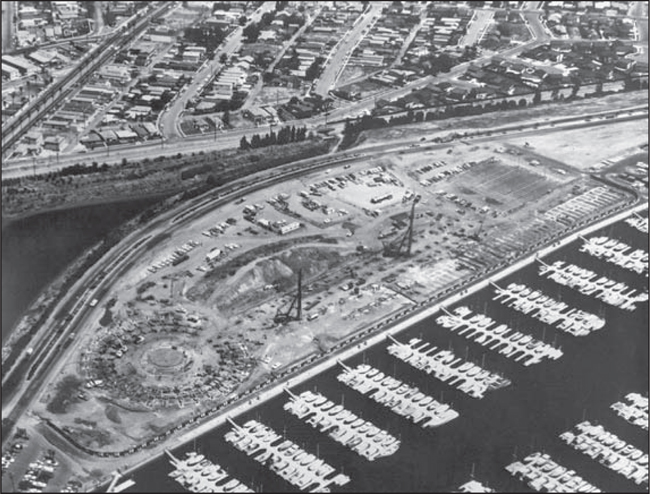
Shown here are, from left to right, Supervisor Burton W. Chace, Aubrey Austin Jr., Arthur Will, and Victor Adorian. They are marking the start of construction of Burton Chace Park with a ceremonial ground breaking on August 22, 1972. The park, at 13650 Mindanao Way, is named in honor of Chace, “Father of the Marina,” who worked diligently with county staff to bring Marina del Rey to reality. (Courtesy of LACDBH.)

The white parallel walkways in the center of this aerial photograph, taken in 1972, lead to what will be the community room, in the area of the white circle. The grassy mounds will be open areas for play, concerts, and special events. There will also be picnic areas with built-in barbecues, a special fishing dock, and great harbor viewing areas. (Courtesy of LACFD.)
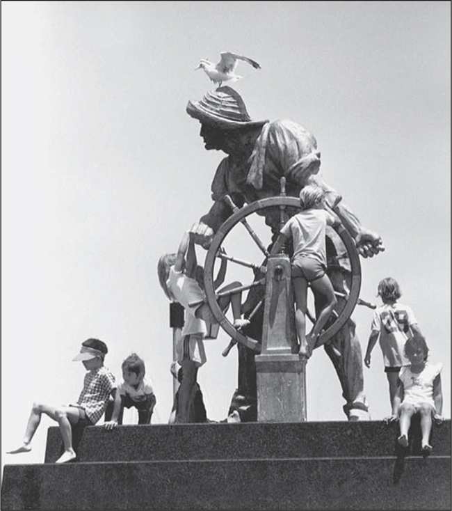
Attired in foul-weather gear and ready for his eventual watch at harbor’s edge, The Helmsman bravely weathered his journey through early-1970s Los Angeles traffic to the new Burton W. Chace county park. Seen here in 1972, the statue is well received by both children and gulls at its new location. (Courtesy of Greg Wenger Photography.)

Originally located on Venice Boulevard at Helms Bakery in Culver City, the statue was donated to the marina through the efforts of Dr. Earl Bubar, president of Venice Chamber of Commerce. The Helms trucks in this c. 1954 photograph carry a fire-prevention message. An illustrated image of The Helmsman would for decades adorn the masthead of Marina del Rey’s local newspaper, the Argonaut. (Courtesy of LACDRP.)

The Burton Chace Park fishing dock was a popular location for anglers both young and old. The park also has a fish-cleaning and prep facility. In this 1972 photograph, youngsters from the Boys Club of Venice are being taught fishing tips by unidentified volunteer mentors. David Mandell (not pictured) founded the Boys and Girls Club of Venice, whose current activities include sailing and kayaking. (Courtesy of Greg Wenger Photography.)

Architect Suat Kepenek’s simple nautical theme graces Burton Chace Park, as seen in this 1972 photograph. Posts and beams are designed into romantic bridges, arboreal structures, and landscaped walkways offering picturesque views of the Marina del Rey harbor. All posts were pressure-treated and colored dark brown to make them stand out against the harbor’s white sails and the green lawns of the park. (Courtesy of Greg Wenger Photography.)

This 70-foot lighted observation tower, located on a mound near the water’s edge at Burton Chace Park, was intended to serve as a navigational landmark for skippers returning to port. It was a popular lookout platform for spectators to view the boats traversing the marina. This photograph was taken in 1972. (Courtesy of Greg Wenger Photography.)

The Pardee Scout Base, located at the Burton Chace Park, was generously endowed by George M. and Katherine M. Pardee, pictured here with Fourth District supervisor James Hayes (left). A replica of a large river tugboat became the clubhouse for the Sea Scouts division of the Boy Scouts of America. The docks attached to the facility accommodate donations of boats to the Sea Scouts and are used in boat handling and safety. (Courtesy of LACDBH.)

Development of Marina del Rey is nearing completion in this photograph, taken around 1979. The last major construction of the Marina City Club is complete. The vacant lot to the left of the three towers is the future site of the Ritz-Carlton Marina del Rey Hotel. The lake in the foreground is the Oxford Flood Control Basin, constructed to control and contain seasonal rain runoff. Traffic moves around the perimeter of the marina on a four-lane divided roadway. Boat slips are at a premium and in short supply. The popularity of boating reflects the presence of many aerospace and technology professionals buying the affordable fiberglass boats of the era. Burton Chace announced in a press release on June 19, 1972, that Marina del Rey was meeting its financial goals “since Marina finances entered the black in 1967” and was accelerating retirement of the state loan, made in 1958, to build the marina. (Courtesy of Greg Wenger Photography.)

In 1972, the first payment of $325,000 of the $2 million land acquisition loan from the California State Navigation and Ocean Development (CSNOD) for Marina del Rey was presented to CSNOD commissioner William DeGroot (second from right) by Supervisor Burton W. Chace (center). Aubrey Austin Jr., Small Craft Harbor Commission chairman, is at far left. Arthur Will, county chief administrative officer who guided the marina from 1963 to 1971, is standing second from left. At far right is CSNOD commissioner Bill Satow. (Courtesy of LACDBH.)
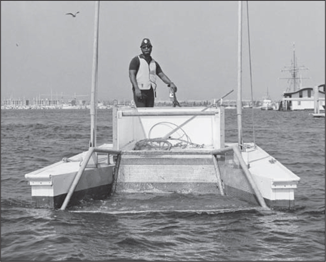
Called an “ecological aid” to coping with waterborne debris, the county’s 17-foot debris-collector boat is shown here being operated by Mathew Miles, senior general maintenance, Department of Small Craft Harbors. The craft collected trash floating in from Ballona Creek and from two storm drain outfalls that emptied into the Marina del Rey basins. The marina in 1970 was home port to over 5,000 boats. This photograph was taken around 1970. (Courtesy of LACDBH.)