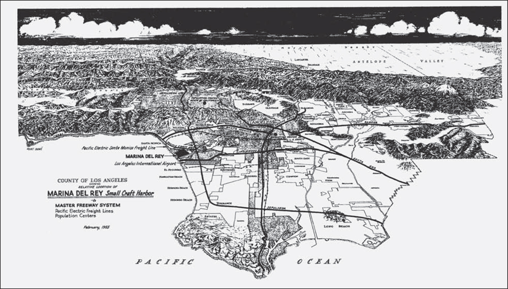
The planned Marina del Rey Small Craft Harbor site is shown in this February 1955 map, which was included in the county’s bidder’s packet for prospective leasehold developers. The railway tracks no longer exist. The dark, small rectangle representing Marina del Rey (center left) is six miles north of Los Angeles International Airport and sits below the Playa del Rey bluffs. (Courtesy of County of Los Angeles.)
ON THE COVER: Marina del Rey’s main channel is 1,000 feet wide, 20 feet deep, and 1 mile long, and it was engineered to true north-south headings. The six-sided clubhouse of California Yacht Club and anchorage are visible alongside Basin F in the left foreground of this 1969 photograph. Marina del Rey Hotel, formerly the Sheraton hotel, is the building with boat slips at center left. The vacant dirt lot (mole) in the upper left became Burton Chace Park next to Basin H, the commercial water section for boat repair and the small-boat launch ramp. (Courtesy of County of Los Angeles.)