![]()
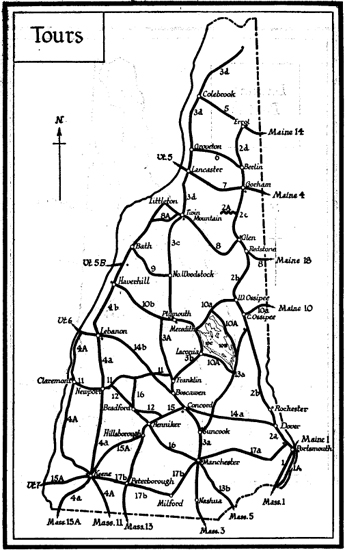
TOUR 1: From MASSACHUSETTS LINE (Boston) to MAINE LINE (Portland), 15.1 m., US 1.
![]()
Via Seabrook, Hampton, Portsmouth.
B. & M. R.R. parallels this route.
All types of accommodations at close intervals.
Well-paved highway.
US 1 crosses the Massachusetts Line 42 miles north of Boston, Mass.
STATE LINE, 0 m.
From the earliest days the road between Newburyport, Mass., and Portsmouth, N.H., often following or closely paralleling the line of the modern highway, served as a cord to bind the sparse settlements together into the beginnings of a nation. Over this country road a lone horseman carried the mail between Boston and Portsmouth until the coming of the stagecoach. He forded rivers, crossed treacherous salt marshes, and, when necessary, fought off Indians and wolves in the discharge of his duties. Stavers Flying Stage Coach, said to be the first stage in America, began a regular run between Boston and Portsmouth in 1761. This was a curricle, a two-wheeled, two-horse vehicle, with room for three passengers. Over this route on December 13, 1774, rode Paul Revere to inform the Committee of Safety in Portsmouth of the British order that no more gunpowder would be exported to America. As a result, the citizens were able to secrete what ammunition they had. Washington passed this way in 1775 after taking command in Cambridge, and again in 1789. James Monroe traveled it in 1817, and Lafayette in 1824, when he had become almost a legendary hero to the early settlers who lined the highway for a glimpse of him.
SEABROOK (alt. 65, town pop. 1666), 1.7 m., limited accommodations, is a village, Old World in appearance and atmosphere, set in the midst of sand-dunes, with cocks of salt hay scattered over them, an unchanged landscape of three centuries ago.
For 57 years a part of Hampton, this Seabrook section was settled in 1638 and did not become a separate township until 1768 when it was incorporated. Settlement was all the more precarious because of frequent Indian attacks. Among many settlers killed was one, Widow Mussey, a prominent and talented member of the Society of Friends. A century ago the building of whaleboats was its chief industry, and from Seabrook vessels made their fishing trips to the coast of Labrador. The names of some of the original settlers have come down for almost three hundred years, such as Byrd, Peavear, Boynton, Bachiler.
A section of the town of Seabrook speaks a language strangely reminiscent of rural England, and at times suggestive of the Yorkshire dialect. Once they were competent shoemakers, doing all their work by hand in ten-foot cabins. Since the coming of machines this shoemaking has been done at the local factory. These Seabrookers work when they please and on their own time. At times they may be found asleep under a tree, in enjoyment of their ease, if the mood suits them to while away their time. A long-lived race, active and hearty, many of them are working at the ripe old age of ninety years or more. Many manners and customs of early days are retained.
The Old Man of Seabrook (R), an antique shop, is curious because of the figure of an old man hanging on its wall. The figure, originally a clothing dummy in Newburyport, was brought to Seabrook about forty years ago and placed in its present position.
Seabrook Nurseries (R), in the season from May to September, exhibit twenty acres of gladioli like a huge palette with every possible variety and color. Ye Cock and Kettle Inn (L) dates back to the 18th century and many of the original characteristics are still in evidence.
HAMPTON FALLS (alt. 62, town pop. 481), 3.1 m., is a delightful village dignified by austere white churches, forever aloof in spirit from the stream of traffic rushing by its door. Originally a part of Hampton, the town was incorporated as a separate township in 1726. In the early part of the 18th century this section was one of the busiest in all New England. Sawmills, gristmills, shingle mills, woolen mills, cotton mills, and fertilizer plants kept many workmen busy.
In stagecoach days Hampton Falls was a post town where changes of horses were made, from 100 to 125 horses being kept here at one time for that purpose. Wellswood Inn (R), then known as Wells Tavern, was such a stage-house and forty horses were stabled across the road. In Hampton Falls the first horse show was held in 1726. When the stage appeared with its galloping horses, everyone and everything cleared out of the way, for the coachman was an important person, privileged to curse at one and all, and if he were particularly pompous give a tardy carriage meeting him the benefit of the wide-stretching whiffletrees. Sunday travel was banned, for in those days the tithing men of Hampton Falls were very active and until 1825 promptly arrested and fined anyone caught in this offense.
On August 10, 1737, the assemblies of New Hampshire and Massachusetts, forming an imposing cavalcade of stagecoaches, horseback riders and carriages, met here to determine the boundary line of the two States.
Elmfield (open by permission of the owner), on the highway (R), with three huge white chimneys, has the same furnishings as in its early days. Dating back to the early part of the 18th century, the old house was built and is still owned by the Gove family. Edward Gove, grandfather of the present owner, was imprisoned for several years in the Tower of London for taking part in a conspiracy against Governor Crandon. He lived to spend his last years in this house, an invalid as the result, he said, of poison administered during his imprisonment. The present owner is Miss Sarah Gove, 70 years of age, the last surviving Quaker in this section. The gardens are delightful, filled with old-fashioned plants and flowers. The log cabin and Colonial kitchen are of especial interest.
Here John Greenleaf Whittier made his headquarters during the summer months and here in 1892 he died in the room overlooking the rose garden.
All this section is Whittier land. The poet took great pride in the fact that he was a lineal descendant of the Reverend Stephen Bachiler, founder of Hampton, and showed a lively interest in the home of his ancestors.
The Monument in the square (L), was erected in memory of New Hampshire’s first Governor, Meschech Weare, ‘President of New Hampshire from 1776–1784,’ who was born and lived here. Its inscription reads:
‘He was one of those good men
Who dare to love their country and be poor.’
The Governor Weare House, on Exeter road near the square, built in 1748, is a splendid example of early Colonial architecture; in it, according to well-authenticated tradition, both Washington and Lafayette were entertained.
1. Left from Hampton Falls on Exeter Road at 1.8 m., is (R), Applecrest Farm, which is most attractive in the spring when thousands of trees are in full blossom and in the fall when the crimson fruit is being picked and packed in a model packing house.
On this road adjoining Applecrest Farm is (R) the two-story unpainted house that was the Birthplace of Franklin B. Sanborn (1831–1917), journalist and author. He was one of the three founders of the Concord Summer School of Philosophy and biographer of his friends Emerson, Thoreau, and Hawthorne.
On the right is a modern two-story house, the Birthplace of Ralph Adams Cram, the leading American exponent of Gothic architecture. At 3.6 m. (L) is the original Cram Homestead, an unpainted house of dignified lines built in 1676.
2. Left from Hampton Falls on the Kensington Road is the Falls River, 5 m., where formerly were a fulling mill, a gristmill and a sawmill which derived their power from the falls here. The mills have long since disappeared, but the charm of the falls still remains. On the river’s bank is (R) the Dodge Homestead. The original house, built in 1648, was replaced by the present structure in 1787, which retains much of the original features and furniture which characterized the early Colonial period.
On the river behind the house is what is said to be the Smallest Episcopal Chapel in the State, a delightful little building of stone fashioned from an old ice house. The chapel is private, but is always open to the wayfarer. Visitors are called to worship every Sunday afternoon at 4 o’clock by an old brass bell taken from one of the ships built on the Hampton River in the early 18th century.
A stone on the estate is by many considered proof that the Norsemen landed in or near Hampton in the early 11th century. Although covered with dry moss, a series of marks can be found chiseled in the stone; at first glance these appear to be a series of crosses, such as the Indians used to guide their tribesmen through the woods, but closer examination makes clear that they are hot characteristic of Indian symbols. They more nearly resemble the runic inscriptions of the Norsemen.
The salt marshes south of Hampton figured rather prominently in the transportation and commercial history of this part of New Hampshire. Extensive salt works in operation on the edges of the marshes in Colonial days extracted the salt from the grass, which in turn was set in cocks on the marsh to dry out for commercial use. A tide mill, of which there are no traces at the present time, was built here in 1681 for the purpose of grinding the town’s corn at ‘a one-sixteenth part thereof’ and continued in operation until 1879.
At Taylor River, 4 m., was the ‘Shipyard’ where vessels, some of them being of large tonnage, were built. A bend in the stream was known as the Mooring Turn, and the contemporary records state that here the vessels, ‘do usually ride at anchor.’ Beginning with 1682, many barques, brigantines and sloops were built and launched to sail out into the world of commerce to distant ports.
At 4.9 m., on US 1 is (L) a large square house (1769) surrounded by an old-fashioned garden, known generally as the home of General Jonathan Moulton of Revolutionary War fame and locally as the Haunted House. A bit of the interior of the house, a fine specimen of Georgian architecture, has been pictured by Whittier in ‘The New Wife and the Old’:
From the oaken mantel glowing
Faintest light the lamp is throwing
On the mirror’s antique mould
High-backed chair, and wainscot old.
Reputedly a miserly man, it is said that when General Moulton’s first wife died he showed his thrift by taking her rings and giving them to the second. In revenge the first wife is supposed to have returned and ever after haunted the place. The story goes, too, that the General agreed to sell his soul to the Devil for as much gold as his boots would hold. The fireplace is still pointed out as the place where the General placed his boots with the toes cut off so that when the Devil poured the money down the chimney it ran through the boots, thus outwitting his Satanic majesty.
About 60 rods on a road opposite the Moulton House is the old Meeting-House Green, or Cow Commons, once the heart of the village. The Log Cabin (open Wed., Sat. aft.; free), on the left, is a replica of the first meeting-house. The cabin’s door was the front door of the Garrison House, built by Colonel Joshua Wingate on order of Governor Dudley in 1703. Also on the left is the Tuck Memorial House (open Wed., Sat. aft.; free) with an historical room containing many odd relics.
One of New England’s most dreaded witches had her hut near the Log Cabin; here she was buried ‘in a grave by a ditch.’ Goody Cole was the fear of the countryside, for, it was charged, she had ‘made a league with the Devil’ and with his aid she was able to render persons deformed, to torture, and even to drown with an invisible hand. Whittier speaks of her in ‘The Wreck of Rivermouth,’ which took place in 1657.
Although none of the fantastic crimes attributed to witches could be laid directly at Goody Cole’s door, she was persecuted and imprisoned by the town for years. In 1673 her plea for liberty was refused by Justice Jonas Clark of Salisbury court in the following decision, ‘In ye case of Unis Cole now prisoner at ye Bar not legally guilty according to Intitement butt just ground of vehement suspissyon of her haveing had famillyarrty with the deiull.’
Opposite the Log Cabin (R) is the attractive Meeting-House Green Memorial Park within a series of boulders marked with the names of the earliest settlers. The park was the joint gift of the towns which once were part of Hampton. The generosity of Edward Tuck of Paris, France, and the enthusiasm of the Rev. I. S. Jones are largely responsible for the restoration of Meeting-House Green.
HAMPTON (alt. 83, town pop. 1507), 5.4 m., limited accommodations, is a compact little village, astir with the same activity it has pursued under its lofty elms since the 17th century. Hampton was an outpost of the Massachusetts Bay Colony, which maintained a block-house here in 1635 against the numerous Indian attacks, and it became one of New Hampshire’s four original towns and the mother of many of the surrounding little towns. A grant of the land was given to a group of Englishmen led by the Rev. Stephen Bachiler who in 1638 sailed in shallops up the Winnicummet River ‘thru salt sea marshes to uplands brown.’ In 1638 the territory was purchased from the Indian sachem Wehanownowit by settlers in Exeter. These pioneers, with thoughts turning homeward to England, promptly changed the lovely Indian name of Winnicummet (Ind.: ‘beautiful place in the pines’) to Hampton at the incorporation of the town in 1639.
Although a farming and shoe manufacturing community on a small scale today, the tang of the sea is in the air and strange objects in the old houses are a heritage of the days when brigantines and clipper ships put out from Hampton Harbor to sail the distant seas.
Right on Winnicummet Road is (R) the First Congregational Church, built in 1843, which contains the pulpit from the Fourth Meeting-House, erected in 1797.
Left on this road in a grove of pines lies the Old Burying Ground, 0.5 m., with its ancient stones (1654–1800) almost hidden by fragrant pine needles.
At 7.9 m., is a junction with a paved road marked ‘Atlantic Road.’
1. Right on this road about sixty rods is (L) the simple, white North Hampton Town Hall in the belfry of which hangs a bell made by Paul Revere.
2. Left on Atlantic Road is North Hill, 1 m., on which stands North Hampton Center. Here, high above the sunny meadows, the white meeting-house dominates the cluster of white farm houses about the village green.
Bordering the Green on the west is the Post Road. On this road a Mile Post in a stone wall is marked,
P
10
N
12
(Portsmouth 10 miles, Newburyport 12.) This post was put up by Benjamin Franklin when he was Postmaster-General under the Crown.
South of this mile post on Post Road is a tablet (R) at 0.25 m., marking the Site of the Home of the First Settlers, Samuel and John Dearborn and their descendant, Major General Henry Dearborn, who commanded the Army of the United States at the outbreak of the second war with England in 1812.
The highway here was a scene where once tragedy trailed its way. It was over this road that three Quaker women were dragged from Dover to be flogged at the ‘cart’s tail’ at each town through which they passed. In 1662, Richard Waldron, constable of Dover, had issued the following order for ‘vagabond Quakers’ to Hampton, Salisbury, and several other towns, but through the courage of Justice Robert Pike of Salisbury, who trod the warrant under foot, it was carried out only at Hampton and Dover: ‘You and every one of you are required in the King’s Majesty’s name to take these vagabond Quakers, Anne Colman, Mary Tompkins, and Alice Ambrose and make them fast to the cart’s tail, and, driving the cart through your several towns, to whip them upon their naked backs not exceeding ten stripes apiece on each of them, in each town; and so to convey them from constable to constable till they are out of this jurisdiction, as you will answer it at your peril; and this is your Warrant.’ Whittier drew a vivid picture of this in his poem, ‘How the Women Went from Dover’:
Bared to the waist for the north wind’s grip
And keener sting of the constable’s whip,
The blood that followed each hissing blow
Froze as it sprinkled the winter snow.
Priest and ruler, boy and maid
Followed the dismal cavalcade
And from door and window, open thrown,
Looked and wondered gaffer and crone.
NORTH HAMPTON (alt. 99, town pop. 695), 8.3 m., is a prosperous town set in green acres, either cultivated by farmers whose holdings run back to the 17th century or occupied by wealthy summer residents whose beautiful estates are on the right between the highway and the sea. Probably settled in 1690 by Samuel and John Dearborn, North Hampton was the scene of many attacks by the Winnicummet Indians. To withstand their attacks its early houses were strongly built of wood, lined with brick, and many of these are still standing in simple dignity here. Formerly a part of Hampton, North Hampton was incorporated in 1742.
At 10.4 m., the western outskirts of the beautiful old town of Rye are entered (see Tour 1A).
At 10.7 m., is a junction with the paved and marked Greenland road.
Left on this road about 500 feet is the site of the capture of Breakfast Hill. A marker on top of a boulder (R) commemorates the capture of a number of Indians here in 1696. Eating a leisurely breakfast following the massacre on Portsmouth Plains the previous day, the Indians were surprised by Captain Shackford and a company of soldiers, who killed them and rescued the captives they had taken.
At the top of the hill is the Lafayette Airport, a privately owned enterprise.
The highway passes through pine woods and salt meadows, dipping into a hollow at 13 m., where Sagamore Creek, a tidal stream, winds along to Little Harbor and thence to the ocean.
PORTSMOUTH (alt. 30, pop. 14,495) (see PORTSMOUTH), 14.6 m.
John Paul Jones House; Peirce Mansion; Home of Thomas Bailey Aldrich; Tobias Lear House, and other points of historical and architectural interest.
Portsmouth is the junction with State 1A (see Tour 1A), State 16 (see Tour 2, sec. a), and State 101 (see Tour 17, sec. a).
At 15.1 m., US 1 crosses the Piscataqua River (the New Hampshire-Maine Line), 50 miles southwest of Portland, Maine. The current of this turbulent stream is so swift that the water never freezes, even when the temperature is far below zero.