41 Mount Rose
A 6.4-mile loop day hike to the summit of Mount Rose.
Trail type: Foot.
Best season: Early June to mid-October.
Elevation gain: 3,500 feet.
Elevation loss: 3,500 feet.
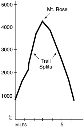
Maximum elevation: 4,301 feet.
Topo maps: Mount Steel; Custom Correct Mount Skokomish–Lake Cushman.
Finding the trailhead: From Hoodsport, drive west on Lake Cushman Road past Lake Cushman State Park. Turn left onto Forest Road 24 and drive 2.7 miles to a sign for the Mount Rose Trail. It is easiest to follow an unmarked path that leaves the road to the west of the nameless feeder stream that descends here.
The Hike
This trail has been recently rebuilt with new switchbacks and erosion control structures. A direct route to the summit allows a loop hike. The trek begins with a tedious, switchbacking ascent through a loose forest of Douglas fir. Thin spots in the canopy allow tantalizing glimpses of Lake Cushman, but the view never broadens into any kind of panorama. As the trail ascends, it passes outcrops of bedrock that rise from the forest like mossy whale backs. Conifers cannot take root on this thin, arid soil, and the resulting sunny spots provide footholds for the shade-intolerant Pacific madrone. This broadleaf tree has a distinctive bark that peels away from the trunk, giving the tree an appearance of nudity.
High up on the mountainside, the trail splits. The left fork climbs directly to the summit. This path zigzags up the mountainside in tight turns, then unexpectedly reaches a flat bench. It then winds into a natural amphitheater of rock that resembles a long-abandoned quarry. An intermittent stream runs through it and may offer water following wet weather. Ascending gradually, the trail passes through a maze of hillocks covered in silver fir and beargrass. As it climbs higher, rounded upwellings of stone support a growth of heather, which brightens the forest with its pink and white blooms in early summer.
The final pitch to the summit is steep and culminates in a fingerlike outcrop of stone that rises above the trees. Lake Cushman lies far below like a giant mirror. Forested ridgetops, dominated by Lightning Peak and Wonder Mountain, stretch away to the southern horizon. Looking through the charred snags of an old fire, it is possible to look straight up the North Fork of the Skokomish at the sharp points of Six Ridge.
Hikers can then follow the “ridge loop” route down the ridgeline to the north. At the time of this writing, the track was faint and prone to blowdowns but could be followed by watching for plastic flagging marking the way. The route descends gradually along the rocky ridgetop, with occasional views of Copper Mountain to the west and Mount Ellinor to the east. Mountain hemlocks rise from chinks in the bedrock and are hung with banners of old man’s beard (a type of epiphytic lichen). Upon reaching a low saddle, the trail turns east and drops from the ridgeline and into a loose grove of mature hemlocks. The path, now more distinct, passes through several spots of catastrophic winter blowdown as it veers southward. The descent picks up speed, and the trail crosses a small stream before zigzagging down to return to the main trail junction. From this point, a foot-pounding descent of 1.8 miles returns the hiker to the road.

Key Points
0.0Trailhead, shore of Lake Cushman.
1.1Trail enters Mount Skokomish Wilderness.
1.8Junction of summit and ridge loop trails. Bear left.
2.9Summit of Mount Rose.
3.7Ridge loop trail drops from ridgeline.
4.6Trail returns to junction.
6.4Trailhead.