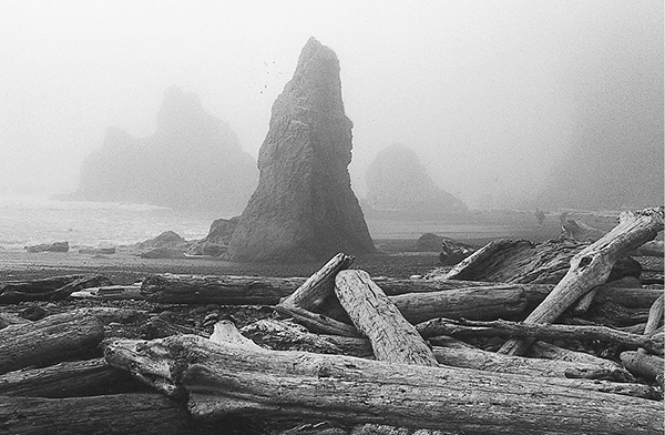
Stacks in the fog at Ruby Beach
59 The Kalaloch Beaches
A series of day trips of varying lengths along coastal routes in the Kalaloch area.
Trail type: Coast routes.
Best season: All year.
Topo maps: Destruction Island, Queets; Custom Correct South Olympic Coast.
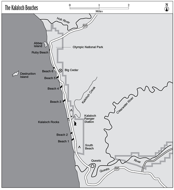
Finding the trailheads: All beaches are accessed from pullouts or parking areas along U.S. Highway 101 between the Hoh River and the town of Queets: Ruby Beach at mile 164.7; Beach 6, mile 162.7; Beach 5, mile 162.1; Beach 4, mile 160.5; Beach 3, mile 159.9; Beach 2, mile 156.2; Beach 1, mile 155.3.
The Hikes
These beaches stretch along the southern coast of the Olympic Peninsula, surrounding the resort village of Kalaloch (pronounced “kuh-LAY-lock”). US 101 runs along the coast here, and a number of short trails descend from the bluffs to reach the broad and almost unbroken strand that stretches between the Hoh and Queets Rivers. Day trips of any length can be undertaken, but camping on these beaches is not allowed. Pets, however, are permitted on these beaches. The beaches will be discussed in detail with reference to their access points; in general, extremely short wooden causeways lead from bluff-top parking areas to the shore.
Ruby Beach: This beach is known for its pinkish sands, which derive their color from the presence of tiny grains of garnet. Ruby is set apart from the other beaches by the presence of sea stacks at its northern end; Abbey Island is the largest of these. Cedar Creek forms a wide lagoon near the stacks, and piles of drift logs litter its edges. Destruction Island can be seen far to the southwest. This mighty rock has lived up to its name over the years, being the site of at least five major shipwrecks.
Beach 6: The trail to this beach passes through a grove of mature Sitka spruce, many of which have been infected with parasitic organisms. In response, the trees have produced a bulbous growth of wood known as a burl around the infected trunk or limb. Note the dwarfed growth form of the spruces nearest the beach. Lashed by winter gales, these hardy trees have adopted aerodynamic shapes that deflect the wind. The beach itself is mostly cobble, and there is a scattering of large drift logs near the high-tide mark.
Beach 5: This track starts from an unmarked pullout just south of the Big Cedar exhibit. The beach is almost indistinguishable from Beach Six.
Stacks in the fog at Ruby Beach
Beach 4: The trail follows a grassy ravine down to the ocean. This beach features exposed strata of shale and sandstone that were tilted and folded as the Juan de Fuca Plate submerged itself beneath the Continental Plate. Outcroppings of bedrock near the north end of the beach offer opportunities for tidepool exploration. Remember that these tiny worlds are fragile; avoid disturbing their inhabitants.
Beach 3: This short stretch of fine sand derives its dark shade from an abundance of black magnetite. It is tucked between tawny headlands capped by Sitka spruce and alder. These trees have been pruned by windblown sand and salt into twisted forms that bring to mind the art of a Japanese bonsai gardener.
Beach 2: This beach has extremely limited parking. The path begins from the north side of the Beach 2 highway sign and makes a very brief and easy descent to the seashore. This beach is part of a broad, sandy strand that stretches north beyond Kalaloch Campground. Drift logs have been weathered into fascinating shapes, as have the spruces that cling to the seaside bluffs.
Beach 1: This beach is almost a twin of Beach 2, but with safer and more spacious parking facilities. It also offers a spur trail through groves of Sitka spruce that sport impressive burl. Gray whales are commonly seen in March and April.