
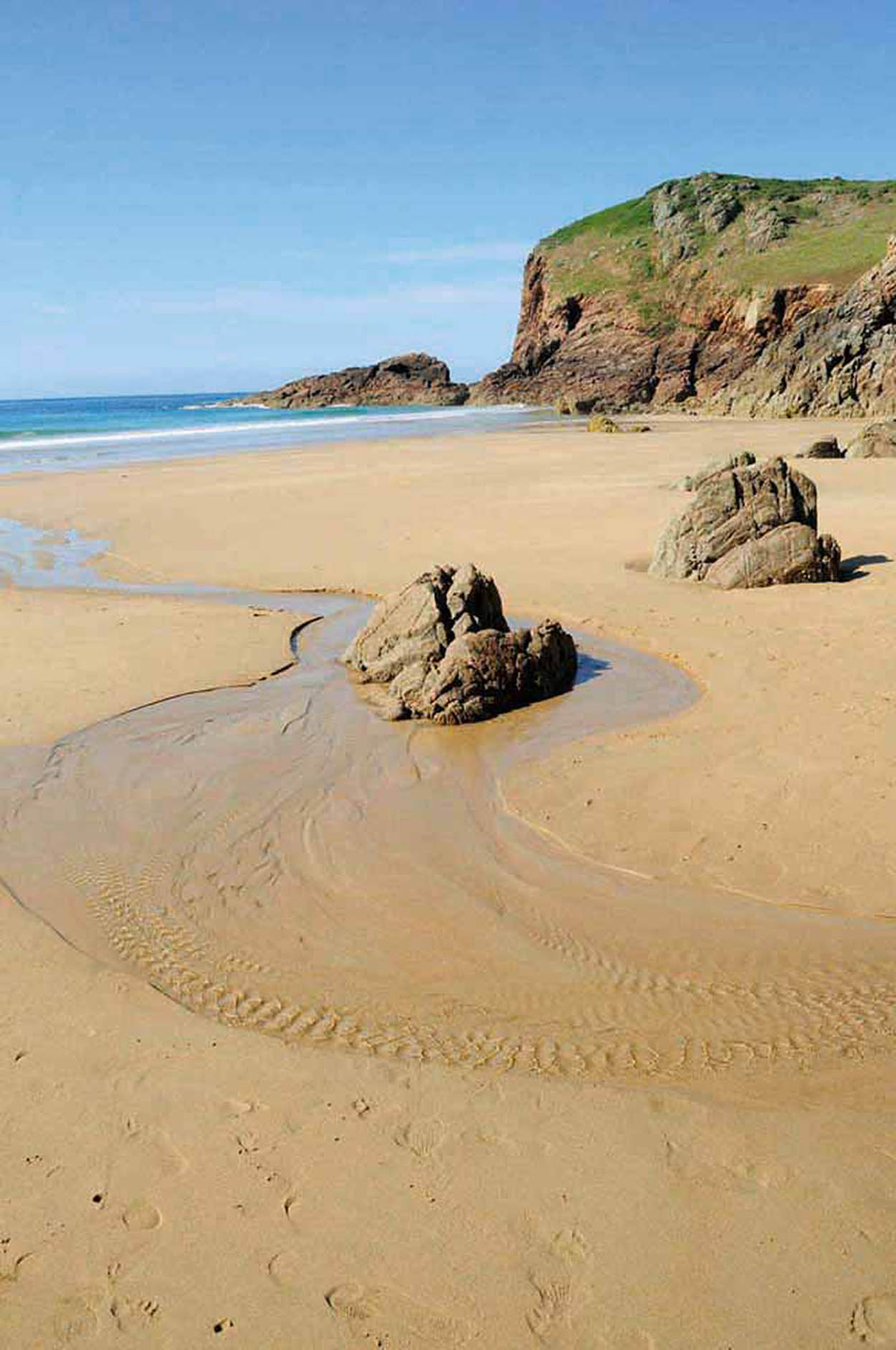
Boats at Bonne Nuit Bay.
Mockford & Bonetti/Apa Publications
Tour 5: The North Coast
No visit to Jersey is complete without a tour of the dramatic northern coastline, where flower-clad cliffs tower over beautiful bays. Take this 22-mile (35km) whole-day tour by car or bike.
Highlights
Boats at Bonne Nuit Bay.
Mockford & Bonetti/Apa Publications
Allow a whole day for all the diversions, take a picnic lunch or stop for a bite of freshly caught seafood. The pretty bay of Bonne Nuit, with a beach, car park and excellent café, makes an ideal place for a break.
The majestic cliffs of the north extend along the entire coast, affording spectacular views across to the other Channel Islands and France.
Dotting the shore are half a dozen little bays, with fishing ports sheltered by rocky headlands. Each of these links up with the north coast footpath, which runs all the way from Rozel in the east to Grosnez in the west.
Try to cover at least a small section of this glorious coastline on foot. Choose a clear day so you can enjoy the views – and preferably when there’s not a north or easterly wind. Don’t forget to bring binoculars for spotting the birds that have habitats in the crevices and rocky outcrops. Species you are likely to see are fulmars, cormorants and shags, and – if you happen to be at Plémont in the spring, you might spy a puffin. Dolphins, grey seals and basking sharks are also occasionally seen from the cliff paths. Cycle route #1 follows the north coast from Rozel Bay right across to Les Landes.

Stop for a crab sandwich at the Hungry Man kiosk in Rozel Bay.
Mockford & Bonetti/Apa Publications
Rozel
From the St Helier ring road follow signs for ‘The North’ and the Five Oaks roundabout. From here take the A6 to St Martin’s, then follow the B38 up to Rozel Bay 1 [map] .
Tucked away in the northeast corner of the island, this is a small, picturesque creek where fishermen’s houses overlook the tiny harbour and the sand and shingle beach. The pier was built in 1829, during the heyday of the oyster industry, when there were around 30 oyster fishing vessels based in the small port. Beside the pier you’re unlikely to miss the legendary Hungry Man kiosk, famous for its fabulous crab sandwiches.
Being the closest point in Jersey to France, at the height of the Napoleonic threat Rozel was considered a valuable defence site. However, no shot was ever fired here in battle.
The lush Rozel Valley, tucked away behind the village, makes a pleasant inland walk with its exotic trees and shrubs. Subtropical flora were first planted here by a 19th-century naturalist, Samuel Curtis, and some of them can still be seen today. The Château la Chaire Hotel has a lovely valley setting and offers fine dining in an oak-panelled restaurant or lighter fare and afternoon tea in the conservatory brasserie.
Bouley Bay
Head westwards out of Rozel on the C93 and after 1.2 miles (2km) turn right into the Rue du Bouillons (C95). At the next junction turn right and from here follow signs for Bouley Bay 2 [map] . As you near the coast the road snakes its way down through the wooded hillside to a pebble bay surrounded by high cliffs. The steeply shelving beach and the deepest waters around the island’s shores are ideal for scuba-diving or snorkelling. The sea here is rich in marine life, including lobsters, crabs, sea urchins and starfish, along with many species of fish.

Wander off the beaten track into St Catherine’s Wood, otherwise known as Rozel Woods.
Mockford & Bonetti/Apa Publications

Bouley Bay and the fort of L’Etacquerel.
Mockford & Bonetti/Apa Publications
The Bouley Bay Dive Centre, based below the Water’s Edge Chalets, offers lessons and facilities to divers of all standards, including ‘try dives’ for complete beginners. Bouley Bay is also the venue of the very popular Hillclimbs, which take place up the steep and twisty road from the bay four times a year.
Any member of the Jersey Motor Cycle and Light Car Club equipped with motorbike, saloon car, racing car, sports car or even a bike is welcome to participate. The village is otherwise peaceful, with no more to it than the hotel and a café above the beach.
Fort L’Etacquerel and Fort Leicester
On the east side of the bay, perched above the sea, the fort of L’Etacquerel 3 [map] was one of several defences built to guard the north coast from French invaders. Another was Fort Leicester to the west of the bay, reached up the steps to the left just before the jetty. Both forts have been converted into holiday accommodation by Jersey Heritage, L’Etacquerel providing ‘stone tent’ accommodation for 10 with sleeping bags, Fort Leicester a relatively comfortable sea-view retreat for up to eight people. Cliff paths either side of Bouley Bay provide delightful walks. In summer the hills are ablaze with heather and wildflowers, while shags, which nest in cliff crevices in the spring, can be seen flying close to the shore.
The North Coast


The Black Dog of Bouley Bay.
Mockford & Bonetti/Apa Publications
Bonne Nuit
Leaving Bouley Bay, climb back up to the top of the hill and turn right at the T-junction along the Rue de la Petite Falaise (C96). In less than half a mile turn right to join the main A8. Take the next main right turn (B63) and follow the signs for Bonne Nuit.
To the right Les Platons, at 420ft (133 metres) above sea level, is the highest spot in Jersey – hence the forest of TV and radio masts. The deep cave at Belle Hougue Point, where the remains of prehistoric deer were discovered, lies below. Only experienced climbers, with ropes, should contemplate attempting the descent.
Black Dog of Bouley Bay
During the latter half of the 18th century numerous tales were told of the Black Dog of Bouley Bay, a huge beast which roamed the cliffs around the bay, dragging its chain behind it. The dog would terrify victims by circling them with the chain, leaving them unharmed but in a state of shock. Any rumour of the Black Dog roaming the region and the locals would hot-foot it home. The stories are believed to have been the invention of smugglers – of whom there were many at the time – to frighten prying parishioners away from the bay and leave the coast clear to land their cargoes of spirits and tobacco.
The name Bonne Nuit 4 [map] (Good Night) appears to have derived from the now non-existent Chapel of Bona Nochte, built in the twelfth century. Conversely, the sea beyond the bay used to be called Maurepos (Bad Repose), possibly on account of smugglers.

Secluded Bonne Nuit Bay was a prime spot for smuggling in the seventeenth and eighteenth centuries; its pier is now the finishing point for an annual rowing race.
Shutterstock
Today it is a secluded little bay, with a tiny harbour and a sand and shingle beach, sheltered below heather-clad hills. At low tide fishing boats and pleasure cruisers are beached on the sands, and resident mallard ducks waddle across the bay, hoping for a crust or two from the Bonne Nuit Beach Café.
The red wooden huts on the jetty belong to fishermen who go out daily for lobsters, crabs and clams. In ancient times fishermen and other islanders rowed around Le Cheval Guillaume or Cheval Roc, the offshore rock, to protect them from evil spirits. Bonne Nuit pier is the finishing point for the Sark to Jersey Rowing Race, held either in June or July depending on the tides, and a plaque, unveiled by Chay Blyth (who, with John Ridgeway, rowed the Atlantic in 92 days in 1966) commemorates the silver jubilee. The fastest rowers from Sark take about 2.5 hours.
Sorel Point
As you head northwest you will see a sign to Sorel Point, which is the most northerly tip of the island, commanding magnificent sea views. Weather permitting, you can make out the islands of Alderney, Guernsey, Sark, the coast of Normandy and the Paternoster Reef closer to shore. Keep your eyes focused out to sea and make sure to avoid the views to the east – Ronez Quarry is one of the very few blots on the north coast landscape.

Solitary Sorel Point.
iStock
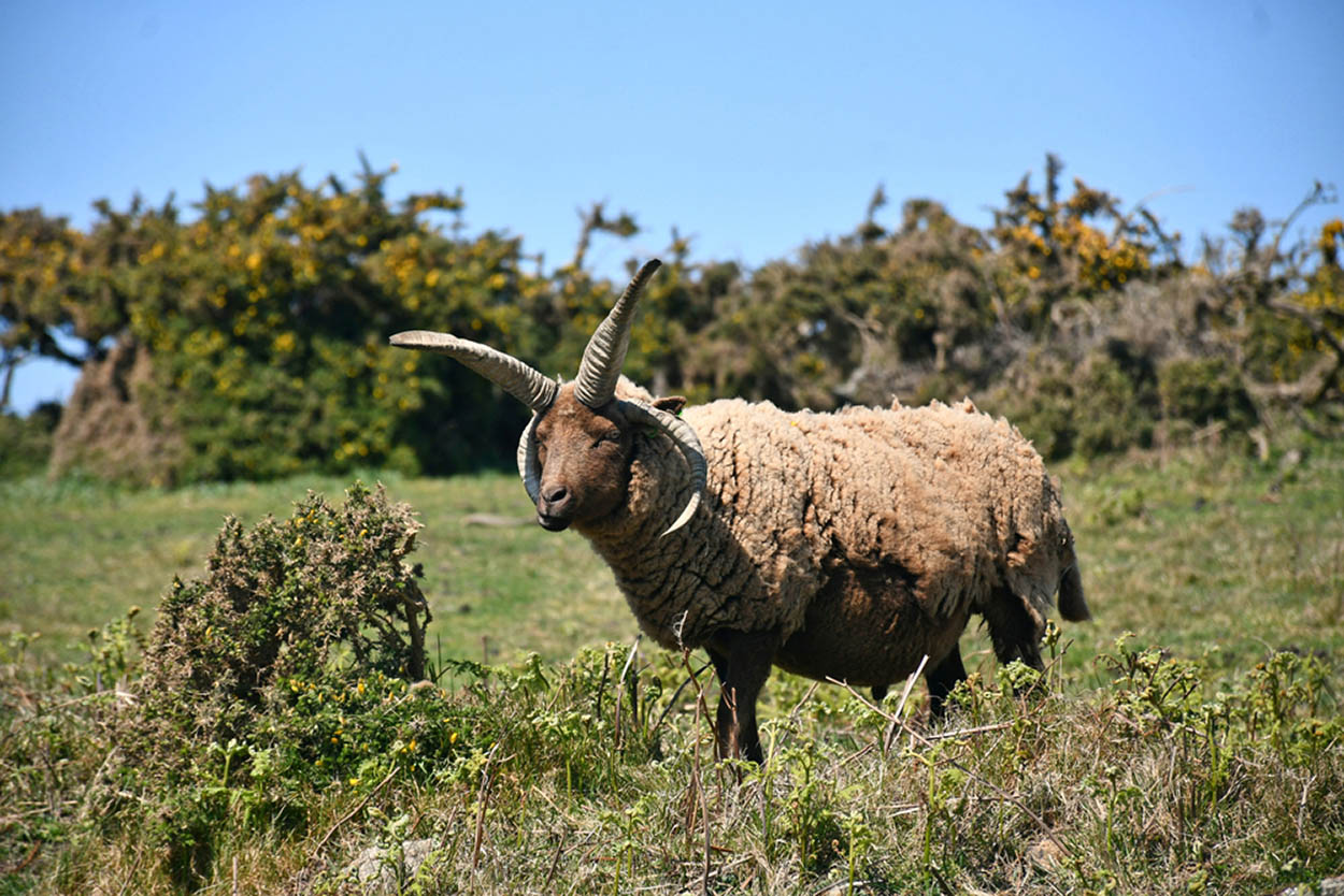
The soft wool of the Manx Loagthan sheep is prized by weavers.
Shutterstock
La Crête Fort
On the promontory to the east of the bay La Crête Fort 5 [map] was built by the British in 1835, on a site that was first militarised in the sixteenth century. The fort was extended during the German Occupation in World War II, and was later used by the Lieutenant-Governor as a weekend retreat. Jersey Heritage has renovated the fort for holiday lets. Tenants can enjoy spectacular sea views to Guernsey, Sark and France, and there’s a secluded beach close by.
Keep the Sheep
As part of a project to help restore Jersey’s coastal grasslands and heath, the National Trust introduced a herd of multi-horned Manx Loagthan sheep to the Mourier Valley between Sorel Point and Devil’s Hole. These spectacular sheep have an average of four horns (but have been known to grow up to seven!), love brambles, gorse and nettles and are the closest living breed to the now extinct multi-horned Jersey sheep that used to graze here over two hundred years ago.
Take the C99 out of Bonne Nuit, going westwards and when you arrive at the T-junction turn right on to the B52. This will take you to the village of St John’s where you turn right on to the main A9. After the church take another right turn, on to the C101, which merges into the C100.
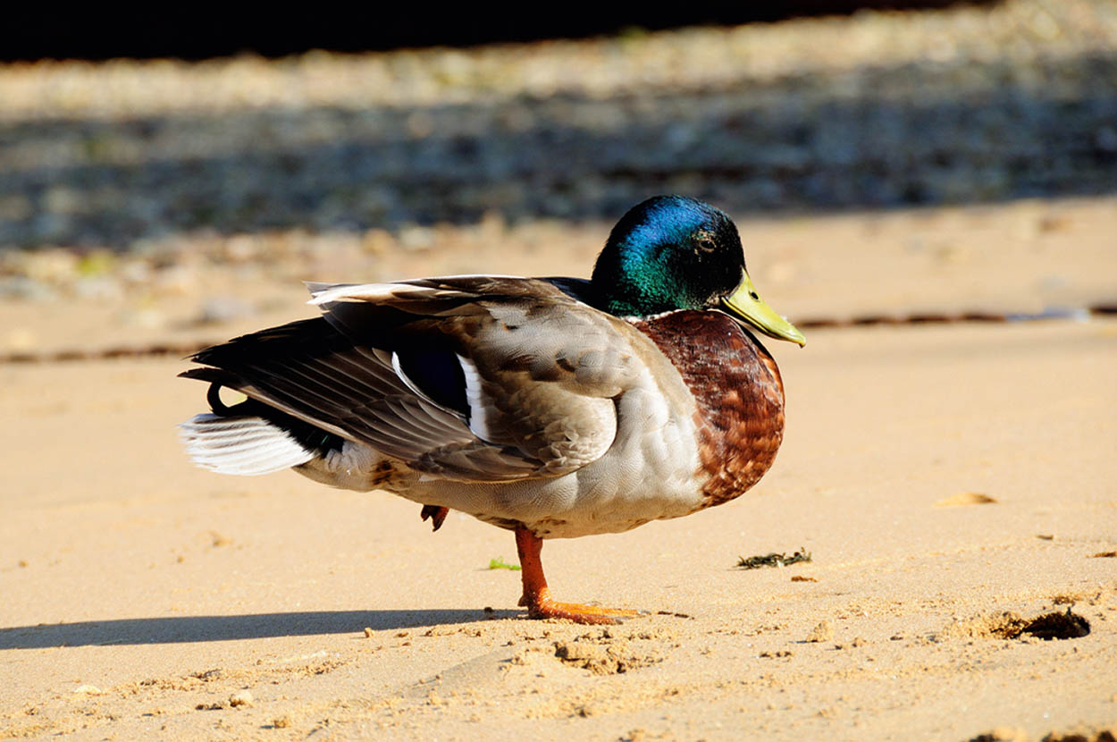
Resident mallard ducks patrol the beach at Bonne Nuit Bay.
Mockford & Bonetti/Apa Publications
Devil’s Hole
The main road veers away from the coast and becomes a Green Lane (with a speed limit of 15mph/24kmh). At the next crossroads turn right for Le Creux du Vis (Screw Hole) or, as it is more popularly known, Devil’s Hole 6 [map] . Park at the Priory Inn and take the steep footpath down the hill to see this spectacular natural feature, a great blowhole, created by a collapsed cave.
The melodramatic name is thought to have derived from the figurehead of a mid-nineteenth-century French shipwreck, which was washed up in the Devil’s Hole and crafted into a wooden horned devil. Over the years various replicas of the devil have been placed on the path going down to add atmosphere, but each one has been stolen. Keep an eye out for the latest one.
The land is owned by the Jersey National Trust, which was responsible for the work carried out at the site to provide safer access for visitors. Wooden steps have been replaced by a tarmac path with handrails leading to a viewing platform, telescope and interpretation panels, and a further decked platform offers sight of the Devil’s Hole and the waters crashing as the tide comes up.

The sea flows into the spectacular Devil’s Hole.
iStock
Grève de Lecq
From Devil’s Hole follow the road south towards the village of St Mary, and take the signs for Grève de Lecq. In the 1860s a decision was made to create a safe harbour for boats from the island’s large fishing fleet. But this never came about. The original pier, started in 1872, was poorly constructed and almost entirely demolished by storms. It lay in ruins for years, and it was not until the following century that it was finally made safe – as a truncated little jetty.
Cliffs and rocky headlands protect the intimate, sandy beach at Grève de Lecq – the north coast’s most popular and busiest family beach.
Mockford & Bonetti/Apa Publications
La Mare Wine Estate
Going south from Devil’s Hole, you may want to check out all the Jersey specialities at La Mare Wine Estate. You’re unlikely to have time for a guided tour and tasting of the winery, but you can get access to the shop (and café) without having to pay the admission fee. The shop has a tempting selection of sparkling and still wines, liqueurs, chocolates and a whole range of preserves – all made at La Mare.
Today Grève de Lecq 7 [map] is a popular beach resort, drawing far more visitors than any of the other north coast bays. It offers ample parking, easy access, a sandy beach, a pub and guesthouse (the Prince of Wales) and a couple of cafés. Children and ducks enjoy the sands here and fishermen cast their lines from the jetty. Overlooking the bay to the east and reached along the coastal path, Le Câtel de Lecq (Lecq Castle) is said to have been the site of an Iron Age hill fort.

Chocolate heaven at La Mare Wine Estate gift shop.
Mockford & Bonetti/Apa Publications
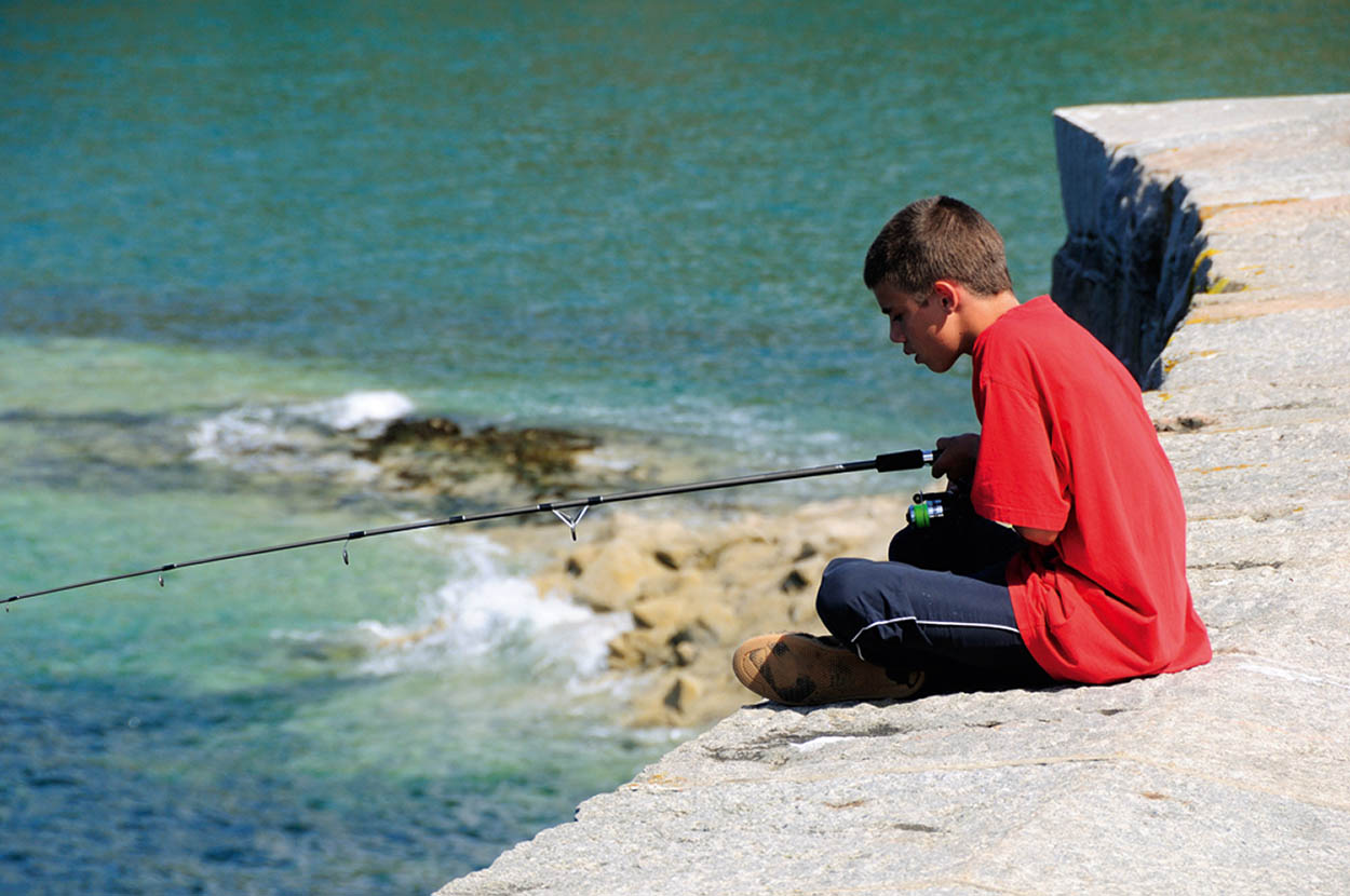
The old pier at Grève de Lecq is an excellent vantage point for budding young anglers.
Mockford & Bonetti/Apa Publications

Behind the beach, the National Trust for Jersey has restored the Grève de Lecq barracks from the Napoleonic Wars.
Mockford & Bonetti/Apa Publications
Grève de Lecq Barracks
Standing behind the bay, the Grève de Lecq Barracks were built to house garrison troops in 1810 when the island feared a French invasion, and are the only surviving barracks on the north coast. Restored by the National Trust, the barracks are today home to the North Coast Visitors’ Centre, devoted to the wildlife and history of the area, plus history and military exhibits and a collection of horse-drawn carriages. The officers’ quarters at the Barracks have been converted into holiday lets.

Refreshments await you at Le Moulin de Lecq inn.
Mockford & Bonetti/Apa Publications
Le Moulin de Lecq
Further back along the main road, Le Moulin de Lecq, which has been converted into an inn, was formerly a flour-grinding watermill. It dates from the fourteenth century, was used for over six hundred years and still retains its massive mill wheel. The stream here, which gushes out on to the beach, is the dividing line between the parishes of St Mary and St Ouen.
Plémont
The last beach on the north coast is Plémont 8 [map] , or more correctly La Grève au Lançon (Sand-Eel Beach). To get there, take the road out of Grève de Lecq (the B65), turning right on to the B55, and right again at the small crossroads at Portinfer. Plémont beach to the north remains unspoilt thanks largely to the lack of vehicular access.
Leave the car at the park above the bay and walk down the cliff path then take the long flight of steps that leads from the café down to the beach. Low tide reveals a wide expanse of fine sands, rock pools and a network of caves in the cliffs on the landward side; but at high tide there is no sand to be seen. The headland to the east, accessible by the north coast footpath, is a good place for birdwatching, especially in late spring/summer. The cliffs here have been home to a colony of puffins for over one hundred years (see box).
Jersey Puffins
Atlantic puffins inhabit the northwest corner of Jersey nesting in the cliffs from Plémont east to Grand Becquet. Puffins lay only one egg per year, and the decline in numbers is of great concern – in 2022 there were just four breeding pairs left on the island. The causes of the decline are not clear, but marine traffic along with predators and disturbance by humans are probably all factors. A seabird protection zone has been established here to try to enhance breeding success, and two giant puffin sculptures were unveiled in 2022 to raise awareness. The least intrusive place to try and see the birds is from the footpath between Plemont and Greve de Lecq.
In 2015 Jersey residents heaved a sigh of relief when it was announced that the beautiful headland above Plémont Bay would be restored to its natural state. For years the site of a derelict Pontins holiday camp, it was purchased by a commercial company who threatened to build a large development here. The National Trust successfully campaigned against the project and after a hearing in Jersey’s Royal Court, and with help from the States of Jersey, the park was sold to the trust in a multi-million deal. The campsite was demolished and archaeologists began examining the area.
Les Landes
Returning to Portinfer, rejoin the B55 going westwards. Take the next turning to the right, a narrow road signed to Les Landes Race Course, which lies to the left as you head towards the cliffs.

Le Moulin de Lecq, now a public house, was one of the many ancient watermills of the island.
Mockford & Bonetti/Apa Publications
Walk This Way
The north coast footpath offers mile after mile of majestic cliffs and dramatic rugged scenery. This is easily the most exhilarating walk on the island, and one that can either be done in its entirety over a very long day (roughly eight hours) or in separate sections at a gentler pace. The walk can be done at any time of year, but the scenery is at its best in spring, when sea campion, thrift, ox-eye daisies, pennywort and bluebells are in full bloom. This is also the time of year that you might spot the Glanville fritillary butterfly dancing over the cliffs.
Race meetings have been taking place on the island for over one hundred and seventy years. The first races in the 1830s were held on the flat sands of St Aubin’s beach, then at Greve d’Azette (St Helier), where several thousand spectators used to watch the big events. Gorey Common hosted the races for over sixty years, and special boats used to come from Guernsey for the events. Lillie Langtry, who later bred her own horses, was one of the famous visitors here. Les Landes is a spectacularly located course, but race meetings these days are point-to-point style, without the glamour of bygone days.
The deserted coast at Plémont.
Mockford & Bonetti/Apa Publications
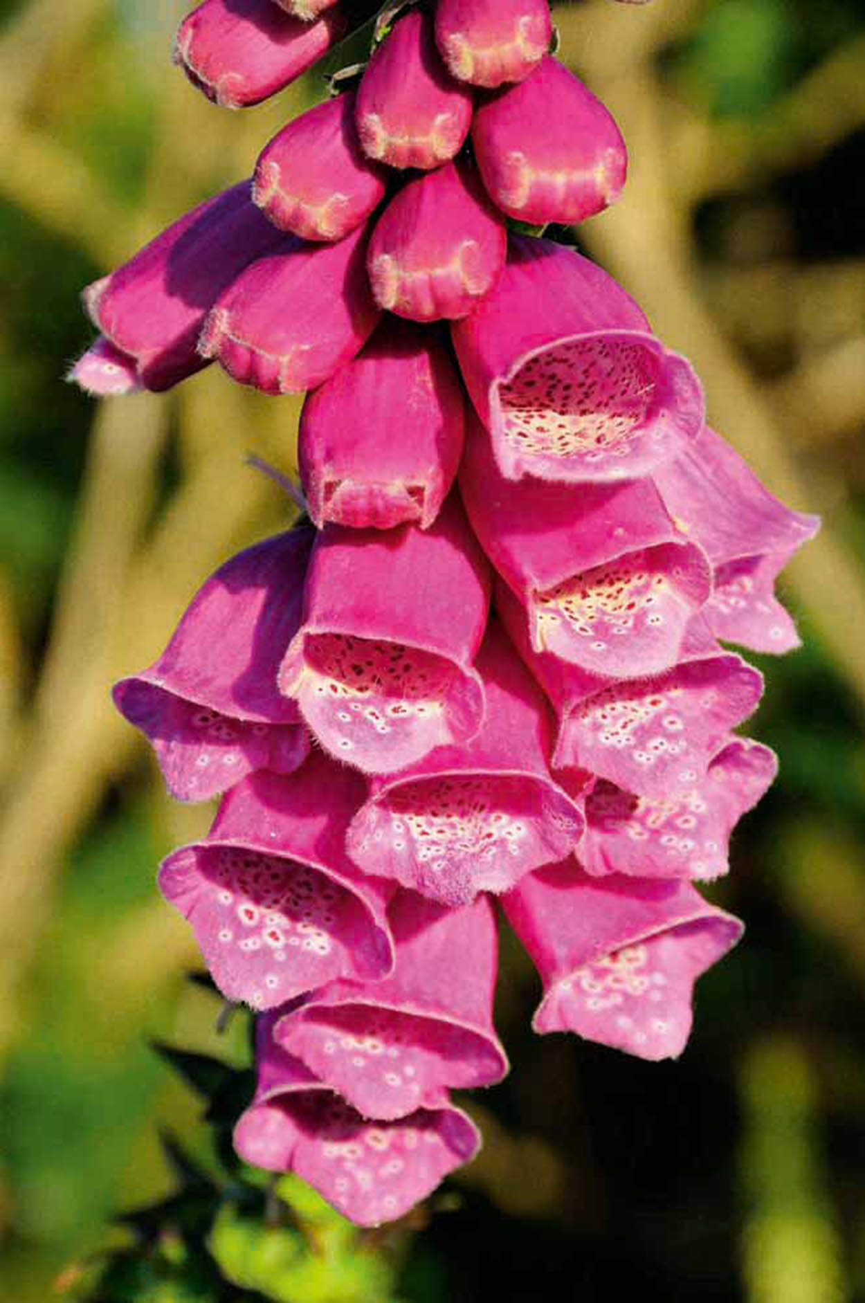
Wild foxgloves are a common sight on the north coast footpath.
Mockford & Bonetti/Apa Publications
Grosnez Castle
At the end of the road, at the most northwesterly point of the island, stand the evocative medieval ruins of the Castle of Grosnez 9 [map] . The only recognisable feature is the Gothic arch, although the foundations of walls and buildings beyond it are clearly visible.
A reconstruction on the information panel shows how the castle would have originally looked, complete with drawbridge, portcullis and machicolated upper storey. Unlike Jersey’s other main strongholds, little is known of the castle’s history.
It was a roughly built fort, constructed in the first half of the fourteenth century in defence against an invasion from the French, then destroyed, probably by the French, either in the same century, or when they occupied Jersey in 1461–8. The carved corbels that once decorated the main arch fell off long ago, but were rescued and safely housed in the Archaeological Museum at La Hougue Bie. The ruins are set dramatically on the clifftops, 200ft (60 metres) above the rough seas. Walk through the arch for fine views, weather permitting, of all the other Channel Islands.
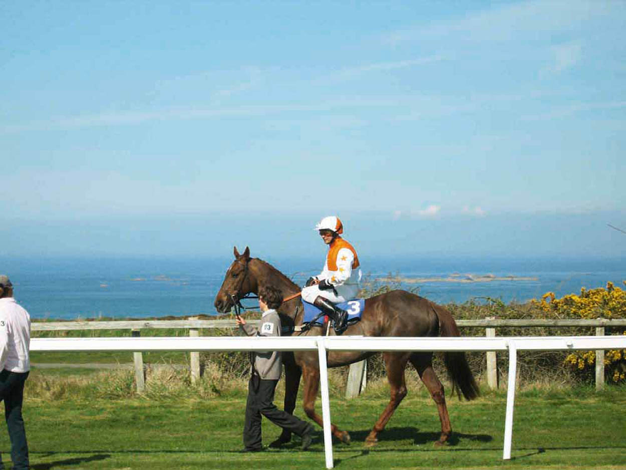
A lap of honour for a jockey and his horse at Les Landes Race Course, next to the ruins of Grosnez Castle.
Ralph on flickr

The main gateway, bastions and a narrow moat are all that remain of Grosnez Castle.
Mockford & Bonetti/Apa Publications
Looking from left to right these are Guernsey, Jethou, Herm, Sark and in the very far distance, Alderney. The coast of Normandy lies in the distance to the east, while closer inland, a chain of uninhabitable rocks known as Pater Noster (Our Father) is visible at low tide.
The name originated from a shipwreck here, involving families who were on their way to colonise the then uninhabited island of Sark. Several of them were drowned, including women and children.
Since then it has been customary for sailors and fishermen to recite the Lord’s Prayer as they pass the treacherous reef.
North Coast Footpath
The official north coast footpath runs for 15 miles (24km) almost the entire length of the coast, and offers some of the most dramatically beautiful hiking on the island. Parts of the walk are quite steep, particularly as the path climbs up from the bays, but it can be exhilarating, and there is nothing that would really challenge an averagely fit walker. The path occasionally breaks from the coast, diverting through wooded slopes or fields, and in St John’s Parish, it joins the main road, following the coast, before heading inland to avoid the unsightly quarry at Ronez.

Walking the north coast footpath is an exhilarating experience.
iStock

A stone signpost points the way on the north coast footpath.
Mockford & Bonetti/Apa Publications
The public bus service provides the best means of transport – whether you’re doing the whole walk or different sections on different days. Services from St Helier operate to points on or close to the north coast (tours 3, 4, 5, 7, 8 and 9), and it’s easy to hop off and on.
Bus timetables are available from Visit Jersey, Liberation Bus Station or www.libertybus.je. If you have your own car, leave it at one of the bays and take a bus back to the parking place (although this may involve taking two services, via St Helier).
Although the footpath is well signed and fairly obvious, a map is nevertheless useful. The best one is the Ordnance Survey style Jersey Official Leisure map, available from Visit Jersey or from bookshops.

Take time to admire the flora on your coastal walk.
Mockford & Bonetti/Apa Publications
Eating Out
Rozel Bay
Château la Chaire Restaurant
Rozel; www.chateau-la-chaire.co.uk.
Behind the bay, in the wooded Rozel valley, this inviting country house hotel offers excellent English cooking with a Gallic influence, in a delightful dining room or in the conservatory with terrace in summer. £££
The Rozel
La Vallée de Rozel; www.rozelpubanddining.co.uk.
Inn with stone and wood floors, real ales and bar billiards. ££
Bouley Bay
Mad Mary’s
Bouley Bay Beach, Trinity.
Lovely sea-view terrace where you can enjoy crab sandwiches, home-made cakes, bacon butties, cream teas and Mary’s legendary hot chocolate with cream and marshmallows. £
Bonne Nuit
Bonne Nuit Beach Café
Bonne Nuit Beach; www.bonnenuitbeachcafe.co.uk.
One of the north coast’s most popular cafés, looking on to the lovely Bonne Nuit Bay and serving everything Thai and other dishes. The café is not licensed so bring your own bottle. £–££
St John
Les Fontaines
La Route du Nord; https://randalls-jersey.co.uk/les-fontaines-tavern.
Charming country pub on the north coast road close to Sorel Point, converted from a seventeenth century farmhouse with a pleasant sea-view terrace and good pub food. Indoor and outdoor play areas. ££
Grève de Lecq
Le Moulin de Lecq
Le Mont de la Grève de Lecq; www.moulindelecq.com.
This traditional, landmark inn was originally a corn mill, parts of which date back to the twelfth century, and is attached to the island’s largest working water wheel. Plenty of character (the bar area is built around the old cogwheels), with a varied menu (both traditional dishes as well as several gluten free and vegan options), garden with adventure playground. ££
Plémont
Plémont Beach Café
Tel: 01534-482 005.
This café above Plémont Beach prides itself on supporting local food and art, which is reflected in both the menu and the decor. £