
St Aubin’s harbour, nestled at the foot of a green valley.
Mockford & Bonetti/Apa Publications
Tour 2: The Southwest
This half-day driving or cycling tour covers 11 miles (18km) from St Aubin’s Bay to Beauport, where the coast is fringed by the finest beaches on the island.
Highlights
St Aubin’s harbour, nestled at the foot of a green valley.
Mockford & Bonetti/Apa Publications
The tour follows the coast west from St Helier, via St Aubin, to the southwestern tip of the island. Cliff strolls afford fabulous views, and the choice of beach breaks ranges from big sandy bays with water sports galore to secluded little beaches sheltering below the cliffs. When it comes to restaurants you are spoilt for choice, from the quayside eateries at St Aubin to the string of cafés and fish restaurants right on St Brelade’s Bay.
St Aubin’s Bay
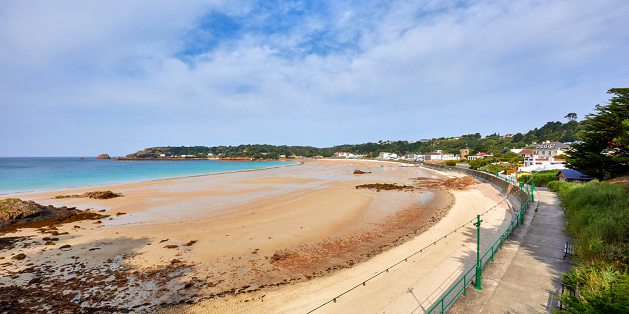
Leave St Helier via the Esplanade, following the signs for “The West” and St Aubin, keeping to the coast all the way. The gently curving, south-facing St Aubin’s Bay stretches for 3 miles (5km) from Elizabeth Castle to St Aubin. The seafront promenade, formerly the route of the Western Railway Line, stretches the entire length of the bay.
During spring tides, giant waves crash over the wall here and sand bags are piled up to protect the small streets leading up from the coastal road. Normally, though, this is a calm, safe bay whose sands are lapped by the shallowest of waters. Prior to the opening of Jersey’s airport in St Peter in 1937, the sands at the eastern end of St Aubin’s Bay were used at low tide for take-off and landing of seaplanes flying between the Channel Islands.
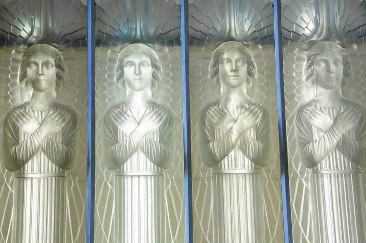
The unique glass interior designed by René Lalique.
Mockford & Bonetti/Apa Publications
Razor fish
When the tide is very low you can have fun trying to catch razor fish (also known as razor clams) in St Aubin’s Bay. Go equipped with a bag of salt, walk along the shoreline and look for the keyhole-shaped burrows in the sand. Sprinkle about a teaspoonful of salt over the hole and wait for around thirty seconds for the razor fish to pop out of its burrow. Hold the clam firmly for a few seconds while it relaxes, then pull it gently out of the hole. The fish are actually long, thin molluscs with cut-throat, razor-like shells. A slightly chewy type of clam, they are popular in parts of Europe and can be delicious if cooked correctly, ideally steamed with wine, garlic and herbs.
Reflected Glory
Halfway round St Aubin’s Bay on the A1, St Matthew’s Church at Millbrook is known as the Glass Church (Mon–Fri 9am–5pm and for services on Sun). The austere church walls belie a glowing interior that was decorated in opaque glass by the Art Deco glass designer René Lalique. Florence Boot (Lady Trent), the widow of Jesse Boot, founder of Boots the Chemists, commissioned Lalique to embellish the church, then dedicated it to her late husband.
The Southwest

At Bel Royal, where the A1 and A2 converge, keep to the coast road for St Aubin’s Harbour. Park just before the harbour, at the main car park on the left hand side of the road.
St Aubin
A far smaller, prettier place than St Helier, St Aubin 1 [map] lends itself to quay or seaside strolls and leisurely lunches at inviting alfresco restaurants. The first pier was built in 1675, and a small town subsequently grew up here, with the Bulwarks – the houses beside the harbour – added in 1790. Thanks to its picturesque cottages and its setting at the foot of a green valley, St Aubin was from its earliest days more popular than St Helier.
A haunt of privateers
Named after a sixth-century Breton saint, who was known as a protector against pirates, the town ironically acquired much of its wealth through profiteering (legalised plundering of enemy shipping), and in the seventeenth and eighteenth centuries it was the leading port on the island. During the English Civil War many a British vessel was captured and plundered by Sir George Carteret, the Royalist governor of the island. Such were the losses of British ships that Parliamentary forces were sent by Cromwell to put down the Royalist resistance.

Picturesque cottages line the harbour at St Aubin.
Mockford & Bonetti/Apa Publications
Cheers to Bergerac
To Bergerac fans the Old Court House in St Aubin will be familiar as the Royal Barge pub that featured in the BBC TV detective series of the 1980s. The combination of crime investigations, affluent tax exiles, beach holiday setting and Bergerac’s affairs proved a huge hit, and the series ran for ten years (you can still catch up with it on some TV channels). The recently refurbished Old Court House is now a hotel with a choice of restaurants and bars.
Merchants’ mansions
Merchants who grew rich on the proceeds of profiteering built themselves fine four-storey houses, often equipped with huge cellars to store the booty. Prior to the construction of the harbour, some of the Bulwarks stood right on the seashore and had spectacular roof outlooks for viewing the return of the fleet. One of the finest still standing is the Old Court House, overlooking the harbour, and now a hotel and restaurant. The loot was stored in the cellars and then divided in what was then the Court Room, presided over by the judges.
Fish and ships
Apart from privateering, fortunes were also made by the more honourable trades of shipbuilding and cod fishing in Newfoundland. The fishing fleet used to set off across the Atlantic in springtime, returning for the harvest in autumn. The cod were dried, salted and exported, and fishing was the island’s most lucrative industry until the late nineteenth century. Shipowning had also expanded rapidly, and in 1865 Jersey and Guernsey were ranked tenth in British ports. However, the islands were to suffer with the advent of iron steamships in the 1870s. These were too expensive to buy – or build – spelling the end of the great seafaring era.

Originally a wealthy merchant’s house, parts of the Old Court House Inn date back to 1450.
Mockford & Bonetti/Apa Publications
Arts and Crafts
Overlooking the port, the Harbour Gallery (The Quay, St Helier) is the largest exhibiting and selling gallery in the Channel Islands. Comprising three galleries and a textile centre, it exhibits work from over 100 local artists and craft workers, showcases a minimum of nine exhibitions a year and hosts workshops, classes and events for all ages. Wander at leisure through the galleries and choose from paintings, prints, ceramics, jewellery, woodwork and textiles. It also has an excellent little café.
Today the St Aubin vessels are either jet skis that roar around the bay, motorboats or yachts. The port is home to the Royal Channel Islands Yacht Club (you can see it at the end of the quayside), whose first female member was Lillie Langtry, one of the most famous figures in Victorian society. She was elected a member of the club in 1892.

Handmade local crafts for sale at the Harbour Gallery.
Mockford & Bonetti/Apa Publications
The Western Railway
Overlooking St Aubin’s harbour on the east side is St Brelade’s Parish Hall, formerly the Terminus Hotel and railway station. The now defunct Western Railway, which linked St Helier to St Aubin, was extended to Corbière in 1884. Trains ran on a single line of standard-gauge track and, apart from delays caused by waves crashing over the sea wall along St Aubin’s Bay, the service ran with remarkable efficiency. However, competition from buses and a fire at St Aubin’s station, destroying the rolling stock, led to the demise of the service in 1936. The track was turned into a footpath and today makes a delightful 4-mile (6km) walk across the western corner of the island.
Offshore, St Aubin’s Fort 2 [map] was built to command the western end of the bay in the mid-16th century, predating Elizabeth Castle at St Helier. Persistent threats of invasion led to additional fortifications over the centuries, the most recent of which were built by the Germans during the Occupation in World War II. You can walk to the fort over the wet sands at low tide, but there is no access to the public as it is now used as a residential sports facility for schools and youth groups; it is only really worth visiting for the views across to St Aubin.
Jersey Birds
Noirmont Point is a critical area for migrant birds; as the most southerly headland in Jersey and the last chance for birds to find food before crossing the open sea to France, it attracts large numbers. Among the less common are honey buzzard, osprey, wryneck, golden oriole, ring ouzel, shorelark, tawny pipit, ortolan and lapland bunting, barred warbler, and melodious warbler. The area was designated an ecological Site of Special Interest in 2007.

The underground Command Bunker gives a unique insight into German military engineering.
Mockford & Bonetti/Apa Publications

St Aubin’s Fort was built in the 1540s to protect shipping in the bay.
Mockford & Bonetti/Apa Publications
Parallel to the coast road, the High Street, known also as Rue du Crocquet, used to be the main thoroughfare for horses and carts linking St Aubin with St Helier. Many of the houses were built by wealthy merchants at the end of the seventeenth century. Those on your right would have backed directly on to the sea, enabling vessels to load and unload. Keep going to the top of the road for fine views across the bay.

St Brelade’s Parish Hall is housed in the former railway station.
Public domain
Noirmont Point
Turn inland from St Aubin along the A13, which climbs up the wooded valley towards St Brelade’s Bay. After about a mile (1.6km), turn left on to the B57, the Route de Noirmont, and at the small crossroads, take the left turn just beyond it for Noirmont Point 3 [map] . This headland was called “Black Mount” after the clouds that gather over it – said to herald rain. A prominent relic of the Occupation is the huge underground Command Bunker of the former German coast artillery battery, complete with a large observation tower brooding on the clifftop. The bunker has been carefully restored by the Channel Islands German Occupation Society and is open to the public from April to October, most Sundays 11am–4.30pm.
The Coastal Artillery gun to the left of it originally stood at La Coupe, on the northeast coast, but after the war it was thrown over the cliffs by the British, then recovered in 1979.
Portelet Bay
Return to the junction and turn left for Portelet Bay 4 [map] . Park the car at the top of the cliff, by the Old Portelet Inn and admire the views from the top of the cliff. The pretty bay of Portelet below, with its soft, sheltered sands, can be reached by a long flight of steps. The beach is rarely crowded and now has the bonus of a delightful café. The little island, accessible at low tide, is properly called the Île au Guerdain but more popularly known as Janvrin’s Tomb, after the sea captain who was buried here.

The sand at Ouaisné Bay is perfect for making sandcastles.
Mockford & Bonetti/Apa Publications

Portelet Bay is one of the island’s most photogenic beaches.
Mockford & Bonetti/Apa Publications
When Janvrin was returning with his ship from plague-infested Nantes in France in 1721, he was refused entry to St Aubin’s harbour for fear of contamination. Janvrin fell victim himself and, since his body was not allowed ashore, he was given a burial on the island. The body was later transferred to St Brelade’s cemetery. The tower on the islet was built over the grave in 1808 as one of the many fortifications against possible invasion during the Napoleonic Wars.
Ouaisné Bay
From the Old Portelet Inn, return to the small crossroads, turn left and then take the right fork down to Ouaisné Bay 5 [map] (pronounced Waynay). The Old Smugglers’ Inn, on the left as you go down, is evidence of former activities in this corner of the island.

Île au Guerdain, home to Janvrin’s Tomb.
Mockford & Bonetti/Apa Publications
The magnificent sweep of sandy beach, sheltered between headlands, stretches for over a mile, Ouaisné Bay being divided from St Brelade’s by a rocky promontory called the Point le Grouin. Even on hot days in high season, Ouaisné’s fine sandy beach has plenty of space.
Portelet Common
For dramatic sea views head for the northern edge of Portelet Common, a 77-acre (31-hectare) nature reserve rising 200ft (61 metres) above sea level. From this elevated plateau the view takes in a huge sweep of bay, from Ouaisné below to the far end of St Brelade’s Bay. The habitat of gorse, dwarf shrub heathland and lichen grassland supports over one hundred plant species, while the crevices of the cliffs provide nesting and roosting sites for shags, oystercatchers and rock pipits.
The cliffs south of the bay shelter La Cotte de St Brelade 6 [map] (closed to the public), a major archaeological site excavated on and off for one hundred years from 1881. Thirteen teeth of Neanderthal man were discovered here, along with the much older bones of prehistoric woolly mammoth and rhino. These piles of bones, discovered in the 1960s and ’70s, suggested that the cave-dwellers stampeded the animals off the cliffs to their deaths.
Behind Ouaisné beach, the gorse-covered common is home to some rare species of fauna. This is the last stronghold of the agile frog, and is also a habitat of the Dartford warbler and the Jersey green lizard. Sightings, however, are rare, and visitors are advised to keep to the pathways and not to disturb the habitat. Protecting Ouaisné Common from the sea and stretching the length of the beach is the German anti-tank wall, built by prisoners during the German Occupation. Portelet Common, an expanse of heathland above the beach commanding splendid coastal views, can be reached by the cliff path (see box).

Sweeping views of St Brelade’s Bay from Portelet Common.
Mockford & Bonetti/Apa Publications
The soft sand and safe bathing make sheltered, south-facing St Brelade’s one of Jersey’s most popular beaches.
Shutterstock
St Brelade’s Bay
St Brelade’s Bay 7 [map] is accessible by foot either across the sands or over the rocky promontory, depending on the tides. To reach the beach by car, return to the junction, joining the A13, then fork left on to the B66 and descend to the bay. With its gently sloping, golden sands, sheltered setting and clear, blue waters St Brelade’s is justifiably the most popular beach on the island.
Seaside Treasure Trove
Design your own glass bead jewellery at Fish ’n’ Beads, a quirky little beach shack on the promenade at St Brelade’s Bay. There are also funky and original gifts for sale, many of them made from recycled driftwood or other finds washed up on the beach. The hut is open 10am–5pm in summer, check for times rest of year; tel: 01534-742 348.
Above the sands, the seafront promenade is bordered by palm-fringed gardens, seafood cafés, souvenir and gift shops. The Sir Winston Churchill Park has immaculate lawns and brightly coloured flowerbeds, while on the slopes above the bay lie some highly desirable tax-exile residences, set in lush south-facing gardens.
The beach is the best equipped on the island, with sun loungers, windbreaks and a whole host of water sports: stand-up paddle boarding, kayaking, coasteering, sailing, water skiing, windsurfing and – when there are waves – surfing and bodyboarding. If you don’t fancy getting wet there are plenty of beach activities including beach volleyball and beach football.
Creative gifts from recycled driftwood.
Fish ‘n’; Beads
When it’s time for lunch there is ample choice. You can just step straight from the sands to seafood eateries for Jersey oysters and crabs, or a laid-back café for burgers, grills or home-made cakes. The string of cafés and restaurants along the boardwalk all have tables alfresco where you can soak up the stunning sea views.
St Brelade’s Church and Fisherman’s Chapel
Overlooking the little port at the far end of the bay, the picturesque parish Church of St Brelade 8 [map] dates back to the twelfth century and still retains its Norman chancel.
This church was built in pink Jersey granite, and inside you can see pebbles and limpets from the beach embedded in the un-rendered walls.
Nearby, the lovely little Fisherman’s Chapel 9 [map] is the oldest place of worship on the island, built in the eleventh century on the foundations of an ancient monastic church. The chapel acquired its present name in late medieval times when it was used by the fishing guilds. Having escaped destruction during the Reformation, it was variously used as an armoury, store room and carpenter’s shop. In 1880 permission was finally given for the building to revert to a church. Restoration early in the twentieth century brought to light the fragments of a series of beautiful medieval frescoes (1375–1425), decorating all four walls. These were restored in 1980, and today the scenes from the Old and New Testaments can be made out with the help of drawings on helpful information boards that reconstruct the missing outlines.

Stroll along the Esplanade and gardens at St Brelade’s.
Mockford & Bonetti/Apa Publications

The early-Norman Fisherman’s Chapel is located beside St Brelade’s Church at the western end of the bay.
Mockford & Bonetti/Apa Publications

Fragments of beautiful medieval frescoes decorate the interior of the Fisherman’s Chapel.
Mockford & Bonetti/Apa Publications
Clearest of all is the scene depicting the Annunciation along the east wall. The small kneeling figures either side of the Virgin and Archangel – seven males to the left and seven females to the right – are members of the donor’s family.
The flight of granite steps linking the churchyard with the small harbour is the shortest Perquage (sanctuary path) on the island. Before the Reformation, criminals who sought refuge in any of the twelve parish churches were allowed to escape via such paths to the safety of a boat and sanctuary in France. Hence each of the parishes has at least a short section of coastline.
Beauport Bay
Take the steep road opposite the main entrance of the churchyard and turn left for Beauport ) [map] . Reaching this unspoilt bay entails a longish trek down a bracken-clad cliff – which deters most tourists. Islanders come here, especially at weekends, when sleek yachts are often moored in the bay. There are no facilities on the beach, so take a picnic, and a sunshade or hat.
The clear, still waters are excellent for snorkelling, and children can enjoy fishing in the rock pools.
End the day at La Corbière, a short drive to the west. This is a dramatic and photogenic spot to watch the sun sink into the Atlantic.
Eating Out
Ouaisné Bay
Kismet Cabana
Ouaisné Car Park, La Rue du Ouaisné; www.kismetcabana.com.
Street food inspired by global flavours. This laid-back shack is in Ouaisné Bay’s car park but you can take away food to the beach. ££
St Aubin’s harbour
Lazin Lizard
Mont Les Vaux; www.lazinlizard.com.
Buzzy little restaurant catering for all tastes, with dishes like Cajun-style crispy squid, Jamaican Jerk chicken, sticky ribs and steak with teriyaki prawns. ££
Salty Dog Bar and Bistro
Le Boulevard; www.saltydogbistro.com.
Relaxed alfresco dining and food that is big on flavour, freshness and spice. Cocktails and contemporary music are part of the scene. £££
St Peter
Mark Jordan at the Beach
La Plage, La Route de la Haule; www.markjordanatthebeach.com.
Run by the same chef as the Ocean Restaurant in the Atlantic Hotel this casual bistro on the beachside promenade offers high quality, simple cuisine with the emphasis on fish. £££
Portelet Bay
Portelet Bay Café
Portelet Bay; www.porteletbaycafe.com.
Family-run café right on the beach with quirky upcycled decor. Delicious wood-fired pizzas and the catch of the day is brought in by boat. A lovely scenic spot, worth the trek down from the Portelet Headland (no car access). Booking essential in summer. ££
The Old Smugglers’ Inn
Le Mont de Ouaisné; www.oldsmugglersinn.com.
Popular pub, close to the beach, converted from seventeenth-century cottages. Fill up on traditional pub food beside a fire in the winter. Easy parking and the landlord is friendly. ££
St Brelade’s Bay
Crab Shack
La Route de la Baie; www.jerseycrabshack.com.
Rustic beachfront eatery that’s all about the seafood; from home-made mackerel pâté and local crab bisque to Jersey oysters and freshly picked spider crab, all beautifully presented. ££
Oyster Box
La Route de la Baie; www.oysterbox.co.uk.
Mainly seafood restaurant with a great location on the bay. The menu stretches across the culinary spectrum from gourmet burgers to Jersey oysters, crab and lobster. Seaside terrace. ££–£££