INFORMATION AND PERMITS: Meiss Country is administered by the Lake Tahoe Basin Management Unit: USDA Forest Service, Lake Tahoe Basin Management Unit, 35 College Dr., South Lake Tahoe, CA 96150; 530-543-2600, fs.usda.gov/ltbmu. No wilderness permits are required, but you must have a California Campfire Permit to have a campfire or use a stove. Day-use parking fee at the Meiss Meadows Trailhead parking lot is $5.
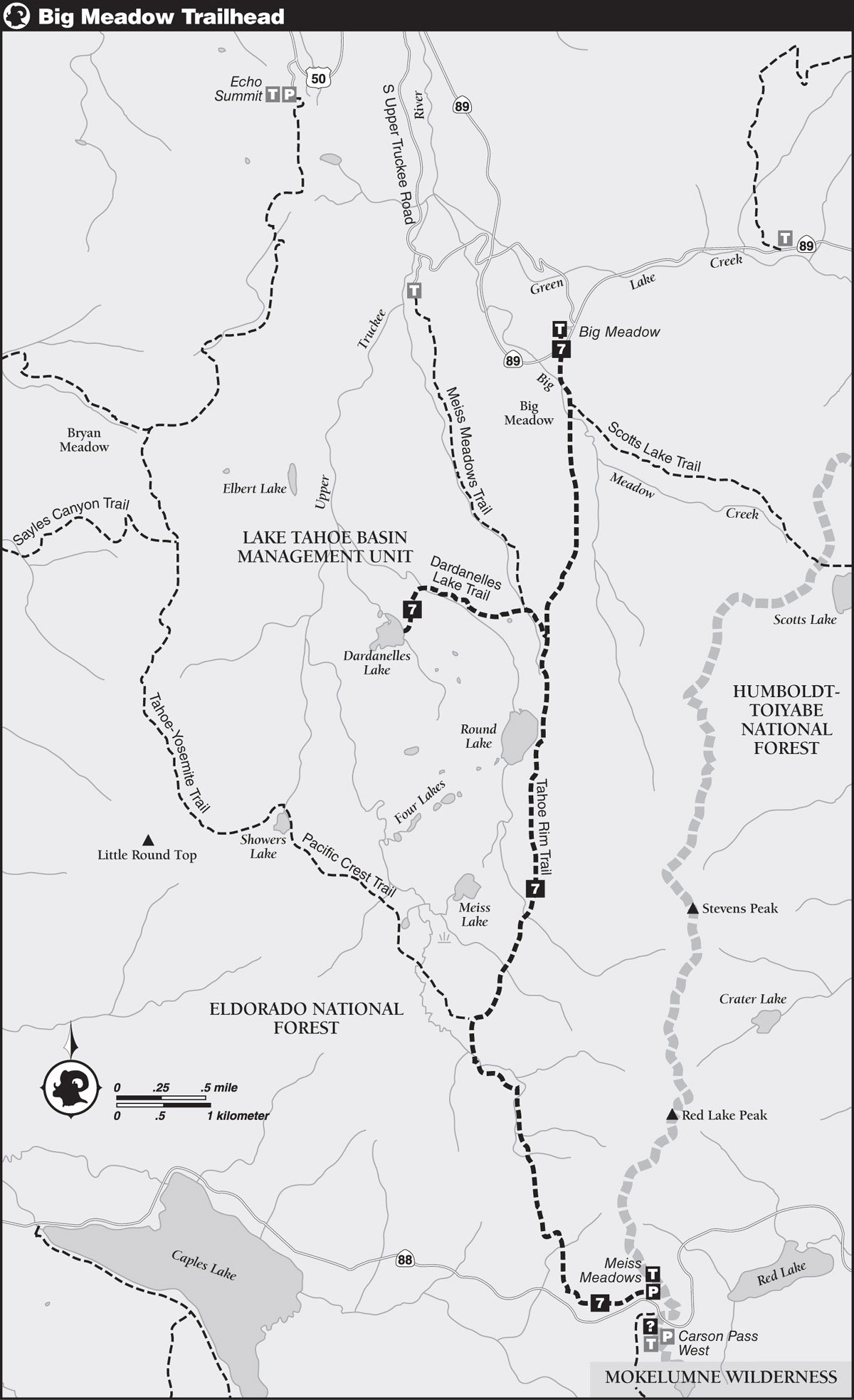
DRIVING DIRECTIONS: Drive on CA 89 to the well-signed Big Meadow/Tahoe Rim Trail parking lot, 6 miles from the CA 88 junction in Hope Valley, and 5 miles from the US 50 junction near Meyers.
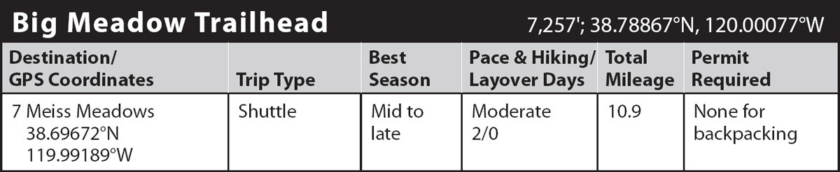
trip 7 Meiss Meadows
Trip Data: |
38.69672°N, 119.99189°W; 10.9 miles; 2/0 days |
Topos: |
Caples Lake, Carson Pass |
HIGHLIGHTS: This trip travels through the heart of the Meiss Meadows area. Following sections of the Tahoe Rim Trail (TRT), the unofficial Tahoe-Yosemite Trail (TYT), and the Pacific Crest Trail (PCT), recreationists can travel from CA 89 to CA 88, visiting Big Meadow, Dardanelles Lake, Round Lake, and Meiss Meadows along the way.
SHUTTLE DIRECTIONS: To get to the Meiss Meadows Trailhead, follow CA 88 0.3 mile west of Carson Pass. There’s a daily fee of $5 to park, and the drive between the trailheads is approximately 16 miles.
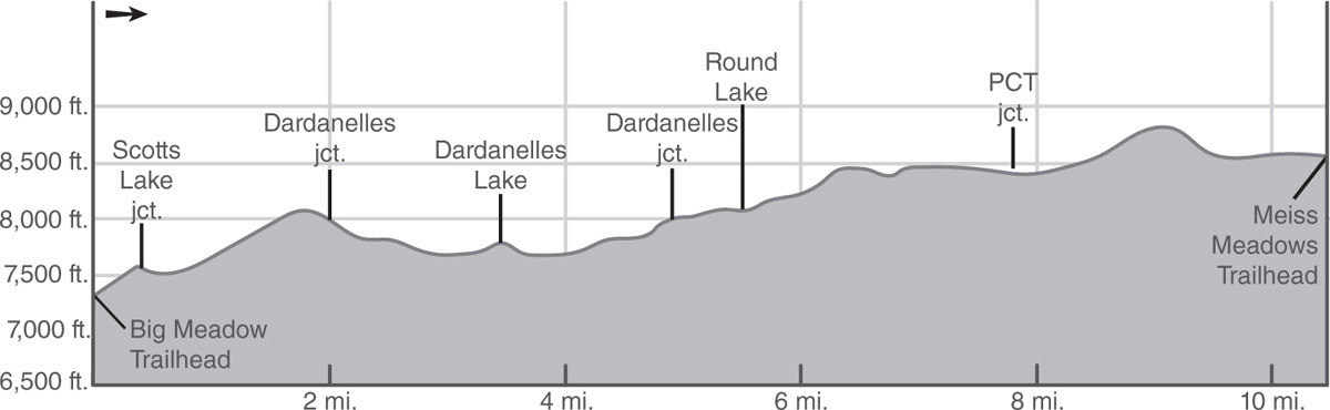
DAY 1 (Big Meadow Trailhead to Dardanelles Lake, 4.0 miles): Leave the southwest side of the parking area and follow the singletrack TRT a short distance to a crossing of CA 89. Once across the highway, pick up the TRT and start a winding, moderate, southward climb through a forest of Jeffrey pines, lodgepole pines, and red firs. At a switchback, you have a fine view of the aspen-lined, rocky channel of Big Meadow Creek, which is vibrantly alive with snowmelt in early July and golden color in autumn. Following more switchbacks, the grade eases just before reaching a junction a half mile from the trailhead, where a trail to Scotts Lake branches left (southeast).
Go right (south) at the junction and quickly leave the trees behind, emerging into grassy, flower-covered Big Meadow. Follow the trail through the meadow to a wood-plank bridge that spans the gurgling creek and proceed to the far edge, where a lightly forested ascent resumes. Sagebrush, currant, and drought-tolerant wildflowers, principally mule ears, line the path. Farther up the trail, wood-beam-reinforced steps help you over the steeper sections of trail that follows a diminishing tributary of Big Meadow Creek, a sprightly watercourse lined with luxuriant foliage.
Continue climbing to a densely forested saddle and then follow a switchbacking descent into the next canyon, through which flows an Upper Truckee River tributary. Reach the floor of the canyon and proceed to a junction marked by a post, where you meet the Dardanelles Lake Trail.
Turn right (west) and make a very brief descent to a junction with the Meiss Meadows Trail. Immediately past the junction, ford an Upper Truckee River tributary, and soon ford a wider stretch of the stream. Early in the season, search for logs upstream in order to avoid getting your feet wet. Away from the streams, stroll across a bench holding a small meadow and seasonal ponds.
Descend from the bench through a dense forest of western white pines, red firs, and lodgepole pines and follow an alder-and-willow-lined stream down a canyon. The grade eases as the trail passes through meadowlike vegetation of grasses, wildflowers, and willows on the way to a boulder hop of Round Lake’s outlet. A short climb amid boulders and granite slabs leads to the east shore of Dardanelles Lake (7,762'; 38.76036°N, 120.02030°W), 1.3 miles from the TRT. Far enough off the thoroughfare of the TRT, you may be able to enjoy the relative seclusion of this lake. The lakeshore is shaded by light forest and dotted with boulders and slabs, and the picturesque cliffs of the Dardanelles loom above the south shore.
DAY 2 (Dardanelles Lake to Meiss Meadows Trailhead, 6.9 miles): Retrace your steps 1.3 miles back to the Meiss Meadows Trail junction, going right (southeast) at the last junction you passed and continuing to the next junction, where you turn right (south) onto the TRT.
From this junction, the TRT follows a steady climb through dense forest. After 0.6 mile, you crest the lip of Round Lake’s basin above the northeast shore and reach an informal junction. From the junction, a use trail wraps around the lake’s west shore, which is lined with rock outcrops and scattered forest, and then follows a cross-country route to Meiss Lake. You continue south on the TRT, skirting the east shore of Round Lake below the ziggurat-like formation that towers above and passing through thick forest, staying away from the lush meadows and thick willows bordering the inlet at the south end.
Beyond the lake, the climb resumes, soon reaching an extensive sloping meadow carpeted with willows, wildflowers, and other lush foliage, well watered by a thin, rock-lined rivulet spilling across the trail. Past the meadow, you reenter forest cover and hop across a pair of trickling rivulets. Eventually the grade eases to a mellow stroll where the trail breaks out into an open forest sprinkled with stands of aspen and swaths of drier groundcover, including sagebrush, currant, grasses, and drought-tolerant wildflowers.
Part of extensive Meiss Meadows soon appears through scattered lodgepole pines to the right of the trail, with out-of-sight Meiss Lake lying just a third of a mile to the west (an optional out-and-back detour). Leaving the meadow behind, hop across Round Lake’s inlet and proceed to cross a creek that runs through a rocky channel 0.4 mile farther, where open terrain allows views of the rugged slopes leading up to 10,059-foot Stevens Peak. Continue on gently graded trail through lodgepole pines to the heart of Meiss Meadows and a well-signed junction with the PCT/TYT.
BYGONE DAYS
Near the junction, an old cabin harkens back to the days, not so long ago, when cattle were allowed to graze the lush grasses of picturesque and pastoral Meiss Meadows. This was once Meiss Cow Camp. Fortunately, the cows are gone, the trampling of the meadows is over, the cow pies have decomposed, and the trails have been left to wildlife and humans.
Leaving the TRT, you turn left (south) on the PCT/TYT at the junction and stroll across the pleasant meadowlands, making several crossings of the nascent Upper Truckee River along the way. Eventually the terrain gets steeper as the trail begins a moderate climb of the narrowing gorge toward a saddle at the head of the canyon. Wildflowers grace the slopes on the way, and just past a lovely pond you reach the saddle, from where there’s a fine view north to Lake Tahoe and south to the jagged peaks of the Carson Pass area, including Elephants Back, Round Top, Sisters, Fourth of July Peak, and Thimble Peak. Red Lake Peak towers immediately to your left.
Leaving the saddle, the trail descends steeply across open hillsides and seasonal streams; these slopes are famed for their seasonal wildflower displays. The final leg of the journey is through a light forest on a long traverse across the hillside above CA 88. Early-season wildflowers are prevalent along this final stretch of trail, although intermittent highway noise may disrupt the ambiance a bit. Soon you reach the parking lot at the Meiss Meadows Trailhead (8,560'; 38.69672°N, 119.99189°W) just off noisy CA 88.
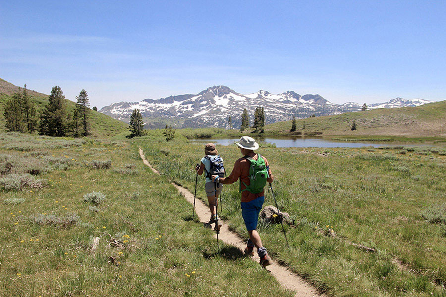
Hikers enjoy a view of Round Top and neighboring peaks on the way toward Meiss Meadows Trailhead. Photo by Mike White