INFORMATION AND PERMITS: All backpackers must secure and pay for a wilderness permit for entry into Desolation Wilderness. The region is heavily used, and strict zone quotas are in place for the number of overnighters departing from every trailhead that enters the wilderness. A majority of permits are available by reservation, with the remainder handed out on a first-come, first-served basis. Reserved permits may be obtained online at recreation.gov. During business hours, walk-in permits may be picked up at the Taylor Creek Visitor Center, Pacific Ranger Station, LTBMU Supervisor’s Office, and LTBMU North Shore Office.
DRIVING DIRECTIONS: Approximately 4 miles west of Strawberry, turn north from US 50 onto Forest Service Road 4 and, following signs for Wrights Lake, drive 8 miles on FS 4 past the Lyons Creek Trailhead and a junction with FS 32 to the vicinity of Wrights Lake. At a stop sign near the Wrights Lake Visitor Information Center, 0.1 mile past the entrance to the Equestrian Camp and Bloodsucker Lake Trailhead, turn right and proceed on a narrow, paved road 0.8 mile to the end of the pavement at the Twin Lakes Trailhead parking area. The trailhead, near the east end of Wrights Lake, is equipped with a pit toilet and bear-proof dumpster.
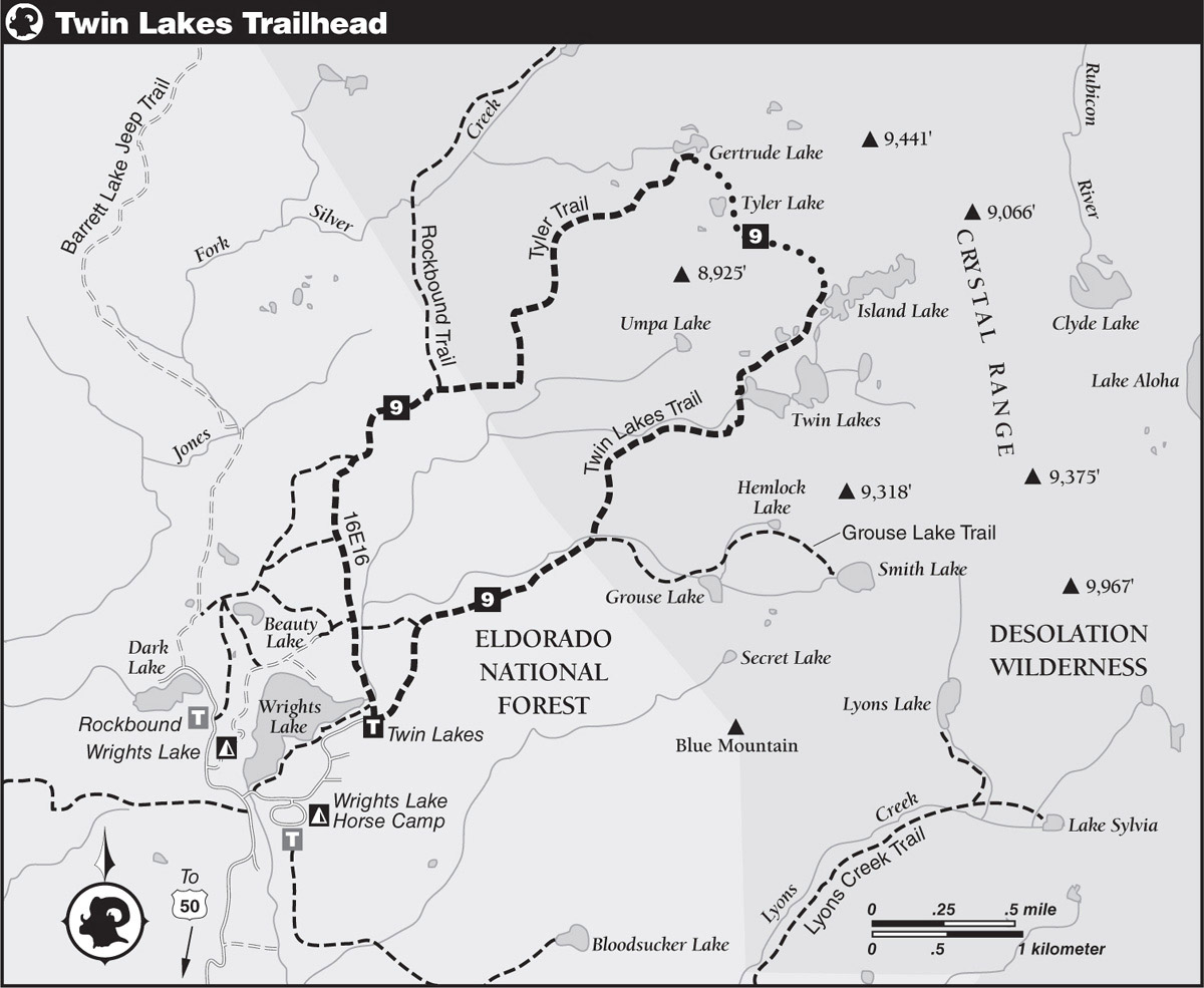
trip 9 Island, Tyler, and Gertrude Lakes Loop
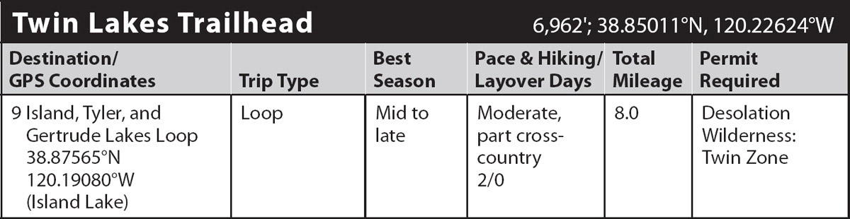
Trip Data: |
38.87565°N, 120.19080°W (Island Lake); 8.0 miles; 2/0 days |
Topos: |
Pyramid Peak, Rockbound Valley |
HIGHLIGHTS: Classic Desolation Wilderness scenery, including craggy granite peaks and glacier-scoured cirques harboring crystal-blue lakes, abounds on this trip into two tributary canyons of Silver Creek. While the maintained trails up both canyons are relatively short and accessible for scads of hikers and backpackers, the mile-long cross-country route over the ridge between is difficult enough to dissuade all but the hardy few from attempting this loop.
HEADS UP! The cross-country leg on Day 2 is only for experienced backpackers with navigational and Class 2–3 climbing skills. Novice backpackers should return the way they came. Note that some maps are misleading: there is no trail directly to Tyler Lake; the maintained trail goes to Gertrude Lake.
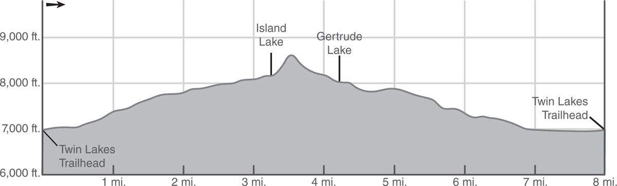
DAY 1 (Twin Lakes Trailhead to Island Lake, 3.25 miles): From the parking lot, walk down a very short section of paved road past a black steel gate and a bridge over Wrights Lake’s lazy inlet (don’t cross the bridge) to the start of the Twin Lakes Trail, marked by a Desolation Wilderness signboard. Proceed on a wide, gently graded dirt path through a mixed-forest canopy shading a lush understory of plants and flowers to a Y-junction with Trail 16E17 (signed LOOP). Turn right (northeast) and begin a stiff climb through alternating sections of open granite terrain and stands of mixed forest, crossing a trickling stream and the wilderness boundary on the way to a junction with the Grouse Lake Trail, marked by a post.
Following the directions for Twin Lakes, turn left (east) at the junction, immediately step across the seasonal outlet of Grouse Lake, and continue the ducked climb over granite slabs interspersed with scattered lodgepole pines. The stiff ascent is momentarily interrupted by an easy stretch of trail that leads near Twin Lakes’ outlet creek. Following another section of steep, rocky climbing alongside the creek, the trail makes a brief descent past a small pond, followed by a slightly rising ascent to the sparsely treed west shore of Lower Twin Lake, where the deep blue water picturesquely reflects the towering granite walls of the basin’s cirque. Decent campsites can be found amid the glacier-polished terrain between the two Twin Lakes. Anglers can ply the waters in search of rainbow and brook trout.
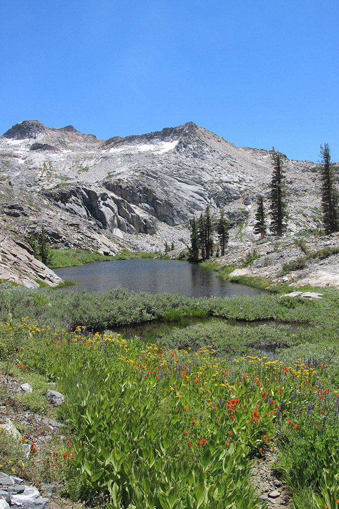
Wildflowers and pond near Twin Lakes Photo by Mike White
Cross the outlet of Lower Twin Lake on the stone remains of an old dam, follow the trail around the west shore, and then make a short, rocky climb to skirt Boomerang Lake’s south shore. Beyond the lake, proceed through a lush pocket meadow and past a cigar-shaped pond. A short, steep, rocky, and winding climb leads to austere Island Lake (8,156'; 38.87565°N, 120.19080°W). As most parties seem content with either of the Twin Lakes as their destination, the open shoreline of rock-island-dotted Island Lake should offer campers a bit of peace and quiet (e.g., 8,149'; 38.87349°N, 120.190498°W). Because the fishing pressure is lower at Island Lake, anglers should do better here than at Twin Lakes. Mountaineers with a layover day could challenge themselves with a climb of 9,975-foot Mount Price.
DAY 2 (Island Lake to Twin Lakes Trailhead, 4.75 miles, part cross-country): From the west shore of Island Lake, leave the maintained trail and start climbing cross-country northwest up the steep slope above the lake, selecting a path that avoids the most brush en route to the crest of the ridge—aim for the low spot (8,596'; 38.87834°N, 120.19321°W) directly northeast of a tan-colored rock outcrop. A short section of Class 2–3 climbing just below the crest may be necessary in order to gain the ridge. Once at the top, views of both canyons are excellent.
The hardest part of the cross-country route is now over, as the climb from the crest down to Tyler Lake is less steep than the climb up from Island Lake. Initially, the way down travels roughly north over talus- and grass-covered slopes before an angling descent over granite slabs leads to the northeast shore of Tyler Lake (8,232'; 38.88083°N, 120.19808°W). Shaded by a smattering of droopy-tipped hemlocks and upright pines, rimmed with low granite humps and angled slabs, and occupying a cirque with less severe walls, the shoreline of Tyler Lake offers visitors more of a pastoral, subalpine ambiance than that of the alpine-looking lakes in the previous canyon. Despite the less dramatic scenery, the lake does offer a reasonable opportunity for solitude because, contrary to what you’ll see on some maps, there exists no maintained trail or boot-beaten path from Tyler Lake to Gertrude Lake, where most visitors prefer to stop.
Go around Tyler’s northeast shore to begin the short and straightforward descent to Gertrude Lake. A light forest canopy obscures your view of Gertrude Lake for much of the trip, so pay close attention to where you’re going as you descend northwest and then north to Gertrude’s south side (7,996'; 38.88400°N, 120.20093°W). Gertrude Lake is a shallow, irregularly shaped body of water encircled by a mixture of grasses, slabs, and stands of conifers, offering limited campsites.
Finding the maintained trail from the vicinity of Gertrude Lake may be a bit of a challenge—look for a large cairn or a series of ducks on the granite bench south of the lake. Having located the ducks or cairn, follow a ducked course southwest on a moderate descent over granite slabs and through boulder- and conifer-sprinkled terrain. Where the trail passes through groves of light forest, the tread becomes easier to follow. The heather-lined path crosses several seasonal meltwater streams before a gentle ascent leads past a small pond. Then a short, steep climb leads to the apex of the ridge dividing the drainage of Jones Fork Silver Creek from the drainage of South Fork Silver Creek.
Breaking out of the trees to open views of Wrights Lake, the trail descends steeply before briefly moderating through a stretch of light forest, where lush vegetation carpets the forest floor. A moderately steep descent resumes down open, shrub-covered terrain that offers excellent views of the canyon holding Twin Lakes. Cross the signed Desolation Wilderness boundary and follow a gently graded path to a post marking a junction with the Rockbound Trail.
Turn left and head southwest on the Rockbound Trail, climb over a low hill, and proceed on the gradually descending trail to another junction, a half mile from the previous one. Here, turn left (south), leaving the Rockbound Trail to follow Trail 16E16 (follow signs to Wrights Lake at all junctions).
From the junction, follow the gently graded, sandy trail through open terrain until a steeper descent on rocky trail leads back into the forest. Pass by an unmarked junction with a short connector southwest to the Rockbound Trail and proceed to a major junction, where two side trails enter, the first from the right and the second from the left several yards farther on. Continuing straight ahead at both side-trail junctions, you soon see a large meadow through the trees to the left, where Wrights Lake’s inlet follows a lazy, serpentine course toward the reservoir. An easy stroll eventually leads alongside this stream and shortly to the well-constructed bridge over the inlet, where you close the loop. From there, follow the paved access road a very short distance back to the trailhead parking lot (6,962'; 38.85011°N, 120.22624°W).