INFORMATION AND PERMITS: Wilderness permits aren’t required in Meiss Country, but you must have a California Campfire Permit to have a campfire or use a stove. There’s a fee of $5 to park at the trailhead, which is in the Eldorado National Forest: 100 Forni Road, Placerville, CA 95667; 530-622-5061, fs.usda.gov/eldorado. For visitor information, call 530-644-6048.
DRIVING DIRECTIONS: From Carson Pass on CA 88, drive 0.3 mile west to the Meiss Meadows Trailhead and the parking lot on the north side of the road.
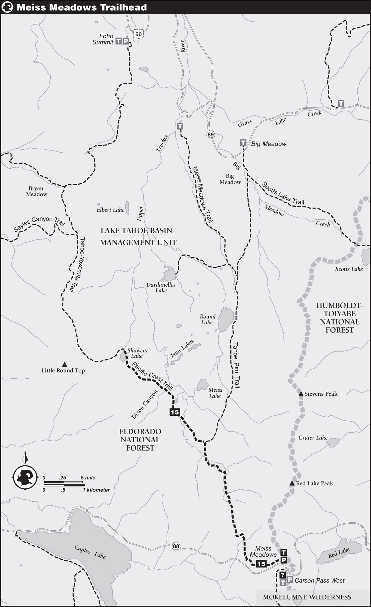
trip 15 Showers Lake
Trip Data: |
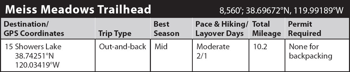
38.74251°N, 120.03419°W; 10.2 miles; 2/1 days |
Topos: |
Caples Lake |
HIGHLIGHTS: Showers Lake is one of the best camping areas between US 50 and CA 88, with numerous campsites and good angling for brook trout. En route, the trail passes through the Upper Truckee River drainage, offering panoramic views of immense volcanic formations.
HEADS UP! There is a daily fee to park at the Meiss Meadows Trailhead.
DAY 1 (Meiss Meadows Trailhead to Showers Lake, 5.1 miles): Leave the parking lot and follow singletrack tread on an undulating traverse across the hillside above the highway. Continue through a light, mixed forest sprinkled with boulders and scattered wildflowers. Soon the trail veers north and exits the forest on a steep ascent across an open slope carpeted with sagebrush and flowers, crossing over a pair of seasonal rivulets on the way to a prominent saddle. Here, at 1.25 miles from the parking lot, you’re blessed with an extensive view to the south of peaks in the Mokolumne Wilderness and north of the Upper Truckee River basin.
The gently graded trail leads past a lushly lined pond nestled into the saddle before descending tread drops you to the headwaters of the Upper Truckee River, crossing the nascent watercourse a few times on the way to the floor of the canyon. An easy stroll crosses flower-filled meadows and over the river once more prior to reaching the vicinity of some rustic cabins from the old days of the Meiss Meadows Cow Camp. Just past the cabins is a signed junction between the Tahoe Rim and Pacific Crest Trails.
Bear left (northwest) from the junction and follow the Pacific Crest Trail (PCT) to another crossing of the river, which might necessitate an ankle-deep ford in early season. Gentle trail leads away from the river crossing, traveling through alternating sections of open meadow and stands of forest. Just past a shallow pond and a tributary draining Dixon Canyon, the trail begins a stiff climb to the crest of a hill and an unmarked X-junction. The faint path to the southwest heads to Schneider’s cow camp, and the old route of the PCT travels around the south side of Showers Lake basin. Turn right at the junction and follow the realigned section of the PCT descending northeast to granite-bound Showers Lake, where several shady campsites may be found near the outlet. (8,658'; 38.74251°N, 120.03419°W).
DAY 2 (Showers Lake to Meiss Meadows Trailhead, 5.1 miles): Retrace your steps.
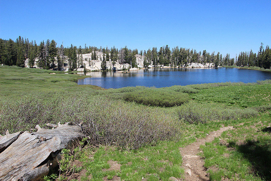
Showers Lake Photo by Mike White