INFORMATION AND PERMITS: This trip is in Yosemite National Park: wilderness permits and bear canisters are required; pets and firearms are prohibited. Quotas apply, with 60% of permits reservable online up to 24 weeks in advance and 40% available first-come, first-served starting at 11 a.m. the day before your trip’s start date. Fires are prohibited above 9,600 feet. See nps.gov/yose/planyourvisit/wildpermits.htm for more details.
DRIVING DIRECTIONS: The trailhead is at the back of the Tuolumne Meadows Campground, just past site B49. Once in the campground, follow road signs to the group-campground loop. Follow the spur to a gate just before the signed HORSE CAMP; the trailhead is here. The campground entrance is located along Tioga Road (CA 120), 7.1 west of Tioga Pass (the Yosemite boundary) and 39.5 miles east of Crane Flat. There are toilets and water at the trailhead.
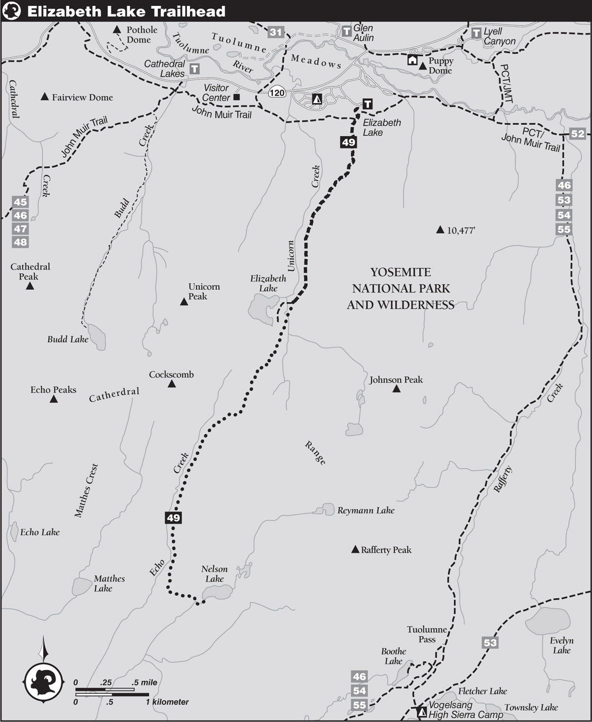
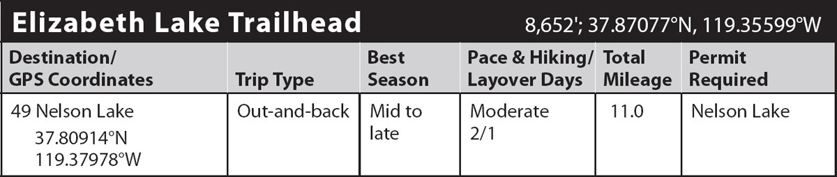
trip 49 Nelson Lake
Trip Data: |
37.80914°N, 119.37978°W; 11.0 miles; 2/1 days |
Topos: |
Vogelsang Peak, Tenaya Lake |
HIGHLIGHTS: Nelson Lake is tucked in a little-visited valley in the Cathedral Range, well off-trail along an unnamed tributary of Echo Creek. This interesting and varied route first visits the scenic Elizabeth Lake basin and continues south over the serrated Cathedral Range on a use trail. It makes a good first off-trail journey into Yosemite’s backcountry, for a decent use trail exists along much of the distance. Nonetheless, only embark on this trip if you have good navigation skills and a paper topographic map.
HEADS UP! Between the Elizabeth Lake basin and Nelson Lake, there’s a beaten path that fades out at times, leaving you to walk cross-country. You need good navigation skills to find your way. Camping is prohibited within 4 miles of CA 120 and throughout the Elizabeth Lake basin.
DAY 1 (Elizabeth Lake Trailhead to Nelson Lake, 5.5 miles, part cross-country): From the campground trailhead, the signed Elizabeth Lake Trail goes south and, after just 200 steps, crosses the well-used Tuolumne Meadows perimeter trail; the perimeter trail heads east to Lyell Canyon and west to Tenaya Lake. You continue straight ahead on a steady southward ascent. Along this lodgepole pine–shaded climb, the trail crosses several seasonal runnels and slowly trends more southwesterly as it sidles over a small rise to reach the banks of Unicorn Creek.
After a 700-foot climb, the gradient lessens, and you cut across sandy flats with increasingly stunted lodgepoles. The younger trees tell a story of trying winters, for they are mostly bent and contorted from the weight of the winter snowpack. Only as they grow taller, and the treetops finally extend above the heavy snowpack, do they have a chance to grow upright. A short time later, you emerge at the foot of a long meadow and are faced with a tangle of use trails, 1.9 miles from the trailhead. All lead right (west) to the northeastern shores of Elizabeth Lake. Staying left (south), after another 0.1 mile you pass another cluster of right-trending spurs—these lead to the lake’s southeastern shores. The view of Unicorn Peak from Elizabeth Lake is not to be missed—walking to the lakeshore is a worthwhile 5-minute detour, despite the sometimes cumbersome hop across Unicorn Creek to reach the lake.
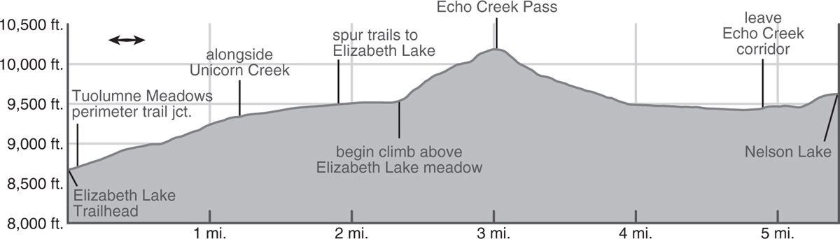
Now on an unmaintained but easy-to-follow trail, you continue south up the meadow corridor, enjoying the wildflowers; pink shooting stars give way to purple asters and yellow monkeyflowers as the season matures. This is a good place to stop and look carefully at your surroundings to ensure you pick the correct route: straight ahead (south) is an open gravelly slope with some late-lasting snow patches that leads to an obvious arc-shaped pass. This is NOT your route. Instead, swivel yourself about 30 degrees clockwise to spy a forested, shallower, lower, less prominent pass that lies immediately east of Knob 10,294, colloquially known as Echo Creek Pass. It leads you across an easy, if unobvious, gap in the Cathedral Range that drops you to the headwaters of the main fork of Echo Creek.
To reach this pass, the use trail soon diverges right (west), trading flat meadow walking for a steady forested climb. It is fairly easy to follow, although, as with all use trails, it occasionally vanishes, only to reappear fully etched in the forest floor a short distance later; the trick is to immediately know you are no longer on a worn pad, so you can search for its continuation before straying far from the correct route. You continue ascending steeply to moderately through mixed lodgepole-and-hemlock forest until 10,000 feet. You then emerge from forest cover onto a shallow, coarse sandy expanse and are led up a channel of decomposing granite between two short but steep rocky ribs. This channel can hold late snow, but is not steep, so continue up it, trending right (west) when outcrops appear ahead. Shortly, you reach the broad, flat pass, sitting between a pair of steep bluffs and dotted with stunted whitebark pines (10,192'; 37.83435°N, 119.37308°W).
Continuing across the pass, the terrain becomes steeper, you are funneled down a gravelly gully. At about the 10,000-foot level, where the slope becomes more vegetated, the trail can quite suddenly vanish. Here, you should turn to the west and descend straight to the banks of nascent Echo Creek, staying just north of a notably wetter slope that is a riot of wildflower color in midsummer. At around 9,900 feet the moisture coalesces into a single channel, and here you resume a more gently angled descent to the valley floor.
Once along Echo Creek, you continue south along the now-again-obvious use trail. The steep glaciated walls loom overhead as you saunter down the shallow valley, passing marmots sunning atop boulders, bright patches of shaggy lupine, and an endless tangle of avalanche-downed trunks. As you descend Echo Creek’s valley, take advantage of the fine over-the-shoulder view of the Cockscomb atop the west valley wall.
THE COCKSCOMB
Aptly named by François Matthes, this slender crest bears clear marks of the highest level reached by the ice of the last glacial episode. Its lower shoulders reveal the rounded, well-polished surfaces that betray glacial action, while its jagged, sharply etched crest shows no such markings. Further evidence of glacial action may be clearly seen on the steep descent into the head of long, typically U-shaped Echo Creek valley. The shearing and polishing action of the ice mass that shaped this rounded valley is evident on the cliffs on the west side.
As you approach the end of the second large meadow in this valley, the trail abruptly curves left (east) and leaves Echo Creek (9,436'; 37.81236°N, 119.38509°W; this is about 1.5 miles beyond where you first reach the creek bottom). The track now veers up to a low, rocky ridge, undulates through sparse forest a little below the ridgetop, then vanishes. Now your route—no longer any trail or possibly even cairns to guide you—cuts up and over the shallow bedrock ridgetop, trending just south of due east. Just as you (maybe) pick up a faint pad again, you reach a forested flat with a dense, unappealing tangle of downed logs, dead bleached lodgepoles, and rapidly growing young trees. Ghost forests, as these stands are coined, are the outcome of lodgepole needle-miner damage. This native moth caterpillar moves cyclically through Yosemite’s forests, defoliating and often killing the majority of trees.
Of more immediately practical relevance, you are unlikely to successfully follow the use trail through the ghost forest, for the young lodgepoles grow preferentially right in the old trail’s depression, forming an impenetrable thicket. Walking where practical, continue your just-south-of-due-east trajectory and you will shortly reach another slab rib, a tad steeper than the previous one. As you climb up it, you may refind the use trail, but it matters little, for you easily surmount it by any number of routes. From atop, turn west to ogle at Matthes Crest, an impressively steep fin of rock lying two drainages to the west, then drop east to reach Nelson Lake’s outlet creek. A very brief ascent along the drainage leads to Nelson Lake. Here you’ll find some delightful tent sites along its southwestern and southeastern shores. It is a remarkably warm lake for swimming and has perfect shoreline for sitting and admiring the truly stunning view. Anglers will find the lake’s waters good fishing for brook trout and wildflower seekers will enjoy the colorful meadows. Peak 11,357, informally named Choo-Choo Ridge, looms to the east, while Rafferty Peak is visible farther northeast (9,629'; 37.80914°N, 119.37978°W).
DAY 2 (Nelson Lake to Elizabeth Lake Trailhead, 5.5 miles, part cross-country): Retrace your steps.
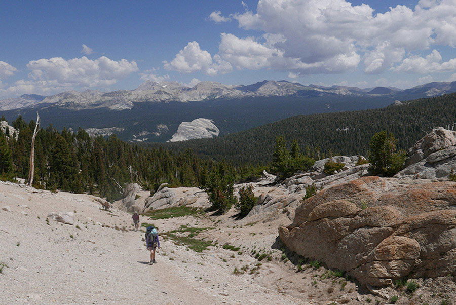
Look back for views of the Mount Conness area as you climb to Echo Pass. Photo by Elizabeth Wenk