INFORMATION AND PERMITS: This trip begins in Sierra National Forest and wilderness permits are required. Once you enter Yosemite National Park, its regulations apply: bear canisters are required, pets and firearms are prohibited, and no fires are allowed above 9,600 feet. Quotas apply from May to October, with 60% of permits reservable online starting in January each year and 40% available first-come, first-served starting the day before your trip’s start date. See tinyurl.com/sierranfwildernesspermits for more details. Monday–Friday, permits can be picked up at the Bass Lake Ranger District at 57003 Forest Service Road 225, North Fork (559-877-2218), and seven days a week in summer at the Yosemite Sierra Visitors Bureau, located in downtown Oakhurst at 40343 CA 41 (559-658-7588). If you plan to use a stove or have a campfire, you also require a California Campfire Permit, available from a U.S. Forest Service office or online at readyforwildfire.org/permits/campfire-permit.
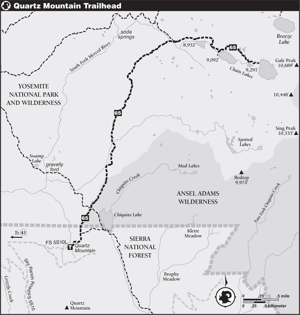
DRIVING DIRECTIONS: This is a quite remote trailhead just south of the Yosemite boundary. First, drive to the start of Sky Ranch Road, located on CA 41 a little north of Yosemite Forks (11.7 miles south of Yosemite National Park’s Wawona entrance station and 4.1 miles north of Oakhurst).
Turn onto Sky Ranch Road (Forest Service Road 5S10) and follow it east for 26.25 miles. Some waypoints are the junction to Soquel Campground (8.25 miles from CA 41), junction with FS 5S06 (14.5 miles from CA 41), Fresno Dome Trailhead (15.75 miles from CA 41), and Grizzly Lakes Trailhead (18.0 miles from CA 41). At the 26.25-mile mark, turn left onto FS 5S10L and follow it 0.4 mile to the Quartz Mountain Trailhead.
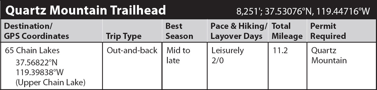
trip 65 Chain Lakes
Trip Data: |
37.56822°N, 119.39838°W (Upper Chain Lake); 11.2 miles; 2/0 days |
Topos: |
Sing Peak |
HIGHLIGHTS: Chain Lakes is the most popular destination in southeastern Yosemite, a string of three subalpine lakes in a narrow, steep-walled granite valley. The greatest challenge getting there is driving to the trailhead, more than an hour up dirt roads from the Oakhurst environs. The walking is pleasant and the destination is stunning lakes.
DAY 1 (Quartz Mountain Trailhead to Upper Chain Lake, 5.6 miles): The trail departs east from the Quartz Mountain Trailhead parking area, dropping steeply down a shaded slope to a lush flat where you step across consecutive trickles. Turning north, you pass a little-used spur trail descending right (east) to Chiquito Lake and continue straight (left; north) through gorgeous red fir stands before emerging on a dry, rubbly slope you follow to the Yosemite National Park boundary fence, and just beyond, Chiquito Pass.
Here you find a diffuse four-way junction, a little difficult to interpret due to a maze of tracks in the sand. Continue straight (northeast), following the route signposted to Chain Lakes and Moraine Meadow; left (northwest) leads to Gravelly Ford and a hard right (south-southeast) to Chiquito Lake. You soon pass by a stagnant pond trapped between the crests of two bouldery, brushy moraines. The moraine to the left remains to your side for a full half mile before you cross it and make a slight descent to a flat-floored forest. In early summer, several creeks and creeklets are flowing, and, during those times, the traverse can be a muddy one that hikers hurry through to evade a marauding horde of mosquitoes.
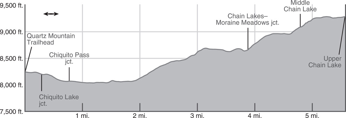
The creek descending from the Spotted Lakes is the widest, and the only one plotted on maps. Beyond it, you have a 1.3-mile-long ascent, broken at about 8,400 feet elevation by a small, moraine-dammed meadow. As you climb, the trail alternates between drier slabs and lush flower-filled forest pockets. Here there are predominately red firs, with some lodgepole and western white pines in the mix. The climb leads to a low point on a glacier-polished ridge, which you cross and then make a rolling 0.75-mile traverse northeast to a junction on the north bank of the boulder-choked Chain Lakes outlet creek.
Turn right (east), upstream, and hike along a moderate-to-steep trail up to shallow, moraine-rimmed Lower Chain Lake (8,950'). Camps here are inferior to those by the deeper middle lake. From the lower lake’s outlet, your trail skirts the northern shore of the lake and then passes a boggy meadow, from where you could head south to some possible campsites. Next, you make a short, fairly steep ascent up along the creek to picturesque, island-dotted Middle Chain Lake. The warm bedrock islands are easily reached, particularly from the excellent large camp along the lake’s southwest shore (9,085';37.57038°N, 119.40884°W). To reach that camp, cross the lake’s two outlet creeks, and then follow a primitive path along the west shore. Twenty feet deep, this is a classic subalpine lake, rimmed with lodgepole pines, western white pines, and mountain hemlocks and understoried with Labrador tea, red heather, western blueberry, and dwarf bilberry. The backdrop to the east, Gale Peak, is perfectly centered over the water. Sitting on slabs on the lake’s western shore, just 4.8 miles from the trailhead, you can understand why this location is so popular.
Beyond the middle lake, the trail is less traveled. It climbs steeply to the bouldery crest of a moraine, winds over to a stagnant pond, and drops south to a photogenic lakelet. Near this lakelet, the trail may divide and reunite, and then it briefly climbs to deep Upper Chain Lake (9,291'; 37.56822°N, 119.39838°W). Cold, windswept, and rock rimmed, it offers only tiny single-tent exposed campsites, but it is a good staging area for adventurers planning to climb Gale Peak, along the park’s southeast boundary crest. Anglers may have a better chance up here than down at heavily fished Middle Chain Lake.
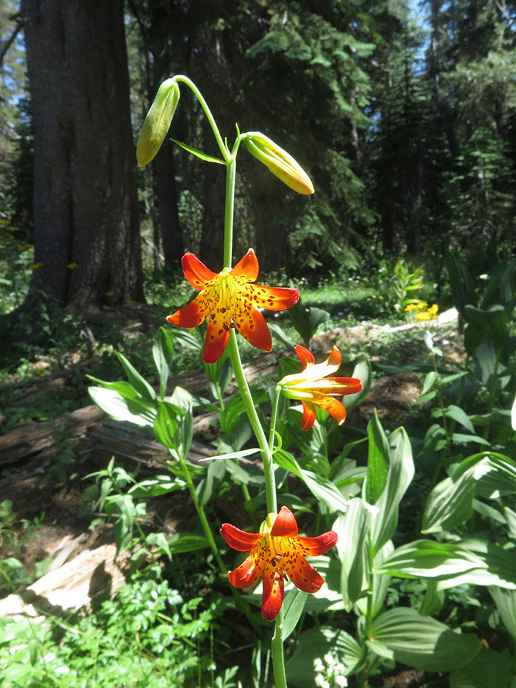
Alpine lilies Photo by Elizabeth Wenk
DAY 2 (Upper Chain Lake to Quartz Mountain Trailhead, 5.6 miles): Retrace your steps.