TRIP 5 Lime Ridge Open Space
| Distance | 3.3 miles | |
| Hiking Time | 2 to 3 hours | |
| Elevation Gain/Loss | ±850 feet | |
| Difficulty | Moderate | |
| Trail Use | Mountain biking allowed1 | |
| Best Times | Fall through spring | |
| Agency | WCOSTD | |
| Recommended Map | Lime Ridge Open Space (WCOSTD) | |
| Notes | 1Bicycles are not allowed on the Lime Ridge Trail, and must instead stay on dirt roads to complete the trip. |
HIGHLIGHTS This athletic loop, a perfect cool-weather outing, uses the Ohlone, Manzanita, Lime Ridge, and Paraiso trails to explore the rugged, chaparral-clad hills northwest of Mt. Diablo on the border of Concord and Walnut Creek.
DIRECTIONS From I-680 in Walnut Creek, or Highway 24 eastbound (just before the merge with I-680), take the Ygnacio Valley Road exit and go northeast 3.5 miles to Oak Grove Road. Turn right and go 0.4 mile to Valley Vista Road. Turn left and go 0.8 mile to a parking area, right.
FACILITIES/TRAILHEAD There are no facilities at the trailhead, which is on the east end of the parking area.

You go through a gate and walk uphill to an information board and the Ohlone Trail. Bearing left, you climb moderately on a dirt road to a junction, where the Paraiso Trail, which you will use later, joins from the right. Turning left, you soon go through a gate into the Walnut Creek Open Space Lime Ridge Preserve, which is closed to dogs.
Descending through a narrow ravine, you come to a T-junction, where you turn right on the Manzanita Trail. Climbing steeply, you follow a rocky dirt road that soon provides great views in exchange for the effort. After passing the Buckeye Trail, left, you reach a saddle where a number of trails meet. Turning right, you follow the Lime Ridge Trail, a dirt road, through a corridor of chaparral. At an unsigned fork, bear left and descend a set of steps, then follow a single-track trail to the base of a power-line tower.

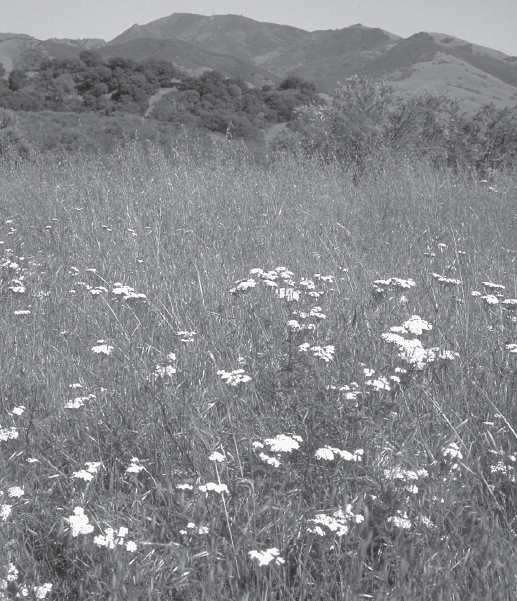
Lime Ridge Open Space: meadow with yarrow frames view of Mt. Diablo.
Lime Ridge Flora
Coast live oaks, blue oaks, and California buckeyes line the route, which also passes hillsides of chaparral, mostly chamise, toyon, California sagebrush, yerba santa, manzanita, and black sage.
With the tower on your right, follow the trail alongside, and then atop, a ridge. A rolling course soon brings you to a junction with a dirt road, where you angle right. After 100 feet or so, you rejoin the Lime Ridge Trail by veering left. The trail soon merges with the dirt road you just left, and now you have an open, ridgetop climb. Topping a rise, you descend to a saddle and a junction with the Paraiso Trail, where you turn right.
Descending a dirt road on a gentle grade, you pass stands of chaparral pea, which produce beautiful magenta flowers in late spring and early summer. After meeting the Timberleaf Court Trail, left, your road curves right and closes the loop by joining the Ohlone Trail. Here you turn left and retrace your route to the parking area.