TRIP 1 Wildcat Canyon Regional Park
| Distance | 7 miles, Semi-loop | |
| Hiking Time | 3 to 4 hours | |
| Elevation Gain/Loss | ±1700 feet | |
| Difficulty | Difficult | |
| Trail Use | Mountain biking allowed1, Leashed dogs | |
| Best Times | Spring and fall | |
| Agency | EBRPD | |
| Recommended Map | Wildcat Regional Park (EBRPD) | |
| Notes | 1Havey Canyon is closed to bicycles and horses during wet weather |
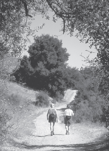
HIGHLIGHTS This semi-loop takes you from the lowlands of Wildcat Creek to the high, open slopes of San Pablo Ridge, using the Wildcat Creek, Havey Canyon, San Pablo Ridge, and Belgum trails, and Nimitz Way. You are rewarded for your efforts by some of the best views in the East Bay, including a 360-degree panorama from an old Nike missile site. Exposed to sun and wind for much of the way, this hike is best done when spring wildflowers bloom or after summer’s heat has abated, when the hills are golden brown. (This route is a favorite among bicyclists: walk on the right side of the trails.)
DIRECTIONS From I-80 eastbound in Richmond, take the Solano Ave. exit, which puts you on Amador St. Turn left and go 0.4 mile to McBryde Ave. Turn right and follow McBryde Ave. 0.2 mile, staying in the left lane as you approach a stop sign. (Use caution at this intersection; traffic from the right does not stop.) Continue straight, now on Park Ave., for 0.1 mile to the Alvarado Staging Area, left.
From I-80 westbound in San Pablo, take the McBryde Ave. exit, turn left onto McBryde, go over the freeway and, from the intersection of McBryde and Amador, follow the directions above.
FACILITIES/TRAILHEAD The Alvarado Area, northwest of the parking area, has picnic tables and water. There are toilets near the trailhead, which is on the east end of the parking area.
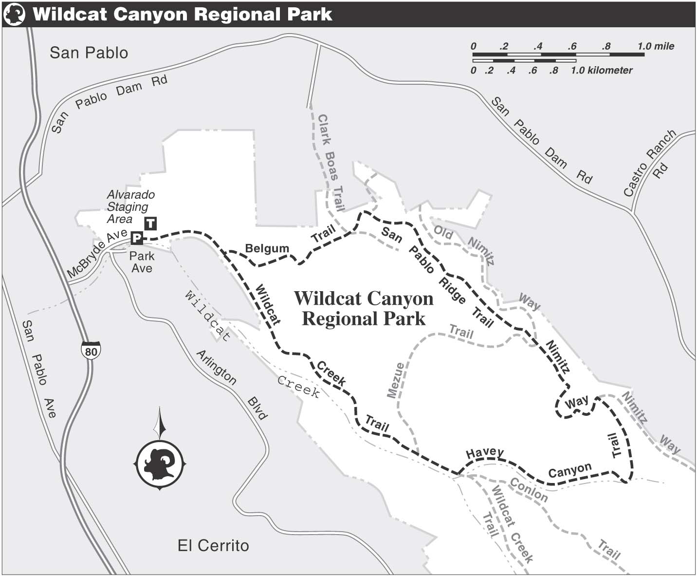
Follow the paved remnant of Wildcat Canyon Road, closed in the early 1980s by landslides and renamed the Wildcat Creek Trail. As you make a gentle climb, you reach a junction with the Belgum Trail, left, which you will use later. Continue straight, alternating on dirt and pavement, parallel to Wildcat Creek, right. Soon the pavement ends and then you meet the Mezue Trail, left. (For a lovely glimpse of Wildcat Creek, shaded here by bay trees, turn right and walk downhill about 100 yards on a dirt path.)
The Wildcat Creek Trail follows a line of willow, white alder, and western sycamore bordering the creek, soon passing Rifle Range Road, right. Now the route climbs to a junction with the Havey Canyon and Conlon trails, at about 2 miles. You turn left on the Havey Canyon Trail, the farthest left of the trails at this junction, following a tributary of Wildcat Creek.
Wildcat Foliage
A mix of native and nonnative trees and shrubs, including Monterey pine, eucalyptus, California bay, blue elderberry, coffeeberry, toyon, and evergreen huckleberry, line the first part of the route. When you reach jungle-like Havey Canyon, you’ll find bigleaf maple, California buckeye, and hazelnut, with an understory of western creek dogwood, snowberry, vine honeysuckle, blackberry, and ferns.
The Wildcat Canyon Trail runs between Wildcat Canyon and Tilden regional parks.
As the route abruptly breaks into the open, you have the open slopes of San Pablo Ridge ahead, dotted with coyote brush and stunted coast live oak. At a T-junction with paved Nimitz Way, you turn left. When you reach a junction with a road heading right, at about 4 miles, take a few minutes to make the climb to an abandoned Nike missile site, a relic of the Cold War, where a rest bench and 360-degree views await. The park’s high ground offers views of Mt. Tamalpais, Mt. St. Helena, Mt. Diablo, the Santa Cruz Mountains, San Francisco Bay, and the Golden Gate Bridge.
Where the paved segment of Nimitz Way ends, continue straight on a dirt road. You come to a cattle pen and a choice of three trails. Bear left on the Mezue Trail, then right at a fork on the San Pablo Ridge Trail. Now the route climbs up and over a series of high points on San Pablo Ridge, then plunges steeply northwest to a junction with the Belgum Trail, a dirt road.
Turn left, soon passing the Clark – Boas Trail, right, and then an unsigned road, left. Now you climb to an fork, where you bear left, still following the Belgum Trail, a dirt road. The route makes a well-graded descent and closes the loop at the Wildcat Creek Trail, where you turn right and retrace your route to the parking area.