TRIP 3 Joseph D. Grant County Park: Ridgetop Ramble
| Distance | 7.1 miles, Loop | |
| Hiking Time | 3 to 4 hours | |
| Elevation Gain/Loss | ±1400 feet | |
| Difficulty | Difficult | |
| Trail Use | Mountain biking allowed1 | |
| Best Times | Spring and fall | |
| Agency | SCCP&R | |
| Recommended Map | Joseph D. Grant County Park (SCCP&R) | |
| Notes | 1Bicycles are not allowed on parts of the San Felipe Trail, and must instead use the Corral and Hotel (or Lower Hotel) trails to complete the trip |
HIGHLIGHTS This vigorous loop, using the Dairy, Dutch Flat, Brush, and San Felipe trails, takes you to through oak woodlands and wildflower meadows to a high ridge where a picnic table and 360-degree views reward the sometimes steep climbing.
DIRECTIONS From I-680 in San Jose, take the Alum Rock exit, go northeast 2.2 miles to Mt. Hamilton Road, and turn right. At 7.7 miles you reach the entrance to the park’s main area, where you turn right. After several hundred feet you come to an entrance kiosk and a self-registration station. Continue straight for about 0.5 mile to the Stockman’s group picnic/parking area.
FACILITIES/TRAILHEAD There are campgrounds, restrooms, picnic tables, phone, and water in the park’s main area. The trailhead is on the northwest corner of the parking area.
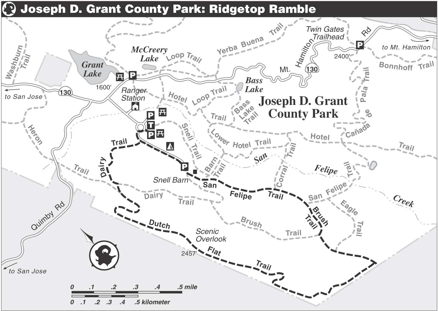
Turn left on a paved road that skirts the north side of the parking area. After about 100 yards, you come to an equestrian area, left, and the start of the Dairy Trail, on the right. You climb gently on the Dairy Trail, a multi-use dirt road. The park’s main area sits in Halls Valley, beside San Felipe Creek. You are climbing toward the ridge that forms the valley’s west wall. To the east rises another high ridge, which you can explore by following the route description for “Antler Point” on p. 178.
As you gain elevation over eroded ground, Mt. Hamilton, with its white observation domes, comes into view. Valley oaks and coast live oaks offer some shade, but much of the climb is in the open. Leave the Dairy Trail where it goes left, and continue through a gate on the Dutch Flat Trail. (To shorten the trip, bear left on the Dairy Trail, follow it down to the San Felipe Trail, and then go straight.)
Curving uphill on a moderate grade, you meet the Heron Trail joining from the right. The Heron Trail and the next 3.5 miles of the Dutch Flat Trail are part of the Bay Area Ridge Trail. Finally gaining the ridgetop, you are rewarded by fine views of the Santa Clara Valley and the Santa Cruz Mountains. The sight of sprawling San Jose underscores the value of protecting open space.
Flora and Fauna Watch
- This park boasts an impressive array of spring wildflowers, including lupine, blue-eyed grass, fiddleneck, bluedicks, scarlet pimpernel, owl’s-clover, mule ears, Johnny jump-up, checkerbloom, California buttercup, yarrow, Chinese houses, winecup clarkia, California poppy, and popcorn flower.
- Here also is a population of wild pigs, and beside the trail you may see evidence of their destructive rooting.
- This park is one of a few places in the Bay Area to find yellow-billed magpies, a large member of the crow family. Also here are western bluebirds, oak titmice, California towhees, northern flickers, and wild turkeys.
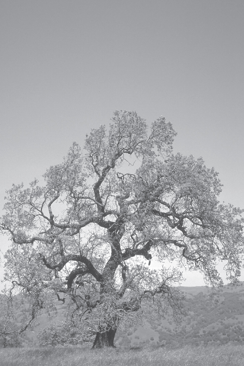
Majestic valley oaks grace many Bay Area parks; elsewhere they are being lost to development.
Around 2 miles, a picnic table atop the ridge welcomes you to the Scenic Overlook (2437’), and indeed it is! (A sign here that robs you of 433 hard-won feet is curious.) Beyond the overlook, the road descends on a moderate, then steep, grade and soon enters a woodland of black oak and valley oak. After passing through a seasonally wet area, the route follows a rolling course along the ridgecrest. In spring, the park’s verdant grasslands, decorated with colorful wildflowers, are lovely.
Several sweeping bends help you descend to a level area holding two ponds, separated by a fence marking the park boundary. Nearby is a granary tree, a large valley oak riddled with holes and used by acorn woodpeckers to store their namesake food. Climbing over a rise, you resume your descent, in places over steep, eroded ground. Passing a dirt road, right, at around 4 miles, you enjoy a mostly level course that soon reaches a junction with the Eagle Trail, right.
You continue straight across a huge, possibly wet, meadow. The Dutch Flat Trail ends at a junction, where you bear right on the Brush Trail. At the next junction, angle left on the San Felipe Trail, a dirt road. A ravine, left, bordered by valley oaks draped with lace lichen, holds a seasonal creek. At about 5.8 miles, the Corral Trail goes right, but you go through a gate and stay on the San Felipe Trail, from here closed to bicycles. Climbing on a gentle grade, you pass Snell Barn, which is right.
A dirt road, not shown on the park map, departs left. Ahead, a road goes sharply right to the barn. You continue straight, passing a gate and junctions with the Snell Trail, right, and the Dairy Trail, left. About 75 feet ahead, the road becomes paved. Just beyond the next gate is a four-way junction with a dirt road, left, and a paved road, right. You go straight, finding a path paralleling the road on its left side. The path soon ends, and now you follow the paved road back to the parking area.