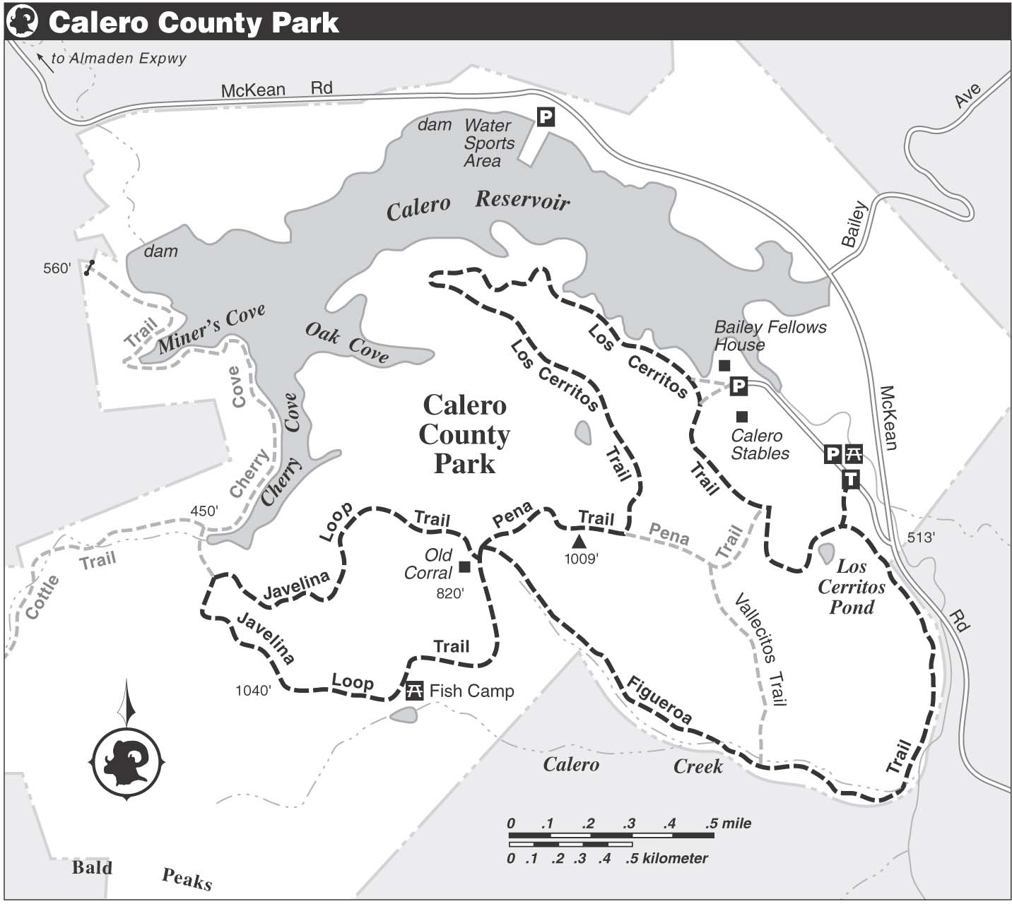
TRIP 7 Calero County Park
| Distance | 7.9 miles, Loop | |
| Hiking Time | 3 to 4 hours | |
| Elevation Gain/Loss | ±1200 feet | |
| Difficulty | Difficult | |
| Best Times | Fall through spring | |
| Agency | SCCP&R | |
| Recommended Map | Calero County Park (SCCP&R) |
HIGHLIGHTS Birds and wildflowers are the main attractions of this route, which uses the Los Cerritos, Figueroa, and Pena trails, along with the Javelina Loop, to make an extended figure-eight through the rolling backcountry south of Calero Reservoir.
DIRECTIONS From Highway 85 in San Jose, take the Bernal Road exit and go south 1.1 miles to Santa Teresa Blvd. Turn left, go 3 miles to Bailey Ave., and turn right. Go 2.3 miles to McKean Road and turn left. Go 0.6 mile to the park entrance, turn right, and go 0.2 mile to a large dirt parking area, right.
FACILITIES/TRAILHEAD There are picnic tables, water, and toilets beside the parking area. The trailhead is about 200 feet south of the parking area, on the west side of the entrance road.
You follow a dirt road south through open country to a junction, where you turn left on the Los Cerritos Trail. A short stroll brings you to the Figueroa Trail, also a dirt road, which you join by angling right. Soon you cross a creek flowing through a culvert, and then the road bends right and stays level through a wooded area punctuated by wildflower meadows. The next creek crossing is on rocks, and now you emerge from forest into an expanse of rolling hills.
On the Ground & in the Air
- The park is home to a variety of shrubs, such as toyon, coffeeberry, snowberry, gooseberry, blue elderberry, California sagebrush, bush monkeyflower, chamise, and black sage.
- Enjoy the spring wildflowers, including Johnny jump-up, lupine, fiddleneck, checkerbloom, California poppy, yarrow, California buttercup, Ithuriel’s spear, bluedicks, blue-eyed grass, and shooting stars.
- Golden eagles have been spotted here, and check the ponds and the reservoir for egrets, herons, ducks, geese, and shorebirds.
Beyond where the Vallecito Trail departs right, you climb gently through a blue oak savanna. The road swings sharply left to cross the creek, then climbs on a moderate grade to a junction, about 2.2 miles. (To shorten the route, turn right on the Pena Trail and follow the route description below.)
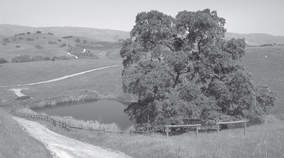
Here you turn left on the Javelina Loop and go past two roads leading left to a closed area. A rolling course, in places steep, brings you ever-improving views. After crossing a saddle, you descend moderately to Fish Camp, where an observation deck and several picnic tables overlook an artificial pond. The pond is home to the endangered red-legged frog, along with California newts, western pond turtles, red-winged blackbirds, and wood ducks.
A steep climb takes you to a serpentine rock garden, decorated in spring with California poppies and goldfields. Cresting a rise, you can admire Mt. Umunhum and the Sierra Azul, a vast area administered by the Midpeninsula Regional Open Space District. A very steep descent drops you to a junction, where you stay on the Javelina Loop by turning right. Rolling for a while, the road next climbs steeply to the Calera Bat Inn, a 512-cubic-foot structure where spotted bats and Yuma bats “hang out.”
Now you descend, curve left, and close the loop at a four-way junction, at about 4.8 miles. Go about 50 feet to the junction of the Figueroa and Pena trails, then straight on the Pena Trail. Climbing steeply, then moderately, you come to a T-junction where you turn left and enjoy a level stroll with fine views of the Santa Clara Valley and the Diablo Range. At a junction, you turn left on the Los Cerritos Trail. (To shorten the route, go straight on the Pena Trail to the Los Cerritos Trail, then follow the route description below.)
Fellows House
Future plans for the Bailey Fellows house, built by Boargenes Bailey around 1870 and later owned by Judge Edward Fellows, include a visitor center, museum, and special-event area.
Turn left and descend moderately, then steeply, along a grassy ridgetop. Beyond a fence with a gate, you roll along toward Calero Reservoir, then curve right and finally find level ground, near the reservoir’s shore. An unsigned road departs, then rejoins, on the left. Where a road goes left to the historic Bailey Fellows house, at about 7 miles, you turn right to stay on the Los Cerritos Trail.
Los Cerritos Pond provides habitat for wildlife, including birds and amphibians.
More ups and downs take you past a junction, right, with the Pena Trail, and then through a valley with a creek. At Los Cerritos Pond, an observation deck with rest benches offers a place to relax. Just ahead is a T-junction where you close the loop. From here, retrace your route to the parking area.