TRIP 5 Memorial Park
| Distance | 3.2 miles, Semi-loop | |
| Hiking Time | 1 to 2 hours | |
| Elevation Gain/Loss | ±800 feet | |
| Difficulty | Moderate | |
| Best Times | All year | |
| Agency | SMCP&R | |
| Recommended Map | Memorial Park (SMCP&R) |
HIGHLIGHTS This short but enjoyable semi-loop uses the Pomponio Trail to explore a redwood forest, a creek-filled canyon, and a ridge with great views.
DIRECTIONS From the intersection of Highway 84 and Pescadero Road in La Honda, go southeast on Pescadero Road, and after 1 mile turn right to stay on Pescadero Road at its intersection with Alpine Road. Go another 4.4 miles to the Memorial Park entrance, on your left. At 0.1 mile there are an entrance kiosk and a self-registration station. Continue straight another 0.1 mile to the Tan Oak Flat picnic/parking area.
FACILITIES/TRAILHEAD Camping is available. A visitor center, camp store, and restrooms (all open seasonally) are near the entrance kiosk, along with phone and water. There are picnic tables and restrooms (open seasonally) near the parking area. The trailhead is on the north side of Pescadero Road, opposite the park entrance.
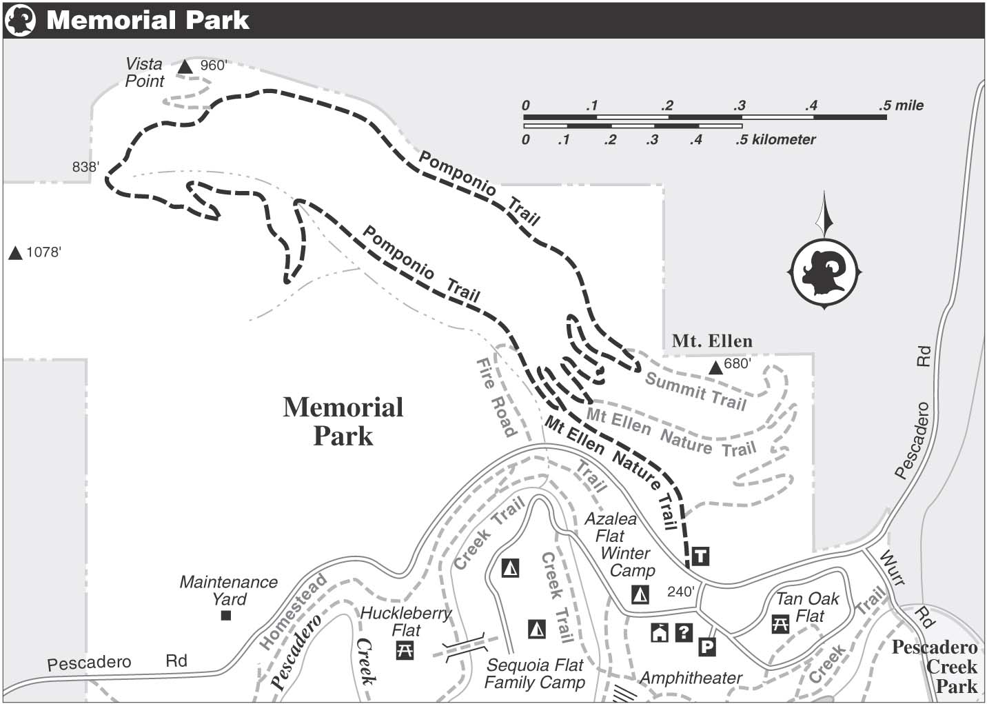
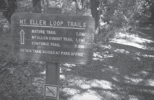
From the trailhead, which serves the Mt. Ellen Nature Trail, the Mt. Ellen Summit Trail, and the Pomponio Trail, you climb gently on a wide dirt-and-gravel path through stands of coast redwood, Douglas-fir, coast live oak, tanbark oak, and fragrant California bay. At a junction, the Mt. Ellen Summit and Nature trails, here joined as one, veer right, but you stay on the Pomponio Trail.
The name Memorial refers to a dedication that took place in 1924 honoring San Mateo County residents killed in World War I. Later, during the Depression, WPA work crews built picnic sites, restrooms, and roads in the park.
Cloud’s Clout
Massive redwood stumps here are remnants of the area’s logging past, which lasted from 1856 to around 1930. About a dozen mills producing lumber and shingles were active along Pescadero Creek and its tributaries. Many of the trees in present-day Memorial Park were spared this onslaught, thanks to the advocacy of Roy W. Cloud, superintendent of schools for San Mateo County. Impressed by a visit here in the spring of 1923, and with the logger’s axe about to fall, Cloud convinced the county board of supervisors to intervene.
The park’s trails take visitors through some beautiful groves of coast redwoods.
The trail climbs moderately via switchbacks, then follows a rolling course across a hillside that drops left. Soon you reach a junction with a trail, right, signed MT. ELLEN SUMMIT TRAIL. This is actually the returning leg of the Pomponio Trail, which you will use later. For now stay left, then merge with a dirt road by bearing right.
Now you climb moderately beside a creek lined with willows and bigleaf maples, colorful in fall. A sharp bend to the left takes you across the creek, which flows through a culvert. The road continues to wind its way uphill on a moderate grade, climbing out of a canyon. At the head of the canyon, the road ends, and you follow a single-track trail that soon crosses a bridge over the creek’s uppermost reaches.
Flora
Evergreen huckleberry, hazelnut, and creambush, along with an assortment of flowers and ferns, grow in the park’s forested areas. Sunny, open slopes are home to thickets of coyote brush, California sagebrush, blue blossom, coffeeberry, creambush, bush monkeyflower, and poison oak.
At about 1.5 miles, a rest bench, left, provides a place to sit and enjoy the view. California fuchsia, one of the Bay Area’s latest-blooming wildflowers and a favorite with hummingbirds, grows nearby. Nearby, a short trail goes left to a viewpoint. Flirting briefly with a forested ridgecrest, the trail soon switchbacks down to a flat area, then climbs moderately beside a precipice where towering Douglas-firs barely cling to the edge.
Now on a gentle descent, you come to a junction with the Mt. Ellen Summit Trail, left. Bear right and continue downhill, dropping into the redwood forest you explored earlier. Where the unsigned Mt. Ellen Nature Trail angles left, you go straight. After a left-hand switchback, you arrive at the junction that closes loop. From here, continue straight and retrace your route to the parking area.