TRIP 11 Wunderlich Park
| Distance | 5.5 miles, Loop | |
| Hiking Time | 2 to 3 hours | |
| Elevation Gain/Loss | ±1250 feet | |
| Difficulty | Moderate | |
| Best Times | All year | |
| Agency | SMCP&R | |
| Recommended Map | Wunderlich Park (SMCP&R) |
HIGHLIGHTS This loop uses Alambique, Bear Gulch, Meadow, and Redwood trails to explore this compact yet diverse park in the foothills of the Santa Cruz Mountains. The park is a favorite among equestrians, but the trails are closed to horses during wet weather.
During the first half of the 20th century, the Folger family used this area for recreation, including horseback riding and camping. The park is named for Martin Wunderlich, who bought the land from the Folgers in 1956. In 1974, Wunderlich deeded 942 acres to San Mateo County for park and open space.
DIRECTIONS From I-280 in Woodside, take the Woodside Road/Woodside/Highway 84 exit and go southwest 2.8 miles to the park entrance, right. Go about 0.1 mile to a dirt parking area, left.
FACILITIES/TRAILHEAD There is a phone beside the park office, just uphill from the parking area. There are water and a toilet near the trailhead, which is on the southwest corner of the parking area.
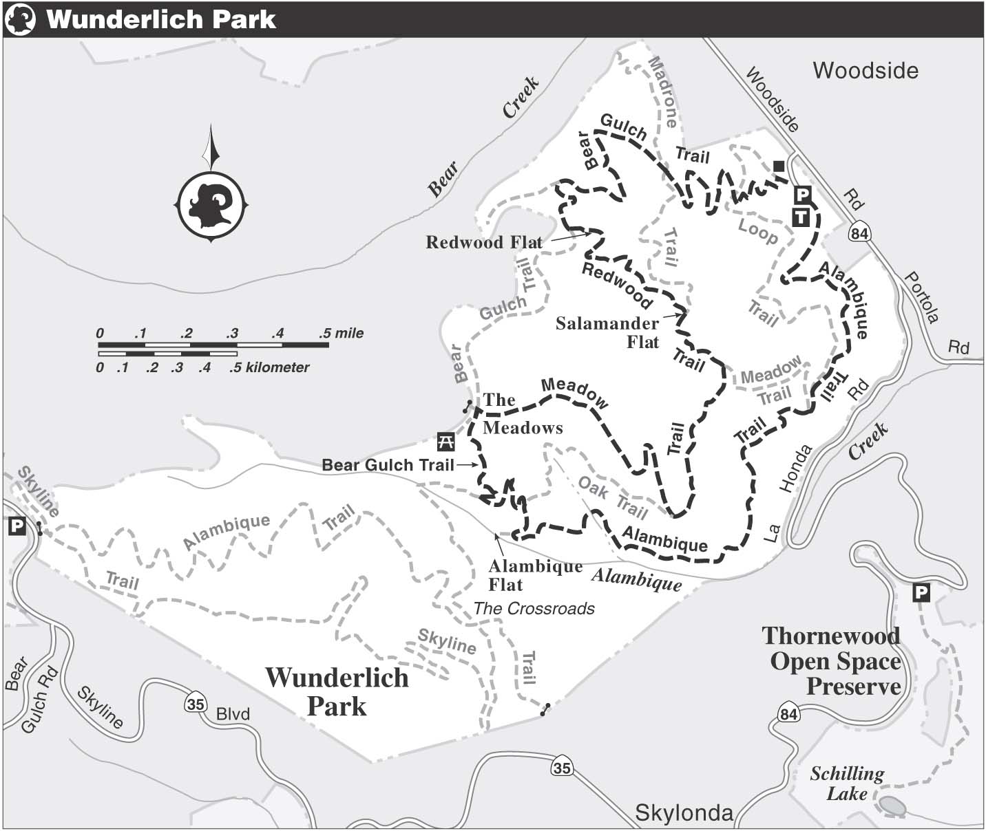
The Alambique Trail, a wide dirt path, follows a level course. The slopes of the Santa Cruz Mountains were once covered with coast redwoods, and this park preserves a remnant of that forest, most of it second-growth. The trail soon begins to climb gently and then moderately into the redwoods, where huge stumps indicate the former stature of the ancient trees. The sparse understory consists mostly of ferns, which thrive in the cool, moist environment.
After passing several unsigned roads, you make a rising traverse across a hillside that drops left and soon reach a junction. Here the Loop Trail goes sharply right, but you bear left to stay on the Alambique Trail, now a dirt road. Where the Meadow Trail heads right, you continue straight, climbing gently beside Alambique Creek. At about 2 miles you reach Alambique Flat, marked by a sign and a grand circle of redwoods. The Alambique Trail continues to the right, and a short trail wanders left toward Alambique Creek.
Follow the Alambique Trail into more open, brighter terrain. Around 2 miles, you reach a junction with the Oak Trail, where you stay on the Alambique Trail by turning left. A short climb via switchbacks brings you to the Bear Gulch Trail, where you turn right. Now you continue to climb on a gentle grade, following a single-track trail out of the forest and into The Meadows. What once may have been a meadow is now overgrown with coyote brush, toyon, coffeeberry, and tangles of berry vines.
This is perfect habitat for the California quail, the state bird. Reluctant to fly, quail often scurry through the underbrush in large coveys. Views from this treeless area extend northeast across San Francisco Bay to the East Bay hills, and southeast along the crest of the Santa Cruz Mountains.
Just after an unofficial trail joins sharply from the left, you come to a four-way junction. Here the Bear Gulch Trail turns left, the Meadow Trail goes right, and an unofficial trail heads straight and uphill. You turn right and follow the Meadow Trail, a dirt road that descends through The Meadows to a T-junction with the Oak Trail. Here you stay on the Meadow Trail by turning left.
Losing elevation on a gentle grade, you soon reach another T-junction, this one with the Redwood Trail. You turn left and almost immediately find yourself back in a dense redwood forest. The Redwood Trail rises on a gentle grade to a junction with the Madrone Trail, where you stay on the single-track Redwood Trail by angling left. A sign at about 4 miles marks Salamander Flat.
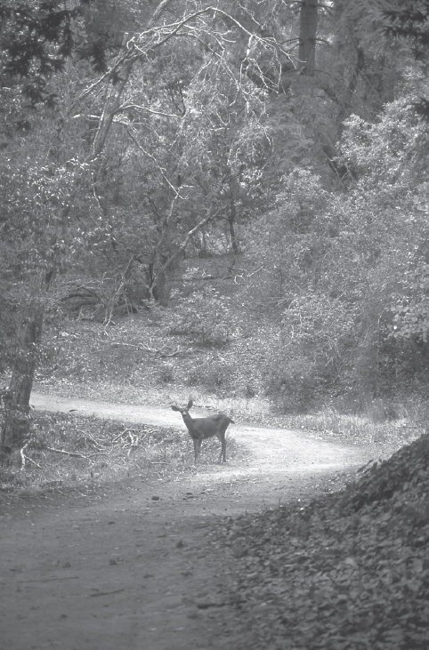
Deer stops while crossing the Alambique Trail.
Creek Lore
According to historian Frank M. Stanger, Alambique Creek — Spanish for still — was the site of the Peninsula’s first bootleg operation and its first sawmill. The mill, a crude, water-driven affair, was built in 1849 for Charles Brown, who owned nearly 3000 acres in the Woodside area, including present-day Wunderlich Park. Steam soon replaced water as a more reliable, year-round source of power and the modern logging era was born. Alambique Creek is also notable, says Stanger, for being the boundary between two large Mexican land grants: Cañada Raymundo to the north and Cañada del Corte de Madera to the south.
The Big Trees
Redwoods support themselves by interlocking their roots in a wide but shallow network. Some of the giant redwoods beside the road have partially exposed roots, allowing you to examine their structure. Lacking the deep tap root of other species, redwoods may be knocked down by high winds. Where tanbark oaks and California bays join the redwoods, they grow tall in their search for sunlight.
At about 4 miles, you come to Redwood Flat, marked by family circles of redwoods that have sprouted from the stumps of their fallen ancestors. Just beyond Redwood Flat is a T-junction with the Bear Gulch Trail. Here you turn right and follow a single track downhill. At a junction with a short trail to the park boundary, left, you continue straight. Switchbacks take you down to a four-way junction with the Madrone Trail.
Salamander Studies
Amphibians thrive in the cool, moist environment of a redwood forest. Among the most common are the lungless salamanders (family Plethodontidae). As their name implies, these salamanders have no lungs and instead breathe through their skin. Western species live, breed, and lay their eggs on land rather than in water. Most salamanders are sedentary, not straying far from where they were born. Studies show that earth movement along fault lines isolated groups of salamanders and caused them to evolve into separate species.
Zigzag your way down the Bear Gulch Trail to a seasonal equestrian gate. About 40 feet past the gate is a four-way junction with the Loop Trail, right, and a service road, left. Go straight. After more switchbacks, a bridge helps you across a seasonal creek, and the you follow a dirt road bordered by rock walls. To your left is a large brown building, part of a ranch complex formerly owned by San Francisco coffee baron James A. Folger. Ahead are the trailhead and the parking area.