TRIP 6 Russian Ridge Open Space Preserve: Borel Hill
| Distance | 4.6 miles, Semi-loop | |
| Hiking Time | 2 to 3 hours | |
| Elevation Gain/Loss | ±1050 | |
| Difficulty | Moderate | |
| Trail Use | Mountain biking allowed | |
| Best Times | All year | |
| Agency | MROSD | |
| Recommended Map | South Skyline Region (MROSD) |
HIGHLIGHTS This remarkable ramble through what many consider the Peninsula’s most scenic preserve uses the Ridge, Ancient Oaks, Mindego, Alder Spring, and Hawk trails. It samples a wide variety of habitats, from the riparian corridor along Mindego Creek to the dazzling wildflower meadows atop Borel Hill, whose displays intensify week by week during spring. Birders will want to have binoculars handy to pick out soaring hawks and falcons. Part of this semi-loop route follows the Bay Area Ridge Trail.
DIRECTIONS From the intersection of Skyline Blvd. (Highway 35) and Page Mill Road/Alpine Road south of Palo Alto, take Alpine Road west about 100 yards to a parking area on the right. (This parking area serves both Skyline Ridge Open Space Preserve and Russian Ridge Open Space Preserve. On busy days parking may be unavailable. There is additional parking and access to the preserve’s trails at the Caltrans Vista Point parking area, 1.1 miles northwest on Highway 35.)
FACILITIES/TRAILHEAD There is a toilet near the trailhead, which is on the west side of the parking area.
Follow the single-track Ridge Trail northwest from the trailhead, then climb via several switchbacks to where the trail becomes a rocky and eroded dirt road. Turn left at a junction with a connector to the Ancient Oaks Trail. Descending on a gentle grade, you wander through a grove of oaks and young Douglas-firs to a junction with the Ancient Oaks Trail. Turning right on a single track, you enjoy a splendid view of the Pacific Ocean as you make a rising traverse across a grassy hillside.
The trail curves left, levels briefly, and then descends to an oak woodland at about 1 mile, where a connector to the Ridge Trail joins on the right. Following a ridgetop downhill, you skirt a steep hillside, left. Soon the trail curves right and enters a dense forest, where many of the oaks and California buckeyes are wrapped with a thick layer of moss. Losing elevation on a gentle grade, you soon reach a junction with the Mindego Trail, a dirt road.
Leaflets Three
A thicket of poison oak near the trailhead serves as a reminder that this irritating plant comes in three forms — herb, vine, and shrub. No matter which form it takes, the same rule applies: “Leaflets three, let it be.”
The junction of the Ancient Oaks and Mindego trails, which is near a tributary of Mindego Creek, is a good place to look for California newts during the rainy season.
Go straight on the Mindego Trail, a dirt road that soon bends left and brings you from forest to open grassland. The road wanders over level ground to a junction with the Alder Spring Trail, also a dirt road. You turn left and enjoy a mostly level walk with views of Mindego Hill and, on a clear day, the Pacific Ocean. Now descending on a moderate grade, the road alternates between wooded and open areas. Listen for the liquid call of the western meadowlark, a grassland bird often found in large flocks.
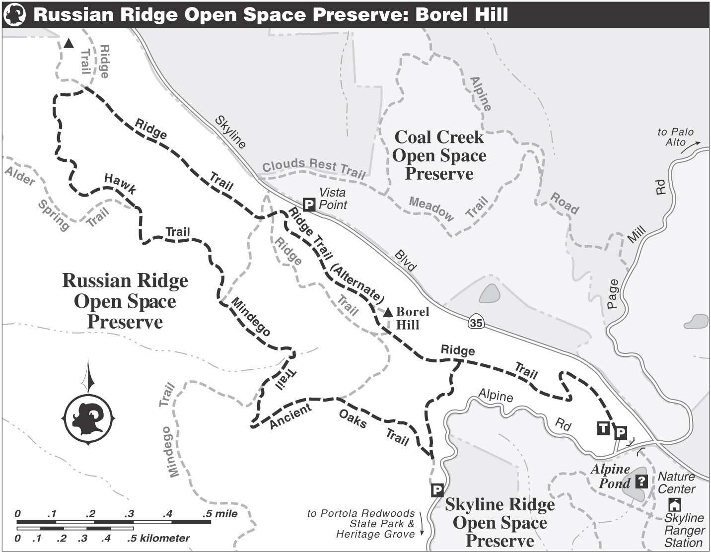
At a junction, you join the Hawk Trail by continuing straight. The single track makes a rising traverse across a steep, open hillside. The top-of-the-world feeling is enhanced as the trail rises toward a gap in the crest of Russian Ridge. When you meet the Ridge Trail, a dirt road, at about 2.8 miles, turn right and enjoy unrivaled views of the Bay Area. A little more than a mile ahead is Borel Hill, the geographic high point of this route.
In this preserve, the Ridge Trail runs along the spine of Russian Ridge. There is also a 0.5-mile segment of dirt road called the Ridge Trail that climbs up and over Borel Hill. In this book, designate this as the Ridge Trail (alternate). Where the Mindego and Ridge trails cross, you continue straight and begin a moderate climb. After about 75 feet, a single-track segment of the Ridge Trail veers right, but you stay on the Ridge Trail (alternate), an eroded path that snakes its way uphill.
At a four-way junction, a trail goes right, to a vantage point, but you turn left for the final push to the top of Borel Hill, where a sign shows you are 2572 feet above sea level. When you are ready to leave this dramatic perch, put the elevation sign at your back and follow the trail in front of you. It soon joins the Ridge Trail (alternate) at a T-junction. Turn left, and after about 100 feet merge with the Ridge Trail. Soon you pass an unnamed trail, right, not shown on the preserve map. Close the loop at the next junction, then retrace your route to the parking area.
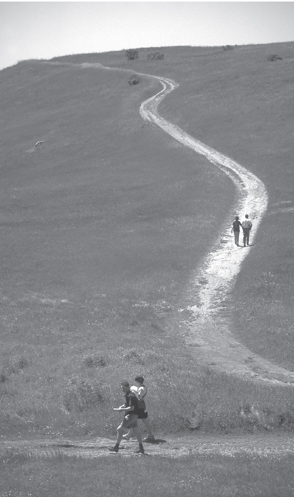
View northwest toward the Ridge and Mindego trails, Russian Ridge OSP.
Spring Color
Russian Ridge is famous for its springtime displays of wildflowers, including California poppy, mule ears, owl’s clover, lupine, tidytips, Johnny jump-up, popcorn flower, winecup clarkia, blue-eyed grass, California buttercup, fiddleneck, and checkerbloom.