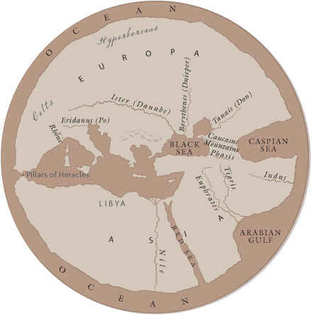

MAP A: The World of Bronze Age Greece

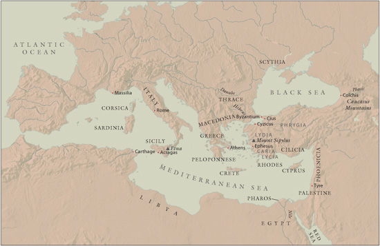
MAP B: The Mediterranean Basin
MAP C: Ancient Greece
At the time when the Greek myths were being formulated, the world, as conceived by the Greeks, was very different from ours. It looked like Map A, not the modern projections of B or C. The main land masses had been identified (apart from the Americas, of course), but were of indeterminate extent, ending in mythical regions and ultimately surrounded by the river Ocean. The Greeks themselves had colonized the coastlines of the known world, like frogs around a pond, as Plato put it. They didn’t occupy countries—there was no nation state called “Greece” until the nineteenth century CE—but more or less independent cities. Most city-states were founded on the coastline for trade and travel, and controlled a certain amount of the interior farmland, often in rivalry with native tribes or neighboring Greeks.