
DURING THE WINTER BREAK, Jeremiah Dixon, who’d spent part of the time in Philadelphia, met with boundary commissioners in Maryland to report on the team’s plan for the new season and the money they’d need to carry it out. By the end of March 1766, Mason, Dixon, Darby, and Cope had assembled at Captain Shelby’s house, at milepost 117 near North Mountain, where the survey had halted the previous year. They star-checked Dixon’s notched tree, made some corrections to the West Line’s direction, and began chaining. The terrain made for slow, strenuous work. After crossing a creek, Mason, Dixon, and the crew climbed the steep flank of North Mountain. It took them seven days to extend the line two miles.
Slowed work wasn’t their only problem. As with the previous year, unpredictable spring weather — this time snow and six days of rain — stranded an increasingly impatient Moses McClean miles away. Chomping at the bit to deliver the wagons loaded with tents and supplies to the survey crew, McClean nevertheless knew that waiting until the ground dried would save time in the long run. Wagon wheels clogged and weighted with thick mud would add to the horses’ burden, and all wagoners hated digging out wheels mired in mud. McClean and the well-stocked wagons finally rolled into sight on April 14, 1766. While he knew that Mason and Dixon would be glad to see him, he also knew that they would not be pleased to learn that he’d run out of cash.
Money from Lord Baltimore and the Penns financed the boundary-line survey. A signed commission stipulated that Mason’s and Dixon’s wages would be paid upon completion of the survey. But every item or service incurred while running the survey had to be paid for. Maryland and Pennsylvania boundary-line commissioners held the purse strings for these expenses, which were many: axmen, carpenters, food, wagons, horses, hay, oats, candles, tents, ink powder, lodging, ferry crossings, and a haystack damaged while running the Tangent Line. Even a silk handkerchief and a coffin were included in one of the expense reports. Periodically, the commissioners dispensed funds. In December 1764, Joseph Shippen, Pennsylvania’s provincial secretary, sent Moses McClean fifty pounds; four months later, he sent an additional four hundred pounds.
Continuing the West Line without funds was unthinkable. The surveyors sent an express letter to Governor Sharpe requesting more funds, noting that “on the whole . . . we have received 615 pounds more of the Proprietors of Pensilvania than of Lord Baltimore. We expect you will please to send 6 or 700 pounds that Mr. McLane may receive it at Frederick Town (as you proposed) the 24th of this month, we having no Cash to proceed with.” Fortunately, McClean was good at obtaining credit from his suppliers, so the continuation of the West Line was not delayed. And Sharpe did, eventually, send money.
Despite sporadic snow flurries, the crew pressed westward. The horses had little trouble hauling the wagons through a few inches of snow. But they halted shortly after milepost 134, defeated by the steep east flank of Sideling Hill. On foot, Dixon and the chain carriers struggled to measure accurately and even to remain upright while threading their way through oak and hickory trees to the summit, which crested at more than 2,300 feet. On the way down, they were forced to take sideways steps and grab small trees to keep from falling or sliding dangerously downhill. Safely at the bottom, 140 miles 15 chains 76 links from the Post Marked West, Mason and Dixon ordered the zenith sector brought from Captain Shelby’s house. There, with “oak and hickory buds just breaking into Leaf,” Mason and Dixon spent three weeks observing the stars and making calculations.
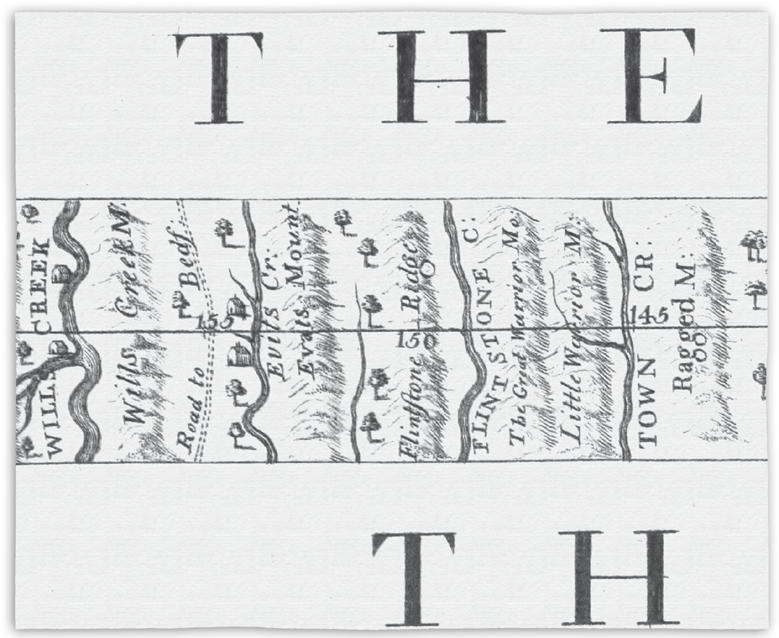
From May 19 to June 5, 1766, roller-coaster geography between mileposts 140 and 165 taxed the crew to its limits. As soon as they climbed down one mountain, another faced them. They measured up and down Town Hill, Ragged Mountain, Little Warrior Mountain, Great Warrior Mountain, Flintstone Mountain, Evitts Creek Mountain, Nobbley Mountain, Will’s Creek Mountain, and the little Allegheny Mountain, all of which had elevations as high as Sideling Hill. On June 9, when Mason and Dixon again set up the zenith sector, everyone was exhausted but glad. They had reached the end of the road for the West Line.
On Saturday, June 14, Mason hiked to the top of Savage Mountain and gazed westward. The mountaintop where he stood was one in the chain that formed the “Boundary between the Natives and strangers; in these parts of his Britanic Majesties Collonies.” King George III’s Royal Proclamation of 1763 temporarily forbade colonists from homesteading in that area, declaring it Indian Territory. Yet colonists in the area had told Mason that the fertile lands on the far side of the boundary were “the best of any in the known parts of North America” and that “The Rivers abound with variety of fish, and quantity almost increditable.” Mason, a fisherman, longed to test the truth of the colonists’ claims.

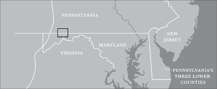
The black rectangle inset includes the area that surrounds mileposts 145–160 of the West Line.

Dixon perfectly illustrated the roller-coaster topography as the crew surveyed farther west.
As Mason looked out at the creeks and rivers on either side of Savage Mountain, he realized that he could see the Eastern Continental Divide. The vast American countryside truly touched Mason: “From the solitary tops of these mountains,” he wrote, “the Eye gazes round with pleasure; filling the mind with adoration to that pervading spirit that made them.”


FROM 1754 TO 1763, war between English and French forces raged along colonial America’s western and northern frontiers. Because the Iroquois confederation and some other native peoples allied themselves with the French, the war became known as the French and Indian War.
When he arrived in the colonies in 1755, General Edward Braddock, England’s commander in chief, planned to capture Fort Duquesne, built and held by the French, in western Pennsylvania. (The city of Pittsburgh now occupies the site.) One of Braddock’s aides-de-camp was a twenty-three-year-old Virginian named George Washington.
To begin his campaign, General Braddock needed horses and wagons. Without them, his troops and artillery couldn’t get to Fort Cumberland, which was built in 1754 by Maryland’s militia and lay halfway to Fort Duquesne. Benjamin Franklin, postmaster general of Pennsylvania, rallied to Braddock’s aid, appealing in a newspaper ad to his fellow colonists’ sense of loyalty to king and country. His plea garnered 150 wagons and 500 horses for the cause. A second appeal yielded forty-one wagonloads of oats and Indian corn to feed the horses.
With almost 2,100 men — a combination of British regulars and colonial militia — assembled at Fort Cumberland, Braddock was ready for the march on Fort Duquesne. But bringing provisions and artillery along with his troops was impossible without a road. Following the path of an old Indian trail, six hundred of Braddock’s men cut a road, twelve feet wide, through the wilderness. Slowly, Braddock’s troops advanced.
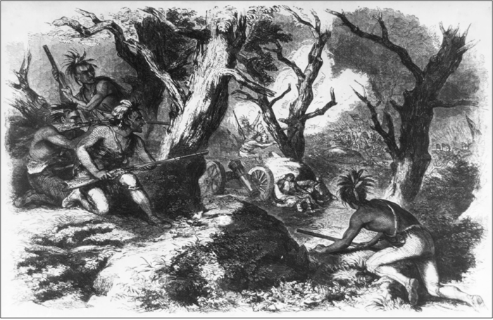
On July 9, two or three miles from Fort Duquesne, French and Indian forces hiding behind rocks and trees attacked Braddock’s army. The British regulars, unfamiliar with this kind of guerrilla warfare, panicked. George Washington later described the battle:
Our numbers consisted of about 1300 well arm’d Men, chiefly Regular’s, who were immediately struck with such a deadly Panick, that nothing but confusion and disobedience of order’s prevail’d amongst them. . . . In short the dastardly behaviour of the English soldier’s expos’d all those who were inclin’d to do their duty to almost certain Death; and at length, in despight of every [officer’s] effort to the contrary, [the Regulars] broke and run as Sheep before the Hounds, leaving the Artillery, Ammunition, Provisions, and every individual thing we had with us a prey to the Enemy.

On their way to Fort Duquesne in 1755, General Braddock’s army was ambushed by French and Indian forces. Years later, during the Revolutionary War, General George Washington borrowed many of the Indians’ battle tactics.
General Braddock, mortally wounded in the chest, was carried from the battlefield in a wagon as the remaining British troops fled. Almost nine hundred men were killed, wounded, or left on the battlefield. Washington and others blamed as many as two-thirds of the company’s deaths on shots fired by the panicked regulars — in modern language, friendly fire.


Even though Mason, Dixon, and their team had reached the end of the West Line, their job was by no means finished. The axmen sharpened their blades and chopped, calling out as trees tumbled. The men hauled brush and dragged tree trunks until they had cleared an eight-foot-wide vista along the parallel of the West Line. It was a boundary line no one could miss.
On Sunday, June 22, 1766, while the crew rested, Mason and Dixon journeyed back in time by visiting Fort Cumberland, located at the confluence of Will’s Creek and the Potomac River. Commissioner Peters had described the log fort as a “dismal inhospitable Place.”
As his horse trotted along a stretch of the road that had been cleared by General Braddock’s men, Mason couldn’t help but think of the tragic battle — how almost exactly eleven years earlier, the road he was riding on had been crowded with wounded and dying men. How ironic and sad, Mason wrote, that Braddock “made through the desert a path, himself to pass; and never; never to return.” While Fort Cumberland, “beautifully situated on a rising ground,” looked good from a distance, when the surveyors went inside, they saw that it was in bad repair. While the French and English had officially made peace three years earlier, Mason and Dixon knew firsthand — from stories heard in taverns, from colonists they’d met, and from visiting the site of the Conestoga massacre — that violent incidents between colonists and native people still occurred.
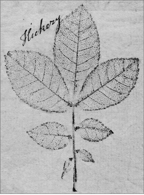
The next day, the surveyors were back on the line as the axmen resumed work clearing the vista to the Post Marked West, a job that occupied them fully through the summer. Yet Mason still found time to investigate the natural world. Hickory trees grew abundantly in the region, and although the nuts weren’t ripe in July, the trees’ spicy aroma scented the air. He marveled at the size of the hickory leaves and “measured three leaves on one Stem . . . each of which was 17 inches in length and 12 inches in breadth.”

This hickory leaf print (shown close to actual size) was made by Joseph Breintnall circa 1730. This leaf was much smaller than the ones Mason measured.
The crew completed the West Line vista when it intersected the North Line. On September 30, the surveyors discharged all hands. Summarizing their achievements, Mason noted that he and Dixon periodically stood on hillcrests that commanded a view of fifteen or twenty miles east or west and happily found the West Line easily visible and nicely conforming to the parallel of latitude. If they celebrated their achievement in any way, no letters or documents survive to tell about it.
With no boundary-line meetings scheduled until the end of October, Mason and Dixon engaged themselves in another task. The Royal Society, the organization that had sponsored their 1761 transit of Venus expedition, hired them to measure the length of a degree of latitude in America. In Europe, French scientists had calculated the length at 69.5 miles. In the scientific quest to determine Earth’s precise shape, knowing if this length varied in different places on Earth’s surface was critical. In completing this task, Mason and Dixon would be literally and scientifically charting new territory.
With permission from the proprietors of both provinces, they departed for the Middle Point, back in southern Maryland, accompanied by three experienced crewmen. Choosing the Middle Point saved time, since star positions and land distances had already been measured and marked there. Even so, they spent two weeks monitoring ten stars with the zenith sector: timing the arc-shaped path of each one and recording the angles formed between the horizon, the surveyors, and the star. Mason used the information to reconfirm the exact latitude of the Middle Point.
Working at night, Dixon and one of the crewmen chained a straight line exactly one mile long north along the meridian. In the daytime, they measured the distance, at a right angle, from the end of the one-mile-long line to the Tangent Line. (The Tangent Line extended in a northwest direction, not straight north.) Later, they would collect additional information at the Stargazer’s Stone and remeasure the Tangent Line. The combined data from these three endeavors would eventually enable them to calculate the length of a degree of latitude. But until they had that additional information, they had done all they could do on the Royal Society’s project. Afterward, Mason and Dixon rode to New Castle County, where one of the Pennsylvania commissioners met and instructed them “to proceed immediately to set 100 Stones (one at each mile) in the [West] Line.”
During November, men hauled boundary stones to the wooden mile markers. One commissioner from each province accompanied them to make sure that the stones were accurately placed and did not favor a particular colony. Mason and Dixon passed the anniversary of their third year in America reviewing their accomplishments in meetings with the commissioners. The lines had been surveyed. All the boundary stones for the Tangent Line were in place, as were those along the North Line. Along the West Line, stones stood at every mile for sixty-five miles, except at the sixty-fourth mile, where there was no stone due to unfavorable geography. Mason and Dixon’s job for the Penns and Lord Calvert was done. Or was it?