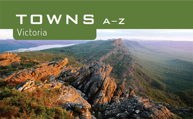
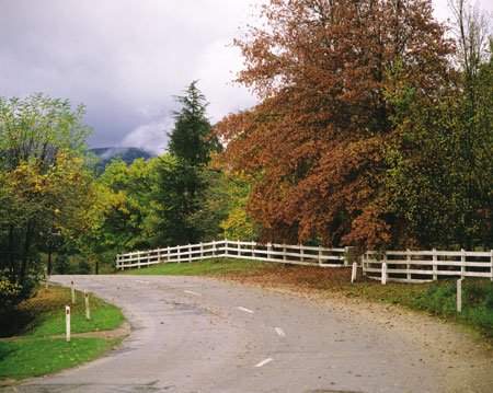
[MOUNT DIFFICULT RANGE, GRAMPIANS NATIONAL PARK]
* Distances for towns nearby are calculated as the crow flies.
* Food and accommodation listings in town are ordered alphabetically with places nearby listed at the end.
Aireys Inlet |
Pop. 754 |
 Geelong and Great Ocean Road Visitor Information Centre, Princes Hwy, Little River; (03) 5283 1735 or 1800 620 888; www.aireysinlet.org.au
 94.7 The Pulse FM, 774 AM ABC Local Radio
Aireys Inlet is one of the prettiest towns on the Great Ocean Road and is famed for being home to the Split Point Lighthouse. While there are many attractions in town to entice, the lure of this town lies in its proximity to the stunning ochre cliffs and secluded beaches of the Great Ocean Road, and to some of the best national parks in Victoria.
 Split Point Lighthouse This famous lighthouse is still operating and is visible for kilometres on the Great Ocean Road. Tours run 11am–2pm daily year-round; 1800 174 045; www.splitpointlighthouse.com.au
Eagles Nest Fine Art Gallery: a small gallery featuring the work of local artists; open 10am–5pm; 50 Great Ocean Rd; (03) 5289 7366.
 Farmers’ market: Aireys Inlet Community Hall; 2nd Sun each month. Aireys Open Mic Music Festival: Mar. Cimarron Sculpture Weekend: Apr. Aireys Inlet Festival of Words: Aug. International Lighthouse Weekend: Aug.
 a la grecque: Greek cuisine; 60 Great Ocean Rd; (03) 5289 6922. Willows Tea House: regional-produce menu and tea; 7 Federal St; (03) 5289 6830.
 Aireys Inlet Holiday Park: 19–25 Great Ocean Rd; (03) 5289 6230. Lorneview Bed & Breakfast: 677 Great Ocean Rd, Eastern View; (03) 5289 6430.
 Great Otway National Park This national park surrounds Aireys Inlet and is home to ancient forests and some of the most spectacular ocean scenery on the Great Ocean Rd. Highlights include Triplet Falls and Wreck Beach, where there are remains from a few shipwrecks. Contact Parks Victoria on 13 1963. See Apollo Bay.
Surf Coast Walk: this ocean walk continues for 66 km along the Great Ocean Road and takes you through scenery including pristine beaches and imposing cliffs; details from visitor centre. Eagle Rock Marine Sanctuary: found off the coast of Aireys Inlet, this marine sanctuary protects an abundance of marine life.
TOWNS NEARBY: Anglesea 9 km, Lorne 14 km, Torquay 24 km, Winchelsea 26 km, Barwon Heads 39 km
Alexandra |
Pop. 2142 |
36 Grant St; (03) 5772 1100 or 1800 652 298; www.alexandratourism.com
102.9 FM ABC Local Radio, 106.9 UGFM Upper Goulburn Community Radio
Alexandra was apparently named after Alexandra, Princess of Wales, although, coincidentally, three men named Alexander discovered gold here in 1866. Situated in the foothills of the Great Dividing Range, Alexandra is supported primarily by agriculture. Nearby, the Goulburn River is an important trout fishery.
Alexandra Timber Tramways: museum housed in the original railway station that offers an insight into the timber industry around Alexandra; open 2nd Sun each month; Station St. Art and craft galleries: many outlets around town displaying and selling local art, pottery and glassware.
Bush market: Perkins St; 3rd Sat each month (excluding winter). Picnic Races: Jan, Mar, Oct and Nov. Truck, Ute and Rod Show: June. Open Gardens Weekend: Oct. Rose Festival: Nov.
Essence Coffee Lounge: good country fare; 79 Grant St; (03) 5772 2122. Stonelea Country Estate: excellent countryhouse fare; Cnr Connellys Creek Rd and Maroondah Hwy, Acheron; (03) 5772 2222. Tea Rooms of Yarck: regional Italian; 6585 Maroondah Hwy, Yarck; (03) 5773 4233.
Alexandra Tourist Park: 5016 Maroondah Hwy; (03) 5772 1222. BIG4 Taggerty Holiday Park: 3380 Maroondah Hwy, Taggerty; (03) 5774 7263. Breakaway Twin Rivers Caravan Park: 91 Breakaway Rd, Acheron; (03) 5772 1735. Idlewild Park Farm Accommodation: 5545 Maroondah Hwy, Koriella; (03) 5772 1178.
McKenzie Nature Reserve: in virgin bushland, with orchids and wildflowers during winter and spring. Self-guide tourist drives: the Skyline Rd from Alexandra to Eildon features lookouts along the way; information from visitor centre. Taggerty: home to the Willowbank Gallery and a bush market; open 4th Sat each month; 18 km S. Trout fishing: in the Goulburn, Acheron and Rubicon rivers. Lake Eildon National Park: excellent walking trails in the north-west section of the park; for more details see Eildon. Bonnie Doon: a good base for exploring the lake region. Activities include trail-riding, bushwalking, watersports and scenic drives; 37 km NE near Lake Eildon.
TOWNS NEARBY: Eildon 18 km, Yea 25 km, Marysville 35 km, Mansfield 37 km, Euroa 50 km
Anglesea |
Pop. 2292 |
Off Great Ocean Rd; or ring Torquay Information Centre, (03) 5261 4219 or 1300 614 219; www.visitgreatoceanroad.org.au
94.7 The Pulse FM, 774 AM ABC Local Radio
A pretty and sheltered part of the surf coast, Anglesea is one of the smaller holiday hamlets along the Great Ocean Road. The main beaches are patrolled from Christmas through to Easter, making it a favourite destination for both swimmers and beginner surfers.
Coogoorah Reserve Set on the Anglesea River, the name of this park means ‘swampy reed creek’. Coogoorah was established after the 1983 Ash Wednesday fires and now features a network of boardwalks weaving through the distinctive wetland vegetation. Keep an eye out for local birdlife, including the peregrine falcon.
Anglesea Golf Course: golfers share the greens with kangaroos; Golf Links Rd. Melaleuca Gallery: open daily 11am–5.30pm; Great Ocean Rd. Viewing platform: overlooks open-cut brown-coal mine and power station; behind town in Coalmine Rd. Paddleboats: for hire on the banks of the Anglesea River.
Markets: local crafts and produce, held over summer, Easter and Melbourne Cup weekend; by the Anglesea River. Rock to Ramp Swim: Jan. Anglesea Art Show: June. ANGAIR Wildflower and Art Show: Sept.
Locanda Del Mare: a slice of Italy; 5 Diggers Pde; (03) 5263 2904.
Anglesea Beachfront Family Caravan Park: 35 Cameron Rd; (03) 5263 1583.
J. E. Loveridge Lookout: 1 km W. Pt Roadknight Beach: a shallow, protected beach, popular with families; 2 km SW. Ironbark Basin Reserve: features ocean views, local birdlife and good bushwalking. The Pt Addis Koorie Cultural Walk leads through the park, highlighting sites of Indigenous significance; 7 km NW, off Pt Addis Rd. Great Otway National Park: the park begins near Anglesea and stretches to the south and west. The section near Anglesea features unique heathland flora and good walking trails; access via Aireys Inlet, 11 km SW. For more details see Apollo Bay. Surf Coast Walk: 30 km from Torquay to Moggs Creek (south of Aireys Inlet). The track passes through Anglesea. Surf schools: learn to surf on one of the beginner courses available at nearby beaches; details from visitor centre.
TOWNS NEARBY: Aireys Inlet 9 km, Torquay 15 km, Lorne 24 km, Winchelsea 25 km, Barwon Heads 30 km
Apollo Bay |
Pop. 1373 |
Great Ocean Road Visitor Information Centre, 100 Great Ocean Rd; 1300 689 297; www.visitgreatoceanroad.org.au
89.5 FM ABC Local Radio, 104.7 Otway FM Named after a local schooner, Apollo Bay has become the resting place of many shipwrecks, yet it maintains an appeal for all lovers of the ocean. The town is situated near Great Otway National Park with a wonderful contrast between rugged coastline and tranquil green hills. The seaside town is popular with fishing enthusiasts and, like many other coastal towns, its population swells significantly over summer as visitors flock here for the holidays.
Old Cable Station Museum: features artefacts from Australia’s telecommunications history and informative displays exploring the history of the region; open 2–5pm weekends and school and public holidays; Great Ocean Rd. Bass Strait Shell Museum: holds an impressive array of shells and provides many facts about the marine life along the Victorian south-west coast; Noel St. Great Ocean Walk: enjoy stunning views on this 91 km walk between Apollo Bay and Glenample Homestead, near the Twelve Apostles. Walkers must register to use campgrounds en route. Further information available at www.greatoceanwalk.com
Foreshore Market: each Sat. Apollo Bay Music Festival: Apr.
Bay Leaf Cafe: substantial cafe food; 131 Great Ocean Rd; (03) 5237 6470. Chris’s Beacon Point Restaurant & Villas: Mediterranean/Greek; 280 Skenes Creek Rd; (03) 5237 6411. Great Ocean Hotel: modern Australian and bar menu; 29 Great Ocean Rd; (03) 5237 6240. La Bimba Restaurant & Cafe: modern Mediterranean; 125–127 Great Ocean Rd; (03) 5237 7411.
Apollo Bay Holiday Park: 27 Cawood St; (03) 5237 7111. Apollo Bay Recreation Reserve Caravan & Camp Park: 70 Great Ocean Rd; (03) 5237 6577. Arcady Homestead: 925 Barham River Rd; (03) 5237 6493. Captain’s at the Bay: Cnr Pascoe and Whelan sts; (03) 5237 6771. Casa Favilla B & B: 18 Great Ocean Rd; (03) 5237 1199. Marengo Holiday Park: Marengo Cres; (03) 5237 6162. Nelson’s Perch Bed & Breakfast: 54 Nelson St; (03) 5237 7176. Pisces Holiday Park: 311 Great Ocean Rd; (03) 5237 6749. A Room with a View B&B: 280 Sunnyside Rd, Wongarra; (03) 5237 0218. Bimbi Park: 90 Manna Gum Dr, Cape Otway; (03) 5237 9246.
Great Otway National Park Formerly named Otway National Park, this section of the 103 000 ha park includes some of the most rugged coastline in Victoria, particularly around Cape Otway and the stretch of coast towards Princetown. It is an ideal location for a bushwalking adventure taking in sights through the park to the sea, from the scenic Elliot River down to adjacent Shelly Beach. Many species of wildlife inhabit the park, including koalas and the rare tiger quoll. Also look out for the historic Cape Otway Lighthouse, built in 1848. Another highlight is Melba Gully, where, at dusk, visitors can witness a show of twinkling lights from glow worms. The Great Ocean Rd, west of Apollo Bay, passes through the park. Contact Parks Victoria on 13 1963; 13 km SW.
Otway Fly The consistently popular Otway Fly is a steel-trussed walkway perched high among the temperate rainforest treetops of the Otway Ranges. The ‘Fly’ is 25 m high and stretches for 600 m. It is accessible to all ages and levels of mobility. Get a bird’s-eye view of ancient myrtle beech, blackwood and mountain ash while looking out for a variety of wildlife, including pygmy possums and the raucous yellow-tailed black cockatoo. A springboard bridge takes you over Youngs Creek, where you might spot a shy platypus. Inquiries on 1800 300 477; 62 km NW via Lavers Hill.
Marriners Lookout: with views across Skenes Creek and Apollo Bay; 1.5 km NW. Barham Paradise Scenic Reserve: in the Barham River Valley, it is home to a variety of distinctive moisture-loving trees and ferns; 7 km NW. Tanybryn Gallery: displays and sells art and craft work in the magnificent surrounds of the Otway Ranges; Skenes Creek Rd; 20 km NE. Forests and Waterfall Drive: 109 km loop drive featuring spectacular Otway Ranges scenery. Waterfalls include Beauchamp, Triplet and Houptoun falls. Drive starts at Apollo Bay, travels west to Lavers Hill and around to Skenes Creek. Map from visitor centre. Charter flights: views of the Twelve Apostles, the Bay of Islands and the ‘Shipwreck Coast’; details from visitor centre.
TOWNS NEARBY: Lorne 36 km, Colac 47 km, Aireys Inlet 50 km, Anglesea 60 km, Port Campbell 60 km
Ararat |
Pop. 7170 |
Ararat and Grampians Visitor Information Centre, Ararat Railway Station, 91 High St (Western Hwy); (03) 5355 0281 or 1800 657 158; www.ararat.vic.gov.au
99.9 VoiceFM, 107.9 FM ABC Local Radio
Ararat is a city with a vibrant history. Once inhabited by the Tjapwurong Aboriginal people, the promising lands soon saw squatters move in, and the area really started to boom when gold was discovered in 1854. Thousands of prospectors arrived, and Ararat finally came into existence when Chinese immigrants rested on the town’s site in 1857, after walking from South Australian ports in order to avoid Victorian poll taxes. One member of the party discovered alluvial gold, and Ararat was born. Today Ararat is a service centre to its agricultural surrounds.
J Ward The town’s original gaol, ‘J Ward’ served as an asylum for the criminally insane for many years and offers an eerie glimpse into the history of criminal confinement. Now guided tours reveal in chilling detail what life was like for the inmates. Girdlestone St; daily tours; (03) 5352 3357.
Gum San Chinese Heritage Centre Gum San means ‘hill of gold’, a fitting name for this impressive centre built in traditional Southern Chinese style and incorporating the principles of feng shui. The centre celebrates the contribution of the Chinese community both to Ararat, which is said to be the only goldfields town founded by Chinese prospectors, and to the surrounding Goldfields region. The experience is brought to life with interactive displays and an original Canton lead-mining tunnel, uncovered during the building of the centre. Western Hwy; (03) 5352 1078.
Alexandra Park and Botanical Gardens: an attractive formal garden featuring ornamental lakes, fountains and an orchid glasshouse; Vincent St. Historical self-guide tours (walking or driving): of particular note are the bluestone buildings in Barkly St, including the post office, town hall, civic square and war memorial; details from visitor centre. Ararat Art Gallery: a regional gallery specialising in wool and fibre pieces by local artists; Barkly St. Langi Morgala Museum: displays Aboriginal artefacts; Queen St.
Jailhouse Rock Festival: Mar. Australian Orchid Festival: Sept. Golden Gateway Festival: held over 10 days; Oct.
Nectar Ambrosia: smart eatery in old pub; 157–159 Barkly St; (03) 5352 7344.
Acacia Caravan Park: 6 Acacia Ave; (03) 5352 2994. Beaufort Lake Caravan Park: 39 Park Rd (Skipton Rd), Beaufort; (03) 5349 2196.
Mt Buangor State Park The park features the Fern Tree Waterfalls and the 3 impressive peaks of Mt Buangor, Mt Sugarloaf and Cave Hill. Its diverse terrain with many varieties of eucalypts offers great sightseeing, bushwalking and picnicking. There are more than 130 species of birds, as well as eastern grey kangaroos, wallabies and echidnas. Contact Parks Victoria on 13 1963. Access to the southern section is via Ferntree Rd off the Western Hwy; 30 km E. Mt Buangor and Cave Hill can be accessed from the main Mt Cole Rd in the Mt Cole State Forest.
Garden Gully Winery: hosts a scarecrow competition each Apr, with ingenious entries from across the state scattered through the vineyard; 17 km N on Western Hwy. Many more of the region’s wineries can be accessed on the Great Grape Rd, a circuit through Ballarat and St Arnaud. This region is famous for sparkling whites and traditional old shiraz varieties; brochure and map from visitor centre. Green Hill Lake: great for fishing and water activities; 4 km E. McDonald Park Wildflower Reserve: an extensive display of flora indigenous to the area, including wattles and banksias, impressive during the spring months; 5 km N on Western Hwy. One Tree Hill Lookout: 360-degree views across the region; 5 km NW. Langi Ghiran State Park: Mt Langi Ghiran and Mt Gorrin form the key features of this park. A popular walk starts at the picnic area along Easter Creek, then goes to the Old Langi Ghiran Reservoir and along the stone water race to a scenic lookout; access via Western Hwy, Kartuk Rd; 14 km E. Mt Cole State Forest: adjoins Mt Buangor State Park, with bushwalking, horseriding, 4WD tracks and trail-bike riding. The Ben Nevis Fire Tower offers spectacular views; 35 km E.
TOWNS NEARBY: Stawell 29 km, Halls Gap 40 km, Avoca 53 km, Dunkeld 66 km, Clunes 76 km
Avoca |
Pop. 948 |
122 High St; (03) 5465 1000 or 1800 206 622; www.pyreneestourism.com.au
91.1 FM ABC Local Radio, 96.5 Radio KLFM
Avoca was built during the gold boom of the 19th century and is renowned for its wide main street, divided by a stretch of park with trees and a war memorial. Avoca is set in the picturesque Pyrenees Ranges, with the Avoca River flowing by the town.
Historic walk: takes in the original courthouse, one of the oldest surviving courts in Victoria, as well as the powder magazine and Lalor’s, one of the state’s earliest pharmacies; map from visitor centre. Cemetery: Chinese burial ground from the goldmining period; on outskirts of town.
Avoca Fine Wine, Arts and Craft Market: 3rd Sun each month. Blue Pyrenees Pink Lamb and Purple Shiraz Race Meeting: country race meeting; Mar. Petanque Tournaments (French Bowls): Mar and Dec. Mt Avoca Anzac Day Races: Apr. Taltarni Cup Races: Oct.
Warrenmang Vineyard & Resort: regional food; 188 Mountain Creek Rd, Moonambel; (03) 5467 2233.
Pyrenees Ranges State Forest Covering a large stretch of bushland, these ranges are great for bushwalking and picnics and camping. Visitors can see a variety of wildlife, including koalas, wallabies, kangaroos and goannas. Orchids and lilies can be found growing around the base of the ranges in season. An 18 km walking track starts at The Waterfall camping area and finishes at Warrenmang–Glenlofty Rd. Access via Sunraysia or Pyrenees hwys. For further information contact the Department of Sustainability and Environment Customer Sevice Centre on 13 1186.
Pyrenees wine region Shiraz is the Pyrenees’ premium drop and its big names are Blue Pyrenees Estate and Taltarni. Dalwhinnie has been highly praised for its Eagle Series Shiraz. It is also doing well in a range of styles including chardonnay, cabernet sauvignon and pinot noir. Redbank Winery is known for its Sally’s Paddock blend, comprising merlot, cabernet sauvignon, shiraz and cabernet franc.
Mt Lonarch Arts: displays and sells fine bone china made on the premises; Mt Lonarch; 10 km S. Warrenmang Vineyard Resort: with cottage-style accommodation and a restaurant specialising in regional produce. The vineyard is also the venue for A Sparkling Affair each Nov, an event celebrating the release of sparkling wines; 22 km NW.
TOWNS NEARBY: Maryborough 24 km, Dunolly 34 km, Clunes 36 km, Creswick 53 km, Ararat 53 km
Bacchus Marsh |
Pop. 13 258 |
Lerderderg Library, 215 Main St; (03) 5367 7488; www.visitmoorabool.com.au
98.5 3APL Apple FM, 774 AM ABC Local Radio
Bacchus Marsh shares part of its name with the Roman god of wine, but is actually better known for the apples that grow so well in the fertile valley region between the Werribee and Lerderderg rivers. Considered a satellite town within commuting distance of Melbourne, Bacchus Marsh retains a certain charm with stunning heritage buildings and a rural atmosphere.
Avenue of Honour Visitors to the town are greeted by the sight of the renowned Avenue of Honour, an elm-lined stretch of road built in honour of the Australian soldiers who fought in WW I. Eastern approach to town.
Big Apple Tourist Orchard: fresh-produce market; Avenue of Honour. Historic buildings: include The Manor, the original home of the town’s founder, Captain Bacchus (now privately owned), and Border Inn, built in 1850, thought to be the state’s first stop for Cobb & Co coaches travelling to the goldfields; details from visitor centre. Local history museum: connected to the blacksmith cottage and forge; open Sat–Sun; Main St. Naturipe Fruits, Strawberry, Peach and Nectarine Farm: pick-your-own fruits and roadside sales; Avenue of Honour.
Rotary Art Show: June.
Bacchus Marsh Caravan Park: 26 Main St; (03) 5367 2775. Sundowner Rockbank: 2057 Western Hwy, Rockbank; (03) 9747 1340.
Lerderderg State Park Featuring the imposing Lerderderg Gorge, the 14 250 ha park is a great venue for picnics, bushwalking and swimming, while the Lerderderg River is ideal for trout fishing. The area was mined during the gold rush, and remnants from the water races used for washing gold can still be found upstream from O’Brien’s Crossing. Late winter and spring are good times to see Wildflowers and blossoming shrubs. Look out for koalas nestled in giant manna gums and for the magnificent sulphur-crested cockatoo and the wedge-tailed eagle. Contact Parks Victoria on 13 1963. Access via Western Fwy to Bacchus Marsh-Gisborne and Lerderderg Gorge rds; 10 km N.
Werribee Gorge State Park Over time the Werribee River has carved through ancient seabed sediment and lava flows to form a spectacular gorge. The name ‘Werribee’ comes from the Aboriginal word ‘Wearibi’, meaning ‘swimming place’ or ‘backbone’, perhaps in reference to the snake-like path of the river. Rock climbing is permitted at Falcons Lookout and a popular walk follows the Werribee River from the Meikles Pt picnic area, providing views of the river and the gorge cliff-faces. Contact Parks Victoria on 13 1963. Access via Western Fwy and Pentland Hills Rd to Myers Rd, or via Ironbark Rd (the Ballan-Ingliston Rd) from the Bacchus Marsh-Anakie Rd; 10 km W.
Sunbury wine region This small but historic wine region is found on the north-west doorstep of Melbourne, just beyond Tullamarine airport. Goona Warra Vineyard was established in 1863, and its winery is set in an original bluestone building. Craiglee, just over the road, was established only a year later in 1864. Shiraz is the specialty of both labels, and Craiglee’s shiraz has won several trophies. Other wineries include Galli Estate, Wildwood and Witchmount.
Long Forest Flora Reserve: a great example of the distinctive mallee scrub that once covered the region; 2 km NE. St Anne’s Vineyard: with a bluestone cellar built from the remains of the old Ballarat Gaol; Western Fwy; 6 km W. Merrimu Reservoir: attractive park area with picnic facilities; about 10 km NE. Organ Pipes National Park: lava flows have created a 20 m wall of basalt columns in this small park near Sunbury. The ‘organ pipes’can be seen close-up via an easy walking trail. Melton: now virtually a satellite suburb of Melbourne, this town has a long and rich history of horse breeding and training. Visit the Willow Homestead to see exhibits detailing the life of early settlers (open Wed, Fri and Sun), picnic on the Werribee River at Melton Reservoir, or taste the fine wines in the nearby Sunbury Wine Region; 14 km E. Brisbane Ranges National Park: with good walking tracks, wildflowers during spring and the imposing, steep-sided Anakie Gorge; 16 km SW. Ballan: try the refreshing mineral-spring water at Bostock Reservoir, or join in the festivities at the Vintage Machinery and Vehicle Rally in Feb, and an Autumn Festival held each Mar; 20 km NW. Blackwood: visit the Mineral Springs Reserve and Garden of St Erth (closed Wed and Thurs). Blackwood is also the start of the 53 km return scenic drive through the Wombat State Forest; 31 km NW.
TOWNS NEARBY: Woodend 37 km, Daylesford 45 km, Kyneton 48 km, Ballarat 52 km, Geelong 53 km
Bairnsdale |
Pop. 11 284 |
240 Main St; (03) 5152 3444 or 1800 637 060; www.lakesandwilderness.com.au
100.7 FM ABC Local Radio, 105.5 3REG Radio East Gippsland FM
An attractive rural centre situated on the Mitchell River Flats and considered to be the western gateway to the lakes and wilderness region of East Gippsland. The area has a rich Koorie history brought to life through local landmarks, especially in Mitchell River National Park, where a fascinating piece of Aboriginal folklore is based around the Den of Nargun.
Aboriginal culture The Krowathunkoolong Keeping Place, on Dalmahoy St, details the cultural history of the region’s Kurnai Aboriginal people and provides an insight into the impact of white settlement. To explore local Aboriginal history further, visit Howitt Park, Princes Hwy – a tree here has a 4 m scar where bark has been removed to make a canoe. The Bataluk Cultural Trail from Sale to Cann River takes in these and other Indigenous sites of East Gippsland. Details of the trail from Krowathunkoolong.
Historical Museum: built in 1891, contains relics from Bairnsdale’s past; Macarthur St. Jolly Jumbuck Country Craft Centre: wool spinning and knitting mills, plus woollen products for sale; edge of town. Self-guide heritage walks: take in St Mary’s Church, with wall and ceiling murals by Italian artist Francesco Floreani, and the Court House, a magnificent, castle-like construction; details from visitor centre.
Howitt Park Market: 4th Sun each month. Line Dancing Championships: Mar. East Gippsland Agricultural Field Days: popular event with family entertainment; Apr. Bairnsdale Easter Races: Easter. Bairnsdale Cup: Sept.
Paper Chase: modern bookshop cafe; Collins Booksellers, 166 Main St; (03) 5152 5181.
Dalfruin & Ballyvista B&B: 18 McCulloch St; (03) 5152 7155. Mitchell Gardens Holiday Park: 2 Main St (Princes Hwy); (03) 5152 4654. Tara House Bed & Breakfast: 37 Day St; (03) 5153 2253. Bairnsdale Holiday Park: 139 Princes Hwy, Bairnsdale East; (03) 5152 4066. Dargo Bed & Breakfast: 1 Lower Dargo Rd, Dargo; (03) 5140 1228. Old School Bed and Breakfast: 720 Fernbank–Glenaladale Rd, Fernbank; (03) 5157 6235. Lakes Bushland Caravan Park: 363 Stephenson Rd, Nicholson; (03) 5156 8422. Nicholson River Caravan Park: 915 Princes Hwy, Nicholson; (03) 5156 8348. Stringybark Cottages: 77 Howards Rd, Sarsfield; (03) 5157 5245.
Mitchell River National Park Set in the remnants of temperate rainforest, this park has its own piece of mythology. According to Koorie history, Nargun was a beast made all of stone except for his hands, arms and breast. The fierce creature would drag the unwary to his den, a shallow cave beneath a waterfall on the Woolshed Creek. This Den of Nargun can be found in the park, as can giant kanooka trees, wildflowers and over 150 species of birds. There is a circuit walk to Bluff Lookout and Mitchell River, and Billy Goat Bend is good for picnics. Contact Parks Victoria on 13 1963; Princes Hwy; 15 km W near Lindenow.
McLeods Morass Wildlife Reserve: a boardwalk extends over the freshwater marshland, allowing a close-up view of the many species of waterbirds found here; southern outskirts of town, access via Macarthur St; 2 km S. Wineries: include Nicholson River Winery, for tastings and sales; 10 km E. Bruthen: hosts a Blues Bash each Feb; 24 km NW. Dargo: historic township in Dargo River valley and major producer of walnuts. Dargo Valley Winery has accommodation and cellar-door sales. The road beyond Dargo offers a scenic drive through high plains to Hotham Heights, stunning in spring when wattles bloom (unsealed road, check conditions); 93 km NW.
TOWNS NEARBY: Paynesville 14 km, Lakes Entrance 34 km, Sale 57 km, Maffra 58 km, Buchan 62 km
Ballarat |
Pop. 85 196 |
43 Lydiard St North; 1800 446 633; www.visitballarat.com.au
99.9 VoiceFM, 107.9 FM ABC Local Radio
Ballarat is Victoria’s largest inland city and features grand old buildings and wide streets that create an air of splendour. Built on the wealth of the region’s goldfields, Ballarat offers activities ranging from fine dining in the many restaurants to real-life experiences of the area’s goldmining past. Lake Wendouree provides a beautiful backdrop for picnics and the many festivals that take place during the year. Ballarat was the site of the infamous Eureka Rebellion of 3 December 1854. When Goldfields police attempted to quell the miners’ anger over strict mininglicence laws, a bloody massacre eventuated. The Eureka Rebellion is viewed by many as a symbol of the Australian workers’ struggle for equity and a ‘fair go’. The best place to get a feel for this historic event is at Sovereign Hill.
Sovereign Hill This is the main destination for visitors to Ballarat and a good place to get a taste for what life was like on the Victorian goldfields. Spread over 60 ha, Sovereign Hill is a replica goldmining town, complete with authentically dressed townspeople. Panning for gold is a popular activity, while in the evening the Blood on the Southern Cross show re-enacts the Eureka Rebellion. Bradshaw St; (03) 5337 1100.
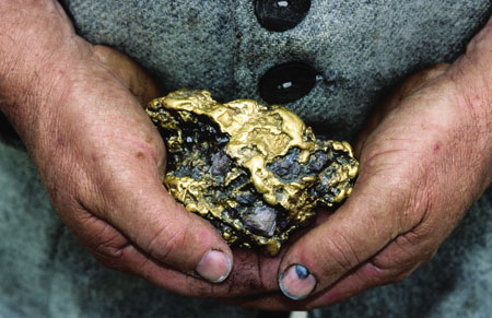
[ GOLD NUGGET, SOVEREIGN HILL ]
Eureka Centre for Australian Democracy: multimillion-dollar cultural centre with information about the famous battle; Cnr Eureka and Rodier sts; (03) 5333 1854. Ballarat Botanic Gardens: an impressive collection of native and exotic plants; Prime Minister Ave features busts of all of Australia’s prime ministers; Wendouree Pde. Ballarat Wildlife Park: houses native Australian animals such as koalas, kangaroos, quokkas and crocodiles; Cnr Fussel and York sts, Ballarat East; (03) 5333 5933. Art Gallery of Ballarat: holds a significant collection of Australian art. The original Eureka Stockade flag is also on display; 40 Lydiard St North; (03) 5320 5791. Gold Museum: details the rich goldmining history of the area; opposite Sovereign Hill, Bradshaw St; (03) 5337 1107; admission free with Sovereign Hill Ticket. Historic buildings: include Her Majesty’s Theatre, built in 1875 and Australia’s oldest intact, purpose-built theatre, and Craig’s Royal and the George hotels, with classic old-world surroundings; Lydiard St. Vintage Tramway: via Wendouree Pde; rides weekends, and public and school holidays. Avenue of Honour and Arch of Victory: honours those who fought in WW I; western edge of city.
Lakeside Farmers Market: Lake Wendouree foreshore; 2nd and 4th Sat every month. Organs of the Ballarat Goldfields: music festival held in historic venues; Jan. Begonia Festival: popular event for garden lovers with floral displays, gardening forums, street parades, fireworks, art shows, kids’ activities; Mar. Heritage Weekend: May. Royal South Street Eisteddfod: music festival; Sept–Nov. Ballarat Cup: Nov.
Boatshed Restaurant: modern Australian restaurant by the lake; 27A Lake Wendouree Foreshore; (03) 5333 5533. Europa Cafe: cafe with all-day breakfast; 411 Sturt St; (03) 5338 7672. L’espresso: Italian cafe; 417 Sturt St; (03) 5333 1789. Masons Cafe & Foodstore: blackboard specials; 32 Drummond St North; (03) 5333 3895.
Shady Acres Accommodation Caravan Park: 9435 Western Hwy; (03) 5334 7233. Braeside Garden Cottages: 3 Albion St, Golden Point; 0419 815 012. Canadian Lodge: 10 Valley Dr, Canadian; (03) 5330 1327. Cruzin the 50’s 60’s Bed & Breakfast: 7 Handford Crt, Invermay; (03) 5333 2484. Eureka Stockade Holiday Park: 104 Stawell St South, Ballarat East; (03) 5331 2281. Lake Burrumbeet Caravan Park: Avenue of Honour, Burrumbeet; (03) 5344 0583. Wintarni Olives: 40 Clearview Rd, Invermay; 0409 812 470.
Enfield State Park Great for bushwalking or horseriding, the park is home to many species of orchids and numerous animals including echidnas, koalas, bats and frogs. There is a pretty picnic ground at Remote Long Gully, and numerous walking tracks. Also featured are the remnants of early goldmining settlements, including the Berringa Mines Historic Reserve. Contact Parks Victoria on 131 963. Access via Incolls and Misery Creek rds; 25 km S.
Buninyong Buninyong features many fine art and craft galleries. The Buninyong Flora and Bird Park, home to many species of parrots, has raised walkways through the aviaries. 408 Eddy Ave, Mt Helen; (03) 5341 3843. Buninyong Good Life Festival; 3rd weekend in Oct, and in May for the Buninyong Film Festival. The Mt Buninyong Lookout east of town offers great views. 13 km SE.
Kirks and Gong Gong reserves: ideal for picnics and bushwalking, these parks include many unique, indigenous plants; on opposite sides of Daylesford Rd; 5 km NE. Kryal Castle: replica of a medieval castle, with daily tours and family entertainment; (03) 5334 7422; 9 km E. Yuulong Lavender Estate: set in scenic landscaped gardens, the estate produces and sells lavender products; closed May–Sep; Yendon Rd, Mt Egerton; (03) 5368 9453; 25km SE. Lal Lal Falls: plunge 30 m into the Moorabool River; 18 km SE. Lal Lal Blast Furnace: fascinating 19th-century archaeological remains; 18 km SE. Lake Burrumbeet: this 2100 ha lake is a popular fishing spot, especially for redfin in spring and summer. Watersports and family activities are available on the lake; various boat ramps provide access. Caravan parks are set on the lakeside and are popular with holiday-makers; 22 km NW. Skipton: in town is an eel factory selling smoked eel and other products; 51 km SW. South of town are the Mt Widderin Caves – one has been named the Ballroom, as it was once a venue for dances and concerts. The caves are on private property; tours by appt (03) 5340 2081. Beaufort: a small town on the shores of Lake Beaufort, an artificial lake surrounded by gardens, providing a picturesque location for picnics and leisurely walks; 54 km W. South of town is Lake Goldsmith, home of a major rally of steamdriven machinery and vehicles each May and Oct. Mooramong Homestead: built in the 1870s and then altered during the 1930s by its ex-Hollywood owners. It is surrounded by beautiful gardens and a flora and fauna reserve, and is open for tours 3rd Sun each month; 56 km NW via Skipton. Great Grape Rd: circuit through Avoca, St Arnaud and Stawell, visiting local wineries.
TOWNS NEARBY: Creswick 16 km, Clunes 31 km, Daylesford 35 km, Bacchus Marsh 52 km, Maryborough 59 km
Barwon Heads |
Pop. 2994 |
Geelong and Great Ocean Road Visitor Information Centre, Princes Hwy, Little River; (03) 5283 1735 or 1800 620 888; www.visitgreatoceanroad.org.au
94.7 The Pulse FM, 774 AM ABC Local Radio
This picturesque village, situated on the banks of the Barwon River near Bass Strait in Victoria, was established in the late 18th century and more recently received nationwide fame as the setting for the ABC’s TV show SeaChange. Although well known for its river beaches and coastal activities, Barwon Heads is experiencing a sea change of its own as the hometown of 2011 Tour de France winner Cadel Evans, which has revived interest in the town. The population of this coastal town swells during the holiday season, as people take advantage of the range of activities on offer and the friendly village atmosphere. Apart from cycling and water activities, Barwon Heads is also home to one of the top links golf courses in Victoria.
Golf Courses: include Thirteenth Beach and the Barwon Heads Golf Club. Barwon Heads Bridge: the recently restored bridge is a heritage-listed structure.
Barwon Heads Festival of the Sea: Mar.
Annie’s Provedore: regional-produce menu; 2/50 Hitchcock Ave; (03) 5254 3233. At the Heads: Mediterranean-style menu; Jetty Rd; (03) 5254 1277.
Barwon Heads Caravan Park: Ewing Blyth Dr; (03) 5254 1115.
Barwon Bluff Marine Sanctuary: covering 17 ha of ocean, the sanctuary is home to a vast array of marine life, as well as kelp forests and a couple of shipwrecks; contact Parks Victoria on 13 1963. Swim with dolphins: swim with dolphins and other marine life in the beautiful waters of the Bass Strait. Jirrahlinga Koala and Wildlife Reserve: home to an abundance of Australian wildlife, including koalas; Taits Rd; open 9am–4.30pm; (03) 5254 2484.
TOWNS NEARBY: Ocean Grove 3 km, Drysdale 14 km, Queenscliff 15 km, Torquay 15 km, Geelong 19 km
Beechworth |
Pop. 2644 |
Ford St; (03) 5728 3233 or 1300 366 321; www.beechworth.com
101.3 Oak FM, 106.5 FM ABC Local Radio
Set in the picturesque surrounds of the Australian Alps, Beechworth is one of the state’s best preserved 19th-century gold towns, with over 30 buildings listed by the National Trust. The grandeur of Beechworth’s buildings can be explained by the fact that during the 1850s over four million ounces of gold were mined here. There is a delightful tale about Beechworth’s heyday: the story goes that Daniel Cameron, a political candidate vying for support from the Ovens Valley community, rode at the head of a procession through the town on a horse shod with golden shoes. Sceptics claim they were merely gilded, but the tale offers a glimpse into the wealth of Beechworth during the gold rush.
Historic and cultural precinct This fantastic precinct provides a snapshot of 19th-century Beechworth. Featuring fine, honey-coloured granite buildings, the area incorporates the telegraph station, gold office, Chinese prospectors’ office, town hall and powder magazine. Of particular interest is the courthouse, site of many infamous trials including Ned Kelly’s, and where Sir Isaac Isaacs began his legal career. Also in the precinct is the Robert O’Hara Burke Memorial Museum, with the interesting ‘Strand of Time’ exhibition where 19th-century Beechworth shops are brought to life.
Beechworth Gaol Built in 1859, the original wooden gates of this gaol were replaced with iron ones when it was feared prisoners would break out in sympathy with Ned Kelly during his trial. The gaol is located in William St but not presently open to the public.
Walking tours: Ned Kelly and Gold Rush walking tours operate daily, and Ghost Tours are available at the former Mayday Hills Asylum; bookings at visitor centre. Carriage Museum and Australian Light Horse Exhibition: National Trust horsedrawn carriage display and Australian Light Horse Exhibition housed at the historic Murray Breweries, which also offers turn-of-the-century gourmet cordial made to time-honoured recipes; 29 Last St. Beechworth Honey Experience: interpretive display on the history of honey; includes a glass-fronted live bee display. A wide range of premium Australian honey is on offer in the concept shop; Cnr Ford and Church sts. Harry Power’s Cell: under the shire offices, where the ‘gentleman bushranger’ was once briefly held; Albert Rd. The Beechworth Pantry: gourmet cafe and centre for produce of the north-east; Ford St. Beechworth Bakery: famous for its pastries and cakes; Camp St.
Country Craft Market: Queen Victoria Park, 4 times a year; details from visitor centre. Golden Horseshoes Festival: a celebration of the town’s past, with street parades and a variety of market stalls; Easter. Harvest Celebration: May; details from visitor centre. Drive Back in Time: vintage car rally; May. Celtic Festival: music festival; Nov.
Provenance Restaurant: contemporary regional food; 86 Ford St; (03) 5728 1786. The Green Shed Bistro: Europeaninfl uenced; 37 Camp St; (03) 5728 2360. The Ox and Hound: contemporary bistro; 52 Ford St; (03) 5728 2123. Wardens Food & Wine: modern Italian; 32 Ford St; (03) 5728 1377.
Barnsley House B&B: 5 John St; (03) 5728 1037. Country Charm Cottages: 24 Malakoff Rd; (03) 5728 2435. Finches of Beechworth Bed & Breakfast: 3 Finch St; (03) 5728 2655. Freeman on Ford: 97 Ford St; (03) 5728 2371. Lake Sambell Caravan Park: 20 Peach Dr; (03) 5728 1421. The Old Priory: 8 Priory La; (03) 5728 1024. Silver Creek Caravan Park: 151 Stanley Rd; (03) 5728 1597.
Beechworth Cemetery This cemetery is a fascinating piece of Goldfields history. More than 2000 Chinese goldminers are buried here. Twin ceremonial Chinese burning towers stand as a monument to those who died seeking their fortune far from home. Northern outskirts of town.
Beechworth wine region According to many wine writers, this boutique region is one to watch. With only small quantities being produced, and much of it quickly whisked away by a discerning clientele, Beechworth’s wines can be hot property. Castagna Vineyard grows its grapes biodynamically and is known for its superb Genesis Syrah Viognier. Gioconda produces outstanding chardonnay, while Sorrenberg is a leader in gamay and does a wonderful blend of cabernet sauvignon, cabernet franc and merlot.
Beechworth Historic Park: surrounds the town and includes Woolshed Falls Historical Walk through former alluvial goldmining sites. Gorge Scenic Drive (5 km): starts north of town. Beechworth Forest Drive: takes in Fletcher Dam; 3 km SE towards Stanley. Kellys Lookout: at Woolshed Creek; about 4 km N. Mt Pilot Lookout: views of Murray Valley, plus signposted Aboriginal cave paintings nearby; 5 km N. Stanley: a historic goldmining settlement with fantastic views of the alps from the summit of Mt Stanley; 10 km SE.
TOWNS NEARBY: Yackandandah 15 km, Myrtleford 23 km, Chiltern 24 km, Milawa 25 km, Wodonga 32 km
Benalla |
Pop. 9128 |
14 Mair St; (03) 5762 1749; www.benalla.vic.gov.au
97.7 FM ABC Local Radio, 101.3 Oak FM
Motorists from Melbourne entering Benalla will notice the Rose Gardens positioned beside the highway a short distance before Lake Benalla – gardens for which the city has become known as the ‘Rose City’. The town is Sir Edward ‘Weary’ Dunlop’s birthplace and proudly advertises the fact with a museum display and a statue in his honour at the Benalla Botanical Gardens.
Benalla Art Gallery Set beside Lake Benalla, the gallery has an impressive collection including contemporary Australian art, works by Sidney Nolan, Arthur Streeton, Tom Roberts and Arthur Boyd, and a substantial collection of Indigenous art. Built in 1975, the gallery is a striking work of modern architecture. There is a permanent exhibition featuring the works of Laurie Ledger, a local resident, and examples of the Heidelberg School and early colonial art. Bridge St; (03) 5762 3027.
Benalla Ceramic Art Mural: a Gaudi-inspired community construction, this fascinating 3D mural is opposite the art gallery on Lake Benalla. The Creators Gallery: paintings, pottery and craft; at the information centre. Benalla Costume and Pioneer Museum: has period costumes, a Ned Kelly exhibit (including Kelly’s cummerbund) and a feature display of Benalla’s ‘famous sons’, in particular, Sir Edward ‘Weary’ Dunlop; Mair St. Lake Benalla: created in Broken River, it has good recreation and picnic facilities and is a haven for waterbirds. Take the self-guide walk around the lake. Botanical Gardens: features a splendid collection of roses and memorial statue of Sir Edward ‘Weary’ Dunlop; Bridge St. Aeropark: centre for the Gliding Club of Victoria, offering hot-air ballooning and glider flights; northern outskirts of town; bookings on (03) 5762 1058.
Lakeside Craft and Farmers Market: near the Civic Centre; 3rd Sat each month. Benalla Festival: Feb/Mar.
Benalla Gallery Cafe: contemporary local-produce menu; Benalla Art Gallery, Bridge St; (03) 5762 3777. Georgina’s: modern Australian menu; 100 Bridge St East; (03) 5762 1334. North Eastern Hotel: regional contemporary dishes; 1 Nunn St; (03) 5762 7333. Raffety’s Restaurant: homemade modern Australian dishes; 55 Nunn St; (03) 5762 4066.
Belmont Bed & Breakfast: 80 Arundel St; (03) 5762 6575. Glen Falloch Farm Cottage: 252 Warrenbayne West Rd, Baddaginnie; 0403 340 660. Glenrowan Tourist Park: 2 Old Hume Hwy, Glenrowan; (03) 5766 2288. Melliodora Farm: 21 Bowers Rd, Winton; (03) 5766 4320.
Reef Hills State Park Features grey box, river red gum, wildflowers in spring and wattle blossom in winter. The park offers scenic drives, bushwalks, picnics and horseriding. There are more than 100 species of birds, including gang-gang cockatoos and crimson rosellas, plus animals such as eastern grey kangaroos, sugar gliders, brush-tailed possums, echidnas and bats. Contact Parks Victoria on 13 1963; 4 km SW, western side of the Midland Hwy.
Lake Mokoan: depending on water levels, great for fishing, boating and waterskiing; 10 km NE. 1950s-style cinema: showing classic films at Swanpool; 23 km S.
TOWNS NEARBY: Glenrowan 24 km, Wangaratta 37 km, Milawa 42 km, Euroa 43 km, Shepparton 56 km
Bendigo |
Pop. 81 941 |
Post Office, 51–67 Pall Mall; (03) 5434 6060 or 1800 813 153; www.bendigotourism.com
89.5 The Fresh FM, 91.1 FM ABC Local Radio, 96.5 Radio KLFM
Bendigo was the place of one of the world’s most exciting gold rushes, with more gold found here between 1850 and 1900 than anywhere else in the world. Elaborate buildings and monuments from the golden past line the main streets, offering an ever-present reminder of the riches from the goldfields. Today modern life weaves itself around this legacy with a vibrant pace. The town’s new wealth can be seen in many areas including art, culture, dining, wine and shopping.
The Golden Dragon Museum The museum commemorates the contribution of the Chinese community to life on the Goldfields. On display are exhibitions depicting the daily life and hardships of Chinese immigrants and an impressive collection of Chinese memorabilia and processional regalia, including what is said to be the world’s oldest imperial dragon, ‘Loong’ (which first appeared at the Bendigo Easter Fair in 1892), and the world’s longest imperial dragon, ‘Sun Loong’. Adjacent to the museum is the Classical Chinese Garden of Joy and newly-developed Dai Gum San precinct; 1–11 Bridge St; (03) 5441 5044.
Central Deborah Gold Mine Perhaps the best way to get a feel for life in a goldmining town is to take a trip down this mine, where you can still see traces of gold in the quartz reef 20 storeys below the ground. The Central Deborah Gold Mine was the last commercial goldmine to operate in Bendigo. From 1939 to 1954 around a tonne of gold was excavated; 76 Violet St; (03) 5443 8322 for tour details.
Bendigo Art Gallery: well-regarded for contemporary exhibitions plus an extensive permanent collection with a focus on Australian artists, including Arthur Boyd, Tom Roberts and Arthur Streeton; guided tours daily; 42 View St; (03) 5434 6088. Self-guide heritage walk: takes in landmarks including the Shamrock Hotel, built in 1897, cnr Pall Mall and Williamson St; Sacred Heart Cathedral, the largest outside Melbourne, Wattle St; Alexandra Fountain, built in 1881, one of the largest and most ornate fountains in regional Victoria, at Charing Cross; and the Renaissance-style post office and law courts at Pall Mall. Details on heritage walks available from visitor centre. Bendigo Pottery: Australia’s oldest working pottery, with potters at work, a cafe and sales; 146 Midland Hwy, Epsom; (03) 5448 4404. Dudley House: National Trust–classified building; View St. Pall Mall: this tree-lined, French-style boulevard is probably country Australia’s most impressive street. Vintage Trams: run from mine on 8 km city trip, including a stop at the Tram Depot Museum; taped commentary provided. Chinese Joss House: National Trust–classified temple built by Chinese miners; included on the vintage tram trip; Finn St, North Bendigo; (03) 5442 1685. Rosalind Park: majestic parklands that sit beautifully in the centre of Bendigo offering stately gardens for leisure and relaxation, includes a lookout tower, Cascades water feature and Conservatory Gardens; Pall Mall. Discovery Science and Technology Centre: features more than 100 hands-on displays; 7 Railway Pl; (03) 5444 4400. Making of a Nation Exhibition: permanent interpretive display providing details about Bendigo’s role in Federation; at the visitor centre, Pall Mall.
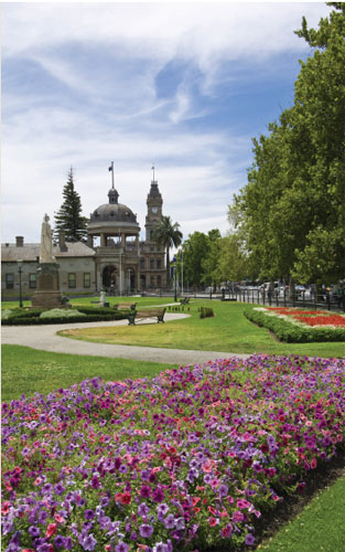
[ ROSALIND PARK ]
Bridge Street Market: features local produce and handmade arts and crafts; 3rd Sat each month, 8am–1pm; Bridge St near Golden Dragon Museum. Showgrounds Market: Prince of Wales Showgrounds, Holmes St; 8.30am–3pm every Sun. Farmers Market: fresh regional produce; Sidney Myer Pl; 9am–1pm, 2nd Sat each month. International Madison: major cycling event, Mar long weekend. Easter Festival: first held in 1871, the festival spans 4 days and is a major event on the town’s calendar, with free music and entertainment, craft markets, art exhibits, food, wine and the famous procession featuring Sun Loong. Australian Sheep and Wool Show: showcases everything from farming to fashion; July. Heritage Uncorked: wine event in the historic streets; 2nd weekend Oct. National Swap Meet: Australia’s largest meet for vintage cars and bikes, Bendigo Showgrounds; Nov. Bendigo Cup: horseracing; Nov.
The Bridge: contemporary gastropub; 49 Bridge St; (03) 5443 7811. The Dispensary Enoteca: European menu; 9 Chancery La; (03) 5444 5885. The Exchange Cafe Bar Restaurant: cafe fare and tapas; Shop 11, Bendigo Centre; (03) 5444 2060. GPO Bendigo: cafe and bar; 60–64 Pall Mall; (03) 5443 4343. Whirrakee Restaurant: contemporary French; 17 View Pt; (03) 5441 5557. Wine Bank on View: Mediterranean wine bar; 45 View St; (03) 5444 4655.
Bishopscourt Bed & Breakfast: 40 Forest St; (03) 5443 9456. A-Line Holiday Village: 5615 Calder Hwy, Big Hill; (03) 5447 9568. Avondel Caravan Park: 723 Calder Hwy, Maiden Gully; (03) 5449 6265. BIG4 Bendigo Ascot Holiday Park: 15 Heinz St, Ascot; (03) 5448 4421. Gold Nugget Tourist Park: 293 Midland Hwy, Epsom; (03) 5448 4747. Central City Caravan Park: 362 High St (Calder Hwy), Golden Square; (03) 5443 6937. Lynnevale Estate: 83 Cahills Rd, Mandurang; (03) 5439 3635. Marong Caravan & Cabin Village: 1449 Calder Hwy, Marong; (03) 5435 2329.
Greater Bendigo National Park The park, which extends to the north and south of town, protects some high-quality box-ironbark forest and is popular for scenic driving, cycling, walking and camping. Relics of the region’s goldmining and eucalyptus-oil industries can be found within. Fauna includes over 170 species of birds including the grey shrike-thrush, a pretty songbird. In the early morning and later in the evening, look out for eastern grey kangaroos, black wallabies and echidnas. Detailed maps of the park are available at the visitor centre. Contact Parks Victoria on 13 1963; access via Loddon Valley Hwy through Eaglehawk; 8 km N.
Bendigo wine region Like neighbouring Heathcote, this area is responsible for some of the country’s richest reds. Both its shiraz and cabernet sauvignon are wonderfully reliable varieties that could only be shaken by a very bad season. Wineries to visit are Pondalowie Estate, Passing Clouds, Water Wheel and the picturesque Balgownie Estate, with its lovely cafe and boutique cottages. Bress also dabbles in traditional apple cider.
One Tree Hill observation tower: panoramic views; 4 km S. Eaglehawk: site of the gold rush in 1852, it features remnants of goldmining days and fine examples of 19th-century architecture; details of self-guide heritage tour from visitor centre; 6.5 km NW. Mandurang: features historic wineries and is the exact centre of Victoria; 8 km S.
TOWNS NEARBY: Maldon 32 km, Castlemaine 35 km, Inglewood 42 km, Heathcote 42 km, Dunolly 50 km
Bright |
Pop. 2113 |
76a Gavan St; 1300 551 117; www.brightescapes.com.au
89.7 FM ABC Local Radio, 101.3 Oak FM
Bright is situated in the Ovens Valley in the foothills of the Victorian Alps. A particularly striking element of the town is the avenues of deciduous trees, at their peak during the autumn months. The Bright Autumn Festival is held annually in celebration of the spectacular seasonal changes. The Ovens River flows through the town, providing a delightful location for picnics or camping. The town also offers off-the-mountain accommodation for nearby Mt Hotham and Mt Buffalo.
Old Tobacco Sheds You could easily spend half a day here, wandering through the sheds filled with antiques and bric-abrac and through the makeshift museums, which give an insight into the local tobacco industry and the gold rush. Also on-site is a historic hut, and the Sharefarmers Cafe serves Devonshire tea. Open 9am–5pm (Sept–May), 10am–4pm (June–Aug); 7377 Great Alpine Rd; (03) 5755 2344.
Gallery 90: local art and craft; 90 Gavan St; (03) 5755 1385. Centenary Park: with a deep weir, children’s playground and picnic facilities; Gavan St. Bright Art Gallery and Cultural Centre: community-owned gallery, displays and sells fine art and handicrafts; 28 Mountbatten Ave; (03) 5750 1660. Bright Brewery: enjoy award-winning beers or brew your own; 121 Great Alpine Rd; (03) 5755 1301. Bright and District Historical Museum: in the old railway station building, with artefacts and photographs from the town’s past; open by appt (contact visitor centre); Cnr Gavan and Anderson sts. Walking tracks: well-marked tracks around the area include Canyon Walk along the Ovens River, where remains of gold-workings can be seen; details from visitor centre. Murray to the Mountains Rail Trail: Bright sits at one end of this 94 km track suitable for cycling and walking; links several townships.
Craft market: 3rd Sat each month; Burke St. Autumn Festival: activities include craft markets and entertainment; Apr/ May. Alpine Spring Festival: free entertainment, displays and open gardens, celebrating the beauty of Bright in spring; Oct.
Poplars: French-inspired menu; Shop 8, Star Rd; (03) 5755 1655. Simone’s of Bright: excellent Italian cuisine; 98 Gavan St; (03) 5755 2266. Villa Gusto: Tuscan-style regional menu; 630 Buckland Valley Rd, Buckland; (03) 5756 2000.
Badrocks Bed & Breakfast: 21 Delany Ave; (03) 5755 1231. BIG4 Bright: 1 Mountbatten Ave; (03) 5755 1064. Bright Accommodation Park: 438 Great Alpine Rd; (03) 5750 1001. Bright Holiday Park: Cherry Ave; (03) 5755 1141. Bright Pine Valley Tourist Park: 7–15 Churchill Ave; (03) 5755 1010. Bright Riverside Holiday Park: 4 Toorak Ave; (03) 5755 1118. Eucalypt Mist: 152A Delany Ave (Great Alpine Rd); (03) 5755 1336. Abby’s Cottages – Bright: 165 School Rd, Wandiligong; 0417 367 494. BIG4 Porepunkah Holiday Park: 6674 Great Alpine Rd, Porepunkah; 1800 234 798. The Buckland Luxury Retreat: 116 McCormacks La, Buckland Valley; 0419 133 318. Freeburgh Cabins and Caravan Park: 1099 Great Alpine Rd, Freeburgh; (03) 5750 1306. Lavender Hue: 20 Great Alpine Rd, Harrietville; (03) 5759 2588. Porepunkah Bridge Caravan Park: 36 Mt Buffalo Rd, Porepunkah; (03) 5756 2380. Porepunkah Pines Tourist Resort: 7065 Great Alpine Rd, Porepunkah; (03) 5756 2282. Riverview Caravan Park: Junction Rd, Porepunkah; (03) 5756 2290.
Wandiligong A National Trust–classified hamlet, the area contains well-preserved historic buildings from the town’s goldmining days. The tiny village is set in a rich green valley, with an enormous hedge maze as the dominant feature and over 2 km of walkways surrounded by lush gardens. The maze is well signposted. Open 10am–5pm Wed–Sun; 6 km S.
Mount Buffalo National Park This 31 000 ha national park is the state’s oldest, declared in 1898. A plateau of boulders and tors includes The Horn, the park’s highest point and a great place for views at sunrise. Walking tracks are set among streams, waterfalls, stunning Wildflowers, and snow gum and mountain ash forest. There is summer camping, swimming and canoeing at Lake Catani, and rock climbing and hang-gliding are also popular. In winter, the Mount Buffalo ski area is popular with families. Contact Parks Victoria on 13 1963; 10 km NW.
Tower Hill Lookout: 4 km NW. Boyntons/Feathertop Winery: open for sales and tastings; at junction of Ovens and Buckland rivers, Porepunkah; 6 km NW. The Red Stag Deer and Emu Farm: Hughes La, Eurobin; 16 km NW. Harrietville: a former goldmining village located just outside the Alpine National Park. Attractions include Pioneer Park, an open-air museum and picnic area; Tavare Park, with a swing bridge and picnic and barbecue facilities; and a lavender farm; 20 km SE. Alpine National Park: see Mount Beauty; to the south-east of town.
TOWNS NEARBY: Mount Beauty 19 km, Myrtleford 28 km, Yackandandah 47 km, Beechworth 48 km, Milawa 57 km
Buchan |
Pop. 326 |
General Store, Main St; (03) 5155 9202 or 1800 637 060; www.lakesandwilderness.com.au
90.7 FM 3REG Radio East Gippsland, 828 AM ABC Local Radio
Situated in East Gippsland, Buchan is primarily an agricultural town renowned for offering some of the best caving in Victoria. Although the origin of the town’s name is disputed, it is said to be derived from the Aboriginal term for either ‘smoke-signal expert’ or ‘place of the grass bag’.
Foothills Festival: Jan. Canni Creek Races: Jan. Rodeo: Easter. Flower Show: Nov.
Buchan Caves Reserve: Caves Rd; (03) 5162 1900.
Buchan Caves Reserve The reserve features more than 350 limestone caves, of which the Royal and Fairy caves are the most accessible – the Fairy Cave alone is over 400 m long, with impressive stalactites. Europeans did not discover the caves until 1907, but from then on they became a popular tourist destination. Now visitors can cool off in the spring-fed swimming pool after exploring the caves. Tours of the Royal and Fairy caves run daily. Off Buchan Rd, north of town; (03) 5162 1900.
Snowy River Scenic Drive The drive takes in the Buchan and Snowy rivers junction and runs along the edge of Snowy River National Park to Gelantipy. Beyond Gelantipy is Little River Gorge, Victoria’s deepest gorge. A short walking track leads to a cliff-top lookout. Near the gorge is McKillops Bridge, a safe swimming spot, a good site to launch canoes, and the starting point for 2 walking tracks. Care is required on the road beyond Gelantipy; 4WD is recommended. Details from visitor centre.
Suggan Buggan: this historic townsite, surrounded by Alpine National Park, features an 1865 schoolhouse and the Eagle Loft Gallery for local art and craft; 64 km N.
TOWNS NEARBY: Orbost 33 km, Lakes Entrance 45 km, Bairnsdale 62 km, Paynesville 62 km, Omeo 68 km
Camperdown |
Pop. 3164 |
Old Courthouse, Manifold St; (03) 5593 3390; www.greatoceanrd.org
104.7 Otway FM, 594 AM ABC Local Radio
Located at the foot of Mount Leura, a volcanic cone, Camperdown is more famous for its natural attractions than for the town itself, being situated on the world’s third largest volcanic plain. But that should not detract from Camperdown: National Trust–listed Finlay Avenue features 2 kilometres of regal elm trees, while in the town centre the Gothic-style Manifold Clock Tower proudly stands as a tribute to the region’s first European pioneers.
Manifold Clock Tower: an imposing structure built in 1896; open 1st Sun each month; Cnr Manifold and Pike sts. Historical Society Museum: displays Aboriginal artefacts, local historical photographs, and household and farming implements; Manifold St. Courthouse: built in 1886–87, described as one of the most distinctive courthouses in Australia; Manifold St. Buggy Museum: collection of 30 restored horse-drawn buggies; Ower St.
Craft market: Finlay Ave or Theatre Royal; 1st Sun each month. Heritage Festival: Nov.
Lakes and Craters Holiday Park: 220 Park Rd; (03) 5593 1253. Grand Central Accommodation B&B: 30 Victoria St, Cobden; (03) 5595 1881.
Crater lakes Surrounding Camperdown are spectacular crater lakes that provide an interesting history of volcanic activity over the past 20 000 years, as well as opportunities for watersports and excellent fishing. Travelling west of town, take the scenic drive around the rims of lakes Bullen Merri and Gnotuk, and join in the watersports and swimming at South Beach. The lakes are regularly stocked with Chinook salmon and redfin. For a scenic picnic spot, and some of the best fishing, visit Lake Purrumbete; 15 km SE. By far one of the most impressive lakes is Lake Corangamite, the Southern Hemisphere’s largest permanent salt lake. This lake lies 25 km E, but the best viewing spot is Red Rock Lookout; see Colac.
Derrinallum and Mt Elephant Mt Elephant rises to almost 200 m behind the small township of Derrinallum – it doesn’t sound like a lot, but across the plains of the Western District you can see it from up to 60 km away. A gash in the elephant’s western side is the result of decades of quarrying. The mountain is actually the scoria cone of an extinct volcano, and inside is a 90 m deep crater. Now owned by the community, there is a walking trail to the top, and the Music on the Mount festival is held here in Nov. Lake Tooliorook on the other side of town offers good fishing for trout and redfin, and watersports. 40 km N.
Camperdown–Timboon Rail Trail: walking or riding track through bush, following historic railway line. Mt Leura: extinct volcano close to the perfect cone of Mt Sugarloaf. A lookout offers excellent views over crater lakes and volcanoes, and north across the plains to the Grampians; 1 km S. Camperdown Botanic Gardens: feature rare examples of Himalayan oak and a lookout over lakes Bullen Merri and Gnotuk; 3 km W. Cobden Miniature Trains: operates 3rd Sun each month; Cobden; 13 km S.
TOWNS NEARBY: Terang 20 km, Colac 40 km, Port Campbell 45 km, Warrnambool 61 km, Winchelsea 73 km
Cann River |
Pop. 223 |
Parks Victoria Cann River office, (03) 5158 6351; or East Gippsland Visitor Information Centre, 1800 637 060; www.lakesandwilderness.com.au
101.7 FM 3MGB Wilderness Radio, 106.1 FM ABC Local Radio
Cann River is situated at the junction of the Princes and Cann Valley highways, and is notable for its proximity to several spectacular national parks. The area boasts excellent fishing, bushwalking and camping in the rugged hinterland, with nearby Point Hicks notable for being the first land on the east coast of Australia to be sighted by Europeans.
Point Hicks Lighthouse: Point Hicks Rd; (03) 5158 4268.
Lind National Park The park includes the Euchre Valley Nature Drive through temperate rainforest gullies. It also supports open eucalypt forests with grey gum, messmate and silvertop ash. Watch for wildlife such as the pretty masked owl and the elusive long-footed potoroo. Has picnic facilities. 15 km W.
Coopracambra National Park This park is in one of the most remote sections of Victoria. Ancient fossil footprints have been found in the red sandstone gorge of the Genoa River, and the surrounding granite peaks create a spectacular scene. The 35 000 ha area protects unique ecosystems and rare flora and fauna. Only experienced and well-equipped hikers should undertake walks in the rugged and remote parts of this park. A ‘trip intentions’ form needs to be lodged at the Cann River or Mallacoota office of Parks Victoria prior to departure, and parks staff must be notified upon return. 30 km N near NSW border.
Croajingolong National Park: the road travelling south of Cann River leads to Pt Hicks and its historic 1890 lighthouse (daily tours offered); for further details on the park see Mallacoota.
TOWNS NEARBY: Mallacoota 53 km, Orbost 63 km, Bombala (NSW) 73 km, Buchan 87 km, Eden (NSW) 87 km
Casterton |
Pop. 1654 |
Shiels Tce; (03) 5581 2070; www.castertonnow.org.au
94.1 FM ABC Local Radio, 99.3 Coastal FM
Casterton is a Roman name meaning ‘walled city’, given to the town because of the natural wall of hills surrounding the valley where it lies. These hills, and the Glenelg River that flows through town, create an idyllic rural atmosphere. The region is colloquially known as ‘Kelpie Country’ as it is the birthplace of this world-famous breed of working dog. In the mid-1800s a prized Scottish collie female pup from nearby Warrock Homestead was sold to a stockman named Jack Gleeson, who named her ‘Kelpie’ – she was bred out with various ‘black and tan’ dogs, and so began the long line of the working man’s best friend.
Historical Museum: housed in the old railway station, the museum displays local artefacts; open by appt; Cnr Jackson and Clarke sts. Alma and Judith Zaadstra Fine Art Gallery: Henty St. Mickle Lookout: a great view across the town; Moodie St, off Robertson St on the eastern edge of town.
Vintage Car Rally: Mar. Polocrosse Championships: Mar. Casterton Cup: June. Australian Kelpie Muster and Kelpie Working Dog Auction: June/July.
Dergholm State Park The park features a great diversity of vegetation, including woodlands, open forests, heaths and swamps. An abundance of wildlife thrives, including echidnas, koalas, kangaroos, reptiles and the endangered red-tailed black cockatoo. A key attraction is Baileys Rocks, unique giant green-coloured granite boulders. Contact Parks Victoria on 13 1963; 50 km N.
Long Lead Swamp: waterbirds, kangaroos, emus and a trailbike track; Penola Rd; 11 km W. Geological formations: in particular, The Hummocks, 12 km NE, and The Bluff, viewable from Dartmoor Rd, 20 km SW. Both rock formations are around 150 million years old. Warrock Homestead: a unique collection of 33 buildings erected by its founder, George Robertson. The homestead was built in 1843 and is National Trust–classified; open day on Easter Sun; 26 km N. Bilston’s Tree: 50 m high and arguably the world’s largest red gum; Glenmia Rd; 30 km N.
TOWNS NEARBY: Coleraine 26 km, Penola 55 km, Hamilton 58 km, Coonawarra 60 km, Mount Gambier 61 km
Castlemaine |
Pop. 7250 |
Castlemaine Market Building, 44 Mostyn St; (03) 5471 1795 or 1800 171 888; www.maldoncastlemaine.com
91.1 FM ABC Local Radio, 106.3 Radio KLFM Castlemaine is a classic goldmining town known for its grand old buildings and sprawling botanical gardens. This area was the site of the greatest alluvial gold rush that the world has ever seen. Now the town relies largely on agriculture and the manufacturing sectors, as well as being home to a thriving artistic community that takes inspiration from the area’s red hills.
Castlemaine Art Gallery Housed in an elegant Art Deco building, the gallery was designed in 1931 by Peter Meldrum and is renowned for its collection of Australian art. Along with the permanent collection, many exhibitions appear here. Works by Rembrandt, Francisco Goya and Andy Warhol have all been displayed at this delightful gallery. 14 Lyttleton St; (03) 5472 2292.
Buda Historic Home and Garden Buda is considered to have one of the most signifi cant examples of 19th-century gardens in Victoria. The house itself is furnished with period pieces and art and craft created by the Leviny family, who lived here for 118 years. Ernest Leviny was a silversmith and jeweller. Five of his 6 daughters never married, but remained at Buda and pursued woodwork, photography and embroidery. Open 12–5pm Wed– Sat, 10am–5pm Sun; 42 Hunter St; (03) 5472 1032.
Victorian Goldfields Railway This historic railway runs from Castlemaine to Maldon. The steam train journeys through box-ironbark forest in a region that saw some of the richest goldmining in the country. As well as the regular timetable, it also hosts special events throughout the year. Castlemaine Railway Station, Kennedy St; recorded information (03) 5475 2966, inquiries (03) 5470 6658.
Diggings Interpretive Centre: housed in the restored 19th-century Castlemaine Market building, the centre features interactive displays about the area’s many goldmines as well as various exhibitions; Mostyn St. Theatre Royal: hosts live shows and films and also offers luxurious backstage accommodation; Hargraves St. Castlemaine Botanic Gardens: one of Victoria’s oldest and most impressive 19th-century gardens; Cnr Walker and Downes rds. Old Castlemaine Gaol: restored gaol now offers tours; Bowden St. Food and wine producers: dotted throughout the area; food and wine trail brochures from visitor centre.
Castlemaine Farmers Market: 1st Sun each month. Wesley Hill Market: each Sat; 2.5 km E. Castlemaine State Festival: oddnumbered years, Apr. Festival of Gardens: Nov.
Bold Cafe Gallery: Asian-influenced nursery cafe; 146 Duke St; (03) 5470 6038. The Empyre: modern gastropub; 68 Mostyn St; (03) 5472 5166. Saffs Cafe: casual cafe food; 64 Mostyn St; (03) 5470 6722. Togs Place: popular breakfast &lunch spot; 58 Lyttleton St; (03) 5470 5090.
BIG4 Castlemaine Gardens Holiday Park: Doran Ave (off Walker St); (03) 5472 1125. Castlemaine Central Cabin & Van Park: 101 Barker St; (03) 5472 2160. Clevedon Manor: 260 Barker St; (03) 5472 5212. Penrhos Cottage: 3101 Calder Hwy, Harcourt; (03) 5474 2415.
Castlemaine Diggings National Heritage Park The wealth on Castlemaine’s streets springs from the huge hauls of gold found on the Mt Alexander Diggings, east and south of town. Thousands of miners worked the fields. Towns such as Fryerstown, Vaughan and Glenluce, now almost ghost towns, supported breweries, schools, churches and hotels. Today visitors can explore Chinese cemeteries, mineral springs, waterwheels and old townsites. Fossicking is popular. Details of self-guide walks and drives from visitor centre. 4 km S.
Chewton: historic buildings line the streets of this former gold town; 4 km E. Harcourt: this town is known for its many wineries, including Harcourt Valley Vineyard and Blackjack Vineyards, with tastings and cellar-door sales. Also at Harcourt is the Skydancers Orchid and Butterfly Gardens. The town hosts the Apple Festival in Mar and spring, and the Orchid Festival in Oct; 9 km NE. Big Tree: a giant red gum over 500 years old; Guildford; 14 km SW. Koala Reserve: Mt Alexander; 19 km NE.
TOWNS NEARBY: Maldon 15 km, Kyneton 29 km, Daylesford 31 km, Bendigo 35 km, Woodend 42 km
[ THE COLOURS OF AUTUMN CREATE A PICTURESQUE SETTING ]
Chiltern |
Pop. 1067 |
30 Main St; (03) 5726 1611; www.chilternvic.com
101.3 Oak FM, 106.5 FM ABC Local Radio
Now surrounded by rich pastoral farmland, Chiltern was once at the centre of a goldmining boom and had as many as 14 suburbs. After the Indigo gold discovery in the 1850s, there was a major influx of miners and settlers, but the boom was brief and farming was soon prominent in the town’s economy. Today the rich heritage of the 19th century can be seen in the streetscapes, a vision not lost on Australian filmmakers keen for that ‘authentic’ 1800s scene.
Athenaeum Museum: historic building with heritage display; Conness St. Dow’s Pharmacy: old chemist shop with original features; Conness St. Star Theatre and Grapevine Museum: the quaint theatre still operates and the museum, formerly the Grapevine Hotel, boasts the largest grapevine in Australia, planted in 1867 and recorded in the Guinness World Records; Main St. Federal Standard newspaper Office: open by appt for groups; Main St. Lakeview House: former home of author Henry Handel Richardson; open afternoons on weekends and public and school holidays; Victoria St. Lake Anderson: picnic and barbecue facilities; access via Main St.
Antique Fair: Aug. Ironbark Festival: heritage fair with woodchopping, live music and markets; Oct.
Lake Anderson Caravan Park: Alliance St; (03) 5726 1298.
Chiltern–Mt Pilot National Park This park stretches from around Chiltern south to Beechworth and protects remnant boxironbark forest, which once covered much of this part of Victoria. Also featured are significant goldmining relics, including the impressive Magenta Goldmine (around 2 km E). Of the park’s 21 000 ha, 7000 were exposed to bushfire in Jan 2003. But its regeneration is evidence of the hardiness of the forest, and there are now upgraded visitor facilities. An introduction to the forest scenery and goldmining history is on the 25 km scenic drive signposted from Chiltern. Other activities include canoeing and rafting, fishing, and cycling and walking trips along the many marked trails. Contact Parks Victoria on 13 1963; access via Hume Hwy and the road south to Beechworth.
TOWNS NEARBY: Rutherglen 17 km, Beechworth 24 km, Wodonga 25 km, Corowa (NSW) 26 km, Yackandandah 28 km
Clunes |
Pop. 1024 |
Old School Complex, 70 Bailey St; (03) 5345 3896; www.visitclunes.com.au
99.9 VoiceFM, 107.9 FM ABC Local Radio
The first registered gold strike in the state was made at Clunes on 7 July 1851. The town, north of Ballarat, is said to be one of the most intact gold towns in Victoria, featuring historic buildings throughout. Surrounding the town are a number of extinct volcanoes. A view of these can be obtained 3 kilometres to the south, on the road to Ballarat. The town was used as a location for the film Ned Kelly, starring Heath Ledger.
Clunes Museum: local-history museum featuring displays on the gold-rush era; open weekends and school and public holidays; Fraser St. Bottle Museum: in former South Clunes State School; open Wed–Sun; Bailey St. Queens Park: on the banks of Creswick Creek, the park was created over 100 years ago.
Market: Fraser St; 2nd Sun each month. Booktown: largescale book fair; May. Words in Winter Celebration: Aug.
Talbot This delightful, historic town has many 1860–70 buildings, particularly in Camp St and Scandinavian Cres. Attractions include the Arts and Historical Museum in the former Methodist Church; the Bull and Mouth Restaurant in an old bluestone building, formerly a hotel; and a market (holds the honour of being the first farmers market in the region) selling local produce, 3rd Sun each month. 18 km NW.
Mt Beckworth Scenic Reserve: popular picnic and horseriding reserve with panoramic views from the summit; 8 km W.
TOWNS NEARBY: Creswick 17 km, Maryborough 28 km, Ballarat 31 km, Daylesford 32 km, Avoca 36 km
Cobram |
Pop. 5061 |
Cnr Station St and Punt Rd; (03) 5872 2132 or 1800 607 607.
101.3 Oak FM, 106.5 FM ABC Local Radio
At Cobram and nearby Barooga (across the New South Wales border) the Murray River is bordered by sandy beaches, making it a great spot for fishing, watersports and picnics. The stretch of land between the township and the river features river red gum forests and lush wetlands, with tracks leading to various beaches, the most accessible of which is Thompsons Beach, located near the bridge off Boorin Street. The town is supported by peach, nectarine, pear and orange orchards and dairies, earning it the nickname ‘peaches and cream country’. A biennial festival is held in honour of these industries.
Historic log cabin: built in Yarrawonga in 1875, then moved piece by piece to its current location; opposite the information centre on Station St. Station Gallery: at the railway station, displays a collection of art by local artists.
Market: Punt Rd; 1st Sat each month. Peaches and Cream Festival: free peaches and cream, a rodeo, fishing competitions and other activities; odd-numbered years, Jan. Rotary Art Show: May. Antique Fair: June. Open Gardens Display: Oct.
Cobram East Caravan Park: 3186 Murray Valley Hwy; (03) 5872 1207. Cobram Oasis Tourist Park: Cnr Koonoomoo and Racecourse rds; (03) 5871 2010. The Cobram Willows Caravan Park: Cnr Murray Valley Hwy and Ritchie Rd; (03) 5872 1074. RACV Cobram Resort: 154 Campbell Rd; (03) 5872 2467.
Cobram Barooga Golf Resort: Golf Course Rd, Barooga, NSW; (03) 5873 4523. Numurkah Caravan Park: 158 Melville St, Numurkah; (03) 5862 1526.
Quinn Island Flora and Fauna Reserve: home to abundant birdlife and Aboriginal artefacts, including scar trees, flint tools and middens, the island can be explored on a self-guide walk; on the Murray River, accessed via a pedestrian bridge off River Rd. Binghi Boomerang Factory: large manufacturer and exporter of boomerangs. Free demonstrations are offered with purchases; Tocumwal Rd, Barooga, across the river. Scenic Drive Strawberry Farm: strawberry-picking during warmer months; Torgannah Rd, Koonoomoo; 11 km NW. Cactus Country: Australia’s largest cacti gardens; Strathmerton; 16 km W. Ulupna Island: part of Barmah National Park; turn-off after Strathmerton; see Echuca for details. Murray River Horse Trails: a fantastic way to explore the Murray River beaches; (03) 5868 2221. Cobram Barooga golf course: across the river in NSW is this renowned 36-hole course.
TOWNS NEARBY: Tocumwal (NSW) 14 km, Finley (NSW) 31 km, Mulwala (NSW) 33 km, Yarrawonga 34 km, Shepparton 55 km
Cohuna |
Pop. 1891 |
Gannawarra Shire Council, 49 Victoria St, Kerang; (03) 5450 9333; www.gannawarra.vic.gov.au
99.1 Smart FM, 594 AM ABC Local Radio
A peaceful, small service centre located on the Murray River. Cohuna’s claim to fame is that its casein factory developed produce that became part of the diet of the astronauts flying the Apollo space missions. East of town is Gunbower Island, at the junction of the Murray River and Gunbower Creek. The island is home to abundant wildlife, including kangaroos and emus, plus breeding rookeries for birdlife during flood years.
Cohuna Historical Museum: housed in the former Scots Church, the museum features memorabilia relating to explorer Major Mitchell; Sampson St.
Murray River International Music Festival: Feb. Bridge to Bridge Swim: Mar. Austoberfest: Oct.
Gunbower Family Hotel: excellent steakhouse; 18 Main St (Murray Valley Hwy), Gunbower; (03) 5487 1214.
Cohuna Waterfront Holiday Park: Island Rd; (03) 5456 2562. Gunbower Caravan Park: 74–80 Main st, Gunbower; (03) 5487 1412.
Gunbower Island This island, surrounded by Gunbower Creek and the Murray River, is an internationally recognised wetland, with a great variety of waterbirds and stands of river red gum forest. A 5 km canoe trail flows through Safes Lagoon and bushwalking is another highlight.
Grove Patchwork Cottage and Tearooms: for local art and craft; Murray Valley Hwy; 4 km SE. Mathers Waterwheel Museum: features waterwheel memorabilia and outdoor aviary; Brays Rd; 9 km W. Murray Goulburn Factory: cheese factory; Leitchville; 16 km SE. Kow Swamp: bird sanctuary with picnic spots and fishing at Box Bridge; 23 km S. Section of Major Mitchell Trail: 1700 km trail that retraces this explorer’s footsteps from Mildura to Wodonga via Portland. From Cohuna, follow the signposted trail along Gunbower Creek down to Mt Hope; 28 km S.
Torrumbarry Weir: during winter the entire weir structure is removed, while in summer waterskiing is popular; 40 km SE.
TOWNS NEARBY: Barham (NSW) 22 km, Kerang 28 km, Pyramid Hill 29 km, Echuca 61 km, Deniliquin (NSW) 74 km
Colac |
Pop. 10 859 |
Cnr Murray St (Princes Hwy) and Queen St; (03) 5231 3730 or 1300 689 297; www.visitgreatoceanroad.org.au
104.7 Otway FM, 594 AM 3WV ABC Local Radio
Colac was built by the shores of Lake Colac on the volcanic plain that covers much of Victoria’s Western District. The lake, once the largest freshwater body in Victoria, is gradually returning to health after having been dried out by harsh drought. Still, the town acts as the gateway to the Otways. The area was once described by novelist Rolf Boldrewood as ‘a scene of surpassing beauty and rural loveliness … this Colac country was the finest, the richest as to soil and pasture that I had up to that time ever looked on’.
Colac Heritage Walk: self-guide tour of the history and architectural wonders of Colac; details from visitor centre. Performing Arts and Cultural Centre: incorporates the Colac Cinema, open daily; and the Historical Centre, open 2–4pm Thurs, Fri and Sun; Cnr Gellibrand and Ray sts. Botanic Gardens: unusual in that visitors are allowed to drive through the gardens. Picnic, barbecue and playground facilities are provided; by Lake Colac. Barongarook Creek: prolific birdlife, and a walking track leading from Princes Hwy to Lake Colac; on the northern outskirts of town.
Lions Club Market: Memorial Sq, Murray St; 3rd Sun each month. Go Country Music Festival and Truck Show: Feb. Colac Cup: Feb. Kana Festival: community festival with family entertainment, music and displays; Mar. Garden Expo: Colac Showgrounds; Oct.
Old Lorne Road Olives: Mediterranean-inspired cafe; 45 Old Lorne Rd, Deans Marsh; (03) 5236 3479. Otway Estate Winery and Brewery: tasting plates and more; 10–30 Hoveys Rd, Barongarook; (03) 5233 8400.
Central Caravan Park: 50 Bruce St; (03) 5231 3586. Duffs Cottage Fine Accommodation: 41 Gellibrand St; 0457 140 349. Colac Caravan & Cabin Park: 490 Princes Hwy, Colac West; (03) 5231 5337. Elliminook: 585 Warncoort Birregurra Rd, Birregurra; (03) 5236 2080. Otways Tourist Park: 25 Main Rd, Gellibrand River; (03) 5235 8357.
Red Rock Lookout The lookout features a reserve with picnic and barbecue facilities, plus spectacular views across 30 volcanic lakes, including Lake Corangamite, Victoria’s largest saltwater lake. At the base of the lookout is the Red Rock Winery. Near Alvie; 22 km N. The Volcano Discovery Trail goes from Colac to Millicent in SA, and follows the history of volcanic activity in the region; details from visitor centre.
Old Beechy Rail Trail: 45 km trail that follows one of the state’s former narrow-gauge railway lines from Colac to Beech Forest, suitable for walkers and cyclists. The trail starts at Colac railway station; details from visitor centre. Art and craft galleries: at Barongarook (12 km SE); details from visitor centre. Burtons Lookout: features Otway Estate Winery and Brewery with its well-known Prickly Moses ale range, views of the Otways; 13 km S. Tarndwarncoort Homestead: wool displays and sales; off Warncoort Cemetery Rd; 15 km E. Birregurra: township located at the foot of the Otway Ranges and the edge of volcanic plains; 20 km E. Forrest: old timber and logging town in the Otway Ranges; 32 km SE. Attractions nearby include fishing, walking and picnics at the West Barwon Reservoir (2 km S), or spotting a platypus at Lake Elizabeth, formed by a landslide in 1952 (5 km SE).
TOWNS NEARBY: Winchelsea 36 km, Camperdown 40 km, Lorne 41 km, Apollo Bay 47 km, Aireys Inlet 47 km
Coleraine |
Pop. 992 |
Lonsdale St, Hamilton; 1800 807 056; www.sthgrampians.vic.gov.au
94.1 FM ABC Local Radio, 99.3 Coastal FM
Situated in Victoria’s Western District, Coleraine is a small, picturesque town supported by wool and beef industries. A chocolate factory, the ultimate native garden and vintage cars are just a few of the intriguing prospects that await in Coleraine.
Peter Francis Points Arboretum Two thousand species of native flora are found here, including 500 species of eucalyptus. ‘The Points’ sprawls up the hillside behind the town, with great views from the top, on Portland–Coleraine Rd. In town is the Eucalyptus Discovery Centre, designed to complement the arboretum and give an insight into the natural history and commercial applications of eucalypts. Whyte St.
Glenelg Fine Confectionery: immerse yourself in the rich aroma of German-style continental chocolates; tastings available; Whyte St. Historic Railway Station: also site of the visitor centre, it displays and sells local arts and crafts; Pilleau St. Coleraine Classic Cars: open by appt; Whyte St.
Tour of Southern Grampians Cycling: Apr.
Coleraine Cup: Sept.
Coleraine Caravan Park: 4 Winter St; (03) 5575 2268.
Bochara Wines: wine-tasting available Fri–Sun; Glenelg Hwy. Glacier Ridge Redgum: gallery of wooden products for sale; open by appt. Balmoral: historic township west of the Grampians; 49 km N. Nearby features include the Glendinning Homestead, just east of town, with gardens and a wildlife sanctuary. The town is also the gateway to Rocklands Reservoir, for watersports and fishing, and Black Range State Park, for bushwalking. It also holds the Balmoral Annual Show in Mar.
TOWNS NEARBY: Casterton 26 km, Hamilton 34 km, Dunkeld 58 km, Edenhope 71 km, Penola (SA) 80 km
Corryong |
Pop. 1229 |
50 Hanson St; (02) 6076 2277; www.pureuppermurrayvalleys.com
88.7 FM Radio Upper Murray, 99.7 FM ABC Local Radio
Welcome to authentic ‘Man from Snowy River’ country. This district offers superb mountain scenery and excellent trout fishing in the Murray River and its tributaries, with the town being known as the home and final resting place of Jack Riley, the original ‘Man from Snowy River’. A life-size statue depicting ‘that terrible descent’ made famous by Banjo Paterson’s poem sits in the town. An annual festival honours Riley’s memory with a feature event called the ‘Challenge’ to find his modern-day equivalent. Corryong is also the Victorian gateway to Kosciuszko National Park across the New South Wales border.
The Man from Snowy River Folk Museum Banjo Paterson’s poem evoked the lives of the High Country’s settlers. This charming museum proudly does the same, with local exhibits, memorabilia and photos depicting the hardships of local life, as well as a unique collection of historic skis. Hanson St.
Jack Riley’s grave: Corryong cemetery. Man from Snowy River Statue: Hanson St. Large wooden galleon: Murray Valley Hwy. Playle’s Hill Lookout: for a great view of the township; Donaldson St.
Towong Cup: Sat long weekend in Mar. The Man from Snowy River Bush Festival: music, art and horsemanship challenges; Apr. Upper Murray Challenge: 1st Sat in Oct. Corryong Pro Rodeo: New Year’s Eve.
Corryong Bed and Breakfast: 148 Harris St; (02) 6076 1268. The Miners Cottage: 93 Hansen St; (02) 6076 1066. Mother Hubbard’s B & B: 57 Donaldson St; (02) 6076 1570. Mt Mittamatite Caravan Park: Murray Valley Hwy; (02) 6076 1152. Clearwater by the Murray: 17 Tintaldra Back Rd, Tintaldra; (02) 6077 9207. Colac Colac Caravan Park: 1994 Murray Valley Hwy, Colac; (02) 6076 1520. Jemba Rock B&B: 10645 Murray River Rd, Walwa; (02) 6077 9236.
Burrowa–Pine Mountain National Park Pine Mountain is one of Australia’s largest monoliths. Mt Burrowa is home to wetforest plants and unique wildlife, including wombats and gliders. Both mountains provide excellent and diverse opportunities for bushwalkers, campers, climbers and birdwatchers. The Cudgewa Bluff Falls offer fabulous scenery and bushwalking. Contact Parks Victoria on 13 1963; main access is from the Cudgewa–Tintaldra Rd, which runs off Murray Valley Hwy; 27 km W.
Khancoban This NSW town was built by the Snowy Hydro for workers on the hydro-electric scheme. Its willow- and poplarlined streets, historic rose garden and mountains give the town a European feel. Huge trout are caught in Khancoban Pondage. Nearby, Murray 1 Power Station Visitor Centre reveals the workings of this 10-turbine station. South, along Alpine Way through Kosciuszko National Park, is the spectacular Scammell’s Spur Lookout and historic Geehi Hut. 32 km E.
Nariel: Nariel Creek is a good spot for trout fishing. The town hosts the Nariel Creek Folk Music Festival each Dec; 8 km SW. Towong: historic Towong Racecourse is where scenes from Phar Lap were filmed. Gangster Squizzy Taylor also once stole the takings; 12 km E. Lookouts: lookout with views over Kosciuszko National Park at Towong, 12 km NE; Embery’s Lookout over Mt Mittamatite, 16 km N. Walwa: hire canoes and mountain bikes from Upper Murray Holiday Resort and Winery; 47 km NW. Touring routes: Murray River Rd, Lakeside Loop, Mitta Valley Loop; details from visitor centre.
TOWNS NEARBY: Khancoban (NSW) 21 km, Tumbarumba (NSW) 48 km, Thredbo (NSW) 50 km, Tallangatta 65 km, Jindabyne (NSW) 69 km
Cowes |
Pop. 4217 |
895 Phillip Island Tourist Rd, Newhaven; (03) 5956 7447 or 1300 366 422; www.visitphillipisland.com
89.1 3MFM South Gippsland, 774 AM ABC Local Radio
Situated on the north side of Phillip Island, Cowes is its major town. It is linked to the Mornington Peninsula by a passenger ferry service to Stony Point and by road to Melbourne via the San Remo bridge. The Cowes foreshore offers fantastic coastal walks and safe swimming beaches, with the focal point being the town’s jetty. It is a popular fishing spot, as well as a departure point for several ferries. Seal-watching cruises to Seal Rocks operate from the jetty and are the best way to see the fascinating fur seals close-up. A major drawcard for the island is the International Motorcycle Grand Prix, which has been held since 1928. There is an abundance of other activities and events that attract 3.5 million visitors to Phillip Island each year. All are within easy reach of Cowes.
[ LITTLE PENGUINS, PHILLIP ISLAND ]
Seal-watching cruises: depart from the jetty to Seal Rocks; bookings on 1300 763 739.
Market: crafts and second-hand goods; Settlement Rd, Cowes; each Sun. Farmers market: Churchill Island; 4th Sat each month. World Superbike Championships: Grand Prix Circuit; Feb/Mar. Churchill Island Heritage Farms Easter Fun: farm show; Easter. Australian Motorcycle Grand Prix: Grand Prix Circuit; Oct. V8 Supercars: Grand Prix Circuit; Sept.
Harry’s on the Esplanade: waterfront dining; Shop 5, 17 The Esplanade; (03) 5952 6226. Hotel Phillip Island: casual bistro dining; 11–13 The Esplanade; (03) 5952 2060. Infused: modern Australian; 115 Thompson Ave; (03) 5952 2655. Foreshore Bar and Restaurant: seafront gastropub dining; 11 Beach Rd, Rhyll; (03) 5956 9520.
A Maze ‘N Things Holiday Park: 1805 Phillip Island Rd; (03) 5952 2020. Anchor Belle Holiday Park: 272 Church St; (03) 5952 2258. Beach Park Tourist Caravan Park: 2 McKenzie Rd; (03) 5952 2113. Cowes Caravan Park: 1654 Church St; (03) 5952 2211. Silver Waters Bed &Breakfast: 9 Gordon St; (03) 5952 5509. Hill of Content: 33 Rhyll–Newhaven Rd, Rhyll; (03) 5956 9197. San Remo Holiday Park: 4 Mary Gr, San Remo; (03) 5678 5220.
Penguin Parade The nightly penguin parade is Phillip Island’s most popular attraction. During this world-famous event, little penguins emerge from the sea after a tiring fishing expedition and cross Summerland Beach to their homes in the dunes. Tours run at sunset each night, and the penguins can be spotted from the boardwalks and viewing platforms. The site also has an interactive visitor centre with fascinating details about these adorable creatures. Note that no cameras are allowed beyond the visitor centre. Bookings on (03) 5951 2800; 12 km SW.
The Nobbies Centre and Seal Rocks An interactive centre gives visitors an insight into local marine life, including Australia’s largest colony of Australian fur seals via cameras that you can control yourself. Outside, the island features a cliff-side boardwalk with views of the fantastic natural landmark The Nobbies and out to Seal Rocks. Walk around to the Blowhole to hear the thunderous noise of huge waves and look out for the nesting sites of vast colonies of seagulls and short-tailed shearwaters that migrate to the island annually. Informative displays explain each natural attraction. Ventnor Rd; 15 km SW.
Phillip Island Wildlife Park: features native fauna, with visitors able to handfeed kangaroos and wallabies; Phillip Island Rd; (03) 5952 2038; 3 km S. Koala Conservation Centre: view these lovely creatures in their natural habitat from an elevated boardwalk; Phillip Island Rd; (03) 5951 2800; 5 km SE. Grand Prix Circuit: the circuit is steeped in both old and recent history, which is detailed thoroughly in the visitor centre. You can also go gokarting on a replica of the Grand Prix track; Back Beach Rd; (03) 5952 9400; 6 km S. A Maze ‘N Things: family fun park featuring a large timber maze, optical-illusion rooms and ‘maxigolf’; Phillip Island Rd; 6 km SE. Rhyll Inlet: wetlands of international significance, with the marshes and mangroves providing an important breeding ground for wading birds. There are various loop walks, as well as an excellent view from the Conservation Hill Observation Tower; 7 km E. Rhyll Trout & Bush Tucker Farm: fish for rainbow trout in the indoor Rainforest Pool, take a fishing lesson or wander around the self-guide bush tucker trail; open 10am–5pm; 36 Rhyll Newhaven Rd, Rhyll; (03) 5956 9255. Wineries: Philip Island Vineyard and Winery offers tastings, sales and casual dining; Berrys Beach Rd; (03) 5956 8465; 7 km SW. Purple Hen Wines also offers tastings and light meals; McFees Rd, Rhyll; (03) 5956 9244; 9 km SE. Churchill Island: a road bridge provides access to this protected parkland, which features a historic homestead, a walking track and abundant birdlife; 16 km SE. National Vietnam Veterans Museum: details the history of Australian involvement in the Vietnam War, displays around 6000 artefacts; 25 Veterans Dr, Newhaven; (03) 5956 6400; 16 km SE. Phillip Island Chocolate Factory: visit Panny’s Amazing World of Chocolate with information on the chocolate-making process and a model of Dame Edna made from 12 000 chocolate pieces; visitors can even make their own chocolate; Newhaven; (03) 5956 6600; 16 km SE. Pelicans: see these unusual birds up close, with feeding time daily at 12pm; San Remo Pier (opposite the Fishing Co-op); 17 km SE. Cape Woolamai: the beach is renowned for its fierce and exciting surf (patrolled in season). From the beach there are a number of 2–4 hr loop walks, many to the southern end of the cape and passing the Pinnacles rock formations on the way. South of Cape Woolamai township; 18 km SE. Wildlife Wonderland: centre includes the Earthworm Museum, a giant earthworm and Wombat World; (03) 5678 2222; 31 km E.
TOWNS NEARBY: Flinders 19 km, Mornington 31 km, Wonthaggi 35 km, Koo-Wee-Rup 36 km, Sorrento 45 km
Creswick |
Pop. 2487 |
1 Raglan St; (03) 5345 1114; www.creswick.net
99.9 VoiceFM, 107.9 FM ABC Local Radio
Creswick is an attractive and historic town, a symbol of the rich and heady life of the gold-rush days of the 1850s. Unfortunately, the goldmining also decimated the surrounding forests. Today the town is surrounded by pine plantations over 100 years old; they exist thanks to the initiative and foresight of local pioneer John La Gerche and – while they are no replacement for the Australian bush – they have given Creswick the title of ‘the home of forestry’. Creswick was the birthplace of renowned Australian artist Norman Lindsay, many of whose paintings can be seen in the local historical museum.
Historic walk: self-guide tour, map from visitor centre. Giant Mullock Heaps: indicate how deep mines went; Ullina Rd. Creswick Museum: photos and memorabilia from the town’s goldmining past as well as an exhibition of Lindsay paintings; open Sun, public holidays or by appt; Albert St. Gold Battery: est. 1897; Battery Cres. Creswick Woollen Mills: last coloured woollen mill of its type in Australia; offers product sales, regular demonstrations and exhibitions; Railway Pde.
Makers Market: 1st Sun each month. CALCAN Market: 3rd Sat each month. Forestry Fiesta: Oct.
Harvest 383: regional produce menu; Novotel Forest Resort Creswick, 1500 Midland Hwy; (03) 5345 9600.
Creswick Regional Park After La Gerche replanted the denuded hills around Creswick in the 1890s, the state established a nursery that it continues to operate today. Further natural history can be explored on the various walking trails, including the 30 min Landcare Trail or the longer La Gerche Forest Walk. Visit St Georges Lake, once a mining dam and now popular for picnics and watersports, and Koala Park, an old breeding ground for koalas that was highly unsuccessful (they escaped over the fences). Slaty Creek is great for gold panning or picnics, with abundant birdlife. The park stretches east and south-east of town. Contact Parks Victoria on 13 1963 or the Creswick Landcare Centre, located within the park, on (03) 5345 2200.
Tangled Maze: a maze formed by climbing plants; 5 km E. Smeaton: pretty little town with the historic Smeaton House, the Tuki Trout Farm and Anderson’s Mill; 16 km NE.
TOWNS NEARBY: Ballarat 16 km, Clunes 17 km, Daylesford 24 km, Maryborough 44 km, Castlemaine 49 km
Daylesford |
Pop. 3071 |
98 Vincent St; (03) 5321 6123; www.visitdaylesford.com
99.9 VoiceFM, 107.9 FM ABC Local Radio
Daylesford is at the centre of Victoria’s spa country. The area developed with the discovery of gold, which lured many Swiss– Italian settlers, but it was the discovery of natural mineral springs that proved a more lasting attraction. Of the 72 documented springs in the area, the most famous are nearby Hepburn Springs. The water is rich with minerals that dissolve into it as it flows from the crest of the Great Dividing Range through underground rocks, and it is known for its rejuvenating and healing qualities. Daylesford has grown as a destination in itself, complete with beautiful gardens, interesting shopping, great eating and a huge range of accommodation. The streets are lined with trees that blaze with colour in autumn, and inside the attractive old buildings are restaurants, cafes, galleries, bookshops, bakeries and chocolate shops. Overlooking the lake is one of regional Victoria’s most highly regarded restaurants, the Lake House.
Convent Gallery A magnificent building surrounded by delightful cottage gardens, this former convent and girls school has been restored and features an impressive collection of artwork, sculptures and jewellery. A cafe serves local produce and Devonshire tea. Open 10am–5pm; Cnr Hill and Daly sts; (03) 5348 3211.
Historical Museum: features a collection of photographs from the region’s past and artefacts from the local Djadja Wurrung people; open weekends and public and school holidays; Vincent St; (03) 5348 1453. Lake Daylesford: a lovely spot for picnics, with paddleboats and rowboats for hire in the warmer months. The Tipperary walking track starts here and ends at the Mineral Springs Reserve. Access to lake is from Bleakly Rd. Wombat Hill Botanical Gardens: established in 1861, these lovely gardens are situated on the hill overlooking town; Central Springs Rd. Daylesford Spa Country Train: leaves railway station for Bullarto (11 km SE) each Sun;( Raglan St; (03) 5348 1759.
Market: for arts, crafts and local produce; Sun morning; Raglan St, near railway station. Silver Streak Champagne Train: train journey with gourmet food; 1st Sat each month; bookings 0421 780 100. Hepburn Swiss–Italian Festival: Apr/May. Highland Gathering: Dec.
The Farmers Arms Hotel: hearty rustic dishes; 1 East St; (03) 5348 2091. Frangos & Frangos: city-chic European menu; 82 Vincent St; (03) 5348 2363. Lake House: exceptional regional dining; King St; (03) 5348 3329. Mercato @ Daylesford: modern Italian; 32 Raglan St; (03) 5348 4488. Cosy Corner: quaint eatery; 3 Tenth St, Hepburn Springs; (03) 5348 2576.
Balconies Daylesford: 35 Perrins St; (03) 5348 1322. Daylesford Victoria Caravan Park: Ballan Rd; (03) 5348 3821. Goldmine Cottage: 71 Duke St; (03) 5348 2171. Jubilee Lake Holiday Park: 151 Lake Rd; (03) 5348 2186. Station House Daylesford: 15 Raglan St; (03) 5348 1591. Azidene House: 68 Central Springs Rd; (03) 5348 1140.
Hepburn Springs spas The Hepburn Spa and Bathhouse Wellness Retreat offers pure mineral water spas and hydrotherapy, massage therapies and an extensive range of relaxation, health and beauty treatments. Mineral Springs Cres, Hepburn Springs; (03) 5348 8888. Dating back to 1894, the recently renovated Hepburn Bathhouse has state-of-the-art communal and private mineral bathing, spas and therapies utilising the renowned local mineral springs, plus a day spa for massage, facials and indulgent beauty treatments. Mineral Springs Reserve Rd, Hepburn Springs; (03) 5321 6000; 4 km N.
Lavandula Swiss Italian Farm A sprawling estate featuring fields of lavender, cottage gardens and sales of lavender-based products. The Lavandula Harvest Festival is a popular event with a variety of family entertainment, held in Jan. Open daily, winter months weekends only; Shepherds Flat; (03) 5476 4393; 10 km N.
Hepburn Regional Park: located around Daylesford and Hepburn Springs, this park features goldmining relics, mineral springs and the impressive Mt Franklin, an extinct volcano, with panoramic views from the summit and picnic, barbecue and camping facilities around the base. There are good walking tracks. Waterfalls: several in area, including Sailors Falls, 5 km S; Loddon Falls, 10 km NE; Trentham Falls, 21 km SE. Breakneck Gorge: early goldmining site; 5 km N. Glenlyon: small town that hosts the popular Glenlyon Sports Day on New Year’s Day, and the Fine Food and Wine Fayre in July; 8 km NE. Lyonville Mineral Springs: picnic and barbecue facilities; 15 km SE. Yandoit: historic Swiss–Italian settlement; 18 km NW.
TOWNS NEARBY: Creswick 24 km, Kyneton 29 km, Castlemaine 31 km, Clunes 32 km, Woodend 34 km
Dimboola |
Pop. 1493 |
Dim E-Shop, 109–111 Lloyd St; (03) 5389 1588; www.hindmarsh.vic.gov.au
96.5 Triple H FM, 594 AM ABC Local Radio
Dimboola, on the Wimmera River, is a key access point to the Little Desert National Park. The area was home to the Wotjobaluk Aboriginal people until the first European settlers arrived. The district was known as ‘Nine Creeks’ because of the many little streams that appear when the river recedes after floods. Many of the early white settlers were German.
Historic buildings: include the mechanics institute in Lloyd St and the Victoria Hotel, a grand 2-storey structure with grapevines hanging from the verandahs (cnr Wimmera and Victoria sts). Walking track: follows a scenic stretch of the Wimmera River. The track can be followed all the way to the Horseshoe Bend camping ground in the Little Desert National Park 7 km away; details of walks from visitor centre.
Little Desert National Park This park covers 132 647 ha. The eastern block (the section nearest to Dimboola) has picnic and camping facilities and good walking tracks. The park does not resemble the typical desert – it contains extensive heathlands and, during spring, more than 600 varieties of Wildflowers and over 40 types of ground orchids. The park is home to the distinctive mallee fowl, and the large ground-nests built by the male birds can be seen during breeding season. Kangaroos, possums and bearded dragons are just some of the other wildlife that inhabit the park. 6 km SW. See also Nhill.
Pink Lake: a salt lake that reflects a deep pinkish colour, particularly impressive at sunset, but has dried up in recent years; 9 km NW. Ebenezer Mission Station: founded in 1859 in an attempt to bring Christianity to the local Aboriginal people. The site contains fascinating ruins of the original buildings, a cemetery and a restored limestone church; off the Dimboola– Jeparit Rd; 15 km N. Kiata Lowan Sanctuary: the first part of Little Desert National Park to be reserved, in 1955. Home to the mallee fowl; Kiata; 26 km W.
TOWNS NEARBY: Horsham 32 km, Natimuk 32 km, Jeparit 35 km, Nhill 37 km, Warracknabeal 39 km
Donald |
Pop. 1429 |
Council Offices, cnr Houston and McCulloch sts; (03) 5497 1300.
96.5 Triple H FM, 99.1 FM ABC Local Radio
Donald is on the scenic Richardson River and referred to by locals as ‘Home of the Duck’, owing to the many waterbirds that live in the region. The town also features Bullocks Head, a tree on the riverbank with a growth that looks like its namesake. The ‘bull’ is also used as a flood gauge – according to how high the waters are, the ‘bull’ is either dipping his feet, having a drink or, when the water is really high, going for a swim.
Bullocks Head Lookout: beside Richardson River; Byrne St. Steam Train Park: a restored steam locomotive, an adventure playground and barbecue facilities; Cnr Hammill and Walker sts. Historic Police Station: dates back to 1865; Wood St. Shepherds hut: built by early settlers; Wood St. Agricultural Museum: an impressive collection of agricultural machinery; Hammill St. Scilleys Island: reserve on the Richardson River featuring wildlife, walking tracks and picnic facilities; access by footbridge from Sunraysia Hwy. Kooka’s Country Cookies: tours and sales; Sunraysia Hwy.
Scottish Dancing Country Weekend: June. Donald Cup: Nov.
Lake Buloke The lake is filled by the floodwaters of the Richardson River, so its size varies greatly with the seasons. This extensive wetland area is home to a variety of birdlife and is a popular venue for fishing, picnicking and bushwalking. The end of the park closest to town is a protected bird sanctuary. 10 km N.
Fishing There is good fishing for redfin and trout in the many waterways close to town. Good spots include Lake Cope Cope, 10 km S; Lake Batyo Catyo and Richardson River Weir, both 20 km S; Watchem Lake, 35 km N; and the Avoca River, which runs through Charlton, 43 km NE.
Mt Jeffcott: flora, kangaroos and views over Lake Buloke; 20 km NE.
TOWNS NEARBY: St Arnaud 37 km, Wycheproof 39 km, Warracknabeal 54 km, Wedderburn 57 km, Stawell 78 km
Drysdale |
Pop. 10 217 |
Queenscliff Visitor Information Centre, 55 Hesse St, Queenscliff; (03) 5258 4843; www.visitgreatoceanroad.org.au
94.7 The Pulse FM, 774 AM ABC Local Radio
Drysdale, situated on the Bellarine Peninsula, is primarily a service centre for the local farming community. The town is close to the beaches of Port Phillip Bay and there are a number of wineries in the area, including the delightful Spray Farm Winery. Drysdale is now considered a satellite town of Geelong, yet retains a charming, holiday-resort atmosphere.
Old Courthouse: home of the Bellarine Historical Society; High St. Drysdale Community Crafts: High St.
Celtic Festival: June. Community Market: at the reserve on Duke St; 3rd Sun each month Sept–Apr.
Loam Restaurant: local-produce menu; 650 Andersons Rd; (03) 5251 1101. The Ol’ Duke Hotel: contemporary cuisine; 40 Newcombe St, Portarlington; (03) 5259 1250. Port Pier Cafe: casual Spanish; 6 Pier St, Portarlington; (03) 5259 1080.
Bellarine Bayside Holiday Parks – Anderson Reserve: The Esplanade (opposite Pigdon St), Indented Head; (03) 5259 2764. Bellarine Bayside Holiday Parks – Batman Park: The Esplanade (opposite Helen St), Indented Head; (03) 5259 2764. Bellarine Bayside Holiday Parks – Portarlington: Boat Rd (off Sproat St), Portarlington; (03) 5259 2764. Bellarine Bayside Holiday Parks – St Leonards Area 3: Bluff Rd, St Leonards; (03) 5259 2764. Bellarine Bayside Holiday Parks – Taylor Reserve: The Esplanade (opposite Batman Rd), Indented Head; (03) 5259 2764. Bellarine Day Spa @ Portarlington Cedar Lodge: Cnr Tower Rd and Oxley St, Portarlington; (03) 5259 1760. Dylene Caravan Park: 5 Mercer St, Portarlington; (03) 5259 2873. Pelican Sands Bed & Breakfast: 149 Pt Richards Rd, Portarlington; 0409 424 462. St Leonards Caravan Park: 99 Leviens Rd, St Leonards; (03) 5257 1490.
Bellarine wine region For over 150 years vines have been grown on the Bellarine Peninsula, and most vineyards here today remain family owned and operated. Owing to the peninsula’s varying soil conditions, a range of white and red wines are produced. Many wineries in the area offer cellar-door tastings and sales. These include the historic Spray Farm Winery, which runs the summer concert series each Feb and Mar, known as A Day on the Green, in a natural amphitheatre. Great views to the sea can be had from Scotchmans Hill Winery. Winery map from visitor centre.
Bellarine Peninsula Railway: steam-train rides from Queenscliff to Drysdale and return; see Queenscliff. Lake Lorne picnic area: 1 km SW. Portarlington: a popular seaside resort town with a restored flour mill featuring displays of agricultural history, a safe bay for children to swim in and fresh mussels for sale near the pier. There is a market at Parks Hall, last Sun each month; 10 km NE. St Leonards: a small beach resort, which includes Edwards Point Wildlife Reserve, a memorial commemorating the landing of Matthew Flinders in 1802 and of John Batman in 1835; 14 km E.
TOWNS NEARBY: Ocean Grove 11 km, Queenscliff 13 km, Barwon Heads 14 km, Geelong 19 km, Sorrento 24 km
Dunkeld |
Pop. 400 |
Lonsdale St, Hamilton; 1800 807 056; www.sthgrampians.vic.gov.au
94.1 FM ABC Local Radio, 99.3 Coastal FM
Dunkeld is considered the southern gateway to the Grampians, and its natural beauty has long been recognised since the explorer Major Thomas Mitchell camped here in 1836. It was originally named Mount Sturgeon after the mountain that towers over the town. Both Mount Sturgeon and Mount Abrupt (to the north of town) have been renamed to recognise the ancient Aboriginal heritage of the landscape; they are now known as Mount Wuragarri and Mount Murdadjoog respectively.
Dunkeld Arboretum Exotic species from all over the world have been planted. Ideal for walking, cycling, fishing and picnics. Old Ararat Rd.
Historical Museum Housed in an old church, the museum features displays on the history of the local Aboriginal people, the wool industry and the journeys of explorer Major Mitchell. It also offers dining and accommodation. Open weekends or by appt; Templeton St.
Corea Wines: open by appt. Varrenti Wines: open 12–5pm; Blackwood Rd. Sandra Kranz Art Studio: Glass St. Waiting Room Art Gallery: Parker St. Bushwalking: walking trails include Mt Abrupt, Mt Sturgeon and the Piccaninny Walk.
Dunkeld Cup: Nov. Arts Festival: biennial, Nov.
Dunkeld Gourmet Pantry: cafe and provedore; 109 Parker St (Glenelg Hwy); (03) 5577 2288. Royal Mail Hotel: outstanding contemporary menu, exceptional wine list; 98 Parker St (Glenelg Hwy); (03) 5577 2241.
Grampians National Park The southern section of the park includes Victoria Valley Rd, a scenic drive that stops at Freshwater Lake Reserve (8 km N), popular for picnics. Also near Dunkeld are various hiking destinations and the Chimney Pots, a formation popular for rock climbing; access via Henty Hwy. For further details on the park see Halls Gap.
Grampians Pure Sheep Dairy: sample some of the sheep milk, yoghurts and cheeses while also watching how they are made; Glenelg Hwy.
TOWNS NEARBY: Hamilton 30 km, Coleraine 58 km, Halls Gap 59 km, Ararat 66 km, Stawell 76 km
Dunolly |
Pop. 605 |
109 Broadway; (03) 5468 1205.
91.1 FM ABC Local Radio, 99.1 Goldfields FM
The towns of Dunolly, Wedderburn and Inglewood formed the rich goldfield region colloquially known in the 1850s as the ‘Golden Triangle’. The district has produced more gold nuggets than any other goldfield in Australia, with 126 unearthed in Dunolly itself. The ‘Welcome Stranger’, considered to be the largest nugget ever discovered, was found 15 kilometres northwest of Dunolly, at Moliagul.
Restored courthouse: offers a display relating to gold discoveries in the area; open Sat afternoons; Market St. Original lock-up and stables: viewable from street only; Market St. Goldthemed tours of the region: include gold panning in local creeks; details from visitor centre.
Market: with local produce, crafts and second-hand goods; Market St; 3rd Sat each month. Community Street Market: Broadway; 4th Sat each month.
Laanecoorie Lakeside Park: 58 Brownbill Reserve Rd, Laanecoorie; (03) 5435 7303.
Moliagul: the Welcome Stranger Discovery Walk leads to a monument where the Welcome Stranger nugget was found in 1869. Moliagul is also the birthplace of Rev. John Flynn, founder of the Royal Flying Doctor Service; 15 km NW. Laanecoorie Reservoir: a great spot for swimming, boating and waterskiing, water levels permitting, with camping and picnic facilities; 16 km E. Tarnagulla: a small mining town with splendid Victorian architecture and a flora reserve nearby; 16 km NE. Bealiba: hosts a market 2nd Sun each month; 21 km NW.
TOWNS NEARBY: Maryborough 21 km, Maldon 33 km, Inglewood 34 km, Avoca 34 km, Clunes 48 km
Echuca |
Pop. 12 361 |
2 Heygarth St; (03) 5480 7555 or 1800 804 446; www.echucamoama.com
91.1 FM ABC Local Radio, 104.7 Radio EMFM
Visitors to this delightful town are transported back in time by the sight of beautiful old paddleboats cruising down the Murray River. The town is at the junction of the Murray, Campaspe and Goulburn rivers. Once Australia’s largest inland port, its name comes from an Aboriginal word meaning ‘meeting of the waters’. A historic iron bridge joins Echuca to Moama, in New South Wales.
Port of Echuca The massive red-gum wharf has been restored to the grandeur of its heyday, with huge paddlesteamers anchored here. Cruises are available on many boats, including the paddlesteamer Pevensey, renamed Philadelphia for the TV miniseries All the Rivers Run; the D26 logging barge; PS Alexander Arbuthnot; and PS Adelaide. Cruises are also available on PS Canberra, Pride of the Murray and PS Emmylou. The MV Mary Ann also features a fine restaurant.
Historic buildings: many along Murray Espl including the Star Hotel, with an underground bar and escape tunnel, and the Bridge Hotel, built by Henry Hopwood, the founder of Echuca, who ran the original punt service. Red Gum Works: wood-turning demonstrations; Murray Espl. Sharp’s Magic Movie House and Penny Arcade: award-winning attractions; Murray Espl. Echuca Historical Society Museum: housed in former police station; open 11am–3pm daily; High St. Billabong Carriages: Murray Espl. National Holden Museum: Warren St.
Southern 80 Ski Race: from Torrumbarry Weir to Echuca; Feb. Riverboats, Jazz, Food and Wine Festival: Feb. Steam, Horse and Vintage Rally: June. Winter Blues Festival: July. Port of Echuca Steam Heritage Festival: Oct.
Ceres: appealing modern menu; 554 High St; (03) 5482 5599. Left Bank: modern bistro; 551 High St; (03) 5480 3772. Oscar W’s Wharfside: modern Australian; 101 Murray Espl; (03) 5482 5133. PS Emmylou: set-price three-course dinner aboard reproduction paddlesteamer; Murray River Paddlesteamers, 57 Murray Espl; (03) 5482 5244.
Cadell Bed & Breakfast: 12 Tyler St; (03) 5482 1163. Coriander Bed & Breakfast: 8473 Northern Hwy; (03) 5480 1254. Echuca Holiday Park: 52 Crofton St; (03) 5482 2157. Steampacket Inn B&B: 37 Murray Esp; (03) 5482 3411. A Shady River Holiday Park – Aspen Parks: Merool La, Moama, NSW; (03) 5482 5500. All the Rivers Run Caravan Park: Headworks Rd, Torrumbarry; (03) 5487 7321. Barmah Caravan Park: Murray St, Barmah; (03) 5869 3225. Maiden’s Inn Holiday Park – Aspen Parks: Deniliquin St, Moama, NSW; (03) 5480 9253. Merool On The Murray: 131 Merool Rd, Moama, NSW; (03) 5480 9111. Moama Riverside Caravan Park: Cobb Hwy, Moama, NSW; (03) 5482 3241. Morning Glory River Resort: Gilmour Rd, Moama, NSW; (03) 5869 3357. Murray River Holiday Park – Aspen Parks: 2 Blair St, Moama, NSW; (03) 5480 9899. Torrumbarry Weir Holiday Park: 835 Weir Rd, Torrumbarry; (03) 5487 7277. Yarraby Holiday Park – Aspen Parks: 75 River Ave, Echuca Village; (03) 5482 1533.
Barmah National Park This park combines with NSW’s Millewa forest to form the largest river red gum forest in the world. Nearby are Barmah Lakes, a good location for fishing and swimming. Canoes and barbecue pontoons are available for hire. Walking trails take in various Aboriginal sites, and the Dharnya Centre interprets the culture of the local Yorta Yorta people. Ulupna Island, in the eastern section of the park (near Strathmerton), has river beaches, camping and a large population of koalas. Barmah Muster, a festival celebrating Barmah’s drovers, is held in the park in Apr. Contact Parks Victoria on 13 1963; 39 km NE.
Moama: attractions include the Silverstone Go-Kart Track and the Horseshoe Lagoon nature reserve; 2 km N. Mathoura: set among the mighty red gums, Mathoura is a charming Murray town over the NSW border. Fishing is popular, with sites including Gulpa Creek and the Edward and Murray rivers. To see the forest in its splendour, take the Moira Forest Walkway or, for that authentic Murray River experience, visit nearby Picnic Pt, popular for camping, picnics, waterskiing and fishing; 40 km N. Nathalia: a town on Broken Creek with many historic buildings. Walking tracks along the creek take in fishing spots, old homesteads and a lookout; 57 km E.
TOWNS NEARBY: Rochester 25 km, Rushworth 55 km, Pyramid Hill 58 km, Cohuna 61 km, Shepparton 64 km
Edenhope |
Pop. 787 |
96 Elizabeth St; (03) 5585 1509; www.westwimmera.vic.gov.au
94.1 FM ABC Local Radio, 96.5 Triple H FM
Just 30 kilometres from the South Australian border, Edenhope is set on the shores of Lake Wallace, a haven for waterbirds. The town is renowned as the site where, in 1868, Australia’s first all-Aboriginal cricket team trained – their coach was T. W. Wills, who went on to establish Australian Rules football. A cairn in Lake Street honours the achievements of this early cricket team.
Edenhope Antiques: offers an extensive variety of antique wares; Elizabeth St. Bennetts Bakery: Elizabeth St. Lake Wallace: walking tracks and birdwatching hides; Wimmera Hwy.
Henley-on-Lake Wallace Festival: with market and family entertainment; Feb. Races: Mar long weekend.
Glendara Cottage: 1484 Mooree Culla Rd, Culla; (03) 5583 1503.
Harrow One of Victoria’s oldest inland towns, Harrow has many historic buildings in Main St, including the Hermitage Hotel, the police station and an early log gaol. The Johnny Mullagh Cricket Centre, a celebration of the first Australian Aboriginal cricketer to travel overseas, is also located in town. Kelly’s Garage and Transport Museum in Main St is popular with car enthusiasts, and the National Bush Billycart Championship is held here in Mar. 32 km SE.
Dergholm State Park: 26 km S; see Casterton. Naracoorte Caves National Park: World Heritage site of fabulous caves with extensive fossil history to explore; around 50 km W over SA border. Fishing: redfin, trout and yabbies in many lakes and swamps nearby. Availability depends on water levels; contact visitor centre for locations.
TOWNS NEARBY: Coonawarra (SA) 50 km, Naracoorte (SA) 50 km, Penola (SA) 55 km, Casterton 62 km, Natimuk 67 km
Eildon |
Pop. 742 |
High St; (03) 5774 2909; www.murrindinditourism.com.au
97.3 FM ABC Local Radio, 106.9 UGFM Upper Goulburn Community Radio
Eildon established itself as a town to service dam workers, and later holiday-makers, when the Goulburn River was dammed to create Lake Eildon in the 1950s. This is the state’s largest constructed lake, irrigating a vast stretch of northern Victoria and providing hydro-electric power. In recent years low water levels have revealed homesteads that were submerged when the dam was constructed. The lake and the surrounding national park are popular summer holiday destinations, especially for watersports, fishing and boating.
Lions Club Monster Market: Easter. Opening of Fishing Season Festival: Sep.
Bluegums Riverside Holiday Park: 746 Back Eildon Rd; (03) 5774 2567. Jamieson Caravan Park: Grey St, Jamieson; (03) 5777 0567.
Lake Eildon National Park Comprising the lake and surrounding woodlands, hills and wilderness areas, this national park provides a venue for many water- and land-based activities. When full, Lake Eildon has 6 times the capacity of Sydney Harbour. Hire a kayak, boat or houseboat from the outlets in Eildon to explore the waters, or enjoy the thrills of waterskiing with the picturesque foothills of the Australian Alps providing a backdrop. In the surrounding hills and woodlands there are various nature walks, scenic drives and panoramic lookout points. Many of the walks start at the campgrounds; details from visitor centre, or from Parks Victoria on 13 1963.
Lake Eildon Wall Lookout: 1 km N. Eildon Pondage and Goulburn River: for excellent fishing – there is no closed season for trout in Lake Eildon. Mt Pinniger: for views of Mt Buller, the alps and the lake; 3 km E. Freshwater Discovery Centre: native-fish aquariums and displays; Snobs Creek; 6 km SW. Waterfalls: include Snobs Creek Falls and Rubicon Falls; 18 km SW via Thornton. Eildon Trout Farm: towards Thornton on Back Eildon Rd.
TOWNS NEARBY: Alexandra 18 km, Mansfield 25 km, Marysville 34 km, Yea 43 km, Healesville 58 km
Emerald |
Pop. 6317 |
Dandenong Ranges Information Centre, 1211 Burwood Hwy, Upper Ferntree Gully; (03) 9758 7522; www.dandenongrangestourism.com.au
97.1 FM 3MDR Mountain District Radio, 774 AM 3LO ABC Local Radio
Emerald is a delightful little town set in the Dandenong Ranges, which lie behind Melbourne’s eastern suburbs. Over the weekend people come from the city into ‘the hills’ to take in the scenic forests and visit the cafes, galleries, and antique and craft stores.
Emerald Lake The lake is a lovely, tranquil spot ideal for picnics and walks. Attractions include the largest model railway display in the Southern Hemisphere, paddleboats, cafe and tearooms, fishing, free wading pool (summer months) and a variety of walking trails. Picnic shelters are available for hire throughout the year. Puffing Billy stops at Emerald Lake and many passengers spend a day here before returning on the train in the late afternoon. Emerald Lake Rd.
Galleries and craft shops: a wide variety, specialising in locally made products; along Main St.
PAVE (Performing and Visual Arts in Emerald) Festival: Apr. Great Train Race: runners attempt to race Puffing Billy from Belgrave to Emerald Lake Park; 1st Sun in May.
Elevation at Emerald: casual dining with views; 374 Main Rd; (03) 5968 2911.
Fernglade on Menzies B & B: 11 Caroline Cres; (03) 5968 2228. Glenview Retreat: 48 Fernglade Dr; (03) 5968 5399. BIG4 Dandenong Tourist Park: 370 Frankston–Dandenong Rd, Dandenong South; (03) 9706 5492. Yuulong Bed & Breakfast: 574 Salisbury Rd, Beaconsfield Upper; 0418 310 524.
Puffing Billy Victoria’s favourite steam train runs the 25 km between Belgrave and Gembrook, stopping at Emerald Lake. The views from the train are of tall trees and ferny gullies, and if you time your trip for the last Sat of the month you could catch the local craft and produce market at Gembrook station. Also at Gembrook is the Motorist Cafe and Museum. Puffing Billy operates every day of the year, except Christmas Day; 24 hr recorded timetable and fare information on 1900 937 069, all other inquiries (03) 9757 0700; Belgrave 9 km W, Gembrook 14 km E.
Menzies Creek This town is home to Cotswold House, where visitors enjoy gourmet food amid fantastic views. Nearby is Cardinia Reservoir Park, where picnic spots are shared with free-roaming kangaroos, and Lake Aura Vale, a popular spot for sailing. Belgrave–Gembrook Rd; 4 km NW.
Sherbrooke Equestrian Park: trail-rides; Wellington Rd; 3 km W. Australian Rainbow Trout Farm: Macclesfi eld; 8 km N. Sherbrooke Art Gallery: impressive collection of local artwork; Monbulk Rd, Belgrave; 11 km NW. Bimbimbie Wildlife Park: Mt Burnett; 12 km SE.
TOWNS NEARBY: Olinda 11 km, Warburton 30 km, Koo-Wee-Rup 30 km, Yarra Glen 31 km, Healesville 32 km
Euroa |
Pop. 2773 |
Strathbogie Ranges Tourism Information Service, BP Service Centre, 29–33 Tarcombe St; (03) 5795 3677; www.strathbogie.vic.gov.au
97.7 FM ABC Local Radio, 98.5 FM 98.5
Euroa was the scene of one of Ned Kelly’s most infamous acts. In 1878 the notorious bushranger staged a daring robbery, rounding up some 50 hostages and making off with money and gold worth nearly £2000. The Strathbogie Ranges, once one of the Kelly Gang’s hideouts, now provide a scenic backdrop to the town, and the region really comes to life in spring, when stunning wildflowers bloom. During this time and in autumn a number of private gardens are open to the public.
Farmers Arms Historical Museum The museum features displays explaining the history of Ned Kelly and Eliza Forlonge; Eliza and her sister are said to have imported the first merino sheep into Victoria. Open Fri–Mon afternoons; Kirkland Ave.
Walking trail: self-guide trail to see the rich history and architecture of the town, including the National Bank building and the post office, both in Binney St; brochure available from visitor centre. Seven Creeks Park: good freshwater fishing, particularly for trout; Kirkland Ave.
Miniature steam-train rides: Turnbull St; last Sun each month. Wool Week: Oct.
Ruffy Produce Store: excellent regional-produce store; 26 Nolans Rd, Ruffy; (03) 5790 4387.
Euroa Caravan & Cabin Park: 73–103 Kirkland Ave; (03) 5795 2160. Forlonge Bed & Breakfast: 76 Anderson St; (03) 5795 2460.
Faithfull Creek Waterfall: 9 km NE. Longwood: includes the delightful White Hart Hotel and horse-drawn carriage rides; 14 km SW. Gooram Falls: a scenic drive takes in the falls and parts of the Strathbogie Ranges; 20 km SE. Locksley: popular for gliding and parachuting; 20 km SW. Polly McQuinns Weir: historic river crossing and reservoir; Strathbogie Rd; 20 km SE. Mt Wombat Lookout: spectacular views of surrounding country and the Australian Alps; 25 km SE. Blue Wren Lavender Farm: lavender products and Devonshire tea; Boho South; 28 km E. Avenel Maze: Ned Kelly–themed maze; open Thurs–Mon, school and public holidays; 37 km SW.
TOWNS NEARBY: Nagambie 37 km, Benalla 43 km, Shepparton 45 km, Seymour 49 km, Alexandra 50 km
Flinders |
Pop. 575 |
Nepean Hwy, Dromana; (03) 5987 3078 or 1800 804 009.
98.7 3RPP FM, 774 AM ABC Local Radio
Flinders is set on the south coast of the Mornington Peninsula, a region famous for its wineries. During the 1880s, it became known as a health and recreation resort and a number of guesthouses and hotels began to emerge. Today Flinders remains a popular holiday spot, with its renowned cliff-top golf course and gastropub. Heritage buildings have wide verandahs, often shading antique and curio shops or excellent cafes, giving the town an enchanting and historic air. This, combined with the view across the bay to The Nobbies and Seal Rocks, makes it easy to understand the town’s perennial appeal.
Foreshore Reserve: popular for picnics and fishing from the jetty. Studio @ Flinders: small but unique art gallery with emphasis on ceramics, also exhibits handcrafted jewellery, glass, textiles, wood and paintings; Cook St. Historic buildings: ‘Bimbi’, built in the 1870s, is the earliest remaining dwelling in Flinders; King St. ‘Wilga’ is another fine Victorian-era home; King St. Flinders Golf Links: great views across Bass Strait; West Head, Wood St.
Peninsula Piers and Pinots: the region’s winemakers showcase their pinots with local food and produce at Flinders Pier; Mar long weekend.
Foxeys Hangout: casual winery cafe; 795 White Hill Rd, Red Hill; (03) 5989 2022. Merricks General Wine Store: wine-friendly rustic fare; 3460 Frankston–Flinders Rd, Merricks; (03) 5989 8088. Montalto: slick vineyard restaurant; 33 Shoreham Rd, Red Hill South; (03) 5989 8412. Ten Minutes by Tractor: cellar-door bistro; 1333 Mornington–Flinders Rd, Main Ridge; (03) 5989 6080.
Between The Bays Retreat: 28 Curzon Rd, Boneo; (03) 5988 5353. The Orchard Luxury Accommodation: 45 Thomas Rd, Red Hill South; (03) 5989 3152. Somers Holiday Village: 93 Camp Hill Rd, Somers; (03) 5983 5538.
Red Hill This is fine wine country, where vineyards are interspersed with noted art galleries, farm gates, cafes and restaurants. The Red Hill Market is legendary and held on the first Sat of each month from Sept to May. It specialises in local crafts, clothing and fresh produce. The town also features a number of galleries and The Cherry Farm, where you can ‘pick your own’ cherries and berries in a pleasant setting (in season); Arkwells La. The Mornington Peninsula Winter Wine Fest is held annually on the Queen’s Birthday weekend (June) and the Cool Climate Wine Show is in Mar.
Mornington Peninsula National Park The park covers 2686 ha and features a diverse range of vegetation, from the basalt cliff-faces of Cape Schanck to banksia woodlands, coastal dune scrubs and swampland. One of the park’s many attractions is the Cape Schanck Lighthouse, built in 1859, which provides accommodation in one of the lighthouse keepers’ houses. Historic Pt Nepean retains its original fortifi cations and has information displays and soundscapes. Also available here is a ‘hop-on, hop-off’ tractor train with commentary, and bicycle hire. There are ocean beaches for swimming and surfing, while the Bushranger Bay Nature Walk, starting at Cape Schanck, and the Farnsworth Track at Portsea are just 2 of the many walks on offer. Contact Parks Victoria on 13 1963; access to Cape Schanck from Rosebud–Flinders Rd; 15 km W.
French Island National Park French Island once served as a prison where inmates kept themselves entertained with their own 9-hole golf course. This unique reserve features a range of environments from mangrove saltmarsh to open woodlands. During spring more than 100 varieties of orchids come into bloom. The park is home to the most significant population of koalas in Victoria. Long-nosed potoroos and majestic sea-eagles can also be spotted. There is a variety of walking tracks on the island and bicycles can be hired from the general store. There are also guesthouses, and camping and picnic facilities. Contact Parks Victoria on 13 1963; access is via a 30 min ferry trip from Stony Pt, 30 km NE of Flinders.
Ashcombe Maze and Lavender Gardens: a large hedge maze surrounded by beautifully landscaped gardens; closed Aug; Red Hill Rd, Shoreham; 6 km N. Ace Hi Horseriding and Wildlife Park: beach and bush trail-rides and a native-animal sanctuary; Cape Schanck; 11 km W. Main Ridge: Sunny Ridge Strawberry Farm – pick your own berries in season; Mornington–Flinders Rd. Also The Pig and Whistle, English-style pub, Purves Rd; 11 km NW. Pt Leo: great surf beach; 12 km NE via Shoreham. Balnarring: hosts a market specialising in handmade crafts; 3rd Sat each month Nov–May; 17 km NE. Nearby is Coolart Homestead, an impressive Victorian mansion with historical displays, gardens, wetlands and a bird-observation area.
TOWNS NEARBY: Cowes 19 km, Mornington 28 km, Sorrento 28 km, Queenscliff 39 km, Ocean Grove 49 km
Foster |
Pop. 1039 |
Stockyard Gallery, Main St; 1800 630 704; www.visitpromcountry.com.au
89.5 3MFM South Gippsland, 100.7 FM ABC Local Radio
Foster was originally a goldmining town settled in the 1870s. The town boasts close access to Wilsons Promontory – affectionately called ‘the Prom’ – and is a popular base for visitors. Set in the centre of a rich agricultural area, Foster is the main shopping precinct for the Prom, Corner Inlet and Waratah Bay.
Historical Museum: in old post office; Main St. Stockyard Gallery: Main St. Hayes Walk: view the site of Victory Mine, Foster’s largest goldmine; starts in town behind the carpark. Pearl Park: picturesque picnic spot.
Tastes of Prom Country: Jan. Great Southern Portrait Prize: Jan. Prom Coast Seachange Festival: Apr. Mt Best Art Show: Apr. Prom Country Challenge: fun run; Aug. Promontory Home Produce and Craft Market: Nov–Apr.
Prom Central Caravan Park: 38 Nelson St; (03) 5682 2440. Bayview House: 202 Soldiers Rd, Yanakie; (03) 5687 1246. Shallow Inlet Caravan Park: 350 Lester Rd, Yanakie; (03) 5687 1385.
Wilsons Promontory National Park The Prom is well loved across the state for its wild and untouched scenery. Its 130 km coastline is framed by granite headlands, mountains, forests and fern gullies. Bordered on all sides by sea, it hangs from Victoria by a thin, sandy isthmus. Limited road access means opportunities for walking are plentiful. The park features dozens of walking tracks, ranging from easy strolls to more challenging overnight hikes that take visitors to one of 11 campsites only accessible by foot. Hikes range from beginner to intermediate, and permits are required. Detailed information is provided at the park’s own visitor centre: the remnants of a commando training camp from WW II. Contact Parks Victoria on 13 1963; 32 km S.
Toora An internationally recognised wetland site located on Corner Inlet, it is renowned for the huge variety of migratory birds that nest in the area. Toora is also home to Agnes Falls, a wind farm, a lavender farm and the Bird Hide where you can watch migratory and indigenous birdlife. 12 km E.
Foster North Lookout: 6 km NW. Wineries: Windy Ridge Winery; 10 km S. Fish Creek: A rural village, which attracts many visitors en route to the Prom. From the novelty of the giant mullet on top of the Promontory Gate Hotel to the fish-shaped seats around town, there is more to this unusually themed town than meets the eye. Galleries and vineyards are located in the area. Access the Great Southern Trail and walk, ride or cycle your way to Foster. Nearby Mt Nicol offers a lookout with spectacular views; 13 km SW. Turtons Creek Reserve: features mountain ash, blackwood and tree ferns, and a small waterfall. Bush camping is available; 18 km N. Coastal towns: popular bases during summer months; Sandy Pt, 22 km S; Waratah Bay, 34 km SW; Walkerville, 36 km SW. Cape Liptrap: views over rugged coastline and Bass Strait; 46 km SW.
TOWNS NEARBY: Welshpool 21 km, Leongatha 30 km, Korumburra 41 km, Inverloch 42 km, Yarram 42 km
Geelong |
Pop. 160 989 |
26 Moorabool St; (03) 5222 2900 or 1800 620 888; www.visitgreatoceanroad.org.au
94.7 The Pulse FM, 774 AM ABC Local Radio
Situated on Corio Bay, Geelong is the largest provincial city in Victoria. Geelong was traditionally a wool-processing centre, and the National Wool Museum in Moorabool Street details its early dependence upon the industry. The town was first settled by Europeans in the 1830s, but Geelong and its surrounds were originally home to the Wathaurong people, with whom the famous convict escapee William Buckley lived for many years. Buckley later described the unique culture of the Aboriginal tribes who welcomed him into their lives, and his writing is now one of the most priceless historical records of Indigenous culture in southern Australia. Geelong is a beautifully laid-out city, and a drive along the scenic Esplanade reveals magnificent old mansions built during its heyday.
Waterfront Geelong This superbly restored promenade stretches along Eastern Beach and offers a variety of attractions. Visitors can relax in the historic, 1930s-built sea-baths, enjoy fine dining in seaside restaurants and cafes or stroll along the famous Bollards Trail featuring colourful sculptures. The Waterfront district is on Eastern Beach Rd, with the beautiful old Cunningham Pier as a centrepiece.
[ COLOURFUL BOLLARDS ALONG GEELONG’S WATERFRONT ]
National Wool Museum Housed in a historic bluestone wool store, the centre features audiovisual displays plus re-created shearers’ quarters and a mill-worker’s cottage. There is a licensed restaurant and bar in the cellar, and a souvenir shop selling locally made wool products. 26 Moorabool St; (03) 5272 4701.
Geelong Art Gallery: this regional gallery is considered one of the finest in the state. The focus is on late-19th- and early-20th-century paintings by British artists and members of the Royal Academy, such as Tom Roberts and Arthur Streeton; Little Malop St; (03) 5229 3645. Historic buildings: there are over 100 National Trust–classifications in Geelong, including Merchiston Hall, Osborne House and Corio Villa. ‘The Heights’ is a 14-room prefabricated timber mansion set in landscaped gardens; contact visitor centre for details of open days; Aphrasia St, Newtown. Christ Church, still in continuous use, is the oldest Anglican Church in Victoria; Moorabool St. Ford Discovery Centre: Geelong has long been a major manufacturing centre for Ford and this centre details the history of Ford cars with interactive displays; closed Tues; Cnr Brougham and Gheringhap sts; (03) 5227 8700. Wintergarden: a historic building housing a gallery, a nursery, antiques and a giftshop; 51 McKillop St. Botanic Gardens: overlooking Corio Bay and featuring a good collection of native and exotic plants; part of Eastern Park; Garden St. Johnstone Park: picnic and barbecue facilities; Cnr Mercer and Gheringhap sts. Queens Park: walks to Buckley Falls; Queens Park Rd, Newtown. Balyang Bird Sanctuary: 50 Marnock Rd, Newton, off Shannon Ave. Barwon River: extensive walking tracks and bike paths in parkland by the river. Norlane Water World: waterslides; Princes Hwy, Norlane. Corio Bay beaches: popular for swimming, fishing and sailing; boat ramps provided.
Steampacket Gardens Market: on foreshore at Eastern Beach; 1st Sun each month. Farmers Market: Little Malop St; 2nd Sat each month. Audi Victoria Week: sailing regatta; Jan. Pako Festa: Victoria’s premier multicultural event; Pakington St; last Sat in Feb. Highland Gathering: Mar. National Celtic Folk Festival: Port Arlington, June. Geelong Show: Oct. Geelong Cup: Oct. Christmas Carols by the Bay: Eastern Beach; Dec. New Year Waterfront Festival: New Year’s Eve.
2 Faces: contemporary cuisine; 8 Malop St; (03) 5229 4546. The Beach House: contemporary beachside; Eastern Beach Reserve; (03) 5221 8322. Fishermen’s Pier: seafood; bay end of Yarra St; (03) 5222 4100. Fishermen’s Pier: mix and match miniature main courses; 247 Moorabool St; (03) 5229 9935.
Vailima Waterfront Apartment & B&B: 26 Eastern Beach Rd; 0417 300 877. Ardara House B&B: 4 Aberdeen St, Geelong West; (03) 5229 6024. Barwon River Tourist Park: 153 Barrabool Rd, Belmont; (03) 5243 3842. Geelong Riverview Tourist Park – Aspen Parks: 59 Barrabool Rd, Belmont; (03) 5243 6225. Riverglen Holiday Park: 75 Barrabool Rd, Belmont; (03) 5243 5505.
You Yangs Regional Park These granite outcrops that rise 352 m above Werribee’s lava plains have an ancient link to the Wathaurong people as they provided a much-needed water source – rock wells were created to catch water, and many of them can still be seen at Big Rock. The park is a popular recreational area: activities include the 12 km Great Circle Drive and the climb to Flinders Peak for fantastic views of Geelong, Corio Bay, Mt Macedon and Melbourne’s skyline. There is also a fairly easy walk (3.2 kilometres return) from the carpark to the top of Flinders Peak. Contact Parks Victoria on 131 963. 24 km N.
Werribee Park and the Open Range Zoo The key feature of Werribee Park is a beautifully preserved 1870s mansion with the interior painstakingly restored to its original opulence. The mansion is surrounded by 12 ha of gardens, including a grotto and a farmyard area, complete with a blacksmith. Within the grounds is the Victoria State Rose Garden with over 500 varieties of flowers. Next to the park is the Werribee Open Range Zoo, developed around the Werribee River. The zoo covers 200 ha and has a variety of animals native to the grasslands of Africa, Asia, North America and Australia, including giraffes, rhinos, meerkats, cheetahs and vervet monkeys. Guided safaris through the replicated African savannah are a must. Access from the Princes Hwy; Werribee Park: 131 963; Open Range Zoo: (03) 9731 9600; 40 km NE.
Geelong and Bellarine wine region During the 1800s, the Geelong region had a large wine industry that competed with Rutherglen for prominence. But when the devastating phylloxera disease hit, all the vines were pulled out. Today Geelong is a re-emerging district and two of its highly regarded labels are found at Bannockburn. The 30-year-old Bannockburn Vineyards and the combined By Farr and farr rising, run by a father and son team, produce shiraz, pinot noir and chardonnay of serious quality. While neither have a cellar door, look out for the wines on local menus or head to Bannockburn Cellars. Scotchmans Hill is a large winery and cellar-door complex on the Bellarine Peninsula with views over Port Phillip to Melbourne. It also owns Spray Farm Estate, which regularly hosts the popular outdoor music concerts known as A Day on the Green. The region’s two other must-visit vineyards are Pettavel, home to one of the best winery restaurants in the state; and Shadowfax, part of Werribee Park where you can also visit Werribee Open Range Zoo and spend a luxurious night at Sofitel Mansion & Spa. Various cellar doors offer tastings and sales; map from visitor centre.
Fyansford: one of the oldest settlements in the region, with historic buildings including the Swan Inn, Balmoral Hotel and Fyansford Hotel. The Monash Bridge across the Moorabool River is thought to be one of earliest reinforced-concrete bridges in Victoria; outskirts of Geelong; 4 km W. Adventure Park: Victoria’s first waterpark, with more than 20 attractions and rides; open Oct–Apr; 1251 Bellarine Hwy, Wallington; (03) 5250 2756; 15 km SE. Avalon Airfield: hosts the Australian International Air Show in odd-numbered years; off Princes Hwy; 20 km NE. Serendip Sanctuary: a wildlife research station that includes nature trails, bird hides and a visitor centre; just south of the You Yangs. Fairy Park: miniature houses and scenes from fairytales; 2388 Ballan Rd, Anakie; (03) 5284 1262; 29 km N. Steiglitz: once a gold town, now almost deserted. The restored courthouse is open on Sun; 37 km NW.
TOWNS NEARBY: Barwon Heads 19 km, Drysdale 19 km, Ocean Grove 19 km, Torquay 20 km, Queenscliff 29 km
Glenrowan |
Pop. 324 |
Wangaratta Visitor Information Centre, 100 Murphy St, Wangaratta; 1800 801 065; www.visitwangaratta.com.au
101.3 Oak FM, 106.5 FM ABC Local Radio
Glenrowan is a town well known to most Victorians as the site of Ned Kelly’s final showdown with the police in 1880. Most of the attractions in Glenrowan revolve around the legends surrounding Kelly’s life – a giant statue of Kelly himself towers over shops in Gladstone Street. Almost as legendary as Ned Kelly are the numerous wineries and fruit orchards in the area.
Kate’s Cottage Museum: with an extensive collection of Kelly memorabilia as well as a replica of the Kelly homestead and blacksmith shop; Gladstone St. Cobb & Co Museum: an underground museum featuring notorious stories of Kelly and other bushrangers; Gladstone St. Kellyland: a computeranimated show of Kelly’s capture; Gladstone St. Kelly Gang Siege Site Walk: discover the sites and history that led to the famous siege on this self-guide walk (brochure available). Wine and produce outlets: over 22 local wines are offered for tastings and sales at the Buffalo Mountain Wine Centre; Gladstone St. Gourmet jams and fruit products are also available at Smiths Orchard and The Big Cherry; Warby Range Rd. White Cottage Herb Garden: herb sales; Hill St.
Trails, Tastings and Tales wine and food event: June.
Old Block Cafe: weekend platters and grazing food; Baileys of Glenrowan, 779 Taminick Gap Rd; (03) 5766 1600.
Warby Range State Park The ‘Warbys’, as they are known locally, extend for 25 km north of Glenrowan. The steep ranges provide excellent viewing points, especially from Ryans Lookout. Other lookouts include the Pangarang Lookout near the Pine Gully Picnic Area and the Mt Glenrowan Lookout, the highest point of the Warbys at 513 m. There are well-marked tracks for bushwalkers and a variety of pleasant picnic spots amid open forests and woodlands, with wildflowers blossoming during the warmer months. Access from Taminick Gap Rd.
TOWNS NEARBY: Wangaratta 14 km, Milawa 19 km, Benalla 24 km, Beechworth 43 km, Myrtleford 46 km
Hamilton |
Pop. 9379 |
Lonsdale St; (03) 5572 3746 or 1800 807 056; www.sthgrampians.vic.gov.au
94.1 FM ABC Local Radio, 99.3 Coastal FM
Hamilton is a prominent rural centre in the heart of a sheepgrazing district. This industry is such an important part of the town’s economy that it has been dubbed the ‘Wool Capital of the World’. It is both the geographical and business hub of the Western District. A thriving country city, Hamilton is filled with cultural experiences, whether gazing at botanical, artistic or architectural beauty, browsing through great shops or putting in a bid as part of a 50 000-head sheep sale.
Hamilton Art Gallery This gallery is said to be one of regional Australia’s finest, featuring a diverse collection of fine arts and museum pieces dating back to the earliest European settlements in Australia. Many trinkets and treasures of the region’s first stately homes are on display, as well as English and European glass, ceramic and silver work. There is also a good collection of colonial art from the Western District. Guided heritage tours of the gallery and district are available. Brown St.
Botanic Gardens First planted in 1870 and classified by the National Trust in 1990, these gardens have long been regarded as one of the most impressive in rural Victoria. Designed by the curator of the Melbourne Botanic Gardens, William Guilfoyle, the gardens feature his ‘signature’ design elements of sweeping lawns interrupted by lakes, islands, and contrasting plant and flower beds. Keep an eye out for the free-flight aviary, enormous English oaks and historic band rotunda. French St.
Lake Hamilton: attractive landscaped man-made lake used for swimming, sailing, yachting and rowing, and featuring an excellent walking/bike track; off Ballarat Rd. Sir Reginald Ansett Transport Museum: birthplace of Ansett Airlines, the museum tells the story of Ansett and our aviation history in one of the airline’s original hangars; Ballarat Rd. Hamilton Pastoral Museum: features farm equipment, tractors, engines, household items and small-town memorabilia; Ballarat Rd. Big Wool Bales: built in the shape of 5 giant wool bales and surrounded by native red gums, the Wool Bales tell the fascinating story of Australia’s wool industry; Coleraine Rd. Mt Baimbridge Lavender: set on 12 acres. Wander through gardens and browse the gallery; Mt Baimbridge Rd; tours available by appt (03) 5572 4342. Hamilton History Centre: features the history of early Western District families and town settlement; Gray St.
Farmer’s Market: last Sat each month. Harvest Rally: Jan. Beef Expo: Feb. Hamilton Cup: Apr. Promenade of Sacred Music: Apr. Plough and Seed Rally: May. Sheepvention: promotes the sheep and wool industries; Aug.
Darriwill Farm: produce/wine store and cafe; 169 Gray St; (03) 5571 2088. The Roxburgh: wine-bar-cum-cosy-cafe; 64 Thompson St; (03) 5572 4857. Cafe Catalpa: game-heavy menu; 7921 Hamilton Hwy, Tarrington; (03) 5572 1888.
Ashwick House: 88 Ballarat Rd; (03) 5572 5929. Penshurst Caravan Park: Cnr Cox and Martin sts, Penshurst; (03) 5576 5220.
Mt Eccles National Park The key feature of this park is a large volcanic crater lake. A range of walks let visitors explore the scoria cones and caves formed 20 000 years ago by volcanoes. The 3 main craters hold a 700 m long lake, Lake Surprise, fed by underground springs. Excellent walking trails and camping is available. Contact Parks Victoria on 13 1963; near Macarthur; 40 km S.
Grampians National Park See Halls Gap. 35 km NE.
Tarrington: established by German settlers and originally named Hochkirch, this area is fast becoming a well-known ‘pinot noir’ grape-producing area; 12 km SE. Waterfalls: Nigretta Falls has a viewing platform; 15 km NW. Also Wannon Falls; 19 km W. Mt Napier State Park: features Byaduk Caves (lava caves) near the park’s western entrance, part of a giant, 24 km lava flow stretching to Mt Eccles. They are a wonderland of ropey lava, columns, stalactites and stalagmites. Only 1 cave is accessible to the public; 18 km S. Cavendish: a small town en route to the Grampians, notable for the 3 beautiful private gardens open during the Southern Grampians Open Gardens Festival each Oct; 25 km N. Penshurst: a lovely historic town at the foot of Mt Rouse. Excellent views from the top of the mountain, where there is a crater lake. Country Muster each Feb; 31 km SE.
TOWNS NEARBY: Dunkeld 30 km, Coleraine 34 km, Casterton 58 km, Port Fairy 73 km, Portland 76 km
Healesville |
Pop. 7357 |
Yarra Valley Visitor Information Centre, Old Courthouse, Harker St; (03) 5962 2600; www.visityarravalley.com.au
99.1 Yarra Valley FM, 774 AM ABC Local Radio
To the west of Yarra Ranges National Park and within easy reach of Melbourne, Healesville has a charming rural atmosphere. There are good restaurants and cafes in town, all focusing on quality local produce, especially the world-class Yarra Valley wines. On top of this is a host of art and craft boutiques and two major attractions – TarraWarra Museum of Art and the famous Healesville Sanctuary, one of the best places in Victoria to experience Australia’s unique wildlife close-up.
Silvermist Studio Gallery: handmade gold and silver jewellery; Maroondah Hwy. Open-air trolley rides: from Healesville railway station; open Sun and public holidays. Giant Steps/Innocent Bystander Winery: thoroughly modern cellar door in the town centre with an excellent bakery, bistro serving mouth-watering pizzas, and cheese room; 336 Maroondah Hwy; (03) 5962 6111 or 1800 661 624.
Market: River St; 1st Sun each month. Grape Grazing Festival: events held throughout wine district to celebrate the harvest; Feb. Australian Car Rally Championship: Sept.
Giant Steps/Innocent Bystander: bakery, cafe, cellar door; 336 Maroondah Hwy; (03) 5962 6111 or 1800 661 624. Healesville Hotel: country gastropub; 256 Maroondah Hwy; (03) 5962 4002. Mt Rael Restaurant: contemporary with views; Mt Rael, 140 Healesville–Yarra Glen Rd; (03) 5962 1977.
Bella Vedere: bakery, cafe-cum-restaurant; 874 Maroondah Hwy, Coldstream; (03) 5962 6161.
Annabelle of Healesville: 10 Glenfern Ave; (03) 5962 6655. Barbs B&B: 23 Marna St; (03) 5962 5172. Myers Creek Cascades: 269 Myers Creek Rd; (03) 5962 3351. Sunway Farm B&B &Tours: 19 Bridges Rd; (03) 5962 4612. Wide Horizons Bed &Breakfast: 19 Juliet Cres; (03) 5962 4119. Lyrebird Cottages: 140 Moora Rd, Mount Toolebewong; (03) 5962 3343.
Healesville Sanctuary Australia’s unique animal species are on show at this 32 ha reserve. The sanctuary is also one of the few places in the world to have successfully bred platypus in captivity. Allow at least half a day to visit and see the animal hospital or go on a behind-the-scenes keeper tour (bookings on (03) 5957 2800). Badger Creek Rd; 4 km S.
TarraWarra Museum of Art TarraWarra Estate has been operating as a vineyard since 1983, producing a selection of fine chardonnay and pinot noir. Now there is a striking building housing an extensive private collection of modern art. The collection focuses on the 3 key themes of Australian Modernism – landscape, figuration and abstraction – and works by artists such as Howard Arkley, Arthur Boyd and Brett Whiteley can be found within. Healesville–Yarra Glen Rd; (03) 5957 3100.
Hedgend Maze: giant maze and fun park; Albert Rd; 2.5 km S. Corranderrk Aboriginal Cemetery: once the burial ground for an Aboriginal mission, and the final resting place of well-known Wurundjeri leader William Barak; 3 km S. Maroondah Reservoir Park: a magnificent park set in lush forests with walking tracks and a lookout nearby; 3 km NE. Donnelly’s Weir Park: starting point of the 5000 km Bicentennial National Trail to Cooktown (Queensland). The park also has short walking tracks and picnic facilities; 4 km N. Badger Weir Park: picnic area in a natural setting; 7 km SE. Mallesons Lookout: views of Yarra Valley to Melbourne; 8 km S. Mt St Leonard: good views from the summit; 14 km N. Toolangi: attractions include the Singing Gardens of C. J. Dennis, a beautiful, formal garden; the Toolangi Forest Discovery Centre, for a fascinating insight into the local forests and how they were formed; and Toolangi Pottery; 20 km NW. Yarra Valley wine region: around 85 in the area open for tastings and sales. Tours available; details from visitor centre. See also Yarra Glen.
TOWNS NEARBY: Yarra Glen 13 km, Warburton 19 km, Marysville 26 km, Olinda 26 km, Emerald 32 km
Heathcote |
Pop. 1572 |
Cnr High and Barrack sts; (03) 5433 3121; www.heathcote.org.au
91.1 FM ABC Local Radio, 100.7 Highlands FM
Heathcote is located near the outskirts of the scenic Heathcote– Graytown National Park, with the McIvor Creek flowing by the town. Heathcote was established during the gold rush, but is now known as a prominent wine region with good red wines produced from a number of new vineyards.
Courthouse Crafts: displays relating to the gold rush, plus arts and crafts; High St. Pink Cliffs: eroded soil from gold sluices gave the cliffs their remarkable pink colour; Pink Cliffs Rd, off Hospital Rd. McIvor Range Reserve: walking tracks; off Barrack St; details of walks from visitor centre. Heathcote Winery: this winery, in the old Thomas Craven Stores building, has an art gallery and cellar-door sales; High St.
World’s Longest Lunch: Mar. Rodeo: Mar long weekend. Heathcote Wine and Food Festival: 1st weekend in Oct.
Hut on the Hill: 720 Dairy Flat Rd, Heathcote South; 0412 194 921.
Heathcote–Graytown National Park Compared with many of Victoria’s national parks, Heathcote–Graytown was declared quite late as part of a statewide plan to preserve box-ironbark forest. Now protecting the largest forest of this type in the state, the park is not only an important nature reserve but also has a long history of settlement. Take one of the many walks or scenic drives to explore evidence of Aboriginal, goldmining and pioneering history, or take in scenic views from the lookouts at Mt Black, Mt Ida and Viewing Rock (just near Heathcote). Contact Parks Victoria on 13 1963; access from Northern Hwy and Heathcote–Nagambie Rd.
Heathcote wine region Heathcote shiraz makes wine lovers go weak at the knees. Its depth is the result of the dark, red Cambrian soil and the continental climate. Jasper Hill is the most exclusive name in the area. Its elegant red wines can be hard to come by, so if you manage to find a bottle it is worth purchasing it on the spot. Other good wineries include Heathcote Winery with its cellar door located on the town’s main street, Shelmerdine Vineyards, Wild Duck Creek Estate and Red Edge. To find most of the region’s wines under one roof, head to Cellar and Store, which also stocks a full range of local gourmet produce.
Lake Eppalock: one of the state’s largest lakes, great for fishing, watersports and picnics; 10 km W.
TOWNS NEARBY: Seymour 40 km, Bendigo 42 km, Kyneton 42 km, Nagambie 43 km, Rushworth 46 km
Hopetoun |
Pop. 591 |
Gateway Beet, 75 Lascelles St; (03) 5083 3001; www.hopetounvictoria.com.au
92.9 3MBR-FM Mallee Border Radio, 594 AM ABC Local Radio
This small Mallee town, south-east of Wyperfeld National Park, was named after the first governor-general of Australia, the Earl of Hopetoun. The Earl was a friend of Edward Lascelles, who played a major role in developing the Mallee Country by eradicating vermin, developing water strategies to cope with the dry conditions, and enticing settlers to the region.
Hopetoun House: the residence of Lascelles, this majestic building is now National Trust–classified; Evelyn St. Mallee Mural: depicts history of the region; wall of Dr Pete’s Memorial Park, cnr Lascelles and Austin sts. Lake Lascelles: good for boating, swimming and fishing when filled, presently dry. Camping facilities available; access from end of Austin St.
Hopetoun Bowl Club Annual Carnival: Apr. Hopetoun A & P Society Annual Show: Oct.
Hopetoun Caravan Park: Austin St; (03) 5083 3001.
Wyperfeld National Park Outlet Creek connects the network of lake beds that are the main highlight for visitors to this park. They fill only when Lake Albacutya overflows, which in turn fills only when Lake Hindmarsh overflows. Once a corroboree ground, the main lake bed, Wirrengren Plain, has flooded only once in the last 100 years. Eastern grey kangaroos can be seen grazing on Wirrengren and the other lake beds, and the Eastern Lookout Nature Drive is a great way to see the range of vegetation in the park – river red gums, black box, mallee and cypress pine, and wildflowers in spring. The park is home to the endangered mallee fowl, a turkey-size bird that makes nesting mounds up to 5 metres across. A variety of walking trails leave from the 2 campgrounds – Wonga Campground in the south and Casuarina Campground in the north, near the lakes. Contact Parks Victoria on 13 1963; 50 km NW.
Patchewollock: the northern gateway to the Wyperfeld National Park, and also home of the Patchewollock Outback Pub; 35 km NW.
TOWNS NEARBY: Jeparit 57 km, Warracknabeal 58 km, Ouyen 73 km, Dimboola 86 km, Wycheproof 87 km
TOWNS NEARBY: Stawell 25 km, Ararat 40 km, Horsham 55 km, Dunkeld 59 km, Natimuk 68 km
Halls Gap |
Pop. 279 |
Halls Gap and Grampians Visitor Information Centre; Grampians Rd; (03) 5356 4295 or 1800 065 599; www.visithallsgap.com.au
94.1 FM ABC Local Radio, 99.9 VoiceFM
The little village of Halls Gap is set in the heart of the Grampians. It was named after Charles Browing Hall, who discovered the gap and valley in 1841. The valley was later developed by cattlestation owners, but the town really took off in the early 1900s when tourists, nature-lovers and botanists caught on to the beauty and diversity of the mountain ranges that would later become Grampians National Park. The town itself has its own charm – shops, galleries and cafes lend a laid-back atmosphere that befits the location, while in the evening long-billed corellas arrive to roost opposite the shops in the main street.
Brambuk – The National Park & Cultural Centre A short drive south of the town centre, it features interactive displays and written information about the park’s attractions, bringing to life the culture of the local Jardwadjali and Djab Wurrung people. 277 Grampians Rd; (03) 5361 4000.
Grampians Adventure Golf: world class mini-golf, 18-hole course set on 2 acres; 481 Grampians Rd; 4 km S near Lake Bellfi eld. Halls Gap Zoo: explore the park’s nature track and view the animals, many of which are free-range; (03) 5356 4668; 7 km SE.
Grampians Jazz Festival: Feb. Grampians Grape Escape: wine and food festival; May. Film Festival: Nov.
The Balconies Restaurant: contemporary Australian cuisine; Main Rd; (03) 5356 4232. Halls Gap Hotel: modern gastropub; 2262 Grampians Rd; (03) 5356 4566.
DULC: 9 Thryptomene Crt; (03) 5356 4711. Grampians Gardens Tourist Park: 2223 Grampians Rd; (03) 5356 4244. Halls Gap Caravan & Tourist Park: Grampians Rd; (03) 5356 4251. Aurora Cottages: 300 Tunnel Rd, Pomonal; 0433 131 054. Corella Rise – Bed & Breakfast: 171 Lake Lonsdale Rd, Lake Lonsdale; (03) 5356 4660. Lake Fyans Holiday Park: 650 Mokepilly Rd, Lake Fyans; (03) 5356 6230.
Grampians National Park Aboriginal occupation of the area known as the Grampians dates back over 5000 years (some evidence suggests up to 30 000 years). To local Koorie communities, this magnificent mountain range is known as Gariwerd. Within the 168 000 ha park is a startling array of vegetation and wildlife, including 200 bird species and a quarter of Victoria’s native flora species. The heathlands abound in colourful shows of Wildflowers including Grampians boronia, blue pincushion lily and Grampians parrot-pea. Twenty of the park’s 800 plant species are not found anywhere else in the world. Natural highlights of the Grampians include MacKenzie Falls, the largest of the park’s many waterfalls; Zumsteins picnic ground, a beautiful spot with tame and friendly kangaroos; and the Balconies, a rock ledge once known as the Jaws of Death, offering views over Victoria Valley. The most popular section of the park is the Wonderland Range, true to its name with features including Elephants Hide, Grand Canyon, Venus Baths and Silent Street. There are over 90 bushwalks available in the park, all varying in length and degree of difficulty. Visitors are advised to consult a ranger before embarking on one of the longer treks. For further information, contact Brambuk – The National Park and Cultural Centre on (03) 5361 4000.
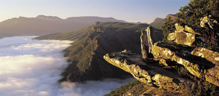
[ BOROKA LOOKOUT, GRAMPIANS NATIONAL PARK ]
Grampians wine region Between Stawell and Ararat, the small town of Great Western encompasses some winemaking treasures and hosts the Champagne Picnic Races every Australia Day. Dating from the 1860s, Seppelt is famous for the historic underground tunnels that form its cellars. Its name goes hand in hand with sparkling white wine, although most of the grapes for this variety are actually grown elsewhere. If you’re after local sparkling, try Seppelt’s sparkling burgundy, made from shiraz. Best’s most prized wine is its Thomson Family Shiraz. The winery has its own set of historic buildings and a small plot of unique vines possibly found nowhere else in the world. East of Ararat, Mount Langi Ghiran Vineyards produces what might be the region’s best shiraz, as well as a great cabernet sauvignon.
Grampians Horse Riding Adventures: morning and afternoon rides lasting 2 hrs, also has on-site accommodation; Brimpaen; (03) 5383 9225; 44 km W. Scenic drive: from Halls Gap drive to Boroka Lookout, Reed Lookout and MacKenzie Falls, and break for lunch at the Zumsteins picnic area.
Horsham |
Pop. 14 120 |
20 O’Callaghan Pde; (03) 5382 1832 or 1800 633 218; www.visithorsham.com.au
96.5 Triple H FM, 594 AM ABC Local Radio
Horsham is an important centre for the Wimmera district. Prior to European settlement, Horsham and its surrounds were occupied by the Jardwa and Wotjobaluk Aboriginal people, who referred to the region as ‘Wopetbungundilar’. This term is thought to have meant ‘place of flowers’, a reference to the flowers that grow along the banks of the Wimmera River. Flowers continue to play an important role in Horsham, which is considered to be one of the prettiest regional towns in Victoria – the town prides itself on its clean streets and picturesque gardens. Although the Wimmera is a renowned wheat-growing region, Horsham is also a centre for fine wool production.
Horsham Regional Art Gallery This is one of Victoria’s key regional galleries, with an extensive collection housed in a 1930s Art Deco building. Most of the artwork is centred on the Mack Jost collection of Australian art, with contemporary Australian photography another specialty. 80 Wilson St; (03) 5362 2888.
Botanic Gardens: picturesquely set on the banks of the Wimmera River; Cnr Baker and Firebrace sts. The Wool Factory: produces extra-fine wool from Saxon-Merino sheep, with tours daily; Golf Course Rd. Wimmera River: key attraction for the town, with scenic picnic spots along the river’s edges. Visit the river at dusk for spectacular sunsets.
Market: showgrounds on McPherson St; 2nd Sun each month. Haven Recreation Market: 1st Sat each month. Wimmera Machinery Field Days: Longerenong; Mar. Art Is: community festival; Apr. Awakenings Festival: largest Australian festival involving disabled patrons; Oct. Spring Garden Festival: Oct. Horsham Show: Oct. Kannamaroo Rock ‘n’ Roll Festival: Nov. Karkana Strawberry Festival: Nov.
Cafe Chickpea: hearty breakfasts and light lunches; 30A Pynsent St; (03) 5382 3998.
Horsham Caravan Park: 190 Firebrace St; (03) 5382 3476. Murtoa Caravan Park: 47 Lake St, Murtoa; 0448 511 879.
Murtoa This town lies on the edge of Lake Marma, which has dried out in recent times. The Water Tower Museum (open Sun) displays the history of the area as well as James Hill’s 1885–1930 taxidermy collection of some 500 birds and animals. On the eastern side of town, among the grain silos, is an unusual relic called the Stick Shed. The roof of this now empty storage shed is held up with 640 unmilled tree trunks, and the interior is an evocative sight (open once a year in Oct); 31 km NE.
Jung: market on last Sat each month; 10 km NE. Fishing: redfin and trout in local lakes, depending on water levels. Reasonable levels at Taylors Lake; 18 km SE. Mount Zero Olives: the largest olive grove in the Southern Hemisphere, with 55 000 trees on 730 hectares. The first trees were planted in 1943, after World War II stopped olive oil imports. You can buy oil, vinegar and lentils, and stay overnight.; Laharum; 30 km S.
TOWNS NEARBY: Natimuk 23 km, Dimboola 32 km, Warracknabeal 54 km, Halls Gap 55 km, Stawell 64 km
Inglewood |
Pop. 684 |
Loddon Visitor Information Centre, Wedderburn Community Centre, 24 Wilson St, Wedderburn; (03) 5494 3489; www.loddonalive.com.au
89.5 The Fresh FM, 91.1 FM ABC Local Radio
North along the Calder Highway from Bendigo is the ‘Golden Triangle’ town of Inglewood. Sizeable gold nuggets were found in this area during the gold rush and are still being unearthed. Inglewood is also known as Blue Eucy town, due to the once vigorous blue mallee eucalyptus oil industry. The town is also the birthplace of Australian aviator Sir Reginald Ansett.
Old eucalyptus oil distillery: not in operation but can be viewed; Calder Hwy, northern end of town. Old courthouse: local historical memorabilia; open by appt; Southey St. Streetscape: historic buildings are evidence of the town’s goldmining history.
Kooyoora State Park The park sits at the northern end of the Bealiba Range and features extensive box-ironbark forests. The Eastern Walking Circuit offers a great opportunity for bushwalkers, passing through strange rock formations and giant granite slabs. The Summit Track leads to Melville Caves Lookout. The caves were once the haunt of the notorious bushranger Captain Melville. Camping is allowed around the caves. Contact Parks Victoria on 13 1963; 16 km W.
Bridgewater on Loddon: fishing and watersports, Old Loddon Vines Vineyard, Water Wheel Vineyards and horse-drawn caravans for hire; 8 km SE. Loddon Valley wine region: the warm climate and clay soils of this region are known for producing outstanding red varieties and award-winning chardonnays. Taste the wines at cellar doors like Pandalowie at Bridgewater on Loddon (8 km SE) and Kingower (11 km SW); winery map from visitor information centre.
TOWNS NEARBY: Wedderburn 29 km, Dunolly 34 km, Bendigo 42 km, Maldon 50 km, Maryborough 53 km
Inverloch |
Pop. 3682 |
A’Beckett St; 1300 762 433; www.visitbasscoast.com
88.1 3MFM South Gippsland, 100.7 FM ABC Local Radio
Inverloch is a small seaside resort set on the protected waters of Anderson Inlet, east of Wonthaggi. It is characterised by long stretches of pristine beach that offer good surf and excellent fishing.
Bunurong Environment Centre: natural history displays with special focus on dinosaur diggings; also sales of natural products; The Esplanade. Shell Museum: The Esplanade.
Food and Wine Festival: Feb. Annual Dinosaur Dig: Feb/ Mar. Jazz Festival: Mar. Billy Cart Derby: Nov.
Tomo’s Japanese Inverloch: sophisticated Japanese; Shop 1, 23 A’Beckett St; (03) 5674 3444. Vela 9: modern Australian/ Mediterranean; 9 A’Beckett St; (03) 5674 1188.
RACV Inverloch Resort: 70 Cape Paterson–Inverloch Rd; (03) 5674 0000. Venus Bay Caravan Park: 113A Jupiter Blvd, Venus Bay; (03) 5663 7728.
Bunurong Coastal Drive Stretching the 14 km of coastline between Inverloch and Cape Paterson is this spectacular coastal drive with magnificent views to Venus Bay and beyond. Carparks offer access to beaches and coastal walks along the drive. The waters offshore are protected within Bunurong Marine National Park, and offer opportunities to surf, snorkel, scuba dive or simply explore the numerous rockpools that are dotted along the coast.
Anderson Inlet: the most southerly habitat for mangroves in Australia. This calm inlet is popular for windsurfing and watersports, and nearby Townsend Bluff and Maher’s Landing offer good birdwatching; adjacent to town. Fishing: in nearby waterways such as the Tarwin River; 20 km SE.
TOWNS NEARBY: Wonthaggi 11 km, Korumburra 23 km, Leongatha 26 km, Foster 42 km, Cowes 46 km
Jeparit |
Pop. 374 |
Wimmera–Mallee Pioneer Museum, Charles St; (03) 5397 2101.
96.5 Triple H FM, 594 AM ABC Local Radio
This little town in the Wimmera is 5 kilometres south-east of Lake Hindmarsh, which was once the largest natural freshwater lake in Victoria. Sadly, it has been empty for the past several years. Former prime minister Sir Robert Menzies was born here in 1894.
Wimmera–Mallee Pioneer Museum This unique museum details what life was like for early settlers in the Wimmera through a collection of colonial buildings furnished in the style of the period. The buildings on display are spread over a 4 ha complex and include log cabins, a church and a blacksmith’s shop. The museum also features displays of restored farm machinery. Southern entrance to town, Charles St; open weekdays 9.30am–12pm, 1–4.30pm, weekends 1–4.30pm or by request; (03) 5397 2101.
Menzies Sq: site of the dwelling where Menzies was born; Cnr Charles and Roy sts. Wimmera River Walk: 6 km return; starts at museum.
Lake Hindmarsh Victoria’s largest freshwater lake has seen dire water levels for the past several years. It was fed by the Wimmera River. Boating, waterskiing and fishing were all popular pastimes (Schulzes Beach has a boat ramp), with pelicans and other waterbirds existing at the lake in breeding colonies. Picnic and camping spots are available on the lake’s shores. A historic fisherman’s hut can also be seen. Contact the visitor centre for an update on water levels. 5 km NW.
Rainbow: a charming little Wimmera township, with Pasco’s Cash Store, an original country general store, and Yurunga Homestead, a beautiful Edwardian home with a large collection of antiques and original fittings (northern edge of town, key available); 35 km N. Pella: former German settlement with Lutheran church and old schoolhouse; 40 km NW via Rainbow. Lake Albacutya: fills only when Lake Hindmarsh overflows; 44 km N. Wyperfeld National Park: great for bushwalking; known for its birdlife, including the endangered mallee fowl, and wildflowers in spring; 60 km NW via Rainbow; for details see Hopetoun.
TOWNS NEARBY: Dimboola 35 km, Nhill 37 km, Warracknabeal 38 km, Hopetoun 57 km, Horsham 66 km
Kerang |
Pop. 3780 |
Sir John Gorton Library, cnr Murray Valley Hwy and Shadforth St; (03) 5452 1546; www.gannawarra.vic.gov.au
99.1 Smart FM, 102.1 FM ABC Local Radio
Kerang, situated on the Loddon River just south of the New South Wales border, lies at the southern end of the Kerang wetlands and lakes. They extend from Kerang 42 kilometres north-west to Lake Boga and offer a wonderland for watersports enthusiasts and birdwatchers; the lakes contain what are reputedly the world’s largest ibis breeding grounds. The town itself is a service centre for its agricultural surrounds.
Lester Lookout Tower: town views; Cnr Murray Valley Hwy and Shadforth St. Historical Museum: focuses on cars and antique farm machinery; Riverwood Dr.
Races: Easter and Boxing Day. Tour of the Murray River: cycling race; late Aug/early Sept.
Ibis Caravan Park: Murray Valley Hwy; (03) 5452 2232. Kerang Caravan & Tourist Park: 21 Museum Dr; (03) 5452 1161. Pelican Waters Lake Charm Tourist Park: Cnr Benjeroop and Boat Ramp rds, Lake Charm; (03) 5457 9318. Quambatook Caravan Park: Meering Rd, Quambatook; 0428 857 122.
Reedy Lakes: a series of 3 lakes. Apex Park, a recreation reserve for swimming, picnicking and boating, is set by the 1st lake, and the 2nd features a large ibis rookery. Picnic facilities are available at the third lake; 8 km NW. Leaghur State Park: on the Loddon River flood plain, this peaceful park is a perfect spot for a leisurely walk through the black box woodlands and wetlands; 25 km SW. Murrabit: a historic timber town on the Murray surrounded by picturesque forests, with a country market 1st Sat each month; 27 km N. Quambatook: hosts the Australian Tractor Pull Championship each Easter; 40 km SW. Lake Boga: popular for watersports, with good sandy beaches; 42 km NW. Fishing: Meran, Kangaroo and Charm lakes all offer freshwater fishing; details from visitor centre.
TOWNS NEARBY: Barham (NSW) 22 km, Cohuna 28 km, Pyramid Hill 40 km, Swan Hill 55 km, Wycheproof 73 km
Kilmore |
Pop. 4720 |
Library, 12 Sydney St; (03) 5781 1319.
97.1 OKR FM, 774 AM ABC Local Radio
Kilmore is Victoria’s oldest inland town, known for its historic buildings and many horseracing events. Like many towns in the central goldfields, Kilmore was the scene of a Kelly family saga. In this case, it was Ned Kelly’s father who had a run-in with the law. In 1865 John ‘Red’ Kelly was arrested for killing a squatter’s calf to feed his family, and was locked away in the Kilmore Gaol for six months. It was a crime that Ned had actually committed. Soon after Red’s release, he died of dropsy and was buried in the small town of Avenel, where the Kelly family lived for some time.
Old Kilmore Gaol An impressive bluestone building, established in 1859, that is now a privately owned auction house; Sutherland St.
Hudson Park: picnic/barbecue facilities; Cnr Sydney and Foote sts. Historic buildings: Whitburgh Cottage, Piper St, and a number of 1850s shops and hotels along Sydney St; brochure from visitor centre.
Kilmore Celtic Festival: June. Kilmore Cup: harness racing; Oct.
Bindley House: Cnr Powlett and Piper sts; (03) 5781 1142. Kilmore Caravan Park: 110 Northern Hwy; (03) 5782 1508. Daisyburn Homestead: 540 Daisyburn Rd, Glenaroua; (03) 5793 8114.
Tramways Heritage Centre at Bylands: extensive display of cable cars and early electric trams, with tram rides available; open Sun only; just south of town. Broadford: a small town featuring a historic precinct on High St; 17 km NE. Mt Piper Walking Track: wildlife and Wildflowers can be spotted along the way (1 hr return); near Broadford. Strath Creek: walks to Strath Creek Falls and a drive through the Valley of a Thousand Hills; starts at outskirts of Broadford.
TOWNS NEARBY: Seymour 34 km, Woodend 38 km, Yea 43 km, Kyneton 45 km, Heathcote 47 km
Koo-Wee-Rup |
Pop. 1423 |
Newsagency, 277 Rossiter Rd; (03) 5997 1456.
103.1 3BBR FM West Gippsland Community Radio, 774 AM ABC Local Radio
Koo-Wee-Rup and the surrounding agricultural area exist on reclaimed and drained swampland. It has given rise to Australia’s largest asparagus-growing district. The town’s name derives from the Aboriginal name meaning ‘blackfish swimming’, a reference to the fish that were once plentiful in the swamp.
Historical Society Museum: local history; open Sun; Rossiter Rd.
Pakenham Caravan Park: Cnr Princes Hwy and Racecourse Rd, Pakenham; (03) 5941 2004.
Swamp Observation Tower: views of remaining swampland and across to Western Port. A market with local produce operates regularly at the base; South Gippsland Hwy; 2 km SE. Bayles Fauna Reserve: native animals; 8 km NE. Harewood House: restored 1850s house with original furnishings; South Gippsland Hwy towards Tooradin. Tooradin: offers good boating and fishing on Sawtells Inlet; 10 km W. Caldermeade Farm: originally a premier beef cattle property but now a fully operational modern dairy farm focused on educating and entertaining visitors; 10 km SE. Pakenham: now considered a suburb of Melbourne, Pakenham is home to the Military Vehicle Museum, Army Rd, and the Berwick Pakenham Historical Society Museum, John St; 13 km N. Tynong: attractions include Victoria’s Farm Shed, featuring farm animals and shearing, and Gumbaya Park, a family fun park; 20 km NE. Royal Botanic Gardens Cranbourne: renowned, wonderfully maintained native gardens; 22 km NW. Grantville: hosts a market 4th Sun each month; 30 km S.
TOWNS NEARBY: Emerald 30 km, Cowes 36 km, Warragul 39 km, Korumburra 39 km, Mornington 40 km
Korumburra |
Pop. 3145 |
Prom Country Information Centre, South Gippsland Hwy; (03) 5655 2233 or 1800 630 704; www.visitpromcountry.com.au
88.1 3MFM South Gippsland, 100.7 FM ABC Local Radio
Established in 1887, Korumburra stands firmly as the heritage centre of South Gippsland. The township was a primary producer of black coal for Victoria’s rail industry until the last mine closed in 1958. Korumburra is set in the rolling green hills of South Gippsland, with scenic drives found in any direction.
Coal Creek Heritage Village Coal Creek is an open-air museum that offers all the fascination of life in a 19th-century coalmining village, including history and memorabilia of the area. The village contains beautiful picnic areas, bush tramway and cafe, and community events are held throughout the year. South Gippsland Hwy; (03) 5655 1811.
Korumburra Federation Art Gallery: South Gippsland Hwy. Whitelaw Antiques & Collectibles: 9 Mine Rd.
Korumburra Farmers Market: Railway Siding; 3rd Sat each month. Korumburra Agricultural Show: Feb. Rotary Club of Korumburra Art Show: Feb.
Korumburra Tourist Park: 56 Bourke St; (03) 5655 2326.
South Gippsland Tourist Railway This railway travels to Leongatha, Korumburra, Loch and Nyora, and provides a scenic way to view the ever-changing South Gippsland landscape. Trains operate Sun and public holidays with a Wed service during school holidays. The grand Edwardian Railway Station behind the main street is also worth a visit. (03) 5658 1111.
Loch: a thriving art and craft village with cosy eateries, antique stores and galleries; 14 km NW. Poowong: beautiful country town nestled among the rolling hills of South Gippsland with Poowong Pioneer Chapel, est. 1878; 18 km NW.
TOWNS NEARBY: Leongatha 12 km, Inverloch 23 km, Wonthaggi 28 km, Warragul 32 km, Koo-Wee-Rup 39 km
Kyneton |
Pop. 4286 |
Jean Haynes Reserve, High St; (03) 5422 6110; www.visitmacedonranges.com
91.1 FM ABC Local Radio, 100.7 Highlands FM
Part of Victoria’s picturesque spa and garden country, Kyneton is a well-preserved town with many attractive bluestone buildings. Caroline Chisholm, who helped many migrants find their feet in this country, lived in Kyneton, where her family owned a store and her husband worked as a magistrate. While living in the town, she established a series of affordable, overnight shelters for travellers on the Mount Alexander Road (now the Calder Highway), a road frequented by gold prospectors. Remnants of the shelters can be seen at the historic township of Carlsruhe, south-east of Kyneton.
Kyneton Museum: in a former bank building, with a drop-log cottage in the grounds; open Fri–Sun; Piper St. Wool on Piper: features a spinning mill, with yarns and handmade garments for sale; Piper St. Botanic Gardens: 8 ha area scenically located above Pipers Creek. The gardens feature rare varieties of trees; Clowes St. Historic buildings: many in town, including mechanics institute on Mollison St and old police depot, Jenning St. Campaspe River Walk: scenic walk with picnic spots; access from Piper St.
Farmers market: farmgate produce; Piper St; 2nd Sat each month. Kyneton Daffodil and Arts Festival: Sept. Kyneton Cup: Nov.
Annie Smithers: French Provincial; 72 Piper St; (03) 5422 2039. Dhaba: Indian; 18 Piper St; (03) 5422 6225. Little Swallow Cafe: European-style cafe; 58A Piper St; (03) 5422 6241. Pizza Verde: city-smart pizzeria; 62 Piper St; (03) 5422 7400. Royal George Hotel: contemporary dining room; 24 Piper St; (03) 5422 1390. Star Anise Bistro: modern bistro; 29A Piper St; (03) 5422 2777.
Airleigh – Rose Cottage: 10 Begg St; 0402 783 489.
Trentham and Wombat State Forest This picturesque spacountry town has a mixed history of gold, timber and farming. It has a charming streetscape and attractions include a historic foundry and Minifie’s Berry Farm, where you can pick your own berries in season. Just north-east of town is Wombat State Forest – deep within is Victoria’s largest single-drop waterfall, Trentham Falls. Cascading 32 m onto a quartz gravel base, the falls are an impressive backdrop for a picnic. 22 km SW.
Reservoirs: several offering scenic locations for walks and picnics. Upper Coliban, Lauriston and Malmsbury reservoirs all nearby. Paramoor Farm and Winery: a former Clydesdale horse farm, now winery and B&B; Carlsruhe; 5 km SE. Malmsbury: a town noted for its old bluestone buildings. It features historic Botanic Gardens and The Mill, National Trust–classified, not open to the public. Also wineries in the area; 10 km NW. Turpins and Cascade Falls: with picnic area and walks; near Metcalfe; 22 km N.
TOWNS NEARBY: Woodend 14 km, Castlemaine 29 km, Daylesford 29 km, Heathcote 42 km, Maldon 44 km
Leongatha |
Pop. 4501 |
Michael Place Complex; (03) 5662 2111; www.visitpromcountry.com.au
88.1 3MFM South Gippsland, 100.7 FM ABC Local Radio
Leongatha is a thriving town, considered the commercial centre of South Gippsland. Idyllically positioned as a gateway to Gippsland destinations and attractions, any major road departing Leongatha provides access to popular attractions, all within an easy one hour’s drive.
Historical Society Museum: McCartin St. Leongatha Gallery: Cnr McCartin St and Michael Pl. Mushroom Crafts: craft sales and gallery; 40 Blair St. Great Southern Rail Trail: commencement of 50 km rail trail that winds between Leongatha and Foster.
South Gippsland Golf Classic: Feb. Music for the People Concert: Mossvale Park; Feb. Mossvale Music Festival: Mar. Raw Vibes Youth Festival: Mar. Daffodil Festival: Sept. Garden and Lifestyle Expo: Nov.
The Koonwarra Store: foodstore and emporium, excellent regional fare, courtyard setting; South Gippsland Hwy, Koonwarra; (03) 5664 2285.
Leongatha Apex Caravan Park: 14 Turner St; (03) 5662 2753. Hudspeth House Bed & Breakfast: Cnr McKitterick and Welsford sts, Meeniyan; (03) 5664 7461.
Koonwarra Situated between Leongatha and Meeniyan on the South Gippsland Hwy, Koonwarra became the first eco-wise town in Australia. The town prides itself on its commitment to sustainable lifestyles. Drop in to the Koonwarra Fine Food &Wine Store to purchase local wines, cheese and pantry items. On the first Sat of each month, Koonwarra holds a farmers market. The town also boasts an organic cooking school, day spa, specialty shops, pottery and winery nearby. 8 km SE.
Gippsland wine region This dispersed wine region stretches from Phillip Island to Lakes Entrance, with the main cluster of wineries around Leongatha. Bass Phillip makes what is regarded as Australia’s greatest pinot noir. Phillip Island Vineyard is responsible for another superb version, as well as an excellent botrytis riesling, in spite of the island’s fierce winds and hungry birds. Chardonnay is Gippsland’s other specialty, evident from wineries such as Narkoojee and Nicholson River. The latter makes a particularly wonderful merlot and a blend called The Nicholson (merlot and shiraz).
Meeniyan: great place to visit for the art and craft enthusiast. Places of interest include Meeniyan Art Gallery, South Gippsland Craft Merchants, Beth’s Antiques and Lacy Jewellery. Meeniyan hosts an annual art and craft exhibition over the Melbourne Cup weekend; 16 km SE. Mossvale Park: tranquil setting for a picnic or barbecue. Music concerts and festivals are held here in Feb and Mar; 16 km NE. Mirboo North: situated among the picturesque Strzelecki Ranges, the township is decorated with murals depicting the history of the area. Grand Ridge Brewery, Lyre Bird Forest Walk and the Grand Ridge Rail Trail are also located here; 26 km NE.
TOWNS NEARBY: Korumburra 12 km, Inverloch 26 km, Foster 30 km, Wonthaggi 34 km, Warragul 35 km
Lorne |
Pop. 971 |
15 Mountjoy Pde; (03) 5289 1152; www.visitgreatoceanroad.org.au
94.7 The Pulse FM, 774 AM ABC Local Radio
Lorne is one of Victoria’s most attractive and lively coastal resorts. The approach into town along the Great Ocean Road is truly spectacular, with the superb mountain scenery of the Otways on one side and the rugged Bass Strait coast on the other. The village of Lorne was established in 1871 and quickly became popular with pastoralists from inland areas, leading to its development around the picturesque Louttit Bay. When the Great Ocean Road opened in 1932 Lorne became much more accessible; however, the area has remained relatively unspoiled with good beaches, surfing, fishing and bushwalking in the hills – activities made all the more enjoyable by the area’s pleasant, mild climate.
Teddys Lookout: excellent bay views; behind the town, at the end of George St. Shipwreck Walk: walk along the beach taking in sites of the numerous shipwrecks along this stretch of coast; details from visitor centre. Foreshore Reserve: great spot for a picnic, with paddleboats available for hire. Qdos: contemporary art gallery; Allenvale Rd. Lorne Fisheries: on the pier with daily supplies.
Pier to Pub Swim: Jan. Mountain to Surf Foot Race: Jan. Great Ocean Road Marathon: May. Anaconda Adventure Race: Dec. Falls Festival: Dec–Jan.
Ba Ba Lu Bar & Restaurant: Spanish-style menu; 6A Mountjoy Pde; (03) 5289 1808. Lorne Ovenhouse: modern wood-fired menu; 46A Mountjoy Pde; (03) 5289 2544. Qdos Cafe: cafe-bar; Qdos Arts, 35 Allenvale Rd; (03) 5289 1989.
Chatby Lane: 4 Howard St; (03) 5289 1616. Lorne Foreshore Caravan Parks: 2 Great Ocean Rd; 1300 364 797. BIG4 Wye River Tourist Park: 25 Great Ocean Rd, Wye River; (03) 5289 0241.
Great Otway National Park This park covers 103 000 ha and includes a range of environments, from the timbered ridges of the eastern Otways to fern gullies, waterfalls and a coastline with tall cliffs, coves and sandy beaches. Around Lorne there are more than 100 walking tracks and the rock platforms along the coast provide ideal spots for ocean fishing. The Falls Festival, a major rock-music festival, is held over New Year’s Eve at a property near the Erskine Falls, 9 km NW. These popular falls are a peaceful location and drop 30 m over moss-covered rocks. As well as driving, you can walk to the falls from Lorne along the river. The park surrounds Lorne and can be accessed from various points along the Great Ocean Rd. Contact Parks Victoria on 13 1963.
Cumberland River Valley: walking tracks and camping; 4 km SW. Mt Defiance Lookout: 10 km SW. Wye River: a small coastal village, good for rock and surf fishing, surfing and camping; 17 km SW. Old Lorne Road Olives: olive grove, cafe and gallery; closed Tues and Wed; Deans Marsh Rd; 22 km N. Gentle Annie Berry Gardens: pick your own; open Nov–Apr; 26 km NW via Deans Marsh. Scenic drives: west through the Otway Ranges, and south-west or north-east on the Great Ocean Rd.
TOWNS NEARBY: Aireys Inlet 14 km, Anglesea 24 km, Winchelsea 33 km, Apollo Bay 36 km, Torquay 38 km
Lakes Entrance |
Pop. 5545 |
Lakes Entrance Visitor Information Centre, cnr The Esplanade and Marine Pde; (03) 5155 1966 or 1800 637 060; www.discovereastgippsland.com.au
90.7 FM 3REG Radio East Gippsland, 100.7 FM ABC Local Radio
Lakes Entrance is a lovely holiday town situated at the eastern end of the Gippsland Lakes, an inland network of waterways covering more than 400 square kilometres. The artificially created ‘entrance’ of the town’s name allows the Tasman Sea and the lakes to meet, creating a safe harbour that is home to one of the largest fishing fleets in Australia. While many of the attractions in Lakes Entrance are based around the water, there is also opportunity for foodies to indulge themselves with a variety of cafes and restaurants lining The Esplanade, plus sales of fresh fish and local wines.
Griffiths Seashell Museum: 125 The Esplanade; (03) 5155 1538.
Markets: Lakes Entrance Primary School, Myer St; 3rd Sat each month. Arts Festival: Forest Tech Living Resource Centre; Mar long weekend. Lakes Motor Fest: biannual; Apr. New Year’s Eve Entertainment and Fireworks: Dec.
The Boathouse Restaurant: local seafood; 201 The Esplanade; (03) 5155 3055. Ferryman’s Seafood Cafe: local seafood; Middle Boat Harbour, The Esplanade; (03) 5155 3000. Miriam’s: local seafood; Level 1, cnr The Esplanade and Bulmer St; (03) 5155 3999. Bancroft Bites: cafe with excellent homemade cakes; 2/57 Metung Rd, Metung; (03) 5156 2854. The Metung Galley: excellent local produce menu; 3/59 Metung Rd, Metung; (03) 5156 2330.
BIG4 Whiters Holiday Village: Cnr Roadknight and Whiters sts; (03) 5155 1343. Eastern Beach Holiday Park: 42 Eastern Beach Rd; (03) 5155 1581. Echo Beach Tourist Park: 31–33 Roadknight St; (03) 5155 2238. Golden Terrace Holiday Park: 651 Esplanade (Princes Hwy); (03) 5155 1237. Idleours: 649 Esplanade; (03) 5155 1788. Lakes Entrance Tourist Park: 127 Princes Hwy; (03) 5155 1159. Lakes Haven Caravan Park: 3 Jemmeson St; (03) 5155 2254. North Arm Tourist Park: 76 Marine Pde; (03) 5155 2490. Silver Sands Tourist Park: 33 Myer St; (03) 5155 2343. Sunnyside Caravan Park: 60 Myer St; (03) 5155 1735. Waters Edge Holiday Park: 623 Esplanade; (03) 5155 1914. Woodbine Tourist Park: 33 Church St; (03) 5155 1718. Lake Tyers Camp & Caravan Park: 558 Lake Tyers Beach Rd, Lake Tyers Beach; (03) 5156 5530. The Lakes Beachfront Holiday Retreat: 430 Lake Tyers Beach Rd, Lake Tyers Beach; (03) 5156 5582.
Gippsland Lakes Five rivers end their journey to the sea here, forming a vast expanse of water tucked in behind Ninety Mile Beach. The lakes are a true playground for anyone with an interest in water activities, especially fishing and boating. Explore the lakes on a sightseeing cruise, including one to Wyanga Park Winery, or on the ever-popular houseboats that can be hired over summer. Contact visitor centre for details. At the centre, the Lakes National Park offers birdwatching, walking, swimming and camping. Access is via boat from Paynesville or road and foot from Loch Sport.
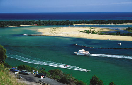
[ FERRY CRUISING THROUGH LAKES ENTRANCE ]
Jemmys Point: great views of the region; 1 km W. Lake Bunga: nature trail along foreshore; 3 km E. Lake Tyers: sheltered waters ideal for fishing, swimming and boating. Cruises depart from Fishermans Landing in town. Lake is 6–23 km NE, depending on access point. Lake Tyers Forest Park is great for bushwalking, wildlife-spotting, picnicking and camping; 20 km NE.
Nyerimilang Heritage Park: 1920s homestead, with original farm buildings and the wonderfully maintained East Gippsland Botanic Gardens. Rose Pruning Day, with demonstrations, is held in July; 10 km NW. Swan Reach: Rosewood Pottery; Malcolm Cameron Studio Gallery, open weekends; 14 km NW. Metung: a scenic town on Lake King with boat hire, cruises and a marina regatta each Jan. Chainsaw Sculpture Gallery has chainsaw sculpture and a display of Annemieke Mein’s embroidery art; 15 km W. Nicholson River Winery: 22 km NW. East Gippsland Carriage Co: restored horse-drawn carriages, and tours; 30 km E. Bataluk Cultural Trail: driving tour taking in Aboriginal cultural sites in the East Gippsland region; self-guide brochure available from visitor centre.
TOWNS NEARBY: Paynesville 25 km, Bairnsdale 34 km, Buchan 45 km, Orbost 45 km, Sale 85 km
Maffra |
Pop. 4151 |
96 Johnson St; (03) 5141 1811; www.tourismwellington.com.au
100.7 FM ABC Local Radio, 104.7 Gippsland FM
Maffra, settled in the 1840s, has the charm and old-style hospitality of another era. Named after Maffra in Portugal because many of the early Gippsland settlers had fought in that area of Europe during the Peninsula War, the town’s early days were fraught with drought until a sugar beet industry established in the 1890s provided a major boost. The Glenmaggie Irrigation Scheme of 1919 also signalled a new heyday and ensured the viable and lengthy success of today’s dairy industry. The sugar beet factory closed in 1948 owing to World War II’s labour shortages and the competing dairy industry, but Maffra continues to support its rich agricultural surrounds. It also holds a great sense of history in its original shop verandahs and grand homesteads.
Maffra Sugar Beet Historic Museum: local history museum with special interest in the sugar beet industry; open Sun afternoon; River St. Mineral and gemstone display: large collection of rare gemstones and fossils at the information centre; Johnson St. All Seasons Herb Garden: Foster St. Gippsland Vehicle Collection: outstanding rotating display of interesting vehicles; located in a historic vegetable-dehydrating factory; Maffra–Sale Rd; (03) 5147 3223. Gippsland Plains Rail Trail: recreational trail for cycling and walking that passes through town; still under development but when complete will link Stratford in the east to Traralgon in the west by traversing dairy country.
Gippsland Harvest Festival: Mar. Mardi Gras: Mar.
Abington Bed & Breakfast: 56 Coghlans La, Heyfield; (03) 5148 2430. Lake Glenmaggie Caravan Park: Heyfield– Licola Rd, Glenmaggie; 0409 854 106. Stratford On The River Tourist Park: 16 McMillan St, Stratford; (03) 5145 6588.
Stratford: the scenic Avon River flows through town. Knobs Reserve is a site where the local Aboriginal people once sharpened axe heads on sandstone grinding stones – it is part of the Bataluk Cultural Trail, which takes in significant Indigenous sites throughout East Gippsland. Stratford hosts the Shakespeare Celebration in May; 9 km E. Australian Wildlife Art Gallery and Sculpture: Princes Hwy near Munro; 25 km E. Robotic Dairy: the first Australian dairy farm to install 4 ‘Astronaut Milking Robots’ where the cows decide when to be milked; open on public visitor days or by appt; Toongabbie Rd, Winnindoo; (03) 5199 2212; 26 km W. Lake Glenmaggie: popular watersports venue; 42 km NW via Heyfield. Alpine National Park: sprawls from Licola, 75 km NW, to the NSW border. Near Licola is Lake Tali Karng, which lies 850 m above sea level and is a popular bushwalking destination during the warmer months. Scenic drives: the Traralgon to Stratford Tourist Route highlights attractions of the area. For stunning scenery, drive north along Forest Rd, through the Macalister River Valley to Licola and Mt Tamboritha in Alpine National Park; or to Jamieson (166 km NW via Heyfi eld), with access to snowfields or Lake Eildon.
TOWNS NEARBY: Sale 17 km, Traralgon 46 km, Walhalla 47 km, Bairnsdale 58 km, Morwell 59 km
Maldon |
Pop. 1222 |
High St; (03) 5475 2569; www.maldon.org.au
91.1 FM ABC Local Radio, 106.3 Radio KLFM
Maldon is one of Victoria’s best-known gold towns and a popular weekend getaway for Melburnians. The town has been wonderfully preserved, with the wide, tree-lined main street featuring old buildings and shopfronts. There is also a tourist steam train. Aside from the cafes and galleries, the town seems unchanged from the gold rush days. Maldon was declared Australia’s first ‘notable town’ by the National Trust in 1966.
Historic town walk: grab a brochure from the visitor centre and take to the wide, old footpaths to discover the historic delights of Maldon. See preserved 19th-century shopfronts and old stone cottages. Highlights include the restored Dabb’s General Store in Main St, and the Maldon Hospital in Adair St. Museum: displays on mining as well as domestic memorabilia from Maldon’s past, in heritage building; open 1.30–4pm daily; High St. The Beehive Chimney: southern end of Church St. Anzac Hill: the walk to the top is rewarded with magnificent views of the area; southern end of High St.
Fair: Easter. Vintage Car Hill Climb: Oct. Folk Festival: Oct–Nov.
Penny School Gallery/Cafe: international cuisine; 11 Church St; (03) 5475 1911. Zen Eden Produce: vegetarian cafe and produce store; 6 Main St; 0408 319 188.
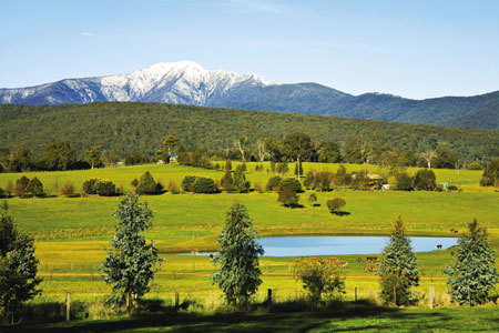
[ MANSFIELD ] FARMLAND WITH SNOW-CAPPED MOUNT BULLER IN THE BACKGROUND
Palm House: 2 High St; (03) 5475 2532.
Porcupine Township This award-winning tourist attraction is a reconstruction of an early 1850s goldmining town, with an array of slab, shingle and mudbrick buildings moved here from other goldfields. The village, complete with a blacksmith’s, a doctor’s surgery and even a bowling alley, is located in rugged bushland on the site of the original Porcupine diggings, where the first gold discovery between Castlemaine and Bendigo was made. Visitors to the township can pan for gold, handfeed emus or take a ride on the Little Toot train, which does a circuit through the diggings. Cnr Maldon–Bendigo and Allans rds; (03) 5475 1000; 3 km NE.
Mt Tarrangower Lookout Tower: town views; 2 km W. Carman’s Tunnel Mine: guided mine tours feature relics from goldmining days; 2 km SW. Nuggetty Ranges and Mt Moorol: 2 km N. Cairn Curran Reservoir: great for watersports and fishing, water levels permitting; features picnic facilities and a sailing club near the spillway; 10 km SW. Victorian Goldfields Railway: historic steam trains run from Maldon Railway Station (Hornsby St) through scenic forest to Castlemaine; operates Wed, Sun and public holidays; bookings on (03) 5470 6658.
TOWNS NEARBY: Castlemaine 15 km, Maryborough 30 km, Bendigo 32 km, Dunolly 33 km, Daylesford 39 km