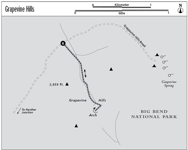
6 Grapevine Hills
A day hike to a wonderland of rock formations culminating with a natural stone arch.
Distance: 2.0 miles out and back
Approximate hiking time: 1 hour
Elevation: 3,230 to 3,480 feet
Trail surface: Dirt path and sandy wash
Best season: Fall through spring
Water availability: None
Land status: National park
Nearest town: Marathon
Fees and permits: Park entrance fee
Maps: USGS Grapevine Hills; Trails Illustrated Big Bend National Park
Trail contacts: Big Bend National Park, P.O. Box 129, Big Bend National Park 79834; (432) 477-2251
Finding the trailhead: From Big Bend National Park headquarters at Panther Junction, drive west about 3 miles toward Alpine and the Basin. Just past the paved Basin turnoff on the left, turn right (north) onto the gravel Grapevine Hills Road. The road has a good gravel surface for the first 4 or 5 miles. The last couple miles are rougher but with care are usually passable by any vehicle. The parking area is on the right, in a canyon mouth, at about 7 miles. An interpretive sign marks the parking area. If you miss the turnoff, don’t worry. The road only goes another mile before ending at Grapevine Spring.
The Hike
The Grapevine Hills were formed when molten rock, or magma, pooled and hardened underground in a large lens-shaped body called a laccolith. Erosion exposed the laccolith to the surface, and the exposed granite has weathered into a fanciful jumble of boulders and pinnacles.
The trail follows the canyon bottom upstream for about 0.75 mile before a short climb up to a small pass, or saddle. Except for the short climb at the end, the trail grade is mild. Walking in the soft sand of the desert wash is the only difficulty. Once you reach the crest of the small pass, follow the trail up the ridge to the right (west). The trail can be a bit hard to follow through the boulders along the ridge, but metal fence posts and signs help mark the way. In a short distance the trail ends at a photogenic arch formed by two pinnacles and a boulder.
Although the trail is short, the rock formations invite additional exploration throughout the hills. This desert hike can be very hot from about April through September. Be sure to go early or late in the day during those months, and carry plenty of water.
Miles and Directions
0.0Start at the trailhead on Grapevine Hills Road.
0.75The trail begins to climb out of the wash to a saddle.
1.0Reach a stone arch at trail’s end. Retrace your steps.
2.0Arrive back at the trailhead.
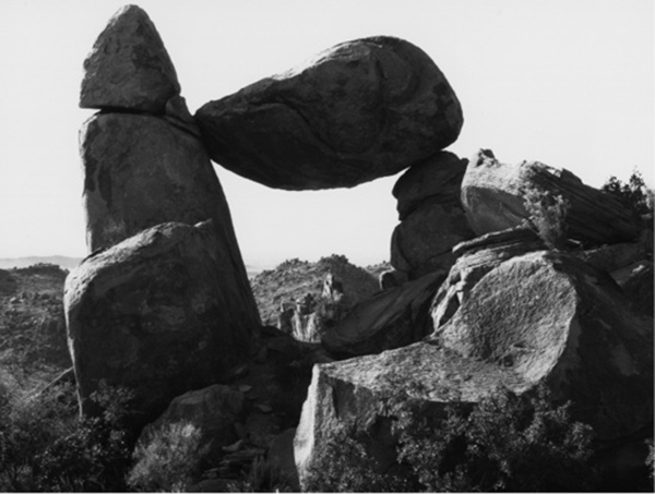
A stone arch lies at the end of the Grapevine Hills Trail.