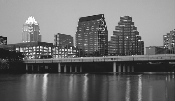
Austin’s skyline at dusk.
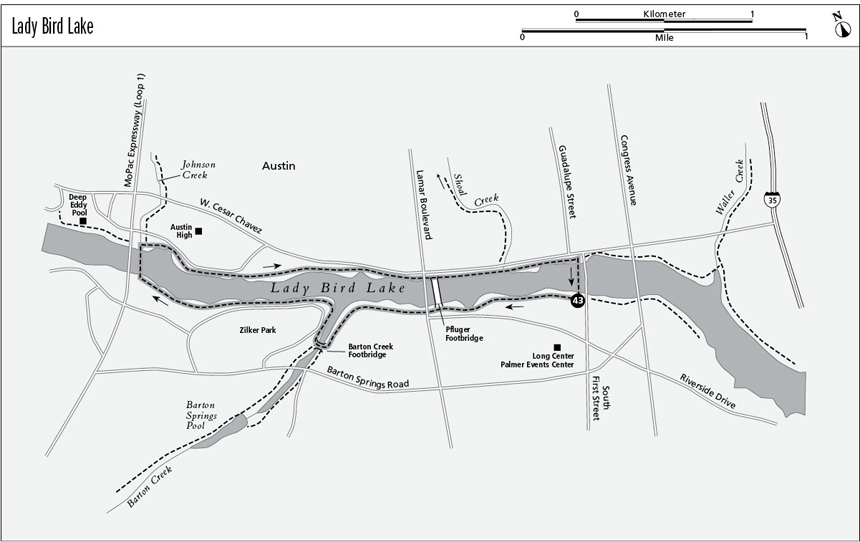
43 Lady Bird Lake
A day hike around the scenic lake in the center of Austin.
Distance: 4.1-mile loop
Approximate hiking time: 1.5 to 2 hours
Elevation: 430 to 450 feet
Trail surface: Improved gravel path
Best season: Year-round
Water availability: Drinking fountains along trail at trailhead, Zilker Park, Zachary Scott Theatre, Austin High School, Pfluger bridge, and other locations
Land status: Austin city park
Nearest town: Austin
Fees and permits: No fees or permits required
Maps: USGS Austin West and Austin East; Lady Bird Lake Hike and Bike Trail (Austin Parks and Recreation Department)
Trail contacts: Austin Parks and Recreation Department, P.O. Box 1088, Austin 78767; (512) 974-2000
Finding the trailhead: The Lady Bird Lake Hike and Bike Trail has numerous access points. This hike starts from the parking lot on the south side of the lake near the Long Center and Palmer Events Center in Austin. The parking lot lies on the west side of the South First Street bridge between the lake and the two centers.
The Hike
Austin has one of the finest systems of jogging and cycling trails in Texas. Several trails follow creek drainages that flow into the Colorado River, now dammed into Lady Bird Lake. The city owns most of the property fronting the lake and has turned it into a large park. Until 2007 the lake was named Town Lake. A long, improved trail was built along much of the lakeshore. The entire trail covers about 10.1 miles (although about a mile on the southeast section of the trail requires walking on sidewalks along busy streets), but this hike follows an easy 4.1-mile loop.
From the suggested starting point by the Long Center, the trail goes west through parkland along the lake, crossing under the railroad bridge, the Pfluger footbridge, and the Lamar Boulevard bridge. At the confluence of Barton Creek, the trail crosses an arched steel footbridge over the creek. Side trails continue up Barton Creek, past the Barton Springs Pool, and onto the Barton Creek Greenbelt Trail. Stay on the main trail along the lake. Watch for the enormous bald cypresses below the trail.
Austin’s skyline at dusk.
At the large MoPac Highway (Texas Loop 1) bridge, the trail crosses the lake to the north shore on a footbridge suspended under the MoPac bridge. On the other side, side trails go left to Deep Eddy Pool and straight ahead up the Johnson Creek Greenbelt. Turn right, and continue to follow the lakeshore back to the east.
As the trail continues around the loop, it again crosses under the Lamar, railroad, and Pfluger bridges. The trail between the Lamar and MoPac bridges is lined with beautiful redbud trees that bloom in early spring. At Shoal Creek a side trail turns left, up the long Shoal Creek Greenbelt, and just beyond the main trail crosses a small footbridge over Shoal Creek. Just beyond the bridge go left at a fork and climb the trail up the bank to the South First Street bridge. Cross the bridge back to the south side of the lake and the trailhead.
The trail can be followed several miles farther east on either shore (the north side avoids the sidewalks along busy streets) to and across Longhorn Dam. The Lady Bird Lake Trail acts as a nucleus for some of the other Greenbelt trails. My favorites, and the two longest, are the trails up the Barton Creek and Shoal Creek Greenbelts. The Lady Bird Lake Trail is probably one of the busiest in Texas, popular with walkers, runners, and cyclists. The trail is pretty, but don’t expect a wilderness experience. Instead, relax and do some people watching. Since the trail is within a city, it probably should be avoided at night, especially the section east of I-35. Incidents are rare, but there’s no sense in tempting fate.
Miles and Directions
0.0Start at the trailhead on the west side of the South First Street bridge.
0.6Pfluger and Lamar bridges.
1.0Barton Creek footbridge.
2.0MoPac footbridge.
3.4Pfluger and Lamar bridges.
4.1Arrive back at the trailhead.