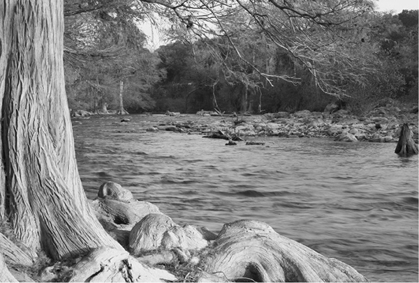
Bald cypress trees line the Guadalupe River.
46 Guadalupe River State Park
A day hike through the grassy uplands above the cypress-lined Guadalupe River.
Distance: 4.3-mile loop
Approximate hiking time: 2 to 3 hours
Elevation: 1,120 to 1,240 feet
Trail surface: Dirt path
Best season: Fall through spring
Water availability: None
Land status: State park
Nearest town: Spring Branch
Fees and permits: Park entrance fee
Maps: USGS Anhalt and Bergheim; Guadalupe River State Park map
Trail contacts: Guadalupe River State Park, 3350 Park Road 31, Spring Branch 78070; (830) 438-2656
Finding the trailhead: From the junction of US 281 and TX 46 in Spring Branch, go west on TX 46 for 7.9 miles to the junction of Park Road 31 on the right. Follow Park Road 31 for 3.1 miles to park headquarters. Take the small gravel road marked with a trailhead sign to the right from the headquarters parking lot to the marked trailhead at its end.
The Hike
This hike makes a large loop through the gently rolling hills of the park to a bluff overlooking the Guadalupe River. Tall prairie grasses and clumps of live oaks and other trees cover the terrain. Much of the trail crosses open areas of meadow without shade, so don’t try this hike during hot weather. The trail is also used by horses and mountain bikers.
The trail goes less than 0.25 mile to the junction with Loop 1 on the right. Unless you want to lengthen the hike, stay left. In a short distance Loop 1 rejoins the main trail. Soon the main loop, Loop 2, begins at a fork. Go right. In about 0.5 mile Loop 4 forks off to the left. Go right unless you want to lengthen the hike a little. The side loop soon rejoins the main trail. Go right and stay on the main trail.
Bald cypress trees line the Guadalupe River.
Soon the trail crosses Park Road 31. In another 0.25 mile turn right onto Loop 3 at a junction. The park’s estimated mileage of 1.7 miles seems a little long for this loop. I estimated more like 1.4 miles. After about 0.6 mile, at a horse watering trough, a side trail forks right that goes a short distance to the Cedar Sage Camping Area. Continue left on the main trail. The trail runs along a high bluff above the Guadalupe River. Short unofficial spur trails offer views down to the river’s crystal-clear water and tall cypresses.
After following the river for a short distance, the trail turns south and gradually climbs back toward park headquarters. At the junction with Loop 2, go right. In another 0.5 mile the trail crosses Park Road 31 again. After about another 0.6 mile the trail hits the junction where Loop 2 started before. Go right and return to the trailhead, ignoring the two forks for Loop 1 on the left.
After doing this hike, be sure to take a walk along the river, reached by following the park road to its end at the picnic area. On Saturday park personnel lead guided hikes into the adjoining Honey Creek State Natural Area. The walk along the beautiful spring-fed creek is very worthwhile. By the time this book goes to print, the park should have opened an extensive trail system on the north side of the river in the Bauer Unit.

Miles and Directions
0.0Start at the trailhead at the end of the small gravel road.
0.2Junction with Loop 1. Go left.
0.3Second junction with Loop 1. Go left.
0.4Junction with Loop 2. Go right.
0.9Junction with Loop 4. Go right.
1.0Second junction with Loop 4. Go right.
1.15Cross Park Road 31.
1.4Junction with Loop 3. Go right.
2.0Junction with Cedar Sage Camping Area spur trail. Go left.
2.8Junction with Loop 2. Go right.
3.3Cross Park Road 31.
3.9Junction at start of Loop 2. Go right.
4.0Junction with Loop 1. Go right.
4.1Junction with Loop 1. Go right.
4.3Arrive back at the trailhead.