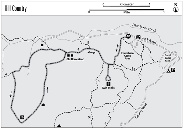
48 Hill Country State Natural Area
A day hike through the hills and valleys of Hill Country State Natural Area.
Distance: 6.7-mile lollipop
Approximate hiking time: 3 to 4 hours
Elevation: 1,540 to 1,950 feet
Trail surface: Dirt path and closed dirt road
Best season: Fall through spring
Water availability: None
Land status: State natural area
Nearest town: Bandera
Fees and permits: Park entrance fee
Maps: USGS Tarpley Pass; Hill Country State Natural Area map
Trail contacts: Hill Country State Natural Area, 10600 Bandera Creek Road, Bandera 78003; (830) 796-4413
Finding the trailhead: From the center of Bandera, follow TX 173 south a short distance to just across the Medina River. Turn right on RM 1077 and follow it about 10 miles south to where the pavement ends. Continue on the good gravel road into the park. Follow the signs toward park headquarters. Soon go right at a junction and cross West Verde Creek. Pass a park residence on the right and turn right at another junction in less than 0.5 mile. Pay your entrance fee and get a map at the office and small campground just after the junction. Drive north a little less than 1 mile to the trailhead parking area on the left (just past an equestrian camping area, also on the left).
The Hike
Hill Country State Natural Area is a 5,370-acre park that lies in a particularly hilly section of the Hill Country southwest of Bandera. It has about 40 miles of hiking/mountain biking/equestrian trails made up of old closed ranch roads and single-track trails. The park is particularly popular with equestrians, so expect to see some horses on the trails. It’s a primitive park with only composting toilets and no potable water or trash collection. Be sure to bring plenty of water with you to the park. This hike visits some of the most scenic parts of the park, including the two best overlooks. It follows parts of the Twin Peaks and Cougar Canyon trail systems.
The trail climbs to the west from the trailhead. Ignore the left fork that you reach in about 0.1 mile that goes to the nearby equestrian camping area. Go right at the next two junctions that hit almost simultaneously. The trail then climbs steeply up a draw to a saddle between two high hills. At the saddle is a left fork that goes to a short loop on the top of the hill. This side trail has probably the best views in the park. It circles around the hilltop, offering great, unobstructed views of a broad expanse of the Hill Country. If you are hiking this trail in the afternoon, you might want to save this side loop until the end of the hike when you return this way. The side loop is a great place to watch the sunset.
From the saddle the main trail drops down into a little valley and quickly hits another junction. Go right about 0.3 mile to another junction. Go left (the right fork just returns to the park road). The trail becomes an old ranch road. In about 0.4 mile the trail comes to another junction at an old homestead. Several buildings here date to the park’s ranching days. This is the beginning of a large loop. Go right on the old ranch road. In about another 0.3 mile go left at another junction. The right fork just goes a short distance to the park road and another ranch house, now a group lodge.
The trail slowly climbs up a small valley to a saddle and another junction. Go left and climb more steeply up onto a ridge. The trail slowly circles a small canyon and reaches the highest point of the hike on this ridge. Soon the trail reaches a great view to the south. From the overlook the terrain drops off fairly abruptly about 400 feet. After the overlook, the trail stays relatively flat for a while before dropping back down to the old homestead at the start of the loop. Go right at the junction at the old ranch house and begin the return to the trailhead on the same route as before. Go right at the junction in about 0.4 mile and left at the junction in about another 0.3 mile. Climb up a short distance to the saddle with the side loop trail. If you haven’t already, take the trail on the right that leads to the short loop with the great views. Otherwise, continue down the other side of the saddle and go left at the next three junctions before the trailhead.
Miles and Directions
0.0Start at the trailhead parking area.
0.1Junction. Go right.
0.5Two junctions. Go right at both.
0.6Junction with side loop. Turn left and go around small side loop.
1.0Side loop junction again. Go left and continue on main trail.
1.1Junction. Go right.
1.4Junction. Go left. Trail becomes ranch road.
1.8Junction at old homestead. Go right.
2.1Junction. Go left.
2.8Junction. Go left around large loop past overlook.
5.3Junction at old homestead again. Go right and return by same route.
5.7Junction. Go right.
6.0Junction. Go left.
6.1Junction with small side loop. Go left.
6.2Two junctions. Go left at both.
6.6Junction. Go left.
6.7Arrive back at the trailhead.
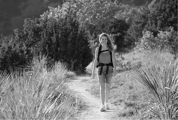
A hiker enjoys her walk through the natural area.