
52 Lake Somerville State Park
A day hike through the Lake Somerville State Park backcountry along the Lake Somerville Trailway.
Distance: 8.2-mile lollipop
Approximate hiking time: 3 to 4 hours
Elevation: 240 to 270 feet
Trail surface: Closed dirt road and dirt path
Best season: Fall through spring
Water availability: Trailhead
Land status: State park and wildlife management area
Nearest town: Giddings
Fees and permits: Park entrance fee
Maps: USGS Flag Pond; Somerville Trailway map (Lake Somerville State Park)
Trail contacts: Lake Somerville State Park, 6280 FM 180, Ledbetter 78946; (979) 289-2392
Finding the trailhead: Drive east from Giddings on US 290 about 7.1 miles to FM 180. Turn left onto FM 180 and go 13.7 miles to the park headquarters of the Nails Creek Unit of Lake Somerville State Park.
The Hike
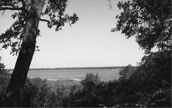
Lake Somerville State Park lies in gently rolling terrain of mixed open prairie and dense stands of post oak, hickory, blackjack oak, and other trees. The park, located on the shores of Lake Somerville, is divided into two parts—the Nails Creek and Birch Creek Units. A 13.0-mile trail connects the two units. Spurs and side loops create a total of 21.6 miles of trail. Since much of the route is a broad, spacious dirt service road, the park has opened most of the trail to horses and mountain bikes.
Probably the best parking lot is at the headquarters building. Walk into the equestrian camping area just past headquarters. The well-marked trail begins at the back of the camping area. An alternate trailhead is possible a bit farther into the park, but the route is somewhat confusing. The broad trail winds through the low hills above Lake Somerville, giving occasional views of the lake. Several small, mowed spur trails turn off, but the main route is obvious.
At about 2.4 miles the trail forks at a well-marked junction on a hilltop. Turn right onto the hiker-only Flag Pond Loop Trail. The trail passes the Mill Pond primitive camp area and then crosses a bridge over the man-made channel connecting Flag Pond and Lake Somerville. The trail loops around the northeast side of Flag Pond on the levee. On the far side of the pond, the trail passes another primitive camp area and two trails forking right. The trail rejoins the main trail at the second fork. Stay left at both forks and continue to loop all the way around Flag Pond to the start of the loop by the Mill Pond camping area. Return to the trailhead by the same route.
If time and energy allow, continue to hike farther on the trail. With a car shuttle, the entire main trail makes a long but excellent day hike or an easier two-day trip. Several primitive camping areas are located along the route. Two of them, Newman Bottom and Wolf Pond, have potable water. Be sure to stop at the side of the trail, well out of the way, if you encounter horses on the trail.
As of this writing, the Nails Creek Unit campground is closed because of budgetary problems. That may change, so call ahead if you plan to camp.
Miles and Directions
0.0Start at the trailhead at Nails Creek Unit headquarters.
2.4Junction near Mill Pond campsite. Go right on Flag Pond Loop Trail.
4.1Junction. Go left.
4.3Junction. Go left.
5.8Junction near Mill Pond campsite. Go right and follow same trail back to trailhead.
8.2Arrive back at the trailhead.
For more hiking in Lake Somerville State Park, take the trailway, which follows the lakeshore.