19 Pictograph Trail
SCENERY: 
DIFFICULTY: 
TRAIL CONDITION: 
SOLITUDE: 
CHILDREN: 
DISTANCE: 2.8 miles round trip
HIKING TIME: 0.5–1 hour
OUTSTANDING FEATURES: Sandy wash, Native American rock art, and a valley view
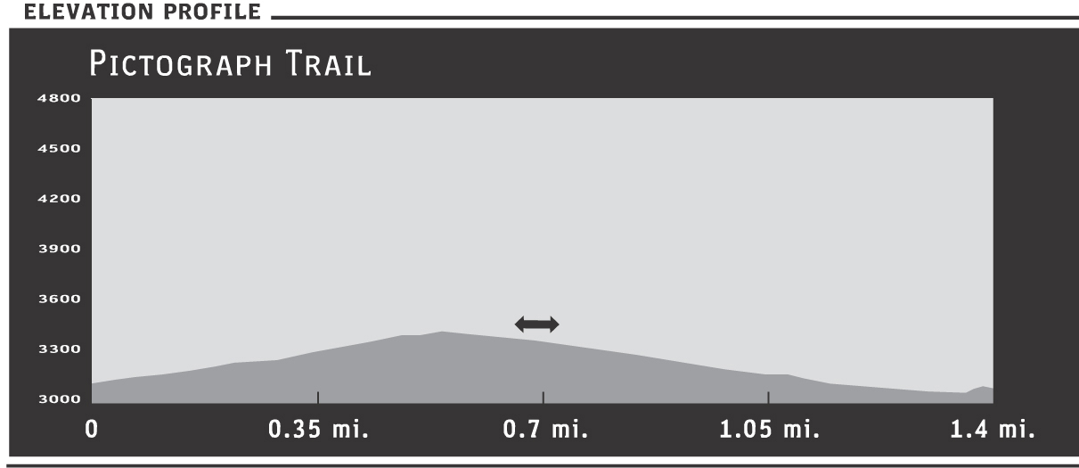
This flat, easy trail travels straight over sandy wash and passes next to a display of native Indian rock art (pictographs). The path then leads to a sudden drop-off overlook into the Vallecitos Valley. The up close view of the rock art symbols at 0.8 miles and the easy hiking make this a good choice for school-age children, but be careful if you hike the remaining 0.6 miles to the overlook. The drop-off is abrupt, so don’t let children run ahead.
Directions: Where CA 78 meets County Route S2 (the Great Overland Route of 1849), head south on S2 for 6.4 miles to Blair Valley Road. Turn left onto this flat, dirt road suitable for most vehicles. After approximately 3.5 miles, a fork joins the road. Follow the sign leading to the Pictograph Trail (left). After another 1.5 miles, the road ends in a large parking turnout. The trailhead sign is on the right.
| GPS Coordinates | 19 PICTOGRAPH TRAIL | |
| UTM Zone (WGS84) | 11S | |
| Easting | 559802 | |
| Northing | 3653644 | |
| Latitude–Longitude | N 33º 1’ 10.6309” | |
| W 116º 21’ 34.9147” |


 The easy trail slopes gradually upward, stretching 0.8 miles to a huge boulder decorated with rock art that features symbols from the ancient Kumeyaay Indian residents of the valley. The boulder is right next to the path, making the art’s preserved nature that much more remarkable. Researchers don’t know for sure what the 200- to 300-year-old symbols represent, but the diamond-chain motifs are typical of other Indian artifacts. This historic rock art is rendered with paints made from ground minerals that endure constant natural erosion from the elements (wind, sun, rain). Please help preserve them for the enjoyment of future visitors. Don’t touch or deface the pictographs, which are protected by law. Instead, bring your camera and consider what the symbols might have meant to the men and women who created them.
The sandy trail grows wider, the soft ground imprinted with the tracks of local wildlife such as jackrabbits, quail, and coyotes. Fairly fresh mountain-lion tracks were present on my last visit during the winter months. The sandy wash continues another 0.5 miles toward a ridgeline that appears to block the path. Several hundred yards from the trail’s end, though, a cleft appears, allowing entrance into a great stone hallway of sorts. The thick rock walls rise on either side of the path, ushering you through. Watch your step—the path ends abruptly on an unshielded precipice. Ever wary of the 100- to 200-foot drop-off, admire the view over the Vallecitos Valley before retracing your steps to the trailhead.