29 Moonlight Canyon Loop
SCENERY: 
DIFFICULTY: 
TRAIL CONDITION: 
SOLITUDE: 
CHILDREN: 
DISTANCE: 1.84 miles round trip
HIKING TIME: 1 hour
OUTSTANDING FEATURES: Sandy wash, interesting boulder and erosion formations
The relaxing experience of a brief stroll on an easy trail with a few steep areas and some hops down boulders seems days away from civilization when you take in the quiet. You may see campers out for this stroll at twilight, when the moon begins to rise. Perhaps the short trek is called Moonlight Canyon Loop because it lends itself to friendly chatting as the sun sets.
Directions: From Interstate 8E, take the Ocotillo Imperial Highway exit and head northwest on County Route S2. Drive 27 miles to Agua Caliente County Park. Turn left into the park and follow the road southwest to the Ranger Station. You’ll pay $5 for day use of any length. The ranger has free maps of the county park’s hiking trails. To get to the Moonlight Canyon trailhead, follow the main park road past the mineral pools, and park near the shuffleboard court. The trail begins just right of the court.
| GPS Coordinates | 29 MOONLIGHT CANYON LOOP | |
| UTM Zone (WGS84) | 11S | |
| Easting | 565115 | |
| Northing | 3645798 | |
| Latitude–Longitude | N 32º 56’ 54.7722” | |
| W 116º 18’ 12.1131” |


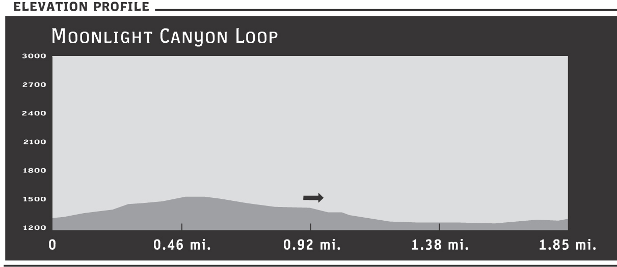
 From the trailhead behind and to the right of the shuffleboard area, you’ll begin immediately climbing on the well-worn trail. After about 0.33 miles, you’ll reach a side trail that climbs to an elevation of about 1,750 feet—your option. It’s a short climb to the peak, which is a good vantage point to the valley.
The trail descends a little, beginning a pattern of rocks underfoot, then sandy wash, rocks, then sand—all rutted into a wide wash path around the peak in the middle. The rocky walls alongside the trail have eroded in intricate patterns, and though this trail is short, there’s a sense of isolation. The rock on either side of the path buffers noise, so you may not realize other hikers are near until they are practically upon you.
At about 0.75 miles, the route dips, crossing a wooded seep. You may see birds here, drawn to the water and willows. In fact, Agua Caliente County Park is a well-known spot for birding enthusiasts. You’ll find more birds along the pond trail and sometimes even among the individual campsites. Just as alfresco city dining attracts birds, humans picnicking in camping areas also attracts wildlife.
At approximately 1 mile the trail opens up, beginning to make the left curve around the middle peak to close the loop. In the northeast, the Vallecitos Mountains come into view, a formidable ridge in the distance. In late afternoon, the shadows bring out mauves and tans that add an interesting frame to your walk. This peaceful, quiet stretch brings you another 0.4 miles to the campground road, where you’ll turn left and follow it back up to your car.
If you’ve stopped in for a day visit, consider one of the other short trails in the county park, or plan a longer trip back—perhaps with your RV or tent.